
-
 12183 Hits
-
 82.48% Score
-
 15 Votes
|
|
Area/Range |
|---|---|
|
|
47.68183°N / 12.69653°E |
|
|
Hiking, Mountaineering, Trad Climbing, Scrambling, Skiing |
|
|
Spring, Summer, Fall, Winter |
|
|
6434 ft / 1961 m |
|
|
Overview
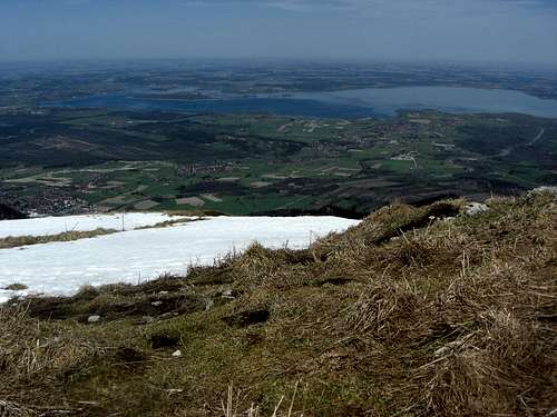
The Chiemgauer Alps are a part of the Northern Limestone Alps and are denominated after the Chiemgau, the region around Chiemsee lake in southeastern Bavaria, Germany. Chiemsee lake is situated north of the mountains and is mainly famous for the royal castle of Herrenchiemsee, built by king Ludwig II in the 19th century and located on the island of the same name.

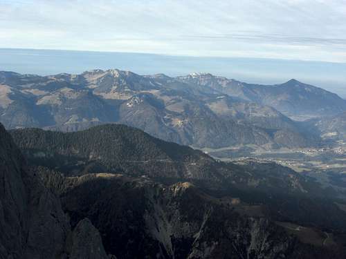
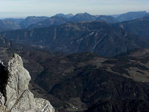
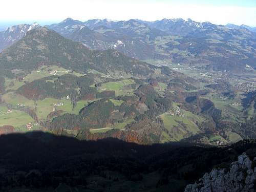
Panorama of Chiemgau Alps as seen from the south
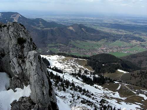
The highest peak of Chiemgauer Alps is Sonntagshorn, 1961 m, 6433 ft, situated in the eastern part of the area. You see that Chiemgauer Alps do not belong to the higher and prominent parts of the Northern Limestone Alps. The whole area, however, is a wellknown, popular and therefor crowded mountain region.
The main part of Chiemgauer Alps belong to Germany, Bavaria, a minor part lays within Austria, divided between the Tirol and Salzburg counties.
Adjacent mountain areas are:
The eponymous Chiemsee lake |
Geigelstein, Hochries and Kampenwand area |
The geographical limitations are
Chiemgau Alps invite for a huge variety of outdoor activities and are a popular area for whatever outings:
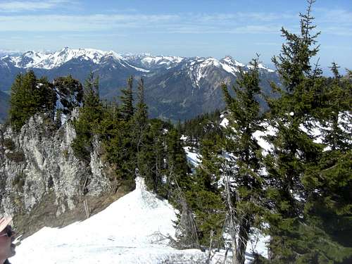
Hiking is a main acticity within Chiemgauer Alps as most summits and ranges are not very high and cragged. All summits can be reached within a day. Some long distance hiking routes like the Via Alpina or the European long distance trail number E4 traverse the area. Many mountain huts and cable cars add to a well built hiking infrastructure.
Popular hiking summits are Sonntagshorn, Kampenwand, Geigelstein, Hochgern, Hochfelln, Rauschberg and Hochstaufen.
Alpine climbs can be done at Kampenwand, Hörndlwand and Steinplatte.
The most popular skiing areas are the Waidring – Lofer – Steinplatte region and the Kampenwand skiing area.
Besides using ski lifts, most of the higher summits of Chiemgauer Alps are popular for ski tours or snow shoe tours in winter and early spring. Spitzstein, Hochgern, Sonntagshorn and Geigelstein are among the most popular ski tours.
Hochries, Spitzstein and Klausenberg: ski touring aims |
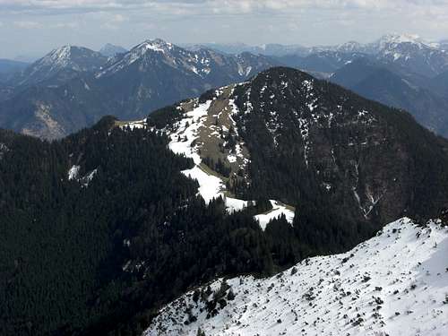
Geigelstein: prime ski touring aim |
Mountain biking can be done on most of the Chiemgauer mountains, some routes and forest roads, however, are closed for mountain bikes. Please respect those limitations.
Paragliding and even delta-gliding is most common in the area. As far as I know there are no special restrictions for that sport.
Getting There
By car:
Highway A 8, München to Salzburg, runs along the north side of the area. The following exits (from west to east) give way to the different regions of the area:
Geigelstein, Kampenwand and Hochplatte as seen from the south |
Heuberg and Kranzhorn in winter |
Highway A 93, the Inntal valley highway, between Rosenheim and the exit Oberaudorf gives access to the western part of Chiemgauer Alps.
From the exit Oberaudorf take the Austrian road number 172 to Niederndorf, Walchsee, Kössen and Reit im Winkl for the southern parts of Chiemgauer Alps.
The German road number B 305 between Reit im Winkl, Inzell and Schneizlreuth gives access to the more southeastern part of the mountain area. German road number B 21 between Schneizreuth and Bad Reichenhall completes the loop.
Some north-south connecting roads and many local roads complete the very good road infrastructure of the area.
Hochries and Spitzstein region |
Geigelstein and Kampenwand region |
Railway:
The railway connections of the area are rather poor. All main railway stations are located near and not within Chiemgau Alps: Rosenheim, Bernau, Traunstein and Bad Reichenhall to the north and Oberaudorf / Kufstein to the west. From there you have to continue by bus.
Only two regional railways are located at the northern rim of Chiemgau Alps:
Busses:
The bus connections are served by Regionalverkehr Oberbayern. All main valleys within Chiemgau Alps have their bus lines; look for busses number
Subranges and summits
Chiemgau Alps summits on SP
Hochries Subrange
The Hochries subrange is located in the western part of Chiemgauer Alps, ist highest summit is Spitzstein. The geographical borders of this subrange are: the northern foreland to the north, Inntal valley to the west, Prien valley to the east and the Niederndorf region to the south

Spitzstein and Klausenberg |

Heuberg (left) and Kranzhorn |

Spitzstein and Inntal |
Summits
- Dandlberg (890 m; 2920 ft)
- Sattelberg (820 m; 2690 ft)
- Kindlwand (1228 m; 4029 ft)
- Wasserwand (1337 m; 4386 ft)
- Heuberg (1338 m; 4389 ft)
- Kitzstein (1399 m; 4587 ft)
- Riesenberg (1449 m; 4754 ft)
- Hochries (1588 m; 5210 ft)
- Karkopf (1496 m; 4908 ft)
- Feichteck (1514 m; 4967 ft)
- Kranzhorn (1366 m; 4482 ft)
- Hammerstein (1280 m; 4199 ft)
- Laubenstein (1350 m; 4429 ft)
- Zellerhorn (1398 m; 4587 ft)
- Heuraffelkopf (1504 m; 4934 ft)
- Predigtstuhl (1494 m; 4902 ft)
- Klausenberg (1554 m; 5098 ft)
- Zinnenberg (1565 m; 5135 ft)
- Brandelberg (1500 m; 4921 ft)
- Spitzstein (1598 m; 5243 ft)
Kampenwand subrange
The Kampenwand subrange is located east of Hochries subrange and north of Geigelstein subrange. Its highest peak is Kampenwand.
Its limitation is: Frasdorf and southern Chiemsee region to the north, Prien valley to the west, Klausengraben / Dalsenbach valley to the south, Grassau valley and valley of Tiroler Achen to the east.

Ammergauer Hochplatte |

Kampenwand south faces |

Gedererwand and Chiemsee |
Summits
- Reifenberg (981 m; 3219 ft)
- Haindorfer Berg (1123 m; 3684 ft)
- Schwarzenberg (1126 m; 3694 ft)
- Breitenberg (1047 m; 3435 ft)
- Gedererwand (1351 m; 4432 ft)
Kampenwand subrange as seen from Hochgern |
Alm hut near Kampenwand |
- Sonnenwendwand (1511 m; 4957 ft)
- Scheibenwand (1597 m; 5240 ft)
- Kampenwand (1694 m; 5558 ft)
- Hochalpenkopf (1494 m; 4902)
- Chiemgauer Hochplatte (1589 m; 5213 ft)
- Teufelstein (1435 m; 4708 ft)
Geigelstein subrange
The Geigelstein subrange is located east of the Hochries subrange and south of the Kampenwand subrange. The highest summit is eponymous Geigelstein.
Geografical limitations are Klausengraben / Dalsenbach valley to the north, Prien valley to the west, valley of Tiroler Achen to the east, Walchsee and Kössen valley to the south.

Geigelstein, Weitlahnerkopf |

Geigelstein subrange from the west |

Geigelstein and Schleching valley |
Summits
- Aschentaler Wände / Tauron (1738 m; 5702 ft)
- Weitlahnerkopf (1615 m; 5299 ft)
- Ahornkopf (1540 m; 5052 ft)
- Roßalpenkopf (1762 m; 5781 ft)
- Mühlhörndl (1518 m; 4980 ft)
- Mühlhornwand Wandspitz (1685 m; 5528 ft)
- Latschkogel (1589 m; 5213 ft)
- Geigelstein (1808 m; 5932 ft)

Geigelstein southern meadows |

Geigelstein summit |

Typical Alm hut near Geigelstein |
- Breitenstein (1661 m; 5449 ft)
- Wandberg (1454 m; 4770 ft)
- Brennkopf (1353 m; 4439 ft)
- Hochköpfl (1539 m; 5049 ft)
- Rescharkopf (1393 m; 4570 ft)
- Horauer Spitze (1117 m; 3665 ft)
- Rudersburg (1434 m; 4705 ft)
- Wetterfahne (1284 m; 4213 ft)
Chiemgauer Berge
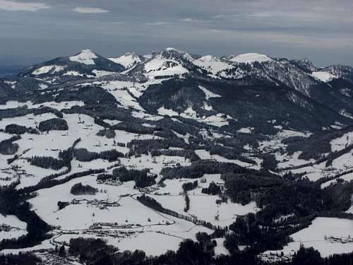
This central subrange is located between Marquartstein / Tiroler Achen valley and Inzell. The highest mountain of the subrange is Hochgern.
Hochgern summit |
Hochgern and Hochfelln |
Summits
- Ebgelstein (970 m; 3182 ft)
- Bairerkopf (1283 m; 4209 ft)
- Schnappenberg (1260 m; 4234 ft)
- Hochlerch (1633 m; 5358 ft)
- Hochgern (1748 m; 5735 ft)
- Silleck (1565 m; 5135 ft)
- Großer Rechenberg (1368 m; 4488 ft)
- Rehwaldkopf (1395 m; 4577 ft)
- Gleichenberg (1156 m; 3793 ft)
- Schleichenberg (1243 m; 4078 ft)
- Haargaßberg (1210 m; 3970 ft)
- Hochfelln (1671 m; 5482 ft)
- Toraukopf (1481 m; 4859 ft)
- Weißgrabenkopf (1578 m; 5177 ft)
- Groerkopf (1562 m; 5125 ft)
- Nesselauer Schneid (1440 m; 4724 ft)
- Haaralmschneid (1595 m; 5233 ft)

Hochlerch and Schnappenkirche |

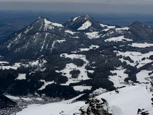
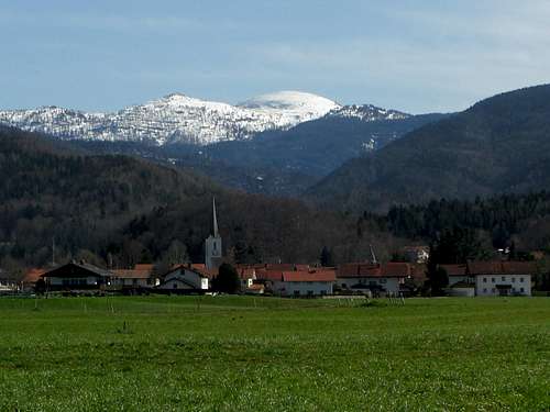
Reit im Winkl with Hochgern (right) |

Religious signs |
- Gründberg (1225 m; 4019 ft)
- Unternberg / Unternbergschneid (1425 m; 4675 ft)
- Sulzgrabenkopf (1521 m; 4990 ft)
- Hörndlwand (1684 m; 5525 ft)
- Gurnwandkopf (1690 m; 5545 ft)
- Hochscharten (1474 m; 4836 ft)
- Rachelspitze (1415 m; 4642 ft)
- Stuhlkopf (1264 m; 4147 ft)
- Mühlprachkopf (1331 m; 4367 ft)
- Dürrnbachhorn (1767 m; 5797 ft)
- Hochgimpling (1539 m; 5049 ft)
- Wildalphorn (1690 m; 5545 ft)
- Hausgrabenkopf (1412 m; 4633 ft)
- Kreuzschneid (1669 m; 5476 ft)
- Fahsteigenschneid (1578 m; 5177 ft)
- Hochbrunstkopf (1499 m; 4918 ft)
Southern Chiemgau Mountains
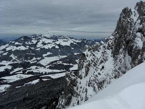
This rather small subarea is located in the Austrian part of Chiemgauer Alps south of the “Chiemgauer Berge” subrange. Highest peak is Steinplatte.
The geographical limitations are the Saalach valley to the east, the Lofer creek valley to the south, the valley of Kohlenbach creek to the west and the Unken / Heutal valley to the north.
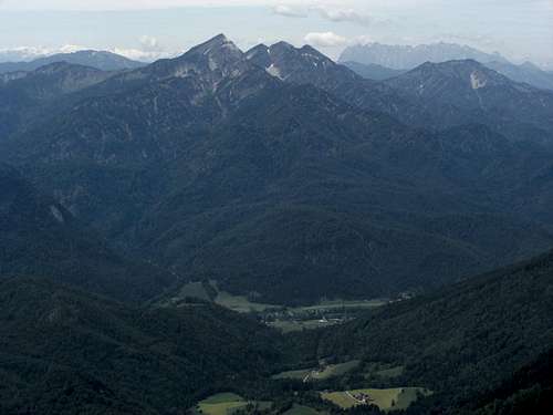
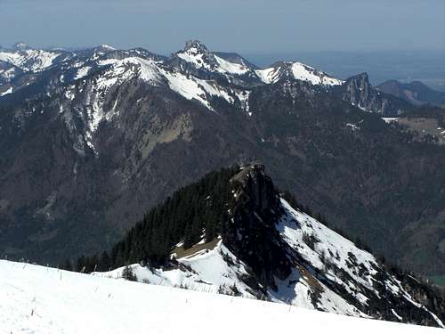
Steinplatte and southern Chiemgau peaks, Staufen and Sonntagshorn in the back |
Fellhorn as seen from Unterwössen |
Summits
- Schwarzeneck (1556 m; 5105 ft)
- Steinplatte(1869 m; 6132 ft)
- Bernfarchtkogel (1537 m; 5043 ft)
- Fellhorn (1764 m; 5787 ft)
- Eggenalmkopf (1686 m; 5531 ft)
- Hiefelstein (1542 m; 5059 ft)
Ruhpoldinger Subrange
Sonntagshorn and Reifelberg
This subrange is located in the eastern part of Chiemgauer Alps and embraces the mountains around the town of Ruhpolding. The highest mountain is Sonntagshorn.
Its limitations are the northern foreland, Weißbach and Saalach valley to the east, Unken / Heutal valley to the south and Urschlauer Achen valley to the west.
Summits
- Zinnkopf (1227 m; 4026 ft)
- Vorderer Rauschberg (1645 m; 5397)
- Hinterer Rauschberg (1671 m; 5482 ft)
- Zenokopf (1603 m; 5259 ft)
- Seßseekopf (1153 m; 3783 ft)
- Ristfeuchthorn (1569 m; 5148 ft)
- Fischbachkopf (1694 m; 5558 ft)
- Reifelberg (1882 m; 6175 ft)
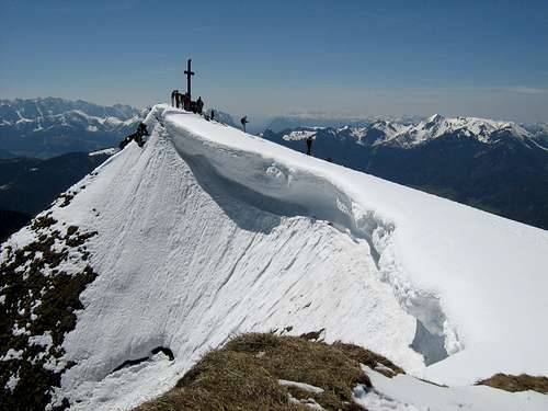
- Sonntagshorn (1961 m; 6434 ft)
- Peitingköpfl (1720 m; 5643 ft)
- Hochgseng (1544 m; 5066 ft)
- Hochgern (1740 m; 5709 ft)
- Aibleck (1756 m; 5761 ft)
- Ochsenhorn (1615 m; 5299 ft)
- Kranzhorn (1241 m; 4072 ft)
- Wendelberg (959 m; 3146 ft)
Staufen subrange
The easternmost subrange of the Chiemgauer Alps is the Staufen subrange with Zwiesel as the highest peak.
It is located between the towns and villages of Bad Reichenhall to the east, Schneizlreuth and the adjacent valleys to the south and Inzell to the west. The northern limitation is the alpine foreland.

Hochstaufen |

Mittelstaufen and Zwiesel |

Zwiesel and Gamsknogel |
Summits
- Hochstaufen (1771 m; 5810 ft)
- Mittelstaufen (1680 m; 5512 ft)
- Zennokopf (1756 m; 5761 ft)
- Zwiesel (1781 m; 5843)
- Gamsknogel (1750 m; 5741 ft)
- Rabensteinhorn (1363 m; 4472 ft)
- Falkenstein (1181 m; 3875 ft)
Geology
Chiemgauer Alpen is a part of the Northern Limestone Alps and shows in its outcrops the different tectonic nappes of the northern Alps rim.
The northernmost tectonic nappe which can be located at the north rim of Chiemgau Alps and which was thrusted onto the Alpine foreland sedimentary deposits (Molasse zone) is the Helvetikum and the Ultrahelveticum nappe. These sediments were deposited on the northern margin of the old Tethys ocean and build many summits and ranges within the Swiss Alps. In eastern Bavaria, however, Helvetikum and Ultrahelvetikum sediments are hardly to be found alongside a small outcrop on the northernmost slopes of the northernmost ranges.
The next nappe to the south is the Flysch nappe, mostly sandstones and siltstones which were deposited in the northern Penninic trough in deep water. Being the relicts of mudflows and turbiditic flows these are not very solid rocks which build up the northernmost and not very prominent ranges of Chiemgauer Alpen. The Flysch zone can best be studied north of Ruhpolding. These ridges with low summits and dense woods, however, are not a preferred hiking region.
The main part of Chiemgauer Alpen consits of the marls and limestones of the Bavarian and Tirolian Kalkalpin, the deposits of the south margin of Tethys ocean. The Kalkalpin of Chiemgauer Alpen is tectonically divided into several nappes which show many intense synclines and anticlines. Huge parts of the Chiemgauer Kalkalpin consist of “Hauptdolomit”, a dolomite rock build in huge lagoons and mudflats of the old Tethys ocean. The highest peaks of Chiemgauer Alps, Sonntagshorn and Reifelberge, are mainly built of Hauptdolomit.
Weitlahnerkopf with late triassic and early jurassic deposits
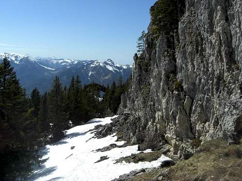
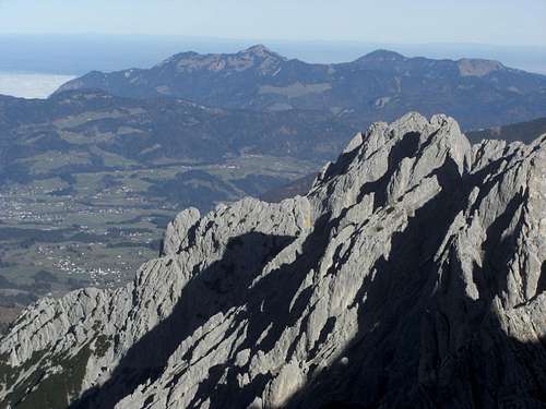
Other Triassic deposits which nowadays form famous and striking landmarks are the coral and limestone algae reef remnants of Wettersteinkalk. Those can be studied at Kampenwand or Gurnwandkopf, both eye-catching rockfaces.
Younger Kalkalpin sediment date of late Triassic and of Jurassic age, such as Kössener beds, Oberrhät limestone (coral reefs again) and Jurassic beds. Heuberg / Wasserwand is built up of an Oberrhät reef. Later jurassic deposits form summits like Hochgern.
The ice ages formed the Chiemgauer Alpen and the valleys intensely. There were not many peaks above the glaciers during the main glaciation times. Moraine remnants can be found even on the highest slopes of Chiemgau Alps. The hugest glacier of the area was a sidekick of the even huger Inntal glacier, called Aschauer glacier, which formed the Prien valley.
Red Tape
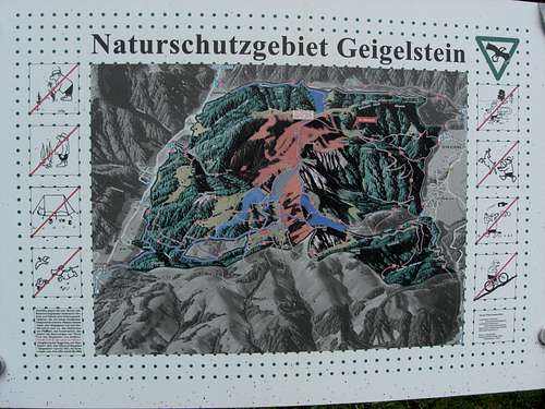
Regulation panel for Nature Protection Zones within Geigelstein subrange
Within Chiemgauer Alpen there are many protection zones. You have to distinguish three types of zones:
Some trails and ski routes are marked within the Nature protection areas and can be used in the restriction times.
All protection zones are marked on the Alpenvereins maps, recommended below in the “Maps and Guid Books” - section.
Hochries subrange:
Winter protection zones: Riesenberg, Spielberg, Karkopf, Feichteneck, Abereck, Heuraffelkopf, Predigtstuhl, Klausenberg
Protection zone: woods west of Aschau im Chiemgau, 15.10. until 31.05. of every year
Kampenwand subrange:
Winter protection zones: some parts north and east of the Hochplatte summit
Geigelstein subrange:
The subrange hosts the important Geigelstein Natural Reserve. No trespassing from 01.12. until 31.05. of every year, with the exception of one northern marked and signposted ski route and most of the southern ski routes and trails. Please stay on the marked routes and trails.
Chiemgauer Berge subrange:
Nature protection area: southern parts of Rehwaldkopf, most of Gurnwandkopf ridge
Winter protection zones: south of Hochgern and Hasenpoint; Hochfelln east ridges (Strohnschneid and Torauschneid); South of Groerkopf; Haaralmschneid east ridge; South of Gurnwandkopf and Hörndlwand and south of east ridge of Hörndlwand
Protection zone: The whole Gründberg from 01.11. until 30.04. every year.
Southern Chiemgau mountains:
Winter protection zones: South sides of Dürrnbachhorn and Hochgimpling, parts of Winklmoosalm and the Steinplatte northeast part: no trespassing from 01st of November through 15th june; corridors for ski touring to Dürrnbachhorn are marked. Fellhorn northern parts below Straubinger Hütte: no trespassing during snow cover
Ruhpoldinger Subrange:
Winter protection zones: Zenokopf south slopes; no trespassing during snow cover
Nature protection area: The whole German part of the Ruhpolding subrange is a nature protection area!
Staufen subrange:
Nature protection area: Falkenstein area
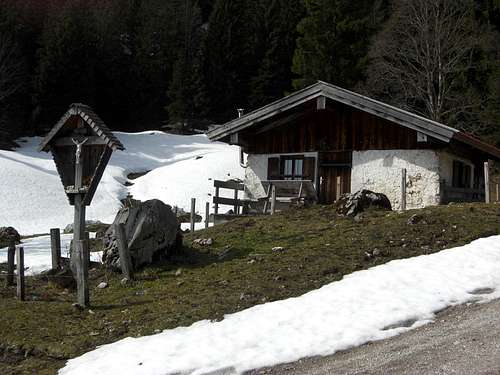
Accommodation
Main villages
on the west side of the area:
Aschau / Chiemgau |
Unterwössen and Wilder Kaiser |
in the western part of the area:
in the central part of the area:
Schleching valley |
Kössen with Hochries and Geigelstein subrange |
in the eastern part of the area:
Mountain Huts
Cablecars
Maps & Guide Books
Maps
Alpenvereinskarte, Bayerische Alpen, number BY 17, Chiemgauer Alpen West; with trails and ski routes, UMT-grid, scale 1 : 25.000, edition 2014
Alpenvereinskarte, Bayerische Alpen, number BY 18, Chiemgauer Alpen Mitte; with trails and ski routes, UMT-grid, scale 1 : 25.000, edition 2012
Alpenvereinskarte, Bayerische Alpen, number BY 19, Chiemgauer Alpen Ost; with trails and ski routes, UMT-grid, scale 1 : 25.000, edition 2014
These are the best maps available even if the austrian part is only an enlargement of the austrian maps, scale 1 : 50.000. These maps are part of the “Alpenvereinskarten digital” edition.
Topographische Karten von Bayern, number UKL 50-54, Chiemsee, Chiemgauer Alpen, trails and MTB routes, UTM grid, scale 1 : 50.000, edition 2016
More maps are available at Kompass verlag or Freytag & Berndt Verlag
Ammergauer Hochplatte |
Hochlerch and Kamprenwand subrange |
Guide Books
There still are books with route descriptions available:
Bergverlag Rother, Chiemgau; 60 routes, 9th edition 2015
Bergverlag Rother, Chiemsee, 53 routes, 2nd edition 2012
Kompass Verlag, Chiemgauer Alpen, 50 routes, edition 2009