Gannett Peak Climb and Rescue
Trip Report – Highpoint of WY
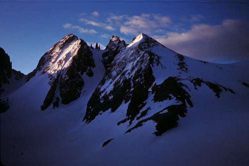
Gannett Peak 13,804 feet 51.4 miles round trip Gain 10,800 feet Summited 8/12/1993 10:30am
January 1993 – I placed a request for climbers to join our team for a climb of Gannett Peak in the “Klimbin’ Kollaborator” column of the Highpointers Newsletter. After much correspondence, the following individuals met at the Glacier trailhead 13 miles south of Dubois Wyoming on August 8, 1993: Ken Akerman, Dave Bowling, Tom DeRoo, Dan Guthridge, Stacy Martin and Tom Martin. My eldest daughter Stacy and I decided to expand our trip to include Yellowstone and Grand Teton National Parks.
8/2 – Stacy and I left Springfield OH, drove to Chicago and then drove straight to Wyoming where we stopped at the Lincoln Monument rest area between Cheyenne and Laramie to sleep in the van. At over 8,500 feet, this is the highest point on I80. We continued to Yellowstone National Park (NP) and then visited Grand Teton NP where we checked conditions on Gannett by talking to a guide at Exum Mountain Guides at Jenny Lake. We then drove to Dubois where we again checked on Gannett conditions with the Forest Service office.
8/7 – When we arrived at the trailhead, we found Ken and Dave already camped there. Dan arrived shortly after and then Stacy, Ken, and I drove into town to drop off our climbing gear at the packer's. We had dinner at the Cowboy Café and then returned to the trailhead for the night.
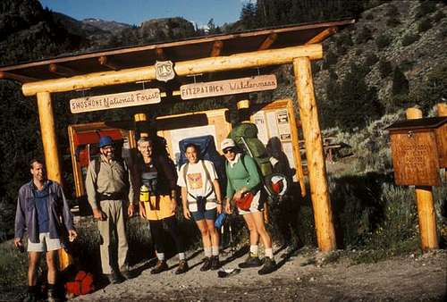
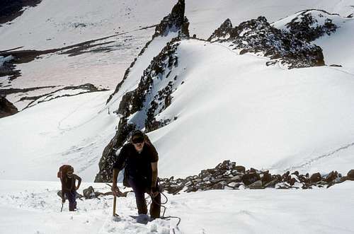
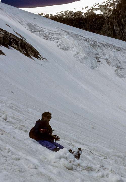
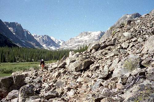
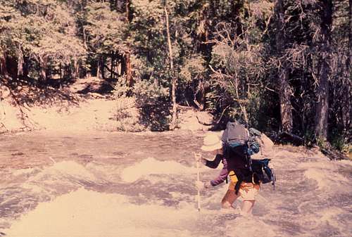
8/8 – The weather was good as we packed and assembled at the trailhead (7,475 feet) at 8am for the start of our trip. I set my camera on Dave's walking stick for a group photo and we all laughed as the pole slowly bent before the shutter clicked, hence the crooked photo.
![Unnamed Image]()
Glacier Trailhead - Dan, Dave, Tom M., Stacy, Ken
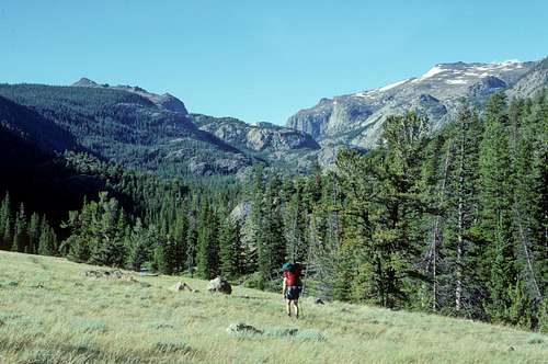
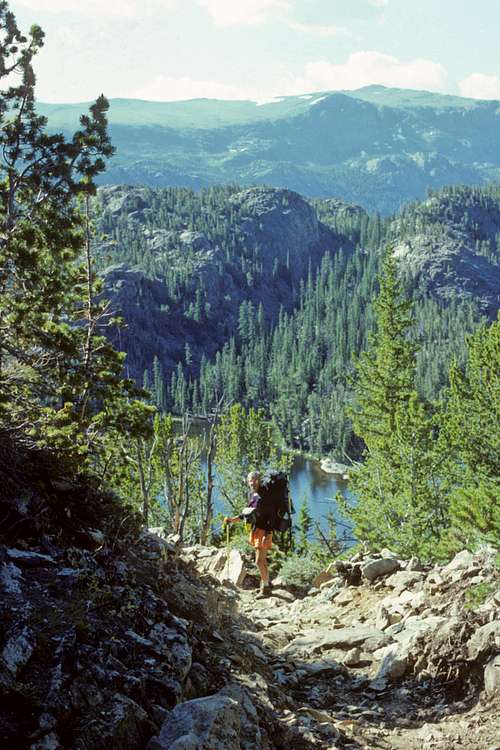
We decided to take the New Glacier Trail because of high water in Torrey Creek. The trail was good as we moved up the valley and then climbed the switchbacks up to the plateau.
![Backpacking into Shoshone National Forest]() Backpacking into Shoshone National Forest
Backpacking into Shoshone National ForestWe had some rain/sleet as we went over Arrow Pass (10,895 feet).
![Toop of Arrow Pass]() Top of Arrow Pass
Top of Arrow PassAs we were coming down from the pass, Tom DeRoo joined us. He had started on the trail at 10am. Everyone was tired after the 3,500-foot ascent and 10.5 miles on the trail so we decided to camp at the upper end of Double Lake (10,150 feet).
![Descending to Double Lake]() Descending to Double Lake
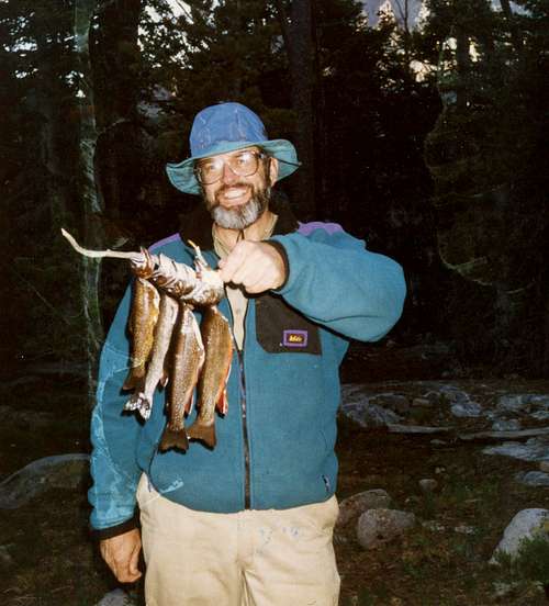
Descending to Double LakeWe were cautioned by the rangers of a substantial bear danger, so were careful to hang all food at least 10 feet up and 6 feet out from a tree. It was very windy that night and evening but it helped keep the bugs at bay. Dave caught four trout, which we were all delighted to share – delicious!
![Trout Dinner!]() Trout Dinner!
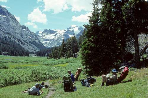
Trout Dinner!8/9 – After some hot cereal and hot chocolate, we started on the trail at 8:30am. The trail went up over a ridge, down to Star Lake and then continued up to the Honeymoon Lake overlook (10,500 feet).
It then descended (switchbacks) over 1,500 feet to the lake.
![Descending to Honeymoon Lake]() Descending to Honeymoon Lake
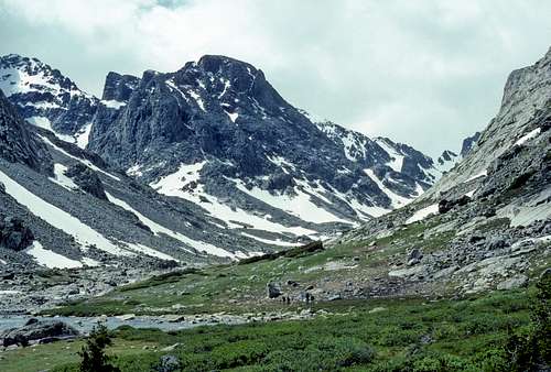
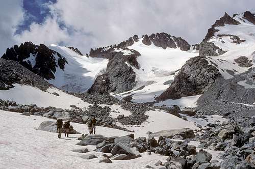
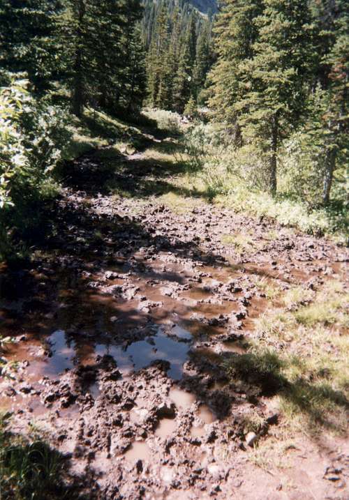
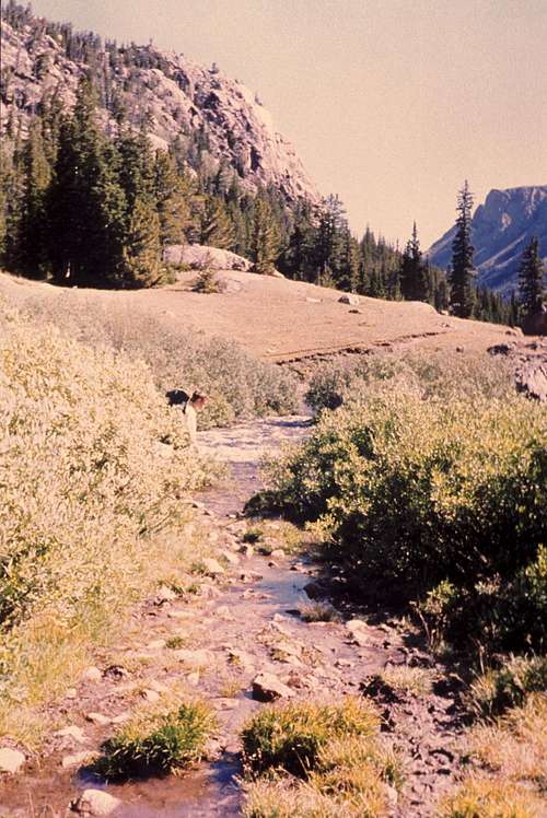
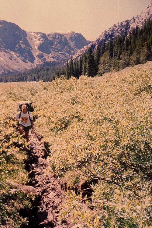
Descending to Honeymoon LakeThe trail continued to Dinwoody Creek and then proceeded up the Dinwoody Creek Valley. There were some ups and downs as we hiked through many wet/muddy/boggy/rocky/sandy areas. Stacy was getting blisters with her new boots and had to change to sandals. It was a warm day with few clouds as we worked under the weight of our backpacks. We walked about a mile through a very sandy meadow – it felt like the seashore! So, I decided to take a dip in Dinwoody Creek to “cool off,” The creek was cold and high with glacier melt and felt great for about three minutes! Refreshed, I continued up the trail and hooked up with Stacy for the log crossing of Klondike Creek. Each member of our group would move at his/her own pace and we would connect at different points to hike and rest together. We were blessed with spectacular views of Gannett Peak and the Wind River Range as we continued up the Dinwoody Creek Valley and then entered Floyd Wilson Meadows.
![Snow Covered Gannett Peak]() Snow Covered Gannett Peak
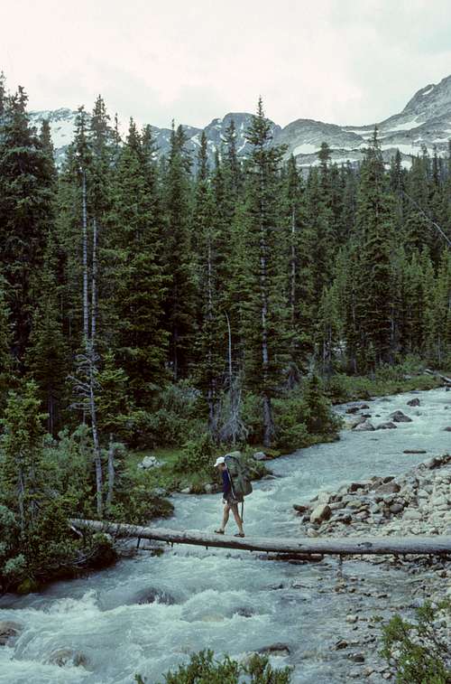
Snow Covered Gannett PeakThe trail now continued to the upper end of Wilson Meadows where there was a log crossing of Gannett Creek. We crossed the creek and started to set-up camp (about 4:30).
![Log Crossing Gannett Creek]() Log Crossing Gannett Creek
Log Crossing Gannett CreekIt started to rain, so we rushed our set-up and just made it before a half-hour shower. It was a tiring 12-mile day. Stacy was carrying a 35-lb. pack and I was carrying a 45-lb. pack. The rain let up to brief drizzles and we made dinner under a tight group of pine trees. The evening discussion centered on the best plan/schedule for summiting the mountain.
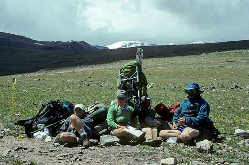
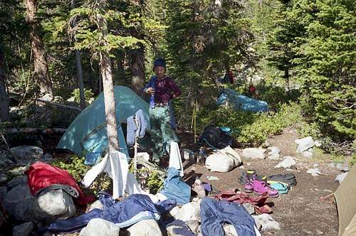
8/10 – I woke up about six but didn't get out of the tent until 8:30. It was a rest day as we waited for Dan Kinneman, our packer, to bring up our climbing gear on his horses. I called a "team meeting" for noon at which we discussed what camp and what schedule to use for our summit attempt. Several scenarios, differences of opinion, and ideas were presented. We settled on packing to the Tarns High Camp the following day with a summit attempt early the next morning (8/12) or if necessary on 8/13. Dan G. decided to hike up to the Tarns Camp (2 miles) and check out the peak from there.
![View Looking Up Dinwoody Creek]() View Looking Up Dinwoody Creek
View Looking Up Dinwoody CreekStacy and I played cards in the afternoon during a hailstorm. The packer arrived at about 6pm and we carried our gear over the log crossing of Gannett Creek to our camp.
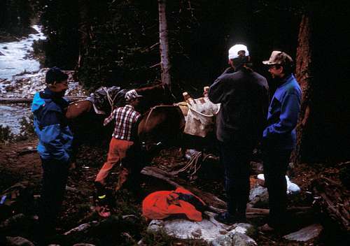
![Packer Arriving with Climbing Gear]() Packer Arriving with Climbing Gear
Packer Arriving with Climbing GearAs we were sorting gear, Dan G. returned from scouting the peak and described how he had seen (telescope) an injured/dead climber being lowered down the Gooseneck Glacier. After a group discussion, a plan was put in place. Tom D. and Stacy started up the mountain immediately with food/clothes and the intention of providing first aid as needed. Ken and I ran back down the valley to find the packer and ask how to send a message for emergency help down the mountain. Dan waited for our return so he could then go back up the mountain with the information and assist the climbers.
It was raining as Ken and I ran about a mile down the trail. I spotted the packer’s camp on the opposite side of Dinwoody Creek in Wilson Meadows. I yelled and waved but to no avail. Finally, I took off my boots, put on my watershoes, and found a large tree limb to use to ford the creek. The creek was cold, powerful, and up to my waist. It was a difficult crossing. I went to the packer’s tent to explain the situation and ask for advice. As I described what was known, I got the impression that he did not think that this was a real emergency. I asked and he informed me of possible radio help transmissions as he returned with his packhorses down the mountain the next day.
The first possibility (radio?) for an emergency message was at an outfitter's camp at Downs Fork Meadows about a 2.5-hour ride down the trail. The second was a trail crew camp at Honeymoon Lake another 1.5 hours down the trail. Finally, if neither was possible, he would get to the trailhead about 5pm and call the Sheriff. We agreed that I would obtain more specific information on the problem and return the next morning at daybreak. I forded the creek again, met Ken, and we ran back to camp to give the information to Dan who was packed and ready to go up the mountain. Tom D., Stacy and Dan returned to camp about 10:30pm. They had gone through the moraine and snowfields to the base of the Dinwoody Glacier (in the dark and rain) but had not been able to find the injured climber. We decided that there was nothing more we could do now and retired to our tents with a plan to move up the mountain in the morning.
A half hour later (11pm), we heard a commotion outside our tents. Chad, who was camped at the High Tarns with his wife Carolyn, entered our camp at Gannett Creek. He described how two hours earlier, Chris, a member of the team that was in trouble, staggered into his camp disoriented and hypothermic. Chris described how he, Arvell "Doc" Luttrell, and Doc's son John were glacading down the glacier (roped!) when they lost control and Doc crashed, "blowing out" his right knee. He said they had gotten Doc down the glacier and placed him under some large rocks for protection but that he was in pain and hypothermic (John was with him). After discussing the situation, it was agreed that Chad and Dan would immediately go to the injured climber with food, supplies and rain protection and that the next morning at day break, I would return to the packer and ask him to request a helicopter evacuation ASAP.
8/11 – I got up at 5:30, put on my wet Gore-Tex suit from the previous night and started on the trail with my head lamp in a slight rain. I again forded the creek and saw the largest, most impressive, moose I have ever seen in my life! Dan, the packer, was just getting out of his tent and his horses were grazing in the meadow. We greeted each other and he began by apologizing for his "cold" behavior the night before. We sat under a large spruce tree to get out of the rain. Dan had picked a gorgeous campsite – a beautiful view of the meadows, the mountains, and a ribbon like waterfall descending from a snowfield. He fired up his stove to make coffee, shared some of his homemade "GORP" and we discussed the condition of the injured climber. It was agreed that he would make the emergency helicopter request at the first opportunity as he rode out that morning and describe the location of the injured climber as being at the rocks between the base of the Gooseneck and Dinwoody Glaciers. We said goodbye; I again forded the creek and was back at camp at 8am, cold, wet, and in the early stages of hypothermia. I took off my wet clothes and crawled into my sleeping bag.
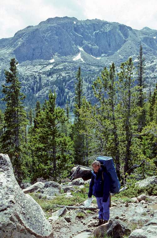
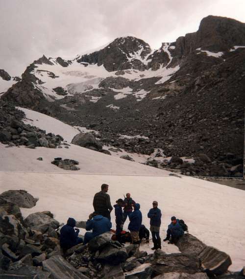
I got up a couple of hours later to eat and discuss the situation with our team members. It was decided that we would go up to the injured climber's base camp at the Tarns (10,800 feet), get his tent and some food, and bring it to him up on the mountain. Also, we would do a “carry” of our climbing gear up to the moraine in case we were able to attempt the peak the next day. Carolyn arrived in camp and we shared information and a cup of hot chocolate before we headed up the mountain.
![Hiking Up to the Tarns Camp]() Hiking Up to the Tarns Camp
Hiking Up to the Tarns Camp
![Starting the Search]() Starting the Search
Starting the Search![Moving up the Moraine]() Moving up the Moraine
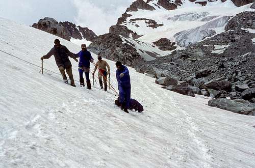
Moving up the MoraineWhen we arrived in the moraine/snowfield area we found Chad, Dan, Chris and John belaying Doc across a snowfield. I was surprised that they had chosen to move him, especially since I had described his location for the helicopter pick-up as being at the base of the area between the Gooseneck and Dinwoody Glaciers. Later I was told that it was felt that it was "psychologically" necessary to move Doc and that they did not want to take a chance on spending another night under the same conditions. Our team members, along with some other climbers returning from the peak, assisted in moving Doc further down the glacier to a point where a helicopter pad could be cut and flattened in a snowfield.
![Pendulum Belay - Moving Doc Down/Across the Dinwoody Glacier]() Pendulum Belay - Moving Doc Down/Across the Dinwoody Glacier
Pendulum Belay - Moving Doc Down/Across the Dinwoody Glacier![Sleeping Bag Stretcher on Belay]() Sleeping Bag Stretcher on Belay
Sleeping Bag Stretcher on BelayIn late afternoon, with the threat of rain and with the obstacle of the rock moraine, it was decided to set-up a tent at that point and make Doc as comfortable as possible in case he had to spend another night on the mountain. Chad and Dan had done an outstanding job in caring for Doc the night before and preventing what could have been a tragedy.
![Tent was Set-Up Near these Rocks]() Tent was Set-Up Near these Rocks
Tent was Set-Up Near these Rocks
We returned to our camp near Gannett Creek and were having dinner when we heard a helicopter moving up the valley. We cheered and waved as it passed our camp. In less than an hour the chopper returned with a basket stretcher dangling about thirty feet below. Doc must have had a “hell-of-a-ride” down the mountain! I called him about two weeks later and learned he had been flown to the Dubois airport and then, because of bad weather, was transferred to an ambulance for transport to Jackson. A surgeon repaired his medial meniscus and used five screws to stabilize a fracture of the medial condyle of his right tibia. He was a “lucky” man.
We had a team meeting and decided that we would get up at 2am and, weather permitting, attempt the summit. Dan decided that he would not join us due to his fatigued condition – a result of his rescue effort the previous two days. It had rained/sleeted on and off each of our four days on the mountain; as a result, we went to our tents somewhat pessimistic as to our chances for reaching the summit.
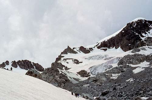
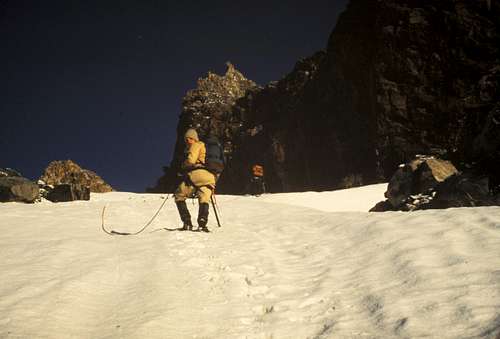
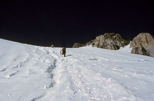
8/12 – I couldn't sleep that evening. It rained hard at midnight and again lightly at 1am. We exited our tents at 2am, packed and were on the trail at 2:30. We made our way up the mountain using headlamps. There was some concern as it started to flurry when we approached the moraine, however, the clouds cleared to reveal a beautiful night sky and a spectacular meteor shower. We were awed at the sight of numerous shooting stars as we picked up our equipment and moved across the moraine and base snowfields.
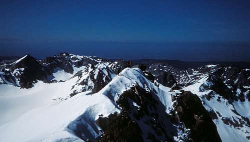
![Sunrise on the Wind River Range]() Sunrise on the Wind River Range
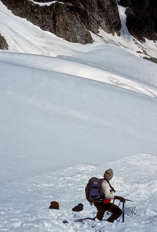
Sunrise on the Wind River RangeWe put on our crampons at the foot of the Dinwoody Glacier and proceeded up the right side. Tom D. was our technical leader and was in front with Ken on his 9mm rope. I lead the second rope (11mm) followed by Stacy and Dave.
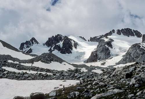
![Moving Up the Dinwoody Glacier]() Moving Up the Dinwoody Glacier - Gooseneck Pinnacle in Center
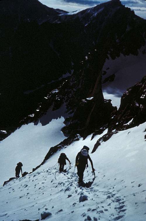
Moving Up the Dinwoody Glacier - Gooseneck Pinnacle in CenterWe side skirted a couple of crevasses and crossed a snow bridge as we went up to a finger of snow which took us across the Gooseneck Ridge to the Gooseneck Glacier. We proceeded up the left side of the glacier to the Gooseneck couloir. This was the crux of the route being quite steep (approximately 50 degrees). We went straight up the center as previous heavy snows had covered most of the Bergschrund. We had to be careful crossing the Bergschrund because some of the snow bridges were starting to dissipate. As I crossed my ice axe punched through the snow (1.5 feet) and found open air in the chasm below.
![Climbing the Gooseneck Glacier]() Climbing the Gooseneck Glacier
Climbing the Gooseneck GlacierGoing was slow as our rope team followed in the steps kicked by Tom and Ken. After topping the couloir next to the Gooseneck Pinnacle, we turned right and proceeded up the ridge glacier.
![Topping the Gooseneck Glacier]() Topping the Gooseneck Glacier
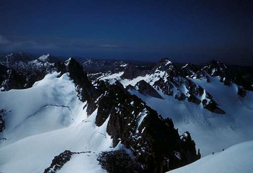
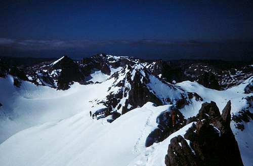
Topping the Gooseneck GlacierAs the sun came up so did the temperature and we placed our jackets in our backpacks. In the next photo, note our trail from the Dinwoody Glacier, up the Gooseneck Glacier and over to the start of the Summit Ridge.
![Approaching the Summit Ridge]() Approaching the Summit Ridge - Note Trail
Approaching the Summit Ridge - Note Trail![Note Climbers at Lower Right]() Note Climbers at Lower Right
Note Climbers at Lower RightTom D. and Ken were ahead of us and took some photos as we moved up the ridge.
![Moving Up the Summit Ridge]() Moving Up the Summit Ridge
Moving Up the Summit RidgeThe route up the Summit Ridge was not steep; however, there were some shear drop-offs on both sides. In a few places near the top the route was only about 2 feet wide.
![I'm in Center of Pic - Steep Drop-Offs on Each Side]() I'm in Center of Pic - Steep Drop-Offs on Each Side
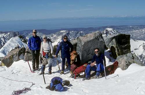
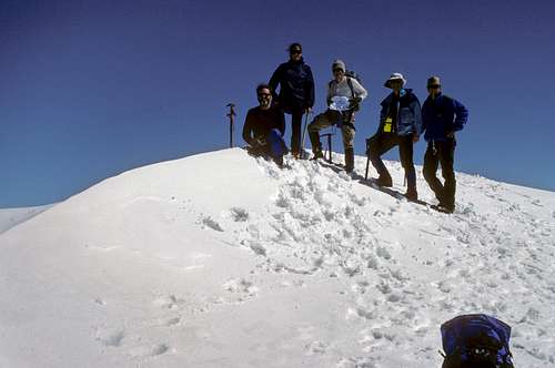
I'm in Center of Pic - Steep Drop-Offs on Each SideWe arrived on the summit at 10:30am.
![Tom D., Ken, Stacy and Dave]() Tom D., Ken, Stacy and Dave
Tom D., Ken, Stacy and Dave![Team on Summit - Highpoint of WY]() Team on Summit - Highpoint of WY
Team on Summit - Highpoint of WY![View from Top of Gannett Peak - 13,804 feet]() View from Top of Gannett Peak - 13,804 feet
View from Top of Gannett Peak - 13,804 feetWe could not have asked for a better summit day. The skies were clear, it was not cold, and there was little wind. We were all in high spirits and took numerous pictures on the summit. The summit registration container was under snow so it was not possible to sign it.
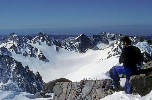
![Descending the Gooseneck Glacier - Note the Avalanche Runouts at the Bottom]() Descending the Gooseneck Glacier - Note the Avalanche Runouts at the Bottom
Descending the Gooseneck Glacier - Note the Avalanche Runouts at the BottomWhen we came to the first snow bridge we had crossed earlier in the day, we were surprised that it was almost gone. It had melted to be only about a foot thick. We were very careful and belayed each other across. The rest of the descent was fun as we plunge stepped and “dupa” slid down the Dinwoody Glacier.
![Weeeee!]() Weeeee!
Weeeee!We arrived at our Gannett Creek Camp in the late afternoon, rested and dried out our gear.
![Drying Gear]() Drying Gear
Drying GearGear, clothing and supplies were sorted into two groups. Those items we would carry and those that would go out with the packer the next day. Everyone was in good spirits after the successful climb. Items were dried out (and burnt!) as we talked standing around the campfire.
8/13 – We “slept-in” until 7:30, had breakfast and then leisurely broke camp. Bags/Equipment were left for our packer and we were on the trail at 9:15. Dan, Tom and Ken decided to packout (individually) in one day, while Stacy, Dave, and I set 10 miles and Star Lake as our objective.
![Wilson Meadows]() Wilson Meadows
Wilson Meadows![Trail?]() Trail?
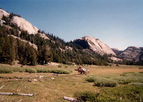
Trail?![Packer Moving Up Valley]() Packer Moving Up Valley
Packer Moving Up Valley![Leaving Big Meadows]() Leaving Big Meadows
Leaving Big Meadows![Creek Crossing]() Creek Crossing
Creek CrossingExample of what happens when people and horses take the same trail through a meadow.
![Pack Trail]() Pack Trail
Pack TrailWe made a side trip to Dinwoody Falls, pushed up the switchbacks above Honeymoon Lake, and arrived at Star Lake at 4pm. It was a beautiful campsite (the best of our three) near the lake, with good sites, fire pit, and food hanging limb. We set-up, ate, Dave tried fishing (no luck), had a fire, and went to bed at dark.
8/14 – We were up at 6am and on the trail at 7:30. We passed Double Lake and went up and over Arrow Pass.
![Crossing Arrow Pass]() Crossing Arrow Pass
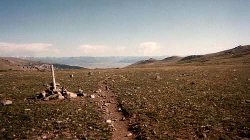
Crossing Arrow PassWe decided to return by way of the Old Glacier Trail. The old trail continued along the plateau and had good views of the surrounding terrain. We arrived at the Torrey Creek crossing at 12:30. The creek was high, moving rapidly, and looked to be a difficult, perhaps dangerous, crossing. I put on my water shoes, tied my boots to my backpack, adjusted my hiking pole for support and started across at the point I thought was most shallow. The water was first up to my knees and then up to my waist as I past mid-stream. I had to force myself forward in opposition to the current to maintain balance. I was through the swiftest part of the current when I lost my footing. I dove to the right to get out of the force of the main current and was lucky to get control and right myself. It would have been extremely dangerous had I been knocked downstream with my heavy backpack on – there was no immediate escape in the rapids below the crossing. In hindsight, we could have put a rope across had we not shipped it out with the packer. Stacy and Dave had to walk another mile down Torrey Creek to a bridge crossing. Stacy was mad (she had wanted to cross the creek after me) when I picked her up with the van – better mad than injured or drown!
![Fording Torrey Creek]() Fording Torrey Creek
Fording Torrey CreekWhile we were driving the bumpy road to Dubois, a man in a pickup truck coming the other way stopped us to ask if we had seen the bear moving up the valley, we hadn’t. When we arrived in Dubois, I went to the Chamber of Commerce. The woman in the office called to get us a room at the Stagecoach Motor Inn downtown. She also told us about the annual Firemen’s Buffalo Roast which was taking place that evening at the city park.
It felt great cleaning ourselves after a week in the wilderness. We met our team (except for Dan) at 6pm at the Cowboy Cafe and decided to go to the Buffalo Roast for dinner. It was delicious! For $6.50 you got corn on the cob, baked beans, coleslaw, buffalo burgers, buffalo steak, and all the lemonade you could drink. We had an enjoyable dinner and then decided to attend the annual Wind River Rendezvous that was taking place outside of town. All traders and campers had to be in period clothing and trade goods had to be circa-1800's. There were teepees, trade tents, tomahawk/knife throws, various contests [rifle, mountain man run, jug pie (schnapps/brandy/crushed ice), etc.] and a Shoshone wedding. I purchased a dream catcher for my wife, beads for my daughter and a fish fossil for my son. We left about 9pm to pick up our gear at the packer's. Afterward, Tom D., Stacy and I went to the Outlaw Saloon to celebrate our successful climb!
It was truly “A Wind River Adventure”
Add Heading Here


Comments
Post a Comment