Prologue: Summer 1985
It is summer 1985. I am a 24 year old junior hospital doctor with a passion for mountaineering. One Friday evening, battered by 14 continuous days of work linked by nights and a weekend on-call, I am making my bid for freedom – for a long anticipated weekend off. I have no plans. Probably I will do little other than sleep – and dream of my next climbing expedition. By the light of an evening sun I amble out of the neon lit world of the hospital and across a court yard towards the junior doctor’s residences.
“Hey Mark!” I am suddenly accosted by Mad Alex, another junior doctor, a couple of years older than me “we’re going off up to Scotland – d’you want to come?” So called Mad Alex is possessed of a kind of restless energy, impervious to nights on call, and which is liable result in things like impulsive weekend trips to Scotland. The “we” is himself, his long suffering physiotherapist girlfriend Karen and another junior doctor by the name of Mike. If at all I would normally go to Scotland to climb things and with a minimum 6 hour journey to reach the Highlands I would aspire to go for longer than a weekend. None of the other three are climbers. Nevertheless in a matter of minutes I find myself piled into Alex’s Red Fiesta GTi and hurtling rather too fast for comfort up the Great North Road.
As the countryside blurs past the windows and Mike snores beside me I get to find out that Alex has a particular agenda: he thinks we need to go up to a place called Glen Affric. I have never heard of it and have no idea where it is. Had I known it was in the far north of Scotland, way up near Inverness, I would have been less than enthusiastic. But Alex is deliberately vague about where he is taking us.
Hundreds of white-knuckle miles and a night in someone’s flat in Edinburgh later we reach our destination. It is now overcast and a light drizzle is misting the car windows. With low cloud there are no mountains to be seen and for the last 10 miles we have been on a deserted single track road. Around us has been a forest of Scots Pine and Silver Birch - and somewhere to the left is a large lake. The road comes to an end and Alex pulls into a clearing in the trees, which is obviously a car park. Having traveled so far to see this place and with Mike indulging in a rare period of wakefulness, we all dutifully pile out of the car.
“Isn’t it great!” enthuses Alex. Squelching slightly he leads us away from the clearing, despite the water soaking into our shoes. He stoops and picks up a handful of the soggy surface we are walking on.“See this?” he says “It’s Sphagnum Moss. Marvelous stuff! Take a smell!” And sure enough it has a clean herbal antiseptic sort of aroma, which I will now forever associate with this place.
![Typical Glen Affric scenery]() Typical Glen Affric scenery...
Typical Glen Affric scenery... | ![Glen Affric]() ...with Loch Affric
...with Loch Affric | ![Glen Affric]() ...and Caledonian Forest
...and Caledonian Forest |
We continue to squelch our way along a dripping trail through the trees. Despite the gloomy conditions I have to admit the place is attractive. There is a Tolkein-esk feel to the forest, with moss everywhere and shapely trees draped with blurred tendrils of Old Man’s Beard. It is a study in shades of green and other earthy colours – and all pervaded with additional Scottish Highland scents of bilberry, thyme and a hint of heather. We spend an hour or so blundering around with bog water soaking into our socks. We have neither the equipment nor time to do more. Presently we are back on the road again, heading back south at Alex’s customary break neck speeds.
Despite the brevity of the visit the place makes an impression on me. I decide I must come back, especially with the added attraction of the unseen mountains. But it will take me 32 years to do that, despite an intervening 5 years when I actually lived in Scotland.
Glen Affric and Golden Retrievers
Glen Affric is a long valley at the northern end of mighty Loch Ness (the lake of monster fame). It connects the western shore of the big Loch with the west coast of Scotland and this connection now boasts a new long distance walk: the four day Affric to Kintail Way. With some of the last surviving Caledonian Forest and two smaller Lochs the glen is said to be the most attractive in Scotland. The northern wall of the valley is peppered with high mountains, several of which are Munros (hills of over 3000ft/955m). The mountains immediately to the south are not quite so high, but some are Corbetts (hills of 2500-3000ft). The mountains alone are more than enough of a reason to go there.
![Glen Affric in relation to Loch Ness]() Glen Affric in relation to Loch Ness
Glen Affric in relation to Loch NessAnother attraction for me is that I discovered that Golden Retriever dogs were invented in the Glen. Having adored one and working on a second in my life (Jake 2004 -2016 and Henry 2017- ) I have become curious as to their origins. I discovered they were first bred around 150 years ago by the then Laird of Glenn Affric and Guisachan, otherwise known as Lord Tweedmouth. Showing a surprising degree of creativity and sensitivity for a politician he created the perfect family dog – amiable, loyal, intelligent and fun-loving. It seems this was incidental however. His actual motives were less altruistic (and more typically politician like): he wanted to create the perfect gun-dog; fetching and carrying game blasted out of the skies on his vast highland estate.
![Jake in bluebell woods]() Jake a.k.a Mr Woof 2004 - 2016 R.I.P.
Jake a.k.a Mr Woof 2004 - 2016 R.I.P. | ![Sir Henry of Glen Affric]() Sir Henry of Glen Affric 2017 -
Sir Henry of Glen Affric 2017 - |
Assuming that Glen Affric lived up to my 32 year old expectations I have laid tentative plans to make a 3 season exploration of the place. I want to explore the mountains in winter and summer – and see how many Munro’s I can bag. Having an interest in wild swimming as well as mountaineering I also want to swim the two lakes. Then in the late Autumn I plan to go back to get the fall colours – with my wife and (who else) but our new Golden Retriever puppy, who will be old enough to take on holiday by then –and perhaps find the ruins of the estate where he and his kind started out.
If all goes to plan I may even end up with enough material to post a new Area’s and Ranges page on SP – and one or two new mountain pages. There are already some excellent pages on Scotland, with very comprehensive coverage of The Grampians and some of the Islands, but as of March 2017, there is nothing on the Glen Affric area (apart from a few photos by rgg - who came all the way from Holland and climbed Sgurr nan Ceathramhnan 1151m (pronounced Skooth nun Terrorvun) - and posted a few photos.
![Looking back down towards Loch Affric]() Winter view of Glen Affric from far western end of the Loch, looking east.
Winter view of Glen Affric from far western end of the Loch, looking east.The winter exploration has now happened. In February 2017 I teamed up with my old climbing companion from the 1980’s, Jon –with whom I enjoyed a wonderful renaissance in the Cairngorms in 2015 and the Andes in 2016. We hope to go back to the Andes in February 2018 – so a winter frolic in Glen Affric has served as useful refresher training. As with both the other two trips and despite the weather forecast we had an absolute ball.
Here is what we got up to: Saturday: a very cold swim
Not unusually for Scotland in February the weather forecast was terrible. The winter season had been poor with occasional good dumps of snow but followed by long periods of thaw and it was clear that there was a poor snow-base. The ski season had been a disaster. Mountaineering blogs suggested a few die-hards were out there putting up ‘winter routes’, but often in foul conditions and mostly involving ‘dry-tooling’ up buttresses coated in mere frost. The week preceding our chosen week had been a mix of high winds, rain and snow at all levels – and from every direction.
We tackled the 7 hour drive up to Glen Affric with little idea of what we would find – beyond that if we started out on our four day expedition as planned, on the Saturday, we ran the risk of being either drowned or buried in an avalanche – unclear which, but possibly both. According to the Scottish Avalanche Information Service (SAIS) any snow accumulations seemed likely to be in condition to slide off – and in every conceivable direction, since the winds had been from all points of the compass. Normally snow bearing winds come from a predominant direction, often westerlies although sometimes easterlies, with corresponding lee edges and slopes being corniced or loaded with wind-slab – so there would be a choice of routes to avoid the dangerous places. The SAIS illustrates any danger on a nice little all points of compass diagram. I’d never seen their diagram thingy looking the way they were exhibiting it now.
We decided to delay our departure by 24 hours. A slight delay could give any recent snow accumulations time to consolidate and besides, the forecast for Sunday was marginally less unpleasant than Saturday.
In our dreams we planned to back-pack the prettiest section of the Affric to Kintail Way, along the southern shore of Loch Affric – and then beyond to a stream confluence at Alltbeithe (pronounced Al-beheth). At this point is a remote Youth Hostel, only accessible on foot – and closed in the winter. We planned to camp here, do a day trip up one of the more remote mountains, followed by a traverse of all or most of the big hills above the northern shores of both the Lochs, with two high camps on route.
![Westward B&B, Cannich]() Westward B&B, Cannich
Westward B&B, Cannich | ![Westward B&B, Cannich]() Getting organised for a 5 day expedition
Getting organised for a 5 day expedition |
Our delay meant an extra night at Westward B&B in Cannich, 10 miles to the East of the Glen. Having tacked the long drive up on the Friday we thus had a leisurely start on Saturday, bolstered by a Full Highland Breakfast – before a mammoth organizing and packing session. Having both just come from full on jobs this highlighted that, as well as duplicating on various things, we were also short on a few items. This was the perfect excuse to spend a few hours checking out the toy-shops in Inverness (read ‘climbing and outdoor stores’) and ducking into cafes for coffee & cakes to avoid occasional hard rain squalls. Meanwhile it had poured with rain continuously in the mountains as predicted. But then in the afternoon it almost cleared – well, it stopped raining anyway. We drove up into Glen Affric to have a quick look.
![Glen Affric]() Glen Affric from the car-park. Immediately below is the River Affric with the Loch starting a few hundred meters further upstream.
Glen Affric from the car-park. Immediately below is the River Affric with the Loch starting a few hundred meters further upstream.The forests were as atmospheric as ever, even under a mostly grey threatening sky. But every so often stray sunbeams would break through. Sadly some of the beautiful landscape was being torn up by the hydroelectric developments going on, but it is to be hoped that this will be temporary and that the organisation doing the work will clear up the mess when they have finished. We parked at the same clearing the forest as I had 32 years earlier – but now furnished with visitor toilets and a big ‘you are here’ sign and map.
We had about an hour to kill before we needed to get back for dinner in a nearby restaurant. Although we intended to explore a bit of the shore of Loch Affric I had an additional agenda. Having decided I want to swim the length of this lake in the summer, I planned to have a preliminary dip in winter conditions. Jon had no such plans and said he thought I was mad. Underneath my clothing I wore a light pair of wet-suit shorts and vest to provide a bit of insulation.
The first bit of water we encountered was the River Affric, which connected the two lakes of Loch Affric and the larger Loch Beinn a Mheadhoin. I had wondered if this could be used to swim between the two, but the briefest inspection confirmed this would be suicide. Swollen with flood water this wide foaming cataract plunged through a series of rapids which would have challenged even a hard core canoeist, never mind an elderly and rather slow swimmer. We had to walk for about a kilometer to get well beyond this death trap – to where the river, having gradually widened, blended into what could be called lake – with no treacherous current.
We reached a suitable place for me to get into the water. I had been swimming the local river at home all through the winter at temperatures between 4° and 9°C. Most of this had been with a full length 4mm wet-suit, which I didn’t have with me now. I just had my thin 2mm ‘summer’ shorts and vest, which I could anticipate being able to get dried off before embarking on our expedition. I had similar thickness wet-suit gloves and shoes to protect my fingers and toes. Curious as to how cold it was, I would be trailing a small floating thermometer to take the lake temperature.
The lake, surrounded by the famous Caledonian Forest and with hints of snowy mountains beyond, looked attractive – although Jon observed: not to swim in.
The thin rubber gave little protection and having walked swiftly in, up to my waist, the cold made me gasp. I paused briefly – and then launched myself forwards, feeling the icy waters close over my bare shoulders. Swimming breast stroke I struck straight out towards the opposite shore some 200m away. I toyed with the idea of swimming across and back. But the cold was intense and I decided to save longer swims for when I came back in the summer. My skin was burning all over – actually felt hot – and I could feel a deep seated ache in both my arms. Not for the first time I wondered why I was doing this…
Jon was recording the spectacle on his camera and I called over my shoulder “It is XXXXX cold – don’t think I am going to stay in for long!”
I swam in wide circles not far out from the shore. After a few minutes the deep ache in my arms diminished and with just the overall burning feeling it started to get more pleasant - and I actually started to enjoy myself. It was the most beautiful lake I had swum in thus far (and Wast Water, in the Lake District, takes some beating). I could now really look forward to coming back and swimming it properly – in the summer.
![Swimming in Loch Affric]() Getting in at 5°C or 41°F made me gasp...
Getting in at 5°C or 41°F made me gasp... | ![Swimming in Loch Affric]() ...and I didn't stay in too long...
...and I didn't stay in too long... | ![Glen Affric]() ...I attracted some curious looks on the way back
...I attracted some curious looks on the way back |
After about 10 minutes I decided enough was enough and headed back towards Jon. I was almost comfortable in the water now, but from past experience I knew if I stayed in I would become core-body cold – needing a prolonged spell in a hot shower and still taking anything up to an hour to warm up, after the shower and even with the additional benefits of hot soup and cocoa. We had a table reservation for dinner and didn’t have time for all of that.
My rubber encased feet touched bottom again and mindful of submerged tree roots and rocks I walked carefully up into the shallows. I paused to check my floating thermometer: the reading was 5°C or 41°F. Not my coldest swim – I had been in 4°C 39°F in the river at home – but that had been in my full-length 4mm wet-suit and relatively easy (FYI: one of the people I sometimes swim with has swum the "Ice-Mile" - which is, as it says on the tin, a measured one mile distance - at less than 5°C... and without a wet-suit. A bit like climbing Everest without oxygen: I don't think I could do that)
I dried myself with a toweling robe, which I then wore – with my bright red gortex jacket over the top. We passed some casual walkers as we walked back to the car – and I attracted some curious looks. I tingled all over – but didn’t feel seriously cold. Five minutes in the shower back at Westward B&B and I was good to go. We drove into Drumnadrochit, near the shores of Loch Ness and had a fine meal to celebrate next day’s departure.
![Sunset Glen Affric]() Sunset over the River Affric with the Loch visible upstream
Sunset over the River Affric with the Loch visible upstreamSunday: to Alltbeithe SYHA
Like the previous day, Sunday got off to a rainy start. There was a difference though. This time the rain came down vertically as opposed to being driven in horizontal gusts – and it wasn’t nearly as heavy. After another Full Highland Breakfast we completed our packing, bid au revoir and see you Thursday to Sue and Alasdair, our amiable hosts – and stowed our heavy packs in the boot of Jon’s car. We were able to leave some bags with going home things and all the items we had pruned during the previous days packing at the B&B.
Jon drove us back along the single track forest road to the Glen Affric car park. We passed a sign pointing into the woods towards something called “Dog Falls” – an indication that we were probably not far from Lord Tweedmouths estate – ancestral home to my beloved Golden Retrievers. A little beyond this we could see glimpses of an expanse of open water and for the next four miles we followed along the northern shore of Loch Beinn a’ Mheadhoin, the first of the two Lakes. By the time we reached the car park the light rain of the early morning had actually stopped. I elected to start out without gortex, but Jon took the trouble to wear his full set. I had an idea I would soon be joining him, since the skies were still pregnant with low rain-bearing clouds.
As I shrugged on my very heavy back pack I reflected that it was a full year since I had last carried more than just a day-sack– and that had been on the final descent from a 4200m Campo Salto in the Argentinian Andes, after our wonderful 3 week expedition in February 2016. I was uncomfortably aware that another year of aging more than lack of effort, had reduced my fitness significantly since then. Weather and conditions permitting we planned a fairly ambitious itinerary, and most with heavy packs, over the next five days. I hoped I wouldn’t hold Jon back. At 54 – two years younger than me – Jon had no concerns about his fitness yet. This trip would be a tester for a return the Andes – a year in the future. I needed to try myself out again before feeling confident enough to commit to this trip - with the goal of climbing Marmolejo, the world’s most southern six thousander.
Having said we planned an ambitious itinerary, today would be straight forward: we merely had to walk the 8 miles of Affric to Kintail Way (the middle stage) to the stream confluence at Alltbeithe, where there was the (closed) Youth Hostel. With a combination of a very gradual overall ascent and various ups and downs we were reckoning on no more than about 400m total ascent – and on easy terrain.
Heavily laden we followed the little track down from the car park which we had followed the previous evening, when I had my swim. This led us back down from a view point to the tumultuous waters of the River Affric, as it flowed for half a kilometer between the two lakes. The previous evening we had headed right along a track leading along the northern shore of the river and then the Loch. Now we angled to the left, following 4WD track first across a substantial bridge over the river – and then on into woods lining the southern shore. The track led us past and even through some more ugly evidence of the on-going hydro-works (again, I hope they do a good clean-up job when they finish…)
![Glen Affric main car park]() Glen Affric main car park - getting ready for the off
Glen Affric main car park - getting ready for the off | ![Affric to Kintail Way]() On Affric to Kintail Way, the Loch and Sgurr na Lapaich 1037m beyond
On Affric to Kintail Way, the Loch and Sgurr na Lapaich 1037m beyond |
Leaving the fences and churned up mud behind we set about our first and largest ascent – up onto hillsides around 100m above the southern shores of Loch Affric. Over much of the initial route I was disappointed to note that we couldn’t see the lake. This changed after about a kilometer. We reached a good view point, looking across over the water to the Glen Affric Lodge (an extremely expensive retreat) and further back down the lake towards my swimming site. Of the mountains we could see very little thanks to low and heavy cloud. We could see most of the conical looking Sgurr na Lapaich 1037m, towering over the northern shore of the Loch like a kind of sentinel of the glen. Only the top few hundred feet of this was dusted with snow. Of the larger mountains of the Carn Eighe group behind we could see no sign. There would be more snow on these – but whether enough to justify the ice-axes and crampons we carried, was unclear just at the moment. Looking at the wet and predominantly brown scene before us, it was a little hard to envisage the conditions predicted in the Scottish Avalanche report – with wind-slab conditions in all directions.
![Affric to Kintail Way]() Looking across Loch Affric into Coire Leachavie
Looking across Loch Affric into Coire Leachavie It started to rain. I was forced to emulate Jon and break out gortex for me and rain cover for my rucksack. Another kilometer or so further along the Loch we paused to look across into Coire Leachavie – a side valley ascending steeply up towards the unseen Mam Sodhail 1181m (pronounced Marm Soil) and slightly larger twin Carn Eighe 1183m (pronounced Karn Icky) –highest mountain north of the Great Glen (diagonal geological fault which divides the Scottish Highlands into north west and south east ‘blocks’). In a day or so we planned to camp high up in Coire Leachavie before attempting the traverse of these two summits with heavy packs and moving camp east along the range to more high summits – beyond Loch Affric and above the northern shores of the other lake, Loch Beinn a’ Mheadhoin.
At the western end of Loch Affric and little more than an hour into our walk we spied a lonely little hunter’s cabin down on some flats. Having made a late start it was now lunchtime and we decided to drop down to the cabin to sit under the porch and get out of the rain for a bit. I noted that there was a nice beach at this nearby lake end – an ideal start to my planned summer swim, down the length of the Loch… hard to imagine on this dull dingy winter’s day with temperature just above freezing and a steady fall of cold rain, bordering on sleet.
We dined sumptuously on trail-mix and energy bars before plodding on away from the lake – and alongside a narrower and sinuously winding section of the upper River Affric. A muddy kilometer later we crossed the river via a bridge and passed a so-called ‘White Cottage’ – which was in fact grey – and like the little hunting lodge, deserted just at the moment. In this area we spied a group of people on the trail up ahead. Coming in the opposite direction were half a dozen elderly walkers clad in dripping water-proofs. We exchanged banter – mostly on the issue of our intention (at that point) to camp – and theirs to go to the pub. They were in the process of completing a 7-8 mile circuit of Loch Affric – having traversed the northern shore and now (after crossing the bridge we had just crossed) returning via the southern shore.
![Panoramic view of Loch Affric]() Panoramic view of Loch Affric, with the little cabin and the beach visible to left.
Panoramic view of Loch Affric, with the little cabin and the beach visible to left.We were about half way to Alltbeithe. So we now had about four miles walk to do, still along straight forward path. However, clad in sodden waterproofs and hefting heavy wet back packs – and with many bits of the trail underwater - it was surprisingly hard going. On the underwater bits we either had to splash through, trusting gaiters would prevent water incursion – or squelch through the bogs either side. And the path now seemed to follow an undulating course up and over numerous low spurs – so a surprising amount seemed to be uphill. With no let up to the rain and the prospect of having to struggle with a wet tent getting ever closer we considered other options. Another two miles beyond the (closed) YHA and our proposed camp site was a lonely bothy – with the promise of being able to get out of the rain and into the dry. Jon was having other thoughts:
![Affric to Kintail Way]() Upper Glen Affric and the (grey) White Cottage
Upper Glen Affric and the (grey) White Cottage“I wonder if the YHA has a winter room” he mused.This hadn’t occurred to me. I presumed ‘closed in winter’ meant closed.
“That would be nice” I replied “but I doubt it what with that bothy just down the valley”
We agreed that we would not worry about whether it would be unsporting to take refuge from the foul weather – if indeed there was a winter room. Using the example of the previous year’s Andes trip we decided that we didn’t really need practice at camping in the rain… in the Andes next year we could count on high winds and maybe some snow – but not good old Scottish winter down-pour. So with clear consciences we stared hopefully up into the gloom further up the valley – and continued on our wet journey. At some point Jon’s keen eyesight picked out a furiously spinning wind-generator on top of yet another low spur. The rising wind accompanying the rain were a further disincentive to getting out the tent. Sure enough, behind the spur were a couple of forlorn looking buildings. We had found the Youth Hostel. A sign on the first and larger of the two buildings proclaimed as anticipated that it was closed. The second building was a winter room! It was available to use ‘in an emergency’ and so long as we left it as we found it.
We decided the rain and miserable conditions constituted enough of an emergency – and without so much as a backward glance plunged inside. Double doors annexed an entry porch, on the other side of which was a single room spanning the entire length of the single story Nissen-type hut. In summer this room would be a back-up dormitory to the main Youth Hostel building 15m away outside. It was clean but basic. All there was were about half a dozen metal framed bunks, without mattresses, a similar number of metal and plastic chairs and a solitary low coffee table with Formica top. A few square windows at head height let in some of the dismal light from outside. The temperature would have been the same as outside – just above freezing.
What with the dim light, chilly temperature and basic furnishings Alltbeithe SYHA winter room was not going to be five star living. But it was dry and spotlessly clean – and would be luxury indeed compared to the option of a rain lashed tent. Before getting settled I ducked back outside armed with all our water bottles. There was a convenient stream just a few meters away from the entrance porch. I filled the bottles. Ducking back inside I found Jon hanging up his wet outer clothing and I soon did the same. In deference to the likelihood of condensation and to provide some ventilation for the stove we opened one of the windows a crack – and set up the low coffee table in the porch to cook on. Propping both doors open then provided a through draft. I set up the MSR and we soon had steaming mugs of soup – and chopped Chorizo with part cooked rice on the go.
![Winter room at Scottish YHA, Alltbeithe]() Winter room at Scottish YHA, Alltbeithe...
Winter room at Scottish YHA, Alltbeithe... | ![Winter room at Scottish YHA, Alltbeithe]() ...and cooking in the porch
...and cooking in the porch |
With there being no mattresses on the basic metal bunks we carefully unrolled Thermorest sleeping mats on bare springs, mindful of collecting a puncture on any sharp metal edges to be found. We unrolled our sleeping bags and left them to fluff up. The already dim light was rapidly fading as evening got underway and we were soon operating by head torch light. After a last brew, this time of Cocoa, we ventured outside for a last pee before bed. In the wind-lashed total darkness outside I noted that the rain was now heavy sleet. We didn’t linger…
Monday: Sgurr nan Ceathramhnan 1151m
Entombed in warm down we passed a very comfortable night. The light of the new day was being filtered through fogged up windows, but otherwise there was much less condensation inside the Glen Affric Hilton, than we had feared. The light coming in was surprisingly bright. A trip outside for the morning pee confirmed that at some point during the long February night, the heavy sleet had turned to heavy snow…
![Scottish YHA, Alltbeithe]() Panoramic view of Scottish YHA, Alltbeithe after the snow
Panoramic view of Scottish YHA, Alltbeithe after the snowFrom the dim dismal wet brown and grey of the day before there was now, in total contrast, a fairy tale winter wonderland!
Blue sky and golden light from a rising sun completed the transformation. And just to add to the fairy-tale-ness a herd of red deer were foraging on the hillside a mere 100m from the hotel. Fairy-tale to look at – from a safe distance… we reflected that there was nothing soft and Bambi-like about these brutes. Surviving out in the open in a Scottish winter they were hard as nails – and with those jagged hat-stands on their heads you wouldn’t want to get on the wrong side of one. We took to referring to them as Caledonian Bison. Jon snapped some photos before we settled into the business of coffee and instant porridge. This time we cooked inside – with wider open window and doors propped ajar to provide a through draft.
![Deer in Upper Glen Affric]() Caledonian Bison...
Caledonian Bison... | ![Deer in Upper Glen Affric]() ...and the Monarch of the Glen?
...and the Monarch of the Glen? |
With some 10cm of new snow at low level we could expect even more high up. With the strong winds of the previous 24 hours there could be serious avalanche risk on some of the larger mountains. Nevertheless we planned to make an attempt to climb Sgurr nan Ceathramhnan 1151m (pronounced Skooth nun Terrorvun). This big hill is only 30m lower than the highest in the range Carn Eighe 1183m (pronounced Karn Ickey) – which is about 8km away to the east. Sgurr nan Ceathramhnan has two tops a mere 8m different in height. On the map they seemed barely any distance apart and we planned to traverse both and complete a circular route – conditions permitting. The normal route ascended long broad south facing slopes immediately above the YHA before finally joining along and probably impressive East Ridge – and heading west to the main summit. What we could see of the slopes above looked loaded with new snow. At the very least it would be hard breaking trail – and higher up there were a few places with the potential for wind-slab formation – and avalanche danger.
We decided to head further west before ascending. There was no path marked on the map, but nevertheless there was a prominent south facing spur which narrowed into a distinct ridge – leading over quite along distance to the subsidiary or western summit. We fancied it would be straight forward to get across from there to the main summit. The descent from the main summit and down the normal ascent route would be a bit of an unknown… we’d just have to see what it was like, when we got up there.
Whilst we were deliberating two men showed up.They were fit looking, well equipped and in their late thirties/early forties. Having spent the night two miles away at the bothy they were also intending to climb Sgurr nan Ceathramhnan, but via the normal route. This was good news from our perspective – if they got though we’d have a trail to follow for our descent.
![Scottish YHA, Alltbeithe]() Jon ready for the off...
Jon ready for the off... | ![Sgurr nan Ceathreamhnan 1151m]() ...heading towards Sgurr nan Ceathreamhnan 1151m
...heading towards Sgurr nan Ceathreamhnan 1151m | ![Sgurr nan Ceathreamhnan 1151m]() ...and on the lower slopes
...and on the lower slopes |
The two men headed off and we completed our preparations, dressed for the hill – and set off heading west along the valley using what we could find of a now mostly buried Affric to Kintail Way. About 1km away from our base we turned away from the trail and started to climb the snowy slopes to the north. The sun was rising rapidly and at low levels, especially on wet boggy ground, the snow pack was beginning to shrink and compact. The combination of the now wet snow with the normal remote off-path highland terrain of bog, grassy tussocks and heather meant for slow going. Nevertheless we made slow steady progress to a sort of subsidiary top known as Beinn ant-Socajch (no idea how it is pronounced) at 845m. Here the spur narrowed to ridge – and the view opened out to expose the upper part of Sgurr nan Ceathramhnan– revealing both of the twin summits, separated by a craggy ridge. The view was stunning in all directions. After the conditions of the day before we couldn’t believe our luck. What we could recall of the last forecast suggested an un-ending series of Atlantic and therefore warm weather fronts with rain at all levels and with no discernible intervals between. Where the snow and then this clear, cold and beautiful sun-lit day fit in we were none too sure.
![Sgurr nan Ceathreamhnan 1151m]() Panorama looking back down the Glen towards the SYHA
Panorama looking back down the Glen towards the SYHA |
![Sgurr nan Ceathreamhnan 1151m]() Panoramic view of Sgurr nan Ceathreamhnan 1151m showing the twin summits
Panoramic view of Sgurr nan Ceathreamhnan 1151m showing the twin summits |
We started along the ridge. Higher up now, the air temperature was cold enough to prevent the snow from thawing and it was becoming progressively deeper. Breaking trail was a little harder still in dry but fairly heavy snow anything up to 15cm deep – apart from some exposed places where most had been blown away. Clearly there had been strong winds yesterday and overnight – but now, at least at these elevations, there was next to no wind.
Jon had worked out projected timings for our ascent. We were taking approaching twice as long to cover ground as expected. It wasn’t that we were struggling. Just that the natural pace was slow on this type of ground and in the conditions we had. But despite the slow progress we were loving every minute. This was the Scottish Highlands at its best. It was what we had come to see – but had not expected to after the dismal weather on our arrival and with the pessimistic forecast to follow. We kept looking across to the east – towards the long slopes of the normal route – trying to spot our two visitors from the early morning. I have fairly good distance vision and Jon’s eyesight compares favorably with that of a Hawk. Nevertheless we never saw some much as a sign of them – all day.
At some point we encountered a delightful slope of hard windblown snow – and had to kick steps. Any steeper and we’d have needed crampons. Jon kicked a perfect staircase of toe-holes, with machine like precision.
![Sgurr nan Ceathreamhnan 1151m]() Some deep snow on the ridge...
Some deep snow on the ridge... | ![Sgurr nan Ceathreamhnan 1151m]() ...and Jon kicking steps up some harder stuff
...and Jon kicking steps up some harder stuff |
Far up ahead, on the skyline was a sort of shoulder to the western summit. We could see a line of fence posts up there which, at this distance, we could see were rimed with snow. We speculated as to why there would be fence posts so close to the summit of this very remote mountain. As we inched our way up towards them the snow cover thinned and we found ourselves crunching over frozen talus under a crust of snowy ice. We turned to follow the line of fence posts, which we discovered had no fencing between them. The line pointed in the direction of the top. And we reached the top of the western summit of Sgurr nan Ceathramhnan at about 3.30pm. A small cairn adorned the highest point of the gently domed plateau at the roof of our mountain. The crust of snowy ice which still crunched underfoot added a peculiarly greenish cast to the wintery scene with predominantly frozen grass underneath, as opposed to talus.
![Sgurr nan Ceathreamhnan 1151m]() High up and approaching the summit ridge...
High up and approaching the summit ridge... | ![Sgurr nan Ceathreamhnan 1151m]() ...and the line of snow-rimed fence posts
...and the line of snow-rimed fence posts |
The view in all directions had everything that the Scottish Highlands in winter can offer: golden light on snow from a now setting sun, ice crusted mountains as far as the eye could see… there was a hint of the great bulk of Ben Nevis peeking over a ridge-line to the south and the northern skyline was dominated by an unmistakably Torridonian looking massif, which turned out to be Liathach… and far away between ridges to the southeast was a glimpse of what had to be Loch Ness, in the Great Glen – and slightly closer but to the northwest was the sea, presumably somewhere in the vicinity of Stromeferry. Immediately due east the horizon was broken by the proud looking prow of Sgurr nan Ceathramhnan east summit. This was a little disconcerting. The 8m of additional height was only too evident, confirming we were not on the highest point of the mountain. It also looked much further away and over much more tricky terrain than our inspection of the map had suggested. And the game plan was for us to go across there – and on down the other side to complete our circular itinerary…
![Western summit of Sgurr nan Ceathreamhnan 1151m]() Panoramic view on the Western summit of Sgurr nan Ceathreamhnan 1151m
Panoramic view on the Western summit of Sgurr nan Ceathreamhnan 1151m![Western summit of Sgurr nan Ceathreamhnan 1151m]() Jon on summit, view looking south east back into Glen Affric...
Jon on summit, view looking south east back into Glen Affric... | ![Western summit of Sgurr nan Ceathreamhnan 1151m]() ...and south west
...and south west |
We scanned the east summit and ridge lines for signs of our two acquaintances from early morning. Had they managed to breakthrough their intended route, through all the fresh snow? If we went over there would we have a nice trail to follow? With so much that we couldn’t see, what about avalanche danger? On the mainly ridge route we had taken, although there was a bit of trail breaking, there were no slopes in dangerous condition. But off to the side of the ridge some of the slopes undoubtedly were. We had seen a few little point releases in the middle distance across on the south face of our mountain.
Most of the ridge between us and the east summit was tantalizingly out of view. I found myself ambling in that direction, wanting to see more. My amble ended up taking me around 200m before my view improved. Now I could see, just below, the start of a narrow snow crusted rocky crest – but with a blocky subsidiary summit just ahead I still couldn’t see what I wanted. I had left my poles on the summit – where Jon was engrossed with photography and his discovery that there was mobile phone coverage. I very carefully balanced my way down to the crest and started along it. It was exposed with precipitous slopes on either side. Brittle crusts of wind-packed snow clung to parts of the ridge and I felt less than secure. Wind-slab is well known for resulting in avalanches when present in large amounts on the right kind of slope. But it can also result in a fall when present in small amounts – and gives way under an ill-advised foot placement in an exposed place.
![Western summit of Sgurr nan Ceathreamhnan 1151m]() Looking at higher eastern summit of Sgurr nan Ceathreamhnan 1151m...
Looking at higher eastern summit of Sgurr nan Ceathreamhnan 1151m... | ![Sgurr nan Ceathreamhnan 1151m]() ...and the ridge, near where I turned back
...and the ridge, near where I turned back |
We didn’t have a rope and clearly there could be a lot more ridge in this same kind of condition – out of site beyond the prominence, but also beyond the east summit. I turned around and picked my way back, placing my feet carefully. Back on safer ground I walked back up to the summit plateau and Jon - who having social media’d the view to various friends and family was now ready to move. He agreed that we should be content with Sgurr nan Ceathramhnan west summit. Time was marching on. Even if we had a rope and could chance the ridge, we would have little spare time to be delayed by anything. As it was we could expect it would be near dark by the time we got back even having descended by the way we had come.
By the increasingly rich golden light of the setting sun we marched back down the line of fence posts – and then on down the long broad ridge we had climbed. At intervals we paused to appreciate the scenery, which we could afford some time to savor, with an easy trail of our ascending foot-steps to follow. Jon spotted the YHA catching the sun far below and captured a remarkable close-up using the zoom of his little camera.
![View looking down on Scottish YHA Alltbeithe]() Jon's remarkable telephoto shot of the SYHA at Alltbeithe
Jon's remarkable telephoto shot of the SYHA at Alltbeithe | ![Looking into Upper Glen Affric]() Descending by light of the setting sun
Descending by light of the setting sun |
We reached the valley floor sometime after the sun had left it – below the horizon somewhere and not even illuminating the higher visible mountains. But there was the most wonderful glow on parts of the skyline still visible. The snow at valley level had thinned even more – but was now freezing hard and crunched underfoot. We located the main trail of the Affric to Kintail way again and were back at our temporary residence about two hours after leaving the summit.
![Returning to the winter room Scottish YHA Alltbeithe]() Returning to the winter room Scottish YHA Alltbeithe...
Returning to the winter room Scottish YHA Alltbeithe... | ![Back at the winter room Scottish YHA Alltbeithe]() ...and Jon on arrival just as it is getting dark
...and Jon on arrival just as it is getting dark |
![Upper Glen Affric at sunset]() View up the valley just after sunset...
View up the valley just after sunset... | ![Upper Glen Affric after sunset]() ...and a bit later, with (we presumed) Venus showing in the sky
...and a bit later, with (we presumed) Venus showing in the sky |
Tuesday: to Coire Leachavie camp
Day 3 dawned clear and frozen again. Today we planned to leave the relative luxury of the YHA and carry our full packs to make a camp high up in Coire Leachavie. This would entail walking back down the Glen to the head of the Loch Affric – and then following the northern shore, half way along, before taking a sharp left turn up into the Coire, which rose up steeply from the Loch-side. There would be about 600m ascent involved and 10km of distance. For a bonus second day in a row conditions were stunningly beautiful. After coffee, breakfast and the luxury of packing in the open space of a room as opposed to a tent, we emerged to find golden sun-light just kissing the higher summits. Soon the same golden light was flooding downwards, filling the valley and providing a welcome distraction to the anticipated exertion of lugging a heavy pack back over all the little undulations of the valley floor.
![Panoramic view of Upper Glen Affric early morning]() Panoramic view of Upper Glen Affric early morning - looking back up towards the SYHA at Alltbeithe
Panoramic view of Upper Glen Affric early morning - looking back up towards the SYHA at AlltbeitheWe couldn’t believe our luck and walked along stopping frequently for photos and GoPro moments. At some stage Jon spotted another herd of what we were still calling ‘Caledonian Bison’ gracing a sunny spot, almost devoid of snow, up to our left. We made comparisons with our ‘Lucky Guanacos’ in the Andes… “Good stuff” observed Jon “we needed another Bison at the start of this next little jaunt!”
![Deer in Upper Glen Affric]() More Caledonian Bison
More Caledonian Bison | ![Looking back down towards Loch Affric]() Loch Affric coming into view - and note weather signs in the sky
Loch Affric coming into view - and note weather signs in the sky |
But luck so far as weather was concerned was not going to be forever. About two hours into our stop-start wander down the valley, at around midday, there came the first signs that things were going to change. The (now dated) weather forecast had promised the series of Atlantic weather fronts marching across the country from the west. Three days ago it had looked as if there would be no pause between them, so that for the most conditions would be warm (by winter standards) and very wet. Where yesterday and (thus far) today's brilliantly clear and cold conditions came from we still weren’t too sure. Nevertheless at around midday there were signs of another front approaching. There had been a few scattered clouds around and these were now moving briskly across the sky, confirming that the winds had picked up. Even higher in the heavens feathery cirrus was beginning to build up and would soon be veiling the sun.
![Loch Affric and Caledonian Forest]() Loch Affric and Caledonian Forest - and the sun now veiled by cirrus
Loch Affric and Caledonian Forest - and the sun now veiled by cirrusAround this time a distant Loch Affric came back into view. We didn’t spend long worrying about the weather and concentrated on milking the still beautiful conditions for all their worth. Our route today continued the circumnavigation of the Loch, we had started two days before, in the rain and on the southern shore. Now, in clear dry frosty conditions we were about to explore the northern shore, as we followed the lake side for about a kilometer, before turning left into Coire Leachavie. We had previously looked into the Coire from across the lake and seen there was a good trail, but low cloud had prevented us from seeing very far. We hadn’t been able to see as high up as were we proposed to camp. As we approached the western extremity of the big lake we could identify that the turn off for the Coire was marked by a little spinney of Caledonian forest, adorning slopes just above the Loch-side. We decided that would make a good place to have a leisurely lunch stop.
We reached our chosen spot at around 1pm. Most of the ground was still frozen and we found a comfortable little knoll to sit on. I set my GoPro to charge from a small battery pack and when we had eaten settled back to have a nap. Jon meanwhile went off with camera, to inspect some Caledonian Forest at close quarters…
![Scots Pines, Glen Affric]() Scots Pines, Glen Affric
Scots Pines, Glen Affric | ![Sgurr na Lapaich 1036m and Scots Pines]() Sgurr na Lapaich 1036m and Scots Pines
Sgurr na Lapaich 1036m and Scots Pines |
After about three quarters of an hour and with the GoPro back at two thirds of full charge we were ready for the off again. The rays of the sun had been almost warm as I settled for my nap. Now the sun was veiled behind a gauzy layer of cirrus, which covered most of the sky now. It felt colder and a breeze was picking up, even at our current low level. I contemplated the next stage of our journey. There was a good path going up into the Coire – for the most ascending across slopes high above a stream in the narrow Coire floor. Nevertheless it was to climb nearly 600m and within a fairly short distance. We had climbed more than this the previous day - but without heavy loads.
![Looking up Coire Leachavie]() Looking up into Coire Leachavie
Looking up into Coire Leachavie | ![Walking into Coire Leachavie]() Jon near the start of the walk up into Coire Leachavie
Jon near the start of the walk up into Coire Leachavie |
“I’m going to need my podule for this bit Jon” I advised my companion as I rummaged in the top of my pack for my iPod. I fancied that a new album I had downloaded would be energizing as well as providing a trance like state to distract from the hard labor ahead. The last time Jon and I had carried heavy loads up a comparable steep 600m ascent into a high Coire had been in the Andes a year before, when we had carried four days’ worth of expedition kit from Piedra Grand up to Campo Cancha. It was extraordinary to think that at 3500m our starting point had been literally 10x higher than we were now, with the finish at over 4000m – and with the eventual goal of a summit of 5400m (compared to our eventual goal now of summits at around 1100m!). Nevertheless I was aware that I felt far less fit than I had been then.
“I’m probably going to be very slow” I warned Jon “so feel free to go on ahead if you want” I added that he could also feel free to have the tent up and a brew on if he wanted, but his response wasn’t promising.
We entered the Coire. Initially we walked on grassy ground which would have been wet and boggy if it had not been gratifyingly still frozen underfoot. We soon reached the main trail of gravel and graded stones, maintained to a high enough standard for a 4X4. We wondered why – the route would surely be rarely frequented. About half an hour up into the Coire we discovered a hydroelectric construction damming part of the stream. This would be why. From here the path was much less defined, but was still fairly good – and enough of a route to be marked on the map – by now no longer suitable for a vehicle. We had reached the steepest section – turning to plunge straight up the valley side and then arching over into a still steeply rising traverse pointing up towards the upper Coire, as yet unseen. On the map a spreading of the contour lines suggested a possible level area up there, at around 820m. But this was still at least 400m higher. Having exchanged a few words with Jon at the hydro construction, I re-settled my earpieces and having reminded him I expected I would be slow, I turned up the volume on my iPod – and started to walk...
![Walking into Coire Leachavie]() Walking into Coire Leachavie, looking back down towards the Loch
Walking into Coire Leachavie, looking back down towards the LochJon set the pace. Although fitter he selected a measured slow plod which actually suited me – and I stayed on his heels. Despite my anxiety about my deteriorated form I found I was enjoying myself. The slightly mesmerizing music went well with both Jon’s pace and the scenery. At some point I acknowledged to him that I would have to incorporate the music into the movie I planned to make about this trip. As we gained height the lively breeze of down by the loch was maturing into a strong gusty wind. I could anticipate (correctly as it happened) that it would have further evolved into a downright gale by the time we were looking for a site for our camp. I hoped there would be some shelter…
The other thing happening was that we were getting back above the snow line. Yesterday the sun (and not very cold ground) had stripped snow off low laying south facing slopes. Now that we were high up again, a scattering of isolated snow patches were rapidly coalescing into continuous snow cover. The path became indistinct – and then disappeared altogether under a smooth white covering. By then we were off the steep valley side and into flattish but still rising valley bottom. This was in fact the first of two spreading’s of the contour lines on the map, indicating possible camp sites. Ahead across this first leveling was a kind of wall spanning the width of the Coire – and we expected our proposed camp at 820m, at the second levelling, to be somewhere above that.
![Jon in upper Coire Leachavie]() Jon back up above the snow line...
Jon back up above the snow line... | ![Kicking steps up into upper Coire Leachavie]() ...and kicking steps up into upper Coire Leachavie
...and kicking steps up into upper Coire Leachavie |
We had just climbed about 250m since the hydro construction and although at Jon’s even pace I had felt good, I was now beginning to flag somewhat. And although not so steep now, the increasing depth of snow was making the going much harder. I was relieved when Jon volunteered to stay in front – breaking trail. He said he still had some energy and was happy to carry on for the moment. Machine like Jon forged his way across the levelling – and then kicked stepped all the way up the increased steepness of the ‘wall’. By now it was almost completely overcast overhead. Clouds were nevertheless visible racing across the sky from the direction in which we were headed. The wind direction seemed to have shifted and stray eddies started to sand-blast us with spin-drift.
We reached the second levelling as indicated on the map, in the upper Coire. It was indeed flat – and approximately horizontal over a distance of maybe 100m by 40m wide. It was slightly humpy and the area was bisected by a now mostly frozen stream, at the bottom of a deep snowy crevice. The place looked bleak and forbidding – and was blasted with gusty winds. It was a strange place to be about to call ‘home’ – and a far cry from the relative comforts of the YHA winter room, far behind and below. We quickly agreed that the most hopeful looking spot was on the other side of the steam, in a slight hollow with low ‘humps’ front and back – which might afford a shred of shelter from the blasts of wind (dream on). At this point the crevice with the stream was not so deep – which meant 1) we could get across it 2) it would be relatively accessible for collecting water (preferred option to melting snow). The walls of the crevice were up to waist deep in dry powdery snow, which partially obscured a variable thickness of ice covering most, but not all, of the stream. We gingerly picked our way across – mindful that a sudden fracture of ice underfoot would result in an uncomfortable icy soaking at best – and all of that plus a broken ankle at worst…
We made it safely across.
We found our chosen spot did indeed have a little shelter, in that any intervals between the howling blasts of wind appeared slightly longer than elsewhere. There were even a few freakish lulls, when the wind barely seemed to be blowing at all, although this was possibly an illusion. Nevertheless, operating predominantly during the lulls, we made a stout job of erecting the tent. We’d had plenty of practice erecting the same tent in strong winds in the Andes – and the intervening year didn’t seem to have degraded the efficiency of our team working. We made sure the lowest (tail end) of the tent faced the upper Coire, where the worst of the wind was coming from. Gratifyingly the head end faced the view – but there was a conical hump there as well, which we hoped would partially deflect things if the wind changed direction again.
During another lull Jon plunged headfirst into the tent and dragged in all the gear which most needed to be protected from the elements. Meanwhile I stamped out a path to the most hopeful looking bit of the stream edge – and set about it with my ice-axe to create a (safe) platform to stand on, beside a convenient water hole, which I enlarged somewhat. I then soaked my sleeve in addition to freezing my fingers filling up all our water containers… reminiscent of Camp 1 at 5000m on Aconcagua 5 years ago, during a storm…
Without much further ado, apart from a good pee, I plunged into the tent after Jon, who had already got the low cramped living space largely organised. We were pleased at how well the tent was withstanding the periodic blasts of wind. Knowing that there could be no cooking outside in these conditions, we created our kitchen in the vestibule at the front of our new home. Having the outer tent partly open to lose the fumes only resulted in a mild dusting with spin-drift – most of the time. Despite these rigors we got the MSR fired up and a fine – no, gourmet meal was had without either an explosion or carbon monoxide poisoning to ruin the occasion. Having cleared up the cooking detritus there was nothing to do now but wait for nightfall – and the not very eagerly anticipated need to pee one last time before bed. We were equipped with pee receptacles but nevertheless, with the lack of head room, intended to go outside to attend to this need and save any internal gymnastics for an emergency during the night.
![Tent in upper Coire Leachavie]() Tent in upper Coire Leachavie looking towards the Loch...
Tent in upper Coire Leachavie looking towards the Loch... | ![Tent in upper Coire Leachavie]() ...and the other way, towards the col
...and the other way, towards the col |
It grew progressively darker and we lay chatting/shouting desultorily as nightfall approached. The winds were certainly not dropping – but the fine hiss of spin-drift hitting the tent seemed to be developing a coarser pitch, as if the minuscule grains were getting larger. Sure enough, when I could put off the evil moment no longer and had to go outside, the spray of spin-drift had apparently turned to predominantly snow. Myriad white ‘blobs’ as well as dots hurtled past in my head-torch beam. I had tried to time it so I went out in a ‘lull’ – but with my stiff back and struggle to get my boots on, I was too slow and the mother of all gusts came through just as I was exposed – and blasted snow into my unfastened boots. Cursing, I dragged myself back into the tent, shook snow out of my boots as best I could and lay back down panting with the effort. Jon timed it perfectly– and was slightly smug as he re-entered our living quarters.
Now we could relax – and get comfy. Prior to the pee-trip I had resisted getting into my sleeping bag, partly to limit gymnastics, but also since, once inside, I knew I would want to go outside even less. Now I put in dry socks, peeled off my outer clothing and underwent the necessary contortions to get my (cold) feet right down the bottom and head hooked under the rim of my down bag… and stretch just so… and after a final wriggle, a tug on the zipper – and I was ready for the night. The only unpleasantness was that I had to have my damp socks inside with me, draped over my torso, such that they would hopefully be dry by the morning. I did not attempt to bring in my wet boots, although I feared they would be frozen by the morning. Jon had remembered to bring a few chemical heat pads however and had generously supplied a couple so I could leave them in my boots overnight –hopefully limiting discomfort with my past frostbitten toes.
With a little more agility Jon got himself similarly ensconced and we battened down the hatches with a view to getting some sleep.
Wednesday: Mam Sodhail 1181m etc
We didn’t get much sleep. The night passed as a series of fitful dozes broken by occasions when we thought the tent might take off. The noise during the infernal bursts of gusts was considerable. Then much to my annoyance, at some point, I discovered my sleeping bag was getting wet. I thought it was condensation around the head end – annoying since the tent supposedly had a ventilation system that was supposed to take care of that. I made the disconcerting discovery that said ventilation system seemed to be letting in wind-blasted spin-drift at the tail end of the fly-sheet – which was then spraying inside all over the thin inner tent – somehow penetrating it then and raining on us as a fine mist of wetness. I could feel it in the darkness, landing on the exposed skin of my face. We both had the same Mountain Equipment down sleeping bags, which are designed to resist damp – to the point of being OK to use, without a cover, in a snow-cave (I’ve tried it – they do). So although soggy on the outside, inside remained dry – and my wet socks even dried out.
![Jon at dawn in upper Coire Leachavie]() Dawn view of Jon
Dawn view of Jon![Dawn in upper Coire Leachavie at 820m]() Dawn view of upper Coire Leachavie at 820m
Dawn view of upper Coire Leachavie at 820mTowards dawn the violent winds diminished. The relative quiet became broken by Jon’s snores. But at intervals I probably did the same. Light started to filter through the walls of the tent. I cracked open an eye… it didn’t seem to be the cold dim grey light of bad weather. Somehow there was a certain warmth to it. Jon snored on – but this warranted investigation. I peeled open the inner tent – initially to find a veritable winter wonderland in the vestibule with powder snow covering everything including a (fortunately) packed stove – and our boots with (fortunately) gaiters stuffed in the openings. With slight difficulty I dragged down the part frozen zip of the outer tent – and a warm mix of mauve and golden light flowed in…Wow!
Outside there was the ultimate sparkly winter wonderland sunrise. The way the tent was pitched we were facing straight into it. I ducked back inside and grabbed my GoPro. I pressed the go button and started towards the tent entrance again, intent on capturing the heavenly scene. At that moment a decidedly disheveled looking Jon stuck his head out of his sleeping bag and into the action. “Good morning!” he said brightly.
Still filming towards the entrance, I observed “What a sight!” and Jon turned towards the door “No” I corrected him “I mean… I mean you!”
“But let’s go and have a look outside…” I continued, whilst shuffling back towards the dazzlingly lit tent entrance “…oh! It’s a bit of a winter wonderland out there!” And the stunning scene came out beautifully on the video clip I recorded. Mere words could not describe it. As I recorded in my movie: “This is why we do this : )”
![Dawn in upper Coire Leachavie at 820m]() Sunrise at 820m: this is why we do this...
Sunrise at 820m: this is why we do this... | ![Sunrise in upper Coire Leachavie at 820m]() ...and a little bit later
...and a little bit later |
We staggered out to pee – grateful to have avoided that discomfort during the long night. The winds were still there up high. And it was far from completely clear with dark bottomed clouds moving briskly across parts of the sky – and clouds of spin-drift were billowing from the col up at the head of the Coire. We were simply getting a temporary reprieve at this lower elevation. Jon started to speak enthusiastically about packing up camp and our game-plan to traverse first Mam Sodhail 1181m and then the (slightly) higher twin and highest in the area Carn Eighe 1183m – and moving on to look for another high camp site somewhere on the other side. Then from there, on the next and our last day, we planned to traverse Tom a’Choinich 1112m (pronounced Tome a Ho-nay) 3647ft and Toll Creagach 1054m 3457ft (pronounced Tole Crickith) – two more big Munros above the northern shore of Loch Beinn a Mheadhoin….
I stared for long moments up at the slopes leading to the col, the clouds of spin-drift and the turbulent sky beyond – and I felt uneasy. It looked as if a lot of snow had accumulated there during the night,when some other slopes were blown relatively clear. In the game plan we had intended to climb straight up to the col, but I reckoned this route was now unsafe – with significant danger of wind-slab avalanche. To the left of the col was an un-named prominence on the ridge – almost a summit and given a spot height of 1062m. A broad spur led to the top of this, more or less straight up from our camp. It looked steep– but safer – and as if we could force a route up there, albeit with some tough trail blazing. So – we could get up onto the ridge… Jon started packing his sleeping bag…
I still felt uneasy.
“Jon let’s think about this” I said “we can’t really see what conditions are like up there. I think we run the real risk of lugging everything up there – and then having to turn around and lug it all back.”
![Route to Mam Sodhail 1181m from camp]() Proposed route to Mam Sodhail 1181m taken day before - before the snow...
Proposed route to Mam Sodhail 1181m taken day before - before the snow... |
![Route to Mam Sodhail 1181m from camp]() ...and proposed alternative as it looked next day after the snow, avoiding avalanche danger
...and proposed alternative as it looked next day after the snow, avoiding avalanche danger |
We could barely see Mam Sodhail from here, with top enveloped in raging clouds and spin-drift. What was on the other side – our route to Carn Eighe and beyond - was a complete unknown. From the look of the terrain on the map I was sure we would be forced to cross slopes which would be plastered in wind-slab, just the same as the Coire head-wall. We discussed the issue. Jon didn’t want to have to lug all the kit back here either. He also ventured that, not that he had ever been in an avalanche, but he still didn’t fancy enriching his climbing career by adding that particular experience now. He remembered I had been in avalanche many years ago and asked me what it was like.
“It was just a small one, in Switzerland, with spring snow conditions” I recalled “but I can remember the sheer power of it and feeling completely helpless… no question of being able to ‘swim’… and I ended up being swept down several hundred feet, over the top of a bergschrund…really lucky I went over it rather than into it – and being buried” With further good fortune I had ended up only waist deep in snow, which as the books say, did indeed set like concrete, so it was still moderately difficult to wriggle out of its cold embrace. The only harm which had occurred was the loss of a prized Charlet Moser ice-axe. I count myself as being very, very lucky. That June day in 1989 could well have been the last day of my life.
I reflected that with wind-slab, it didn’t need to be a big collapse to sweep your feet out from under you – and precipitate a serious fall, never mind the danger posed by an entire slope collapsing. I remembered the bits of slabbed snow adherent to the bit of exposed ridge between Sgurr nan Ceathreamhnan west and east summits two days before. On our return to civilization I was prompted to check the Scottish Avalanche Information website, for their assessment of conditions – and was gratified to note they agreed with my assessment, giving the danger as medium to high on southeast to east facing slopes, on the day in question. We agreed to change our plans. We would forget Tom a’Choinich and Toll Creagach – and if necessary Carn Eighe. We would attempt a day trip from the camp: to climb lightly laden up the spur to the 1062m prominence and then see how far we could get along the ridge. We would likely reach the summit of Mam Sodhail, but were prepared not to go on to the higher twin if in any doubt on conditions.
Another positive spin-off from the amended plan was that with intermittent sun hitting the tent both it and our sleeping bags would have a chance to dry out after our damp night.
![Ready to leave camp upper Coire Leachavie]() Ready to leave camp upper Coire Leachavie
Ready to leave camp upper Coire Leachavie | ![Climbing out of Coire Leachavie to Point 1062m]() Climbing out of Coire Leachavie towards Point 1062m
Climbing out of Coire Leachavie towards Point 1062m |
We were ready to move by around 9am. With the cold and wind it was a question of putting everything on including outer gortex. We would protect our eyes from the anticipated stinging spin-drift by wearing clear plastic safety glasses. Mindful of Jon’s generosity in trail-breaking the day before and on Sgurr nan Ceathreamhnan, I volunteered to start us off. The snow was anything up to knee deep as we floundered across our little plateau and started to climb the lower slopes leading up to the spur, where we hoped the snow would be shallower, having been scoured by a cross wind all through the night. Thanks to Jon’s heat pads my feet started off in soft unfrozen boots and my damaged feet were initially warm. However since my boots were still wet and with an ambient temperature of around minus six, they soon started to freeze and before long my toes were cold – but not half as cold as they would have been. I would subsequently be thankful that my boots froze on the move though…
The slope soon steepened and with a now lusty cross-wind blowing spin-drift across in front things were beginning to look a trifle dramatic. Some of the surface was composed of hard frozen snow – or if not the turf underneath was. I suggested we stop and put on our crampons before it got any steeper and windier. Crampons work as well on frozen turf as on snow– not a common need in the Alps, but part of what is normal for winter mountaineering in Scotland.
This was when I made a terrible discovery: I had brought the wrong pair of crampons!
![Climbing out of Coire Leachavie]() Climbing out of Coire Leachavie
Climbing out of Coire Leachavie | ![Looking down on our tent]() Looking down on our tent
Looking down on our tent | ![Climbing out of Coire Leachavie to Point 1062m]() Fixing on the wrong crampons!
Fixing on the wrong crampons! |
In my daze, following the usual fraught week at work in the run up to going on holiday, I had rushed down into the cellar to grab kit for the trip. I have two pairs of crampons: a rigid C3 pair for my rigid high altitude B3 boots and a flexible C1 pair for my B1 walking boots, which I was now wearing. I had brought the C3 crampons, which are clip on. I felt initial despair. I couldn’t climb this slope without crampons! Momentarily I was thinking we would have to turn round and go back… but then I decided I had to make them work.
![Climbing out of Coire Leachavie to Point 1062m]() Thus far crampons are staying on...
Thus far crampons are staying on... | ![Climbing out of Coire Leachavie to Point 1062m]() ...and Jon is out front breaking trail again
...and Jon is out front breaking trail again |
Although my walking boots did not have a ‘ledge’ for the clip on heal piece of the crampons I jammed them on anyway after something of a struggle and a bit of bad language. I assume, since my boots were frozen solid, they did not immediately ping off. I then used the strap to lash the crampons to each boot as best I could. To my surprise the end result worked – and the crampons stayed on all day. I trod very carefully however – especially when there were rocks around. Now lacking in confidence in my footwear I asked Jon if he’d mind taking over the trail breaking again. We had decided the spur would not be as steep as it looked since (generally) things looked at head on looked steeper than they were. We found this slope was different – it was every bit as steep as it looked – about 45° in the upper half. I broke out an ice-axe for added confidence, but Jon continued to use his poles – as he kick-stepped up the snow with his customary metronomic precision. I managed to get some beautiful GoPro footage looking up at him with spin-drift blowing around his feet and the burning orb of the sun beyond.
![Climbing out of Coire Leachavie to Point 1062m]() Jon climbing into the sun, spin-drift blowing around him...
Jon climbing into the sun, spin-drift blowing around him... | ![Jon getting through incipient cornice]() ...and later breaking his way through the cornice
...and later breaking his way through the cornice |
Our course up the spur was anything but straight. We had to weave around little buttresses of rock – and tried to keep away from bits of slopes which may be in avalanche condition. It crossed my mind that this would be a challenge coming down, when I suspected (rightly) that our foot-steps would be all filled in – and I would still have my dodgy crampons to contend with.
Jon reached the top of the spur. As we had observed from 250m below there was a small incipient cornice up there. Since the wind was mainly across it hadn’t built up to any great size – compared to other parts of the ridge where the wind was at more of a right angle. I stopped to film him as he kick-stepped his way up the final few meters – and then kicked a V channel through the little wall. Once again the scene looked dramatic – with wind-blown clouds as well as spin-drift rushing across and the sun, again, blazing in the back ground. I kick-stepped my way up to join my companion,widening the V he had created in the cornice. We hoped that this at least would still be easy to find and not be filled in, on our return. We needed to start down in exactly the right place in order to stand a chance of picking the right and safest way down the spur when the time came.
![Emerging through cornice]() Me following through the little cornice...
Me following through the little cornice... | ![On top of Point 1062m after climbing out of Coire Leachavie]() ...and up on to top of Point 1062m
...and up on to top of Point 1062m |
We now turned northwest to follow the ridge we had just reached. Having arrived at the 1062m ‘top’ there was initially a small descent. The ridge was narrow and there was a little danger with variable cornicing to the right. We did our best to keep left of the airy crest. Far up ahead and out of sight behind surging clouds the ridge led to the named top of Ciste Dubh 1104m. At this point the ridge descended again and turned northeast towards Mam Sodhail 1181m, about another 700m of horizontal further on and about 100m of ascent. Finding a sheltered spot on the ridge, out of the wind, we stopped to have a bit to eat and a welcome hot coffee enriched with cocoa. Then it was off up into the clouds – and fairly quickly, the wind again. We reached a huge cairn at the top of Ciste Dubh and then, following a new compass bearing, descended towards the wide unseen saddle, before the final climb up broad rocky slopes to the top of Mam Sodhail.
![On the ridge up to Mam Sodhail 1181m]() On the ridge leading up to Mam Sodhail 1181m...
On the ridge leading up to Mam Sodhail 1181m... | ![On the ridge up to Mam Sodhail 1181m]() ...and on up into the clouds ...and on up into the clouds
|
We were forced to weave around boulders and little rock steps protruding through the snow. At some point as we were gaining height again we passed some a stone structure, evidently the ruin of some kind of small building. We wondered who would build a house up here. Then we forged on up through the mist and stinging spin-drift – glad of having eye protection. As always in white out the distances seemed much longer. A mere 700m of horizontal distance seemed to take disproportionately long even allowing for the uneven frozen terrain – until finally there loomed out of the snow an even bigger and flat topped cairn, like some sort of sinister castle.
![White-out conditions on final ascent to Mam Sodhail 1181m]() White-out conditions on final ascent...
White-out conditions on final ascent... | ![White-out conditions on Summit of Mam Sodhail 1181m]() ...to summit of Mam Sodhail 1181m, 3,874ft
...to summit of Mam Sodhail 1181m, 3,874ft |
There was no celebration on this our highest summit thus far – and only one that was truly a Munro. Jon wondered if in fact the huge cairn was actually a shelter. Cautiously, with my un-trustworthy crampons, I did an orbit of the thing treading on snowy boulders all the way round – to see if I could find an entrance.
“No entrance” I reported back to Jon, who was inspecting the map “and I don’t propose to climb up and look over the top in these crampons”
“Fair enough” he replied “Now – what about Carn Eighe?” he asked “It’s about a kilometre and a half and 150m ascent – probably about an hour from here in these conditions…”
“I don’t think the view will be any different” I said staring into the mist and having to shout slightly above the roar of the wind. “It’ll be an hour there and an hour back – it’ll be two by time we are back here – and all our tracks have filled in by then. I think I’d rather head back whilst we have an easy trail to follow”
“O-kay” he said – not sounding especially disappointed. But he was already scheming. If I thought I was going to get away with just blundering up Mam Sodhail I would be mistaken, but he didn’t have any other suggestions to make – yet.
We plodded back down and across the broad saddle and all the way back to the cairn on top of Ciste Dubh. Our trail had already all but vanished – and it took a lot of concentration to spot the subtle signs in the snow. On the broad rounded top by the cairn we may have needed to use acompass bearing to find the right direction to the ridge, but a line of fairly well exposed footsteps gave the direction more quickly and we forged on – and presently we were back on the right ridge. I started to anticipate getting back on top of the 1062m prominence and hoping we would still have an easy trail to follow – down the tricky descent… with my improperly fitted crampons. We’d be back down to the tent mid-afternoon. I started to look forward to having a brew…
![Heading for An Tudair 1074m]() Back down ridge out of the clouds again looking towards Point 1062m
Back down ridge out of the clouds again looking towards Point 1062m | ![Looking down on our tent in Coire Leachavie]() Looking down on tent in Coire Leachavie, Sgurr na Lapaich beyond, in the sun
Looking down on tent in Coire Leachavie, Sgurr na Lapaich beyond, in the sun |
We popped back out of the clouds. Down there far below to the left was the tiny dot that was our current domicile. I looked at it with a bit of longing – aware that it was on the other side of the tricky descent. We continued along the familiar ground of the ridge. Not that we needed footsteps to follow now, but our trail was clearly visible once out of the worst of the wind. Soon we were climbing back onto the top of Point 1062m. I went straight to the edge of the little summit plateau. An arrow I had stamped into the snow was barely visible, but the V notch in the cornice was only half filled in. I turned round to speak to Jon, but he was still standing on the top 20m away. Perhaps he wanted to stop for a rest?
No he did not want to stop for a rest. He was eyeing up a conical summit apparently at the far end of the ridge. There was a similar looking conical peak at the end of the parallel ridge to this one, across on the other side of Coire Leachavie. Jon had already clocked this as a fine viewpoint for looking down on Glen Affric and the big lake. In fact it was the ‘Sentinel’ and only summit we had been able to see trudging along in the rain on the first day. It was called Sgurr na Lapaich 1036m. Although relatively lowly (not even as high as the mere ‘top’ we were standing on) it was nevertheless a Munro since it had a prominence of over 150m. The summit Jon was now pointing at was An Tudair. At 1074m it was higher than Sgurr na Lapaich by 38m and it was marginally higher than our current top by 12m – but it wasn’t a Munro. It only had a prominence of 60m - in other words to reach it would involve a mere 50m descent followed by 60m ascent. Nevertheless it would be a fine view point – even better than Sgurr na Lapaich – and was cloud free, unlike the higher summits we had just been on. I didn’t particularly want to climb Sgurr na Lapaich the next day – it looked a pain in the arse to get to, nice view or not.
In our climbing partnership, spanning three decades now, Jon has always been the one to disdain cheating with cable cars in the Alps (to get out of doing hut-plods) – or to push to slip in an extra summit or two etc. It has become a source of banter between us. Firing up the GoPro I gave a commentary on the situation:
![Heading towards An Tudair 1074m]() Jon with An Tudair 1074m beyond, Sgurr na Lapaich 1036m further to L
Jon with An Tudair 1074m beyond, Sgurr na Lapaich 1036m further to L | ![Climbing An Tudair 1074m]() Climbing An Tudair, with Point 1062m, Ciste Dubh and Mam Sodhail beyond
Climbing An Tudair, with Point 1062m, Ciste Dubh and Mam Sodhail beyond |
“Sir Jon has said we have to go and climb that” I pointed at An Tudair “and if I don’t want to have to climb that tomorrow…” I swung around to point at Sgurr na Lapaich “…then I guess I’ll just have to stumble along in his foot-steps…”
Jon nodded and grinned into the camera – miming the word YES.
Half an hour later we had gone down and up – and reached a nearly shoulder high cairn on the top of Jon’s extra summit. If the size of the cairn and moderate effort to reach it were anything to go by, it surely deserved Munro status. The view was pretty good. But irritatingly there was another little top even further along the ridge, which bisected our view of the lake. There was some more banter as Jon made the case for going there.
![On top of An Tudair 1074m]() On top of An Tudair 1074m
On top of An Tudair 1074m | ![On top of An Tudair 1074m]() On top of An Tudair 1074m
On top of An Tudair 1074m |
We went there. “Ahhh – that’s better” I was forced to concede as I arrived in Jon’s footsteps, as a totally un-broken view of Loch Affric spread before me far below. But Jon was still in banter mode. He pointed his walking pole in the direction of yet another little summit even further along the ridge. It was a lot lower and it was not blocking the view…
“Y’know what?” I said “NO!” I went on “If you had your way we’ll end up in the bloody lake – and then we’ll have to traipse all the way back up to find the bloody tent!”
Banter suspended we bathed in the glorious vista spread out before us. We could see the entire 2.5 mile/4km length of Loch Affric, adding a rich deep blue to the greens and browns of the world down below the dazzling snow. I thought of my plans to swim it in the summer…starting almost immediately below on the beach at the far western end – all the way along the widest part, with forest on both banks – passing the lodge and going under the big bridge there (if I didn’t get shot at by the Laird) – and finally finishing the swim, where I had my dip at the start of this venture –just before lake narrowed into river, with its strong current sweeping on down to the next lake, Loch Beinn a Mheadhoin – which I also hope to swim, but is much longer…
![Glen Affric]() Final unbroken view of Glen Affric with all of the Loch in sight. This was what we had come to see...
Final unbroken view of Glen Affric with all of the Loch in sight. This was what we had come to see...Beyond Loch Affric a sea of snow-capped mountains stretched to a far horizon, surprisingly clear of cloud. There were a just a few small cumulus clouds around, floating just above the tops – but beyond was what looked like another band of cirrus – perhaps outrider to yet another front(it was). Looking back towards Point 1062m and the bigger mountains, there was a lot more cloud – but there was a brief window when both Mam Sodhail and Carn Eighe came into view – the only time when we saw them. Pity we hadn’t had that clearing when we were over there – but with what we were experiencing on the current summit we could hardly complain.
![Mam Sodhail 1181m and Carne Eighe 1183m.]() View from furthest point back to An Tudair, Point 10062m (just) - and far behind Mam Sodhail 1181m and Carne Eighe 1183m.
View from furthest point back to An Tudair, Point 10062m (just) - and far behind Mam Sodhail 1181m and Carne Eighe 1183m.We turned our attention to going home. We now had to climb around 50m to get back on top of An Tudair. Then after a descent same again to get back on top of Point 1062m. The V notch was still discernible at the cornice edge. I put away my poles and got out my ice-axe. This time Jon did the same. My wrongly fitted crampons had stayed attached since I had lashed them on five hours earlier. Nevertheless I felt a little anxious how they would fare with the added demands of a tricky descent, with rocks to negotiate. Jon agreed to break trail again for the descent – although we had high hopes we’d be able to follow the footsteps we made coming up.
We stepped carefully through the cornice and onto the 45° slope below. Our footsteps were gone. We would have to try and remember where we came up – or find a new route. Eyes searching the slope Jon started carefully kick-stepping down, axe firmly in his uphill hand. A few times we spotted traces of our earlier steps and slowly and methodically linked them together. We thus successfully rounded a couple of little rock buttresses, which would have been awkward had we been compelled to tackle them direct. But then all traces of the trail vanished. Jon stopped and we both searched, scanning for just the faintest little irregularity. Nothing. Jon shrugged and started to carve a new trail of steps in what he hoped was the right direction.
“I’ve no idea if this is right” he admitted.
We started to carve a groove to the right across the top of a wide unbroken bit of snow-slope and it was getting progressively steeper. I started to feel uneasy. For one thing my instincts were that we had been over to the left. For another thing I felt uneasy about the safety of the slope. Snow was fracturing into blocky fragments in places. Wind-slab! And the worst thing to do on a suspect slope is to make a trail across it – acting like a knife, cutting across tenuous supports…
“Jon – I don’t like this!” I said abruptly “I think we were much further over to the left!”
Wordlessly Jon waved me in the direction I was proposing. He was indicating he wanted me to have a go at leading. I realized my crampons were doing fine – probably further welded to my boots by crusted ice and freezing of the strap, lashing them in place. Nevertheless I still felt a tinge of anxiety, as to what could happen if I kicked on an unseen rock – and I wasn’t fully confident in my convictions about the route. I headed left and soon got away from the scary snow slope. The gradient eased slightly – but underfoot was soft snow of variable depth over rock, which occasionally broke the surface. I had to be very careful not to jar my crampons and we both had to be very careful to avoid a trip. A fall could have serious consequences. But I remembered we had come upon ground like this. Then with a sense of relief I spied a mark in the snow which was not natural. It was a partially obscured foot print. We had found our route!
We carried on picking out way carefully down. Other traces of our trial materialized… but then finally came to an end. I cast about me left and right. Where did they go?
Jon was reassuring “Look – it doesn’t matter now” he said “we are off the steep bit. You can more or less pick any line now.”
He was right. I strode out more confidently. However the flip side was that we were back to wading. On the lower slopes the snow was much deeper. And then we couldn’t see the tent. It didn’t show up very well between the boulders in the now poor light, as clouds came in again. I started to become anxious that we might miss it – and end up blundering off down the Coire below it. I was tired now and the last thing I wanted was to have to do more uphill. Then we suddenly recognized the low conical rock mound at the front of our camp and shortly after, the tent. Sinking up to our knees in soft snow we floundered towards it. It seemed unfair to have be making so much effort with the end so near. Finally we reached it. As camps go it was bleak and inhospitable with the sky overcast – and the winds picking up again. But it was the only home we had got just at the moment. I hoped the sleeping bags would have dried out. There was more hard work to be done collecting icy water from the (now re-buried) stream, getting snowy gear off – including my crampons which showed every sign of being permanently ice-welded onto my boots – and finally getting inside the tent, getting organised, getting the stove going etc– before the wonderful moment of getting into sleeping bags with everything done, including that last crucial pee.
![Looking back at Point 1062m]() Looking back at Point 1062m and ...
Looking back at Point 1062m and ... | ![Looking back at top of Point 1062m]() ...cropped image showing the V notch we made in the cornice
...cropped image showing the V notch we made in the cornice |
Before ducking inside the tent we scanned the slope we had just descended – before Point 1062 was lost behind the lowering clouds. We couldn’t see our tracks. The only sign of our passage that we could see was the little V notch in the cornice right at the very top.
We had some chicken and noodley sort of creation for supper. It was pleasant and warming but a little insubstantial. We topped up with various bits and pieces before rounding off with mugs of cocoa. It was even more of a challenge cooking than the previous night, since the winds were stronger than ever. We put off the dread moment of going out for the last pee until after 9pm and once again I mis-timed it and collected a lot of snow or spin-drift – or both.
We got comfy in our sleeping bags – they had indeed dried out…
Thursday: storm and last day
We had an even more disturbed night and got very little sleep. It was back to the cycle of bursts of gusts with eerie lulls in between. But this time the gusty period sounded as if we were being run over by a train, whilst the tent shook and vibrated most alarmingly. It was almost deafening. Not that we talked much, but when we did it was a matter of shouting above the cacophony. As the night dragged on I found myself lulled into false optimism during the lulls, trying to convince myself that the storm was going way… only to be stunned by the ferocity of the next onslaught.
Once again I was disconcerted to feel a spray of icy powder settling into cold moisture on my face – and an awareness that my sleeping bag (and therefore Jon’s) was wet again. Speaking of Jon, I became aware that all through the long night he was gradually getting closer. In my groggy state I recognized this was not misplaced affection on his part, but most likely due to spin-drift crowding in between the outer and inner tent –causing the inner tent to collapse wetly on top of him. Similar was happening on my side of the tent, but not quite so much. Extremely uncomfortable and tired, but not especially cold I lay for what felt like hours wondering if we should do something.
Around 6.45am I realised we could put off action no longer. Weak grey light was now penetrating the tent. There wasn’t the warm orangey glow of the previous morning. I propped myself up on an elbow to look around me. A flickering strip of lighter grey low down around mainly Jon’s side of the tent told me that the fly-sheet was beginning to come adrift. If this happened properly it would be a mess. The whole tent was flapping and shaking – with a deafening roar as the latest gust series came through. It died away. But I was no longer fooled. The interminable experience of the night had finally convinced me that the lulls were just nature’s idea of a rather un-funny joke. Now that all was relatively quiet I decided to grab the opportunity to alert Jon, who had just started snoring for perhaps the first time during the night.
“Jon… JON! I think we have to get moving – we are losing the tent!”
There was a sudden snort and Jon returned to full awareness. “Ooh-Kay!” he said brightly, absurdly using the same professionally optimistic tones as I imagined he would use in his work as an anaesthetist, when told something had just gone catastrophically wrong.
Despite the partially collapsed state of the inner tent and fury of nylon flapping around our heads we sprang into action. Hastily we slurped mugs of luke-warm coffee using water from the insulated bottle. That would have to do since there was no time for breakfast – and besides the stove was now buried under more than 10cm of powder snow in the tent vestibule, along with our boots. Initially I wondered how on earth we were going to manage to pack in the wet confined space of the collapsing tent. And then we had to get all our layers of clothing on before wrestling on frozen boots, dug up out of the snow in the vestibule at the front. But we just sort of got on with it and bit by bit the job got done. The first thing we did was to get out of our wet sleeping bags and stuffed them away into stuff sacks. We struggled into intermediate layers of clothing. Then in the middle of it all Jon discovered his camera and decided to record a brief video interview…
“Mark… MARK!” He shouted above the noise of the latest assault on the tent “I say, give us a wave young man!”
Laying on my side trying to pack various items I raised an arm against the flapping wet roof and peered down the tent into the fogged lens of his camera. It occurred to me that some sort of live commentary would be good for the movie…
“Here we are at 800 meters in the Scottish Highlands… we have just had the wildest night yet and we have decided we want to go home and we don’t want to do it anymore!” The flapping and roaring slowly starts to diminish again and I am inspired to carry on, in the relative quiet “So we are just trying to pack up the tent which with two aging crocks in a confined space, snow getting in everywhere and everything dripping wet is a challenge to put it mildly… and then when we have packed all this compartment up we have to get into alcove which is buried in snow, somewhere underneath which is boots and a stove and various things like that… So all in all, our last day, although it contains no summits, is going to be the biggest challenge of the whole trip…would you concur Sir?” I asked my companion.
![In storm battered tent in upper Coire Leachavie at 820m]() In storm battered tent in upper Coire Leachavie at 820m
In storm battered tent in upper Coire Leachavie at 820m | ![Storm battered tent in upper Coire Leachavie at 820m]() ...view from outside
...view from outside | ![Emerging from Storm battered tent in upper Coire Leachavie]() ...and emerging to collapse tent and start descent
...and emerging to collapse tent and start descent |
“I entirely agree” replied Jon “a very pleasant night had by all!” Just at that moment the latest gust series started up and everything started to flap and roar again “Oooargh – here we go again!” he shouted.
We turned back to the job in hand. Working head to tail in the confined space we got all stowed into our rucksacks. Jon went through the necessary contortions required to wrestle on his outer gortex layers, dug out his boots – and bailed out into the wild twilight outside. This gave me space to sort out the cooking equipment and whatever else was still left in the tent vestibule once Jon and his boots had gone. I found everything and having shaken/brushed the worst of the snow off the stove stowed it into its bag – and thence into my pack. Now there was just the two packed rucksacks and my gortex outers left in the tent. I hastily fixed rain-covers onto both sacks(why I am not quite sure – everything was wet anyway) and then struggled into the waterproofs. Meanwhile, outside, Jon was filming the view and muttering a terse commentary above the noise of the storm:
“Well, this is the view from outside…” a few words are drowned out by the wind “…snow got between the inner and outer tent… we’ll start to take it down when Marks out.” He paused for moment “Pretty good!” he exclaimed with abrupt enthusiasm – I am not sure whether with the conditions – or at our progress thus far, being on the verge of the final challenges: me getting my boots on and then packing up the tent. I bundled out the rucksacks enshrouded in their covers. Then I followed and stood up in the open vestibule to wrestle on a sodden pair of boots. I didn’t bother with gaiters – there was little point.
Packing the tent was surprisingly easy. Working from head to tail into the wind we got all the pegs out and with two on the job it was not hard to prevent the tent from taking off once all the anchors were out. In a couple of minutes the tent was folded in on its self and rolled small enough to wrestle into its stuff sack along with poles and pegs. Having got going at 6.45am we were ready to go by 8am, just over an hour later. We spared the bleak wind-blasted scene a last long look – and then turned our backs on the wind and started walking. The first challenge was the stream, which was completely buried. There was nothing for it but to flounder across almost waist deep in snow, hoping that the bed ice wouldn’t break. It didn’t – and then we could start breaking trail down the Coire.
![Descending Coire Leachavie]() Descending Coire Leachavie and looking back where we had come from
Descending Coire Leachavie and looking back where we had come from | ![Back down in Glen Affric]() Back down in the Glen among the Scots Pines
Back down in the Glen among the Scots Pines |
For the first hour it was hard work. There was no trace at all of our trail coming up and in and out of snow-drifts we made slow progress. Jon managed to get a foggy photo looking back up at where we had come from just at the bottom of the last riser up to the high Coire before all further attempts at photography or filming were abandoned for a while. In the second hour it started to become progressively easier. We were out of the wind and started to reach elevations where any precipitation was rain, not snow – and we found the path.
![Panoramic view Glen Affric in bad weather]() Panoramic view of Glen Affric from near where we stopped
Panoramic view of Glen Affric from near where we stopped Two hours after breaking camp we were back down by the Loch and resuming a somewhat delayed breakfast, at a place we selected with trees around. The rain had reduced to mere drizzle – otherwise known in the Highlands as Scotch Mist. Within another hours walking we passed the Glen Affric Lodge, followed by my swimming site from five days before. Looking at the dark icy waters, the cold dripping vegetation around and the dull grey sky overhead I did not feel the slightest bit tempted to have another dip.
![By the shores of Loch Affric]() Back to where I had my swim, completing full circle
Back to where I had my swim, completing full circle | ![Glen Affric main carpark after an eventful 5 day expedition]() Back in Glen Affric main car park after an eventful 5 day expedition
Back in Glen Affric main car park after an eventful 5 day expedition |
We had now gone full circle and accomplished acomplete circumnavigation of Loch Affric. Mere minutes later at around 11am we were back at the car, still standing alone and forlorn in the main Loch Affric car-park. Half an hour later we were back at Westward B&B, wondering what we could do with all our wet kit...
“You can dry your stuff in my workshop” we were told by Alasdair, our genial host. “I’ve got a wood-burner in there and a drying rack… and you can hang your tent up as well if you want”
We
did want. And then it was a matter of hot showers, chilling for a few hours as intermittent rain squalls lashed the windows of our bedroom – and finally a slap up meal at the same restaurant in Drumnadrochit as we had been to on the eve of our little expedition.
After the rigors of the previous night it was wonderful to slip between clean dry sheets and drift off into deep sleep, undisturbed by howling winds and being sprayed with ice dust. After a third Full Highland Breakfast - better than our main expedition fare of a tepid mug full of instant porridge - we packed up, paid the bill and bade fare well and thank-you to Alasdair and Sue. Within a short while we were back on the road south - and around 7 hours later, back across the border and on into Yorkshire.
![Dawn in upper Coire Leachavie at 820m]() Dawn in upper Coire Leachavie at 820m
Dawn in upper Coire Leachavie at 820mAcknowledgements
Many thanks to Jon for his companionship, trail blazing and navigating on another memorable trip - to add to many. Thanks also for at least half the photos featuring here, especially all the panoramas.
Thanks to Sue & Alasdair Mann of
Westward B&B for their hospitality and for the use of Alasdair's workshop for drying out all our kit.
Thanks also to Dr Alex McClure for making me go here 32 years ago.
Movie of the trip
Here is the 26 minute movie of this wonderful trip, set to music and in Full HD 1080:
Map excerpts
![OS map showing route from Alltbeithe to western summit of Sgurr nan Ceathreamhnan]() OS map excerpt showing route from Alltbeithe SYHA to western summit of Sgurr nan Ceathreamhnan
OS map excerpt showing route from Alltbeithe SYHA to western summit of Sgurr nan Ceathreamhnan
|
![OS Map Coire Leachavie and Mam Sodhail]() OS Map excerpt showing route up into Coire Leachavie to high camp and on to Mam Sodhail and back to view point beyond An Tudair
OS Map excerpt showing route up into Coire Leachavie to high camp and on to Mam Sodhail and back to view point beyond An Tudair
|

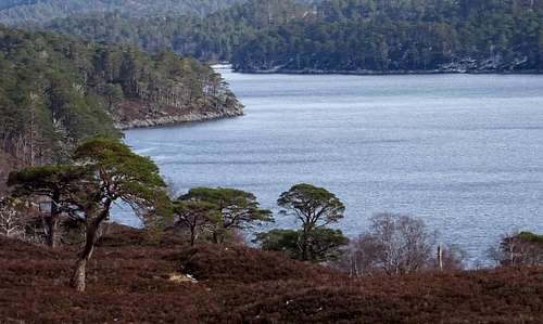
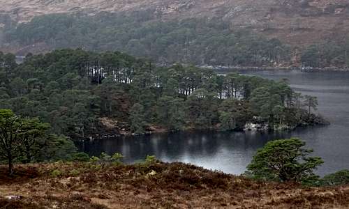
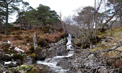
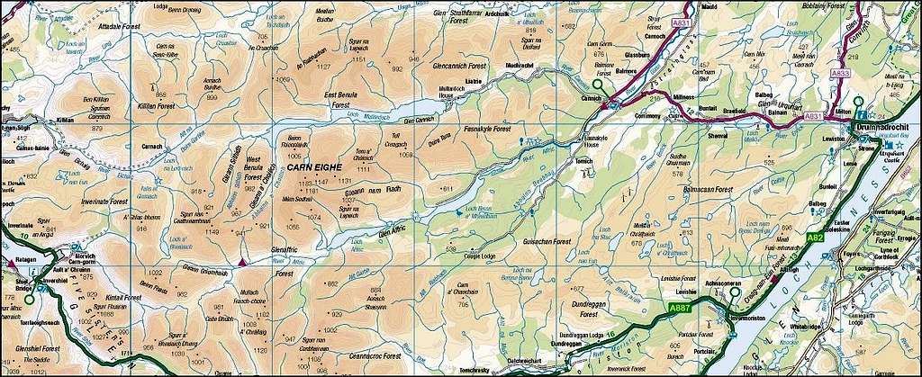
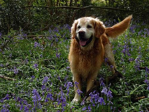
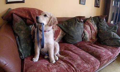
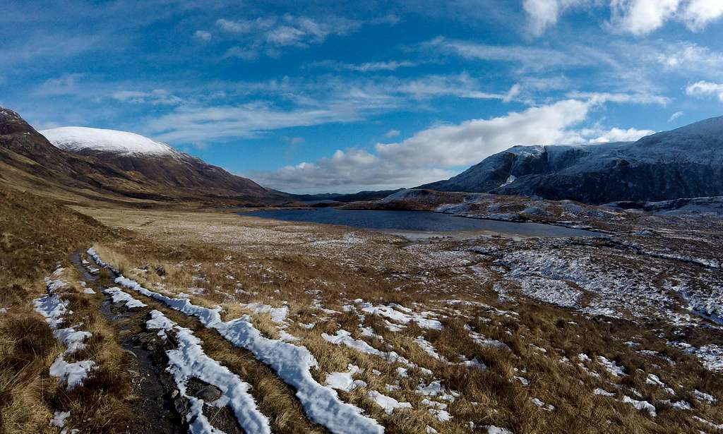
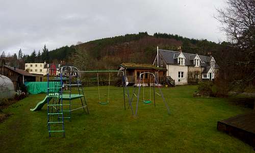
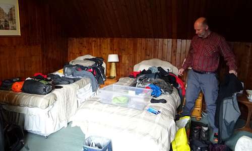
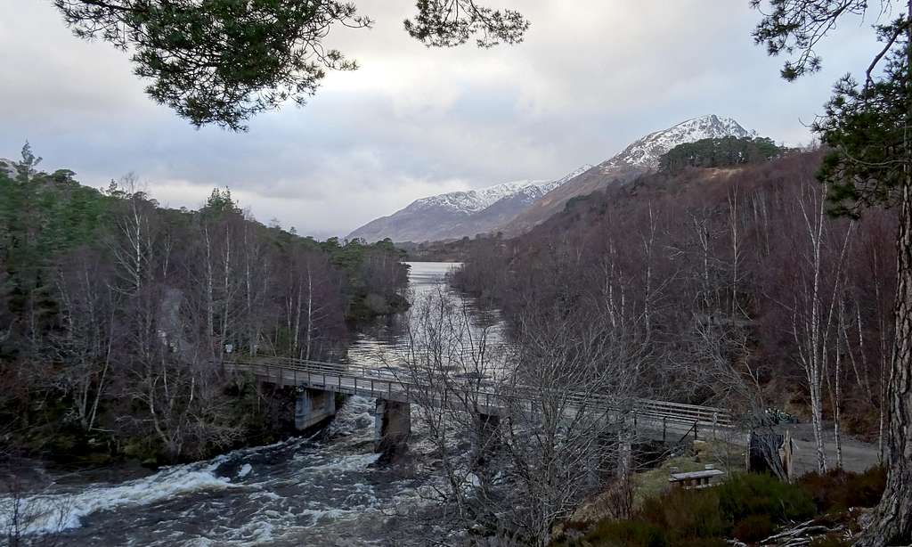
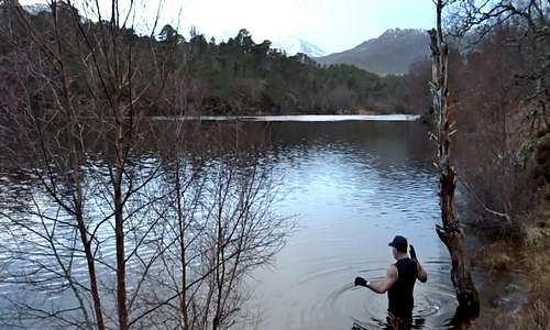
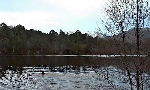
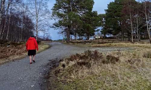
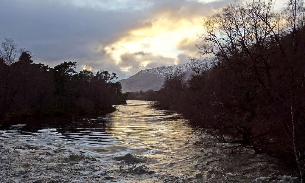
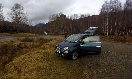
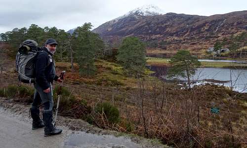


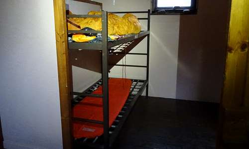
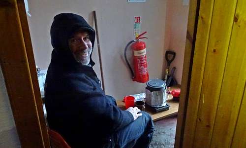
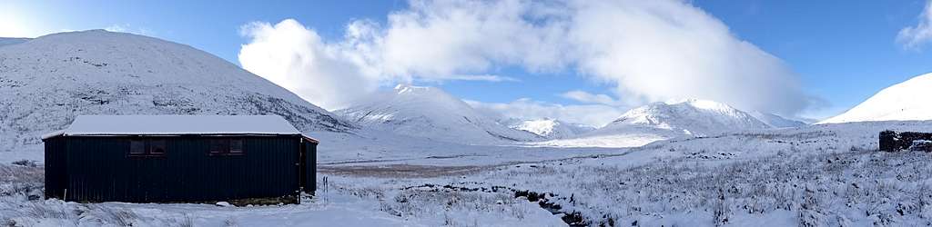
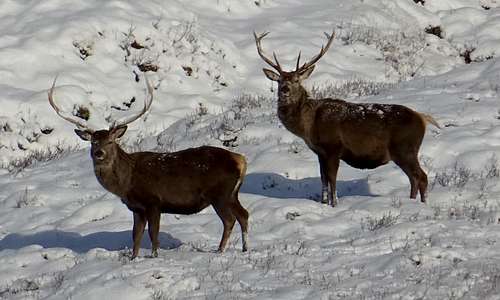
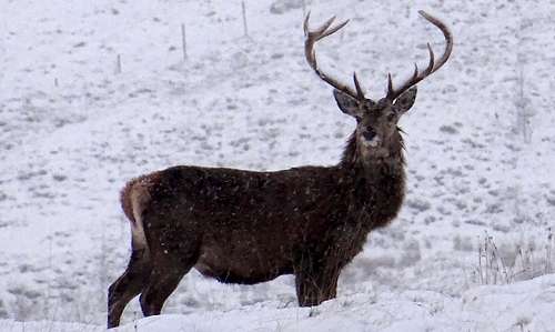
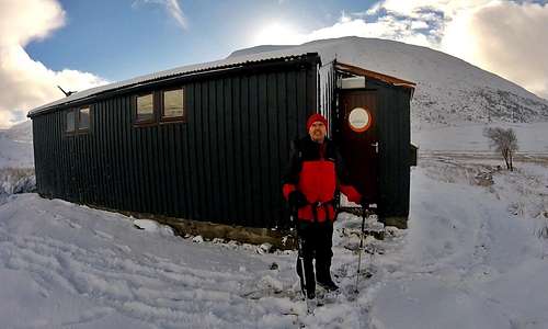
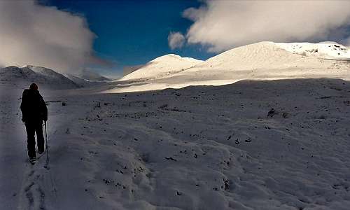
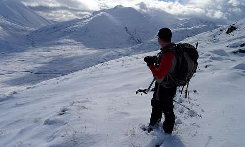
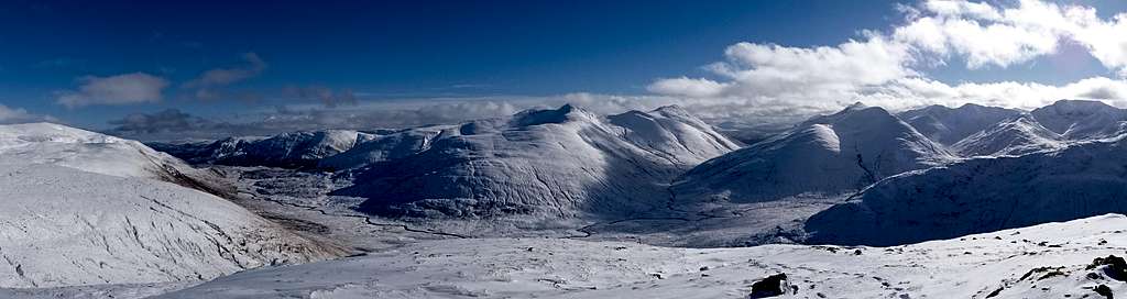
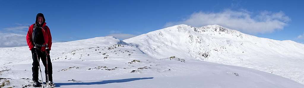
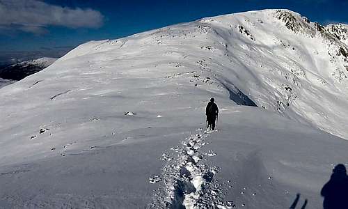
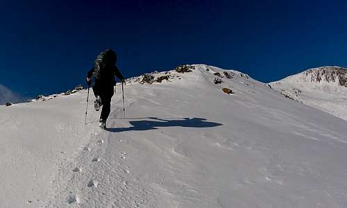
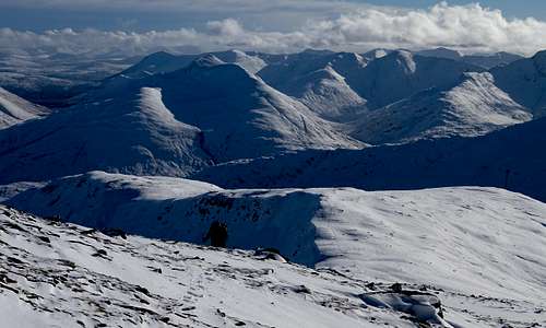
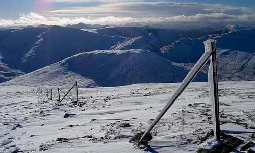
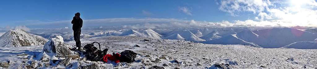
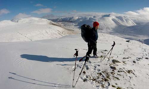
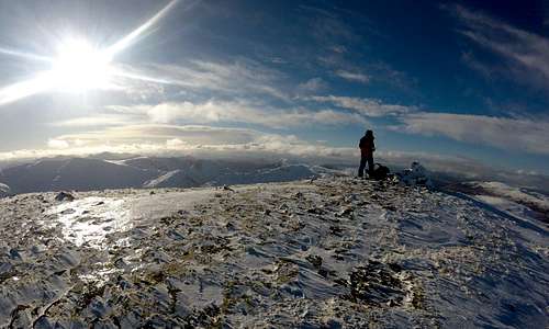
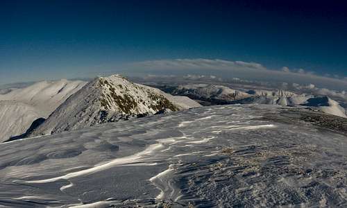
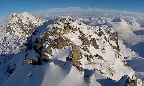
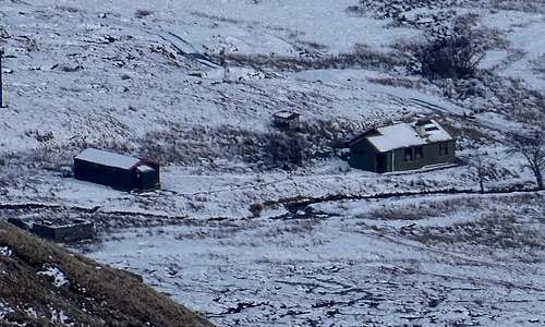
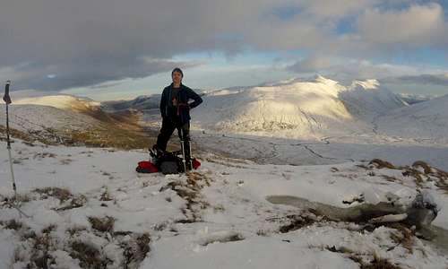
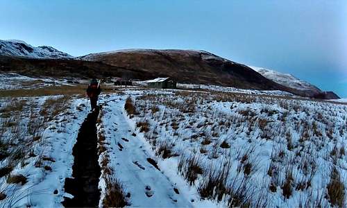
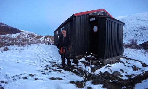

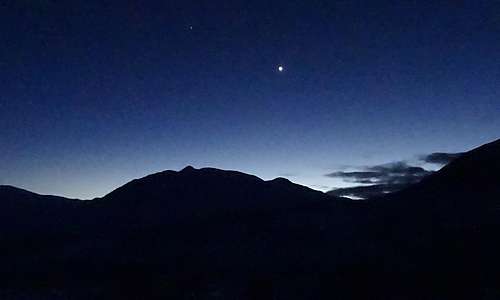
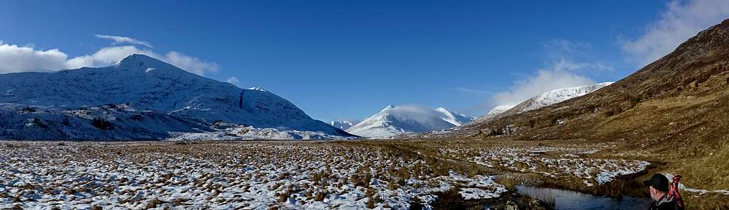
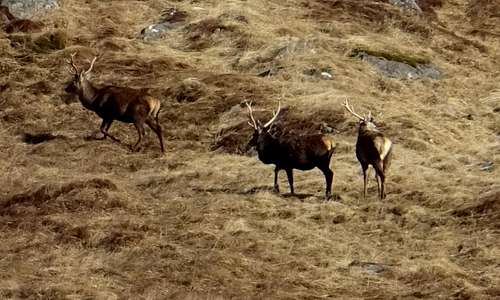

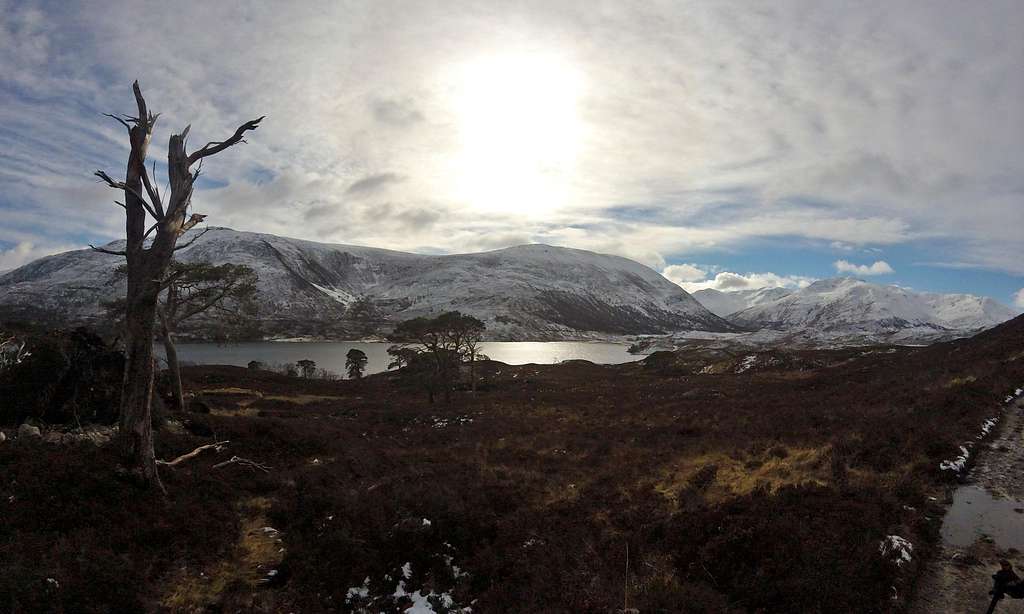
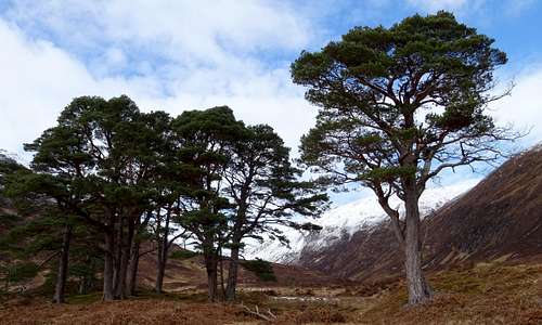
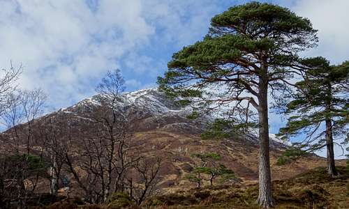
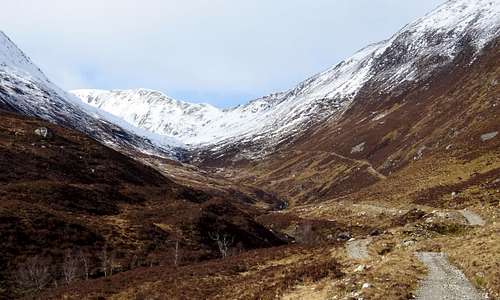
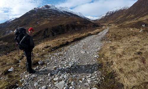
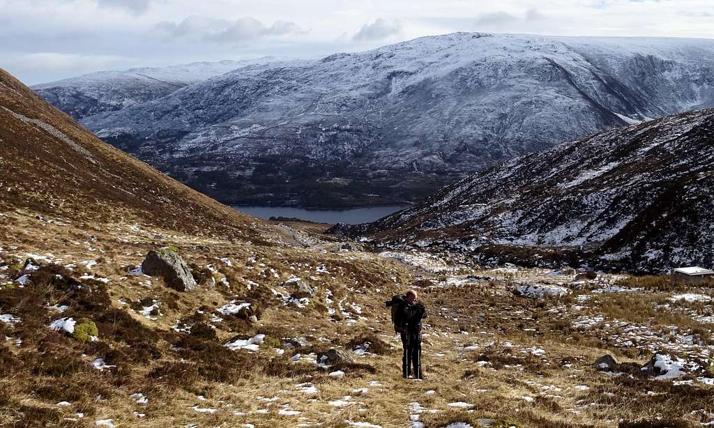
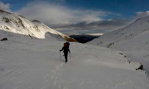
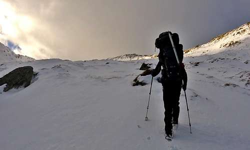
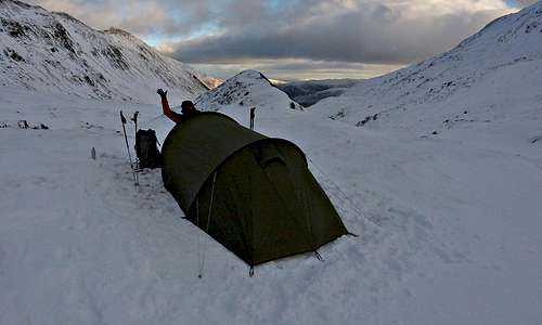
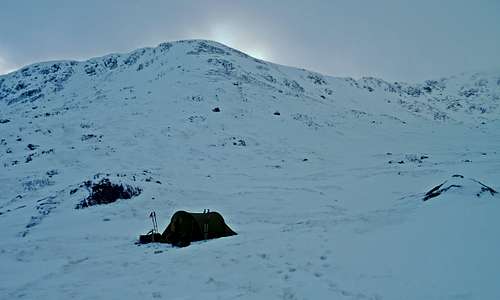
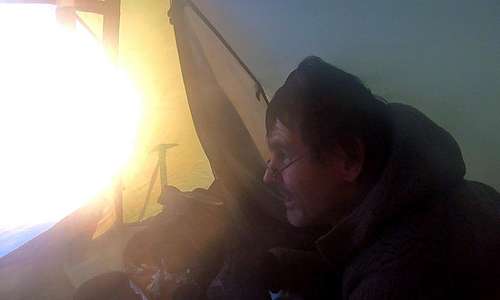
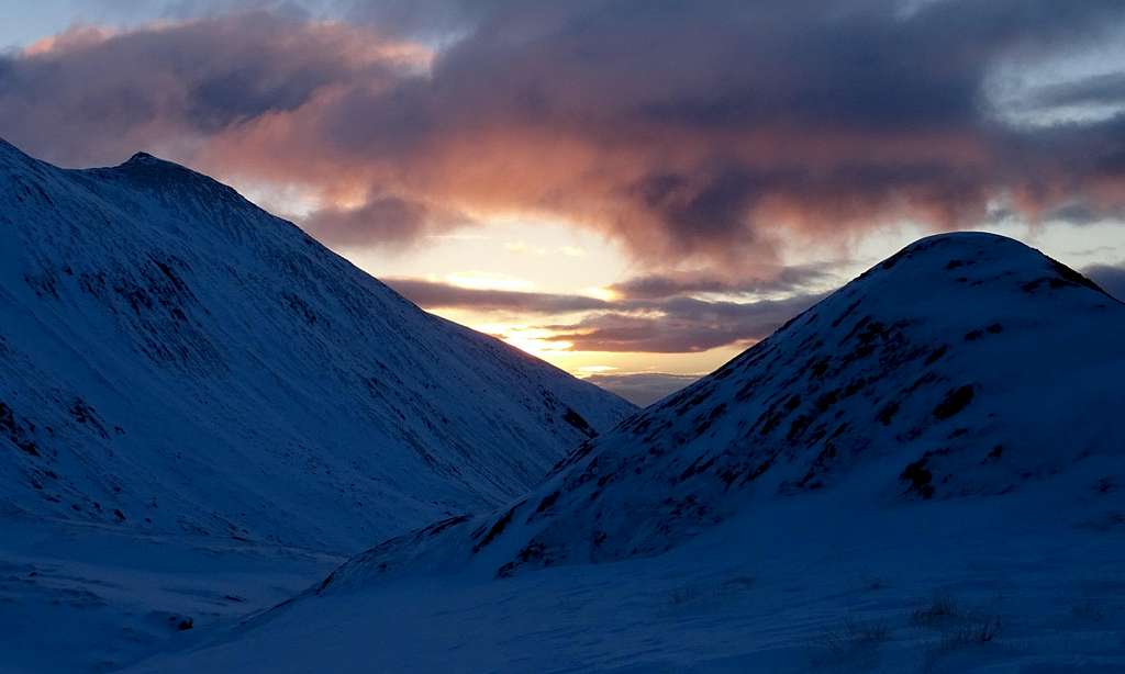
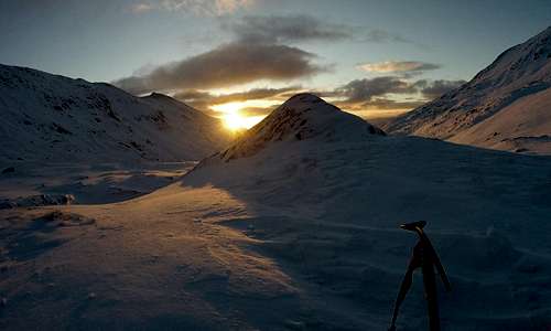
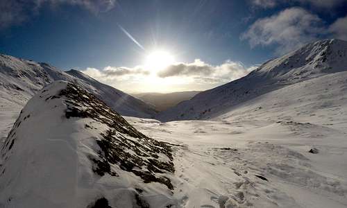
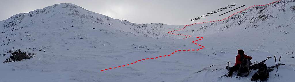
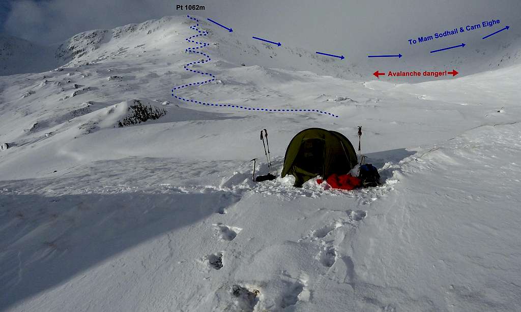
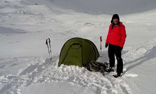
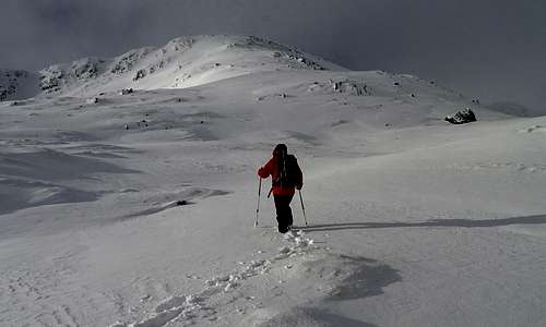
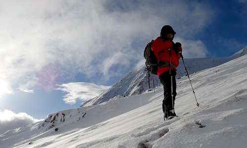
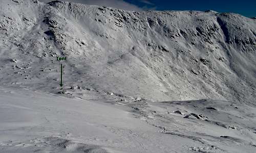
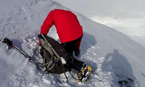
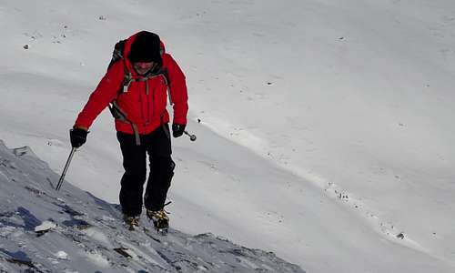
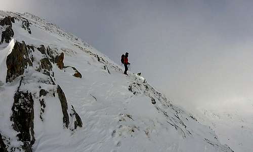
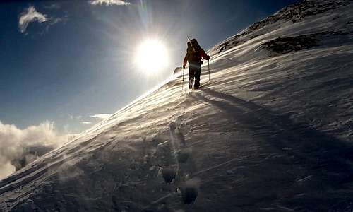
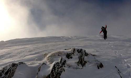
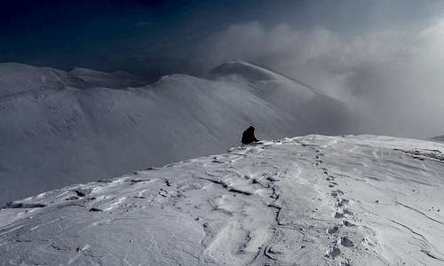
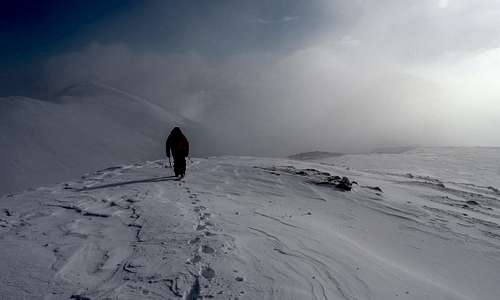
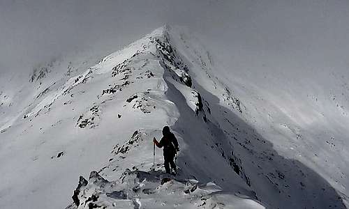
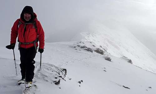
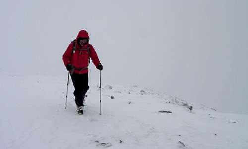
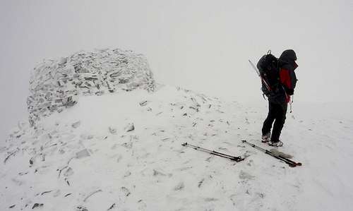
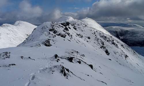
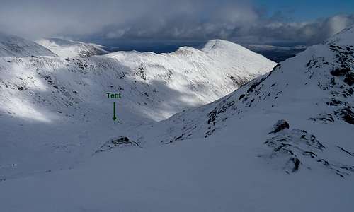
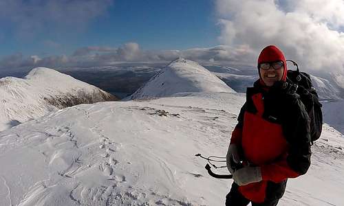
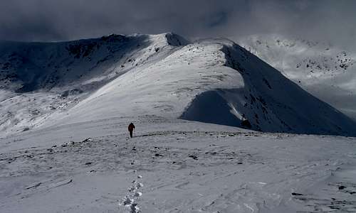
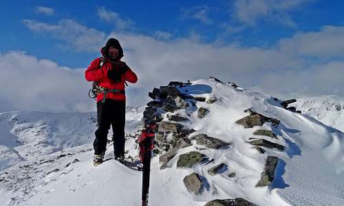
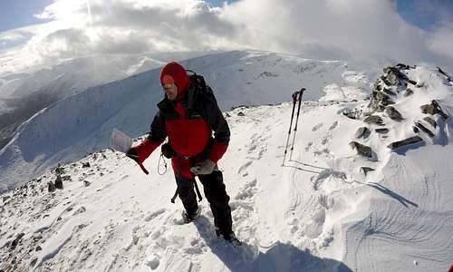
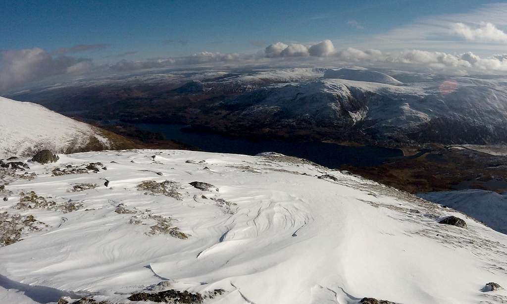
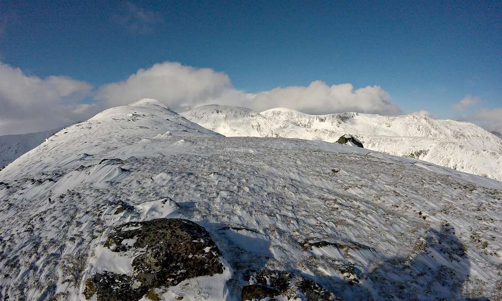
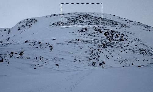
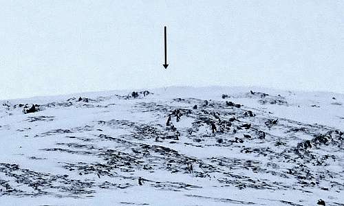
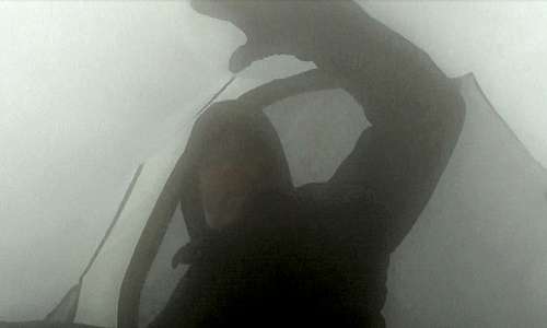
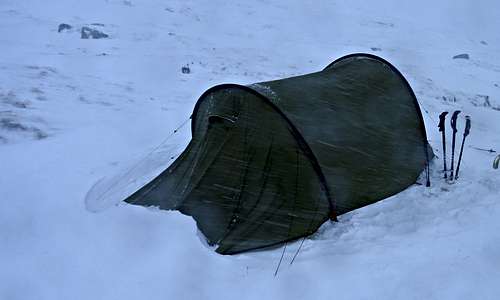
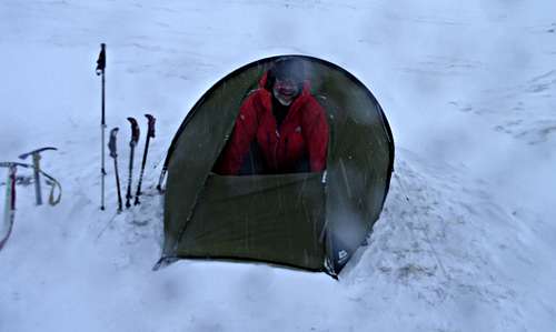
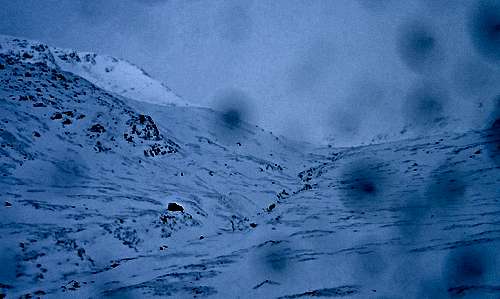
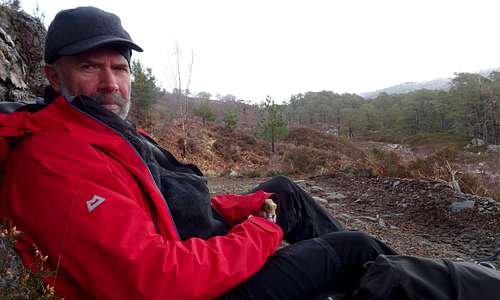
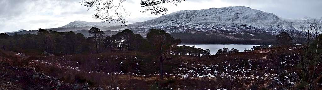
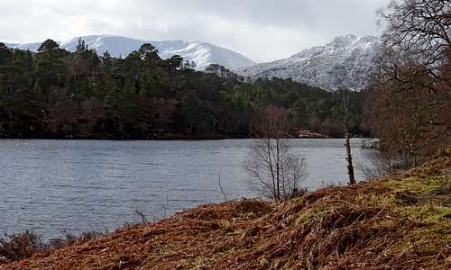
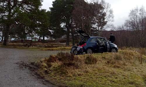

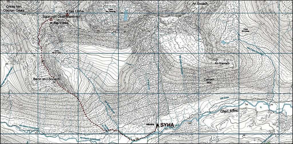
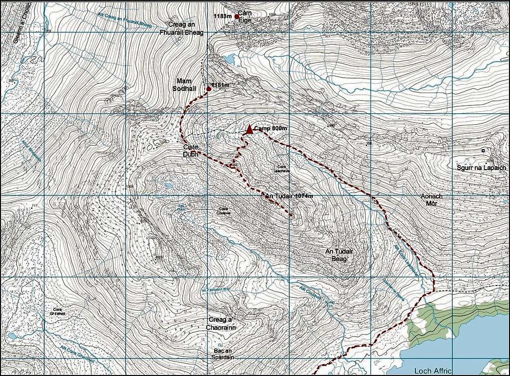


Comments
Post a Comment