Introduction to Langdale
The Langdale Pikes are a collection of four summits in one of the most beautiful and famous parts of the English Lake District. The classic skyline features in many a photo and in paintings dating back for literally centuries. My parents (sadly long dead) had a treasured painting, by an artist of modest renown, which I came to realise was of the Langdales, back in the 1960's. Then I remember walking the Pikes back in the 1980’s and rock-climbing in the Langdale valley in the 1970's, on Gimmer Crag...
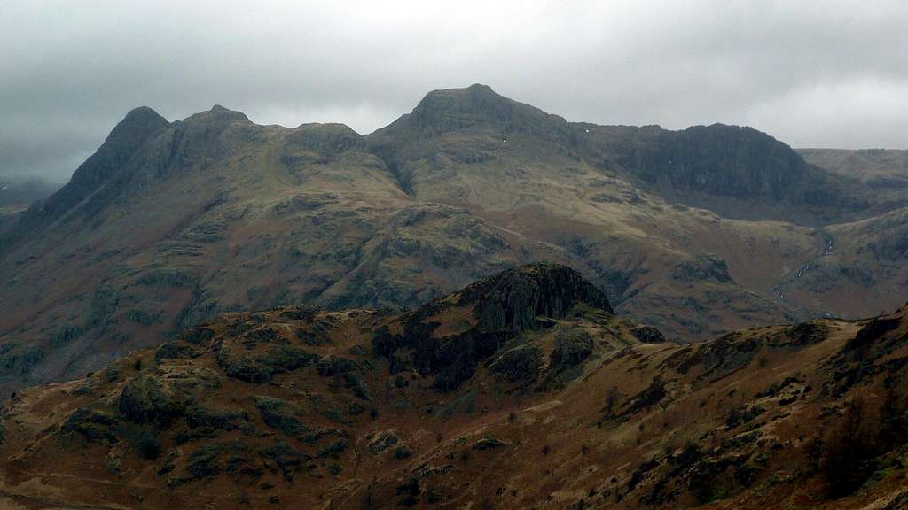
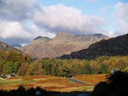
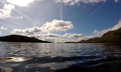
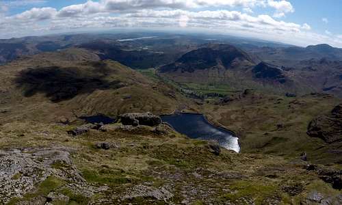
![Langdale Pikes]() Typical Langdale Pikes view as captured by Simnel on a grey February day... Typical Langdale Pikes view as captured by Simnel on a grey February day... | ![Langdale Pikes]() ...and classic view by nks as captured by generations of painters ...and classic view by nks as captured by generations of painters |
Browsing ‘Scrambles in the Lake District’ Cicerone guide by Brian Evans, inspired me to go back again in 2017. I particularly liked the look of Jack’s Rake – a mere grade 1 scramble, but slashing its way up across the otherwise strictly rock-climbing territory of the south-east face of Pavey Ark. In my early explorations I somehow missed this out. I also liked the look of Stickle Ghyll – less dramatic, but nevertheless a more sporting way of reaching Jack’s Rake than the boring foot-path. My interest stepped up a further notch: between the two scrambles lies the attractive mountain lake of Stickle Tarn. Normal procedure would be to walk round this 500 meter diameter water feature. Having recently taken up wild swimming, I started to like the idea of swimming across it – thus creating an eccentric scramble-swim-scramble combination… and with the possibility of going on to traverse the rest of ‘The Pikes’ after that… making it a scramble-swim-scramble-walk! (which I felt should give me the right to say I have done a triathlon ; )
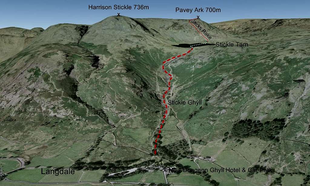
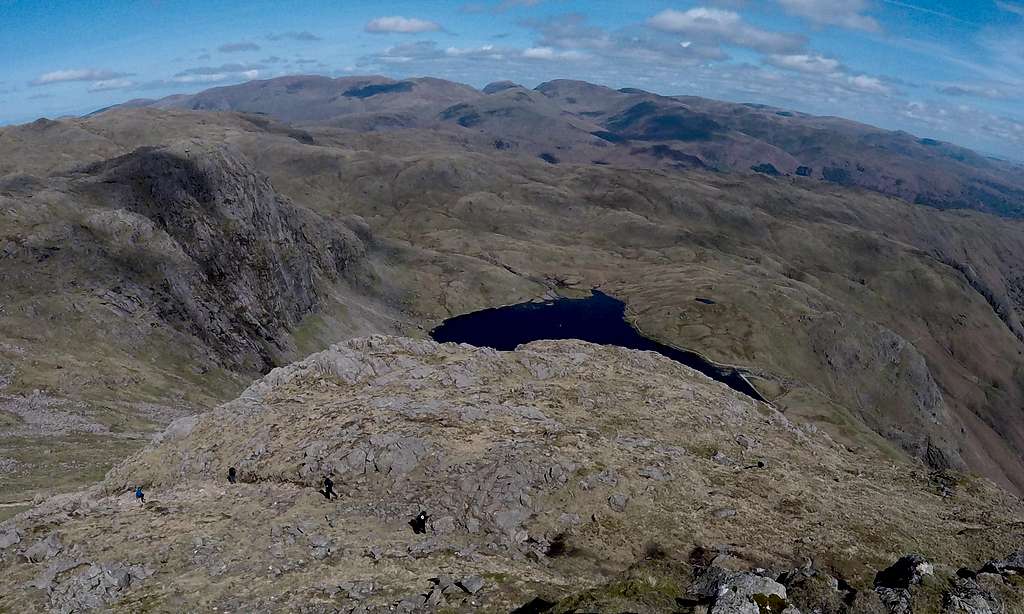
![Langdale Pikes: a route topo]()
L
angdale Pikes - and the proposed scramble-swim-scramble route to the top of Pavey ArkStickle Ghyll scramble
An opportunity to grab a day in the Lake District arose on Sunday 23rd April 2017 – although the weather forecast was not particularly good. Cold northerly winds were promised which were predicted to drag down freezing rain and even snow by midday. With a bit of luck there seemed to be the chance of a dry and even fair to fine start to the day. So I fancied I’d set off very early and after a two and a half hour drive expected to reach Langdale by around 7 am. If the tops were already in cloud I’d abandon my Pavey Ark plans and go off to explore the low laying Grasmere Lake...
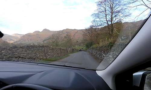
It was gratifyingly frosty and clear as I drove across the Pennines at sunrise. By the time I reached Kendal and shortly after Windermere, it was looking as if Pavey Ark was going to be a ‘go’. At the northern end of Lake Windermere I passed through a sleeping Ambleside and soon had the classic oft painted Langdale skyline slowly growing in the car windscreen: the two striking summits of Pike of Stickle and Harrison Stickle were totally free of cloud.
![Classic Langdales skyline]() Classic Langdales skyline seen through car windscreen... Classic Langdales skyline seen through car windscreen... | ![Classic Langdales skyline]() ...and from the car park for the cycling event ...and from the car park for the cycling event |
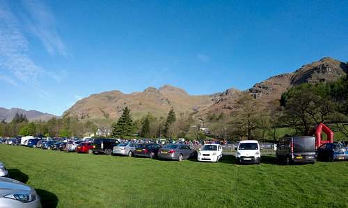
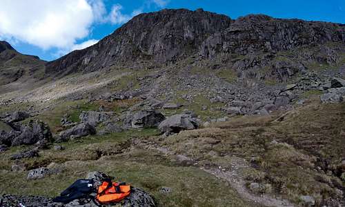
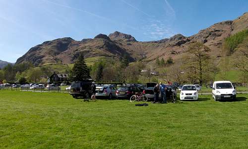
A little later I parked in a large field near to the New Dungeon Ghyll Hotel to find controlled chaos. There was a major cycling event on and even at 7 am the place was heaving with cars, competitors and their support crews – and bikes of course. I found where to pay my £5 for the privilege of parking in among it all for the day. Then I swiftly readied myself, packing swimming things, thermos and snacks into a bright orange dry-bag come day-sack come tow-float. By 7.30 I was away, off up in the trees and looking for the start of Stickle Ghyll.
A Ghyll incidentally is a shallow ravine with a stream in it. In the kingdom of Yorkshire these are called Gill’s, but in the Lake District Ghyll’s, a more ‘old English’ spelling. Both Yorkshire and Lake District are famous for their ‘Ghyll’ or ‘Gill’ scrambles - and with good reason.
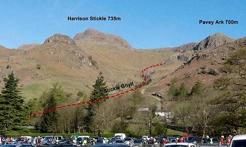
Stickle Ghyll is the shallow ravine in which the stream flows down from Stickle Tarn. It is 1.3 km long and descends some 270 meters. Given that water generally follows the shortest course downhill the Ghyll offers the most direct route up to the Tarn and Pavey Ark. But the more usual route is a well maintained tourist path which runs along and up the valley sides above. With the odd switch back and swapping of valley sides this route is less direct – but nevertheless offers a much quicker and easier ascent (as I would later have pointed out to me, by a baffled Scottish lady...)
![Stickle Ghyll route topo]() Stickle Ghyll route topo up to the little lake (out of view)
Stickle Ghyll route topo up to the little lake (out of view) | ![The start of Stickle Ghyll]() The start of Stickle Ghyll - initially horizontal boulder hopping
The start of Stickle Ghyll - initially horizontal boulder hopping |
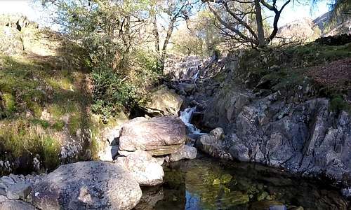
I followed this path into the trees and soon peeled away to the left when I first encountered the stream. Initially the going was a matter of mostly horizontal boulder hopping with the odd scramble around the edge of little waterfalls or up little rock steps. I circumnavigated little pools – nothing very deep. I wondered if there may be the odd deep plunge pool with bigger waterfalls up ahead, so at some point I stopped on a grassy leveling and changed into swimming gear – essentially a pair of light 2mm wet-suit shorts and vest – with heavy duty wet-suit shoes. I had no idea if there was a need to get wet on this scramble. Water levels were very low so probably not. However, if I found any really deep plunge pools then I may be tempted – but if not, then I’d try to stay dry until my swim across the lake.
![Near the start of Stickle Ghyll]() Near the start of Stickle Ghyll: a little cascade
Near the start of Stickle Ghyll: a little cascade | ![Near the start of Stickle Ghyll]() ...and a little later, a distant view of Pavey Ark
...and a little later, a distant view of Pavey Ark |
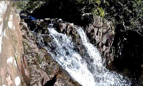
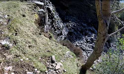
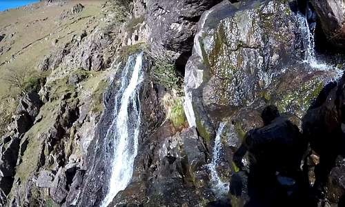
At some point the ravine was blocked by a man-made sheep barrier and I was forced to stray onto the path to get round it. A little beyond the trees started to thin out and the terrain started to become more interesting, with higher rock steps and waterfalls to circumnavigate. I reached the highest cascade and rocky barrier yet. From my recall of the guidebook I presumed this to be the crux (and rope recommended...). The obstacle was not much more than 30 feet high and the main waterfall was at the right hand end. Clearly it could be avoided, by climbing grassy ledges at the left hand end, but I decided to give it a go.
![The crux of Stickle Ghyll]() The little wall that is the crux of Stickle Ghyll
The little wall that is the crux of Stickle Ghyll | ![Climbing the crux of Stickle Ghyll]() Enjoyable climbing on the crux of Stickle Ghyll
Enjoyable climbing on the crux of Stickle Ghyll |
I picked a prominent rib heading straight up and initially ascended easily on good holds. The higher I got, the wetter – and I started to encounter patches of moss and green slime, which became progressively harder to avoid. I had limited trust in the gripping power of my wet-suit shoes at the best of times. Five feet from the top of the wall it steepened to nearly vertical with most holds I needed to use now wet and more uniformly slippery. A fall would result in serious injury or worse, so it wasn’t a difficult decision to turn back and climb back down. I have to say I enjoyed this little climb even though I didn’t reach the very top of the barrier. At the bottom I picked my way carefully over the rocks and headed to the left hand end before scrambling up the grassy ledges to the top – and heading on up-stream.
![Slimy finish to the crux of Stickle Ghyll]() The slimy finish which I didn't fancy soloing...
The slimy finish which I didn't fancy soloing... | ![Top of the crux of Stickle Ghyll]() ...and looking down after scrambling up the grassy ledges to the left
...and looking down after scrambling up the grassy ledges to the left |
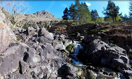
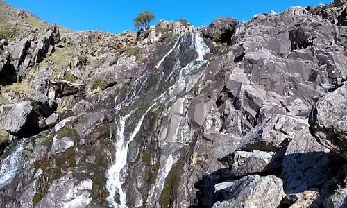
The next section involved consistent height gain and was a delight. A series of further cascades followed one immediately after the other, but each not quite as steep as the crux. There were a few plunge pools, but nothing worth getting wet for. I found the best thing was climbing on the easy slabs and rock steps to the right of the stream bed, albeit with some care on the slimy bits. Maybe 50 meters/150 feet of height were gained in this way and I was sorry when this section ended – and the water course flattened out into almost level boulder field which then eased around a right hand bend in the shallow valley.
![Near the top of Stickle Ghyll]() The next section involved scrambling to the right of the cascades...
The next section involved scrambling to the right of the cascades... | ![Upper section of Stickle Ghyll]() ...up little slabs and rock steps - with some care on the slimy bits
...up little slabs and rock steps - with some care on the slimy bits |
Around this bend the end was in sight. The bouldery stream bed rose up to a sort of sill – poking of the top of which were the now less distant and more striking tops of Harrison Stickle and Pavey Ark. I knew that my lake was just up there, on the other side of the sill, which was in fact a low man-made dam. The first thing I encountered when I popped up out of the boulders was a lone woman, standing on the low dam and admiring the views by the early morning sunlight. She seemed startled by my appearance and then rather amused.
“There is a perfectly good path you know” she lilted, immediately giving away her Scottish origin and whilst pointing over my right shoulder.
“Oh – I thought there was!” I responded in kind, playing the bumbling idiot “Damn - I should have checked the map!”
![Harrison Stickle and Pavey Ark]() Harrison Stickle and Pavey Ark from almost the top of Stickle Ghyll...
Harrison Stickle and Pavey Ark from almost the top of Stickle Ghyll... | ![At the very top of Stickle Ghyll]() ...and the Scottish lady telling me about the path...
...and the Scottish lady telling me about the path... |
Stickle Tarn swim
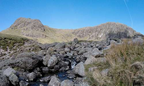
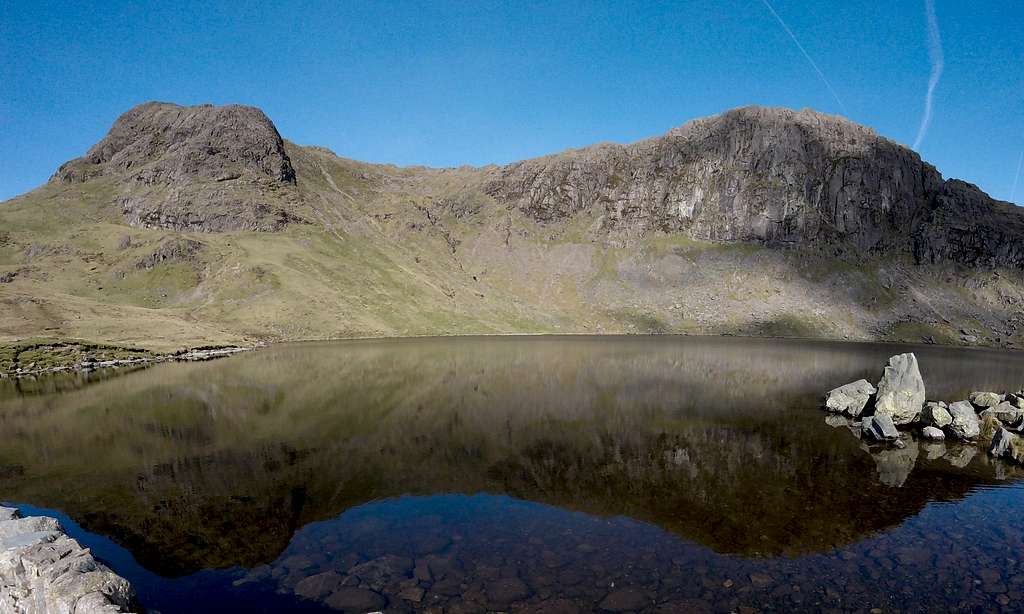
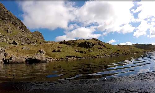
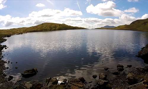
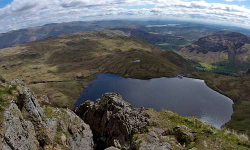
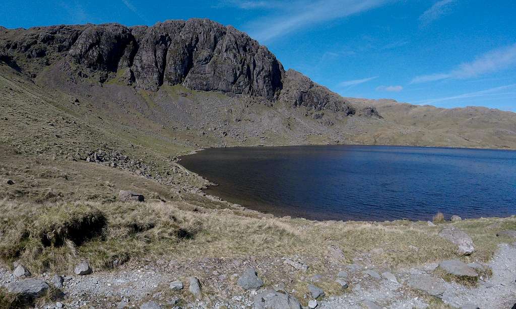
The crystal clear mirror smooth water of Stickle Tarn was now before me. Perfectly reflected were the striking prominence's of Harrison Stickle and Pavey Ark. This was what I was here for. The only thing was that it was a little cold, despite the still golden light of the mid-morning sun. That cool northerly wind was here, albeit very light just at that moment. The temperature in the lake was 9°C (48°F) – actually not too bad considering the time of year and altitude of around 470m.
![Stickle Tarn with Harrison Stickle & Pavey Ark]() The crystal clear waters of Stickle Tarn reflecting the back drop of Harrison Stickle & Pavey Ark
The crystal clear waters of Stickle Tarn reflecting the back drop of Harrison Stickle & Pavey Ark Diagonally across the lake and around 400m away I could see a continuation of the path rising up to the now quite formidable looking buttress which was the south-east face of Pavey Ark. And cutting up and across the buttress was the diagonal slash which I knew to be my next objective – Jack’s Rake. It looked very steep and exposed for a mere grade 1 scramble and I expected it would justify the 3 star rating given… But for now I turned my attention to my swim. My garish day-glow orange back pack was also a ‘dry-bag’ – which also metamorphosed into a tow-float. Having stowed away the ruck-sack straps and sealed it, I blew into a valve at the base and the thing inflated into a tense sausage, which I attached to a waste belt via a short lanyard. Equipped now to cross the channel if need be, I set about my 4-500 meter swim. Treading carefully I stepped off the low dam and into the shallows. Cold water seeped into my wet-suit shoes. Cold – but not icy. A couple of months earlier I had been for a swim in Loch Affric, up in Scotland. The temperature had been 5°C (41°F). That was really cold and had frozen my fingers and toes. Stickle Tarn was fairly mild in comparison. Nevertheless as I waded in ever deeper and the water closed over my bare shoulders I found myself taking a few gasping breaths.
![Swimming across Stickle Tarn]() Setting out towards Pavey Ark...
Setting out towards Pavey Ark... | ![Swimming across Stickle Tarn]() ...looking back towards the dam
...looking back towards the dam | ![Swimming across Stickle Tarn]() ...and looking back from further out
...and looking back from further out |
Tow-float obligingly following I struck out towards the middle of the lake – swimming my usual breast-stroke (I can’t do the crawl – and besides, I like to be able to see the view). A couple of ducks swam swiftly away – startled at the bizarre apparition invading their territory. About 100m out I made the first of several slow orbits to take in the scenery. The low dam was also a causeway and I took in that there now seemed to be a few people there silhouetted against the low sun. They seemed to be watching something – probably me. I could see the Scottish woman, slowly ascending the sunny slopes leading up to Harrison Stickle. She also seemed to pause at intervals to look down on the apparently unusual spectacle of a man + bright orange tow-float heading across the lake.
I passed the middle of the lake and headed directly for the opposite shore for a while, before gradually curving around to point at my planned landfall –diagonally across from my starting point. Thus my course was a curved ellipse –with further loops to review the view. After swimming for about 15 minutes I had a final look around and then headed purposefully towards the edge of the lake, where I could see sunny rocks and flat grass near to the path, just at the point where it started rising up the scree at the base of Pavey Ark. It looked an ideal spot to have a break and sort myself out before the next leg of the journey. I coasted towards the shallows, where a rocky bottom was soon visible through crystal clear water. Time to stop kicking and lower the undercarriage... my feet came into contact with the rocks, enabling me to stand up and carefully start treading my way to the edge – and out.
![Swimming across Stickle Tarn]() Getting closer to Pavey Ark...
Getting closer to Pavey Ark... | ![Swimming across Stickle Tarn]() ...and then my exit point just ahead...
...and then my exit point just ahead... | ![Swimming across Stickle Tarn]() ...and rocky bottom coming into view in the shallows
...and rocky bottom coming into view in the shallows |
A few steps on grass now and I was at a large flat topped boulder, which looked good both as a seat and drying rack. I peeled off my thin rubber vest and shorts and laid them out on the rock before deflating my tow-float and reaching inside for a small towel, clothes and now all important small flask of hot coffee. A little later I reached into the bag for some food. Although a little early the setting was perfect for an early lunch and some leisurely contemplation of the view across the lake – and on turning around; the next objective…
![Looking up at Pavey Ark]() Swimming things drying on the rock - looking up at Pavey Ark...
Swimming things drying on the rock - looking up at Pavey Ark... | ![Looking back across Stickle Tarn]() ...and back across Stickle Tarn
...and back across Stickle Tarn |
Jack’s Rake scramble
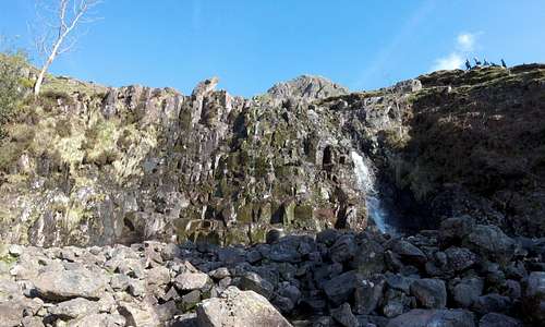
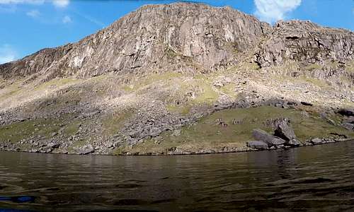
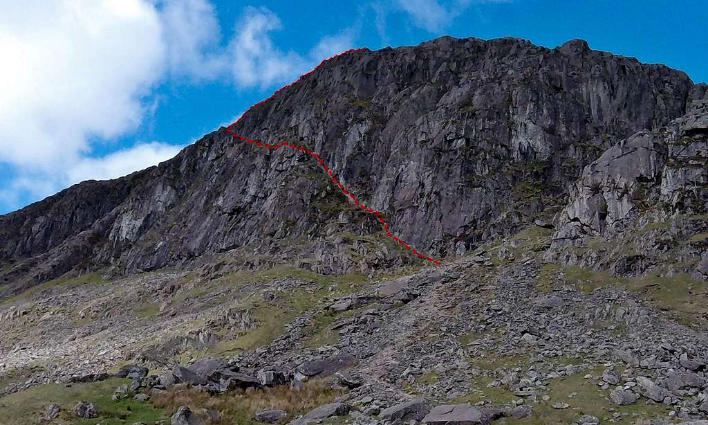
Close up Pavey Ark presents as a forbidding squat bulk of almost impregnable rock buttresses rising up out of a great fan of bouldery scree. But the fortress can be seen to be breached by what at close range looks like a great diagonal and even grassy ledge rising up from low right to upper left. This is Jack’s Rake –one of the arguably top 10 classic UK Grade 1 scrambles , with a 3 star rating for quality – well up there with the likes of Helvellyn’s Striding Edge, The Snowdon Horseshoe and Ben Nevis’s Carn Mor Dearg Arete.
![Topo of Jack's Rake, Pavey Ark]() The forbidding squat bulk of Pavey Ark, with topo of Jack's Rake
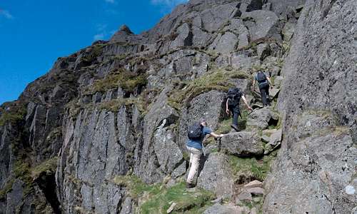
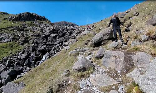
The forbidding squat bulk of Pavey Ark, with topo of Jack's RakeI packed away my swimming and lunch things – and got onto the path which had circumnavigated the little lake. Almost immediately an off-shoot started ascending the scree fan. My timing coincided with a large party of walkers, all headed in the same direction. It looked as if they also were headed for Jack’s Rake. I looked at them appraisingly and concluded from their progress up the scree that they would be of very mixed ability and that some of the stragglers would probably struggle with the steep scramble looming up overhead. Safe passing places looked to be few and it was easy to envisage getting stuck behind this party as any novices were coaxed over the more challenging bits. I decided to try and get ahead and off to a start before this large and unwieldy group. I moved off the main path and directly onto boulders and put on a bit of a sprint. I had no trouble getting round the stragglers, but it was a little harder overhauling the more able walkers at the front of the group, so I was in a bit of a sweat as I reached my objective.
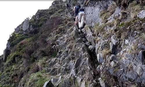
At the foot of the rocks I found another party – readying themselves to make a start on the scramble. This was a bunch of three young men. They looked potentially fit, so I made no effort to pass them. At least a couple of decades younger they’d probably leave me behind. Besides, I wanted to film the ascent on my GoPro – and having people in the frame would enhance things, especially as the exposure built. I ended up starting pretty much simultaneously with the three young men.
Jack’s Rake is fairly broad at the start, but soon rears up as a quite forbidding looking narrow and steep cleft. It is easy to see that the options are to stay in the cleft, keeping any exposure to the minimum – or to teeter on the edge, where there was some nice slabby climbing with impressive views into a growing void to the left.
![On the lower rocks of Jacks Rake]() Two of the young men on the lower rocks of Jacks Rake
Two of the young men on the lower rocks of Jacks Rake | ![Climbing the lower rocks of Jacks Rake]() ...and all three higher up the initial steep cleft
...and all three higher up the initial steep cleft |
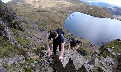
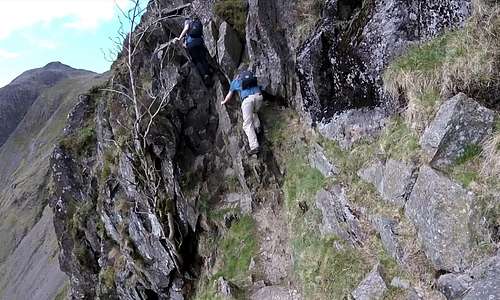
At the wider start I found myself climbing alongside the three young men. The smaller of the threesome appeared to be the leader. He moved a little faster up the rocks – but kept pausing and being attentive to his two companions, one of whom moved more slowly and seemed a little nervous at times. With the differing speeds, I came to be between the leader and his two team mates – and I paused to film them climbing up and past me, against the back-drop of the lake, now a few hundred feet below. I then found myself at the back of the pack – and filmed them climbing up ahead of me. Moving on average at the pace of the slower man, the party nevertheless moved quickly enough not to hold me back. I became an un-spoken member of their little group. Meanwhile the very large party, stragglers and all, were clustering down at the bottom of the climb, but not yet starting up. This was the last I saw of them and I wondered if they were even going to attempt Jack’s Rake. Maybe they were bound for one of the walking routes.
![Climbing the lower rocks of Jacks Rake]() Pleasant scrambling up slabby rocks to the left of the cleft
Pleasant scrambling up slabby rocks to the left of the cleft | ![Climbing Jacks Rake]() The lake beginning to recede far below as the exposure increased
The lake beginning to recede far below as the exposure increased |
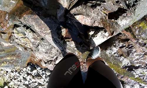
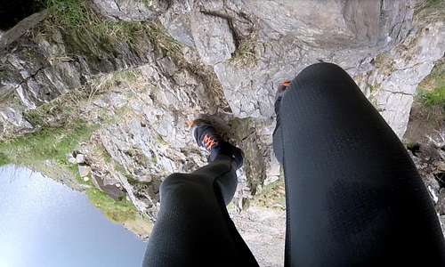
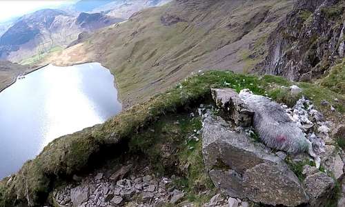
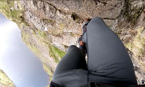
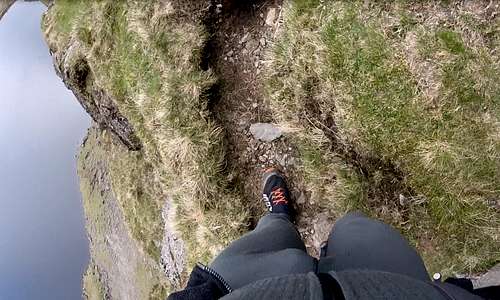
Where possible I tried to stay out of the cleft and climbed on the slabby rocks at the edge. The exposure, predictably, was growing and I started to appreciate why Jack’s Rake commands such respect, even though ‘just a grade 1 scramble’.At some point I reached a little ledge, with a tree and paused to admire the view. Just a little bit further on I encountered a dead sheep, which had clearly fallen from the precipices above. The smell was not pleasant as I eased around it and I held my breath. Rather sad – and at this time of year potentially made at least one lamb an orphan...
The poor unfortunate sheep marked a change in the angle of the route. There was now a section where for a hundred meters or so the route was almost horizontal. There was actually a path, forming a narrow walkway with the abyss of the lower Pavey Ark main buttress to the left and the forbidding vertical world of the upper buttress to the right. Half way along the level section I encountered the three young men carefully climbing a step, where a rib of rock came down and split the level ledge into two sections. The climbing was easy but this was one place where there was no choice but to push out towards the very edge of the big drop.
![Climbing Jacks Rake]() The unfortunate sheep...
The unfortunate sheep... | ![Climbing Jacks Rake]() ...and the lads on the little step at end of first horizontal section
...and the lads on the little step at end of first horizontal section |
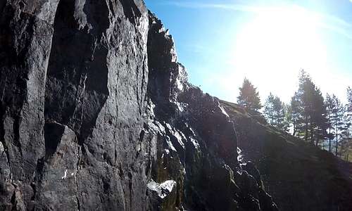
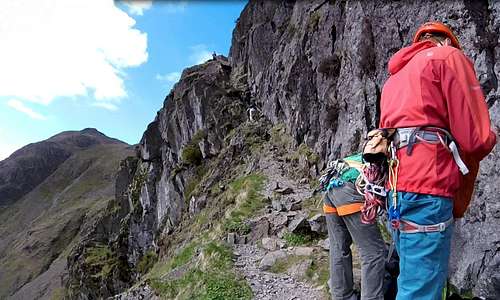
Just on the other side of the rock step the horizontal path continued, but at a slightly higher level. Here were a couple of rock-climbers, readying themselves to launch up into the dizzy heights of the upper buttress. I assumed they had already completed a climb on the lower buttress. The routes on both these walls are mostly hard and uncompromising, with only a handful of climbs below UK VS (‘very severe’ or UIAA V, USA 5.7) in standard. Thirty years ago I would have been attracted to some of these routes, but not now. As I stepped carefully around the two rock-climbers I felt no envy.
![Climbing Jacks Rake]() Passing the climbers heading along more horizontal ledge...
Passing the climbers heading along more horizontal ledge... | ![Crux of Jacks Rake]() ...and on to the chock-stone crux of Jacks Rake
...and on to the chock-stone crux of Jacks Rake |
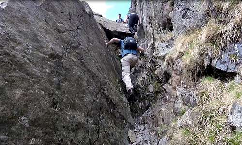
I walked along the path, enjoying the magnificent views down to the lake far below. All too soon the gradient started to increase and it was back into increasingly steep rock crevice again – but a bit more open and closer to the edge of an even bigger void. There was an increased sense of seriousness and of approaching some kind of crux…
I caught up with the lads again. They were getting to grips with a deep narrowing in the cleft with a big chock-stone at the top. This seemingly was the crux. The gingery bearded, bespectacled and peak capped leader had climbed around this obstacle easily, as did the dark haired second. But the more cautions and fair haired and bespectacled third man looked to be finding things more difficult. I paused to watch – and film. I noticed the leaders head bobbing back into view. He had climbed back down a little way and peered back around the big rock, to give encouragement. Evidently he was advising his friend to tackle the obstacle without his rucksack since he was now shrugging it off and handing it upwards, to where it was swiftly grabbed and stowed up out of sight. Now the man climbed up, slowly and methodically, following his leaders instructions. With an awkward step to make I noticed him trying to use his knee – and I heard ginger-beard rebuking him. Quite right too! He changed his position and got his foot up onto the ledge he was trying to gain purchase on – and then he got up and around the boulder – and out of sight.
I quickly decided that I didn’t want to challenge my greater bulk with the narrow cleft – and returned to my teetering on the edge, well out of the recess. Once again, this provided some quite breath-taking scrambling, with little more than air between me and a distinctly distant lake, far below. A few steps along a narrow walkway and I soon joined the lads on a wide sunny ledge above the little crux. The red-shirted and bespectacled third man was now shrugging his rucksack back on as the little group prepared to move off again. We acknowledged each other in a brief exchange of words. They didn’t seem to mind my loose association with their little party and I carried on following them –and filming them at intervals.
![Climbing Jacks Rake]() I avoided the squeeze round the chock-stone...
I avoided the squeeze round the chock-stone... | ![Climbing Jacks Rake]() ...by teetering on the edge and climbing up to...
...by teetering on the edge and climbing up to... | ![Climbing Jacks Rake]() ...the narrow walkway at the top of the pitch
...the narrow walkway at the top of the pitch |
We seemed to have completed the main ascending diagonal slash of Jack’s Rake across the vertical main wall of Pavey Ark. The route now bent to the right around another rocky rib to climb steep but broken rocky terrain at the edge of the upper buttress. The most obvious line of weakness was towards a prominent conical rock up on skyline. As with all of the route thus far this was diagonally up to the left, but the route to get there weaved about around low rock steps on a mix of bits of path or less clearly defined grassy ledges. The route was no longer exposed and there was a sense of having passed the crux and being on the home straight. I kept glancing up at the conical rock. Did that mark the top of the route?
![View from Jack's Rake]() The grassy ledge above the crux with tarn and Langdale far below
The grassy ledge above the crux with tarn and Langdale far below | ![The final section of Jacks Rake]() The three lads heading up towards the prominent conical rock
The three lads heading up towards the prominent conical rock |
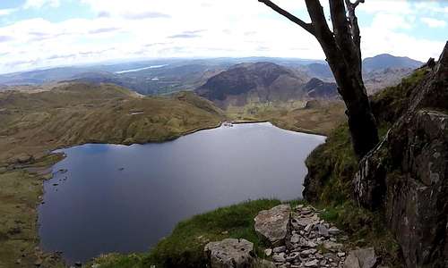
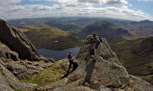
I followed the three lads up the easy but pleasant final scramble up to the prominent rock. Close up this metamorphosed from a cone into a rather wonderful viewing platform, commanding an Eagle’s eye view of the lake and on down into Langdale. To the right the near skyline was taken up with the impressive profile of Harrison Stickle, highest of the four ‘Pikes’. My mental query was answered: yes - this was the top of route. It wasn’t the top of Pavey Ark though. Having traveled in a roughly westerly direction up Jack’s Rake to the prominent rock, the summit lay off to the northeast somewhere – behind a barrier of easy angled rocks. I didn’t stay long. I chatted for a few moments to the three lads – and one of them noted my e-mail address on his phone, so I could send them 'the movie' with all my GoPro footage of them climbing the Rake (many of the images are frames captured from video clips, but there are a few still shots as well)
![Three lads from Lancashire at the top of Jacks Rake]() Three lads from Lancashire on top of the conical rock at the top of Jacks Rake
Three lads from Lancashire on top of the conical rock at the top of Jacks Rake | ![The top of Jacks Rake]() And again, showing the magnificent view beyond
And again, showing the magnificent view beyond |
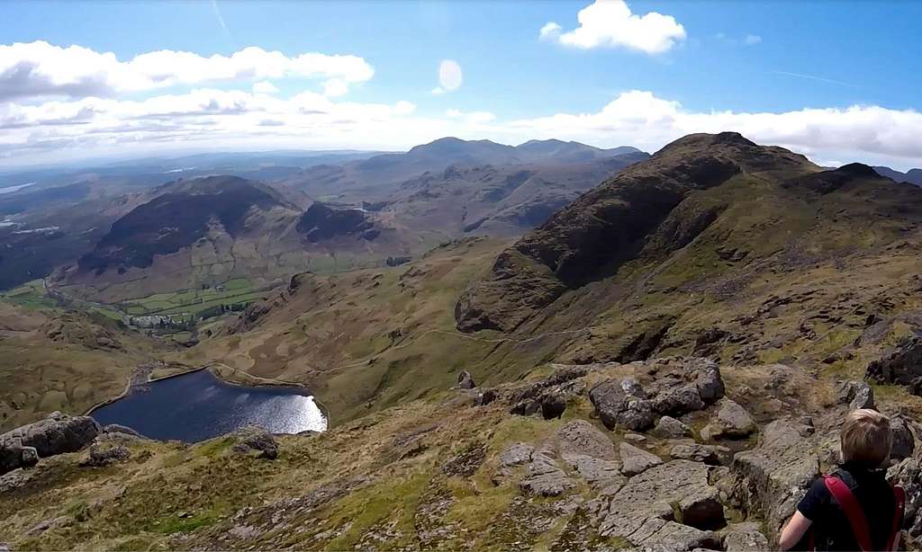
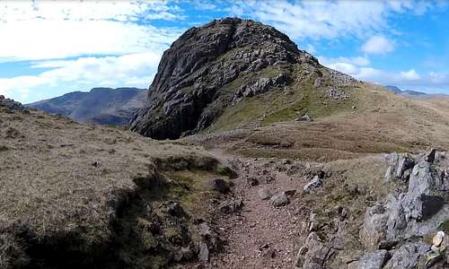
I carried on, impatient to see the views from the top of Pavey Ark. Away from the conical rock and the edge of the buttress was a trail – initially heading northwest along the bottom of the barrier – but very soon turning right and penetrating at an obvious weakness. A few meters of easy scrambling and there was the top of Pavey Ark: a low bouldery prominence sticking up out of a wide grassy plateau, set well back from the edge of the buttress. As much as anything it was marked by the hordes of people swarming all over it – plus several dogs. In addition to Jack’s Rake there were more than a couple of popular walking routes up here – and despite the iffy forecast it was still a fine day.
![View from summit of Pavey Ark]() View from summit of Pavey Ark looking south towards Harrison Stickle - with few signs of the overdue weather front.
View from summit of Pavey Ark looking south towards Harrison Stickle - with few signs of the overdue weather front.The view was good, but being set back away from the edge the summit did not have the Eagles nest feel of the conical rock. I had a quick look round, took some more GoPro footage and then considered my options. I had achieved my objectives of Stickle Ghyll, swimming the lake and scrambling up Jack’s Rake to the top of Pavey Ark. It was only midday. Whilst there was a keen northerly breeze blowing now and a few meaningful clouds were popping up here and there, it did not look as if the weather was going to close in as soon as the forecast had said. I still had plenty of energy left – and there were the other Pikes…
![View from summit of Pavey Ark]() View from Pavey Ark summit looking east...
View from Pavey Ark summit looking east... | ![View from summit of Pavey Ark]() ...and looking south east
...and looking south east | ![At the summit of Pavey Ark]() ...and looking south
...and looking south |
The Langdale Pikes
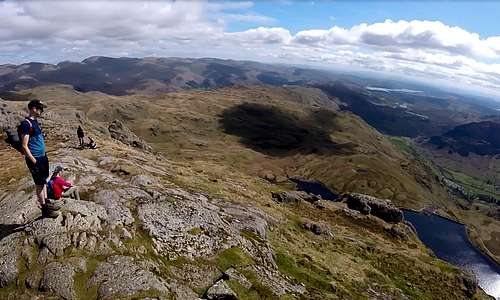
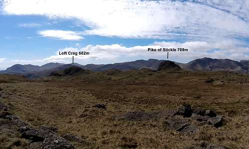
A route I had seen on WalkLakes took in the three other Pikes of Pike of Stickle 709m 2326ft, Loft Crag 682m 2238ft and Harrison Stickle 736m 2415ft, but also another top called Thunacar Knott 723m 2371ft. None of these little summits were much more than a kilometer away from where I stood on top of Pavey Ark. With the weather signs I was seeing I decided I easily had time to get round all of them… starting with Thunacar Knott.
Thunacar Knott was the least inspiring but actually second highest of my now four objectives. At 723m it was actually all of 23 meters higher than the summit I was standing on. It didn’t look it. I stared WNW across 600 meters of boggy plateau behind Pavey Ark – and there it was: a grassy knoll, distinguished only by an undeservedly large cairn. There was little in the way of distinguishable trail. WalkLakes pointed out that this particular summit was hard to find in the mist. I could see why. But there was no mist. I picked my way down the back of Pavey Ark, around little rocky humps and boggy hollows, onto the marshy plateau. Less than 15 minutes’walk, slowed only by my desire to try to keep out of the wet bits in my trail shoes, and I was at a large cairn marking the summit of Thunacar Knott. Being in the middle of the large marshy plateau there was not much more to see. The terrain looked similar to photos I had seen showing the wilderness of the Falkland Islands. Looking back the way I had come, in an easterly direction, I could barely make out the top of Pavey Ark. Looking south, more obviously, I could see the tops of all three of my next objectives, poking up rather incongruously out of the edge of the plateau.
![At the summit of Thunacar Knott]() At the summit of Thunacar Knott...
At the summit of Thunacar Knott... | ![Heading south from Thunacar Knott]() ...and heading south, initially to Pike of Stickle
...and heading south, initially to Pike of Stickle |
I set out roughly in the direction of the most distant and right hand top, Pike of Stickle. I say roughly since my trail shoes were still dry and I continued to aspire to keep them that way – or at least for as long as possible. Pike of Stickle was the most incongruous looking of the threesome, popping up out of no-where like the ruins of some medieval castle just over a kilometer away, on the near horizon. Between me and it was the low boggy depression of Harrison Combe. WalkLakes said go right across it, but on seeing it I decided to skirt around it to the left – picking up a more major (and hopefully drier) path.
At some point I chanced across a little grassy prominence with a tempting sunny façade, out of the cool northerly breeze. Having not had a re-fueling stop since the lake I decided a break was in order. It was also an opportunity to dry out my still damp swimming things a bit more. So I hauled my rubber shorts and vest out and draped them over nearby boulders for half an hour whilst I had a snack – and, in deference to my advanced age, a nap.
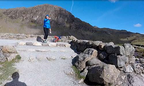
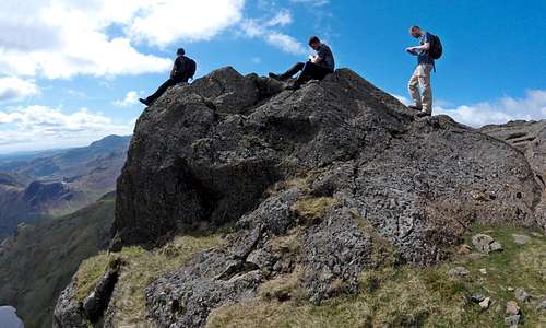
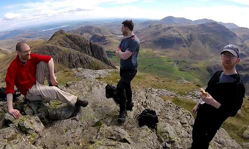
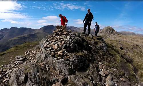
My kit was virtually dry when I awakened. I packed all away in my rather garish day glow sack cum tow-float – shrugged it onto my back – and cast off in the direction of Pike of Stickle – or rather in the direction of the well-established trail at the edge of the plateau, which led to this incongruous looking top. Just before I reached the trail I hit the first piece of bog which I couldn’t avoid – and had no alternative but to squelch on through it,instantly saturating my feet through my inadequate trail shoes. Shortly after, I reached the main path and there before me were the final battlements of the medieval fortress of Pike of Stickle. A pleasantly airy bit of path easily breached these defenses, winding its way around small buttresses and all the way up to a large summit cairn. As I approached the cairn there was nobody to be seen and I assumed I had the summit all to myself. Just on the other side however, I stumbled across the threesome from Lancashire – enjoying their lunch along with the rather fine view down into Langdale. After Jack’s Rake they had also visited the summit of Pavey Ark, but then had come direct to this summit, missing out Thunacar Knott, which in any case was not one of the Langdale Pikes.
![Top of Pike of Stickle]() Final battlements of Pike of Stickle...
Final battlements of Pike of Stickle... | ![The three Lancashire lads at the top of Pike of Stickle]() ...and look who I found on the summit
...and look who I found on the summit |
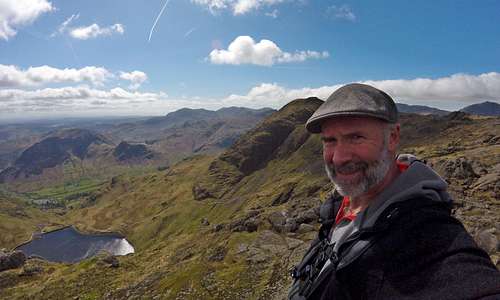
At this point I became an unofficial fourth member of the party and joined the lads for the scenic traverse all the way over Loft Crag to the final and highest Pike – Harrison Stickle, all of 736m 2415ft high. This is a trivial altitude by SP standards, when Alpine ranges (in several countries), Andean and Himalayan giants feature in abundance. I have bits of experience of all three mountain settings over many years, including recent experience up to 6000m, in the Andes – but I could nevertheless still find the view from the top of Harrison Stickle spectacular, with the 600m drop-off down into Langdale – and some 250m back down to my new friend the little lake. We all enjoyed a last prolonged stop to make the most of the view – stretching to all four corners of the horizon. The time was around 1.30 pm. The anticipated weather front was now well overdue – although signs of its approach were increasingly evident with streaks of cirrus now intermittently veiling the sun and occasional tattered looking small clouds being briskly dragged overhead by the still strengthening northerly winds.
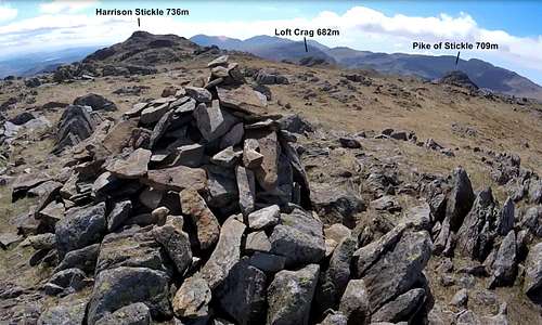
![Three Lancashire lads at the top of Loft Crag]() Three Lancashire lads at the top of Loft Crag...
Three Lancashire lads at the top of Loft Crag... | ![Harrison Stickle from Loft Crag]() ...and looking towards last and highest summit Harrison Stickle
...and looking towards last and highest summit Harrison Stickle |
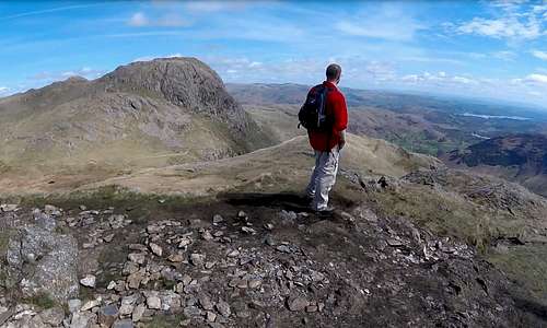
![View from the summit of Harrison Stickle]() GoPro still image of Pavey Ark and Stickle Tarn from Harrison Stickle summit
GoPro still image of Pavey Ark and Stickle Tarn from Harrison Stickle summit |
![Pavey Ark and Stickle Tarn]() Another still image of Pavey Ark and Stickle Tarn after the 250m descent from Harrison Stickle
Another still image of Pavey Ark and Stickle Tarn after the 250m descent from Harrison Stickle |
Still with the three lads (I never found out their names!) I cast off from the summit for the final descent to Langdale. We descended the steep rocky path dropping back down to Stickle Tarn between Harrison Stickle and Pavey Ark. There was time for a last contemplation of the little lake, which I had swum across just a few hours earlier. And then on back in the direction of Stickle Ghyll – but this time, not down all the boulders and rocky waterfalls of the Ghyll itself,but down the well-defined path alongside (which the Scottish lady had teasingly pointed out to me hours earlier)
![Descending from the Pikes alongside Stickle Ghyll]() Descending from the Pikes alongside Stickle Ghyll
Descending from the Pikes alongside Stickle Ghyll | ![Looking up Stickle Ghyll towards the Harrison Stickle and Pavey Ark]() Looking back up Stickle Ghyll towards the Harrison Stickle and Pavey Ark
Looking back up Stickle Ghyll towards the Harrison Stickle and Pavey Ark |
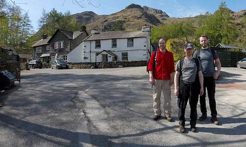
We reached the New Dungeon Ghyll Hotel at around 2.45 pm – for me completing a 7 hour circuit. Here I bade farewell and thanks for your company to the Lancashire lads, as I have come to remember them. One of them had noted my e-mail address on his phone and was supposed to contact me – so I could send them the link of the little movie they now feature prominently in – and to this post as well. But thus far no contact. C'mon guys - where are you? You are missing your big break into the movie world!
![Three Lancashire lads at New Dungeon Ghyll]() (The elusive) 3 Lancashire lads at New Dungeon Ghyll (anyone recognise them?)
(The elusive) 3 Lancashire lads at New Dungeon Ghyll (anyone recognise them?) | ![Langdale Pikes]() Full circle: The Langdale Pikes from the carpark again
Full circle: The Langdale Pikes from the carpark again |
I headed back to the car, well satisfied with the most varied and one of the most enjoyable days I have had in the Lake District. I reflected that combining scrambling with walking – and swimming – is a really fun thing to do. I could get used to it.
And at some point there is Eskdale Gorge still to do…Map of the route
![UK OS Map of the Langdale Pikes]() UK OS Map of the Langdale Pikes
UK OS Map of the Langdale PikesThe Movie
Here is a 16 minute vimeo movie edited from GoPro footage:


Comments
Post a Comment