A Doublespring Thing - July 26th, 2016
The first week of my trip was plagued by worry and anger about being sick and losing my wallet on the first day of my climbing vacation stumbling down from Crazy Peak. Physically weakened by a throat infection/inflammation and an intense hacking cough, I kept Sam waiting a-plenty on our hikes of Francs and Windy in the Absarokas. The lost wallet meant I had to divert my Montana/Idaho/Wyoming trip with a one day detour to Salt Lake to grab a credit card I had my bank send to Greg’s address.
I was honestly still feeling somewhat crappy leaving Salt Lake but climbed surprisingly spry on a quick scramble up Willard Peak en route to the Lost Rivers Monday afternoon. Weighed down by the exhaustion of all the driving from the last few days, I nevertheless had trouble sleeping in the back of the 4Runner outside Mackay Reservoir due to the humid night's heat and relentless waves of gnat like bugs swarming my car every time I tried opening the windows for cooler air to prevail.
Despite not getting my preferred 7-8 hours (9-12 ideally to be honest) of sleep I woke early the with morning sun struggling desperate to overcome the sheer mass of Borah and the other high Lost River Peaks looming above me. Despite me having to drive no further than Challis or Salmon this night an early wakeup was necessitated due to the strong likelihood of thunderstorms after noon.
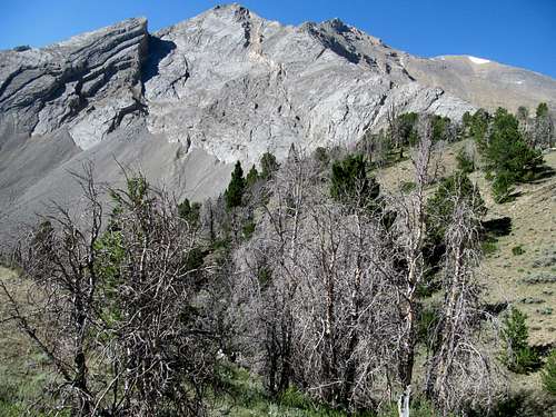
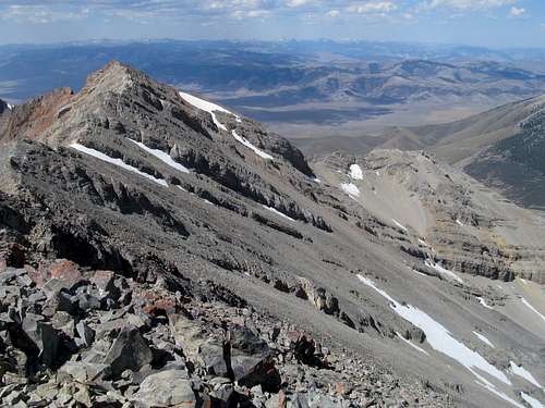
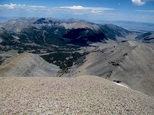
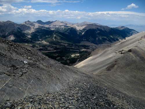
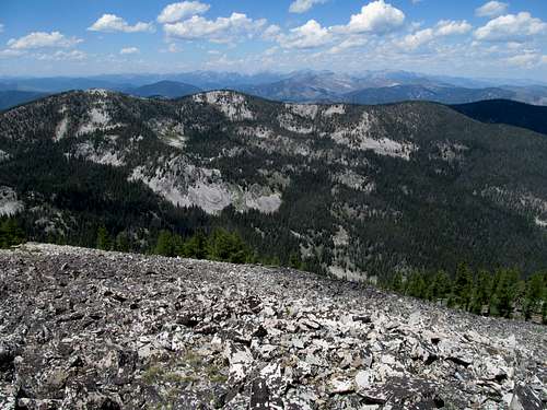
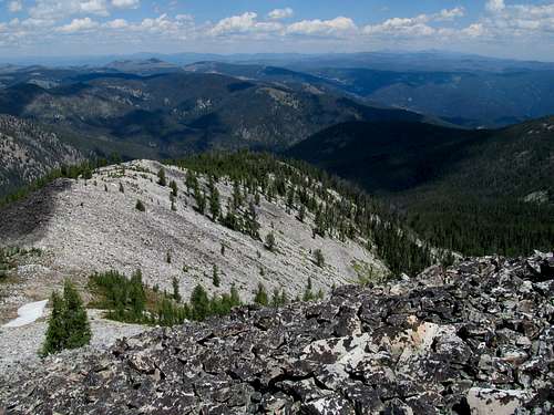
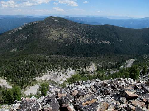
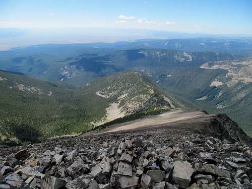
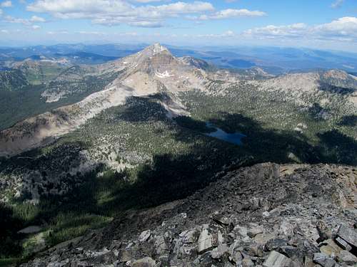
The cold predawn air woke me up driving down US-93 to Doublespring Pass, where the fine dirt road switchbacks through small isolated pockets of woods en route to the junction for the rougher road to Horseheaven Pass. I took the small side road and parked at the water tanks on a sparking bluebird morning, readying myself for a peak as obscure as its official moniker of unnamed Peak 11,611. There’s not that many pictures of the peak online, and with its highpoint not even marked on Google Earth, I constantly had to remind myself which bump I was aiming for when scouting out the route.
I was expecting the low trudge through Cayuse Canyon to be boring but it was anything but. The narrow entrance seemed to pass quickly than its distance would indicate and I was quickly graced by fantastic views of your typical layers of grotesque and distorted Lost River bedrock straight ahead at what’s seemingly the end of the canyon.
Except it’s not the end of the canyon, as this one twists and turns as much its underlying geology. The drainage splits here, with the longer branch/Cayuse proper makes a sharp right towards a ridge composed of upward tilting rock layers. I reached my waypoint marking the right turn near a small meadow below the rock face marking the actual termination of Doublespring’s true east ridge, and figured my best course of action would be to follow close to the low points of the drainage as much as possible to avoid any unnecessary elevation gain, which I suspected of a small grassy knoll lining the left side of the canyon.
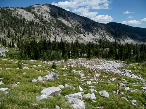
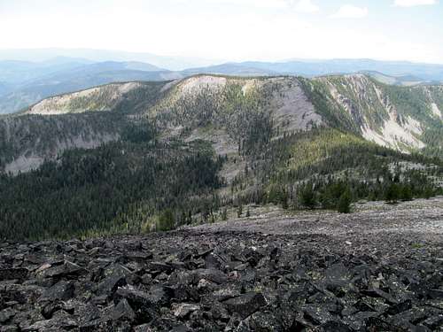
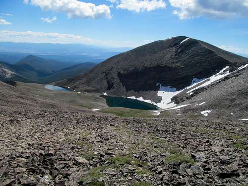
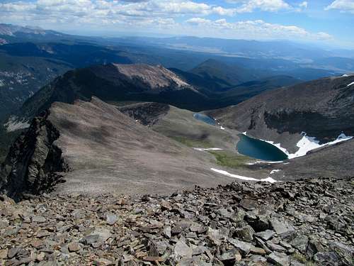
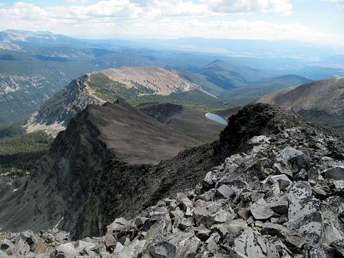
This section of the canyon was quite intimate, and as I approached yet another twist of the canyon, this time a left, I was expecting the peak to reveal itself in all its glory. What I saw were massive piles of talus below tantalizingly distant looking piles of…well…more talus, except higher elevated. The low center of the drainage cut an oddly deep cleft through this final stretch of the canyon; standing along the right side I realized that I was taking the longer track around the left turn, especially seeing that I would need to cross back over to the left side sooner or later to gain Doublespring’s north ridge to my right, if that makes any sense. The small grassy knoll I had seen preturn actually would not have required much extra elevation gain/loss and I would have had a more direct track to the ridge. I noted this for the descent and traversed the small boulderfield as the center cleft turned right near the head of the canyon.
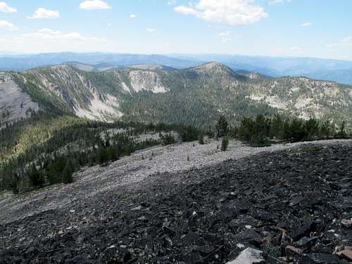
I had some questions as to which of the ubiquitous round lumps above me was the actual 2,000 ft. prominence highpoint; my GPS indicated that the lump at the head of the canyon was the likely candidate despite another summit to its left, connected by what looked like a low saddle, looked higher (and more dramatic).
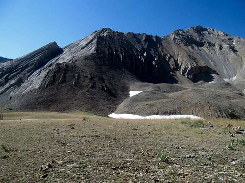
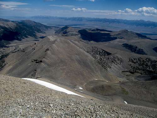
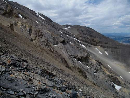
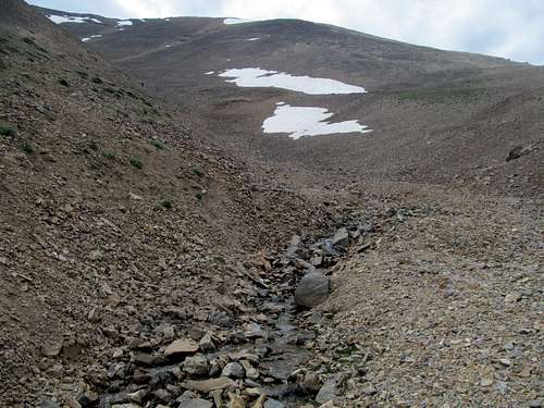
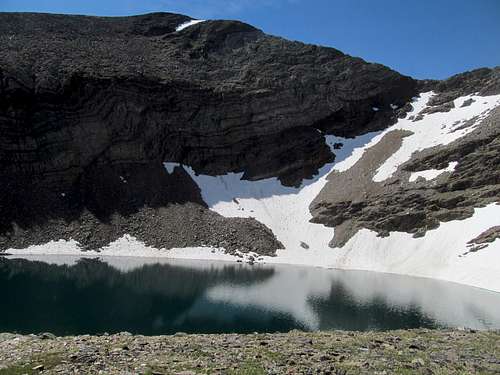
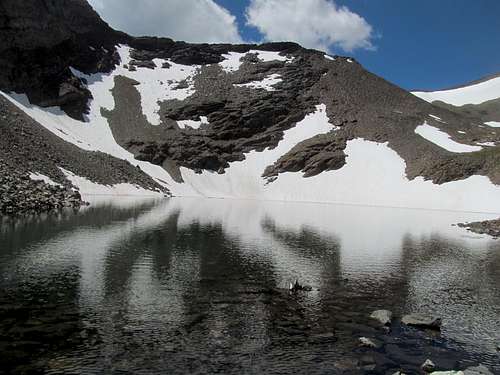
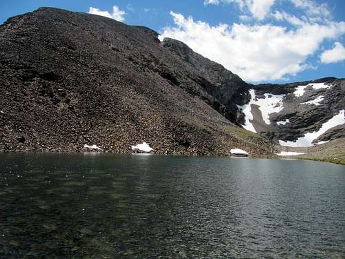
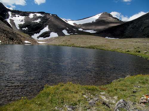
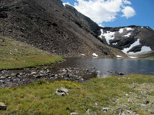
A brief scamper up a loose dirt slopes to climb out of the cleft was required, and from here I continued up the dry terrain towards the saddle between Doublespring and 10,878 to the north. Between and the saddle lay yet another small cleft, this one wholly covered by a residual tongue of snow that had to be climbed.
A mandatory snow climb on a low Lost River Peak was unexpected this far into July but served to spice things up on a normally dry peak, and the constant trickle of the creek below the snow tongue amplified the experience. Above the snow was several hundred feet of steep scree that I climbed without much difficulty; was this a sign that my climbing legs (& lungs) were returning to form?
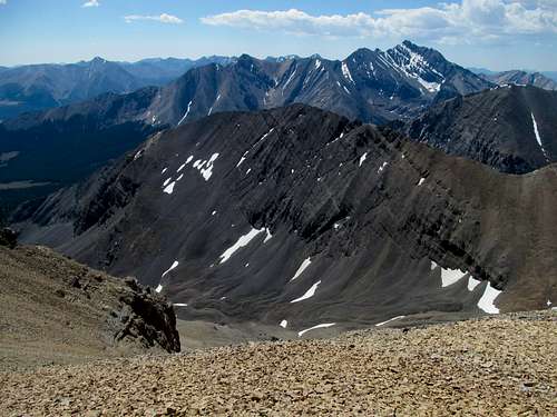
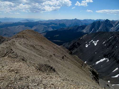
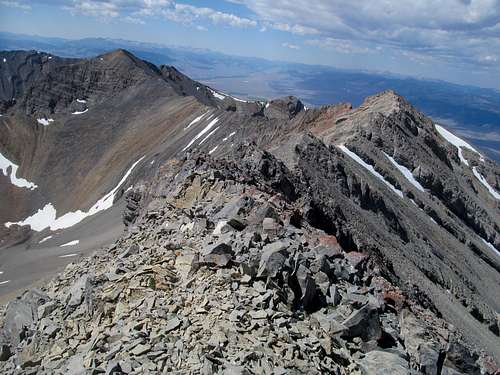
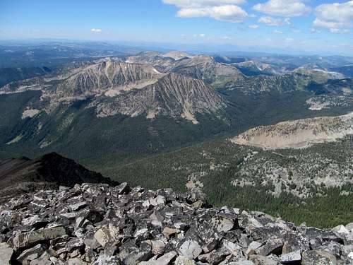
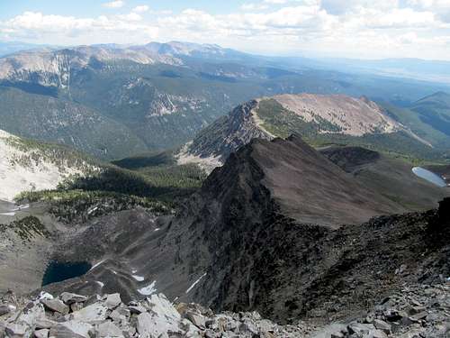
I angled right to climb the final 1,200 feet to the top, staying close to the left side of the ridge due to a stuff breeze coming from the west, forsaking views of Castle and the White Clouds as a result. Behind me Dickey and the Pahsimerois (great name for a band!) clumped together in an impressive mass of anonymous talusy summits. Greg had described Doublespring as being pretty sketchy, and I was expecting the worse going into the home stretch of the ascent, but encountered nothing besides some mild slabs a few hundred feet below the top.
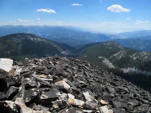
The summit benchmark had apparently been uprooted, and I was surprised that the round metal surface hid a long pole underneath it. I checked it out in curiosity then tried my best to bury just the tip within the summit cairn.
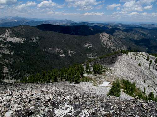
It was obvious the true summit was where I stood, but I followed the summit ridge west as it narrowed towards the end to get some views and pictures of the impressive cliffs astride one of Doublesprings’ subsummits. The rocks did indeed look sketchy along that ridge, and I wondered if Greg had ascended that route instead (later confirming he did due to its direct start from the main Doublespring Pass Road).
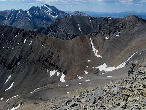
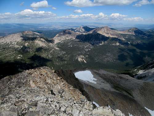
By far the best views were of Borah’s dramatic north face, and after wandering back and forth the summit ridge I did my part to stand and take in the beastliest aspect of Idaho’s signature summit.
The clouds were still innocuous so I stayed and soaked in the views for a few extra moments, but departed knowing that whatever storm would later stir up would develop and hit me on my blind side.
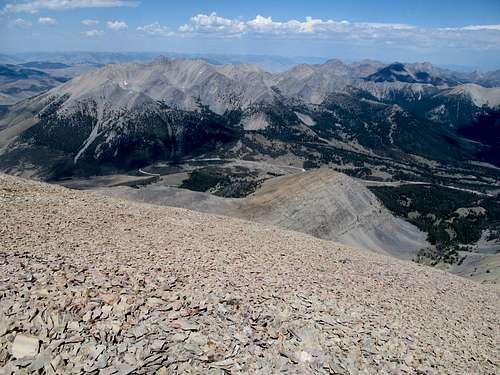
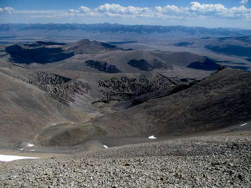
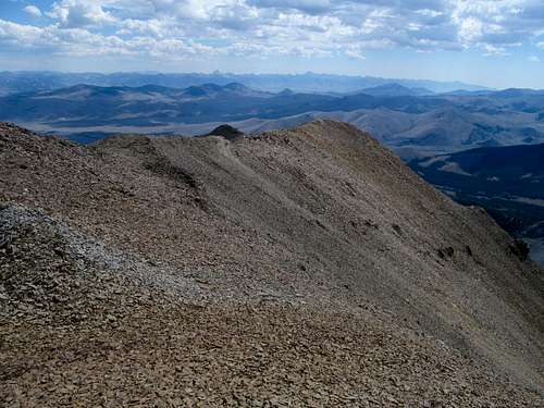
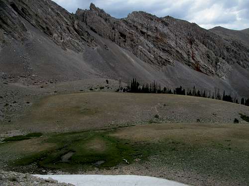
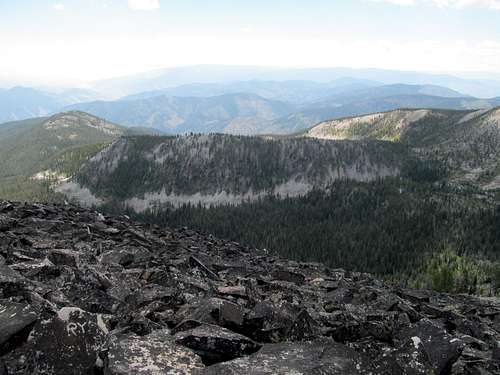
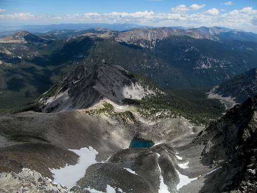
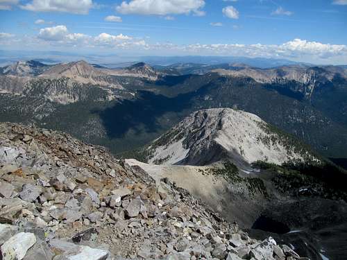
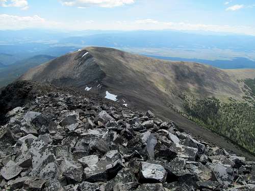
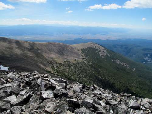
I trudged rather swiftly down the talusy ridge and enjoyed a rather pleasant descent laden with vistas of the Pahsimeroi’s. I descended the peaceful little snow tongue back down into Cayuse Canyon and as planned, followed the higher ground on the grassy, undulating plateau to the right of the canyon (on the descent), cutting a shorter loop as the canyon took the sharp right on the way down.
Fears about ups and downs had nudged me towards ascending the opposite side of the canyon on the way up, a slightly more annoying route. There were no unnecessary gains on my descent route all the way back down to the canyon floor en route to the dirt track, just a solemn, gentle peace. For the first time this trip I found myself allowing my senses to absorb the splendid beauty of nature and the serenity of something so simple as a small grassy meadow framed by sparse evergreens under a darkening sky. I felt so much rage against my former employer for having denied me a day of this joy due to the sick/wallet bullshit, but at the same time the sheer awe pushed aside that rage to merely an abstract level as I took in the overwhelming joy surrounding me.
The absurd but rare enjoyment I got from being immersed in nature made the rest of the descent through the canyon go by rather quickly. I drove back to US-93 and watched the storms finally gathering above the summit of Doublespring while pondering Greg’s direct route to the peak starting from the main gravel road.
I wanted to check out the brewery in Challis but like my attempt the previous summer, found it closed for the day. Disappointed, I gassed up and drove through light rain to Salmon, getting a room at my usual motel just north/west of downtown and enjoyed a meal and brews at Bertrams Brewery whilst reviewing my pictures of the day. The next day was a relatively “easy” rest day slotted towards Allan Mountain en route to West Goat, the peak I most feared on this portion of the trip, so I allowed myself to sleep in.
Pallin' with Allan - July 27th, 2016
Ken Jones’s directions to Allan on Peakbagger were pretty basic, but the endless gravel roads inspired my wrong-way paranoia as I chuckled at Pardon My Take’s fantastic Rachel Nichols interview. Eventually I located the gate marking the trailhead at a gated U-bend along the road, and probably didn’t get started hiking until past 10 AM, enjoying the late morning sun bathing down through blue tinted pine trees. This occupied most of the approach as the trail paralleled the steep northeastern face of the Ditch Creek Drainage. The trail ascends gradually towards Allan Lake and I was beginning to get impatient as the terrain leveled off in terrain that would usually signify a lake basin, but it took a few extra walks in the woods for me to reach the tranquil lake at the foot of its namesake mountain.
So close to the summit here, but the trail veers the opposite direction to the left en route to a ridge southwest of Allan. This section was mostly flat and boring yet scenic with small green uprisings to the left and lush terrain leading into swampy marshes near where the topos show two small lakes.
Views open up after the trail ascended up the ridge towards Allan’s SW saddle, finally revealing the peak’s gentle strength; the glistening green terrain reminded me of a poor man’s version of Allan’s northern cousins Buffalo Hump and Grave Peak in the Clearwaters. I stopped at several open rocky outcroppings to take pictures and gauge the weather, which remained clear and promising.
I left the trail where it obviously switchbacks southwest and navigated some mildly brushy and deadfall strewn areas for a maybe a hundred yards or so before escaping to the open terrain that would accompany me to the summit. The rest of the ascent was gentle and boulder hopping easy. I had cell reception for the first time in hours and texted away the day until I reached the summit.
These were the hashtag views I should have had, yay was entitled to(!), on Piquett a year ago. I would have had a better, close up view of the Bitteroots, but not as clear a view as I did now of the Beaverheads and the Homer Youngs group.
The direct amphitheater view of the valley leading back to Salmon, complete with small wildfire, made for a dramatic vista, and for the second day in a row I found myself actually enjoying nature and taking in the vibes of the great outdoors along with the views, and for the second day in a row I found that these weren’t positive vibes only, but only skin deep and covering up much darker undercurrents of rage: at the old employer as remembered on Doublespring, rage at opening the wound of no views on Piquett (or McGuire or Taylor or Leidy) the year before.
I felt the raw soreness of being in the same range as the prior years failures, but my mind had already resolved to punt a possibly repeat of McGuire this trip despite spending the entire year fuming and planning for it. Having lost a day already I could not afford two days straight days of repeats (Taylor would naturally have to be repeated along with McGuire), and my focus and fear were concentrated on my more immediate goals at hand: West Goat the next day and Glacier area peaks in the days to come.
Prior TR’s maintain that the direct ridge descent to Allan Lake is a bad idea, and Greg confirmed this via text as I talked to him from the summit. It looks so enticing and basic, but I trusted in the wisdom of those who came before me and returned the way I came. Tracking too low and along the descent, I figured I may as well straight shot it and thus avoided some of the trail’s circuitous ways. The occasionally brushy descent into the basin wasn’t too bad, and the mostly flat traverse back through the basin was almost pleasant. I rejoined the trail near the marshy areas and headed back down after one last look at Allan Lake.
My thoughts were piqued by lack of closure from Piquett after the mostly uneventful hike, and I resolved to solve it as I drove north into familiar territory. Upon entering Montana after passing way too many slow ass trucks I took a detour back past the work camps below Trapper Peak towards the West Fork and the Painted Rocks Lake. I do not want to repeat Piquett in this lifetime, basic-ly pleasant as that hike was, but hoped that dirt roads approaching Rombo Mountain would give me a somewhat equivalent view.
I followed the damn road for what seems like hours but in actuality was only 10 miles as it cut in seemingly every direction and flirted with every ridge, hill and drainage on the western face of Piquett and Rombo. Finally an open spot on the road allowed for views of the Trapper area and while my elevation was way too low to allow for any summit-like views of the Bitteroots, I suppose that the angle was right and this limited vista would have to suffice.
Having gained at least partial closure on one of the prior year’s summit view failures, I impatiently retraced my tracks back down the road and raced into Darby for what I hoped to be better tidings: a visit to Bandit Brewing. I had observed a billboard for a brewery here last year en route to Piquett, advertising that it was Montana’s smallest. I kept this tucked in my memory for a year and looked forward to finally obeying the billboard’s commands. The brewery was a bit hard to find in the residential outskirts east of the highway, but it delivered. The small farmhouse was buzzing with patrons and good beer, the bartender was friendly, and I found out that the brewers here made only one batch of each beer. Miss that batch and that beer was gone forever, to be replaced by new concoctions!
I was hoping to grab dinner at a restaurant in Wisdom that Sam had enjoyed, but realized I would not make it into town on time. Instead I grabbed a bite at a café on the main strip in Darby before driving apprehensively over Chief Joseph Pass back into Montana. With the sun already over the hill I drove past the empty cattle ranch plains northeast of Wisdom watching the prominent silhouette of West Goat, the next day’s goal, fade to black.
West Goat is Best Goat - July 28th, 2016
Upon reading reports of difficulty locating West Goat’s trailhead I waypointed it in addition to saving Sam’s peakbagger GPS trax. Today was the big day, and I wanted to complete the peak and still make it to Butte then Helena to see a few breweries, including Blackfoot Brewing, which I had missed on my last trip through Helena due to its earlier closing time.
There was nothing technical about West Goat, nor did it require any absurd mileage count or elevation gain. Various sources had pointed it to being a laborious and rugged hike nevertheless, a combination of what would be difficult routefinding, countless deadfalls, sticky bogs and mud, and what would likely be the most gain I’d endure so far this trip.
I parked by the side of the dirt road and wandered right to find the trail, somewhat faded at its junction with the road. The first mile was rather flat as it wound through the open woods, fading at times but never dying even as willows threatened to overwhelm it near a right curve along a small creek and drainage's embankment. There were to be two bogs along this route; the first was not long after the creek, where the trail disappeared before an obvious open marsh. There is dryer terrain through the brush and trees on the left, and with Sam’s tracks guiding me I followed it to the opposite end of the marsh, where an obvious trail exited the bog quite steeply up a small ridge.
Here the trail tried its best to expunge my lungs of energy as I got my first good elevation gain of the day. The grade lessened I found the next few miles to be the most mundane of the route. The more gain I got out of the trail the less I’d have to face further along, which was why the constant up and downs as the trail seemingly and meaninglessly traipsed along a broad ridge felt like a green and big sky-less purgatory. I could see larger fields of talus in the distance and different ridges surrounding me but had no real idea of how my route related to the larger area in general.
The trail traversed several small creek crossings along a gentle incline before it traversed what I believe to be the crux of this route…the second bog. Rather than being one field, this second marshy area was a long and sinewy stretch of land between occasional spots of trees that give you a false sense of security. Again, some dryer terrain can be found on the left side of the marshes, but this alternative was much brushier. I postholed several times ankle deep through this section before it mellowed out.
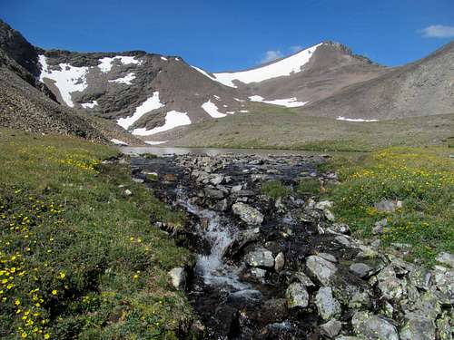
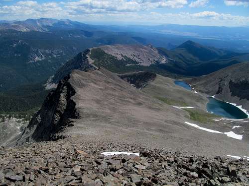
Both the lower flanks of East Goat on the left and the side ridge apparent on the right that had been visible through the trees over the last few miles seemed to be very approximate, and by the time I climbed out of the bog I was already pretty damned tired. I followed the trail aimlessly thinking I was gucci, only to check my GPS and see that Sam’s tracks had veered to the left quite a while ago. I left the trail and did an easy bushwhack and ascending traverse through beautifully open woods while aiming for the obvious saddle beneath East Goat’s NE ridge. Here the sublime part of the route began. The lower slopes were carpeted with these pale blue/pink (I’m a bit colour-blind) wildflowers, and I crossed a small creek marking the outlet for the Lost Lakes above, ascending the talus dotted tundra just to the right of the creek. I was pretty winded these few hundred feet but at the same time exhilarated at the first open views of the day.
The Lost Lakes between the Goats are everything that’s advertised and more. There are no adequate ways for me to describe the tranquil beauty of the lower lake, wedged like a teardrop so precariously above the precipice, in the shadow of cliffs, gentle peaks, and a lush tundra in peak verdant season. I rock hopped to the middle of the outlet, standing between the lake and its rush to feed the unpleasant bogs below.
I spent a few extra minutes taking in this sublime scenery in spirit and on camera, veering right towards my oh-still-so-distant objective after passing by Lost Lake from above.
As I sucked in oxygen I concentrated on studying the most efficient route and spot (read: lazy) to gain the final NE summit ridge.
Every drop of fatigue I felt was countered by the infinite blue drops of water below, each view soothing my weariness; as I neared the summit I noticed a tiny, crystal clear blue heart-shaped lake set just below the ridge in the talus fans below.
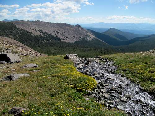
Ridge after ridge of the incomparable Pintlers revealed themselves to me, and I took in the expansive views once fully on the summit three hours and 35 minutes after leaving the car.
The rugged visage of Warren Peak to the west was most impressive and intimidating, causing me to notch on one more peak to the list of potential future objectives. The horizons were mildly hazy but I was still able to discern the rugged ridgelines of the Bitterroots west and the Pioneers south. While Warren rose in its rugged glory behind me I observed the equally dramatic rise of Evans to the Northeast, a complex series of ridges and summits clustered and uplifted together from the valley floor.
This was a special moment indeed for me seeing how much I had lusted after West Goat all these years (it’s likely it eluded me in 2014, as I probably would have gone after it had I not gotten hit by a car). Finally on top, I knew that every second was worth the wait, and swore that I would never return up here again.
I could hit East Goat as well but wanted to get those breweries before they closed.
Still, the connecting Southeast ridge looked inviting enough for me to follow it down to the inter-Goat saddle filling up on some snow/future-water on the obvious line of snow on the left side of the ridge, and enjoying the constant views back up at West Goat.
Embarking down from the saddle, this loop allowed me traverse right beside the Lost Lakes for a more intimate alpine tarn experience. As usual the lakes were totes gorge and I took endless pictures bathing in its peace.
With knowledge of my route finding errors on my way down I took a straight shot from the Lost Lakes back down to the trail, but not before enjoying once more the tranquil meadows below East Goat…similar to what I had encountered on Homer Youngs a valley across and two years ago.
I survived the upper bog crux relatively unscathed armed with a better grasp of its incongruities. The lower bog was fine and once again, mostly avoidable by traversing to the right.
I was completely by the thyme I stumbled back down the final legs of the trail, arriving at the car six hours and forty five minutes car to car and feeling relieved that I was hashtag done with the toughest peak of this leg of my trip.


Comments
Post a Comment