
-
 8712 Hits
-
 83.69% Score
-
 17 Votes
|
|
Mountain/Rock |
|---|---|
|
|
34.58764°N / 114.87294°W |
|
|
Download GPX » View Route on Map |
|
|
San Bernardino |
|
|
Hiking |
|
|
Winter |
|
|
2940 ft / 896 m |
|
|
Overview
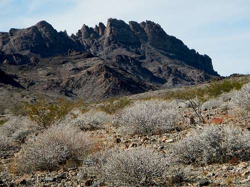
Stepladder Mountain
Awesome Ledges
Aside from the tortoise, other plant and animal species you might encounter include; creosote bush, palo verde, smoketree, catclaw, yucca, wild lavender, cholla, coyote, jackrabbits, kangaroo rats, quail, roadrunners, rattlesnakes, and lizards. Please respect this wilderness and do not drive beyond the marked boundary.
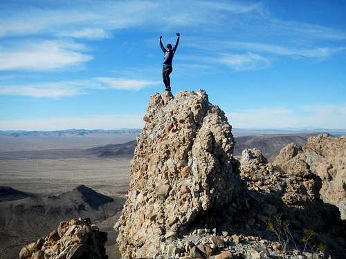
Stepladder Summit
Outside of folks working the DPS list, not a lot of peakbaggers visit the Stepladder Range. It is extremely remote and the final access road is very difficult to find. Bushes and cactus grow in the final road and there are many hundreds of naturally formed inverted speed bumps. The roads all have sandy patches, so high clearance and 4-wheel-drive is highly recommended. Until the creation of this page, access to the Stepladder Range was a well kept secret.
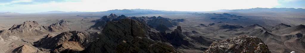
Southern Panorama With The Turtle Mountains and Old Woman Mountains
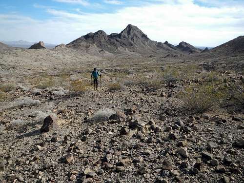
The Stepladder Range is rather small compared to the surrounding ranges. To the west are the Old Woman Mountains. To the south are the Turtle Mountains including Mopah Point and Umpah Peak. To the southeast are the Whipple Mountains and to the east are the Chemehuevi Mountains. All these ranges are remote and seldom visited by summit bound hikers.
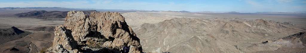
Northeast Panorama Overlooking The North Peak
Perhaps the most interesting thing about the main peak is the type of rock it consists of. The vertical rise of the main crest of the range is crowned with a cap of volcanic breccia. This agglomerate is the result of a very explosive type of volcanic eruption. The top layer of the mountain is the only place to view this rock, which is knobby and fun to climb on.
Driving Directions
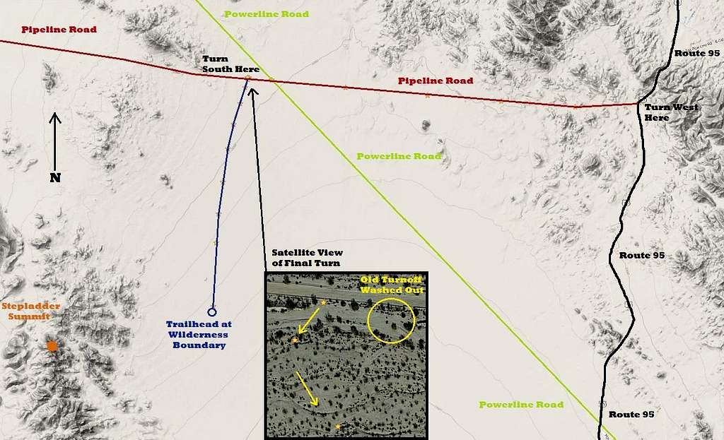
Driving Map
Note: The pipeline road and final access road (above in blue) do not appear on Google Maps unless you use satellite view.
Drive US Route 95, either 13 miles south from Needles, or 36 miles north from Vidal Junction, to the pipeline road (34.670295, -114.628857). Turn west onto this dirt road and watch for sandy sections. After 8.8 miles, cross a diagonally intersecting powerline road, but stay on the original pipeline road.
Continue west another 0.6 miles to (34.678770,-114.791461). No road junction is visible here. It is suggested that you park here and get out and walk around to locate the junction. Tire tracks in the wash on the south side of the road might give you the clue you need. The old junction has washed out completely and a new access point slightly farther west has been created.
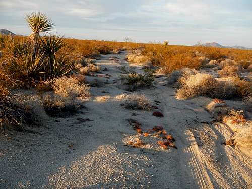
The Final Road
Drive across the sandy wash and carefully follow the new access track for a few hundred yards until you locate the better defined road heading south. This road is overgrown with brush and small cacti but easy to follow. Maximum speed is about 7 miles per hour because of hundreds of dips and micro washes that bisect the old road.
Continue south for 5.5 miles to the wilderness boundary which is marked with posts (34.600655,-114.805714).
Interactive Map
This GPX file can be downloaded in the link near the top of the page.Route Description
This is a fun and easy route. Congratulations if you found your way to the trailhead! The hardest part is now over. Prepare to gain 1400 feet in 4 miles (8 round trip).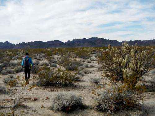
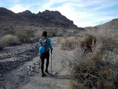
Cross Open Desert
Cross open desert on a west by southwest bearing, aiming for the southern tip of the foothills separating you from the main peak. Pass around the south end of these foothills and enter a drainage valley which opens to the southeast.
Entering The Wash
This broad wash has a dry water channel in the in the center of it. At times following the bank of the water cut might be easier than staying down inside it because often the brush is thickest there. Take the line of least resistance and aim for the head of the valley.
Second Valley With Low Pass Visible At Left
Near the head of the valley, turn west (left) and go over a low pass. On the other side of the pass you will be in another valley near the head of it. This valley opens to the south. The peak is now towering above your head to the west. It’s appearance might be intimidating because the ledges are not visible from below.
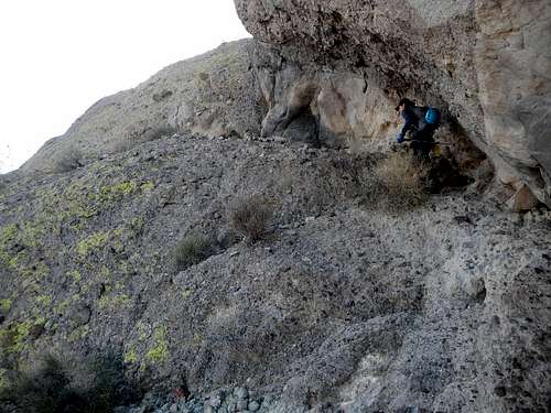
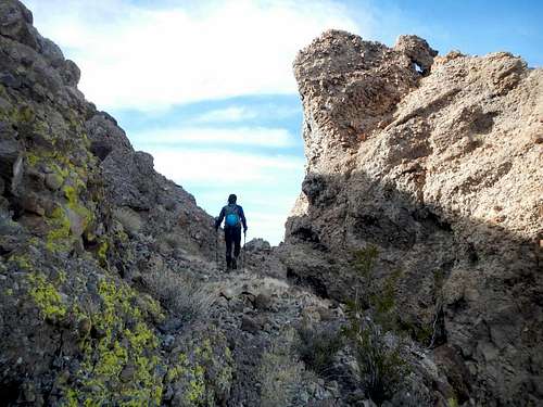
Ledge Start Below Overhang
A minor cliff band bars access to the easy slopes below the main cliffs. Locate a gully which cuts through this first cliff band and then ascend the easier slopes above the gully to come to the base of the main cliffs.
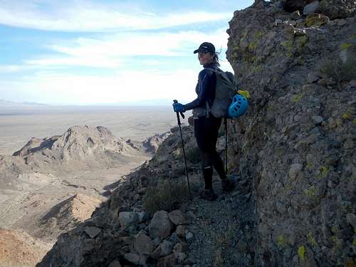
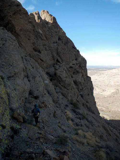
Broad Horizontal Ledges
A cleft in the cliffs divides the face of the main peak from the north peak. Start at the base of this cleft and scramble up a ramp under an overhang to reach the first horizontal ledge. Follow the ledge south to find another diagonal ramp leading up to the second horizontal ledge.
The Notch Between Peaks
There are a few places between ledges that could be considered class 3 for a few moves, however exposure is at a minimum and the breccia is extremely easy to scramble on, almost like a stepladder. There might be more than one way to reach the notch between the two peaks. Explore your ledge options as you work your way up.
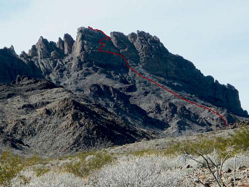
Stepladder Route Line (not exact)
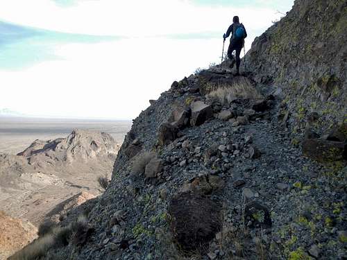
Once at the notch, turn south and you will come to the final summit pinnacle as well as the register. The highest rock is 15 feet of solid class 3, with some exposure.
Upper Ledges
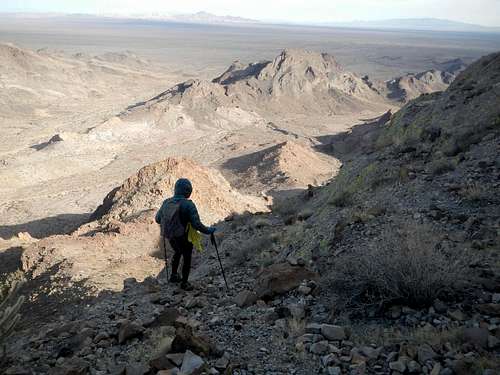
If you wish to climb the north peak as well, go back and pass through the notch and traverse on the west side to where you can scramble up steeper rock. This lower peak might be more challenging than the main peak. Beware of loose rock.![Descending Stepladder]()
Descending
Bob Burd's February 2008 trip report
gimpilator's December 2016 trip report
Camping / Red Tape
Camping is permitted. No motorized travel inside the wilderness boundary.External Trip Reports
Descending
gimpilator's December 2016 trip report