Revisiting a Recurring North Cascades Theme
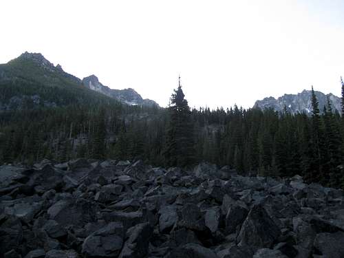
Looking at the three pics below…I can’t help but smile! These are three of my favorite scenes from my four days on the trail in the Enchantments. I look at these and it reminds me of how much beautiful scenery I consumed and how fond I became of this area on this short first visit. But I must confess, I often find myself thinking back to how the whole five days went down, and at times I can’t help but feel disappointed. I saw so much, but accomplished so little! As I have reminisced over the past several months, it has made for some very mixed emotions.
The more I thought about this visit to the Enchantments, the more I realized I needed to revisit the theme from my 2013 adventures in North Cascades National Park, as this 2016 trip was definitely a repeat of
sunshine on cloudy days. But in this case the clouds weren’t limited to just the weather. I came to the area with high hopes, plans for nearby peaks not even in the Enchantments, but between some bad planning for Little Annapurna, the weather, and some nearby forest fires, I would end up not reaching a single one of my main objectives. Based upon that I could say my Enchantments visit was a total failure. But that of course, would be inaccurate…
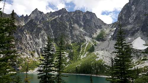
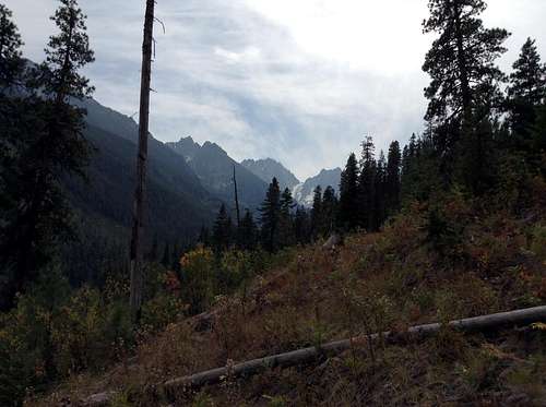
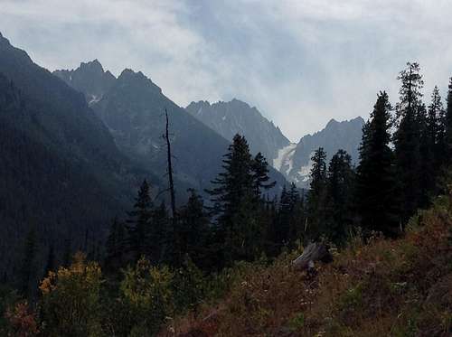
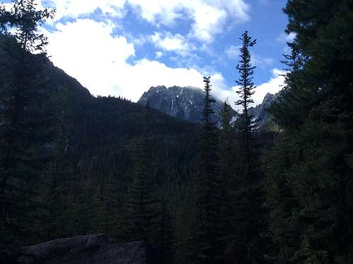
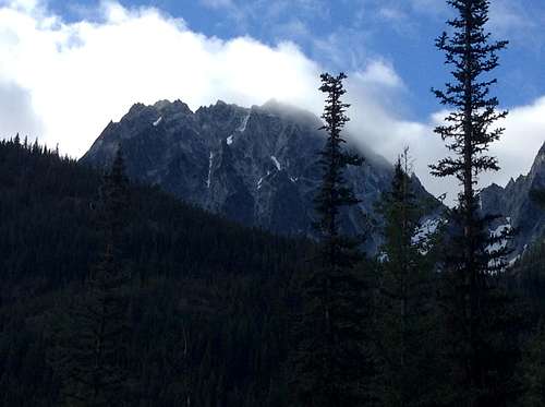
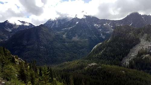
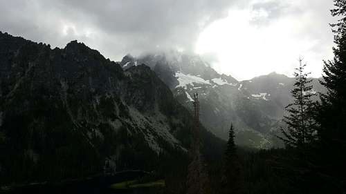
![The Echantment Peaks Ridge and Aasgard Pass]() Aasgard Pass
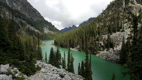
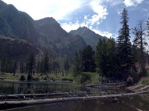
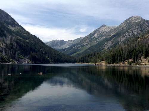
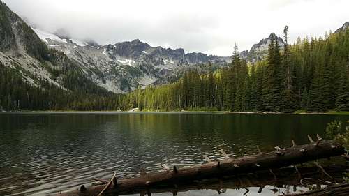
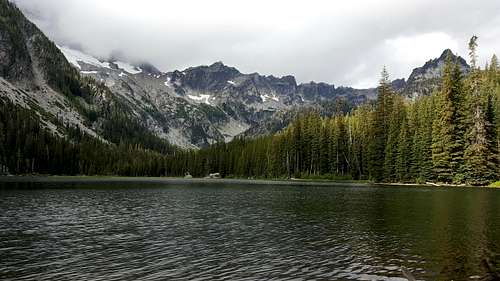
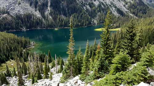
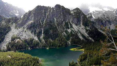
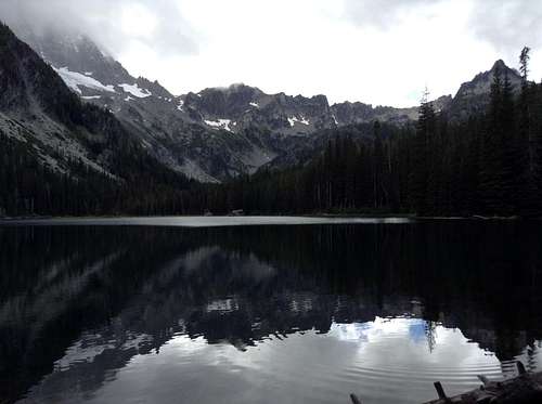
Aasgard Pass ![Nada Lake]() Nada Lake
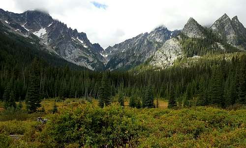
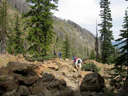
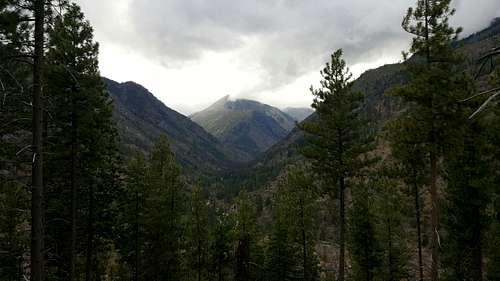
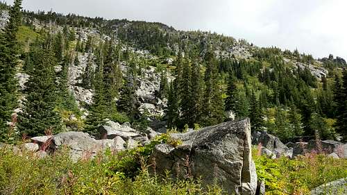
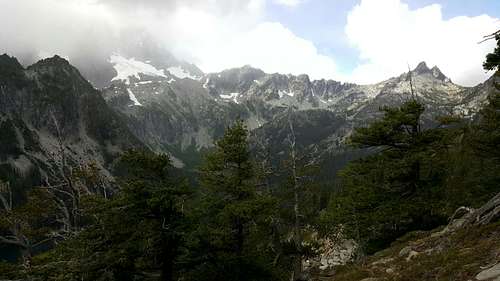
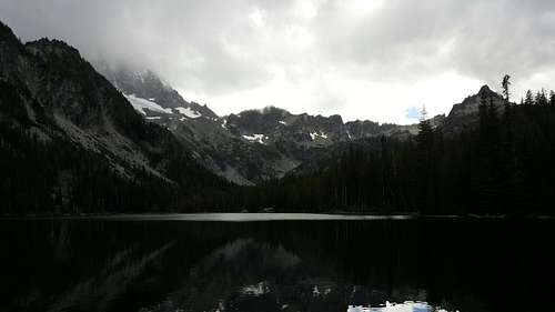
Nada Lake ![The Meadows - Stuart Lake Trail]() The Meadows
The Meadows An Enchanting Option
…after finishing up on the Maple Pass Loop in NCNP on Monday afternoon, Andrew, Pettie and myself turned the rental for the Enchantments. We were meeting Chris, Tyler and Wes at Eightmile campground on Icicle Road some time that evening, the three of them making a three day cross country driving adventure from Indiana. For the five boys, it would be a short visit at Eightmile. We’d hike on Tuesday and Wednesday and then they would head to the Gorge Amphitheater for the Dave Matthews Band concerts Labor Day weekend, which was the real brainchild for why we were in the North Cascades in the first place, and why I ultimately decided to stay in the Enchantments. It is less than a two hour drive to the Gorge from Eightmile. So besides getting to see some spectacular scenery, the boys would be able to make a quick trip from the mountains to the
wild on Thursday.
I was intrigued by and had wanted to visit the Enchantments for quite some time, but I was a bit hesitant to head there this year, mostly from a timing standpoint. Being Labor Day weekend I assumed the trailheads and trails would be busy. I was quite sure that precious solitude would be hard to come by. I unfortunately would be correct!
I reserved one of the two riverside campsites at Eightmile months in advance as it would make an ideal base camp for what I wanted to accomplish, which besides several hikes in the Enchantments, included hopes and dreams for Seven Fingered Jack and Atrium Peak, as the trailheads for those peaks were less than a two hour drive away. The riverside campsite would be a major success with the boys as well, as Chris, Tyler and Wes would make their daily full body dunk in the icy cold water, and the ambiance didn’t exactly suck either! It made for a great campsite to hang out.
An Eightmile Lake Starter
My plan for a big peak on this trip was Little Annapurna, and the plan was to go for her on Wednesday. That gave us Tuesday for an easy hike and I didn’t want to do anything too ambitious. I figured the short hike to Eightmile Lake would be a good warm up for Chris, Tyler and Wes, and it would allow Andrew and me to “rest” after our two good hikes in NCNP on Sunday and Monday. Pettie was content to hang back at the campsite!
At just over six miles roundtrip and with only 1,300 feet of elevation gain I also planned this as a social experience. When I told the boys to pack a cold beer to enjoy at the lake, they should have expected an easy day, and that it was. If only the scenery would have been more upbeat. Afterwards, I remembered some of the comments I had read about the Eightmile Lake area, that due to fires in recent years, all the burned trees - and their remaining stumps - didn’t make for the most upbeat scenery. And I would have to agree with that sentiment! It didn’t help that it was a partly cloudy day. With non-stop views of the burn as well as some gray skies…well, you kind of get the mood of the place, at least on this day. It definitely made for a less than stellar day for scenery. The views at the lake were quite good, but in the end I would end the day feeling disappointed with my choice. At least from a scenery standpoint!
![Dragontail Peak]() Dragontail Peak
Dragontail Peak ![Dragontail Peak]() Dragontail Peak
Dragontail Peak ![Little Eightmile Lake]() Little Eightmile Lake
Little Eightmile Lake
From a social experience, the hike was a blast. With the four boys together on the trail it was non-stop laughs, and the cold beer by the lake made for a relaxing time. We sat by the side of the lake enjoying a good cold one, with a continual stream of humorous chatter from the boys, and enjoying the views of the lake as well. After finishing the beer I hopped some stones to get a better seat within Eightmile Lake, hoping to get some decent pictures of the early afternoon reflections. I also spent my time admiring Axis Peak. I had Axis on my list of possible summits, particularly now, with the forest fires closing Phelps Creek Trailhead eliminating my chances for a shot at Seven Fingered Jack. The fire freed up a day, and Axis was looking more and more likely for a solo shot late in the week…but from the more reasonable Lake Stuart side of the mountain. From Eightmile Lake, the route looked rather steep as well as a scree filled nightmare.
![Eightmile Lake]() Eightmile Lake
Eightmile Lake![Axis Peak]() Axis Peak
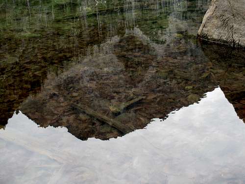
Axis Peak ![Axis Peak Reflection]() Axis Peak Reflection
Axis Peak Reflection
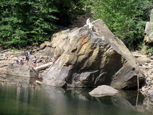
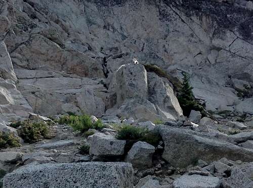
We finished our stay at the lake with Chris making the scramble up a rather impressive rock. I gave it some thought but passed. Getting to the top seemed simple enough, but with the smooth rock I knew the downclimb would be nerve racking for me, so the old man chickened out! Fortunately for all of us, Chris’s decent was uneventful.
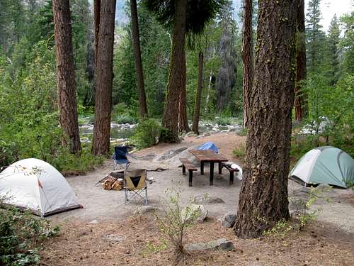
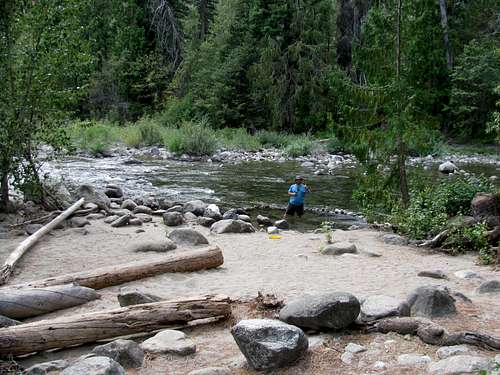
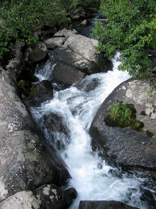
![Icicle Creek]() Pettie, enjoying our campsite, a cold one and Icicle Creek
Pettie, enjoying our campsite, a cold one and Icicle Creek
We made it back to camp to relax and soak our feet in Icicle Creek, while Chris, Tyler and Wes made the daily ceremonial full body dunk. We headed into Leavenworth to find a biere garden and pretzels, and then dinner. After that it was back to camp for an early evening. Little Annapurna was the one worthy peak I was going for on this trip and the alarm would be ringing relatively early.
Cloudy Sunshine ~ A No Go on Ass-Guard Pass!
If I was disappointed with the scenery the day before, that would not be the case this day. Of course, I would be disappointed in the day’s outcome!
On these annual trips west I always hope to bag at least one peak I consider to be notable. Notable for me usually either refers to a peak I have a particular passion for, or to its difficulty. Little Annapurna fell into the latter category. At about 15 miles roundtrip with 5,100 feet of elevation gain, I consider a one day attempt on such a peak to be difficult. Others may not, but I do! This was the big day for this year! It didn’t turn out to be the big day…
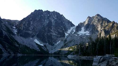
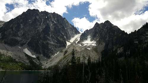
We had an early enough start, as by the time we made it to the trailhead and started up the trail it was right about first light. I do remember the hike to Colchuck Lake being much more enjoyable than the hiking the day before. While there weren’t necessarily a lot of open views, it was a great morning on the trail…albeit a difficult one! Maybe it was the fact that it was the fourth straight day on the trail for Andrew and me, but the hike just to Colchuck Lake was by no means easy. Although with the views afforded from the lake it is no wonder that it is such a popular destination.
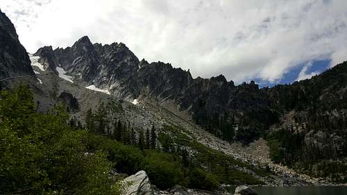
We took our first good break at the lake, with that amazing view towards Dragontail Peak in front of us! I scrambled down to the lakeshore to try and get a better view.
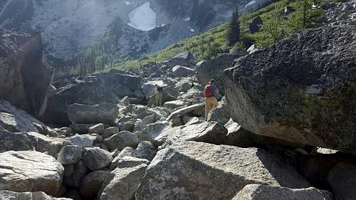
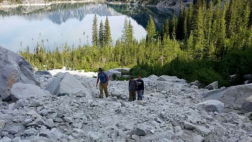
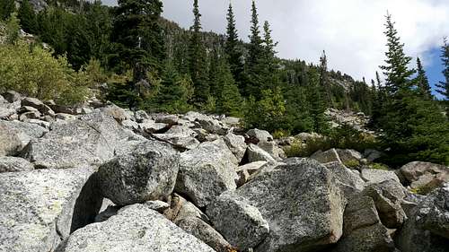
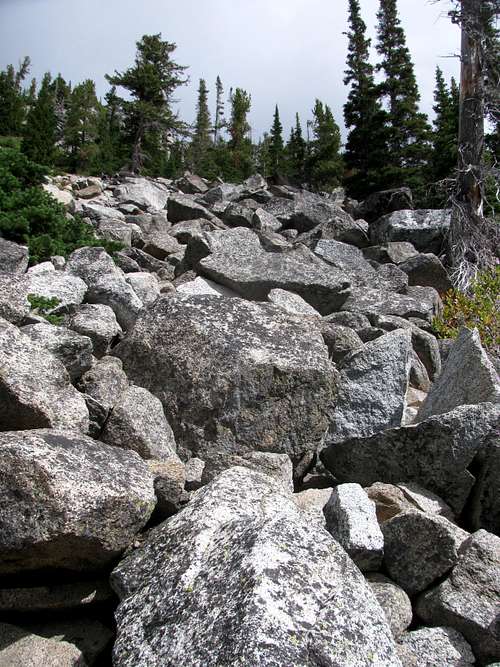
We made the long hike around the lake. I remember the trail seeming a bit rugged. And then even before hitting the climb up Aasgard Pass the scrambling began, with a good stretch of boulderfield just to get around the far end of the lake. To say this part of the trail is rugged would be an understatement.
We reached a point where I decided to start heading uphill, and it was here that I should have realized that our chances for success this day were slim. Before we started up Chris decided he had had enough. He called it a day and said he would wait by the lake for us. I wasn’t too concerned about this at this point. Weather wise it was a beautiful day, so I felt comfortable letting Chris hang at the lake all afternoon while we spent the day heading to the summit.
![Colchuck Lake and Cashmere Mountain]() Colchuck Lake
Colchuck Lake
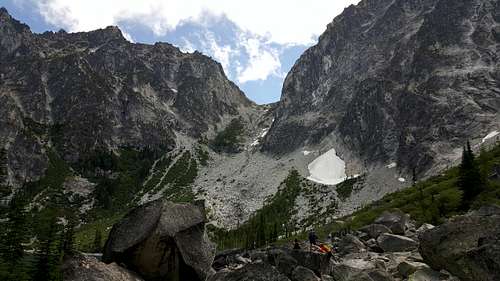
So first we lost Chris…and then I lost the trail. Well not really! It got to a point where cairns were harder to find so I decided to start heading uphill. We didn’t get too far when we realized that we were heading up the couloir to Dragontail versus up towards Aasgard Pass. This actually wasn’t a big deal. Looking at the route, it seemed pretty straightforward. Make for the snowfield above us and then make an ascending traverse towards the correct gully that led to Aasgard Pass.
By the time we realized my mistake Chris must have gotten a second wind and decided to join us. The five of us slowly made our way up and over. Outside of the steepness, there were no issues…except of course the pace that we as a group were keeping. As we ascended, the rest stops came more and more often. We finally made it over to the correct “gully” and stopped to take a long break, and to consider our realistic options for the day.
![Colchuck Lake and Cashmere Mountain]() Colchuck Lake and Cashmere Mountain
Colchuck Lake and Cashmere Mountain
Even before we reached this point though there had been some discussions on whether we really had a chance to summit. Thoughts were thrown out about just making it to the pass. On the ascent I still held out hope that we would be able to break up into two groups – those that wanted to summit and those that just wanted to make it to the pass.
But these hopes began to slowly fade the higher and higher we went. The pace was too slow and the breaks came too often. I knew deep down that today was once again not one of those days! And by the time we stopped to take a long break in the “gully” the plans started to unravel rather quickly.
In short order, Chris unashamedly announced that he was done. While I didn’t mind Chris hanging by the lake all day, I wasn’t thrilled with the idea of him descending to the lake solo. We were probably half way up from the lake to the pass, and with Chris being tired, descending solo on this choss didn’t seem like the safest idea. It was tough to read Tyler and Wes. Like Chris, these guys are really laid back, so I couldn’t sense whether or not they had a strong desire to continue on, or just how strong their passion was to actually summit. Then there was Andrew! Having been up a number of tough summits with him I sensed that he wasn’t feeling it this day. His pace reminded me a lot of his pace once we got into the Trough on Longs Peak the year before. Andrew suffered a lot that day…but it was Longs…and he was willing to go through that sufferfest. But Little Annapurna isn’t Longs! (No offense to the Cascadians – trust me I love the Cascades!) Bagging Longs was huge for Andrew and very important, but not Little Annapurna. Yeah, he wanted to bag a good peak, just like I did, but this peak didn’t create the passion – the fire in the belly – like Longs did for him. That I could definitely sense. Realistically, I could see Little Annapurna being every bit as difficult as Longs, but Andrew’s memories – and mine – of how difficult that day was weighed in on my thinking. By this point I think he had given up on the idea of summiting all together, but he did keep suggesting that we at least keep going to the pass. While we stopped for a good long break I considered all the inputs…and rather dejectedly decided to call it a day. I suppose Andrew, Tyler and Wes could have said they wanted to continue on, but none of them did. I don’t think my decision broke any of their hearts.
![Heading Towards Aasgard Pass]() Andrew on the slopes...
Andrew on the slopes...![Looking Up Towards Aasgard Pass]() Looking up towards the pass
Looking up towards the pass![You Shall Not Pass]() "You shall not pass!"
"You shall not pass!" ![Our Incorrect Route Up from Colchuck Lake]() We came up from the other side of the row of trees, and then to the snowfield.
We came up from the other side of the row of trees, and then to the snowfield.
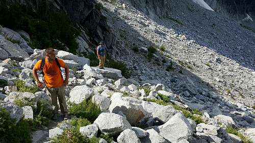
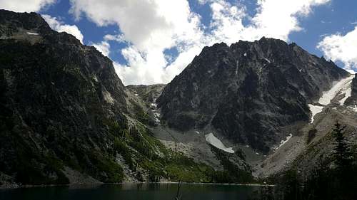
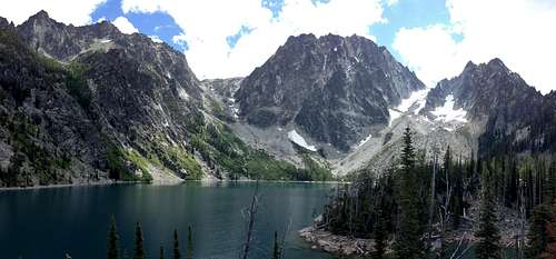
With everyone either grateful, or accepting, of the decision to call it a day we hung out on the slopes for a bit, which didn’t exactly make for a bad consolation prize. The views from here were stellar all the way around, from the shots towards Dragontail and Colchuk Peaks, down to Colchuk Lake, and then beyond to Cashmere Mountain. It was pure 360 degree sensory overload. I couldn’t have been more disappointed and more ecstatic all at the same time!
Eventually we headed down, which is always a challenge on choss and scree. There was plenty of slipping and sliding, but eventually we made it back to the lake. And of course, at this end of the lake, as with the other end, the views are also stellar. Since we weren’t summiting today time became a non-issue, which meant I was free to slow down and soak in the scenery. And that is what I did!
![Colchuck Lake and Cashmere Mountain]() Colchuck Lake and Cashmere Mountain
Colchuck Lake and Cashmere Mountain![Colchuck Lake and Cashmere Mountain]() Colchuck Lake and Cashmere Mountain
Colchuck Lake and Cashmere Mountain ![Colchuck Peak]() Colchuck Peak
Colchuck Peak![Aasgard Pass]() Aasgard Pass
Aasgard Pass![The Echantment Peaks Ridge and Aasgard Pass]() Aasgard Pass
Aasgard Pass
When we reached the other side of Colchuck Lake I stopped to try and get a few more pics towards Aasgard Pass and Dragontail. And with the afternoon sun and aesthetic puffs of clouds, I was much happier with the afternoon photo shoot…
![Aasgard Pass and Dragontail Peak]()
![Dragontail Peak and Colchuck Peak]()
We made the long slow hike out, and that is what it was. Long and slow! After four days on the trail my knees and feet weren’t feeling it! I should say they were feeling a lot, and that feeling was soreness. While I was confident I could have summited today, on the hike out I kept wondering how painful the hike out would have been given a couple extra thousand feet of ascending and descending along with the additional scrambling? And this became one of the clouds hanging over me on this beautiful sunshiny day in the Enchantments. In four days on the trail the mileage and elevation gain hadn’t been all that excessive, at this point only totaling somewhere around 35 miles and 10,000 feet. In years past I’ve brutalized my legs and feet much more and recovered quicker (
2012 comes to mind). I definitely was questioning if it was time for this 53 year old to slow down and stick to trail hiking, and skip the peakbagging? F that!!! I didn’t really consider it! But I did consider if maybe it’s just time to revisit the training program…as the plans west for 2017 don’t include any slowing down, let me be quite clear on that!
![Views on the Trail to Colchuck Lake]()
![Views on the Trail to Colchuck Lake]()
I’ve spent a lot of time pondering what went wrong on Little Annapurna, and I do consider the mistakes to be mine. In the end, it was just a poor choice for Chris, Tyler and Wes. Physically these young chaps were more than capable of making the summit, guaranteed. But I think it may have been too big of a jump from last year’s day on Mount Ida in RMNP. That was a simple walk up with < 2,500 feet of gain. Jumping up to a peak with over twice as much gain, with a steep ascent and a bunch of scrambling on choss…that was a bit much. I’ve had the pleasure of ascending a number of peaks with nearly as much, or more, vertical gain, and with as much or more scrambling, and Andrew has as well. We knew ahead of time how difficult Little Annapurna would be. They didn’t! And I didn’t do a good job of mentally preparing them for what lied ahead. While they did plenty of physical conditioning ahead of time to prepare, it was the mental aspect of peakbagging that I failed them on. Sometimes you just have to be willing to go through the sufferfest to get to the summit. Andrew and I had the benefit of being well aware of the price of admission. Chris, Tyler and Wes have a better idea of this now as well!
![Colchuck Lake Pano]()
When we got back to camp it was pretty much a repeat of previous days…cold beers by the stream and Chris, Tyler and Wes getting in the full body dunk in Icicle Creek. With how sore the bodies were at this point, I suppose it was actually therapeutic besides being crazy!
A Much Needed Rest Day
Thursday was here and it was the big day for the boys. They would leave the “wilderness” and head for the
wild at the Gorge…which is what they really came for. With them needing to prep to head out it also made a great excuse for me to take a much needed rest day.
Andrew, Pettie and I headed into Leavenworth for breakfast, the first good one of these on the trip so far, and for them to pick up supplies (aka, craft beer) for their four nights at the Gorge. Then it was back to Eightmile so they could break down camp and pack things up into Chris, Tyler and Wes’s rental van. With all their gear loaded up we said our good byes, and then there was one.
It would mostly be a relaxing day. I did take the time to reorganize the rental and my gear. But mostly I sat around camp and finished reading
Buried in the Sky. That’s not 100% accurate. Yes, I finished the book, but with the weather I spent half the time reading in my camp chair and the other half reading, wrapped up in my sleeping bag in my tent. Since leaving NCNP on Monday, we were not experiencing the normal hot sunny weather that is expected on this side of the pass in late August, early September. When I looked at the weather forecast leading up to our week in the North Cascades, Leavenworth weather was calling for blue skies and highs in the 90s. By the time we drove into Leavenworth on Monday a weather system that effected the entire stay in the Enchantments had arrived, and was only getting worse as the week wore on. By Thursday clouds had consumed the blue sky, the temps had plummeted barely reaching 60 by mid-day, and the sky was occasionally spitting on my campsite. And it wouldn’t let up, even when I pulled out of camp on Sunday morning. It’s not the weather you hope for! So it only made for so relaxing of a recovery day.
Come supper time I headed back into Leavenworth hoping to find a place with some decent food. That had been a challenge so far in the faux Bavarian town. I hadn’t been particularly impressed with the food I had tried on the two previous evenings – other than the beer and pretzels at
Munchen Haus (the dipping sauces were awesome). And I wasn’t particularly impressed with the town as well. Definitely ranks up there as one of my least favorite foothills cities! Fortunately, I did finally find some amazing food. Ironically, in this German town, it was a restaurant called
South, serving Latin American cuisine. It was so good, I would end up going back on Friday night as well.
Back at camp, it was cold beers and a roaring fire, with the overpriced but excellent firewood I was purchasing from the Eightmile camp hosts. But I didn’t stay up late. I had big plans for Friday with a nice long 15 mile stroll along the West Fork Foss River Trail to Atrium Peak on the agenda, far from the Enchantments…
Even Saint Agnes Couldn’t Stop the Rain
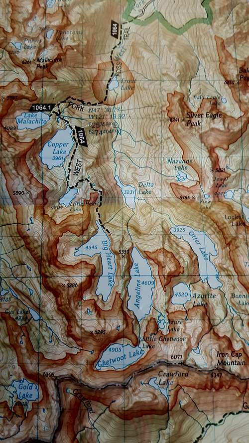
From the first time I ever looked at the topo map for the West Fork Foss River Trail I was intrigued. All those lakes! All those nearby peaks!
I suppose there are some perks to being the dweeb who enjoys spending hours researching ideas for these annual hiking trips, studying maps, reading countless trips reports, and skimming the dark reaches of Summitporn and the internet for ideas and beta. Generally when I am doing this I hear smart ass comments that “Mark is in the nerdery!” But it has allowed me to plan some amazing hiking trips and has helped me find some obscure places to visit…like Saint Agnes Ridge!
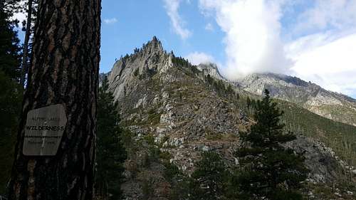
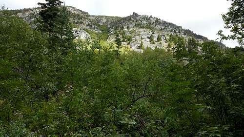
![Saint Agnes]()
One of the reasons I picked Eightmile for our front country campsite was how close it was to the West Fork Foss River trailhead. It wasn’t exactly next door, but being less than a two hour drive away I knew that with an early start I would have enough time to make the 7+ mile hike to Big Heart Lake plus bag a peak. When I stumbled upon the peak known as Saint Agnes Ridge, which is not too far past Big Heart Lake, I knew that had to be my peakbagging objective for this hike. Why Saint Agnes Ridge? Well Agnes is my mother’s name of course (God rest her soul!).
There isn’t much information on the internet about Saint Agnes Ridge. But from what I could find it seemed relatively uncomplicated, except for some possible bushwhacking and elevation loss and gain getting around Angeline Lake. In the end I decided that just going for Atrium Peak seemed like a more reasonable option. Located on a ridge between Big Heart and Angeline Lakes, it would keep my mileage to a more reasonable 15 miles, and the summit would offer the chance for a possible pano photo with both Big Heart Lake and Saint Agnes Ridge in the same picture. Of course I would carry a picture of my mother with me to include in the photo!
And yes, my mother was a saint, and had a big heart! She had to be to raise 11 children! So what could have been more appropriate than to try and get this picture? Besides getting to hike in an area with several amazing lakes and bag a peak, I’d get a picture I’d be able to share with all my siblings. Unfortunately, even Saint Agnes couldn’t stop the rain.
I don’t remember the time I left Eightmile, but it was early. It would just be getting light out when I turned off Highway 2 onto Foss River Road after over an hour of driving. Unfortunately all of that driving was done in the rain! I suppose I could have bailed on this hiking plan early into the drive, and the thought crossed my mind a number of times. But I kept thinking that there was a chance the weather might be better on the west side of the pass. I at least held out hope! At Stevens Pass the rain got worse, not better. By the time I turned onto Foss River Road, it was still raining but it had let up significantly. Again, more hope! Once leaving Highway 2, it was still a 6.6 mile drive to the trailhead with the last 5.5 on gravel, and it sounded complicated, having to make a number of turns onto other, probably poorly labeled, roads. I was about 100% positive I wasn’t going hiking this morning, but I kept driving. I figured that if nothing else, I’d know how to get to the trailhead when I returned another day.
Outside of the rain, this was my kind of trailhead. Instead of the overflowing parking lots at all the other trailheads I had been at on this trip there were only two other cars here. It would be a day of solitude on a long trail. I’d pretty much have the place all to myself! The rain seemed to have let up enough to at least consider going. I got out of the rental and wandered the area a bit. I even started packing my backpack, including tucking away my picture of Mom in a safe place so that it wouldn’t get wet, as I knew I would be getting wet this day. I spent a good 5 or 10 minutes debating about whether or not to go. Looking up at the sky I knew I had been in similar weather enough times at trailheads to know that it wasn’t going to be an enjoyable day. I would be guaranteed to get wet and guaranteed not to see any mountain vistas. The clouds were just too low. I got back in the rental and headed back towards Eightmile! With this weather it looked like it was going to be a long day, and probably a wash out! It wasn’t even 8 AM yet.
Making Nada Out of Nothing
The day would end up spectacular! Thank you Saint Agnes…
As luck would have it, on the drive back to Eightmile the weather started to improve. When I crossed Stevens Pass the weather to the east looked better, even some blue sky peeking out. Maybe the day wouldn’t be a total wash out!
With some hope for a good day of weather I decided that it was time for Axis Peak so I mentally started preparing myself for that and pointed the rental towards the Stuart Lake Trailhead. But then at the last minute I made a quick change of plans. By the time I got back to Icicle Road there was mostly blue sky hanging over the ridgeline of the Enchantments. I drove by the Snow Lakes trailhead and decided that this would be a good day to head up towards Snow Lake. This was going to be my hike tomorrow anyway. Why not just go for it now? I turned the car around and headed back to the overflowing parking lot. I knew there wouldn’t be any solitude today, but at least I’d be on the trail.
![Snow Lakes Trail]() Not a bad view from the Snow Lakes trailhead parking lot.
Not a bad view from the Snow Lakes trailhead parking lot.
Leading up to this trip I had made no plans for hiking the Snow Lakes Trail. At most, I would have five days on the trail in the area, and with my original hopes of bagging Seven Fingered Jack and Atrium Peak, I would run out of available days, so Snow Lakes Trail took a far back seat on the possibilities list.
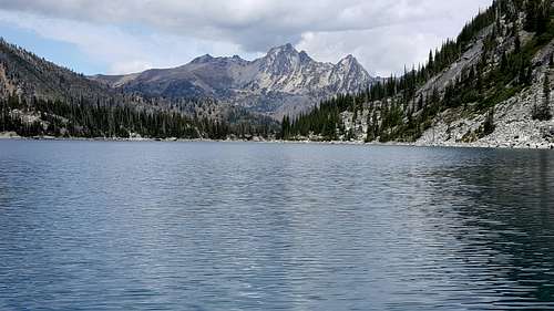
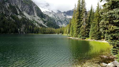
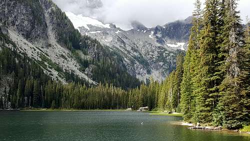
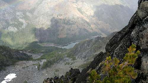
By the time I started up the trail I had lost a lot of day. It was now approaching 10 AM so the realistic chances for getting farther than Snow Lake were slim. But there’s always hope! I would end up making it no farther than Nada Lake, and that was due to a combination of the weather as well as me taking a very leisurely pace. But despite only making it to the first lake in the long chain of lakes in the Enchantments, it was a special day.
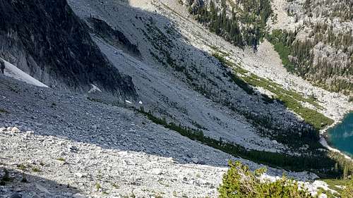
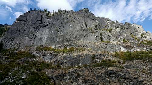
I was pleasantly surprised by the lack of people on the trail. Maybe it was my late start, but I was in front of the Snow Wall before I saw anyone else. I would end up crossing paths with a number of backpackers, as they were making their way down from their overnight stays in the core Enchantment zone. A small group of us gathered with Snow Creek Wall in view as we had spotted two climbers just heading up. By now, after getting with the 90s and utilizing Airplane mode, I was mostly using the camera on my phone for taking pictures, and at full zoom was able to spot the climbers at the base of the climb. I tried taking a picture but it was far too pixilated to see them in the photo. This photo experience, along with my slow pace, got me thinking that maybe it’s time to finally invest in a real camera!
![Snow Creek Wall]() Snow Creek Wall
Snow Creek Wall ![Snow Creek Wall]() Snow Creek Wall
Snow Creek Wall![Snow Creek Wall]() Snow Creek Wall
Snow Creek Wall
The reason for my leisurely pace this day was the fact that I was stopping to take so many photos. While I may have only made it about five miles up the trail, the day offered a plethora of amazing views, so I was stopping often to take photos.
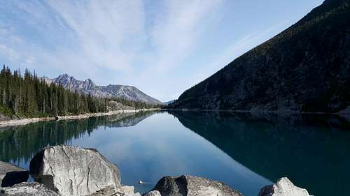
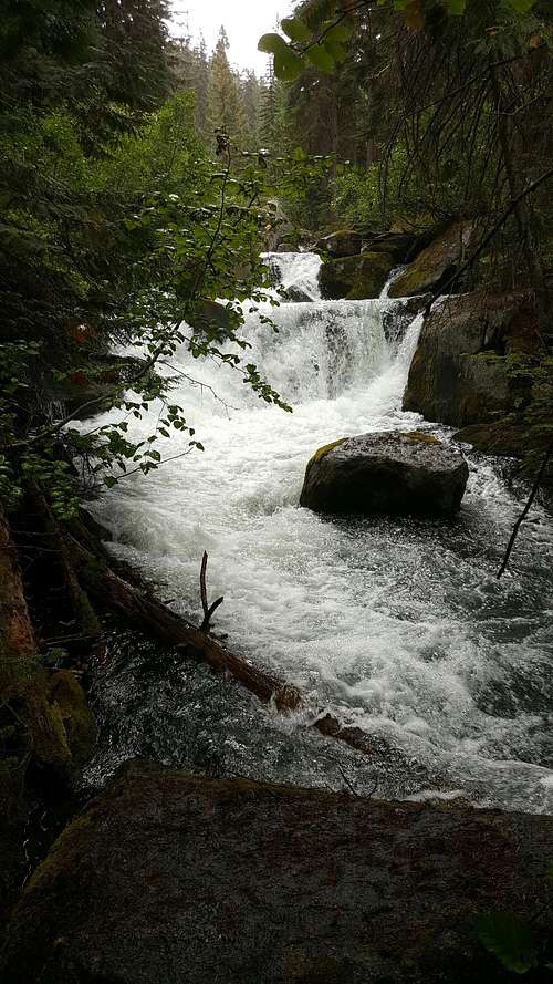
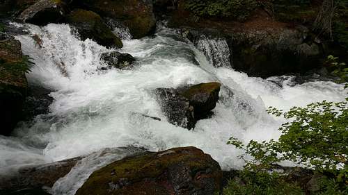
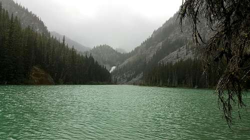
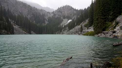
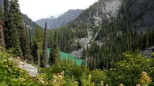
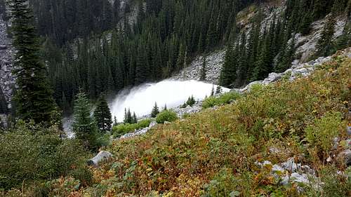
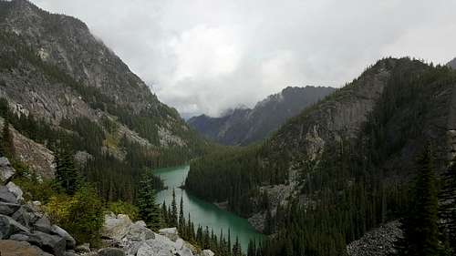
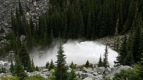
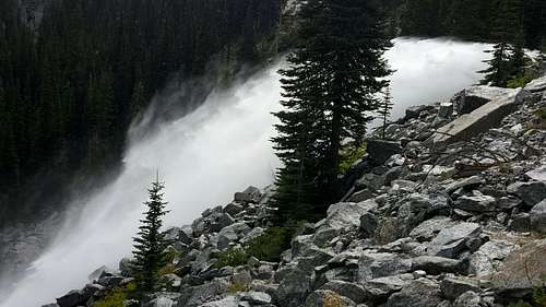
Two things made this day so magnificent; the turquoise waters of Nada Lake and the Snow Lake Spillway!
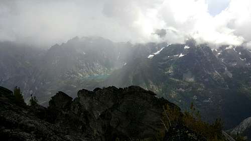
By the time I made it to Nada the sun had gone bye bye. The clouds were low and the skies were occasionally spitting down on me. But in a theme that I am starting to embrace and seem to be revisiting often, the low lying clouds added to the ambiance, and while I would have preferred blue skies, the views around Nada were amazing.
Maybe it was the element of surprise that made the day so amazing? I hadn’t done any research on the trail so I had no idea of what to expect. I had no idea Nada Lake was so large, I surely wasn’t expecting the turquoise water, and I had no idea that there was a spillway. So when I finally reached the lake and my first view brought all three of these elements together I was very happy that I had made the decision to head up this trail today.
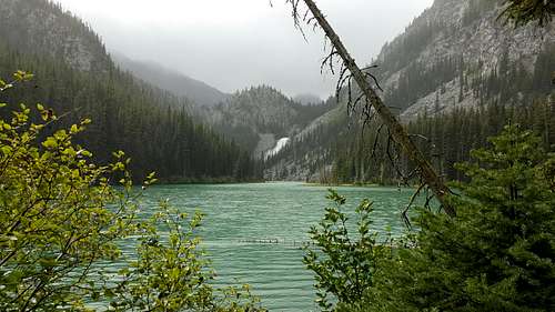
The hike around the lake and up towards the spillway was non-stop beautiful, with one amazing view, followed by another amazing view, and so on and so on, until I finally stopped high above the lake and was now looking down towards the spillway.
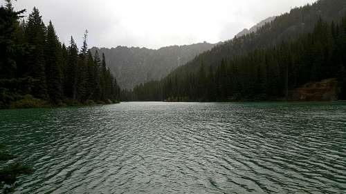
I reached a point where I had to decide whether or not I was going to continue on to Snow Lake. It seemed pretty obvious that the Nada Lake views were past and I’d enter into the woods again. By now the weather had deteriorated. There was a steady rain and it was obvious it was going to rain for quite a while. It was early afternoon by now and I decided I’d come far enough and that saving my legs for a shot at Axis Peak on Saturday seemed like a smart idea. So with little doubt in my head about the merits of turning around, I headed back down the trail for the parking lot. But it wasn’t raining that hard, so I took my sweet time and enjoyed all the views of Nada Lake on my way down.
The hike out was special as well. The weather improved, with the rain eventually stopping as I approached the trailhead, allowing for some good views of the surrounding ridges.
It was late enough in the day that I just headed into Leavenworth for dinner – at South again of course! I made it an early evening. Axis Peak was awaiting in the morning, and I was hoping for a little peakbagging mojo!
Getting Some Mojo Back on Axis
Saturday morning in the Enchantments on a Labor Day weekend! It was worse than I expected – as the area was insanely busy! Eightmile Campground, which hadn’t been all that busy earlier in the week, was now packed and was a zoo. As I drove to the Stuart Lake trailhead there was a steady stream of car campers along the road. And then there was the trailhead parking lot. It’s large, and it was packed! I got lucky and was able to find a parking spot in a far far corner of the lot. I wasn’t thrilled with this zoo of insanity. Way too many people! Solitude wasn’t looking like a possibility this day. Fortunately, tourons aren’t interested in Axis Peak…
I am curious how many people bag Axis Peak every year? I am quite sure it’s not many. I’ll use my firsthand evidence from a Saturday on a holiday weekend to back up my hypothesis. There was no one on the mountain with me the entire day, from the time I left the trail at the lake, until the time I returned to the trail at the lake.
The biggest reason for the lack of Axis peakbaggers is of course the Enchantments. That’s where most everybody heads. While yes, Axis does technically lie with the Enchantment zone, and plenty of hikers visit Lake Stuart, far more make the left hand turn at the trail junction and head towards Colchuck. And that boded well for me on this day.
From an aesthetic standpoint I suppose Axis isn’t much of a draw either. The standard and more reasonable route is from the Lake Stuart side, and well, Axis isn’t much too look at from this side. Then there is the route! It’s just an uncomplicated very long slog of 2500 vertical feet from the lake to the summit, with plenty of loose scree at the upper reaches to greet you.
![First View of Axis Peak from the Stuart Lake Trail]() First view of Axis Peak
First view of Axis Peak
Yeah, there aren’t a lot of good reasons to want to bag Axis, unless of course you’re into solitude, a physical challenge and amazing views. The views would be somewhat obstructed on this cloudy and at times rainy, sleety day, but they were still amazing.
Even for me, there was something about Axis that made it hard to get really excited about a summit bid. In the end, I only picked it because other “better” options were now not available for this dayhiker. I would be glad I picked her…for all the reasons I stated above; solitude, a physical challenge and oh yeah, amazing scenery. It didn’t hurt that I got back some much needed mojo this day.
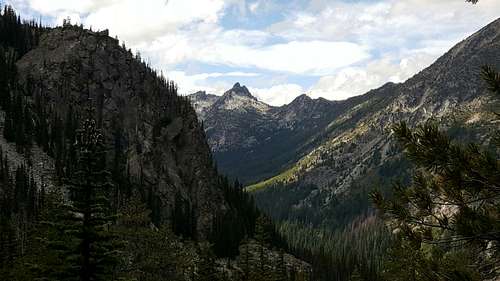
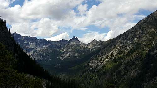
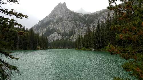
The 4.5 mile hike to Lake Stuart was pretty uneventful. The trail was busier than I would have cared for, but it was expected. There were a few good views here and there, but mostly it was a long walk in the woods. At least until I reached the meadows!
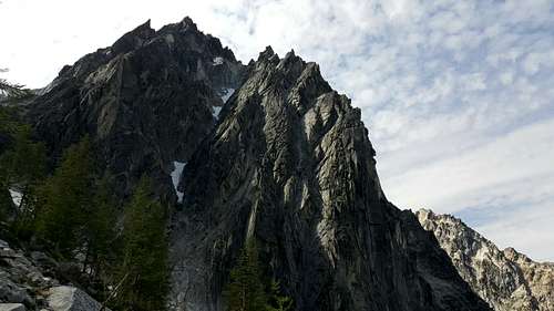
![Dragontail Peak]() Dragontail Peak
Dragontail Peak![Dragontail Peak]() Dragontail Peak...with some zoom!
Dragontail Peak...with some zoom!
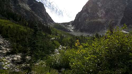
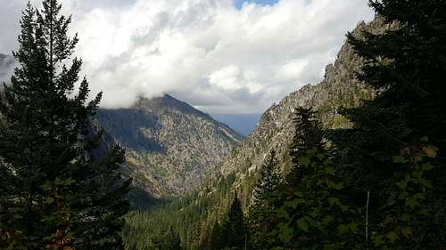
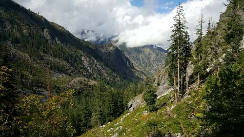
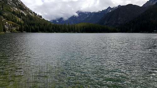
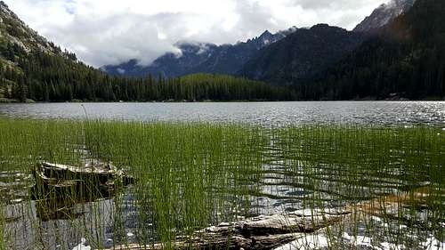
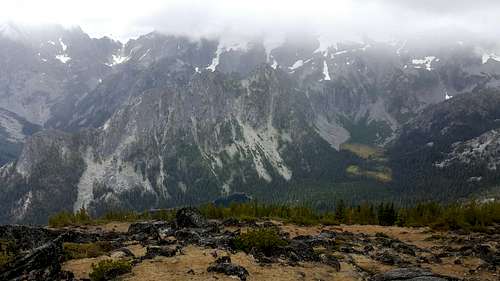
Every bit of beta I ran across for Lake Stuart and Axis Peak seemed to include a picture of the meadows. And rightly so! For many weeks after I returned home, it was my picture of the meadows that turned any dark thoughts I had about this trip to the North Cascades positive. Every time I’d see that picture I just couldn’t help but think how much I loved the scenery of this area. I still think it’s my favorite picture from the entire trip. I suppose I could have stopped at this point on the trail and said all was good and skip Lake Stuart and Axis Peak. But that thought never crossed my mind at the time. So I continued on to the lake.
![The Meadows - Stuart Lake Trail]() The Meadows
The Meadows
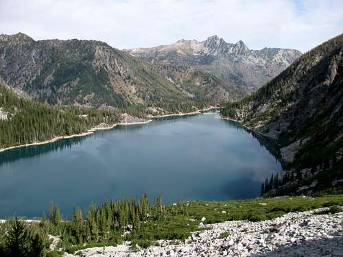
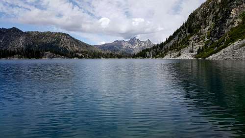
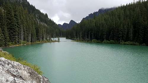
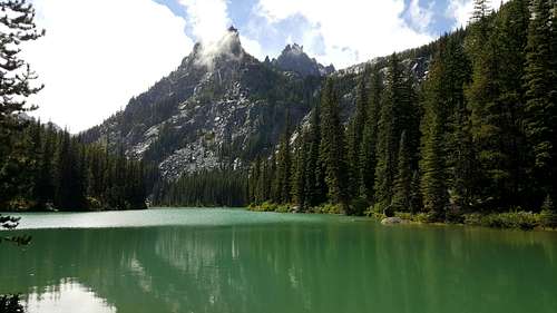
If I was in a hurry to get peakbagging, you wouldn’t be able to tell, based on how long I spent at the lake. Both ends! When I reached the east end of the lake I found a good viewing spot and took a nice long break, to snack and to soak in the scenery. Lake Stuart is a stellar destination!
I headed on to the other end of the lake to soak in the views from there. Again, if I was in a hurry to go peakbagging, it sure wasn’t obvious. I even found a good place to leave the trail where I could have headed up towards the Axis boulderfield, but I just kept on walking all the way around the lake, to the far west end, and found a wonderful spot for another break and more amazing views.
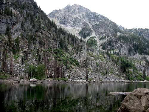
![A Good View of the Scramble Up Axis]() Axis Peak
Axis Peak
Sure, the clouds were low, here as well as at the other end of the lake, but they would be low all day long. I didn’t care! The area was amazing, with clouds, and I am quite sure even more so, without them.
![Lake Stuart]()
![Lake Stuart]()
![Lake Stuart]()
![Lake Stuart]()
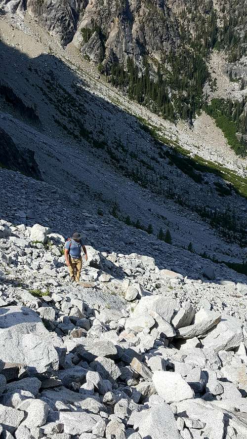
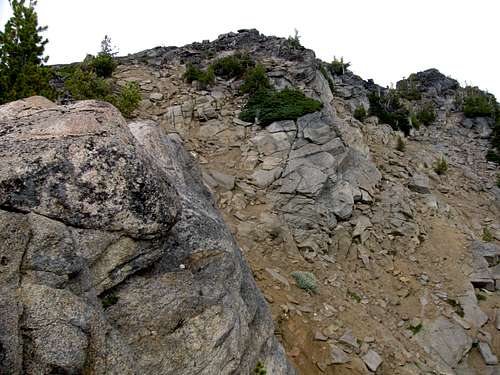
Eventually I decided that it was time to start heading uphill. I left the west end of the lake and started making my way back around the lake. I found a good spot to break off the main trail and not have to do much, if any, bushwhacking. Frankly, it was a breeze making it up a social trail, through a minor amount of knee high brush to the base of the boulderfield. Not that there were any cairns showing me the way! And that would be the case all day. I didn’t see a single cairn from top to bottom. There is no defined route! Of course the route is pretty obvious; make it to the lake, find a good spot to easily reach the boulderfield and start heading up; if you veer far enough left on the ascent that you reach a scree filled gully, start heading back to the right; if you veer far enough right on the ascent that you reach a scree filled gully, start heading back to the left; other than that pick your way up the boulders and then the scree until you reach the summit.
![Heading up the Axis Peak Boulderfield]()
![Lake Stuart from the Boulderfield]()
![Heading up the Axis Peak Boulderfield]()
![Heading up the Axis Peak Boulderfield]()
It was about a two hour scramble to the summit. And none of it was particularly easy! True, it is not technically difficult, but physically…well it sure is steep. I’d still call it difficult Class 2, but I did use my hands a bunch to assist with the climb up. These weren’t climbing holds, just holds that made moving vertically a helluva lot easier! The most difficult part of the scramble was working around the cliff bands. And the difficulty wasn’t on the ascent so much as on the descent. On the way up I found myself having to work around some big rocks that would have required some Class 3 or more difficult climbing to attack head on. I chose to take the easier work arounds. They were still steep, but easily managed. But as I ascended, I started thinking about the descent, and I was a bit nervous about being able to work my way around these small cliffs on the way down. I figured it would be easy to get into a spot that would require some difficult downclimbing. With this in mind I started making mental notes of the route as I took my frequent breaks on the way up, stopping to look back for some reference points…and to get plenty of pictures.
![Eventually You ll Hit Some Cliff Bands]()
![Working Around the Cliff Bands]()
![Dragontail and Colchuck Peaks in the Clouds]()
![Lake Stuart and Mountaineer Ridge]() Lake Stuart
Lake Stuart![Views on the Ascent of Axis Peak]()
![Mountaineer Ridge and Lake Stuart]()
It was quite the scramble up Axis! And the entire time I was making the climb I was glad I hadn’t brought Andrew and boys up here. Leading up to this trip I gave serious thought about making Axis a peakbagging day for the boys. The higher I got up on the mountain the more I was glad that that didn’t materialize. All I could think was, “Andrew would hate this route!” I’ve hiked with Andrew enough to know what he doesn’t like, and this kind of route would have been one of them. Actually, the lack of a route would have been the issue. As I ascended I just made route finding adjustments as I went up. Going left looks good…moving back towards the right might be a smart idea…gotta work around this cliff band…I hope I’m going the right way or I’m gonna have to backtrack…so on and so forth all the way up her slopes. Yes, Dad knows what Andrew likes, and he would have hated this! It’s OK, he was having a great time at the Gorge and I was having a great time on Axis. I’d see him tomorrow…
After my two hour scramble I finally made it to the vertigo inducing summit ridge, and then over to the true summit. Finally, a summit! About time I got some mojo back! Well only some mojo!
![Looking Up at the Summits]() Summit
Summit
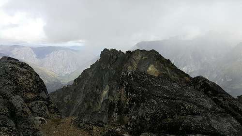
My summit experience wasn't exactly smooth sailing. First off I was beat! The 2,500 foot scramble from the lake is by no means easy. Then of course, there was the rain…and the sleet. It started raining about 15 minutes before I reached the summit. By the time I was on top it was a mixture of rain and sleet…slow, but still not the best summit weather. Then there was the vertigo inducing summit ridge. I didn’t actually experience any vertigo, but between being tired, the rain, and the severe drop-off towards the Eightmile Lake side of the peak, I didn’t feel very comfortable sitting on the summit block trying to take in the cloud covered views. I was also a little concerned about the descent, mostly worried that I would take a bad line and end up with some difficult Class 3 scrambling, which isn’t the worst thing in the world, but I was solo and tired so it was a concern. Then of course, there was my doubt at the time that I had bagged the correct summit block.
Directly east of the true summit there is another “summit” block, and just eye balling it, it wasn’t clear whether that block or the block I was on was the true summit. Add in that I couldn’t find a summit register and I started questioning things. I just wasn’t sure. At the time I was pretty sure I hit the wrong summit block. That didn’t help getting my mojo on! I didn’t realistically think about venturing over to that block (and in hindsight I am very glad I didn’t) as it would have been a tough scramble. Between the weather and how tired I was it wouldn’t have been the safest venture. Whether or not I made the true summit was irrelevant at this point. The only direction I was going to move now was downhill. It wasn’t until I got home and could pull up a detailed topo map that I realized that yes, I did bag the true summit! My worries were in vain…
![So, Which is the True Summit?]()
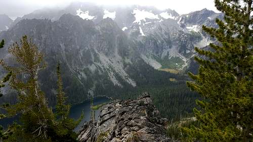
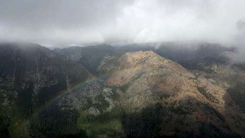
Once I decided I wasn’t going to worry any more about the true summit I was able to slow down long enough to soak in the views. The ridgelines might have been covered in clouds but it was still an amazing place to be standing. The rain resulted in a summit rainbow towards Eightmile Lake; Lake Stuart looked amazing, and amazingly small, from this vantage point; Mount Stuart was still being obstinate and wouldn’t stick out its beautiful face; and Colchuck Lake and the Enchantments were still as gorgeous as ever. Yes, the summit of Axis is a great place to be, even in a cloud covered drizzle!
![Axis Peak Summit Rainbow]() My summit rainbow!
My summit rainbow!![Eightmile Lake]() Eightmile Lake
Eightmile Lake ![Lake Stuart]() Lake Stuart...2,500 feet below
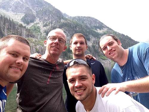
Lake Stuart...2,500 feet below![Axis Splattski]() Summit Splattski
Summit Splattski
It wasn’t a long stay on the summit, and then came the long slow downclimb. It was mostly uneventful. I was glad that I had slowed down on the way up to get some reference points for the descent as these came in handy several times. I made only one particularly bad route decision on the way down, and ended up having to result to a couple of Class 3 moves to bail myself out. Of course the scree on the upper slopes made for plenty of slip sliding away on the way down. It was steep enough that I resorted to screeing on a number of occasions just to speed up the descent. The toughest part of the descent was most certainly the boulderfield. It’s easy to forget how long you are on the boulders on way up. Going up boulder hopping is so easy, efficient and makes for some rapid elevation gain. On the way down…well, that changed! Add in tired legs and I took my sweet time getting down this section. I was 1,000 vertical feet from the safety of a trail and I didn’t want to screw up the trip now by spraining an ankle!
OK, I have to stop and rant! Don’t bring your F*%#ing boom boxes out on the trail! As I reached the bottom of the boulderfield, I started thinking again about what was probably my least safe move the entire day, which happened on the way up. I wasn’t far up the boulderfield when I heard music, which is and should be foreign to me when I am on the trail. I then spot a stream of seven or eight young hikers walking around the lake, and one of them has a radio on his shoulder with the music blaring. To say I was incensed would be an understatement. Without hesitation I yelled down to them “No one comes out here to listen to your damn music! Turn it off!” One of them responded “We can do whatever we want to do!” In typical Mark fashion, I didn’t have a quick come back for their dumb ass comment. But I pondered it as I turned and made my way up the boulderfield and I realized I should have replied, “Yes, you can do whatever you want to do…but that doesn’t mean that you should!” I have no problem with hikers that use ear buds and listen to music on the trail. I don’t, that is my choice. But for those that do, it’s fine, they can enjoy their music within the confines of their own space. It would just be nice if everyone respected others space when they are out in the wilderness. That’s enough of that, now back to the trail
It seemed like an eternity, but I eventually made it back to the trail. I stopped back at my first viewing spot of Lake Stuart to get some more pictures of this amazing scene, which looked even more amazing in the late afternoon. I then turned and headed for the car.
![My Best Shot of Mount Stuart]() Mount Stuart behind the clouds
Mount Stuart behind the clouds
Between the brutal descent and six great days on the trail, my legs were toast at this point. Fortunately it was four miles on a well-groomed trail out to the trailhead parking lot and the car.
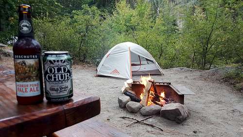
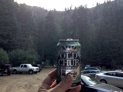
Of course the trailhead meant the end of the hiking adventures. Definitely a mixed bag of emotions there! My head wished for more miles on the trail. My legs were saying “Thank you very much, we are finally done!” I made my way to the car, pulled out a cold Old Chub and proceeded to painfully pull off my hiking shoes and socks. I opened the back hatch of the rental, sat there, rested, enjoyed my cold beer, thought about the week’s adventures, and smiled…definitely another case of more sunshine on cloudy days!
I drove into Leavenworth for pizza, and then the normal routine of some beers around a big campfire. I didn’t need to be in a rush on Sunday morning to get to the Gorge, so I stayed up late to burn up the remaining fire wood.
From the Wilderness to the Wild ~ Take Two
Sunday morning was another repeat of my 2013 trip. I broke camp so I could head towards the Gorge, hoping to arrive by noon. Again, like 2013, I had no plans for hiking this morning. Even if I did, my legs weren’t having any of that. My knees and my legs as a whole were sore and shot. I was moving a bit gingerly as I broke camp and packed up the rental. I said my good byes to Icicle Creek, headed east and was happy to put Leavenworth behind me.
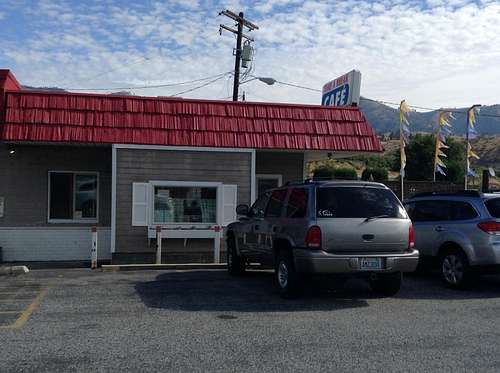
Again, like 2013, I was hoping to find a good spot for breakfast in a small town. Something quaint! I pulled off Hwy 2 in Dryden hoping to find such a spot. All I could find was the Take a Break Café. It didn’t look quaint! It looked more like a truck stop. I wasn’t thrilled with the choice, but I was pretty sure there wouldn’t be a lot of other options as I drove towards the Gorge. I reluctantly went in, and am glad to say I couldn’t have been more wrong! It took a few minutes to realize my error in judgement, as I sat at the counter looking over the menu…and heard Dylan’s Desolation Row as the cook’s musical selection…and looking around noticed the guitars hanging on the walls…and then the pictures of Pete Seeger and Bobbie gracing the walls as well. Yep, this was my kind of place! And the food was stellar as well, with the half serving of the So Be It enough to keep me full until show time!
![Take A Break Cafe]()
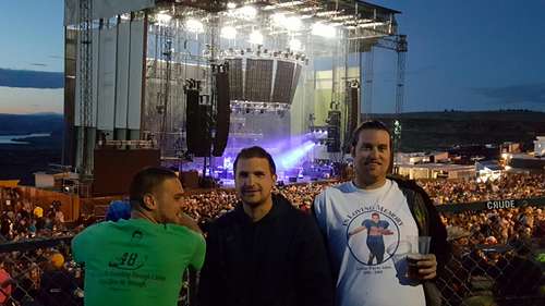
Again, like 2013, it was an afternoon of hanging around the Gorge campground with Andrew and all of his friends that had made the trip…which numbered over a dozen. We headed to the amphitheater early, to catch the opening act (Lake Street Dive…man that lead singer has some lungs!) and to wander the area. Regardless of your taste in music, if you ever get a chance to catch a show at the Gorge, I highly recommend it. It’s referred to as Heaven’s Amphitheater for a reason!
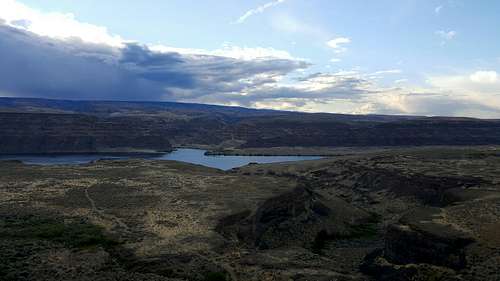
![Columbia River Gorge]() Columbia River Gorge
Columbia River Gorge
Unlike 2013, I didn’t guess the opening song correctly, but he did open with The Stone, which I thought was appropriate considering the amount of time the six of us had spent walking, scrambling, slipping, sliding…and yes, gracefully making our way, on rocks and stones over the course of the past week.
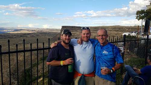
![Gorge]() Chris, Wes and Tyler
Chris, Wes and Tyler
Another Dave show with Andrew! A great way to end another one of our adventures west. Monday meant the two and half hour drive to SeaTac. Andrew and I parted ways as he headed back to Chicago…but we’d see each other again in a six short weeks, for a slightly different party, for his wedding in Cancun.
Looking at the three pics below…I can’t help but smile! These are three of my favorite scenes from my four days on the trail in the Enchantments. I look at these and it reminds me of how much beautiful scenery I consumed and how fond I became of this area on this short first visit. But I must confess, I often find myself thinking back to how the whole five days went down, and at times I can’t help but feel disappointed. I saw so much, but accomplished so little!…stop…slow down…take a deep breath…ponder those five days…and yes, now that I’ve had more time to take it all in, yeah, I saw some amazing scenery, and I accomplished a whole helluva lot. Yep, there was only sunshine on those cloudy days! Happy Trails…


Comments
Post a Comment