

Comments
No comments posted yet.
|
|
Trip Report |
|---|---|
|
|
Jan 5, 2014 |
This is just a simple log to keep track of our 2014 trips.
See the 2013 Trip Log for 2013.
See the 2012 Trip Log for 2012.
See the 2011 Trip Log for 2011.
See the 2010 Trip Log for 2010.
See the 2009 Trip Log for 2009.
See also the 2008 Trip Log for 2008.
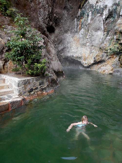
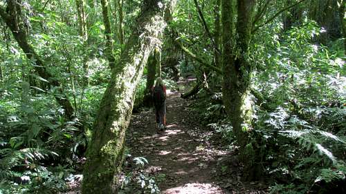
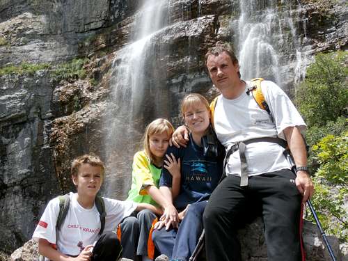
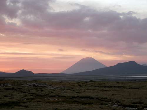
December 31: Fuentes Georginas (Guatemala)
In the morning we took a shuttle to Quetzaltenango (Xela) and headed to the Fuentes Georginas (hot springs) shortly after arriving. The hot springs were quite nice and there were several pools to visit of varying temperatures. The natural setting in the rain forest was spectacular and some of the hot springs have waterfalls spilling into them.
We did the short hike to the outlier hot spring as well. It was a really great day.
December 30: Volcán San Pedro (Guatemala)
Today Shaylee and I climbed the San Pedro Volcano. For safety reasons we took a guide, but with all the people on the mountain, it probably wasn’t necessary. We all went very fast up the mountain and made the summit in two hours and ten minutes, which is pretty good considering the elevation gain was around 4000 feet (1200 meters).
The hike was actually really interesting and had some nice cloud forest. There were some great views of the lake from the top. We had a nice lunch before heading down in a fast one hour.
We still had time to pack some things in, so Shaylee and I went horseback riding.
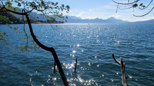
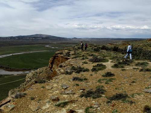
December 29: Reserva Natural Atitlán (Guatemala)
Today we spent much of the day around Panajachel and the east side of Lago Atitlán, which is said by some to be the most beautiful lake in the world (though there are many other beautiful lakes around the world). We woke up early and found a tuk tuk (motorcycle taxi) to the Reserva Natural Atitlán where there were said to be many good hikes and activities on the shore of Lago Atitlán. The hikes were actually quite nice, with lots of high swinging bridges, a waterfall, and some nice forests, as well as viewing platforms for coatis and monkeys.
We did all the hikes including down to the beach. We had hiked up to the top of the zipline beginning, but weren’t sure how to arrange it. We walked back down to the visitor center and then did the zipline. It was a lot of fun.
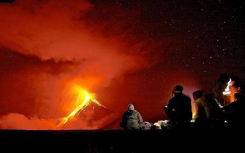
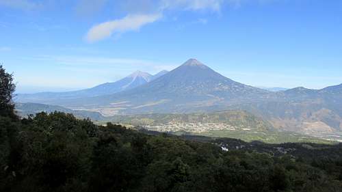
December 27-28: Volcán Acatenango (Guatemala)
December 27
For safety reasons, Shaylee and I joined a guided group for the climb of Volcán Acatenango. We went with O.X. expeditions. Since there have been a few robberies in the past, our group was to include two police officers. It was a good group of us and we all headed up the mountain. Since we had to carry so much water most of us (Shaylee and I included) opted to have a horse carry our stuff to camp.
We went at a pretty good pace, but took a lot of breaks, so it wasn’t overly strenuous. It was a nice uphill and then up and down trek to camp. Our camp had an excellent view of the very active Volcán Fuego. Fuego means fire. The volcano has been erupting a few years now. Rather than flow, it explodes a few times an hour. At night everything glows and it is spectacular. We had one spectacular fireworks display at night!
December 28
It was a pretty long night for me (crowded tent), but the others seem to sleep OK. I got up once at night and it was very foggy outside. In the morning we awoke at 4 am in order to climb the volcano. There was frost on the ground, but the sky had cleared.
The route up the volcano was rather strenuous due to loose ash and cinders on the steep slopes. We still made good progress and found ourselves on the crater rim for sunrise. Shaylee was first to the top.
Once on top and after watching the spectacular sunrise, some of us ran around the crater. If you run all the way without stopping, you get a t-shirt. Shaylee had to stop because of a stomach cramp and was sad.
After enjoying the summit we descended to camp, packed up and walked all the way down via a different route.
With the eruptions of Fuego, Acantenango was the most spectacular climb of the trip.
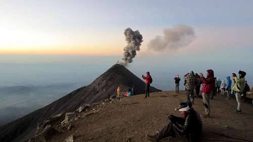
December 26: Volcán Pacaya (Guatemala)
Today Shaylee and I climbed an active volcano, Volcán Pacaya. It was a pretty easy and popular climb, but it was very scenic. The point we actually reached was Cerro Chino, since the highest summit of the volcano was off limits because of potential activity. There was lots of new lava around, but the volcano was actually quiet, though it was smoking. It hadn’t had a real eruption since November 2013.
We got to roast marmallows in the vents of on the volcan. We left super early in the morning (dark) and got back early afternoon.
Obviously climbing an active volcano isn´t enough adventure, so we went bungee jumping, including doing a sling shot bungee jump where they launch you in the air, which is supposedly more thrilling than simply jumping off a bridge. Shaylee did three jumps, but one was enough for me.
The weather was good and it was a spectacular trip.
December 20: Emerald Mountain (Colorado)
I climbed Emerald Mountain near Steamboat Springs today. It was snowing, but due to the low elevation of the peak, conditions were not severe. I made it to the summit and back using the standard route.
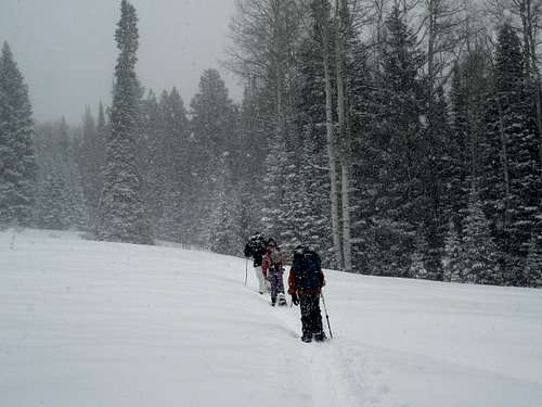
December 13-14: Spraddle Creek/Peak 12,380 (Colorado)
December 13
Shaylee, Kessler, Kimberly, and I set off for a weekend adventure. The plan was to snowshoe up the Spraddle Creek Route in the Gore Range to the Eiseman Hut (11,180 feet) and then hopefully climb Peak 12,380. The weather forecast didn't look very good though.
On the drive I was worried about bad snow conditions as I saw that the south facing slopes between Avon and Vail were fairly bare. Once we got to the trailhead though, the snow was pretty good.
We snowshoed up Spraddle Creek and completed the crux of the route, which is the steep climb out of the creek valley. The weather was actually pretty sunny.
Once we dropped into the Middle Creek basin, the slope relented and it was a fairly gentle climb until we had to climb out of the Middle Creek Basin as well. The sky began to look much more threatening and we wondering if we would get hit by the snowstorm.
Other than a few flakes, we did managing climbing to the hut before the storm hit. It had taken us 5 hours to do the 6.8 miles and 3000 feet elevation gain. Since all sources and guidebooks said it was supposed to take 6-8 hours, we felt pretty good, especially since we hadn't rushed it too much and took some good breaks.
There was still and hour and a half of daylight left, but the weather wasn't looking promising, so we decided not to climb the peak in the evening and come down in the dark.
December 14
It snowed through the night and we awoke with poor visibility outside. It was a relatively warm 18F/-8C though. We decided not to climb Peak 12,180 and instead headed down the mountain. It was snowing hard most of the time, and Kessler had to break much of the trail, but it wasn't a bad descent.
The drive home during the storm was the worst part.
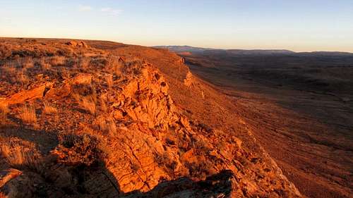
December 9: Sand Rocks (Colorado)
Alone, I did a hike across the Sand Rocks.
December 7: Cedar Mountain (Colorado)
Again alone, I did an evening climb of Cedar Mountain, completing the short loop. The trail was pretty dry, but there was some snow in places.
December 5: Sand Rocks (Colorado)
Alone, I did an evening hike up the Sandrocks.
November 30: Parriot Mesa/Peak 5420
A group of us set off to climb Parriot Mesa, but it was very windy. Since it was so windy once we hit the ridge, the kids decided that they would rather do something else since technical climbing in high winds can be problematic.
Kessler, Shaylee, and I headed back down and climbed Peak 5420 instead. It was a nice scramble with one class 3 section.
November 29: Big Horn/Delicate Arch/Un-named Butte
A group of us, led by AJ completed the Bighorn Route in Arches National Park. As usual, the scrambling was fun as were the down climbs.
After completing the Bighorn Route, Shaylee, Kessler, and I hiked to Delicate Arch. We also climbed the nearby butte for some fine views.
November 28: Wall Street/Corona Arch (Utah)
Kessler, Shaylee, Rebecca, and I did several climbs on Wall Street, with ratings between 5.4 and 5.9 (the kids were the only ones that did the 5.9). For the lead climbs, Kessler insisted on leading all the pitches himself.
After climbing on Wall Street for several hours, we headed for Corona Arch and hiked to the arch to watch some of the others do the arch swing (which I have no desire to do). Kessler wanted to do the arch swing, but I wouldn't let him and he had to be satisfied with climbing the technical route (low 5th class) to the top of the arch and then rappelling back down.
November 27: Fiery Furnace/Lomatian Canyon/Krill Canyon (Utah)
A group of us (Bonnie, Prashanth, Kessler, Shaylee, and I) set off to do some routes in the Fiery Furnace of Arches National Park, namely Lomatian and Krill Canyons.
Lomatian Canyon was straight foreward and the approach only had a few exposed sections, but climbing from Skull Arch to Krill Canyon was an exciting and exposed scramble and climb.
Both Canyons were really nice and we completed the canyons without any issues. It was a fun day.
November 21-22: Shrine Mountain (Colorado)
November 21
Shaylee and I snowshoed up to Jays Cabin Friday evening. We started at 4:45 PM and walked in the fading daylight before having to pull out the headlamps at Shrine Pass, but it was only a short snowshoe in the dark.
November 22
In the morning, Shaylee and I set off to climb Shrine Mountain. It was 7F (-14C), but even on the mountain there was only a slight breeze. We had to break trail for the last 1/3 of the climb, but it was a good day and the views were beautiful.
After enjoying the nice views from the summit, we headed back down.
November 16: Onion Creek Side Slots (Utah)
Charlie, Terresa, Rob, and I met in Moab so we could explore some slide slots of Onion Creek. Unfortunately, Charlie had a very serious accident and we are all hoping for his recovery.
November 15: Medieval Chamber/Wall Street (Utah)
Charlie, Terresa, Rob, and I met in Moab in order to do the Medieval Chamber canyon. We made our way quickly to the technical part and were able to avoid the two big pools in the canyon. The rappel at the arch was really nice. Overall, it was an enjoyable canyon and better than expected.
After Medieval Chamber, we headed to Wall Street. We climbed the routes next to Sheela the Peeler (all other routes were already taken), but I don't know the specific names of the routes.
November 9: Cedar Mountain (Colorado)
In the afternoon, Shaylee, Kimberly, and I climbed Cedar Mountain, completing the medium loop. It was a nice day, but a bit windy.
November 8: Duffy Mountain (Colorado)
I climbed Duffy Mountain alone from the west I walked all the way to the east end of the mountain before returning the same way. There were a few hunters about, so I wore orange. I did see one deer and a few rabbits.
Before I climbed the peak, I hiked the fairly new geology trail, but it's already fading away due to lack of use.
November 1: Spring Creek (Colorado)
Shaylee was supposed to be running a 5K today, but she woke up sick. Instead Kessler and I hiked up Spring Creek from Steamboat Springs. We made it to just over 7100 feet before turning back.
October 31: Cedar Mountain (Colorado)
Alone, I climbed Cedar Mountain, completing the long loop.
October 30: Sand Rocks (Colorado)
Alone, I made a night climb of the Sand Rocks.
October 26: Cedar Mountain (Colorado)
Kim, Kessler, Shaylee, and I set off to climb Cedar Mountain. It was sprinkling, but we went anyway. We made it to the saddle between the two main peaks before there was thunder. Because of the thunder, we decided not to continue and we turned around.
October 25: Black Mountain (Colorado)
It is hunting season, so I dressed in hunter orange for safety. The trail is really dry for this time of year, and there wasn't much snow either. It was pretty windy, but the route via the Southeast Ridge is pretty protected. After a nice rest on top, I returned. I saw one hunter on the ascent.
October 19: Winter Camp Slot (Utah)
Today, Shaylee chose Winter Camp Slot because she wanted to do the big rappel. Erin, Bill, Shaylee,and I headed to the big drop and Bill set it up. Everything went well and after the drop, the canyon was just a walk out. Just below the drop, it had a nice and deep narrows though and the route was quite pretty.
Erin and Bill headed off to do Repeat Junior, while Shaylee and I headed off for home.
October 18: Undercover Canyon (Utah)
Shaylee and I met Bill and Erin in order to try Undercover Canyon. We originally planned to go to the Roost, but we heard that conditions weren't the best right now and it would have been a longer drive.
For the drive, we left early in the morning. The canyon itself went pretty well, but we got stuck behind a slower group. Once in the canyon, it was pretty nice and we enjoyed it at a leisurely pace.
The exit was actually quite a bit spicier than I expected. It was not difficult, but it was exposed. After exiting the canyon, we headed off to find the impressive Covert Arch. After enjoying the arch, we returned to the vehicles in order to find a campsite. Strangely, there is perfect cell phone coverage in the area and it was good enough to sing campfire songs over the phone with my wife.
October 15: Sand Rocks (Colorado)
I took a night hike over the top of the Sandrocks.
October 12: Wildhorse Window (Utah)
After a windy night of camping and packing up camp in the wind, Kimberly, Kessler, Shaylee, and I headed off to hike to the Wildhorse Window. As expected, the arch was really nice, but someone left a lot of trash around. We packed out an entire backpack of trash.
October 11: Gilson Buttes/Angel Canyon/Angel Trail (Utah)
Kimberly, Kessler, Shaylee, and I headed out to explore the area around the impressive Gilson Buttes. We explored and walked all the way around Little Gilson Butte and then headed south to Sheepherders Rock to find some old signatures.
After exploring the Gilson Buttes, we ate lunch in Hanksville and then explored the technical Angel Canyon. It was a great slot and better than expected. It also took longer than expected. We could stay dry until the end and then there were two pools to wade through. There were a lot of fun and technical downclimbs and one rappel as well.
We rested on the bench containing the Angel Trail before climbing out the trail. We climbed a slickrock dome along the way in order to see the scenic views.
It was a great trip, but the route took much longer than expected and we almost ran out of daylight.
October 10: Little Wildhorse Canyon/Bell Canyon/Goblin Valley (Utah)
Kimberly, Kessler, Shaylee, and I did a variation of the Little Wildhorse/Bell Canyon Loop. After hiking up Little Wildhorse, which is always a pleasure, we got to a pool of water. This was the perfect excuse to try a proposed cutoff that I have wondered about for years.
Little Wildhorse Canyon has a small west fork which I hadn't been to. I had proposed for a long time that the west fork might make an interesting shortcut. We decided to try it. We explored the west fork and had to pass several drop-offs along the way. We ended up in a maze of interesting canyons. The left most fork ended in a fall, but we tried another fork which went all the way to the rim.
After some exploring around, I found a break in the cliffs and the others followed. It was a steep descent, but we found our way into Bell Canyon which we followed back through the San Rafael Reef and to our vehicle. I don't know if the "shortcut" really saves any time, but it was an interesting route.
Later in the day we headed for Goblin Valley to do some exploring. The kids took off to do some exploring and playing tag on their own, which Kimberly and I climbed the highest non-technical butte for the views.
Later that evening and near dark Kessler and I explored the ridge above the campground leading to Wildhorse Butte.
It was a fantastic day and we packed a lot of fun in.
October 5: Bald Mountain (Utah)
Kessler, Shaylee, Kimberly, my dad, and I planned to hike the ridge over Bald Mountain from Big Mountain Pass to Parleys Summit. When we got to Parleys summit for the car shuttle, we found out that it is now posted as private land (even though it's part of the Great Western Trail.
We all drove to Big Mountain Pass to make the hike from there. It was a good hike out to Bald Mountain and we went over some intermediate peaks along the way. We ate lunch on the summit before returning back to the vehicles and heading for home. It was a beautiful fall day.
October 4: Red Baldy (Utah)
My dad led a Wasatch Club trip to Silver Glance Lake. Kimberly, Kessler, Shaylee, my dad, and I met three others at the REI in Sandy before driving to the trailhead. We all hiked to Silver Lake at a moderate pace, but Kim wasn't feeling well and opted to stay at Silver Lake. Shaylee decided to stay with her.
The rest of the group hiked up to Silver Glance Lake, in a beautiful mountain cirque. We were all going to climb up to the Silver Glance/White Pine Pass, but one of the group had to be back early (3 pm), so other than Kessler and I, everyone turned back half way to the pass. Kessler and I climbed as fast as we could up to the pass and then over to Red Baldy. There was a little more scrambling than I remembered and there were a few places where the snow was about a foot deep in places, but we made our way rather quickly to the summit of Red Baldy. It was a beautiful summit, as always.
We only had less than an hour and a half before we were supposed to be back at the trailhead so we decided to try a quicker route down the south face. The route was a pain and we probably should have used the route we ascended.
We made our way down to Silver Lake with only 30 minutes left to make it to the trailhead. We were only a little late and it took us 35 minutes, but rushing it made us tired.
Red Baldy was a nice peak as always, and it was nice to climb it again. The last time I had climbed it was more than 15 years ago.
September 28: Cedar Mountain (Colorado)
Alone, I took an evening hike up Cedar Mountain. Parts of the loop have been washed out on the northeast section. I saw several rabbits along the route.
September 27: Fish Creek Falls/Long Lake (Colorado)
September 22: Cedar Mountain (Colorado)
Kimberly and I left the kids at home so they could do there homework, and her and I headed for Cedar Mountain. The weather was good, but a bit breezy and we saw rabbits and deer along the way.
September 21: Craig BM (Colorado)
In the afternoon, Kimberly and I took a long walk from home in order to see how close we could get to the Craig BM.
September 20: Rabbit Ears Peak/Elmo Point (Colorado)
Kessler, Shaylee, and I headed to Rabbit Ears Peak in order to climb it. I had been to the base a few times, but still hadn't made the climb.
When we reached the base of the summit block, it was discovered that although we brought lots of equipment, we had somehow left the rope. We had a few long slings, so decided to do the climb anyway since the technical section was short and it could probably be done without a rope anyway.
There was another man at the base of the rock who wanted to climb the rock as well and we offered to let him use the slings as well. Him, Kessler, and I actually climbed the peak without ropes or any other equipment, but I belayed Shaylee up the first little pitch.
Kessler I actually ended up freesoloing the route four times, once in order to help his sister up and the other times just for fun or to get more photos.
Both kids could descend the whole block without ropes since they could squeeze through a crack, but the two adults opted to rappel off the sling.
It was a fun little climb and the rock was more solid than some guidebooks indicate.
Incidentally, although the map labels the west summit as Rabbit Ears Peak, I believe that the east ear of the Rabbit Ears is actually higher. It would be a much harder and more dangerous climb.
September 15: Cedar Mountain (Colorado)
In the evening, Kessler, Shaylee, Kimberly, and I hiked Cedar Mountain, completing the medium loop. It was a good hike, but Kessler was allergic to something there and his eye swelled up. He probably won't climb Cedar Mountain at that time of year again (same thing happened last year at about the same time). On the plus side, we saw several deer along the route.
September 13: Peak 13,248/Notch Mountain (Colorado)
Kessler, Shaylee, and I set off to climb Peak 13,248 and Notch Mountain. We awoke to 26F/-4C, but it was a beautifully clear day. We hiked up the trail before turning up Notch Mountain and I was surprised how well graded and pleasant the trail was all the way to the shelter.
Once at the shelter we had some snacks and headed for Peak 13,248. Once on top we were still feeling good and since we had a lot of time still available, we contemplated doing the Halo Ridge. Since we hadn't planned to do that ahead of time, we didn't think we had enough water since we only had two combined liters left. We decided to head over to Notch Mountain instead.
We scrambled up Notch Mountain and then enjoyed the views before heading back down along the ridge.
It was a pleasant and good climb. It was a bit breezy at times, but the weather was really good.
September 12: Fall Creek Trail (Colorado)
In the late evening, I took a hike for a little ways along the Fall Creek Trail before returning to camp and going to bed at the Half Moon Campground.
September 6: Naomi Peak (Utah)
After spending the night near Bear Lake, Shaylee, Kessler, Kimberly, and I climbed Naomi Peak. Most of the flowers were gone, but it was still a nice hike and the weather was good.
September 3: Sand Rocks (Colorado)
After scouts, I traversed the Sand Rocks, west to east.
September 1: Green River/Green River Lakes (Wyoming)
After a clear and cold start (25F/-4C), it was a beautiful day. Unfortunately, it was time to pack up and head for home. It was a routine hike back under sunny skies. The haze was gone as well.
August 30-September 1: Green River Lakes/Square Top Mountain/Trail Creek Park (Wyoming)
August 30
My dad, Shaylee, and I planned to climb Square Top Mountain in the Wind River Mountains. The weather forecast was bad for today, but good tomorrow when we planned to climb the peak. It was really hazy, but we made good progress to Beaver Meadows. Pixley Creek was a bit challenging to cross without getting wet and Shaylee fell in.
It rained in the evening. Luckily we found a nice camp and got mostly set up before it rained.
August 31
It rained hard all night and the tent leaked a bit. We were a little wet. Because of the weather, we decided to give up on climbing Square Top. Instead, we hiked towards Green River Pass in the rain. It was raining almost all of the way up and when we got to the stream crossing at Clark Creek, just before Trail Creek Park, we decided not to wade the creek. We were already wet enough.
We hiked back down to Beaver Creek and hiked towards Granite Lake, but we didn't make it all the way to the lake.
August 26: Williams Fork Mountains (Colorado)
I did a quick after work hike in the foothills of the Williams Fork Mountains.
August 24: Fishhook Lake/Lost Lake/Lake Elmo/Round Lake/Lake Percy/Long Lake (Colorado)
We got a very late start, but Kim, Kessler, Shaylee and I set off to hike to several lakes. Because we didn't start until after normal lunchtime, we didn't know if we would make all six lakes. We managed to hike to all six lakes and back in 5.5 hours, which isn't bad for an 11 mile hike. The weather was good all the way to Long Lake (our last lake), but it rained with a bit of graupel on the way back. It was a chilly day for August, but still a nice hike.
August 23: Cedar Mountain (Colorado)
The weather was bad almost all day. We had plans to climb something bigger, but we settled for a quick evening climb of Cedar Mountain; completing the medium loop.
August 17: Portland Creek (Colorado)
We were originally going to join a group for Portland Creek, but the kids, Kim, and I were tired and slept in (it was a long day the day before). We headed to Portland Creek on our own. Shaylee, Kessler, and I completed upper Portland Creek (Kim walked to the head of the canyon, but had a bad sunburn that made scrambling painful) and Kessler and I completed lower Portland Creek. It was a nice route, but the exit was kind of a pain.
August 16: Cascade Creek (Colorado)
Kevin, Logan, Stacy, Kessler, and I set off to do the Cascade Creek Route near Ouray. It is considered to be the most challenging canyoning route in the area. There are many slippery and high rappels including a 3000 foot one at the end.
It was a great route, but I injured myself on the Charmin Tube Falls. I ended up with some rope burns and a banged up shoulder, foot, and elbow. The damaged elbow and shoulder made the rest of the route more difficult.
August 13: Sand Rocks (Colorado)
On the way back from scouts, I hiked over the Sand Rocks, west to east.
August 8-10: Mount Ethel/Lost Ranger Peak (Colorado)
August 8
Since the weather forecast was good, Shaylee, Kessler, and I set off to climb Mount Ethel and Lost Ranger Peak. We started at around 5 pm and hiked for three hours where we found a nice secluded hollow to camp in at the headwaters of Newcomb Creek (six miles from the trailhead). Just short of the campsite, we stopped to climb Peak 11,173.
It was a beautiful campsite next to a nice crag. Despite the good weather forecast, we did get rained on. The wildflowers were good along the way though.
August 9
With clear skies, we set off towards Mount Ethel. It was a really nice day to Mount Ethel and although the mountain is a fair distance from the trailhead, by Colorado standards at least, the climb is easy. There were some interesting rocks to climb near the top.
After Mount Ethel, we set off for Lost Ranger Peak. It was good weather until we were near the peak and then a storm built up incredibly quick and hit us when we were only a few feet from the summit. The storm was rather severe and the lightning scary thus we only spent a few seconds in the summit area. We raced down the mountain and huddled in a group of trees near the saddle south of the summit to wait out the storm. It hailed, snowed, and rained hard.
After the storm abated we made our way quickly over the shoulder of Mount Ethel and down towards camp. Since the sky was clear again we climbed Point 11,262 for the views and to get some photographs.
WE did 15+ miles round trip on this day. We were going to hike back Saturday making it a 21 mile day, but Shaylee's (our 10 year old girl) feet were blistered from her wet boots.
It was a challenging, but good day, except for the severe storm and the blisters. It's a good thing that we have a tough girl. She never did complain at all about the blisters, other than she wanted to finish the final six miles the next day.
August 10
Today started out clear as well. We packed up camp and walked back to the trailhead. It took us three hours, but we had to bandage Shaylee's feet up good. It did rain with a little sleet mixed in, but by the time that happened we were well below timberline.
August 3: Sand Rocks (Colorado)
Alone, I took an evening hike on the Sand Rocks, traversing the low ridge east to west and back again.
August 2: South Fork Buckwater Draw (Colorado)
I was asked to go with some college students to take some photographs for the Chamber of Commerce. There were three college students, two of them were experienced rock climbers
We wanted to go to the Outlaw Arch area, but it was closed for Peregrine nesting, so we went to South Fork Buckwater slot canyon instead. Because of the recent rains, there was a fair amount of mud in the slot, but it was still fun.
There were a lot of fresh rockfalls too. The weather was nice and luckily there were some high clouds keeping us shaded for the hike out. It wasn't as hot as it usually is in early August.
August 1: Bears Ears (Colorado)
Shaylee, Kessler, and I set off to climb Black Mountain, but the kids decided they would rather climb Bears Ears instead. We took the northern route this time. As always, it was a good, but very steep climb. The weather was OK, but it did rain on the way back.
July 27: Cedar Mountain (Colorado)
Kimberly and I took an evening hike up Cedar Mountain, completing the short loop. It was a nice trip. We saw many rabbits and several deer as well.
July 26: Wyoming Peak/Mount March Madness (Wyoming)
Kessler was at scout camp and the weather in Colorado was looking pretty poor, so Shaylee and I headed north to Wyoming in order to climb Wyoming Peak. We didn't leave until late on Friday, so arrived in Big Piney very late at night.
The next morning, we headed for Middle Piney Lake where we started our climb. After an 8:45 AM start, we made good progress up to the base of the mountain, though there were a couple tricky stream crossings.
Since this was a last minute planned trip, we didn't bring a topo map and only had the sketch map from Hiking Wyoming. We made our way north to Wyoming Peak, where it was cold and windy. The views were really good, including the Grand Teton to the north and the Wind River Mountains to the east.
Shaylee didn't want to spend much time on top, so we headed south, staying on the ridge crest over March Madness Peak, Point 10,905, and Point 10,765 and then to the saddle.
Since we didn't have a topo map, we ended up taking the high route and ended up near the ridge top above the North Fork of Fish Creek We then headed down a rugged avalanche chute to the north and ended up right at Lower Wohelo Falls.
From there, it was a routine walk back to the trailhead. The guidebook said that Wyoming Peak alone was supposed to take 9 hours, but we did the entire round trip in 8 hours, which wasn't too bad for a 10 year old girl and an out of shape dad, considering we did three extra sub summits and took a rough cross country route down.
July 19: Black Mountain (Colorado)
Kim, Kessler, Shaylee, and I climbed Black Mountain from the southeast ridge. It was perfect weather, but the sky was smokey from forest fires in other western states.
We made good time to the eastern summit where we took a quick break. We didn't sit for long as there were lots of bugs.
We continued on to the west summit of Black Mountain, having some good snowball fights along the way.
We at lunch at the Raptor Overlook before heading back the same way.
Sadly, we found the remains of the horse I had found (live) on the mountain back on November 11 2009.
July 13: Cave Rock (Colorado)
Kimberly, Shaylee, and I took an evening hike to Cave Rock. It was a pleasant walk.
July 12: Chimney Rock/Ryder Peak (Colorado)
Kessler and I met Brian Kalet at the trailhead for Chimney Rock. It had rained hard the night before, and although the weather was good for our climb, we still got wet walking through the vegetation. It was very foggy for much of the approach as well.
Once at the base of Chimney Rock, we scouted various routes. I place a cam in the crack on the north side of the east face and it seemed to hold all our weight. A crack on the east side of the south face also looked OK.
Eventually we climbed a crack on the south face. Kessler climbed the upper part of the route first since we weren't sure if we could fit through the crack. There were lots of marmot droppings in the crack and on the summit.
We enjoyed the views before rappelling off the rock (Kessler could squeeze through the crack; Brian and I rappelled over the top of it).
Chimney Rock is nice to look at, but it isn't the most pleasant climb in the world because of the loose rock and marmot crap.
After the climb of Chimney Rock, we set off to climb the nearby Ryder Peaks since they looked interesting from the summit of Chimney Rock. The climb of South Ryder was easy, but horribly plagued with mosquitoes! It was one of the worse mosquito infestations that I have seen (including places like Alaska, the Amazon, Yellowstone, and Southeast Asia!). We didn't spend much time on top and decided not to push on to North Ryder.
July 7: Rabbit Ears Peak (Colorado)
After beautiful Kimberly's doctor appointment, we drove up to Rabbit Ears Pass for a hike. We wanted to hike to Fishhook Lake, but found that the road was closed.
Instead we hiked the 4wd road and trail to Rabbit Ears Peak. Once at the base of the ears we poked around and hiked and climbed to the various overlooks.
Since I was alone and didn't bring a rope (Kim didn't want to climb the summit block), I chickened out on the final pitch below the summit. It didn't look hard, but I didn't want to do it alone and Kim didn't want me to either.
July 6: East Rim (Utah)
Because of the potential risky weather, we decided not to do any slot canyons today. Instead we hiked the East Rim Trail from the East Entrance of the Park. Kessler, Shaylee, Kimberly and I hiked the trail up to the rim near the head of Jolley Gulch. It was not as spectacular as doing a slot canyon, but was a nice mellow hike.
July 5: Pine Creek/Keyhole Canyon (Utah)
Today the flash danger was rated moderate, so Shaylee, Kessler, Kimberly, and I decided to get up really early and try something (we had permits for Pine and Keyhole). I was hoping to be done very early morning since t-storms are very rare in the morning. There were three swims in Pine before the first rappel and we decided to retreat. I don't mind the swimming, but I thought it might slow us down enough to prevent us getting through in the early morning hours, so we retreated.
Kessler and I (the girls didn't want to go) did Keyhole in about one hour and it was also completely filled with water and it was obvious that it really flashed (you could see wet sand and pine needles caked high on the walls). Incidentally, we found lots of gear. We found a backpack, headlamp, etc, strewn on the debris in the canyon. We packed it all out (since we did it early morning I assume we were the first ones through since the flood), but we wondered if someone got caught in a flash flood in there.
That evening I also took a hike around the Ponderosa.
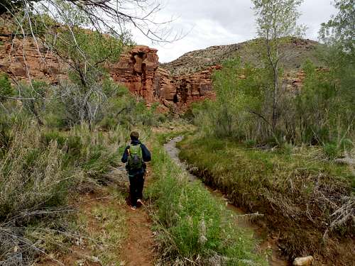
July 4: Orderville Canyon (Utah)
Kim, Kessler, Shaylee, and I did Orderville Canyon. We hired a shuttle from Ponderosa, but unfortunately left the camera in the car (the photo below is from SP member Tanya).
It was a hot day, but Orderville is a great trip in the heat, especially the lower half. The narrows were great and fun, but there was much more swimming than the NPS said there was. We were surprised by this, but it was pleasant on a hot day.
The waterfalls were really nice as well and the kids really enjoyed the canyon. We did the route in a fast six hours, plus the hike out the Narrows.
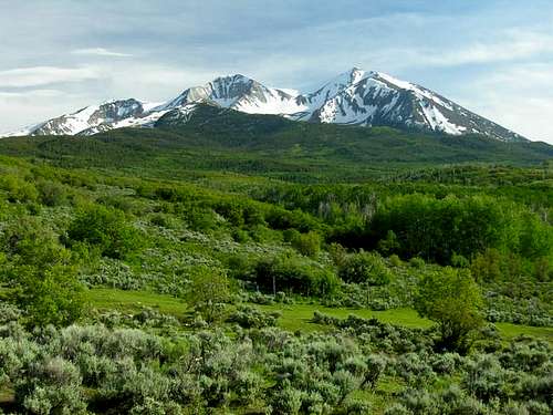
June 28-29 2014: Mount Sopris (Colorado)
June 28
After rafting Roaring Fork, Kessler and I set off for Mount Sopris. We started early evening and hiked up to Thomas Lakes. It was a popular place! It was a rough night as well. Kessler threw up a few times (probably the results of Chinese food in Basalt) and I didn't sleep at all due to allergies. It was an unusually warm and windy night as well and the temperature never dropped below 49F (which is unusual for this altitude).
June 29
Because of the rough night, we rose rather late and were dragging a bit on our ascent. We still made steady progress to the East Summit of Mount Sopris. There were only a few snowfields to cross.
Once on the East Summit of Sopris, we ate lunch before traversing over to the West Summit. Once on the West Summit we returned to near the saddle between the two peaks and glissaded off the north face. It was a good glissade down to the basin below.
We then followed the drainage downwards and to another glissade. It was much steeper than I expected so we did the glissade in a permanent self arrest position. We could still stop by kicking in.
Once at the bottom of the next basin, we had to make our way back towards Thomas Lakes. We climbed partially on snow up to the saddle near Point 11425. The section without snow was really tedious.
We then crossed the rock glacier to the ridge above Thomas Lakes. The rock glacier was extremely slow going and we wished the route had been covered in snow. We then followed the ridge above Thomas Lakes until we could descend very steeply in the trees and down to another rock glacier, which was also a pain to cross in order to get to the lakes.
This descent route was really steep, strenuous, and tedious, even though the difficulty never exceeded class 3. It is not recommended unless covered in snow. On the plus side we got a really good view of the seldom-viewed-up-close north face of East Sopris, which is really spectacular.
After reaching the lakes, the final task was to follow the nice trail to the trailhead, but after our strenuous route, it seemed long even though it wasn't.
It was still a good climb, but next time we'll do it earlier season. The weather was perfect as well with no threat whatsoever of thunderstorms.
Incidentally, our camera died and we didn't get any photographs. This was a real shame since we could have gotten some really great photos.
The photo below was taken by SP member Kane at about the same time of year.
June 25: Sand Rocks (Colorado)
Kimberly and I went for a hike over the Sand Rocks.
June 24: "Model A Peak" (Colorado)
After work, I climbed Model A Peak between Craig and Hamilton since I hadn't done it in a while. It was very windy. There is a new mining claim near the trailhead, which I hope doesn't block access to it in the future!
June 22: Stewart Falls (Utah)
On the way back from visiting family in Utah, Kim, Shaylee, Kessler, and I hiked to Stewart Falls on Mount Timpanogos. It was a great hike. Kim did trip and scraped her knee on the trail. Other than that, we had a great hike!
June 21: Butterfield Peak (Utah)
After visiting family; Kim, my dad, and I hiked up Butterfield Peaks in the Oquirrh Mountains. I had not hiked in the Oquirrh Mountains since climbing Lowe Peak on May 11 1996. We didn't bring a map or information, so we got on the wrong trail for a short distance, but we found the right trail and hiked to the summit rather quickly.
Once on the summit we hiked towards White Pine and Kelsey Peaks, but we didn't make it all the way to the summit of those peaks since we ran out of time. It was a great hike.
June 18: Cedar Mountain (Colorado)
I hiked with the scouts on Cedar Mountain. We did the full loop.
June 16: South Castor Ridge (Colorado)
I did an afternoon hike after work to the South Castor Ridge. The mosquitoes were really out, but other than that it was a good climb.
June 14: Sleepy Cat North (Colorado)
Shaylee, Kimberly, Kessler, and I went for a big hike in the Flat Tops. The area around Baldy Mountain was chosen because it usually melts out quicker than the Flat Tops at the higher elevations.
Kim had to work in the morning, so we didn't start until the afternoon. We made good progress up to the snow line. Shaylee had some blisters and didn't quite make it to the top of the ridge. Kim stayed with her while Kessler and I continued.
Once on the ridge above 10,000 feet, the snow got pretty deep and we decided not to complete our planned loop. We climbed a peak north of the main Sleepy Cat Peak before heading back the same way.
It was a good hike, but it was long since we didn't start until afternoon. We covered more than 10 miles and got back home very late. Unfortunately, the camera didn't work which was a shame since we had some good views and everything was green.
June 11: Sand Rocks (Colorado)
I walked over the Sand Rocks from west to east.
June 7: Loudy Simpson Nature Trails (Colorado)
It wasn't a major hike, but Kim, Kessler, Shaylee, and I participated in the 5K at Loudy Simpson. It covered the nature trails there. Shaylee came in 4th place for the under 12 age group.
June 1: Lizard Cannyon (Utah)
Jason, Charlie, Kessler, and I met at a trailhead in Capitol Reef in order to do Lizard Canyon in the Waterpocket Fold. I didn’t sleep much at all the night before, so knew that it would be a long day.
We left the trailhead fairly early and quickly walked the 5.6 miles to the approach slabs leading to the head of the canyon. We made our way through the slickrock and towards the top of the fold in order to access the canyon.
After one unattended detour we found the route into the head of the canyon where we continued down. The canyon started out tight and exciting right away and had some tight squeezes. Eventually, the slot became too tight to squeeze through and we had to resort to some chimney work and high stemming. Kessler was a little intimidated at one of the wider places on the stemming section. It was challenging.
Eventually we could drop back to the canyon floor for some more tight squeezes before hitting a pothole section. There were many downclimbs and one mandatory rappel for which we made an underwater anchor for.
After that, there were several pothole obstacles, downclimbing, and much swimming. We made our way through the canyon and to the final section. There was an exit here so we contemplated whether to exit or continue (I had to drive all the way home that night and be to work very early in the morning).
We decided to continue down canyon. There were some tricky downclimbs, more pothole obstacles, and one 13’ jump into a pool of water. This was a really spectacular section of the canyon. We eventually made our way to the final pool, where it was just a walk out.
All that was left was the 5.6 mile walk back to the trailhead. We hiked this quickly, but it was tiring after a long day. The drive was long as well! We arrived home around midnight.
It was a great trip!
May 31: Zero Gravity (Utah)
Kessler, Charlie, and I met Matt and three others at the Zero Gravity trailhead. Zero Gravity is a really nice slot canyon in the San Rafael Swell. It had lots of interesting downclimbing and swimming. Luckily the water was pretty clear.
There was one semi-keeper pothole that Kessler was able to surmount directly before he helped me out of it.
For the last obstacle, a few of us big guys had to climb up and over the chockstone, while the rest of the people could squeeze underneath.
It was a great little canyon.
May 26: Gunnison River/Side Canyon (Colorado)
It rained again at night, but the morning was mostly clear. We canoed down to Whitewater, and hiked a nice little side canyon along the way.
May 25: Big Dominguez Canyon (Colorado)
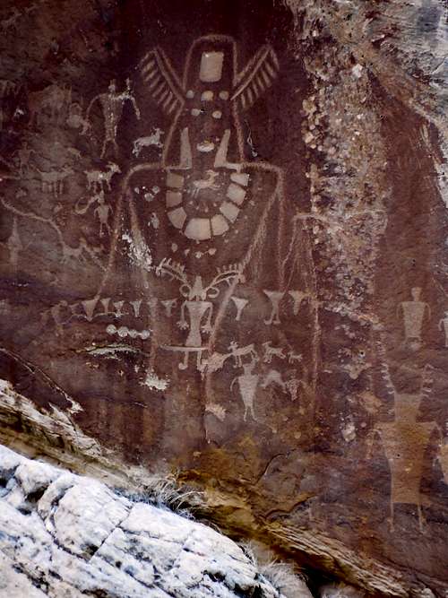
It rained hard all night. Since we were camped at the river, we decided to do an all day hike up Big Dominguez Canyon. We checked out many petroglyphs and waterfalls along the way and made it 6.5 miles up canyon before turning around. We also looked for signatures around the old mine shaft and checked out some balanced rocks.
Kessler and I also took another walk down to the Bridgeport Bridge so I could show him some of the old signatures that I had found. It was a beautiful and scenic day.
May 24: Gunnison River/Little Dominguez Canyon (Colorado)
My dad, Kessler, and I met at Whitewater in order to canoe the Gunnison River, something that has been on my list for a long time. We drove to Escalante Canyon to start the trip. The river was scenic and enjoyable and we made good time to Dominguez Creek. It rained briefly before stopping.
After setting up camp, we set off to hike Little Dominguez Canyon. When we were a ways up canyon, the creek immediately went from clear and ankle deep to muddy and chest deep. We could watch the flood rise quickly.
Kessler and I quickly crossed the creek since we didn't know if it would rise more. My dad did not want to cross and stayed on the other side of the creek.
Because Kessler and I were on the trail, we beat my dad to the campsite by half an hour. My dad was able to make it back to camp on one side of the creek.
In the evening, we took a walk down to the Bridgeport Bridge to check things out. I actually did the walk twice in order to look around more.
May 21: Sand Rocks (Colorado)
We took the scouts on the Sand Rocks for a hike.
May 14: Sand Rocks (Colorado)
After scouts, Kessler and I took a hike all the way over the Sand Rocks, from the west end to the east.
May 10: Cedar Mountain (Colorado)
It was a bad weather weekend, with a fairly big storm coming through, but Cedar Mountain is always a bad weather choice. Shaylee, Kessler, and I completed the long loop with only a little snow and rain. It was a good choice for a hike.
May 7: Sand Rocks (Colorado)
After scouts, Kessler and I took a hike all the way over the Sand Rocks, from the west end to the east.
May 4: Sand Rocks (Colorado)
I took a night hike up and along the Sand Rocks.
May 2-3: Crystal Creek Basin(Colorado)
May 2
Shaylee wanted to go to a hut for her birthday, so we headed for Francies Cabin in the Crystal Creek Basin. We started up the trail at 5:10 PM and made the hut in just over an hour. It was a warm day, but it snowed briefly from one cloud.
May 3
We awoke to a fairly mild 28F, but the snow conditions were good in the morning. The original plan was to climb Peak 10, but the kids decided they didn't want to climb the peak. Instead we headed back down the mountain rather quickly.
April 30: Sand Rocks (Colorado)
Kessler and I took a hike with the scouts up the Sand Rocks. We started from the west side and went along the ridge to the highest point and returned along the top of the cliffs.
April 26-27: Shrine Mountain/Wingle Ridge (Colorado)
April 26
Kessler and I were thinking of climbing a 14er, but the weather forecast wasn't looking good. Kessler still wanted to practice with the ice axe somewhere, so we made a last minute reservation for Walters Cabin. We didn't leave the Vail Pass trailhead until 9 PM! Because it was late, we snowshoed quickly and reached the cabin at 10 PM.
April 27
In order to practice with the ice axe, we climbed the east face of Shrine Mountain directly. It was a good route for practicing with the ice axe. We were going to head directly for the Wingle Ridge, but since the snow conditions were good, instead we glissaded down the steep east face before contouring around and climbing to the pass between Shrine Mountain and Wingle Ridge.
We could see the gathering storm that was in the forecast and it was very windy so we made our quickly to the summit of the Wingle Ridge (Peak 11,977). The views were still good with some sun and some clouds dancing around the peaks. We also saw one pure white ptarmigan. We returned to the false summit to the south and had a good glissade down the east face.
After glissading the east face of Wingle Ridge, we followed the base of the ridge back to Walters Cabin where we ate lunch and then packed up for the descent to Vail Pass. It got cloudier as we descended, but we only had a few snowflakes. We had beaten the storm.
April 24: Sand Rocks (Colorado)
I took an evening hike up the Sand Rocks, walking the ridge east to west. I saw several deer.
April 20: Hogwarts Canyon (Utah)
Scott (a different one) met Kimberly, Kessler, Shaylee, and I at the Santhrax campsite in the morning. We planned to do Hogwarts Canyon. The canyon was OK and the arch and pothole was interesting. Kessler, Scott,and I actually did the canyon twice because I left the camera on a ledge and we went back for it.
April 19: Ding and Dang Canyons (Utah)
Today Kim, Kessler, Shaylee and I completed the Ding and Dang Canyon Loop, which is located in the San Rafael Swell. We weren't going to do a narrow canyon and we drove down to Green River in the rain, but once we hit Green River, there was nothing but sunshine.
We completed the loop in a fairly fast three hours. The kids liked the scrambling sections, but the route was fairly easy compared to what we're used to. It's a really fun route.
We met one family in the canyon that was struggling, but they told us that they didn't need help.
April 12: Duffy Mountain (Colorado)
Kim, Kessler, Shaylee and I went for a climb of Duffy Mountain. It was really windy, and it sprinkled rain a little bit, but it was still a good day for a hike. After following the ridge crest for several miles and enjoying the views, we headed back down.
April 11: Cedar Mountain (Colorado)
Shaylee and I made an evening climb of Cedar Mountain. There was some snow and mud, but it was a pleasant climb. We had a nice sunset as well.
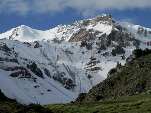
April 2-5: Hualca Hualca (Peru)
April 2
Today we started our big traverse of Hualca Hualca. It was a major endeavor, so we had two mules to help carry gear. Eloy, Nicolas, and a muleteer joined us.
We started right from Cabanaconde in good weather. We walked through town and then through the beautiful terraced fields above town. We were told that the terraces are hundreds or even thousands of years old and are still being used today.
The valley was very green because we were at the tail end of the rainy season. After the scenic valley, we had some steep climbs and much of the route was off trail. The views of Hualca Hualca were really nice and we saw several condors (I actually lost count of how many condors we saw on this trip).
The route was pretty rugged, but we all did fine. Shaylee would sometimes get “tired” so rope the mule a bit. I think she just liked riding the mule, but the route was tiring at times. Shaylee really enjoyed the wild horses which were seen.
There were some really spectacular views (Hualca Hualca itself is a really beautiful mountain) as we climbed high and higher into the mountains. It got cloudy as well and we were glad to climb over the final ridge and to descend to a beautiful little valley to camp. Camp was set up at 4600 meters /15098 feet.
Except for a bunch of cows pooping up the place, it was an ideal campsite with a nice crystal clear stream, a waterfall just above camp, and hot springs. Bad weather hit not long after camp was set up, so we retreated into the tents early.
It was a beautiful day.
April 3
It snowed throughout the night, so we awoke to a blanket of white. The weather was a mix of sun and clouds. Camp was packed up and we headed up the valley. It was pretty steep at first and we climbed up to and past the waterfall. Along the way we saw some vizcachas in the rocks.
After the initial steep climb we found ourselves traversing a gentle high elevation valley. We would then climb up to a pass. Unfortunately, the pass which is normally climbed on this route was iced up and had fresh snow, so we had to climb an alternate pass. This once was at 5000 meters/16,404 feet. The other pass was higher, but this alternate route would be much longer and more rugged.
Climbing up to the pass was pretty easy and there were some nice views of the storm clouds dancing over and shrouding Hualca Hualca. We could see the Colca Valley as well. After the pass is where the route got much more difficult. We would have to traverse up and down the steep mountains. There were some nice views, some wild horses, vicuñas, and an interesting area of geysers and hot springs, but it was a long and tiring route.
In the early evening, we finally reached our campsite near a constantly erupting geyser. We were at 4600 meters. We had actually planned to go up to the Hualca Hualca basecamp at 5000 meters, but we ran out of time and energy since our alternate route was so rugged and tough.
We had some rain in the evening as well. Kessler and I went over to check out the geyser close up before heading to bed. It was an exhausting day!
April 4
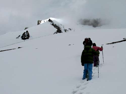
It rained the night before, but the snowline was higher up and around 5000 meters. We awoke to a mix of clouds and sunshine. Since we had camped lower than planned, it was assumed that we woudn’t make the summit of Hualca Hualca. Climbing 1425 meters/4700 feet isn’t that easy at over 6000 meters (nearly 20,000 feet). The summit of Hualca Hualca is 6025 meters/19775 feet elevation. Because of the rugged day before, we got a late start as well.
We started out on a really steep climb towards the basecamp. Shaylee rode part of the way, but the mules couldn’t go very high. We moved fairly quickly and were at basecamp after an hour and a half of climbing. There were several wild horses at basecamp.
From basecamp, it was steep climbing on boulders and into a hanging valley. The weather was still pretty good most of the time, but it did snow a bit as well.
The upper realms of Hualca Hualca were really impressive up close. The mountain is a mass of snow, ice, and rock and is very craggy. Giant icicles hung of the cliffs of the mountain. We pressed upwards and upwards. Shaylee was ahead of Kessler and I much of the time and really seemed to be adjusting the altitude quite well.
We took a break and short lunch on a rocky knoll and climbed up higher and higher. With every step the kids were setting their new altitude records, something they were proud of. Eventually we donned our crampons and started up the snow slopes. It was snowing on and off as well.
The snow was quite soft, but we pushed on to a highpoint along the ridge. The summit looked oh so close, but the snow was soft and not in good condition. We were at a point that Eloy estimated to be 5800 meters (after carefully studying the map with the satellite photos after we got back, I estimated that we were actually at 5850 meters/19,200 feet). It was definitely the highest elevation the kids had climbed to and my third highest as well. It was time to turn back.
Eloy wanted to take pictures of him with the kids since he had never climbed with children before.
We took an alternate route down the mountain and followed a ridgeline. At times the ridge was very rugged and there were some cliffs to climb down. The end of the ridge was extremely steep as well, and it snowed at times, but we made it rather quickly back to basecamp.
It was a long and tiring, but very spectacular day!
April 5
After our big climb the day before, we slept in a little bit. We packed up camp and headed down the mountain following the creek. We checked out the geyser before continuing the descent. The weather was good and the descent was beautiful route through a well watered valley. The trip down was mostly uneventful.
We had some good views of the mountains and eventually reached the green fields above Pinchollo. My feet were pretty sore, so I was being the rest of the group much of the time. Eventually we descended down to the town of Pinchollo and visited Eloy’s house and then the main square while waiting for the bus.
After that it was a bus ride back to Arequipa.
Hualca Hualca was certainly the highlight of the trip and one of the most interesting climbs I have done. It had a variety of scenery, some rugged peaks and crags, and active geysers and hot springs. There was also lots of wildlife and especially condors. It was a very memorable trip.
March 30-31: El Misti (Peru)
March 30
Today we started on our climb of El Misti, a huge symmetrical volcano piercing the sky at 5822 meters and rising 3600 meters above Arequipa.
Shaylee, Kessler, and I left with two Peruvians to climb the mountain. We drove to the trailhead on a mostly sunny day and headed up. El Misti is non-technical, but it is steep and requires 2400 meters of elevation gain.
It took us five hours to climb up to basecamp at 4610 meters. We ate dinner and watched the sunset. It was very beautiful since we could look down on the clouds. The lights of Arequipa were far below as well.
March 31
We awoke very early in the morning, around 3 am. It was windy and cold, but the weather was pretty good. The kids said they weren’t hungry, but I really encouraged them to eat some high calorie foods. I had them eat a huge chunk of cheese. This was probably a mistake since it didn’t set well with Kessler’s stomach. He didn’t make it very far up the mountain. He returned with one of the Peruvians.
Shaylee and I continued up the mountain. Shaylee was determined to reach the top, but high on the mountain she had stomach cramps. We reluctantly turned around and headed back down the mountain.
It was still a good climb, even though we didn’t reach the summit.
March 27-28: Pichu Pichu (Peru)
March 27
Today was mostly a laid back day. We drove to the Pichu Pichu basecamp. Hugo and Nicolas set off to find a route up Pichu Pichu. The kids and I climbed a smaller peak not far from basecamp. It was mostly an acclimatization day.
It was a rough night with lots of wind and some snow.
March 28
Today Kessler, Shaylee, and I attempted Pichu Pichu with Incadventura, with Nicholas, Eloy, and Hugo (it was just me and the kids, so I thought we'd better go with a guide service). Because the night was rough (blowing snow and high winds) and we still were not fully recovered from a stomach bug picked up in Arequipa, Shaylee only made below 16,000 feet (4800 meters) and Kessler 17,100 feet (~5200 meters). Kessler turned back with Nicholas that worked for the agency (Nicholas was really tired too since he scouted a route towards the summit the day before).
I wanted to push on, but I did not want to pass under the cliffs of the headwall, due to the rock fall danger from the fresh melting snow so I suggested to the Peruvian guide Eloy (I did not want to climb these big mountains with children alone, so we hired a local agency) that we climb the headwall directly. He was a little hesitant at first, but agreed and we climbed the steep headwall directly. He had never heard of anyone climbing this route.
It was steep and difficult and we eventually found ourselves on a subpeak on the knife edge ridge about 30 feet lower the true summit. On the subpeak was a Inca shrine (made of wood and rocks) that seemed to be in really good condition considering it was several hundred years old (most of the other ones were grave robbed years ago, even on high mountains). I assume that because it was so hard to get to that it had been in good condition after hundreds of years. Probably very few people have seen it since then since it is well off any known route and the route is very rugged.
Because the true summit was on a technical ridge that was iced up, it was unclimbable with the gear that we had. We returned down the mountain. We took a different way down and descended into a cirque basin. We had to downclimb a cliff band and the route was fairly rugged.
I was not disappointed that we did not reach the true summit since we were on a more spectacular summit and it had an Inca shrine.
It was a good climb, but I was exhausted.
March 26: Laguna Salinas (Peru)
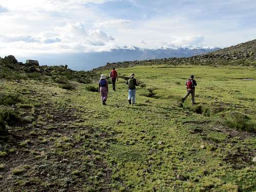
Today we left for the Pichu Pichu area. We drove through some beautiful fields and terraces before reaching the high paramo. Laguna Salinas didn’t have that much water, but we saw lots of animals and birds. There were many llamas, alpacas, vicuñas, and guanacos.
After an early lunch we went for a hike around the lake. We saw hundreds of flamingoes, but we couldn’t get close to them.
After the hike, we drove to some hot springs and set up camp. Kessler, Shaylee, and I went to climb a small un-named peak for the views and to help acclimatize. There was a beautiful sunset behind El Misti and the last of the sun painted Pichu Pichu red.
March 24: Bosque de Piedras/Sumbay Cave Paintings/Nevado Chucura (Peru)
Today was our (Shaylee, Kessler, and I) first day in Peru. We met with Hugo, Eloy, and Nicholas Incadventura to visit the cave paintings at Sumbay and to climb Nevado Churcura.
We drove to the Pampas Cañahuas and stopped at Patahuasi. Along the way, we saw thousands of llamas, guanacos, vicuñas, and alpacas. haylee especially really liked them. From Patahuasi, Kessler, Shaylee and I did a hike over to the Bosque de Piedras, which has some impressive and strange rock formations. After arriving back at Patahuasi, I was chased by a huge and angry sheep! I do not know what I did to make it mad; I just walked by. I had to run fast before the local ladies chased the sheep away with a broom!
After Patahuasi, we headed for the Sumbay Cave Paintings, which are 6000-8000 years old. We had to pass through a ghost town, which was eerily quiet. Someone from the town (only a very few people still live there) usually comes to open a gate, but there wasn’t a human in site.
We were able to pass through the gate to the lip of the gorge containing the cave paintings. The gorge was actually a narrow and impressive gorge and the region looks like it would make for some good exploring. We climbed down into the gorge and visited the caves and paintings. Most of them were white and interesting. Some day it would be nice to explore the rest of the gorge for a day or two.
We returned to the vehicles for lunch before heading for Churcura, an old volcano. Near the crater and along the road, we saw some vizcachas, which are similar to a large rabbit, but with a long tail.
The route to Churcura starts right at the Mirador de los Volcanes, which in good weather provides an outstanding view of all the major volcanoes in the area. This time though, it was cloudy and there weren’t many views.
We climbed up the ridge towards Churcura (which is a very easy climb for its altitude). There was some light snow falling at times, but the weather was pretty good even though we didn’t see much in the way of views.
To date, this was the highest elevation Shaylee had even been and her first time over 5000 meters (Kessler had been above 5000 meters many times). We climbed one of the summits of Churcura, and because it was windy and cold, Shaylee wanted to go back. Kessler and I wanted to head to another one in order to get a better look at the crater. Shaylee headed back with Nicolas and Kessler, Eloy, Hugo and I went over another ridge to see if we could see more of the crater.
After climbing up the ridge, we headed back. We a condor, but Shaylee and Nicolas say two more condors close up.
It was a great day!
March 16: Yampa Core Trail (Colorado)
After church, Shaylee, Kimberly and I hiked a few miles on the Yampa Core Trail at Steamboat Springs.
March 15: Vermilion Creek (Colorado)
I hiked Vermilion Creek with the scouts (including Kessler). We camped the night before and did the hike the next day. Passing the waterfall was challenging and involved a very old ladder.
After viewing many of the petroglyphs, we headed back down canyon. One of the scouts had a minor injury climbing around the rock to avoid the water.
March 13: Cedar Mountain (Colorado)
Kessler, Shaylee, and I made a late evening climb of Cedar Mountain. We completed the short loop and arrived at the trailhead long after sundown. The moon was plenty bright though.
March 9: Mount Elbert (Colorado)
I did the climb of Mount Elbert with several 14ers.com members. The climb was supposed to be on Saturday, but bad weather caused the postponement of the trip.
After a late start the night before, I arrived very late at the trailhead and didn't sleep. It was -2F in the morning, but the weather was clear.
The group was pretty spread out and I left at 7 am. I took 10 hours 15 minutes round trip, but several other people were faster.
The climb was straightforward, but long and it was windier and colder than the weather forecast had predicted.
Unfortunately, I had forgotten my sunscreen, but I was able to borrow some early on. I still could have used more as I got burned in places. It was a very sunny day and the sun was intense!
It was a nice climb.
March 8: Cedar Mountain (Colorado)
Alone, I climbed Cedar Mountain, completing the long loop. The snow was hard in the morning, so I didn't need snowshoes.
March 2: Monument Canyon (Colorado)
Justin Kuhn, Kessler, Shaylee, and I did the one way hike from the top of Monument Canyon to Grand Junction. We hiked the 7.5 miles rather quickly. It was a beautiful spring-like day.
March 1: Grand Junction Climbing Center (Colorado)
Do I really count this? It was my first time climbing in a gym. I went with Kessler, Shaylee, and my friend Justin.
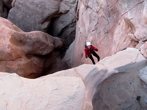
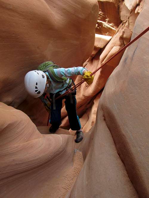
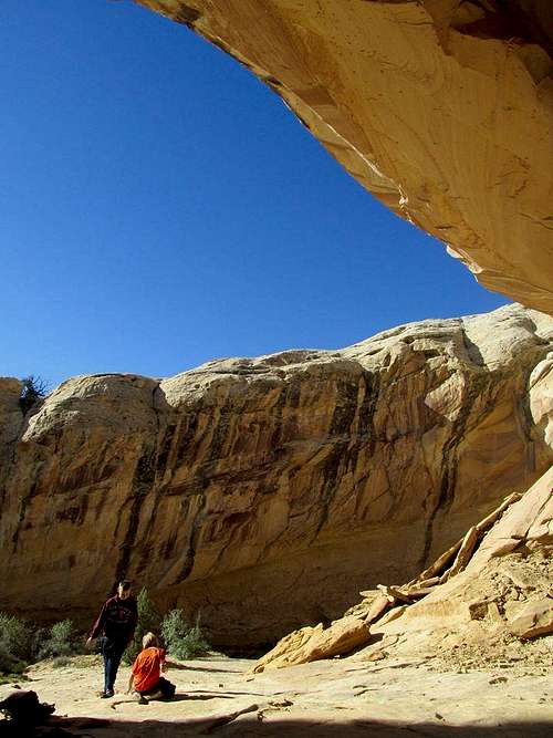
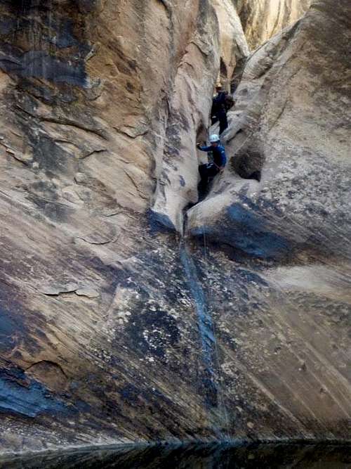
February 22-23: Elephant Canyon/Lower Salt Creek (Utah)
Matt Lemke contacted me and asked me if I wanted to go canyoneering for the weekend. At first we were thinking of the Roost, but the un-betaed canyon I had in mind might be too long for the short days. Doing it in two days would be hard since it would be too tight to take packs through.
I had remembered that years ago (1991) I had scouted out Elephant Canyon in Canyonlands National Park. I knew it wouldn’t be a tight slot, but what intrigued me about the canyon is that I could see huge pools and waterfalls and a narrows section. While canyons with pools and running water are common in places such as Zion National Park or Escalante, they are very rare in Canyonlands National Park. The canyon was also ruggedly spectacular and 1300 feet in its lower end. I suggested the possibility of descending the canyon to Matt and he was interested.
I wondered how many people had seen those pools and waterfalls up close. Probably not many people at all. Had anyone completed the entire route to the Colorado River? Almost no one goes canyoneering in Canyonlands. It's definitely a forgotten area when it comes to canyoneering.
I had known of a steep, rugged, and strenuous exit route by following the Colorado River down river and climbing a steep route to the rim. At first this was to be our planned route, but on the drive down I thought of a perhaps even grander possibility.
Matt Lemke is a good climber, so I wondered if we could actually climb up Salt Creek. Salt Creek does have a technical section that a few people have downclimbed and rappelled and then re-ascended. The only glitch to the plan was that those who re-ascended left ropes behind at a critical waterfall.
We were not sure if the waterfall was climbable without a fixed rope in place, but it seemed worth a shot. I Matt could get up, the rest of us would be able to ascend the rope if necessary.
February 22
Kessler and I met Matt at the Lazy Lizard Hostel in Moab. I have a park pass, but the visitor center was closed and you just signed in for your own permit. I was relieved about this since we wouldn’t have to listen to the rangers telling us that our route was impossible (which seems to happen most times I’ve gone to Canyonlands in the past several years!) and trying to talk us out of attempting the route.
We started along the Confluence Overlook Trail with full backpacks, descended into Big Spring Canyon, and then climbed out and over the ridge to Elephant Canyon, which we descended. It was a beautiful February day and the views were really nice on the approach.
After not too long we reached our first real obstacle, an approximately 100 foot/30 meter drop off. We could see running water below the drop, and I wanted to drop into the canyon directly, but Matt wanted to contour around since that’s what I did years ago. Somewhere I had found a rough scramble route to the canyon floor. I had left a sling behind for a handline in one location, but it was just down-climbable.
We contoured around for quite a ways on the west side of the canyon and found a location where the drop was short and we rappelled off a tree through the cliff band and scrambled. Somewhere in this vicinity I had found a handline route down, but we decided to rappel down the drop in order to enter the canyon.
Once in the pristine canyon, we continued to follow it as it snaked around bends en-route to the Colorado River. One thing different about this part of Canyonlands is that the rocks are a mixture of limestone and sandstone, rather than just sandstone as it is in much of the park and region. The limestone layers formed several drops that were obstacles.
Eventually we found ourselves staring down a huge drop, one of two big ones we expected to find in the canyon. Years ago, I had made it down to this point using a really rugged route, but I was unable to continue down canyon. Instead I walked the benches on the west side hoping to find a route in, but I was stopped.
The drop was actually quite impressive and had a spring coming out of the cliff about 15 feet below the lip of the falls. The amount of water wasn’t huge, but it was a high waterfall, much of it covered in ice. We decided to eat our lunch in this spectacular place. This is also where we began to find some really nice fossils.
After lunch we worked our way along a rugged bench (with signs that the bench is used rather frequently by bighorn sheep) to where the drop was shorter. I had been here years ago as well, but remembered the drop as being bigger. I was able to lower belay Matt down the cliff and then Kessler as well. After that Matt spotted me down for the climb. It was challenging, but just doable (though more risky) without rappelling.
Since the rest of the canyon was new to me (and possibly to anyone else), it was a joy to explore new ground. There were some nice pools and waterfalls in the canyon, but no major obstacles until we reached a big and ominous looking drop into a narrows (not a slot, just a more narrow section of the canyon). There was a huge pool of water at the bottom of the falls as well. I had viewed this drop from a distance years ago and expected it to be much higher, thus we carried more than 400 feet of rope.
We crawled over a narrow ledge (with a low ceiling) to a boulder which would serve as a solid rappel anchor. The drop though was sharply overhung and would make a challenging rappel. Because of the sharp overhang and huge packs, it was very challenging, but only 80 feet, when I had expected it to be much higher.
Matt rappelled down first and suggested that we lower our packs (dangling them off the harness is another possibility, but there were a lot of loose ledges on the way down).
Kessler rappelled next and I followed. The canyon was mostly dry below the falls and I regretted not tanking up with the clear water.
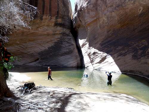
As we walked down canyon, the fossils were really good. There were two more falls to bypass which would be the last obstacles. Near the Colorado River we found one Anasazi ruin that we checked out. I wanted to try and traverse high on the benches in order to reach Salt Creek, but the others wanted to try a route close to river level, so we descended Elephant Canyon to the Colorado River.
We had finally traversed the entire Elephant Canyon to the Colorado River and we were elated. Were we first to do so? I don’t know, but it is possible.
Even though we had made it all the way down to the Colorado River we were far from being done with the route. We still had to hike up the Colorado River to Salt Creek and attempt to climb out of it. If we couldn’t climb back we would have to return all the way back to Elephant Canyon and then make an arduous hike down river to another rugged exit point. Elephant Canyon, Salt Creek, and the Colorado River Gorge are all about 1300 feet (400+ meters) deep so we would have come climbing to do.
We made our way upriver towards Salt Creek. The route was very rugged going with lots of boulderhopping, some bushwhacking, loose rock, and many climbs up and down ledges. This part of the route was only a half a mile long, but it took us an hour in a half to negotiate, even moving at a good pace. This was the least pleasant part of the route. Some of the time, the going was aided by the fact that we could walk on the frozen Colorado River in the sections that remained permanently shaded throughout the winter. The rest of the time we were forced above river level.
We were relieved when we finally reached the mouth of Salt Creek. We had to fill all of our water bottles in the very muddy Colorado River since we weren’t sure if we’d reach more water by the time daylight ran out.
We made our way up canyon and eventually found a small clear pool. We immediately dumped out the river water and filled our bottles with the clear water.
We made our way up canyon and found the first major obstacle. It was a fairly slippery climb up a “trickle fall”. We made the climb with no problems and continued up canyon. The stream got bigger as we continued up canyon, sometimes on the frozen stream. In addition to the high canyon walls, there was a really impressive pinnacle that kept catching our eyes. Kessler and I decided to call it Mom Rock because it looked like a mom sitting there with her arms folded after you have done something naughty.
We eventually reached the technical obstacle in the canyon. It was a flowing waterfall 20 feet high. We hoped that we could climb it. The daylight was fading and if we couldn’t climb it we would have to backtrack all the way back to Elephant Canyon (in the morning).
The climb was slippery, wet lower down, and loose where dry. I belayed Matt the best I could and after several tries and fumbles, he was able to climb the drop. We were relieved! Kessler climbed the drop next while being roped in. I climbed last and was frustrated that a few of the footholds wouldn’t hold my weight and broke on me.
Once at the top of the waterfall, we breathed a sigh of relief and continued up canyon. The canyon was beautiful with water flowing over slickrock. We reached a nice area for a camp and stopped there not long before it got dark.
February 23
After waking up, we packed up and headed up canyon. It was another beautiful day. There was still a major obstacle ahead. We had to climb a very steep and slippery waterfall. When flowing, the climb is challenging. It still wasn’t as hard as the waterfall climb the previous evening though.
We were glad that we could make the climb because above here there was an almost sure chance that we could climb all the way out. We continued up the beautiful canyon and climbed yet another waterfall, but this one was easier.
After this waterfall, the canyon began to open up and become wide. The walking became easier, though not quite as spectacular, though still pretty. It was a routine walk up Salt Creek to the confluence with Big Spring Canyon which we followed up canyon. We found some fossil footprints of some creature that expires eons ago.
There were several obstacles in Big Spring Canyon, but nothing really major until the very end. As we continued up canyon we began to see vague signs of travel by other humans, including a few cairns. The last fall was challenging to bypass, but only because we bypassed it on the wrong side. We climbed a cliff band and did a tricky traverse until we could descend back down to the canyon floor. It was later learned that we could have bypass the obstacle on the other side of the canyon and it would have been easier that way.
Shortly after the bypass, we intersected the Confluence Overlook Trail again and it was a route and short walk back to the trailhead.
The Lower Elephant Canyon/Lower Salt Creek Loop was a done deal and we had the privilege of seeing parts of the national park that few have ever laid eyes on. It was a beautiful trip.
February 14-17: Madonna Dome/Bald Mountain (Colorado)
February 14
Kessler, Shaylee, Kimberly, and I had planned to go to the Section House (cabin) on Boreas Pass for some peak climbing over Presidents Day weekend. Unfortunately, the weather forecast was for another blizzard! It seemed to be a common trip this year whenever we planned a trip!
We decided to head for Section House Friday night anyway. We didn’t reach the trailhead until 6 PM and we still had 6.5 miles to go on snowshoes. It was actually raining in Frisco, so the weather was actually mild, even though it was snowing heavily and was very windy. It was going to be a long evening.
Once we snowshoed 2 miles in, I remembered that I had forgotten something very important back in the car! I sent Kim and the kids ahead while I backtracked to the car. They would wait for me at Baker Tank, which is 3 miles from the trailhead.
I nearly ran and snowshoed as quickly as possible back to the car. I didn’t leave the car until 7:30 PM. The return two miles and then additional mile to the Baker Tank left me very tired. We sat down at Bakers Tank and had a snack before pushing on.
After Bakers Tank, there was quite a bit of trail breaking to do because of the recent storm. Kessler was out ahead and breaking trail. It was a full moon on this night, but with heavy snow, it was almost always behind the clouds. The wind was quite strong and we struggled up to Boreas Pass and thus to the Section House. Just before reaching the cabin, the moon did break out briefly, but was quickly swallowed again by the clouds.
We arrived at the Section House at 10:40 PM, but that was in good time considering the conditions. The only rest we took was the one at Bakers Tank.
February 15
We were all tired from the late night before, so we didn’t plan a big day. The blizzard was still continuing on and off throughout the day as well. It was a very warm night though and never dropped below 18F. After a very late start, I did climb Madonna Dome (12,331 feet/3759 meters) to the west of Boreas Pass. Kim and the kids decided not to try the climb in order to save up energy for the next day’s climb. The weather was OK with light snow and cloudy skies. I had to break the trail most of the way up to 12,000 feet, but the ridge was windblown after that. Avalanche danger was high, so I had to make my way by using a winding and non-direct route that avoided any avalanche danger.
From the summit, I had a good view of Bald Mountain, which would be our destination for the next day. The climb looked reasonable and I could pick out the route to the saddle and then along the ridge to the summit.
After climbing Madonna Dome, I returned to Boreas Pass and the Section House. With the trail already broken on the ascent, the return back was much faster.
February 16
Today was our big climb. The temperature got down to 9F (-13C) early in the morning and the weather was a mix of clouds and sun. It was windy, but this is to be expected at such elevations in the winter time, so the climb was a go.
We decided to climb Bald Mountain, a 13,684 foot/4171 meter peak which was the highest mountain in the vicinity of Boreas Pass. With the recent storm, we knew that avalanche danger would be high, so we would have to choose a route carefully.
We would follow the patches of timber and then wind swept bare ground (it had snowed a lot, but the wind strips the snow off the ridges and slopes in places above timberline) and hopefully reach Black Powder Pass (12,159 feet/3706 meters) without running into avalanche danger. If we found any dangerous slopes we would abandon the route and return to Boreas Pass.
We set off towards Black Powder Pass, with Kessler in the lead to break trail (even though 11 years old, he is the strongest trail breaker in the family). We stayed in the trees whenever possible even though trailbreaking was more difficult. Once in the heavy timber, I set off a fracture line. We were safe since we were in heavy timber, but it was yet another sign that avalanche conditions on open slopes would not be stable. We also say some pure white ptarmigans in the timber and we took some photographs of them.
We found a safe route up to Black Powder Pass, although it was strenuous, especially through sections of willows where I would constantly sink down to my waist in the willows and snow. The last part of the route was across a mix of windblown bare ground and very shallow snow.
The wind was really howling on the pass, but we took a break anyway. We still had a lot of climbing to do. There was once slope above the pass that I was worried about and we thought that we might have to turn back at that point. The route was steep, but we found the slope to be surprisingly stable, It was all stable windblown snow.
The ridge was a straightforward climb, but the weather was windy, so it was challenging. Most of the time we were on hard snow, but there were sections of bare rocks and boulders to cross. Bald Mountain is a mountain where even the false summits have false summits. We took a rest on some of the false summits. We couldn’t bypass them since we stayed on the ridge top to avoid any avalanche danger.
The weather was pretty good and the views were fantastic. To the west, it appeared to be quite stormy, while to the east it was mostly clear. We kept waiting and expecting to get slammed by the storm, but it stayed to the west. It appeared that it was even snowing at times down at Boreas Pass.
It was challenging, but we thoroughly enjoyed the climb. It was a great experience for the family and it is sad that more families don’t climb mountains in the winter time.
Eventually, it was time for the long journey back to Boreas Pass. It was still windy, but the storm seemed to still stay to the west. Climbing back down the ridge was faster than ascending and we even got a good butt slide in since the snow was so stable.
Once we were below Black Powder Pass, the wind tapered off a bit, but the storm decided that it had been held at bay for a long enough and the mountains disappeared in a mist. The storm finally slammed us. Since the trail was broken, it was still fairly fast going where we could find the trail, though we lost our broken trail several times and had to break a new one. At once point we had to climb 100 feet higher in order to reach our old trail (which we knew provided a safe route).
The storm was short lived and quickly passed over. It was fairly sunny once we were back at Boreas Pass. We settled in for a well-deserved rest and could be proud of our winter ascent of Bald Mountain.
We played games and I made some Chicken Noodle Soup for dinner.
February 17
We awoke to clear and cold skies. Because of the recent storm and clear skies, it was much colder in the morning that it had been for the previous mornings. My thermometer indicated that it dropped down to -15F (-26C).
There was a little breeze, which made it feel chilly, but we sure enjoyed the sunny weather. It was a good shoeshoe back to the trailhead. Once we were down in the trees it was pleasantly warm.
It was a great trip.
February 8-9: Resolution Mountain (Colorado)
February 8
The weather forecast was not good and we (Kessler, Shaylee, Kimberly, and I) considered cancelling the trip. It seems like every time we plan a mountain trip this year, there is a blizzard warning. I tire of driving through the blizzards as well. In the end we decided to try to go anyway.
Most of the time, we did snowshoe in a blizzard up to the hut, but there were occasional lulls where there would be moderate snow before returning to a full out blizzard. The route up to the ridge and treeline was still fairly easy to follow and was rather pleasant in the falling snow. Once we reached the ridge, the winds were really strong and visibility was poor much of the time. Any sign of the trail was gone, so we had to break our own. The kids had to break trail most of the time, because the adults would sink farther in the snow.
We eventually made it to the notch just north of the summit of Resolution Mountain and we descended down and found the Fowler Hillard Hut. The last part of the route and the descent were actually quite challenging due to deep powder. We were all pretty exhausted by the time we reached the hut.
February 9
The next morning the weather was still blizzard. There was an occasional lull or two, but we headed back out into the blizzard in order to climb over the notch. Once at the notch we stayed high because we through the route would be easier to find if we did and we went over Resolution Mountain and towards the ridge. We did get disorientated in the whiteout conditions, but eventually we found a trail marker. It was still challenging to find the route though.
Once we reached the part of the route where it drops off the ridge and enters the timber, the rest of the route was easy to follow. The weather got better as we descended as well, though there were still periods of very heavy snow and poor visibility.
I was a very challenging trip and we never did get any views, but it wasn’t a bad experience.
February 2: Sand Rocks (Colorado)
At sundown, I did the Sand Rocks Loop, this time bringing snowshoes. It was cold and breezy.
February 1: Cedar Mountain (Colorado)
Kessler and I were supposed to do a scout campout, but Kessler was sent home sick from school Friday. I wasn't feeling that good either.
In the afternoon, Kim and I climbed Cedar Mountain, completing the medium loop. We got through just before dark. There were many animal tracks in the snow and we saw several deer.
January 26: Sand Rocks (Colorado)
I decided to do a quick trip to the Sand Rocks after dark. I underestimated the amount of snow that would be up there, so it was more challenging than I thought. I did a loop passing over the highest point and back.
January 25: Cedar Mountain (Colorado)
I haven't been feeling well lately, so Kessler, Shaylee, and I settled for climbing Cedar Mountain. We completed the long loop. Conditions were good and the trail was broken.
January 19: Dock Rock/Lizard Rock (Utah)
Kimberly, Kessler, Shaylee, and I met Matt Lemke in Moab in order to head for the Fisher Towers. First we dropped off the bag of stuff we found on Elephant Butte.
After reaching the trailhead, we headed for Dock Rock. Impish was covered in snow and ice, so we climbed the slightly harder Chimney Variation which was in the sun. Once again, Matt lead and Kessler cleaned. Shaylee attempted the climb, but decided to come down. I followed and met the others on the belay ledge. The climb was pretty dirty.
Once on the belay ledge we did a very exposed traverse on the east side and to the summit. We had to do a two stage rappel off the icy and snowy north face. The rope was just short of being long enough for a one stage rappel.
After climbing Dock Rock, we headed for Lizard Rock. Matt lead the climb. It was a good one. Kessler followed and made the summit. I was very near the summit, but decided not to pull the final move above the flake. I wish I would have tried it. The skin and some of the muscle on arms were severely burned off in an industrial accident several years ago and I don't have the confidence on rock that I used to.
January 18: Elephant Butte/Bullwinkle (Utah)
Kimberly, Kessler, Shaylee, and I met Matt Lemke in Moab in order to climb Elephant Butte. I suspected that the route would be too icy to attempt, but we went to check it out anyway.
As expected, there was much ice and snow in the shade and the climbing was treacherous in places. The crux of the climb was completely iced up. We provided Matt a spot while he climbed the crux and he dropped a handline for us to grab on the way up. The last few feet were icy! There was a bag of gear at the top of the crux. I'm guessing that whoever left it threw it up the crux and was unable to climb it. The bag had a nice camera, some shoes, and lots of climbing gear in it. I redistributed it among Kessler's and my pack and from then on I had a heavy pack!
The ascent rappel went smoothly. Because the standard route was iced, we took a different and more difficult route up the left side of the butte since it was dry. We then traversed over to the final crack and climbed to the summit.
It was definitely an earned summit. The kids enjoyed it, but Kim didn't like it that much in the ice.
The descent went smoothly and we found the pool above the exit rappel to be frozen solid. This was a good thing since none of us felt like wading in ice water.
The final rappel had a huge icicle on it that made it much more challenging. We hoped that we wouldn't knock the icicle down on us! Luckily none of us did.
After climbing Elephant Butte, we decided to check out Bullwinkle. I thought that it would be a fairly easy climb, but my leg was too fat to fit in the off width. It was quite frustrating. Matt led the climb and Kessler cleaned.
It was a good day.
January 10-11: Shrine Mountain (Colorado)
January 10
The plan was to snowshoe to Walters Cabin on Day 1 and climb Shrine Mountain and Wingle Ridge on Day 3. The weather on January 10 was insane though.
The only thing I have to say about it was that I screwed up and should have cancelled regardless of our reservation at a hut. We decided to try anyway since we could always turn back. Besides the Shrine Mountain cabin is usually a good destination in bad weather since it's usually an easy to follow route.
The kids, my wife, and I left for home to drive to Vail Pass at 1:30 pm Friday. It was extremely windy on the drive and at one point on 20 mile road (between Hayden and Oak Creek) visibly was extremely bad. During one wind gust the road just disappeared in the whiteout so we stopped, but were quickly buried by the snowdrifts. Luckily we were next to the mine. Unluckily though, the blade they were using as the snowplow was also stuck in nearby snowdrifts. At times you could see, but when a gust came up you couldn't see anything. We could see that the mine brought a bulldozer to pull out the plow blade and we walked down to see if they could help us out of the snowdrifts too. While we were talking to them another truck became trapped in the snowdrifts.
Anyway, the bulldozer helped everyone out of the snowdrifts and the wild calmed enough (but still blowing hard) that we all got out of there. The rest of the drive went without incident other than the section of I-70 from Vail to Vail Pass was ridiculously slow and took several hours.
We finally arrived at the trailhead at 8 pm (we originally planned on 4 pm). I have snowshoed up to the Shrine Mountain cabins four times, including three times in the dark, and I know the route well so thought we could make it, even if it was snowing and blowing hard.
We made half a mile up the trail (a very difficult half a mile) before losing the trail completely and not being able to find the markers. We backtracked down to the trailhead since we knew that we could follow the road (closed in winter) up to Shrine Pass.
It sounds easy enough to follow a road in a blizzard, but it wasn’t. We lost the road twice and when we didn’t lose it, it was still extremely difficult to find. The wind was blowing hard enough and the snow was coming down hard enough that you couldn’t see from one side of the road to the other. In fact, with a headlamp on, any light would reflect back on the heavy snow so you couldn’t see at all other than snowflakes in front of your face. We would have to turn the lights off in order to look for markers. . By the time we were over the half way point, it was thought that it was be better to try and reach the cabin that retreat since we speculated that the freeway was probably closed by now anyway. We literally felt our way on the Shrine Pass road by looking for the packed spots. When you hit a deep drift, it was hard
We lost the road at the minor saddle and I set off to find it, which took maybe a half hour. We eventually reached the first sign at Shrine Pass and lost all sign of the road. While Kim and Shaylee stopped at the sign, Kessler and I set up due west using a compass in order to find the outhouses we knew were on the pass proper. We found them, but breaking the trail was difficult, even though it wasn’t very far. I set off south in order to try and locate the trail to the cabins, which I found once in the thick timber.
Kessler and I returned to the sign were we had left Kim and Shaylee and we told them we found the trail. We still lost it a few times, but since the timber provided some shelter, it was easier routefinding to the first cabin. We contemplated crashing in there (we accidentally woke up the occupants and they said we could), but we pushed on to Walters. We lost the trail several times, but found it until near the cabin. By the time we lost it there though the wind died down slightly and we could see the cabin. We broke trail directly to it and arrived completely exhausted at around mid-night. Two others were in the cabin and had hiked up before things got really bad. They thought no one else was going to come, so they moved their stuff and we crashed in there for the night.
Shrine Mountain cabins are actually some of the easier 10th Mountain Huts to get to in winter. I had never expected that it could ever be that difficult to get there. Since the hut was at 11,223 feet, I imagine that conditions on the mountain tops were really extreme.
January 11
Saturday was sunny, calm, and beautiful. There was no sign of the previous maelstrom. We were too tired to climb to the top of Shrine Mountain or Wingle Ridge, which is the usual plan. We head back for hope without incident, though we were very tired.
January 4-5: Swett Creek (Utah)
January 4
Kimberly, Kessler, Shaylee, and I were originally going to backpack in the San Rafael, but due to the amount of snow there we headed down to Swett Creek, which drains into the west side of Lake Powell.
Swett Creek did have continuous snow cover in all the shady spots, but it wasn’t deep and hiking was not difficult. We explored Milk Creek and some side canyons on the way down. There were several minor obstacles in Swett Creek, but none were a problem.
When we got to the spring area, deep within the Wingate Narrows, there was a little running water and several pools. We found a little nook in the rocks that would fit our tent and set it up around lunch time since it was known that it would be easier to do more hiking in the dark than to do more setting up camp in the dark.
After setting up camp in the wind, we continued down canyon through the beautiful narrows. The hike was very windy from here on. Right at the end of the Narrows and just before the canyon opened up; there was a big swim hole, mostly covered with ice. We decided not to do continue down canyon.
Just before the pool, Kessler and I found an exposed moki step climb up the north wall and to the Kayenta bench. It was assumed that the route would be too difficult for Kim and Shaylee so we returned to the canyon floor and headed back up canyon towards camp. Just before camp we explored a snow and ice filled side canyon and explored it to the headwall. It was pretty tricky because of the ice and snow.
Since it was very windy we contemplated packing up camp and hiking back in the dark. We decided to stay and hiked back up canyon a ways until we could climb up to the Kayenta bench. Once we climbed up to the bench we explored the beautiful rimlands and climbed the highest butte around. The scenery was fantastic, but there was a lot of unpleasant wind. After exploring around, we headed back for camp. Luckily the wind died down after dark.
January 5
We awoke to a frosty, but sunny morning and packed up camp. It was a fairly uneventful and pretty hike back to the vehicles. We were relieved that the wind was gone.
Accumulated Totals for 2014:
Days that I went hiking or climbing: 135
Summits Climbed: 88
Summits Attempted: 99
Rock Towers/Technical Buttes: 4
Rock Towers/Technical Buttes Attempted: 6
Technical Canyons: 20
Technical Canyons Attempted: 21
Overseas Climbs: 9
Goals for 2014:
Days spent hiking or climbing: 130
Summits: 75
Summits with the kids: As many as possible!
Rock Towers: 5
Technical Canyons: 20
Highest Elevation Reached
19,200 feet (5850 meters) on Hualca Hualca (Peru); April 4.
Highest Elevation Reached in USA
14,440 feet (4401 meters) on Mount Elbert (Colorado); March 16.
Highest Sleeping Altitude
15,223 feet (4640 meters) on Pichu Pichu (Peru); March 27-28.
Highest Sleeping Altitude in USA
11,540 feet (3517 meters) at Resolution Mountain (Colorado); February 8-9.
Highest Elevation Climbed To By Month
| Month | Feet (USA) | Meters (USA | Feet (World) | Meters (World) | |
| JAN | 11,223 | 3421 | 11,223 | 3421 | |
| FEB | 13,380 | 4078 | 13,380 | 4078 | |
| MAR | 14,440 | 4401 | 18,455 | 5625 | |
| APR | 11,977 | 3651 | 19,200 | 5852 | |
| MAY | 11,360 | 3463 | 11,360 | 3463 | |
| JUN | 12,953 | 3948 | 12,953 | 3948 | |
| JUL | 11,378 | 3468 | 11,378 | 3468 | |
| AUG | 11,924 | 3634 | 11,924 | 3634 | |
| SEP | 13,248 | 4038 | 13,248 | 4038 | |
| OCT | 11,171 | 3405 | 11,171 | 3405 | |
| NOV | 11,888 | 3624 | 11,888 | 3624 | |
| DEC | 11,220 | 3420 | 13,053 | 3979 |
Highest Outdoor Sleeping Altitude By Month
| Month | Feet (USA) | Meters (USA | Feet (World) | Meters (World) | |
| JAN | 11,223 | 3421 | 11,223 | 3421 | |
| FEB | 11,540 | 3517 | 11,540 | 3517 | |
| MAR | 9620 | 2932 | 15,223 | 4640 | |
| APR | 11,223 | 3421 | 15,091 | 4600 | |
| MAY | 11,360 | 3463 | 11,360 | 3463 | |
| JUN | 10,205 | 3111 | 10,205 | 3111 | |
| JUL | 6420 | 1969 | 6420 | 1969 | |
| AUG | 10,720 | 3267 | 10,720 | 3267 | |
| SEP | 10,280 | 3133 | 10,280 | 3133 | |
| OCT | 5260 | 1603 | 5260 | 1603 | |
| NOV | 11,223 | 3421 | 11,223 | 3421 | |
| DEC | 11,180 | 3408 | 11,180 | 3408 |
April 4
Highest April ascent; 19,200 feet (5850 meters) on Hualca Hualca (Peru). Previous April record was 14,269 feet (4349 meters) on Castle Peak on April 16 2006. This was also the highest Peru ascent.
April 3-5
Highest April camp/sleeping altitude; 15,092 feet (4600 meters) at Hualca Hualca. Previous April record was 11,430 feet (3484 meters) at Montezuma Basin (Colorado) on April 15-16 2006.
March 28
Highest March ascent; 18,504 feet (5640 meters) on Pichu Pichu (Peru). Previous March record was 14,440 feet (4401 meters) on Mount Elbert (Colorado) on March 16 2014.
March 27-28
Highest March camp/sleeping altitude; 15,223 feet (4640 meters) at Pichu Pichu. Previous March record was 11,860 feet (3615 meters) at Mount Yale (Colorado) on March 7-8 2008.
March 16
Highest March ascent in Colorado; 14,440 feet (4401 meters) on Mount Elbert. Previous March record was 14,427 feet (4397 meters) on Mount Harvard on March 19 2011.
February 8-9
Highest February camp/sleeping altitude in Colorado; 11,540 feet (3517 meters) at Resolution Mountain. Previous February record was 11,490 feet (3581 meters) at Boreas Pass on February 27-28 2010.