


Viewing: 1-1 of 1

EastKing - Feb 11, 2016 10:11 pm - Voted 10/10
Already a good trip logNice start off to 2016!!!!
Viewing: 1-1 of 1
|
|
Trip Report |
|---|---|
|
|
Jan 1, 2016 |
This is just a simple log to keep track of our 2016 trips.
See the 2015 Trip Log for 2015.
See the 2014 Trip Log for 2014.
See the 2013 Trip Log for 2013.
See the 2012 Trip Log for 2012.
See the 2011 Trip Log for 2011.
See the 2010 Trip Log for 2010.
See the 2009 Trip Log for 2009.
See also the 2008 Trip Log for 2008.
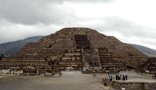
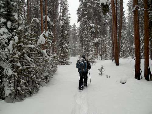
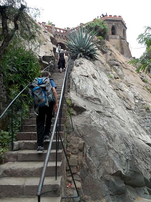
December 30: Teotihuacan (Mexico)
Today Kessler and I explored Teotihuacan. We "climbed" to the top of several pyramids and then walked the entire Avenue of the Dead. It was an interesting place and the pyramids were fascinating.
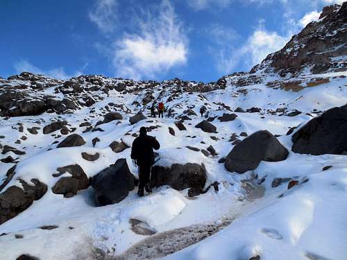
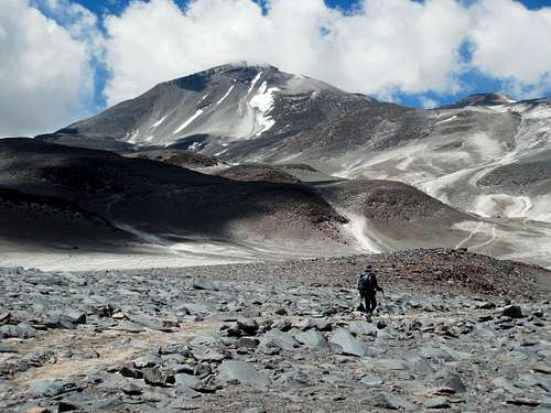
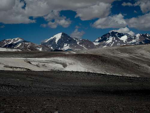
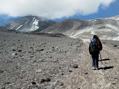
December 26-27: Pico Orizaba (Mexico)
December 26
The two adults in the group had colds/flu, but we (Kessler, Steve, Caleb, and David) all felt excellent otherwise. The weather was great as well and the winds were light.
We arrived at Pierda Grande in the early afternoon. We all decided to hike up to the Glacier Jamapa at 4900 meters/16,074 feet. The route through the upper part was icy, but things went rather smoothly. On the way down and with crampons, I got a bad blister on my big toe. It was really painful on the way down. We arrived back at the hut just after sunset.
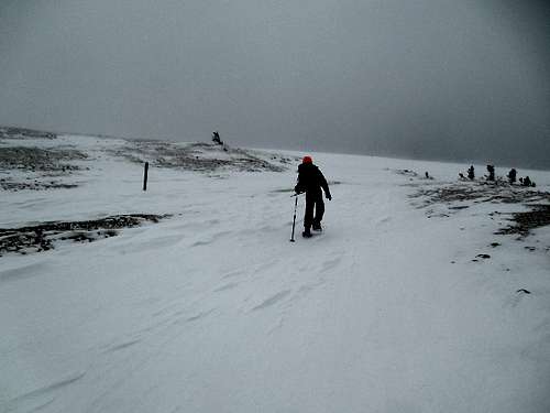
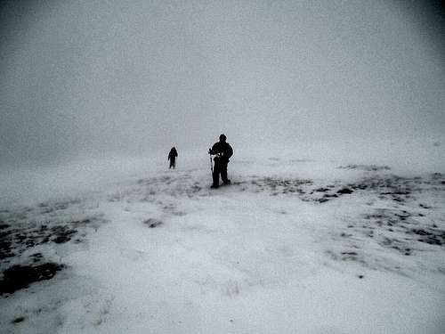
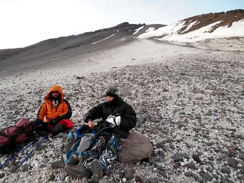
December 27
The mountain gods were not with us today. Because I had the flu, I didn't sleep hardly at all the previous night and was tired. The weather wasn't good and it was snowing and raining. It was very windy as well. My blister on my toe was pretty bad at all. The other adult in the group was also sick and we had three kids with us, ages 9, 12, and 14.
All this we could handle, but as we were trying to rest for the upcoming climb at night, about 100 people suddenly showed up at the hut and campsites, which dropped the chances of getting any rest at all to zero. I also didn't want to infect the entire camp and hut with my flu.
With all of the above problems conspiring against us, and with out driver already at the hut, we reluctantly decided to head back down. This was unfortunately since we were all strong and well acclimatized. It was a difficult decision, especially since Orizaba had been on my list for a long time. Unfortunately, we wouldn't have enough time for a second attempt on this trip.
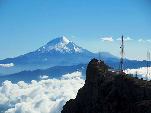
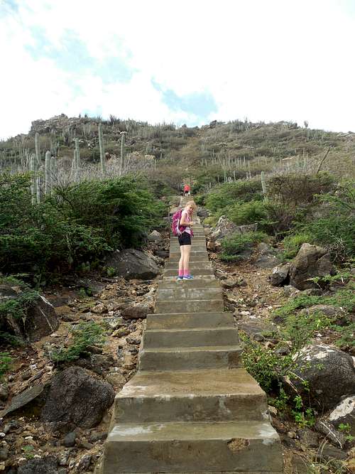
December 24: Cofre de Perote (Mexico)
Kessler, Steve, Caleb, David and I climbed Cofre de Perote today. We didn't start until late morning because all the buses the day before to Perote were already full! We didn't leave Puebla until the morning.
As soon as checking into a hotel, we caught a taxi ride to El Conejo, where we started our hike. Rather than following the cobblestone road, we found trails in most places that avoided the road, including one that was modified for mountain bikes, but seemed to be long abandoned (by bikes).
We made our way to the summit area and found the steep cement staircase and handrails to the top of the summit block. There was one patch of old snow on top. The weather was great and the views were fantastic. The radio towers on top were a distraction though.
After climbing the peak, we descended the mountain and about half way down to El Conejo, we caught a ride back to El Conejo in the back of a pickup truck.
After reaching El Conejo, we had to walk towards Perote. We walked all the way down past El Rancho Nuevo before flagging down a taxi. Kessler had to run ahead quickly in order to catch it.
Because of the late start, it was a long day.
December 22: La Malinche (Mexico)
Today, Kessler, Steve, Caleb, and David climbed La Malinche. It was Steve's, Caleb's, and David's highest mountain to date.
We decided to do the entire trip in one day from Puebla in order to stay on the trip schedule and to avoid lugging around all our gear. We took a taxi to the trailhead and started up the mountain mid-morning.
Things went rather well and we made the summit in 4.5 hours. The weather was clear and the views from the summit were really great.
After enjoying the summit, we descended to the trailhead. Since we didn't know where the bus picked up, we walked the road down to the next intersection and waited there.
Eventually the bus picked us up at around 5 PM. We rode the mini-bus down to Apizaco and then found a bus back to Puebla. It was well after dark before we reached the hotel.
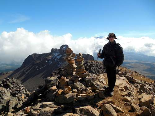
December 19: Iztaccíhuatl (Mexico)
Kessler and I had planned to climb Iztaccíhuatl over two days, spending one night at the Albergue/Altzomoni Lodge. We made the fateful decision to leave the tent back in Amecameca, which was a big mistake!
Since we were only planning on an acclimatization hike today, we arrived at the La Joya Trailhead late morning. It was there that we found out that in order to stay in the lodge, we had to get the key back in Amecameca! Since we were supposed to meet friends in two days, we didn't have time to go back and get it! (Later we found out that we may have been able to retrieve a key at Paso de Cortes?).
We contemplated sleeping under the stars or up at one of the huts, but we had brought our suitcase with us. We didn't want to leave it out in the open. We found a place to hide much of what we had and started up the mountain.
The weather was perfect, but with a bit of wind and we made our way quickly up the mountain. We made it up to "The Knees" a.k.a. "Las Rodillas" at about 5000 meters before it was time to turn back. The Knees is only about 200 meters lower than the main summit, but it would have been a long walk to get there. We did well considering the very late start. There was a little snow around, but not that much.
We descended back down the mountain to La Joya, where we caught a ride back down to Amecameca in the back of a very crowded pickup. It wasn't comfortable, but we were very grateful for the ride.
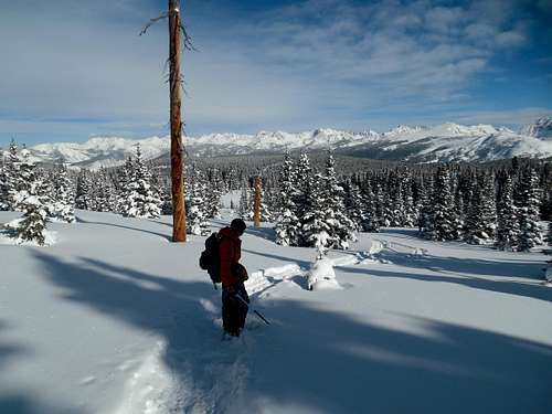
December 10-11: Burnt Mountain (Colorado)
December 10
Kessler and I were to attempt Burnt Mountain in Colorado. The plan was to stay in the Harry Gates Hut and make the ascent up the mountain the next day.
We packed in the morning, but upon arriving at the trailhead, we noticed that somehow we left the wool shirts and one coat behind. Not good. Instead of abandoning the trip right then and there, I borrowed Kessler's sweatshirt and put it under the one I was wearing. Kessler wore the coat with no shirt. We decided to make an attempt to get to the hut anyway.
Shortly after starting, it began to snow heavily. Unfortunately, it was a really wet snow and my sweatshirt got soaked. There were 14 people staying in the hut (3 different groups; we didn't know them), and eventually we caught up with the other groups. No trail was broken and the group in front was disorientated. There was no trail broken and we were all off route since they other groups just followed the tracks. We all looked at the map and headed cross country to where we were supposed to be. We eventually reached the correct route and made our way to the hut through the snowstorm.
To make things worse, my snowshoe broke along the way. Kessler is lighter than me, so I borrowed his snowshoe, but he had to wade through powder with only It was well after dark before we all reached the hut. This was the first hut trip I have been on where all the groups reached the hut at the same time! It snowed a lot during the day and we were pretty soaked upon reaching the hut.
December 11
With the broken snowshoe and only one coat between us, and with two feet of new snow on the ground, Kessler and I decided to bail on our attempt on Burnt Mountain. We made our way back to the trailhead through the new snow. We had to break trail much of the way and there were many new elk tracks.
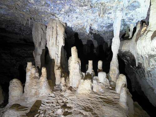
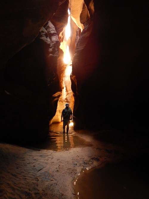
December 3: Barcadera Caves (Bonaire)
Shaylee and I explored two of the Barcadera Caves with a local guide. The first cave was pretty dry, easy, and scenic. There were quite a few bats in the cave.
The second cave was more difficult and had deep wading in water. There was some climbing involved to get into the cave. We got to use snorkeling equipment to view the underwater formations. Luckily the water was a perfect temperature. When the lights were turned off, cave shrimp would come and swim around our legs.
After the caves, we went snorkeling on our own in the same area.
December 2: Mount Brandaris (Bonaire)
Today Shaylee and I explored Washington-Slagbaai National Park on Bonaire. We saw many flamingos in the brackish lakes.
We climbed Mount Brandaris, the highest point on Bonaire. By most standards, it was be a hill, but it was still a nice climb with some scrambling. We saw many lizards and a few parrots and parakeets on the hike. It was hot, but the breeze made the climb tolerable. We also brought plenty of ice water with us.
Along the way, there was a forest of cactus with a few trees. We also saw two caracaras (birds of prey) near the trailhead. We also went snorkeling on the way back.
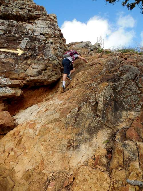
November 28: Christoffelberg/Hato Caves (Curacao)
In the morning, Shaylee and I climbed Christoffelberg, the highest point on Curacao. We took a few wrong turns getting there from the aquarium, but once were on the made road, we went right there.
At the beginning of the hike, I soaked my shirt in the creek that was there, but it didn't do much good because of the really high humidity.
The peak was actually a very interesting climb and the mountain was more impressive than its elevation would indicate. It rained a little, so the steep scramble was a little slippery. The vegetation was really interesting as well.
From the summit, we could see all the way to South America. There were many colorful beetles on top which would land on us and cover us.
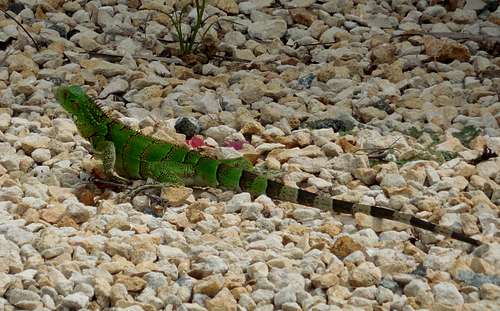
On the way down we saw a small snake and two really big iguanas. We got back just in time since it started raining really hard just after we reached the rental car.
On the way back, we visited the Hato Caves. These are commercial caves, but they were really beautiful and interesting. We saw another iguana in the tree as well.
November 27: Bubali Bird Sanctuary (Aruba)
Shaylee and I walked from Eagle Beach to the Butterfly Garden, and to the Bubali Bird Sanctuary after visiting the butterfly garden. We hiked the trails around the sanctuary. We saw more iguanas and lizards than we saw birds, but there were a few birds about, including some ducks and herons.
November 26: Casibari Rocks/Hooiberg (Aruba)
In the morning, Shaylee and I took a bus to downtown and then took a taxi (there weren't many buses running on this day) to the Casibari Rock Formations. They were really neat, sort of like a mini Joshua Tree area.
After exploring the rocks we walked to Hooiberg. We climbed the steep staircase to the top. It was hot, but it was also cloudy and it rained a bit. The rain was actually refreshing. The views from the summit were really nice.
After climbing Hooiberg, we walked around the mountain and through the waterpark and to the main highway south of the peak. We waited for a bus, but finally someone picked us up and gave us a ride into town. We went snorkeling in the afternoon.
November 25: Eagle Beach (Aruba)
In the afernoon, Shaylee and I walked the entire length of Eagle Beach.
November 20: Sand Rocks (Colorado)
Alone, I took a hike over the Sand Rocks.
November 18-19: Twin Cones (Colorado)
November 18
I had to work late, so Shaylee, Kessler, Kimberly and I didn't start up the trailhead to the Broome Hut until 9:30 PM! We made our way quickly with headlamps to the hut which is located at 11,350 feet.
November 19
No one else but me wanted to climb anything, so I set off alone for Twin Cones. I climbed both the north and south cones before heading back to the hut and packing up. It was a little breezy and cold on top, but it wasn't that bad for November.
November 14: Wall Street (Utah)
Kessler, Shaylee, Kimberly and I headed for Wall Street to do some climbs. We thought about trying Bad Moki Roof, but I didn't like the looks of it, so we headed farther up the road to Neapolitan, which was free.
We all climbed several variations of Neapolitan. The other crags in the immediate vicinity were already "taken", so we headed home, stopping at Moab Giants along the way.
November 13: Elephant Butte/Ice Cream Parlor (Black Slab) (Utah)
In the morning, Kessler, Shaylee, Kimberly, and I met some friends at the Elephant Butte Trailhead. We all climbed Elephant Butte, but part of the group didn't want to go all the way to the summit for some reason. The rest of us enjoyed one of the best views in the world from the summit.
After climbing Elephant Butte and dropping the girls off in Moab, Kessler and I headed for the Ice Cream Parlor. We didn't have the guidebook with us, so just chose a climb that didn't already have climbers on it. It was also nearing sunset by the time we started.
We ended up climbing Black Slab. Kessler led, I climbed it once, and then Kessler was able to climb it again in the fading daylight. It was dark by the time he was finished, so we headed back down.
November 6: Lily Pad Lake (Colorado)
Kimberly, Shaylee, and I hiked to Lily Pad Lake near Frisco. It was a good hike and the trail was in summer conditions. It did rain a very little bit on the way down.
November 5: Quandary Peak (Colorado)
Kimberly, Shaylee, and I climbed Quandary Peak with the 14ers.com gathering. A blizzard hit when we were high on the ridge. We continued up through the storm and summitted anyway.
It was still a good climb and it was nice to meet some old and new friends.
October 29-30: Derby Peak (Colorado)
October 29
Kessler and I decided to climb Derby Peak in the Flat Tops. It was the last 12,000+ foot peak I had left in the Flat Tops to climb.
The weather forecast didn't look that bad as it was only supposed to rain/snow Saturday morning, but it was raining and snowing pretty hard on the way to the trailhead. By the time we got to the trailhead, there was only a light mist and it stopped after a few minutes.
We hiked up to Mosquito Lake. Luckily there were no mosquitoes by late October! We had to walk through some mud, but all snow was avoidable. We found a nice campsite at the lake. The skies were threatening at times, but the weather wasn't bad. There were many birds and ducks around the lake.
October 30
It rained and snowed a little in the night, but it wasn't raining or snowing by morning. The thermometer said that the low at night was 34F (1C), which is very warm for the time of year.
It was very windy, but we made our way to the top of the plateau. We headed north along the official trail before striking off cross country for the peak. The peak was actually longer than it looked to get to! We had to walk through some snow, but it wasn't bad.
We made our way to the top of the summit block and then over to the summit, which was a detached rock knoll that required a little scrambling to get to. Before standing on the true summit, we found the register on the wrong (not the true) summit, but there was no pencil or pen in the jar.
The weather was very windy for the entire ascent, which made it feel chilly. We didn't spend too much time on top, but ate a quick lunch and headed back.
The weather looked threatening for much of the day, but it only spit a little snow at us. After arriving back at camp, we packed up and headed back down to the trailhead.
October 23: Puoux (Colorado)
Kessler, Shaylee, and I did several routes on The Incisor. Some of them seemed more difficult than the route ratings indicated. We also checked out the routes around Jungle Monkey. We left when we got tired.
October 22: Puoux (Colorado)
Kessler, Shaylee, and I did several climbing routes at Puoux in Glenwood Canyon. We did some climbs around Traditional Values on the main Puoux Wall and then did several routes on The Incisor (Insisor is a mini-tower of sorts) and Molar. Kessler led all the climbs. It was a great day.
October 20: Cedar Mountain (Colorado)
Starting at around sunset, Kessler, Shaylee, and I climbed Cedar Mountain to the high point and then returned the same way in the dark.
October 19: Sand Rocks (Colorado)
Alone, I did a night hike of the Sand Rocks.
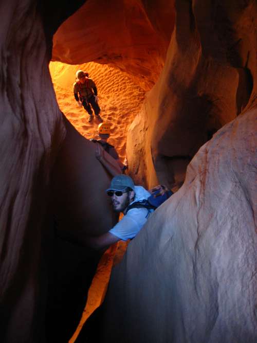
October 16: Bluejohn Canyon (Utah)
The night before was extremely windy and had a sand storm. Unfortunately, I left the windows part way open and the vehicle got a lot of sand inside. It was a rough night.
Shaylee, three other friends, and me decided to do Little Bluejohn Canyon and exit the West Fork. Little Bluejohn was the only part of Bluejohn that I hadn't seen, so I wanted to do it.
The canyon was pretty good, but it was short. After doing Little Bluejohn, we hiked down the Main Fork of Bluejohn to the West Fork. We climbed up the West Fork back to the trailhead. It was a good trip.
October 15: Spur Fork/Cowboy Cave (Utah)
Shaylee and I had planned to go canyoneering this day (Robbers Roost area), but we missed the rest of the group so set off on our own. I wanted to hike Spur Fork since I hadn't hiked before. We went down Spur Fork and up the drainage where Cowboy Cave was. The cave was once home to animals such as mammoths, camels, and giant ground sloths. It also has signs of human habitation from more than 9000 years ago.
After visiting the cave, we set off cross country back to the trailhead. There was some nice scenery along the way.
October 9: Three Forks (Colorado)
Kimberly and I took a hike up Three Forks Trail north of Rifle. We hiked most of the trail and to the head of Hoover Gulch before returning. There were a few autumn leaves out, but most were gone. We saw a few bear tracks in the mud along one section of the trail.
October 8: Grizzly Creek (Colorado)
Originally, Kimberly and I wanted to hike to Hanging Lake, but the parking lot was full. Instead, we hiked up Grizzly Creek (Glenwood Canyon). We made it to the area around the aqueduct before returning.
October 7: Sand Rocks (Colorado)
At night, Kessler, Shaylee, and I took a hike over the Sand Rocks.
October 1-2: Flattop Mountain (Colorado)
October 1
Kessler and I started at the Slavonia Trailhead and hiked up past Gold Creek Lake to the 8800 foot elevation area. We decided to try and old abandoned trail along Gold Creek in order to head farther up the valley, but this was a big mistake and we got soaked in the marshy areas. We camped where the Ute Pass Trail crosses Gold Creek.
The weather forecast was good, but it rained anyway.
October 2
In the morning, we realized that we had forgotten the water filter, so we boiled enough water for the hike today. It was cloudy and overcast with low clouds covering the mountains.
We hiked up to Red Dirt Pass. It became colder and windier as we ascended. At the pass, it was really blowing and it was misty. We had planned on climbing both Peggy Peak and Flattop, but we decided to forget about Peggy Peak since there was poor visibility anyway.
We climbed up to the mesa-top of Flattop Mountain and headed south towards the true summit. It was windy, cold, and foggy for much of the way, but occasionally the fog lifted. We actually got some pretty good views from the summit.
We descended the mountain to Ute Pass and then took an old trail back down to our campsite, which we packed up before heading back down to the trailhead. The weather was a mix of partly cloudy and overcast skies. It was a good climb.
September 29: Sand Rocks (Colorado)
I took a late evening hike over the Sand Rocks. There were many deer about.
September 25: Mad Creek/Saddle Trail/Red Dirt Loop (Colorado)
Today Kimberly, Shaylee, Kessler, and I completed the Mad Creek/Saddle Trail/Red Dirt Loop north of Steamboat Springs. It was a gorgeous day and the autumn leaves were out. It was a great hike.
September 24: Cedar Mountain (Colorado)
Alone, I climbed Cedar Mountain, completing the short loop. The weather was threatening most of the day and the mountains were covered with new snow, but it only sprinkled on me.
September 21: Sand Rocks (Colorado)
I did a night hike over the top of the Sand Rocks. It was cloudy, so there weren't too many stars.
September 18: Cedar Mountain (Colorado)
Shaylee, Kimberly, and I did an afternoon hike up Cedar Mountain, completing the long loop.
September 17: Cedar Mountain (Colorado)
Alone, I did a late evening climb of Cedar Mountain, completing the log loop. The sunset was fantastic; one of the best from Cedar Mountain that I have seen.
September 16: Cedar Mountain (Colorado)
Shaylee and I hiked the long loop on Cedar Mountain in the afternoon and evening. We saw lots of deer and antelope on the way to the trailhead.
September 13: Sand Rocks (Colorado)
Kessler, Shaylee, and I had a nice evening hike over the Sand Rocks. We saw several deer.
September 11: Black Mountain (Colorado)
Shaylee, Kessler, and I climbed Black Mountain, this time from Freeman Reservoir. It had been a long time since we had climbed Black Mountain via that route. We were hoping that the leaves had turned, but most were still green. There were several sections of the trail though where the leaves had turned.
We made it to the summit in the afternoon and tried to view raptors at the raptor viewing area. It was probably too windy for them. We did see a few raptors and the way up and down though.
It was a nice hike.
September 9: Mount Royal (Colorado)
I took another evening hike to the summit of Mount Royal. I started early enough to make it to the top before sunset and without pushing too hard. The weather was perfect and it was a good hike.
September 8: Coon Hill (Colorado)
After work, I climbed Coon Hill since I failed on September 1 due to bad weather. I really had to push hard to make the summit at sunset. The sunset was nice and there was a lot of smoke in the air from a forest fire somewhere.
I descended a steep gully on the east face because I though it would be faster than the ridge and since daylight was fading. It was very dark by the time I reached the base of the mountain.
September 7: Peak 12,585 (Colorado)
After work I drove to Loveland Pass and climbed Peak 12,585 via the west ridge. After that I hiked to point 12,414. I saw a few pikas and one runner. It was a little chilly with the wind, but the weather was good. I arrived back at the vehicle around sunset.
September 6: Meadow Creek (Colorado)
After work, I took a hike up Meadow Creek in the Gore Range. I made it to about 10,500 feet before turning back. I hiked back in the dark.
September 4-5: Surprise Peak/Island Lakes Peak North/Island Lake Peaks South (Colorado)
September 4
The weather was bad around here on September 3, plus it was my first full day off in almost two months, so we didn't start our hike until September 3. It was decided that we go to the Flat Tops in order to climb or attempt three of the mountains there.
The weather looked threatening and it was very windy, but Kessler, Shaylee, Kimberly, and I started up the Stillwater Trail late morning. The forest has all burnt up and hadn't recovered since the 2002 fire, so there was no trees to block the wind. We followed the main trail (meeting two small groups along the way-the only people we saw the entire weekend) up to the plateau. Along the way, we stopped at a big group of perfectly ripe raspberry patches and had a delicious snack.
From the top of the plateau, an old map we had showed an abandoned trail to Surprise Lake. We wanted to see if we could follow it. We found the old trail, losing it in a few places and made our way to the saddle just north of Surprise Lake. It was still really windy and there were some small snow pellets, but we decided to climb the peak anyway since there was no thunder. We made our way to the west and found ourselves on the summit. The summit of the peak was really pristine and there wasn't even a summit cairn. After climbing the peak we descended to the saddle and then to Surprise Lake, where we set up camp. It was a really secluded lake and we had it all to ourselves.
September 5
After a windy night, we awoke to clear skies and 31F degrees. It was still windy, but the sky was completely clear.
We headed cross country towards Peak 11968, a.k.a. Island Lakes Peak North. It was a fairly gentle climb, but there was boulder-hopping near the end. It took a little bit longer than expected as well. Near the summit we saw many pikas and an ermine/weasel, the first we have seen in Colorado. On the summit, we found the register and found that it was last signed in 2015, but the signature before that was in 2004.
We took a pretty long break on the summit and headed south towards Peak 11926, a.k.a. Island Lakes Peak South. We decided to skirt around the west base of Point 11824. There was some boulder-hopping, but it wasn't that bad. Once we were at the saddle between Island Lakes Peak South and Point 11824, Kim decided to wait and Kessler, Shaylee, and I headed for the summit.
We found the summit to be very pristine with no register or summit cairn. It was getting late now, so we hurried back to the saddle where we reunited with Kim.
We still had seven miles to go, so we headed back towards Trapper Lake as quickly as possible. We only stopped a few times to get drinks and to look at the map. Along the way we did see one big marmot. We arrived at the trailhead at around 5 PM. It was a great trip, but we were all tired. I was the last one back to the car.
September 1: Coon Hill (Colorado)
I set off to climb Coon Hill after work and in the evening. It started raining and hailing at about 12,000 feet, but I decided to continue on as long as there was no thunder. The precipitation was coming down very hard and there was thunder when I reached 12,500 feet. I turned back at this point. I got soaked on the way down, but by the time I was back the rain and hail had stopped. It was a little disappointing not to reach the summit.
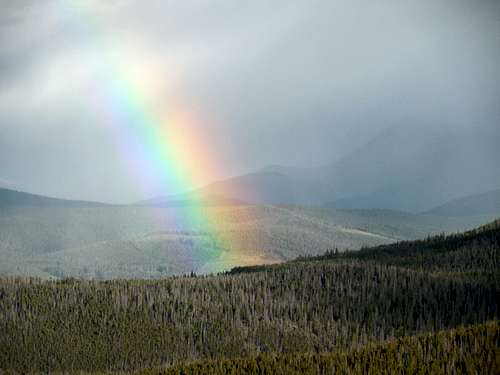
August 30: Royal Mountain (Colorado)
I took another hike to the summit of Royal Mountain. The weather was good on the mountain, but it was raining to the west and there was a nice double rainbow visible for much of the hike. It didn't rain on me, but it was raining to the east, so I got some nice views of a double rainbow.
August 29: Royal Mountain(Colorado)
It rained part of the day, but it cleared enough by evening that I took a hike up Royal Mountain, returning just before dark.
August 27: Sapphire Point (Colorado)
On the way home, I took a hike around Sapphire Point. The weather was good.
August 26: Rock Creek (Colorado)
After work, I took a hike up Rock Creek in the Gore Range. I made it to near the mine before I had to turn back. It was a nice hike and the weather was good.
August 25: Royal Mountain (Colorado)
I climbed Royal Mountain in the evening yet again. The weather was good when I started, but when I reached the top just after 7 PM, the weather quickly changed and the snow was coming down sideways and very hard! It was a really wet snow and I did get wet. There was some lightning on the descent as well.
August 24: Royal Mountain (Colorado)
It rained and snowed most of the day, but by evening it finally cleared. I decided to climb Royal Mountain. I only made it 1/3 of the way before sunset, but I continued up the mountain reaching the summit just before it got really dark. There were some nice views along the way. I hiked back down in the dark.
August 23: Sapphire Point (Colorado)
The weather was threatening, so I just did the short loop hike around Sapphire Point again. I got done with the hike before it started raining.
August 19: Sapphire Point (Colorado)
I worked late, so after sunset, I did the loop hike around Sapphire Point.
August 19: Mount Royal (Colorado)
After work, I walked half way up Mount Royal before deciding to stop and head back down. I had to work late so I didn't start until near sunset and I was tired.
August 17: Lily Pad Lake (Colorado)
After work, I had a beautiful hike to Lily Pad Lake in the Gore Range. I got back at sunset.
August 14: Mount Sniktau/Cupid Peak (Colorado)
Shaylee, Kessler, Kimberly and I climbed Mount Sniktau and Cupid Peak from Loveland Pass. We got a fairly late start, but the weather was beautiful. There was some smoke and haze in the air, but there was no threat of thunderstorms.
We climbed Sniktau first, passing over unranked 13,152 along the way. Along the way we saw one marmot and many pikas.
After climbed Sniktau, we returned to Wishbone Pass and climbed Cupid. We watched an entertaining marmot on the summit while we were eating our lunch. Kim didn't want to continue on to Grizzly Peak, so we returned. Kim and I took the bypass trail around Wishbone Trail, while the kids took the longer way over Wishbone Pass again. We met at the junction.
It was a good hike.
August 11: Mount Royal (Colorado)
after work, I climbed Mount Royal in the evening, reaching the summit just after sunset. I came down in the dark.
August 10: Peak 10,315 (Colorado)
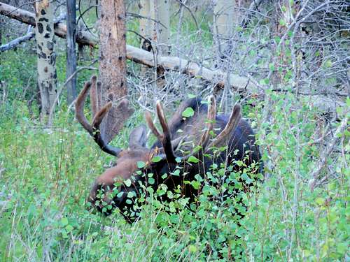
After work, I climbed Peak 10,315, a scruffy peak located between Frisco and Breckenridge. The trail has been rerouted, so the route is much longer than the map indicates. Unfortunately, I didn't bring my headlamp and it was pretty dark by the time I got back to the trailhead.
There were some nice views from the slopes of the mountain. I also saw two big bull moose up close on my descent.
I thought 10,315 was a ranked peak, but after looking at a detailed map the next morning it's 7 feet short!
August 8: North Tenmile Creek (Colorado)
After work, I hiked up North Tenmile Creek. It was a pleasant hike and I made about five miles round trip before running out of daylight.
August 6: Sapphire Point (Colorado)
After work, I took a hike around the Sapphire Point Trail. The weather was good, but cloudy.
August 2: Mohawk Lakes (Colorado)
I took an evening hike up to the Mohawk Lakes. It was very beautiful and I got back just before dark. There was a cold rain part of the time.
August 2: North Tenmile Trail (Colorado)
I took a late evening hike up North Tenmile Creek. I had to work late, so most of it was done in the dark!
July 29: Mount Royal (Colorado)
After work and dinner, I climbed Royal Mountain, reaching the summit after sunset. It was dark on the way down.
July 28: Monte Christo Gulch (Colorado)
After work, I hiked from Blue Lakes up Monte Christo Gulch to near the Fletcher Mountain/Quandary Peak Saddle. It was a great hike.
The mountain goats seemed to want to eat my truck though. Several pikas and marmots were seen as well.
July 27: Willow Creek/Lily Pad Lake (Colorado)
After work, I hiked up Willow Creek and then to Lily Pad Lake in the Gore Range. There were a few mosquitoes, but not that many.
July 23: Royal Mountain (Colorado)
After a 76 hour work week, I still needed to climb something after work and in the evening. I climbed Royal Mountain via its standard route from Frisco. It was a good hike, but I was a bit tired.
July 21: Royal Mountain (Colorado)
In the evening, I made an attempt on Royal Mountain, but it started raining heavily just over half way up. I turned around at that point.
July 19: Lake Dillon Trail (Colorado)
The weather looked threatening, so I just hiked the paved trail along Lake Dillon in the evening.
July 16-17: Paradise BM (Colorado)
July 16
Originally Kessler, Shaylee, Kimberly, and I were going to climb several peaks in the Trappers Lake area, but we had a tire blowout right near the trailhead for Mirror Lake. Rather than risk an extra 22 miles on a washboard road on the spare tire, we decided to hike to Mirror Lake and climb the Paradise BM instead.
There were many flies along the trail, more than I have ever seen. It was a hot climb as well. Half way up the trail, the mosquitoes came out as well.
After setting up camp at Mirror Lake we hiked around the lake and then to the next lake to the west. There were coyotes howling at night.
July 17
Kessler and I woke up early in order to climb the Paradise BM. We climbed up the very steep north ride of Sable Point. It was a tedious route and we got eaten alive by mosquitoes.
From Sable Point, we made our way over to the Paradise BM. We saw several bull elk resting around a snowbank near the summit.
The views were nice from the summit, but there was some haze from forest fires. There was a gigantic orange wasp that was covered in hairs on the summit, but it flew away before I got a photo of it. After enjoying the summit (there were still mosquitoes on top!), we headed southeast before descending a very steep elk trail down to the north.
We eventually lost the elk trail and got cliffed out and had to backtrack a bit before finding a very steep route down to Mirror Lake. We hiked along the shore back to camp and then headed back down home where I had to leave and go to Breckenridge for work.
July 14: Sand Rocks (Colorado)
Alone, I made a late evening hike over the Sand Rocks.
July 12: Sand Rocks (Colorado)
Kessler and I made a late evening hike over the Sand Rocks.
July 10: Cedar Mountain (Colorado)
Shaylee, Kessler, Kimberly and I completed the long loop on Cedar Mountain in the evening. It was very windy, but was still a good hike. We saw one big bull snake near the trailhead.
July 9: Mount Welba (Colorado)
Kessler, Shaylee, and I climbed Mount Welba in the afternoon and evening. There were still snowbanks around and lots of mosquitoes! I should have brought a map along since it took us a little time to find the summit. We say one really big vulture near the summit and one big buck as well.
July 4: Canyon Overlook/Navajo Loop (Utah)
Kimberly, Kessler, Shaylee, Justin, and I hiked the Canyon Overlook Trail in Zion National Park. It was great to see Pine Creek from above and the view at the end of the trail is spectacular.
After hiking the Canyon Overlook Trail, Justin and the rest of us parted ways and we headed to Bryce Canyon National Park. We hiked the Navajo Loop. It was a great hike and although it was warm, it wasn't too hot.
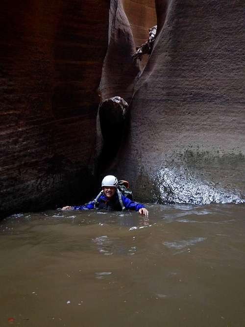
July 3: Pine Creek/Keyhole Canyon (Utah)
Justin, Kessler, Shaylee, Kimberly, and I made the canyoneering trip through Pine Creek. As always, the canyon was very impressive. Since it had flash flooded two days prior, it was also full of water, which wasn't bad in July. Pine Creek is one of the best canyons in the world and we thoroughly enjoyed it. There were lines at some of the rappels and especially the last one, so it took 7 hours to get through. Still, it was enjoyable. At the last rappel it started raining and there was thunder. The weather forecast today was actually perfect, but this is the day it rained. The hike out felt longer than it was, but it was still a good route.
In the afternoon we drove to the Keyhole Trailhead to see if the weather would clear. It did and Kessler, Shaylee, Justin, and I made a quick run through Keyhole Canyon. It only took us 30 minutes, which is a pretty good time for four people.
July 2: Keyhole Canyon/Lower Pine Creek (Utah)
Because of the weather forecast (40-50% chance of rain in the afternoon), we canceled our hard to get permit for Mystery Canyon and got one for Keyhole Canyon. Participants were Rob, Justin, Kessler, and I. In the afternoon Kessler, Shaylee, Justin, and I hiked up lower Pine Creek to the pools and waterfalls. Although it was a nice hike, I was disappointed that we had cancelled our permits to Mystery Canyon. It ended up being sunny all day.
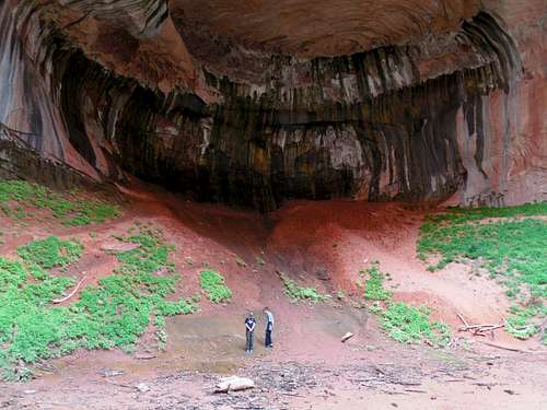
July 1: Double Arch Alcove (Utah)
We (Justin Kuhn, Kimberly, Shaylee, Kessler, and I) had permits for Pine Creek (Zion National Park) today, but because of the weather forecast, we wanted to change it to a quick run through Keyhole Canyon. Since we had kids along, the NPS was apprehensive, so we relented and did the hike to the Double Arch Alcove in the Kolob section of the park instead.
It was a good hike and we took a side trip to the waterfall. Luckily with plenty of water around, the hike wasn't too hot. We hung out at the alcove for quite a while before heading back.
June 26: Black Mountain (Colorado)
After church, Shaylee, Kimberly, and I climbed Black Mountain via the southeast ridge. There was only a little snow on the trail, but the mountain top was buried in snow. There were a few mosquitoes around as well, but they weren't terrible.
We saw a fox at the trailhead and several deer on the drive.
June 25: Baldy Mountain (Colorado)
Kimberly and I climbed Baldy Mountain/Peak 10,455 in the Flat Tops. It was a gorgeous day. We chose this trail because it stayed away from the lakes and it wouldn't have as many mosquitoes.
We saw several elk and a deer along the way. There was a bit of snow around, but we could avoid it. It was a good hike.
June 19: Cedar Mountain (Colorado)
It was a very hot day (at least for Craig), so I waited until almost sunset to do the hike up Cedar Mountain. I saw several deer and did the medium loop. I got back after dark.
June 18: Hog Canyon (Utah)
It was time for another attempt of Hog Canyon. Kessler and I finally found three more willing partners to give it another shot.
Because of our previous difficulties on the approach to the head of the canyon, we decided to take a different approach to the problem and to do a car shuttle to the top of the Yampa Plateau, where we could hike to the head of the canyon, hopefully without too much difficulty. I had also thought of using an alternate route from the bottom of South Split Mountain which stayed away from the rugged rim of Hog Canyon, but in June it didn’t sound appealing to climb that steep route that was fully exposed to the sun.
Peter, Ron, George, Kessler, and I all gathered at the Welcome Center in Jensen to discuss logistics. Since we planned on doing two canyons this day, I suggested Hog Canyon first since the second canyon planned was more of a slot and would be more shaded for the afternoon. Hog Canyon faces south and gets more sunlight, so it would be nice to not do it in the afternoon.
We decided to leave two cars at the entrance to Dinosaur National Monument and to leave mine at the mouth of Hog Canyon and to all pile in George’s truck to drive to the top o the plateau. The ranger at the entrance warned us that the road was in very rough condition and that we would beat up our vehicles trying to attempt it. With two 4x4’s and some trepidation we decided to try it anyway, since the alternative driving route entailed a long roundabout way through Colorado and the Harpers Corner Road.
In reality, we were relieved to find that the ranger’s report was grossly exaggerated and the road was actually well graded, though steep. I could have taken the Subaru, I said out loud. It was a very scenic drive as well. We started in the desert and there were many pine trees by the time we reached the top of the plateau. We navigated by map and GPS in order to locate the less used road to the Yampa Plateau. This road was much less used, but still not extremely rough. We stopped just before the steep drop into Docs Valley. It was a good place to stop since the road was very washed out below this point. It had taken us 1.5 hours to reach this point since leaving my car at the mouth of Hog Canyon.
We sorted out gear and decided to leave lunch behind since we expected to be at the vehicles in a reasonable time for a late lunch. It was destined to be a hot day, so we took 2 liters of water.
We followed the old track down into Docs Valley and then around the hills to near the head of Hog Canyon. There were some up and downs in the already hot sun, but we were sure glad that we didn’t try the alternative route up South Split Mountain.
Once we located the correct drainage, we headed down in. The drainage was very rugged and had quite a bit of bushwhacking. It was slow going. It was evident that Peter, Ron, and Kessler (the youngest three members) were the strongest members of the group with George and I going strong, but lagging slightly behind. We still were in high spirits and made it to the big drop down into Hog Canyon. It was a huge drop. Topo maps are misleading. Even though the topo map does show a big drop, the drop is even bigger than the map indicates.
We had 520 feet of rope available (one 120 foot rope and two 200 foot ropes), an additional 200 feet of pull cord, and maybe 200 feet of tubular webbing. I had told everyone that from the dome I had spotted a place where the rappel sequence might be 120 feet or less. We only had to find it.
George discovered that sometime during the rugged approach to the fall, he has lost his 200 foot rope. Not good. I sent Kessler back with George to see if they could find the rope. Since the last part of the approach was the most rugged and the most likely place to find the rope, I expected to see them again in a few minutes.
Ron and Peter checked out the drop in detail and Ron threw the rope down in a few places. Peter thought the rope was at least 30 feet short of touching the bottom, but it could have been farther than that. We decided to look around for other routes.
Peter and I took two different routes to the bench above and then traversed it west. At one corner I found a route which looked a lot better than tying one down the initial drop. We could see all the way down canyon from the ledge. Ron joined us shortly after and set up the anchor, while I took off to look for George and Kessler.
I left the water back at the packs near the drop and set off, expecting to meet them soon. I became more and more worried since I didn’t see them. I made it all the way back to the vehicle without seeing them. Where were they? I was really worried. It was unusually hot for June as well.
Worried, I headed back down to the canyon and down the drainage (easier said than done) where I still didn’t see them. I climbed up to the bench and found that Ron and Peter had completed the first rappel and were waiting for us on a ledge. I expressed my concern that I didn’t find George and Kessler and said that I might need help. I told them that I would go back and look for them. When I walked east back towards the big drop though, I was relieved to find them. They never did find the rope, but got another one from the truck.
The fiasco brought up two puzzling questions. How did three people scan the same route we had done twice without seeing any signs of the lost 200 foot rope? How did we miss each other when following the route back to the vehicles and then back to the same drop?
I was very thirsty and I had to drink nearly a liter of water, even though I was trying to ration it. I was relieved to find out that George and Kessler drank much water while back at the truck.
The rope problem seemed to be solved, but it came at a high cost. We lost almost four hours during the incident. Even rationing, we drank a fair amount of water.
George was exhausted and said that he would rest and then hike back to the vehicle. He gave Kessler and I a little of his water and all of his webbing (about 100’). I respected George for his decision and it turned out to be a good one since our challenging were just beginning (though we didn’t know at this point how challenging the canyon would end up being).
Kessler and I climbed back up to the ledge and followed it to where Ron and Peter were. I yelled down happily that I had found George and Kessler and that George was going to head back. I asked if we should come down to the ledge. They yelled in the affirmative and Kessler and I made the near 200 foot rappel down to the ledge. Since they didn’t have the other 200 foot rope at the time, the rappel was rigged with one 8.3 mm rope and a pull cord. I am not a fan of long single line thin rope rappels, but luckily for this one, Peter was kind enough to provide a belay while sitting under a shaded and safe little alcove in the ledge. I was especially thankful since on the rappel I went over a bush which pulled up my shirt which got caught in the rappel device. It wasn’t hard to get it out, but I had to rip it.
Unfortunately, Peter and Ron had been baking in the sun on the ledge for several hours. Peter had also made a very tiring ascension of the rope to near the top of the rappel. There was only that tiny little alcove spot with any shade at all on the ledge. On the plus side, I promised that once we get done with the technical section of the canyon, there would be a crystal clear spring spurting from the rocks.
I retrieved the rope and pull cord from the anchor, knocking down a big rock in the process. Luckily we were out of the danger zone and not standing in that area.
Even though we had rappelled nearly 200 feet down to the ledge, we were still several hundred feet above the floor of the canyon. Ron and Peter had explored the ledge and found a possible way down on the north side of the ledge we were standing on. When the ledge we were standing on pinched out, there was another tinier ledge and tree about 40 feet below. I rigged a rappel of a root of a bush that was growing in the rock. It seemed solid, but there was one problem. George, who turned back had most of the rappel rings. I rigged the rappel without a rappel ring, since it was the shortest of our rappels down the three stage 420 foot drop. I didn’t want to leave any caribiners behind just yet.
Ron rappelled down to the ledge and rigged the tree for the final rappel down the headwall. After tying into the tree and leaning over the cliff, he could see that the rope would reach the bottom.
Peter followed and rappelled the remaining near 200 feet down to the base of the headwall. Kessler and I then followed and made the very dirty and loose rappel through a crack down to the ledge with the tree. Kessler when down the big drop first while I tried to retrieve the 120 foot rope. I couldn’t budge it. I really regretted not using a biner as a rappel ring (although I have done probably done well over one thousand rappels, very few of these were without some sort of rappel ring). I would have rather sacrificed the biner than the rope. Try as I may, I couldn’t budge the rope, but I did succeed in showering myself with rocks. Unfortunately, this was the only rope pull that we didn’t test out first, probably because of the exposed ledge at the tree.
Now what? We had wisely brought two sets of ascenders, but they were already with the others at the bottom of the headwall. I could ask someone to tie them to the rope and I could haul them up in order to use them, but I was already feeling weak from being in the hot and direct sun for so long and was worried about running out of water. I was also worried about pulling loose rocks down on myself since I was already doing that even before I tried to ascend the rope. I didn’t think I could ask someone else to ascend the almost 200’ foot rappel and up to me and then to ascend up the next one. Disappointed, I decided to leave the rope where it was. I sadly (it was one of my favorite ropes) hooked into the rope and made the last big rappel to the bottom of the headwall. The device and my caribiner were very hot by the bottom! Unfortunately, we didn’t get many photographs of the headwall descent, but Kessler did manage to get one of me on the last sequence.
Ron and Peter had done an excellent job of pioneering the route down the headwall. The question I had however, was where the route down the headwall was that we saw in March 2012? It appeared as if it had a much shorter rappel than the 420 foot drop that we just completed. Did we miss it? Was there an obstacle in my field of vision that obscured part of the cliff? Was I fooled on the length of the drop due to the sheer immensity of the canyon walls? I still don't know.
I expected that the hardest part of the route was now behind us, but the next section of canyon was still unknown. We still had 1300 feet to descend before we were in known territory.
Ron commented on how beautiful the canyon was, but water was what was on most of our minds. Luckily much of the route should be shaded from here on. Towering walls surrounded and enclosed us in a spectacular box canyon.
Although the gorge wasn’t technical at this point, it still dropped quickly and was strenuous. There was lots of bouldering and scrambling. The steep slickrock made a pleasant descent in a few places, but in most places the going was very rugged. Peter was out of water and the rest of us were nearly so. I was starting to suffer from the heat and dehydration. We had less than a liter of water left (the water George gave us). Kessler, Peter, and I shared the last of that water. The water was hot, but was needed. Thoughts of the spring were in our minds. Every time I tilted my head down, water would pour out of it from sweat that was getting trapped in there. At this time, we decided to take off our helmets for a time. We were just losing too much water from sweat.
After much scrambling, which seemed endless at times, we finally found ourselves at the head of the narrows. Ron thought the narrows looked too brushy, and wanted to bypass them. I wanted to descend them, especially since the greenery seemed to indicate that there might be water somewhere in there. We split the group, with Ron staying on the west rim of the narrows and the rest of us descending. Ron had plenty of rope and so did we.
At this point, Peter was starting to suffer from dehydration and let us know that he felt weak. We did a difficult 5th class downclimb into the narrows and to a bench where we took a short rest. I rigged the next rappel down a brushy crack to the floor of the canyon. This time, we left behind a sacrificial biner. I didn’t want to take any chances losing the rope. After we were down the rappel, we continued downcanyon. It was a beautiful section of canyon, but there was bushwhacking in places that slowed us down, even though the bushwhacking wasn’t severe. There were several drops to bypass or downclimb as well.
We met Ron again at the top of another rappel in the canyon. He had rappelled back in the canyon at this point. Ron rigged the rappel. This was the easiest and most pleasant rappel in the canyon. It was in an especially scenic section of the canyon as well. I was asked if it looked familiar and if it could be the last one and I answered in the affirmative hoping that this was the last rappel. It did seem shorter than I remembered though.
I rappelled first in order to get photos, and Peter went second. We suggested he go on ahead so he could get to water. We told him to yell if he reached water, but we heard nothing but silence. I went next in order to get photographs. Kessler went last.
Ron didn’t seem to be suffering, or at least didn’t tell us about it, but Kessler’s and my mouth was extremely dry by now and it was hard to swallow.
We continued down canyon and found Peter standing at the top of a big rappel. Apparently we weren’t done yet. I rigged this one with the last of the 100 feet webbing left to us by George. That made a total of 125 feet of webbing used in the canyon, much more than expected!
Again we sent Peter on ahead after he rappelled down first so he could get to water. After completing the rappel, we continued down the steep canyon with much bouldering. Peter yelled up some advice for us to stay left. After much scrambling we heard Peter yell up canyon that he had found the trail and less than a minute later he yelled that he was at the spring. Elation! Soon we met Peter waiting for us at the trail and we all walked down to the water. The clear and cold water flowing out of the rock was incredible welcome and we all spent much time drinking the refreshing water and letting it cool our throats and quench our thirst. It was now later than 8 PM!
Upon reaching the spring, the character of the canyon immediately changed. It was still beautiful, but much gentler. Tall green grass surrounded the clear flowing creek. The canyon was wide, but the walls were still impressive. Instead of scrambling, bushwhacking, and rappels, there was a nice and nearly level trail. There was some healthy looking poison ivy around, but it was easy to avoid. We were tired (well, at least I was), but we knew that the end was near. It was an easy hike back to my vehicle which was left at the lower trailhead. After thirteen years and four attempts, Hog Canyon was now fully explored!
June 14: Cedar Mountain (Colorado)
Alone, I completed the long loop on Cedar Mountain in the late evening. There was a nice sunset, but also mosquitoes where there wasn't a breeze.
June 11: Fish Creek Falls (Colorado)
Kessler, Shaylee, Kimberly, and I hiked to Fish Creek Falls and Upper Fish Creek Falls. We saw two moose along the way and even had to walk around them since one was right on the trail and the other were only a few feet away.
After taking a rest at the Upper Falls we continued towards Long Lake, but turned back when the weather turned. It was hot on the walk up, but soon the weather turned and there was very cold and hard rain. We got soaked, despite the raincoats and we headed back down to the trailhead rather quickly.
It was a good hike.
June 9: Sand Rocks (Colorado)
Kessler, Shaylee, and I hiked over the Sand Rocks. I should have brought the camera because the sunset was really nice.
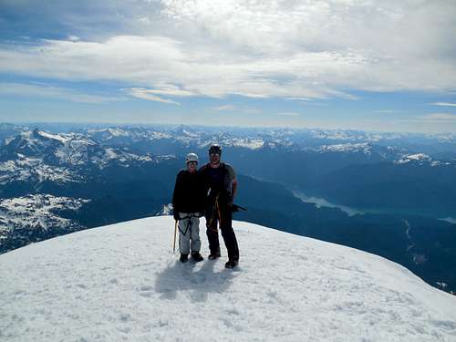
June 4-5: Mount Baker (Washington)
June 4
Kessler's 14th birthday was on May 17th and my 42nd (ugh) will be on June 13, so we decided to combine our birthday presents and have an adventure between the two. We decided on Mount Baker. Since there are crevasses and since it is unlikely that Kessler could pull me out of a crevasse (I weigh 3.5 times as much as he does!) if the need arose, we enlisted the expertise of Crew Treks for their light-guided Mt Baker trip (I would highly recommend them).
We met Kyohei from Crew Treks and Tomek in Seattle and drove to the trailhead. We started up to the Coleman Glacier camp in hot weather. Since the snow was really melting, we had to cross several streams. There was snow starting at below 5,000 feet, but the weather was good.
We made it to the Coleman Glacier camp without a hitch, where we set up camp. The weather was perfectly clear and quite hot (considering our elevation).
June 5
We awoke at 2 am in order to pack up for the summit climb. The night was warm and it never did freeze, so the snow was softer than usual. The climb to the summit went well and since it was early season there were no large crevasses to cross.
We made our way up the steep headwall to the summit plateau and then onto the summit. The views were fantastic, but unfortunately, it was a little hazy.
We then descended the mountain back to camp and packed up. We had some really good and long glissades on our way back to the trailhead. It was a great climb.
May 31: Sand Rocks (Colorado)
Kessler and I did an evening hike over the Sand Rocks.
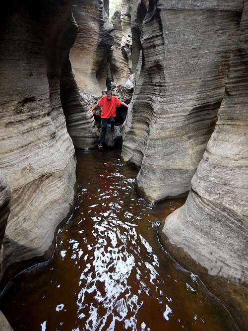
May 28-30: Right Fork North Creek [Great West Canyon] (Utah)
May 28
After obtaining a permit to do Right Fork North Creek (a.k.a. Great West Canyon), Kessler drove to the lower trailhead and hitchhiked to Lava Point. I had been up the canyon from the bottom several times in the 1980's and once from the top in 1992, but not since then, so I was excited to see it all again. We took three days so we would make sure to have plenty of time for side trips and exploration. We were told that we would be first through the canyon this year, but we found some footprints that seemed pretty fresh.
We made our way down Wildcat Canyon (a.k.a. Blue Creek). There was quite a bit of bushwhacking, but it would be a small price to pay for all the wonderful scenery and absolute solitude ahead. There was a lot of knee deep to waist deep water to wade as well (this part of the canyon was completely dry last time I was there).
The scenery was quite pretty and we took some extra time to explore some of the slots in Wildcat Canyon. There are some pretty good ones in there, but almost no one takes the time to check them out. We waded through one walk through slot and I went through another one that required jumping into pools.
The route down to Left Fork was rather rugged, but the days are long this time of year so we still had time. We found a little stream with literally thousands of frogs umping around.
We left Left Fork and made our way to the saddle between the Left and Right Forks. The route from here to the Giant Staircase was steeper and more rugged than I remembered it. We had to so some routefinding and a little backtracking to avoid brush, but eventually we made our way to the ridge. Once on it, the route was easy to follow. We did some poking around some of the peaks in the area.
It was getting pretty late by the time we reached the Giant Staircase so we looked around for a campsite. We didn't find anything that good, but found a flattish place on the slickrock that would do. There were thousands of frogs around and it was extremely noisy! The noise continued well into the night. I didn't sleep that well tonight.
May 29
After a rough night, we packed up camp and climbed down the Golden Staircase and ledges down to the floor of the Right Fork. It wasn't too bad and the route down the crack was actually fun. At the bottom, there was the first of several rappels. It landed right into a pool of water.
We headed down canyon and had to do a deep wade under a huge chockstone boulder. It was cold, but not as cold as in Echo Canyon (which we did Friday). After that, there was another rappel that didn't exist in 1992. After much bouldering we found our way to a nasty rappel, the hardest one in the canyon. Maybe there was an alternate route, but we went down this rappel. We had to lean over a void to get to the anchor and it was very slippery. The rappel was short, but very difficult to clip into and not fun.
Not long after that we found ourselves at the infamous Black Pool. . Since we didn't bring wetsuits (I had a bad reaction to neoprene on Friday, but my son brought a neoprene jacket), we had originally planned to bypass the Black Pool as well and the pools at the next rappel after that (the water at the Grand Alcove is usually warmer). I jumped into the Black Pool to test it out. It didn't feel that bad to me (my son apparently didn't fully agree with my opinion), so we just swam though it. The water temperature was probably around 50F/10C. Not long after a pool, there was another rappel into a pool, but the swim was much shorter.
After much wading and a fairly easy section of canyon, we found ourselves at the Grand Alcove, which is one of the most impressive alcoves in the world. The best slot in the canyon, and one of the neatest slots in the world is right under the alcove. Surprisingly, most people that do come here bypass it. We wanted to do it directly (as we did in 1992). There were some very slippery slides and some tricky downclimbs, plus lots of swimming, but the clear spring water was much warmer than the stagnant water higher in the canyon.
After getting through the wonderful slot, we were at the last technical obstacle of our route, Barrier Falls. It was a neat rappel down to the pool in the canyon below.
After completing the technical section of the canyon, we decided to take an inventory of all out equipment and see if anything got wet. The only thing that got wet was Kessler's sleeping bag, but only the top corner of it. We laid it out to dry and relaxed by the water. Unfortunately, out of the blue, a big wind gust came and blew Kessler's drying sleeping bag right into the water! We spread out the sleeping bag once more to dry while we ate lunch and explored around.
After a few hours and once we had everything packed up, we headed back down canyon. There were many waterfalls to bypass. We had to dodge poison ivy in sections as well. We took another break at the beautiful Double Falls, which were actually Quadruple Falls since there was more water in the canyon than there normally is.
There were no more real obstacles after Double Falls and we made time to explore the first side canyon, which came in from the north. There was some wading and some bushwhacking, but we pushed pretty far up canyon. After exploring the side canyon, we headed down the main Right Fork to the next side canyon, this one coming in from the south. This is the best of the side canyons of Right Fork. It's a really good one with many waterfalls and pools and with a very impressive headwall and dripping falls at the end. The end is a huge and impressive amphitheater. Daylight was fading so we hurried back to the main canyon and set up camp. We had a much better sleep and the frogs weren't as numerous and noisy here. It sure was a beautiful day.
May 30
Today we had a 5.2 mile hike out to the trailhead and then a very long drive home. Some refer to the hike out as a slog, but it is still pretty and the stream has some nice pools in it. Other than some pools to wade and many rocks to walk over and a few minor cascades, there weren't any real obstacles. We eventually found ourselves at the confluence of the Right and Left Forks.
From the confluence we headed down canyon a little ways to locate the informal trail up the boulders and lava cliffs which formed the rim of the canyon. Apparently people have gotten lost here, but we found the trail without a problem and only got off course a few times. At the rim, we also saw the first people that we had seen in three days. We greeted them briefly and hiked along the flats to the vehicle. We did lose the trail for a bit, but found it again and were soon at our car.
It sure was a beautiful and spectacular route and one that isn't very popular. With a feeling of accomplishment, we headed back home.
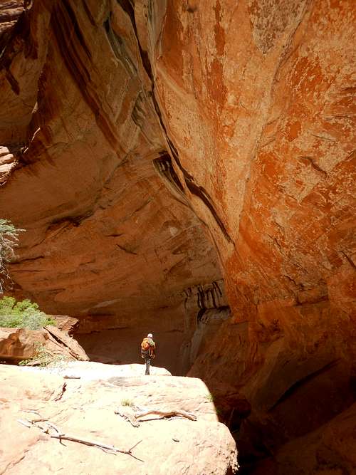
May 27: Echo Canyon (Utah)
Kessler and I completed the Echo Canyon Route in Zion National Park. The park was crowded(!), but we saw no one in Echo Canyon. It took us four hours to get from the East Entrance, to pick up our permit and drysuit, and to wait in line for the shuttle before finally arriving at the trailhead. We didn't start up the trail until 2:40 PM.
We were carrying a lot of gear since it was only my son and I and since we were told that there was a difficult keeper pothole in the canyon. I even carried a small rubber raft and Kessler carried a life jacket just in case. Several people were wondering what we were doing with a life jacket on the trail.
We made our way to the top of the canyon and scrambled our way into the slot. Almost immediately the cold swims began and they were very COLD since the snow and ice had just melted out of the canyon. I was chilly in my 4/3 wetsuit and I wished I had brought gloves for us.
The rappels and downclimbs were fun and the narrows were nice. The canyon was a lot wetter than when we did it before. The keeper pothole wasn't a problem and we really didn't need to bring all that gear.
After exiting the slot, we took some time to dry off and hiked down the trail and back to the shuttle.
At around 8 PM, the rest of the group called us and said that they changed plans for Imlay Canyon the next day, and they planned to be on the trail by 2 AM. Since we stayed up very late the night before (driving) and since we hadn't even eaten dinner yet, and since I wanted to pick up more cold water protection in the morning, we opted to not do Imlay. It was a big disappointment.
May 24: Cedar Mountain (Colorado)
Alone, I did the medium loop on Cedar Mountain. It was a good hike, but the sunset wasn't as good because of cloud cover.
May 22: Spring Creek (Colorado)
Kessler, Shaylee, Kimberly, and I hiked up Spring Creek near Steamboat Springs. We hiked three miles before having to return.
May 21: North Castor (Colorado)
Today I climbed North Castor alone. I hadn't been there for years. I spent too much time on ridge and had to come down the cliff bands in the dark, but it wasn't that bad.
May 20: Cedar Mountain (Colorado)
Again I did the loop hike on Cedar Mountain.
May 18: Cedar Mountain (Colorado)
Kimberly and I did an evening hike of Cedar Mountain, completing the long loop. The sunset was great.
May 17: Cedar Mountain (Colorado)
Alone, I completed the long loop on Cedar Mountain in the evening. There was a nice sunset and the weather was great.
May 10: Sand Rocks (Colorado)
Kessler and I did an evening hike over the Sand Rocks.
May 7: Quarry Trail/Sound of Silence Loop (Utah)
We did some short hikes in Dinosaur National Monument today. First we hiked up along the Quarry Trail up to the Dinosaur Quarry and Wall of Bones. After seeing the quarry and wall, we hiked back down the trail (there is a shuttle, but we opted to walk) and drove to the Sound of Silence Trail. We hiked half of the loop under cloudy skies, but it never did rain.
May 3: Sand Rocks (Colorado)
I did an evening hike over the Sand Rocks.
May 1: Sand Rocks/Cedar Mountain (Colorado)
In the afternoon, I hiked over the Sand Rocks from west to east. In the evening, Kim and I did the short loop on Cedar Mountain, completing the hike right at dark. There was a nice sunset and we saw several deer.
April 30: Peak 6140 (Utah)
Today Kessler and I, along with two good lead climbers made an attempt on a beautiful and spectacular un-named peak in Utah today. It is a tough one and we were stopped by a crux wall 300 feet from the summit. I believe that the summit is still unclimbed, but we were hoping to find a reasonable route up. There is no mid-5th class route here, it is quite a bit harder. We think we found a reasonable line, but it is very challenging.
It was drizzling and snowing a bit today, which made our route treacherous in places.
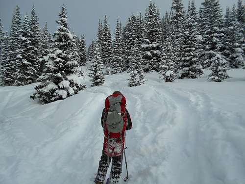
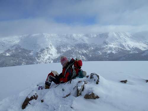
April 23-24: Galena Mountain (Colorado)
April 23
Shaylee, Kessler, Kimberly and I set off for Uncle Buds Hut. We planned to climb Galena Mountain the next day.
We didn't leave the trailhead until after 1 PM, so we snowshoed relatively quickly. The first half of the route was in bad condition since it was melted out for much of the time and there were many bare spots.
The second half of the route was in better condition. We made the hut in about four hours and arrived just before it began to snow.
April 24
There was a blizzard in the morning. The wind was really howling and the viability poor. We decided not to climb Galena Mountain. We packed up and headed back down the mountain in the snow. Although it was snowing, in the trees, we were sheltered from the wind so it wasn't bad. The lower part of the route was still in bad condition since the new snow wasn't enough to cover the bad spots.
April 22: Cedar Mountain (Colorado)
Shaylee and I hiked the long loop on Cedar Mountain. We saw several deer. It was a nice hike and there was only one snow bank on the trail and one short section of mud.
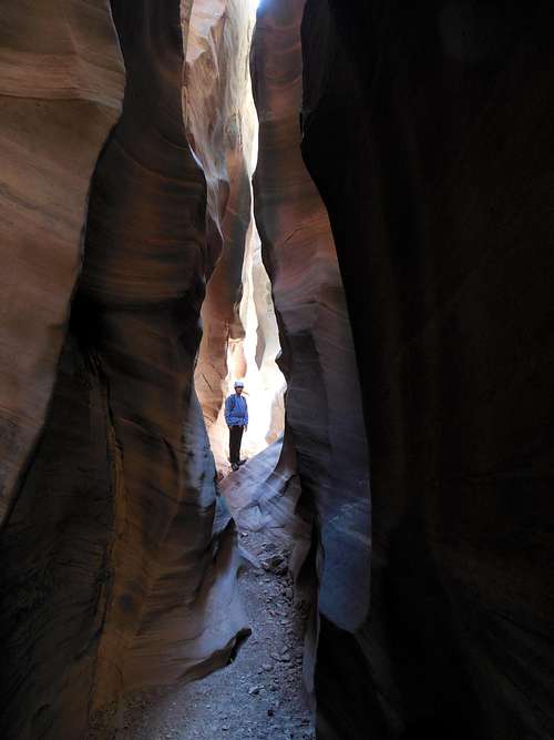
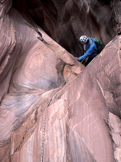
April 17: Baptist Draw/Chute Canyon (Utah)
The weather forecast was good and the skies looked mostly clear, so Justin, Kessler, and I headed out for the head of Baptist Draw. The drive took a little longer than expected, but we had started early so had plenty of time to explore the canyon.
We took off from the trailhead and made our way into Baptist Draw. It was a nice slot canyon. At the first 12 foot drop, we opted to rappel. Previously I had downclimbed the drop. After that, it was a nice descent to the top of the big rappel. It's only 65 feet high, but for some reason it looks a lot higher from above.
After rappelling into Chute Canyon, we took a little break before heading up canyon. This is one of the best slot canyons around and is is nearly dark in places. It is a very impressive slot canyon and very deep. The slot was also a little more difficult than it was previously since a log was wedged in the slot at one drop and it was a pain to climb around. The drop at the head was also a bit tougher than I remember it.
After that it was just a cross country scramble and ramble back to the trailhead. It was a great slot canyon loop and we were glad to do it.
April 16: Sneak Canyon/Three Canyon/Baby Slot (Utah)
Justin, Kessler, and I set off to go canyoneering in the Three Canyon area south of Green River. Because of the forecast, we decided not to do any technical canyons, but by morning the forecast had changed and there was only a 20% chance of rain. It was still cloudy, so we didn't want to chance a long slot canyon.
We chose to descend Sneak Canyon, a pleasant, but short side canyon of Three Canyon that I had descended many years earlier. It should be short enough that we could hurry through safely in case it did rain. On the way out we stopped at the Chaffin Geyser, which was spitting and having small eruptions, but it didn't have a big one.
After driving to the trailhead, we spent some time fixing some ropes at the exit route before heading to the head of the canyon. The canyon had a few small pools that required some acrobatic skills to keep our feet dry, but the canyon went smoothly and was really fun and enjoyable.
After reaching the confluence of Three Canyon, we hiked down Three Canyon to the river. Along the way, we went up the Baby Slot canyon to a dryfall before heading back down and to the river. After reaching the river, we retreated and did the side canyon to the south. It ended in a big and impressive headwall.
After exploring the side canyon, we hiked back up Three Canyon and up Sneak Canyon to the exit. As always, the exit was an exciting scramble and we were thankful for the fixed rope.
After Sneak Canyon had been completed, we headed over to "Baby Slot", the next side canyon east. The initial climb was harder than I had remembered and is probably 5.5 or so. We downclimbed that and into the slot. We explored down canyon and through the slot. It was better than I had remembered and was actually a good little canyon.
After exploring to near the big drop, we climbed back up canyon. I scouted out another exit, but joined the others to climb out via the exit at the head of the canyon. It was a bit challenging. After completing the Baby Slot, we headed back for Green River.
April 10: Mount Olympus Trail/Bonneville Shoreline Trail (Utah)
Kessler, Shaylee, Kim, Mark (brother), Matthew (nephew), Josh (nephew), and I hiked up the Mount Olympus Trail and the Bonneville Shoreline Trail for a few hours. We did not have time to climb to the summit.
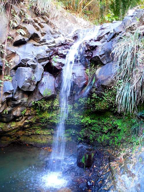
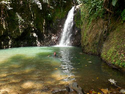
April 8: Annandale Falls Falls/Grand Anse Beach (Grenada)
Kimberly and I rode the bus to Annandale Falls, where we took a refreshing dip and hiked the nearby nature trails. The falls was quiet since it was afternoon and since no cruise ships were around.
After the falls, we walked most of the length of the Grand Anse Beach, seeing the sunset. The sand here is softer than any other beach I have ever been on.
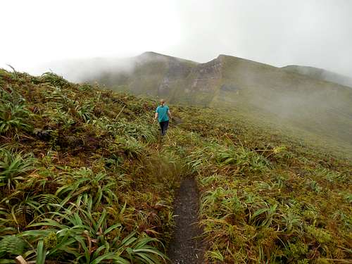
April 7: La Soufrière (Saint Vincent)
Kim and I flew to Saint Vincent the night before, so we were tired by the time our ride came to pick us up. We could have taken the bus, but we were really pressed for time since we had to catch a plane back to Grenada that afternoon.
La Soufrière is an active volcano and the last big eruption was 1979. We found the trail to the summit to be a scenic one and very enjoyable. It wasn't very slippery for a rain forest hike and there was only a little mud. The route was very beautiful as well.
We passed some nice pools and small waterfalls part way up. After that, the trail steepened, but it never got too bad, though it was quite steep near the summit.
The upper mountain was socked in with clouds most of the time and it rained. By the time we got to the crater, there was enough views through the clouds to see the bottom of the impressive crater at times. We then walked west to the highest point on the south side of the crater. The end was a steep scramble up some slippery rocks. We did get some views of the ocean, but they were so short lived that they were gone by the time I got the camera out.
The true summit of La Soufrière is actually on the north side of the mountain, but it's a long way over to there and we didn't have time to climb it. The views aren't as good from there anyway as it's a long way from the main crater and you can't see it well.
We headed back down the mountain and to the nice waterfalls, where we took a break and ate some lunch. After that, we hiked back to the trailhead. I would consider this to be one of the best hikes in the Caribbean.
Unfortunately, once we were back to the airport, the plane was delayed for several hours and there was no where to get any food or drinks, other than alcohol.
April 5: Mount Saint Catherine (Grenada)
Today Kim and I climbed Mount Saint Catherine. We were thinking of doing the hike on our own, but we heard some horror stories about the condition of the route. This time, the route lived up to the hype. We were also very tired since we spent much of the previous night watching the sea turtles.
We took a bus to Paraclete and walked up the steep concrete road to the radio towers. From there, the route immediately got challenging. There was a lot of razor grass which stung like hell and lots of steep slippery mud and some bushwhacking. We had brought long pants, but wish we had brought long sleeve shirts as well.
We slowly made our way to the summit. It was pretty challenging since the trail hadn't been cleared in a long time. Once at the top we were greeted by an old derelict radio tower (serviced by helicopter). It was no longer functional. We ate lunch at the summit before heading down the Victoria side of the mountain.
The route was very challenging and muddy and landslides had obliterated some sections of the trail. This time, the guides came in very handy and the route would have been harder without knowing the correct route. Even then, we got turned around a few times.
The going was very slow and challenging and we didn't make it to the trailhead until nearly dark. We did see some monkeys near the end of the hike. The hike was pretty, but I was a bit disappointed with it. Although it was the highest mountain on the island, I thought the Mount Qua Qua to Concorde Falls was a more scenic hike and it wasn't as difficult either. We also didn't pass any waterfalls on this route. We took the bus and arrived at the hotel quite late.
April 4: Seven Sisters/Grand Etang Lake (Grenada)
In the morning, Kim and I took a bus to the Seven Sisters Waterfall Trailhead. We hiked down the good trail to the first two watefalls, which we very beautiful. I had a most refreshing swim in the pools, but Kim didn't want to get wet.
We also climbed up to the other waterfalls. Since our shoes were so muddy from the previous day's hike, we didn't take them and we did the route in sandals and flip flops. Shoes would have been much better and the climb up was challenging. We decided not to jump down all the falls, which has been done before.
After taking another dip, we headed back down. I had to do much of the climb down barefoot since I was wearing flip flops.
We then hiked back up to the trailhead.
Another couple who were at the trailhead gave us a ride to Grand Etang Lake. We hiked part way around the lake, but we ran out of time and had to head back.
That night we went to see the sea turtles nesting at Levera Bay. It was n incredible experience, but we returned to the hotel very late.
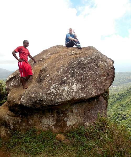
April 3: Mount Qua Qua/Concorde Falls (Grenada)
In the morning, Kim and I set off to climb Mount Qua Qua and to do the route down to Concorde Falls. The weather was good and it was a perfect day to complete the route.
We saw a monkey at the trailhead, which entertained us for a while. At the trailhead, we got talked into a guide since the trail from Mount Qua Qua to Concorde Falls was said to be obliterated by Hurricane Ivan and it was supposed to be hard to find and in bad condition.
We made our way up to the summit of Mount Qua Qua, which was a very pleasant and scenic walk. There was a little mud and some steep places, but overall it was an easier ascent by rain forest standards. We found the written descriptions of exposure and steep scrambling to be highly exaggerated. At the summit, was an interesting boulder to climb, and adding more interest to the area.
After enjoying the summit, we headed down to Concorde Falls. The turnoff was marked, so it wasn't hard to find the trail. The route was pretty challenging and steep though and had quite a bit of mud. We passed a small, but beautiful waterfall and then the route got more challenging. There were some exposed sections, including a 50 foot/15 meter cliff do downclimb, which was aided by a fixed cable. It was an interesting route.
Eventually we reached the highest of the Concorde Falls (also known as Foountainbleu Falls) and it was very beautiful. We should have brought our swimsuits as the pool looked really inviting!
After the falls, it was a fairly easy hike down to the trailhead. We saw one snake along the way. There were two more really nice waterfalls at the trailhead, which we also visited.
It was a great hike and perhaps the best hike on the island of Grenada. Since we are experienced hikers and climbers, we could have done without the guide since the route wasn't difficult to find. The entire route took us five hours.
March 26: Emerald Mountain (Colorado)
Kessler and I snowshoed up to the summit of Emerald Mountain on a nice day and with good snow conditions. I did get a blister, so I was dragging a little, but other than that it was a routine ascent.
March 20: Main Canyon/Spring Canyon (Colorado)
Shaylee, Kimberly, and I hiked up Main Canyon to the junction and then hiked up Spring Canyon past the rock formations. I was still dragging because I wasn't feeling well.
On the way back, we met the Granlunds, who we hadn't see for several years and whom we attempted Elbrus with back in 2003. They showed us the wild horses on the hill as we had walked by them.
It was a good trip.
March 19: Liberty Cap (Colorado)
Shaylee, Kimberly, and I make the hike up to Liberty Cap from Grand Junction. I made the final climb up to the summit; it is a bit harder now that the metal ladder has been removed.
I was dragging a bit because I wasn't feeling well. Kim and Shaylee had to wait for me several times.
March 12-13: New York Mountain (Colorado)
March 12
Kessler, Shaylee, and I started late from the trailhead (1:30 PM) and snowshoed up to the Polar Star Hut. It was snowing much of the time and the snow was very wet, which soaked everything. We made it to the hut in a relatively fast four hours.
March 13
We awoke to 16F and clear skies and decided that it was a good day to climb New York Mountain. We broke trail to timberline, at which point it was breezy and cold. We went over the big false summit and then followed the steep and sometimes rocky ridge to the true summit. Along the ridge, there were some monster cornices to stay away from.
The views were really great, but the climb took us much longer than expected. After a short break, we headed back down to Polar Star. After that we packed up and headed down, but we missed to turnoff for the shortest route, so we took a slightly longer route down. We were tired by the time we reached the vehicle.
It was a good trip.
March 8: Rifle Arch (Colorado)
On the way back from Grand Junction, I made a quick run up to Rifle Arch. The trail was mostly dry, but there were a few muddy places.
March 5: Dry Creek (Utah)
Before a wedding, Kessler, Shaylee, Kimberly and I hiked up Dry Creek, in the foothills of Mount Timpanogos. We made it to the Curly Spring Trail and hiked a bit farther on that trail before we had to turn back.
February 28: Sand Rocks (Colorado)
In the afternoon, I took a hike over the Sand Rocks, east to west. There was quite a bit of postholing. I should have taken snowshoes!
February 27: Rifle Falls (Colorado)
Kessler and I went on a scout camp at Rifle Gap with two other scouts and one other leader. In the morning we did the trails around Rifle Falls and also explored the caves. It was a good trip.
February 21: Cedar Mountain (Colorado)
This evening, I snowshoed up Cedar Mountain, completing the long loop. The first half of the loop was somewhat easy, with only a little postholing, but the second half was much more challenging and took much longer than expected.
I saw a huge rabbit that was completely white and several deer. There was a nice sunset from the summit as well.
February 13-15: Hagerman Pass (Colorado)
February 13
Today was the first day of our three day adventure to Betty Bear Hut, Hagerman Pass and Skinner Hut. Kessler, Shaylee, and I got a much later start than planned (almost noon), so we had to hurry. The first 4.75 miles to the hut was pretty gentle, but the last 2.25 miles was much steeper. It is one of the steepest sections of route to any backcountry hut.
The weather started out clear and warm, but with approaching clouds, we made the hut in 4 hours 20 minutes, which was enough to get up before dark.
February 14
This morning we had a decision to make. Hagerman Pass is said to be very treacherous in bad weather and we would have to cross it in order to reach Skinner Hut. We discussed this in the morning. Shaylee wanted to go back, Kessler, was neutral, and since the weather didn't look terrible, I thought we should push on. The weather forecast had only predicted 1-3 inches of snowfall.
We started towards the pass in the morning. The route isn't marked very well, so it takes navigation skills. It began to snow maybe 2/3 of the way up to the pass. The visibility was still OK, so we pushed on, reaching the pass in a full-fledged snowstorm. We decided to forgo climbing Divide Peak, which was the original plan, but we did climb one small summit in the vicinity of the pass. We made our way to Skinner Hut, while pulling out the map several times.
Five other people were in the hut when we got there, and they had snowshoed up from the east the day before. Apparently seven others didn't make it to the hut.
February 15
A severe blizzard lasted all night. I felt guilty for taking the kids there is such bad conditions, but the weather forecast had said that it was supposed to clear up today. I woke up at 4 AM because I was worried about having to recross the pass. We could go down the east side of the mountain, but that would put us a very long way from our vehicle.
Finally, and after much pondering, we decided to try the route up and over the pass. The kids and I started along the route and found that any signs of the previously broken trail were invisible. We continued through the maelstrom and blizzard. Visibility was extremely poor up to timberline. At timberline, visibility disappeared completely and the wind was screaming.
I contemplated turning back, but a look at the map said that we weren't too far from the pass. We decided to push on. Visibility dropped to nothing and we couldn't see the ground beneath our feet. The kids really got blown around and it was hard for me to stay standing as well. Shaylee screamed (she had to scream because the wind was so loud) "Dad, can you see anything?!". I said: "no, but the wind is being funneled through the pass. If we keep climbing directly into the wind, we will reach the pass". It was a real struggle and the wind screamed back in protest, doing its best to blow us down.
After much struggle, we reached the pass. We didn't rest at all, but immediately continued west, feeling our way through the storm. We were able to locate a marker pole and were greatly relieved. It took some time, but we were able to locate the next pole and the next until visibility improved not far below the pass. Although it was still snowing, visibility improved greatly as we lost elevation.
All traced of previous tracks had been obliterated by the storm, so Kessler set out breaking trail. We could see the bare spot that we had to head to and we could just barely made out a distant trail cut on the mountainside. We headed for that. Although it was challenging, trail breaking wasn't too bad since the snow was firm below the one and a half feet of powder. We moved quickly and on track until we were about a half a mile or so from Beatty Bear Hut. We met two skiers at that location and we were relived that we would have another trail to follow, made by the skier. After a brief chat, we headed towards the hut, meeting a few more people as we got near it.
It had taken us 3.5 hours to travel to 4.5 miles from Skinner Hut to Beatty Bear Hut, which is an excellent time considering the circumstances. We were exhausted, so we took a quick lunch break. By this point in time, everyone had had enough and we made the last 6.9 miles in a very quick 2.5 hours, which is very fast considering that we were on snowshoes. It snowed on and off and the way back, but it didn't slow us down much.
We made it down to the vehicle and were happy with what we accomplished. It was another good adventure.
February 5-6: Wingle Ridge (Colorado)
February 5
Shaylee, Kessler, Kimberly, and I set off to snowshoe up to Chucks Cabin (a backcountry cabin near Vail Pass). We got a much later start than planned. Also, upon reaching the trailhead, we found that we had forgotten the food bag and that it was left at home.
At 9:35 PM, Kimberly, Kessler, and Shaylee dawned headlamps and set off for Shrine Pass. I headed back towards Vail in order to buy food. Upon returning to the trailhead at Vail Pass, the snowcat operator was on the way to Shrine Pass. I asked for a ride and he kindly obliged. Luckily I reached the pass right at the same time as the rest of the family.
We then snowshoes to Chucks Cabin, reaching it at 11:05 PM.
February 6
We awoke to clear skies and -20F. Kimberly didn't feel well, and Shaylee had some big blisters, so Kessler and I headed up to the Wingle Ridge. The approach took longer than expected since we had to break trail. It was a very sunny day, but once we reached the ridge it was very windy and cold. We trudged on over the two false summits and to the true summit of Wingle Ridge. Since it was cold and windy, we only spent a brief time on the summit before heading down. The views were great though.
Upon reaching Chucks Cabin, we packed up and all snowshoed down to the trailhead. Unfortunately, Shaylee ended up with some pretty big blisters.
January 29: Cerro Santa Lucia (Chile)
Kessler and I made the short climb up to the Cerro Santa Lucia in Santiago. The views were great. We also did a lot of other walks in town.
January 28: El Morro (Chile)
After walking along the beaches for a while, Kessler and I climbed the highest hill around, known as El Morro.
January 27: Bahia Inglesa (Chile)
Kessler and I did a hike along the beach in either direction from Bahia Inglesa. We saw much sea life, including some large crabs.
January 23-26: Ojos del Salado (Chile)
January 23
It was the first day of our attempt on Ojos del Salado. From 4900 meters (16,076 feet) elevation, we walked up to the Refugio Atacama at 5210 meters (17093 feet). We set up camp in the strong winds and setting up the tent was a challenge.
January 24
Total was a haul day. We carried gear up to Camp Tejos at 5837 meters (19150 feet). Unfortunately the refugio at camp was pretty dirty. At the refugio, we talked to one group consisting of two Americans and one German. They were to attempt the mountain the next day.
January 25
In the morning, the Russian expedition, run by Alex Abramov got a detailed weather forecast by satellite phone and warned us about high winds for the next three days. Unfortunately, Kessler and I didn't have that many days to spare so we headed up towards camp Tejos. The Russians also headed up there, but after that they were going to retreat for four days and wait for better weather.
We also met the American/German Team. They were also retreating down the mountain to wait for better weather. That meant that we would have the mountain all to ourselves, though the conditions would not be ideal for a summit attempt. On the way up it was windy and cloudy and some of the mountains had some large lenticulars over them. We made it to Camp Tejos with no problems.
I had a slight cold, but breathing at the altitude of Camp Tejos was a nightmare at that altitude, at least during the night. I also coughed a lot.
I was able to eat two cup o soups and Kessler was able to eat one. Even though we were to get up early, the night was still long and I didn't get hardly any sleep. Kessler seemed to get more. I don't have any desire to sleep that high again anytime soon!
January 26
After a rough night of coughing, my alarm went off at 2 AM. Since it was very windy and since Kessler and I were both coughing, we decided to postpone the summit attempt for a couple hours. I reset the alarm for 4 am and we went back to bed. When the alarm went off at 4, we started packing up and getting ready. Fernando didn't think that it was a good idea to make the attempt since we were coughing and it was very windy and cold (cold enough to freeze all the water jogs inside), but it was clear and Kessler and I wanted to see how high we could make it (we didn't expect to make the summit with the current conditions).
After a small breakfast, at 5 AM we started up the mountain slowly in the cold and wind. The moon was almost full, so we turned off the headlamps just before starting.
Although we were wearing the same clothing, Kessler had trouble keeping warm in the strong winds. I had more "body insulation" to keep me warm. We decided to keep on pushing up slowly. We stopped briefly at 6000 meters and again at 6220 meters (20,407 feet), which is about the same time the sun came up (around 7 AM). We were near the edge of the "glacier" though it appears to be more of a permanent icefield.
The views were really nice and the sky was clear, but the wind sucked away any heat our bodies could generate, so we decided to retreat. Our summit attempt was over. We had one day to spare, but none of us wanted to suffer through another night at Camp Tejos and the conditions weren't supposed to improve the next day anyway.
We hiked rather quickly down the mountain and to Tejos. We packed up our stuff and then descended to Refugio Atacama where we packed up the tent and retrieved the rest of the gear we left behind. We said goodbye to the Russian expedition and got in the Hilux (Toyota Truck) for the long ride down to lower altitudes. Fernano was driving and we actually drove all the way to Bahia Inglesa. It was quite a change to go from 6220 meters (20,407 feet) to sea level on the same day! After checking into the hotel, we walked around a little and rested.
January 22: Laguna Verde (Chile)
Today was a planned rest day. Kessler and I walked around before walking to the fresh water stream at the west side of Laguna Verde. We say one flamingo and a white bird. we explored some shallow caves.
The sun was really intense and felt hot, so we decided to find a cave that might be good for a rest. One of the caves had a rough floor and one had a sandy floor. Since it was so hot (surprising at this elevation), we took a rest and I even took a nap in the cave with a sandy floor.
In the afternoon, we did the same walk again with Fernando and one of his friends, but this time we climbed to the top of the cliffs that formed a small mesa-like peak. Fernandos friend free soloed a 5.8 wall, but I wasn't happy about it.
The climb up to the cliffs was very sandy and strenuous, but there were good views from the top.
Back at camp, the Russian expedition offered us dinner. We had a 1/2 portion and it sure was good. After that, we ate our other dinner in camp.
January 21: Mulas Muertas (Chile)
Today we set off for Mulas Muertas. We climbed it right from Laguna Verde. The summit of Mulas Mertas is actually a long way from the lake and extremely long day climb from there, so we only went up to the first false summit on the ridge. We could have climbed farther along the ridge, but it was supposed to be a rest day and we had to save our energy for Ojos del Salado. Since we were well above 5000 meters though, it made a good acclimatization climb.
Once again, it was very windy and my hat kept blowing off. We had some great views of Laguna Verde, Incahuasi, and many other volcanoes.
January 20: Laguna Verde (Chile)
Today we traveled by truck to Laguna Verde (4300 meters/14,200 feet). The lake is extremely salty and I tried to wash our clothes in it. That was a mistake. It made them stiff and salty. I washed them another three times in the fresh water hot springs, but they were still a little stiff. We also took some nice baths in the hot springs.
Setting up the tent in the strong wind was challenging. The wind always seems to blow here.
After dinner, Kessler and I walked west along the south shore of the lake to a freshwater spring and to some big cliffs made of volcanic tuff. There was one flamingo in the pool at the spring.
In the late evening, Kessler and I played UNO with the Russian expedition in their big dining tent. I wanted to ask them about joining them on a future expedition to Peak Lenin, but we only played cards. They gave us some chocolate as well. We ended up going to bed very late.
January 19: Siete Hermanas (Chile)
Today we climbed Siete Hermanas (also known as Siete Hermanos). We made pretty good time up to the summmit (4890 meters/16,043 feet). It was clear and the views were great. Kessler was the first one to the summit. We could see many volcanoes from the summit and the views were great.
January 18: Laguna Santa Rosa (Chile)
In the morning, Fernando drove us to the Laguna Santa Rosa. There were many flamingoes in the lake. We also saw vicuñas and guanacos. We hiked around to the other side of the lake and climbed a small peak for the views.
The wind is relentless here and blows constantly. On the summit of the peak, many of the flat lying rocks were vertical became the wind had blown them that way!
We had good views of Tres Cruces, some of the highest mountains in South America.
January 17: Valle Chico (Chile)
In the afternoon, we were at Valle Chico, at a beautiful spring and oasis surrounded by canyon walls. Kessler and I hiked up the valley and explored around an old mining camp and some caves.
January 9-10: Prospect Peak/Charles Peak (Colorado)
January 9
Kessler was supposed to go with me on this trip, but he had a bad ingrown toenail, so I got to go with Shaylee. We had a reservation for the Peter Estin Hut. Since we didn't start towards the hut until 1 PM, we hurried fast.
The route up went pretty uneventful and we made the 4.4 miles with 2000+ feet elevation gain in less that three hours, which is good considering we were on showshoes. The guidebook said the route take 5-7 hours, so we were pleased with ourselves. There was some light snow at times, but the weather wasn't that bad.
January 10
Shaylee and I set off to climb Prospect and Charles Peaks. It was a somewhat mild 1F (-17.5C), which was much warmer than our Christmas trip.
Unfortunately, the route towards Charles Peak was not broken and there was lots of strenuous trailbreaking. Shaylee broke the whole trail up, but I would still sink to my chest at times. The powder snow was really deep!
We made slot progress up to the summit of Prospect Peak (11,860 feet). The views were spectacular. We then headed towards Charles Peak (12,050 feet) and climbed up the scenic ridge to the summit. There were some clouds at times, but the weather was pretty good. The chill factor was -22F (-30C), but we were working hard! It actually took us as long to get to the summit of Charles Peak from Peter Estin Hut than it did from the trailhead to Peter Estin Hut!
After enjoying the summit, we headed back down to the hut. I wanted to try a shorter route down, but it was a mistake and we had another long trailbreaking experience. We should have went back over Prospect Peak on our previously broken trail After finally reaching the hut, we ate a quick lunch and then snowshoed rather quickly down to the trailhead.
It was a great trip and the summit of Charles Peak was well earned!
January 2: Hog 2 (Utah)
Kessler and I joined four other canyoneers in order to complete Hog 2 canyon, which is a good one. We took an alternate route around the first rappel by doing a steep side slot. The 5.6 traverse over to the slotwas quite exposed, but I went first without a rope. The others except for the last person had a belay.
After that, there were a few raps, but it was mostly downclimbing and squeezing through the slot.
The end of the canyon has a spectacular dark slot near the exit. In order to exit the slot, we took the 5.3 exit between Hog 1 and 2 canyons. It was a good canyon trip.
January 1: The Twist/Lower White Canyon (Utah)
Kessler and I attended Freeze Fest, a canyoneering gathering in North Wash. On January 1, the rest of the group did the Black Hole of White Canyon, but I didn't know if we had enough neoprene, so Kessler and I opted for something different.
We followed the rim of Lower White Canyon down to near Lake Powell. From there we found a nice little technical slot dropping into White Canyon which we dubbed The Twist. There were some nice twisty narrows and then some nice downclimbs and then some acrobatic work to get around one pothole.
Once in White Canyon, we hiked up canyon, bypassing most of the ice filled pools. Near the highway bridge (which spans the canyon 300 feet above) we got to a pool which we couldn't bypass, so we took off our shoes and socks and busted through the ice and waded across in knee deep water. It was cold, but luckily the only water we couldn't bypass. We hiked as far up White Canyon as we could without swimming. Once we were at the exit, we heard the rest of the group coming down White Canyon so we waited. We exited with the first part of that group. As always, Lower White Canyon was very scenic.
Accumulated Totals for 2016:
Days that I went hiking or climbing: 151
Summits Climbed: 88
Summits Attempted: 96
Rock Towers/Technical Buttes: 4
Rock Towers/Technical Buttes Attempted: 5
Technical Canyons: 14
Technical Canyons Attempted: 14
Overseas Climbs: 16
Goals for 2016:
Days spent hiking or climbing: 130
Summits: 75
Summits with the kids: As many as possible!
Rock Towers: 5
Technical Canyons: 20
Highest Elevation Reached
20,407 feet (6220 meters) on Ojos del Salado; January 26.
Highest Elevation Reached in USA
14,270 feet (3949 meters) on Quandary Peak; November 5.
Highest Sleeping Altitude
19,150 feet (5837 meters) at Camp Tejos; January 25-26.
Highest Sleeping Altitude in USA
11,680 feet (3560 meters) at Glacier Creek (Colorado); February 14-15.
Highest Elevation Climbed To By Month
| Month | Feet (USA) | Meters (USA | Feet (World) | Meters (World) | |
| JAN | 12,050 | 3673 | 20,407 | 6220 | |
| FEB | 11,980 | 3652 | 11,980 | 3652 | |
| MAR | 12,550 | 3825 | 12,550 | 3825 | |
| APR | 11,380 | 3469 | 11,380 | 3469 | |
| MAY | 7524 | 2293 | 7524 | 2293 | |
| JUN | 10,815 | 3296 | 10,815 | 3296 | |
| JUL | 12,400 | 3780 | 12,400 | 3780 | |
| AUG | 13,234 | 4034 | 13,234 | 4034 | |
| SEP | 12,757 | 3888 | 12,757 | 3888 | |
| OCT | 12,186 | 3714 | 12,186 | 3714 | |
| NOV | 14,270 | 4350 | 14,270 | 4350 | |
| DEC | 10,050 | 3063 | 16,074 | 4900 |
Highest Outdoors Sleeping Altitude By Month
| Month | Feet (USA) | Meters (USA | Feet (World) | Meters (World) | |
| JAN | 11,200 | 3414 | 19,150 | 5837 | |
| FEB | 11,680 | 3652 | 11,680 | 3652 | |
| MAR | 11,040 | 3365 | 11,040 | 3365 | |
| APR | 11,380 | 3469 | 11,380 | 3469 | |
| MAY | 5880 | 1792 | 5880 | 1792 | |
| JUN | 6700 | 2042 | 6700 | 2042 | |
| JUL | 10,050 | 3063 | 10,050 | 3063 | |
| AUG | |||||
| SEP | 11,135 | 3394 | 11,135 | 3394 | |
| OCT | 10,680 | 3255 | 10,680 | 3255 | |
| NOV | 11,350 | 3460 | 11,350 | 3460 | |
| DEC | 9725 | 2964 | 13,974 | 4260 |
December 2
Highest ascent in Bonaire; 792 feet (241 meters) on Mount Brandaris.
November 28
Highest ascent in Curacao; 1220 feet (372 meters) on Christoffelberg.
November 26
Highest ascent in Aruba; 541 feet (165 meters) on Hooiberg.
June 5
Highest June ascent in Washington; 10,781 feet (3286 meters) on Mount Baker.
June 4-5
Highest June sleeping altitude in Washington; 6700 feet (2042 meters) on Coleman Glacier.
April 7
Highest ascent in Saint Vincent; 3281 feet (1000 meters) on La Soufriere.
April 5
Highest ascent in Grenada; 2760 feet (841 meters) on Mount Saint Catherine.
February 14-15
Highest February sleeping altitude; 11,680 feet (3560 meters) at Glacier Creek (Colorado). Previous sleeping altitude record was 11,540 feet (3517 meters) at Resolution Mountain (Colorado) on February 8-9 2014.
January 26
Highest ascent in Chile; 20,407 feet (6220 meters) on Ojos del Saldado. The previous record for Chile was 18,045 feet (5500 meters) on January 21 on Mulas Muertas.
January 25-26
Highest sleeping altitude; 19,150 feet (5837 meters) at Ojos del Salado (Chile). Previous sleeping altitude record was 17,008 feet (5200 meters) at Gorak Shep (Nepal) on December 23-25 2012.
Nice start off to 2016!!!!
Comments
Post a Comment