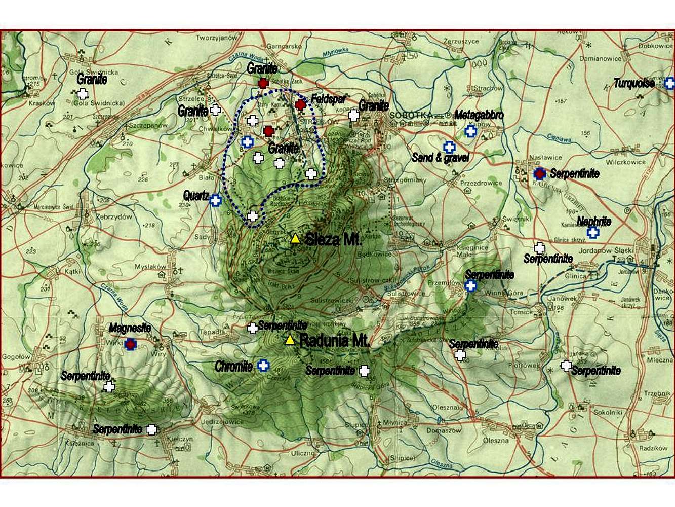
A scheme map of quarries and mines in the area of the Sleza Massif. The past objects are marked by white crosses, the others still open in red. Sites documented in this album are outlined in blue. An area of granite quarries working during the Roman and Mediaeval Periods is encircled by blue dashed line.


