

-
 22754 Hits
-
 95% Score
-
 50 Votes
|
|
Mountain/Rock |
|---|---|
|
|
45.84990°N / 6.92340°E |
|
|
11607 ft / 3538 m |
|
|
Overview
What's new:
- Jul 13th, 2017 Inherited the page from Brenta.
- Aug 11th, 2017 Started to modify the page and the other sections.
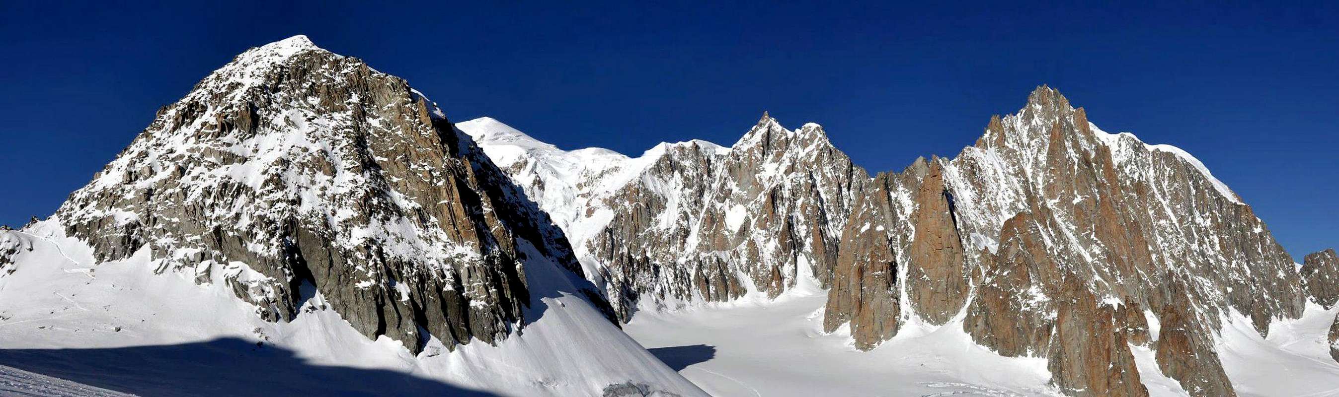
Aiguille de Toula (3.538m) is a minor summit in the Mont Blanc group situated between Aiguille d'Entrèves (3.604m) to the southwest and Grand Flambeau (3.566m) to the East, along the watershed that divides France from Italy. The north side of Aiguille de Toula descends to the Géant glacier, while the south side presides over the Toula glacier. Thanks to its proximity to Punta Helbronner--reachable by cable car--Aiguille de Toula is a popular destination. The easiest route to its summit requires nothing more than scrambling up easy broken rocks. The approach, however, is on glacier: proper caution should be exercised. Some sources call this peak Aiguille de Toules or Aiguille de Toule. The version adopted here appears to be the one in common use in Courmayeur. The origin of the name, on the other hand, is not disputed: In the local dialect, the word toula denotes a rectangular pasture. Since there are two such grassy bands on the south side of the peak, Buscaini, in his Monte Bianco, Volume I argues that the name should use the plural toules. The elevations reported in this page are the ones on the italian map of Istituto Geografico Militare (I.G.M.). As is the case with most features along the border, there are small discrepancies with the heights given in the French maps. Besides the standard route, which is suitable as a gentle introduction to alpine climbing, Aiguille de Toula provides more challenging routes, especially on the steep snow of the northwest face. The Toula glacier, in addition, is often descended by expert skiers.
Importante montagna nel Gruppo del Monte Bianco che si trova tra l'Aiguille d'Entrèves (3.604m) a sud-ovest e il Grand Flambeau (3.566m) ad est, lungo lo spartiacque che divide la Francia dall'Italia. Il lato nord dell'Aiguille de Toula scende sul grande ghiacciaio del Gigante mentre il lato meridionale sul ghiacciaio di Toula. Grazie alla sua vicinanza alla Punta Helbronner - raggiungibile con la funivia – l'Aiguille de Toula è una vetta molto frequentata. La via normale non richiede altro che una arrampicata su rocce rotte. L'approccio, tuttavia, è su ghiacciaio: quindi bisogna esercitare una cautela adeguata. Alcune fonti chiamano questo picco l'Aiguille de Toules o Aiguille de Toule, ma la versione adottata qui sembra essere quella di uso comune a Courmayeur. Le elevazioni riportate in questa pagina sono quelle riportate sulla mappa italiana dell'Istituto Geografico Militare (I.G.M.). Come per la maggior parte delle linee di confine, ci sono piccole discrepanze con le altezze date nelle mappe francesi. Oltre alla via normale, che è adatta ad una dolce introduzione all'arrampicata alpina, l'Aiguille de Toula offre percorsi più impegnativi, soprattutto sul ripido versante nord-occidentale. Il ghiacciaio di Toula, inoltre, è spesso disceso da sciatori esperti.
First Ascents
- First in the summit: Giovanni Bobba, Luigi Vaccarone, Casimiro Thérisod and Pietro Re Fiorentin, (Aug 10th, 1895).
- In winter: A. Bonacossa and L. Hosquet, (Jan 05th, 1917).
Getting There
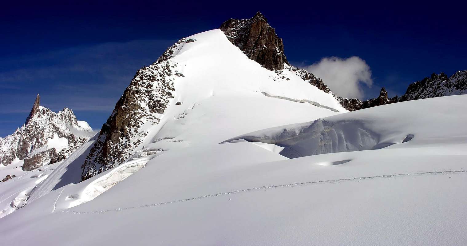
Climb to the Aiguille de Toula
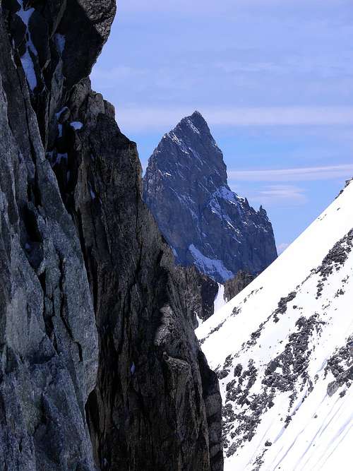
Aiguille Noire de Peuterey (3.773m)
BY CAR:
- From Torino, Milano, etc: Motorway A5. Exit at Morgex.
- From Switzerland: through the Grand St. Bernard Tunnel or the homonym pass.
- From France: through Mont Blanc Tunnel or Petit St. Bernard Pass.
BY PLANE:
- Aeroporto "Corrado Gex" Saint Christophe (Aosta).
ACCESS FROM COURMAYEUR (La Palud) PUNTA HELBRONNER:
- Funivie Monte Bianco S.p.A. - Frazione La Palud n° 22 - 11013 Courmayeur Aosta
ACCESS FROM CHAMONIX-FRANCE:
COMPAGNIE DU MONT BLANC Chamonix-France
The easiest approach to Aiguille de Toula is from Punta Helbronner (3.462m), which can be reached by cable car from Entrèves, near Courmayeur. Punta Helbronner is also reachable from Chamonix via Aiguille du Midi. Please, refer to the main Mont Blanc GROUP page for general directions to Courmayeur and Chamonix.
L'approccio più semplice per l'Aiguille de Toula è dalla Punta Helbronner (3.462 m), raggiungibile in funivia da Entrèves, vicino a Courmayeur. Punta Helbronner è raggiungibile anche da Chamonix via Aiguille du Midi. Fare riferimento alla pagina principale del gruppo Mont Blanc GRUPPO per indicazioni generali a Courmayeur e Chamonix.
Route


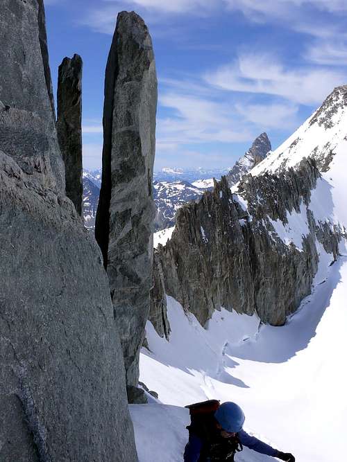
From Punta Helbronner, go to Col des Flambeaux (3.407m) and, veering left, reach the Eastern Col de Toula, (3.411m), between Aiguille de Toula and Grand Flambeau (3.566m). An alternate, longer, and more challenging approach to the col from the south starts from Mont Frety (2.174m), the first intermediate station of the cable car. From there it follows the trail for Rifugio Torino until the grassy slopes turn into rocks. At that point it traverses to the left towards the snout of the Toula glacier and climbs it to the Eastern Col de Toula. From the col the summit is reached by a steep but uncomplicated scramble. The overall rating is F if coming from Punta Helbronner and PD via the Toula Glacier.
Da Punta Helbronner, superare il Colle des Flambeaux (3.407 m) e, girandosi a sinistra, raggiungere il Colle de Toula (3.411 m), tra l'Aiguille de Toula e il Grand Flambeau (3.566 m). Un approccio alternativo, più lungo e più impegnativo al colle da sud parte dal Mont Frety (2.174 m), la prima stazione intermedia della funivia. Da lì segue il sentiero per Rifugio Torino finché le pendici erbose si trasformano in rocce. A quel punto con un traverso sulla sinistra si raggiuge il ghiacciaio di Toula da dove si sale al Colle di Toula orientale. Dal colle medesimo la vetta si raggiunge da una ripida, ma semplice arrampicata.
Difficulty
Difficulty: F+/PD.
Difficoltà: F+/PD.
Gear
Mountaineering equipment, including rope, iceaxe, and crampons.
Da alta montagna, corda, picozza e ramponi.
Red Tape
No permits are required and no fees must be paid to climb Aiguille de Toula. Since it is on the Italian-French border, carry some means of identification.
When To Climb
The period from mid June to mid September usually offers the best conditions. Access on skis is possible year-round--weather permitting. The rock climbs would be substantially more challenging off season.
Camping and Hut
A list of possible camping sites can be found on the main Mont Blanc GROUP page. The most convenient moutain hut for Aiguille de Toula is Rifugio Torino. It is quite possible, though, to climb this summit without spending the night at the hut.
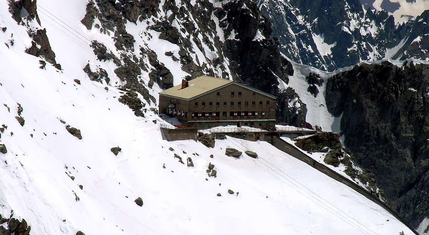
- Rifugio Torino (3.329-3.375m) Tel.: Nuovo numero telefonico +39 3402270121 Cell. Gestore +39 3356184758 Funivie Monte Bianco +39 016589925
Mountain Conditions
- You can get meteo information at the official site of the Regione Valle d'Aosta:
- Valle d'Aosta Meteo
Webcam
- WEBCAM on Aosta Valley:
- Webcam
Books and Maps
BOOKS:
- "Guida delle Alpi Occidentali", di Giovanni Bobba e Luigi Vaccarone C.A.I. Sezione di Torino Volume II (parte II), 25 Maggio 1896.
- "Guida dei Monti d'Italia-Monte Bianco" (Vol.I°) di Gino Buscaini-Club Alpino Italiano/Turing Club Italiano, 1994 (in Italian).
- "I Rifugi della Valle d'Aosta" di Stefano Ardito, Ed. Guide iter, Febbraio 2003.
- "A piedi in Valle d'Aosta" (Vol.1), di Stefano Ardito, Ed. Guide iter, Giugno 2003.


MAPS:
- Kompass "Massiccio del Monte Bianco Valle d'Aosta Sentieri e Rifugi" Carta turistica 1:50.000.
- I.G.C. Istituto Geografico Centrale Torino "Massiccio del Monte Bianco" (n° 4), Torino, 1998 1:50.000.
- I.G.C. Istituto Geografico Centrale Torino "Monte Bianco-Courmayeur-Chamonix-La Thuile" (n° 107), 1:25.000.
- Kompass "Massiccio del Monte Bianco Valle d'Aosta" Carta escursioni, bike e sci alpinismo 1:50.000.
- L'Escursionista "Monte Bianco Courmayeur" (n° 1) Edizioni Rimini 2004 1:25.000.
- IGN Carte de randonnée CHAMONIX - MASSIF DU MONT BLANC 3630 OT 1:25.000.
- Edizioni Tabacco "Mont Blanc" Udine, 1978 1:50.000.
- Studio F.M.B. Bologna 1988 "Monte Bianco-Mont Blanc" 1:50.000.
- IGN institut géographique national grenoble mont-blanc parc national de la vanoise (n° 53), 1:100.000.
Important Information
- REGIONE AUTONOMA VALLE D'AOSTA the official site.
- FONDAZIONE MONTAGNA SICURA Villa Cameron, località Villard de la Palud n° 1 Courmayeur (AO) Tel: 39 0165 897602 - Fax: 39 0165 897647.
- Società Guide Alpine Courmayeur www.Guidecourmayeur.com - Strada Villair n° 2 - 11013 Courmayeur (Aosta) Italy - Tel. +390165842064 Fax. +390165842357 - P.I. 01022640070
- A.I.NE.VA. (Associazione Interregionale Neve e Valanghe).
Useful numbers
- Protezione Civile Valdostana località Aeroporto n° 7/A Saint Christophe (Ao) Tel. 0165-238222.
- Bollettino Meteo (weather info) Tel. 0165-44113.
- Unità Operativa di Soccorso Sanitario Tel. 118.