Dora Overview Baltea
Pictures are by andrea.it, Antonio Giani, Gabriele Roth, livioz, emilius, om, ronfo SalVal & Osw.
![]()
In this particular trip we wanted to highlight the various Dora that run through the valleys of the Valle d'Aosta and marked with this specific place name.
This first part is addressed to torrents of orographic and hydrographic South or right side of Baltea; subsequent work will be devoted to the opposite or Northern, always starting from the Col de la Seigne and Mount Blanc to the ends over the Southern extreme offshoots above small Pont Saint Martin Town, at the end of the Aosta Valley Region.
Always taking into account, as in the seven previous analytical work, the course clockwise we have tried to summarize what are the characteristics and the particular features of the Valleys and the torrents, starting from the South, or from the little Town of Pont Saint Martin, at Eastern Valley of Aosta, coming from Piedmont, to the famous Tourist Resort of Courmayeur, at the foot of Mount Blanc. Hence our work is split, as at the end of the Vény Valley is the starting that area which is the orographic and hydrographic or right side of the Northern Valley of Aosta. This leaves the border with France at Mount Dolent (3819m) to begin the next with Switzerland starting from Ferret Hills at the end of the two, same name for both sides, long valleys. From this point on the border ridge walks in the opposite direction toward reaching the Eastern Group of the Grand Golliaz and the much larger and more important of the Mount Velan. Leaving to North the majestic Group of Combins, entirely in Swiss territory, even if considered a little "valdotain" so that there is a Community of Grand Combin, reaches the Col Fenêtre Durand and Mount Gelé. Then "down" with an endless series of summits to Dent de Bouquetins, Dent d' Hérens, the Matterhorn to the great Mountain Chain of Monte Rosa. From Signalkuppe of this last, leaving even here in the North Point Dufour higher (4633/4m), starts the watershed between the Regions of Aosta Valley and Piedmont, again to the small Mombarone above Pont Saint Martin. It closes in such a way the circle of mountains, valleys and torrents belonging to this region, but this second section, highlighting what has already been exposed, will be part of a subsequent job summarizing the most Northern part.
![]()
In codesto particolare viaggio abbiamo voluto evidenziare le varie Dore che percorrono le vallate della Valle d'Aosta e che riportano questo specifico nominativo.Questa prima parte é devolutata ai torrenti della sponda orografica ed idrografica Meridionale o di destra della Dora Baltea; un successivo lavoro sarà dedicato all'opposta o Settentrionale, sempre partendo dal Col de la Seigne e dal Monte Bianco fino alle estremità Meridionali sopra l'abitato di Pont Saint Martin, al termine della Regione Valle di Aosta.
Sempre tenendo conto dell'andamento in senso orario abbiam cercato di sintetizzare quelle che son le caratteristiche e le peculiarietà dei medesimi partendo da Sud, ovvero dal Borgo di Pont Saint Martin, all'ingresso Orientale della Valle di Aosta, arrivando dal Piemonte, fino al famoso Complesso Turistico di Coumayeur, ai piedi del Monte Bianco.
Da qui il nostro lavoro si sdoppia, poichè al termine della Valle Vény prende inizio quel settore che costituisce la sponda orografica ed idrografica destra o Settentrionale della Valle di Aosta. Questa abbandona il confine con la Francia al Mont Dolent
(3819 m) per iniziarne il successivo con la Svizzera partendo dai Colli di Ferret alla fine delle due, omonime per entrambi i versanti, lunghe vallate. Da questo punto la cresta di frontiera si dirige in senso inverso verso Oriente raggiungendo il Gruppo del Grand Golliaz e quello ben più grande ed importante del Mont Velan. Lasciando a Nord il maestoso Gruppo dei Combins, completamente in territorio elvetico anche se considerato un pò valdostano tanto che esiste la Comunità del Grand Combin, raggiunge il Col Fenêtre Durand ed il Mont Gelé. Poi "discende" con una serie interminabile di cime verso Dent de Bouquetins, Dent d'Hérens, Cervino fino alla Catena estrema del Monte Rosa. Dalla Punta Gnifetti di quest'ultimo, lasciando anche qui a Nord la Punta Dufour la più elevata
(4633/4 m), s'inizia lo spartiacque tra le Regioni di Val d'Aosta e Piemonte, nuovamente insino al piccolo Mombarone sopra Pont Saint Martin. Si chiude in siffatto modo il cerchio di monti, valli e torrenti appartenenti a questa regione, ma questo secondo tratto, sottolineando quanto già precedentemente esposto, farà parte di un successivo lavoro che sintetizzerà la parte più Settentrionale.
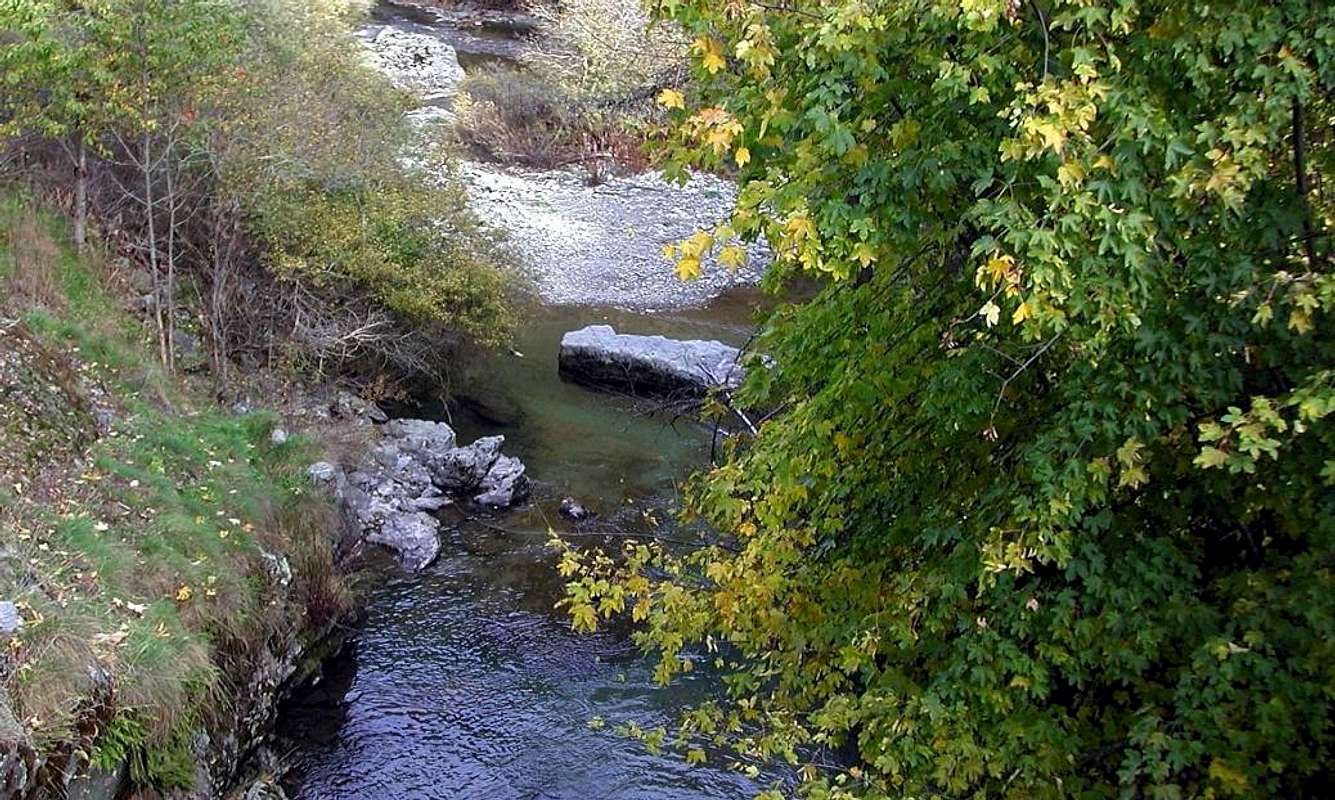
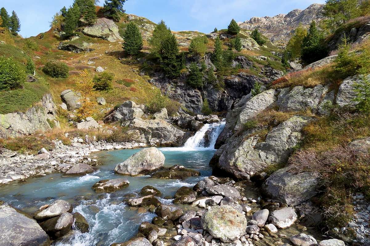
![]() The torrents and streams begin when "die" glaciers, giving form to any hint of life with their fresh and still unspoiled waters, as willed by the Mother Nature.
The torrents and streams begin when "die" glaciers, giving form to any hint of life with their fresh and still unspoiled waters, as willed by the Mother Nature.The same quench the Mountaineer and Hikers returning from the goal achieved by giving him a first signal of peace, safety and contentment. After so much hard work ...
I torrenti iniziano là dove "muoiono" i ghiacciai, dando forma a qualsiasi spunto di vita con l'acque fresche ed ancora incontaminate, come sol in Madre Natura. Le stesse dissetano l'Alpinista e l'Escursionista al rientro dalla meta raggiunta donandogli un primo segnale di riposo, sicurezza ed appagamento. Dopo tante dure fatiche ...
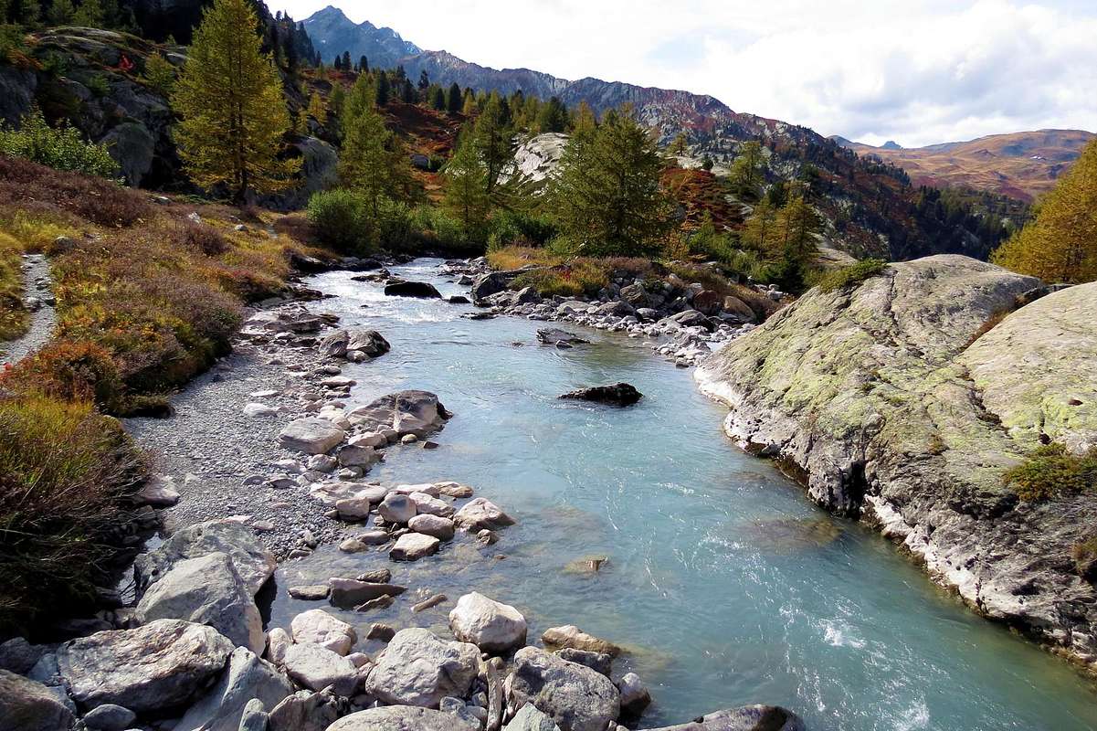
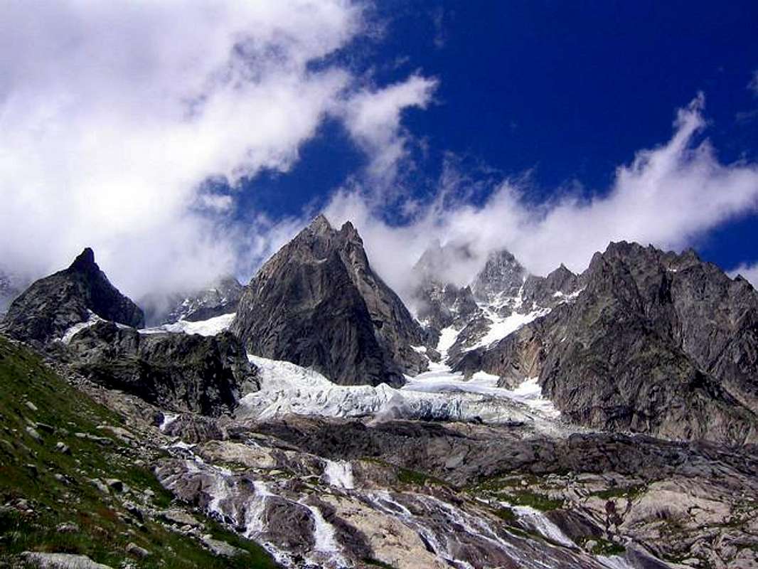
![]() How many Dora or Streams in Aosta Valley, in addition to the Central River Dora Baltea
How many Dora or Streams in Aosta Valley, in addition to the Central River Dora Baltea that plows from the West or from the small Valleys of Vény and Ferret at the foot of Mount Blanc Mountain Chain towards Southeast, where lies the Valley of the Po? Easy. To make the bill and give the answer: four are in addition to the torrents of Champdepraz, Fénis-Clavalité, Saint Marcel, Arpisson, Comboé and Grand'Eyvia in Cogne's Valley. Fourthat are actually, for the filename extensions and the breadth, of the real valleys. You are placed over the edge of the basin South Dora Baltea and in order from East to West: Champorcher, Cogne, Valsavarenche, Rhêmes, Valgrisenche Valley and of La Thuile. All perpendicular to the central axis of the Dora Baltea, except the first knife that goes down to the Southwest to the Northeast. On the opposite side we count seven others, and always with the same criteria: Gressoney, Ayas, Valtournanche, St. Barthélemy, Valpelline, Ollomont with above Basin By and, finally, the Valley of Great St. Bernard.
![]()
Quante son le Dore o torrenti in Valle di Aosta, oltre a quella Centrale della Baltea solcantela da Ovest ovvero dai Valloni di Vény e Ferret ai piedi della Catena del Monte Bianco verso Sudest, ove si estende la Valle del Po? Facile. Far la conta e darne la risposta: sono sei oltre ai Torrenti di Champorcher, Champdepraz, Fénis-Clavalité, Saint Marcel, Arpisson, Comboé e Grand'Eyvia in Val di Cogne. Quattro son disposte oltre il limite idrografico Meridionale della Baltea ed in ordine da Est ad Ovest: Valsavarenche, Rhêmes, Valgrisenche e Dora di La Thuile. Tutte perpendicolari all'asse centrale della Baltea, tranne la prima discendente a coltello da Sudovest verso Nordest. Sull'opposto ne contiam altri sette e, sempre con stesso criterio: Gressoney, Ayas, Valtournanche, St. Barthélemy, Valpelline, Ollomont con soprastante Conca di By ed, infine, Valle del Gran San Bernardo.
Getting There
By car:
- From TORINO, MILANO, etc: Motorway A5. Exit at IVREA or Quincinetto (PIEDMONT)
From IVREA Town: in West (Southern side) to Pont Saint Martin, Donnas, Bard, Champdepraz, Pontey, Fénis, Saint Marcel, Grand Brissogne, Pollein, Charvensod, Gressan, Jovençan, Aymavilles, to Villeneuve, Arvier, Avise, Morgex (Internal side) and to Pré Saint Didier, Courmayeur Municipalities (Western side).
From Courmayeur Resort: in East to Morgex, La Salle, Saint Pierre, Sarre, Aosta (Norhern side), Saint Chistophe; Quart, Nus, Chambave, Verrayes, Saint Denis, Châtillon, Saint Vincent, Emarese, Arnad, Verrès, Hône, Donnas, Pont Saint Martin (Northern and Northeastern sides) Municipalities.
![]()
Southern Side:
From Hône-Bard to Pila Basin
From Pont Bozet (775m) to Champorcher Valley, Camporcher-Château (1427m), Petit, Grand Mont Blanc, La Cort Villages, towards Dondena Village (2092m), Dondena & Miserin Refuges, through Royal Road and dirt roads; Barbustel Refuge, through Royal Road and path towards Champdepraz Vallon.
From Champdepraz (523m) to Lakes Vallon and Voella or Raye Chevrères Village (1307m; by Regional Road). Barbustel Refuge with path from Voella.
From Fénis (537m) to Clavalité-Grand'Alpe Pastures (2129m; through dirt road), just below E. Borroz/Rotary-Clavalité Refuge (2156m) at Cuneu Alp.
From Saint Marcel (630m) to Saint Marcel Valley and Turati Reserve up to the Mulac & Grande Chaux Hunting Houses & Alp (1937m, 2370m).
From Grand Brissogne (827m) to L'Arp, dirt road, Les Laures Vallon-Ernesto Ménabreaz Shelter at Lower Laures Lake (2546m), path-muletrack.
From Pollein (575m; secondary road) or from Charvensod (746m; main road and connection) to Martsaouchy Damon-Arpisson Vallon, through dirt road, and to Arpisson Lower and Upper (2010m) Alpages with path. To Federigo Zullo Bivouac (2907m), through moraines on Western Arpisson Glacier.
From Charvensod to Dard-Comboé-Arbolle Vallons towards Ponteilles (1697m) Alp/Waterfall, through dirt road, Comboé Alp/Saint Ours Shelter (2114m), through dirt road, and Arbolle Refuge (2516m), near Lakes (2497m), by Chair Lift to Chamolé Station (2309m), Lake (2325m) and muletrack.
From Charvensod (main road from Pont Suaz 567m) or from Gressan (603m; alternative road) to Tivet, Les Fleurs Hamlets (1292m, 1414m) Pila Basin and Pila Resort (1800m); upper parking 1850m). Arno Shelter (2660m), always open but unguarded, nearby Couiss Summit on watershed Pila/Cogne Valley.
From Jovençan (631m) to Pila Conca, exclusively through path-muletrack to Tourlin Dessous (1466m) and by dirt road to Pila-Posse Tennis (1776m).
From Aymavilles (646m) to Western Pila Conca, through Main Road to Cogne Valley, alternative to Ozein/Turlin Dessus Hamlets and dirt road to Pila-Posse.
Internal Dora Baltea Areas from Villeneuve to Arpy Conca
From Villeneuve (620m), Martignon (823m), San Bernardo through dirt road in Southeast, towards Prorayé Alp to Upper Champlong in Poignon Vallon.
From Introd (873m), with Municipal or dirt road towards Buillet (1030m)/Biolay (1042m) small Villages to Montagne.
From Arvier (776m), with Regional Road, towards Crête, Verney, Petit Haury, Scierie, Grand Haury with Municipal Road, to Combes Basin.
From Avise-Runaz (786m), with Municipal Road, to forks 956, 998, 1115 metres, Marbrière Pasture, Faveroy Alp to Monte Colombo.
From Derby-Chez Les Gontiers (839m) Village, with short Municipal Road through path in South towards Créton (1523m), Dailley (1621m) Alpages. Through two parallel secondaries small paths, to fork 1823 metres with dirt road and Tillac Alp (1848m) to Faveroy Area.
From Morgex (920m), with Regional Road in South, towards Liarey, Pre Villair, Mont Rotie, alternative around 1275m just before Tirecagne Pasture (1532m), with dirt road in Southeast, towards Costablinaz de Meitin Pasture (1420m), after through path, towards Damon (1445m), Champex (1519m) Pastures, Plan Rançon Alp (2098m) to Becca Pouignenta Northern Area.
From Morgex (920m), crossing the bridge above Baltea with Regional Road in South, towards Liarey, Pre Villair, Mont Rotie small Villages, alternative around 1275m) just before Tirecagne Pasture (1532m) and the Main Roads to Arpy Basin.
![]()
From Villeneuve to Rhêmes Valley
From Villeneuve (670m) to Rhêmes Valley: Introd (880m), Rhêmes Saint Georges (1171m), Notre Dame (1725m) Communes, through Regional Main Road, up to the Thumel Village (1887m) with Municipal Road and to Gian Federico Benevolo Refuge (2280m), through dirt farms road or underlying path.
From Liverogne (Arvier) to Valgrisenche
From Arvier to Liverogne Fraction (730m) and from this to Valgrisenche Valley, up to the Valgrisenche Municupality (1664m) and Mondanges, Surier, Us(s)eliéres Villages around the artificial Beauregard Dam, through Regional Road. Mario Bezzi at Vaudet and Chalet de l'Epée Refuges through paths.
From Pré Saint Didier to La Thuile & Little Saint Bernard Valleys
From Pré Saint Didier (1010m), with State Road, to La Thuile Valley: Elévaz, Balme Villages, La Thuile Commune, 1441m; from this to Little Saint Bernard Vallon towards the Little Saint Bernard Hill (2188m), through State Road. To Albert Deffeyes Refuge with muletrack from La Joux Fraction.
Western and Northern Sides:
From Courmayeur to Aosta Town
From Courmayeur (1198m) towards Pont des Chèvres, Notre Dame de la Guérison, Lassy Dèsot/Perthud Villages, Gabba, Chalets du Miage, La Visaille Cave, Plan de Lognan Alp (1676m), with Municipal Road; from this to Lake Combal (1950m) and to Refuge Elisabetta-Soldini (2197m), through dirt road.
From Courmayeur-Notre Dame de la Guérison Sanctuary (1444m), through private dirt road, to Monte Bianco Refuge (1666m).
From Courmayeur-la Palud (1370m), towards Montitaz, Planpincieux (1593m) Villages, Tronchey (1620m), Praz Sec du Milieu, Lavachey (1640m), Arnouva Dèsot (1769m) Villages, through Municipal Road, to Malatrà Vallon and Walter Bonatti Refuge. Also from Arp Nouva to Elena Refuge, through dirt road on valley floor; or from the fork after Planpincieux, small bridge, towards Leuchey Dèsott, Damon Pastures to Mont de la Saxe Hump/Giorgio Bertone Refuge.
![]()
- From FRANCE: through the Mont Blanc Tunnel to Entrèves-crossroads to Vény/Ferret Valleys - Mountain Guides of Courmayeur - La Saxe Rock Gym - Courmayeur. By Little Saint Bernard Pass, closed since November until half May to La Thuile Valley - Pré Saint Didier - Courmayeur.
It is not necessary to take Motorway A5: you can drive on State Road n° 26, in the direction of AOSTA - IVREA - TURIN.
By plane:
- Aeroporto Internazionale "Corrado Gex" Saint Christophe (Aosta)
A small trace of Travel
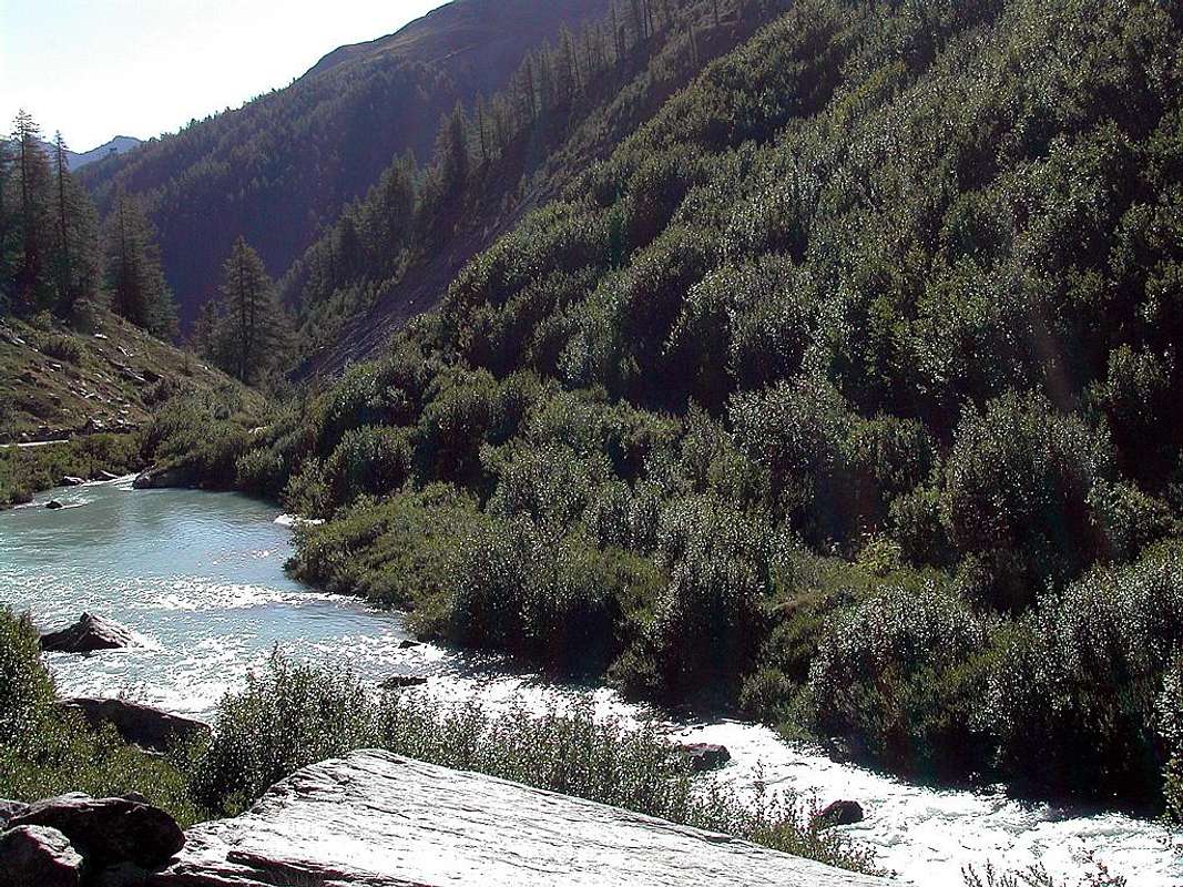
From Mont Dolent & Ferret Hill towards Courmayeur with the Ferret's Dora
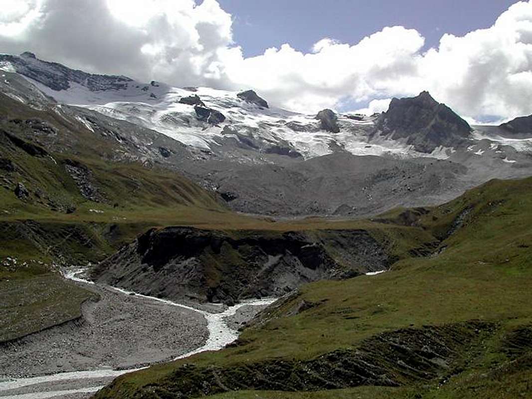
From Courmayeur Baltea towards the Dora of La Thuile, Valgrisenche, Rhêmes & Valsavarenche
Starting on the North by Mont Dolent the Ferret Dora meets with that of Veny, who comes from the West or by Aiguilles des Glaciers Trélatête at Courmayeur.
Sitting as a single Dora, going to the East in the direction of Aosta City, it collects the waters of other secondary Doires coming from Southern valleys and in perpendicular to the course of the Dora Baltea. At Pré St. Didier arrive the waters of the Dora of La Thuile along with those that come from the Little St. Bernard Pass with Torrent Verney, while later at Liverogne (Arvier), Introd and Villeneuve come those of Grisenche, Rhêmes and Savaranche Valleys that reach the waters of the Dora. Here ends the Doires, because the next stream is called Grand'Eyvia and is no longer a Doire but a great river descending by bringing together all the waters of Gran Paradiso Chain, passing through Cogne Common.
Besides, ie from Aymavilles and from Southeast to St. Vincent, Pont St. Martin and the Plain of the Po, a long series of torrents (Comboé, Arpisson, St. Marcel, Clavalité, Ponton, Ayasse etc) but none of these bring the name of Dora. As on the Northern slope where the place names are those of Planaval, Verrogne Clusella, Artanavaz, Buthier, Marmore, Evançon and Lys.
Only the big Dora Baltea goes by this name in the footsteps of the ancient Balteus Glacier from Mont Blanc Chain until the Serra in Ivrea ...
Partendo a Nord dal Mont Dolent la Dora di Ferret si riunisce con quella di Veny, che arriva da Ovest o da Aiguilles des Glaciers e Trélatête, presso Courmayeur.
Riunita in un'unica Dora, scendendo verso Oriente in direzione della Città di Aosta, raccoglie le acque di altre Dore secondarie che provengono dalle vallate Meridionali e perpendicolarmente al corso della Dora Baltea. A Pré St. Didier arrivano le acque della Dora di La Thuile insieme a quelle che provengono dal Piccolo San Bernardo con il Torrente Verney, mentre più avanti presso Liverogne (Arvier), Introd e Villeneuve giungono quelle delle Valli Grisenche, Rhêmes e Savaranche. Qui terminano le Dore, poiché il fiume successivo si chiama Grand'Eyvia e non é più una Doire bensì un grande torrente che scende riunendo tutte le acque della Catena del Gran Paradiso, passando atrraverso Cogne.
Oltre, cioé da Aymavilles e verso Sudest fino a St. Vincent, Pont St. Martin ed alla Piana del Po, una lunga serie di torrenti (Comboé, Arpisson, St. Marcel, Clavalité, Ponton, Ayasse etc) la raggiungono ma nessuno di questi porta il nome della Dora. Come sul versante Settentrionale dove i toponimi son quelli di Planaval, Verrogne Clusella, Artanavaz, Buthier, Marmore, Evançon e Lys.
Sol la Dora Baltea prosegue con sto nome sull'orme dell'antico Ghiacciaio Balteo dal Monte Bianco fino alla Serra presso Ivrea ...
Comments
No comments posted yet.