


Comments
No comments posted yet.
|
|
Trip Report |
|---|---|
|
|
45.74710°N / 7.32241°E |
|
|
Jul 16, 2016 |
|
|
Hiking |
|
|
Spring, Summer, Fall, Winter |
All pictures of this second page are by andrea.it, Romuald Kosina, hiltrud.liu, om, SalVal & Osw.
This second part is addressed to torrents of orographic and hydrographic North or right side of Baltea, always starting from the Col Ferret at the end of Mount Blanc Chain to the ends over the Eastern extreme offshoots above small Pont Saint Martin Town, at the end of the Aosta Valley Region. Always taking into account, as in the seven previous analytical work, the course clockwise we have tried to summarize what are the characteristics and the particular features of the Valleys and the torrents, starting from the South, or from the little Town of Pont Saint Martin, at Eastern Valley of Aosta, coming from Piedmont, to the famous Tourist Resort of Courmayeur, at the foot of Mount Blanc. Hence our work is split, as at the end of the Vény Valley is the starting that area which is the orographic and hydrographic or right side of the Northern Valley of Aosta. This leaves the border with France at Mount Dolent (3819m) to begin the next with Switzerland starting from Ferret Hills at the end of the two, same name for both sides, long valleys. From this point on the border ridge walks in the opposite direction toward reaching the Eastern Group of the Grand Golliaz and the much larger and more important of the Mount Velan. Leaving to North the majestic Group of Grand Combins, entirely in Swiss territory, even if considered a little "valdotain" so that there is a Community of Grand Combin, reaches the Col Fenêtre Durand and Mount Gelé. Then "down" with an endless series of summits to Dent de Bouquetins, Dent d' Hérens, the Matterhorn to the great Mountain Chain of Monte Rosa. From Signalkuppe of this last, leaving even here in the North Point Dufour higher (4633/4m), starts the watershed between the Regions of Aosta Valley and Piedmont, again to the small Mombarone above Pont Saint Martin and Carema, this last Common now out by the Valley of Aosta. It closes in such a way the circle of mountains, valleys and torrents belonging to this region. In this broad field we do not find more the Dora, if not the first or of Ferret that originates on the slopes of Mont Dolent at the end of the Mont Blanc Chain. The others are the various Artanavaz or Buthiers coming down by the Comba du Merdeux and other secondaries sides, from Gran San Bernardo, By Basin, Ollomont and Valpelline until reaching the gates of the City of Aosta between the Roman bridge and the Arch of Augustus. In addition, and to the Middle and Lower Valley are other known and important streams as the Torrents St. Barthélemy, Marmore in Valtournanche, Evançon in Ayas Valley and Lys Gressoney Valley.
Questa seconda parte é devolutata ai torrenti della sponda orografica ed idrografica Settentrionale o di destra della Dora Baltea, sempre partendo dal Col Ferret al termine della Catena del Monte Bianco fino alle estremità Orientali sopra l'abitato di Pont Saint Martin, al termine della Regione Valle di Aosta. Sempre tenendo conto dell'andamento in senso orario abbiam cercato di sintetizzare quelle che son le caratteristiche e le peculiarietà dei medesimi partendo da Sud, ovvero dal Borgo di Pont Saint Martin, all'ingresso Orientale della Valle di Aosta, arrivando dal Piemonte, fino al famoso Complesso Turistico di Courmayeur, ai piedi del Monte Bianco. Da qui il nostro lavoro si sdoppia, poichè al termine della Valle Vény prende inizio quel settore che costituisce la sponda orografica ed idrografica destra o Settentrionale della Valle di Aosta. Questa abbandona il confine con la Francia al Mont Dolent (3819 m) per iniziarne il successivo con la Svizzera partendo dai Colli di Ferret alla fine delle due, omonime per entrambi i versanti, lunghe vallate. Da questo punto la cresta di frontiera si dirige in senso inverso verso Oriente raggiungendo il Gruppo del Grand Golliaz e quello ben più grande ed importante del Mont Velan. Lasciando a Nord il maestoso Gruppo dei Grand Combins, completamente in territorio elvetico anche se considerato un pò valdostano tanto che esiste la Comunità del Grand Combin, raggiunge il Col Fenêtre Durand ed il Mont Gelé. Poi "discende" con una serie interminabile di cime verso Dent de Bouquetins, Dent d'Hérens, Cervino fino alla Catena estrema del Monte Rosa. Dalla Punta Gnifetti di quest'ultimo, lasciando anche qui a Nord la Punta Dufour la più elevata (4633/4 m), s'inizia lo spartiacque tra le Regioni di Val d'Aosta e Piemonte, nuovamente insino al piccolo Mombarone sopra Pont Saint Martin e Carema, quest'ultimo Comune ormai fuori dalla Valle d'Aosta. Si chiude in siffatto modo il cerchio di monti, valli e torrenti appartenenti a questa regione. In questo ampio settore non troviamo più Dore, se non la prima o di Ferret che si origina alle pendici del Mont Dolent al termine della Catena del Monte Bianco. Gli altri sono i vari Artanavaz o Buthiers che scendono dal San Bernardo e dalla Valpelline raggiungendo le porte della Città di Aosta tra il ponte romano e l'Arco di Augusto. Oltre e verso la Medio e la Bassa Valle troviamo altri torrenti conosciuti ed importanti come il St. Barthélemy, Marmore, Evançon od Ayas e Lys.
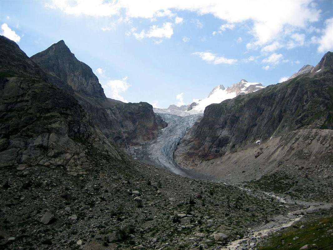
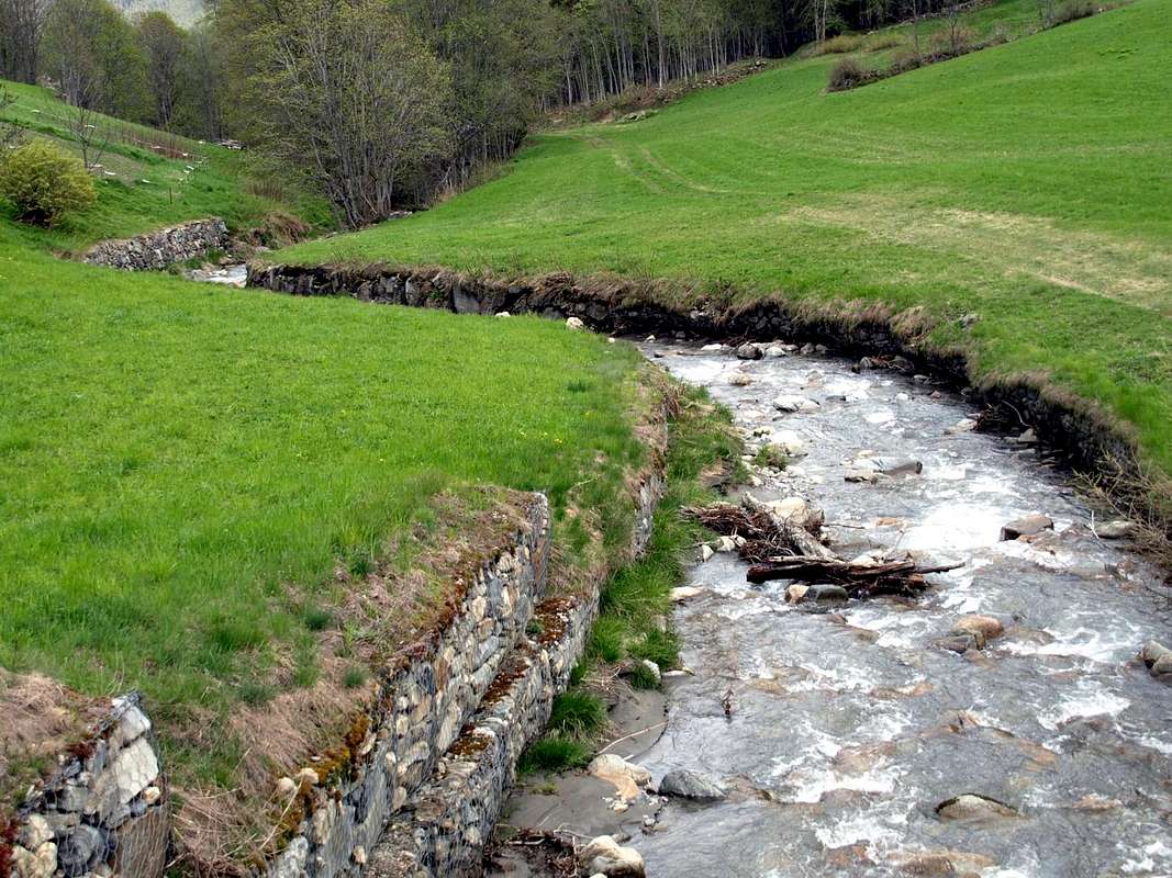
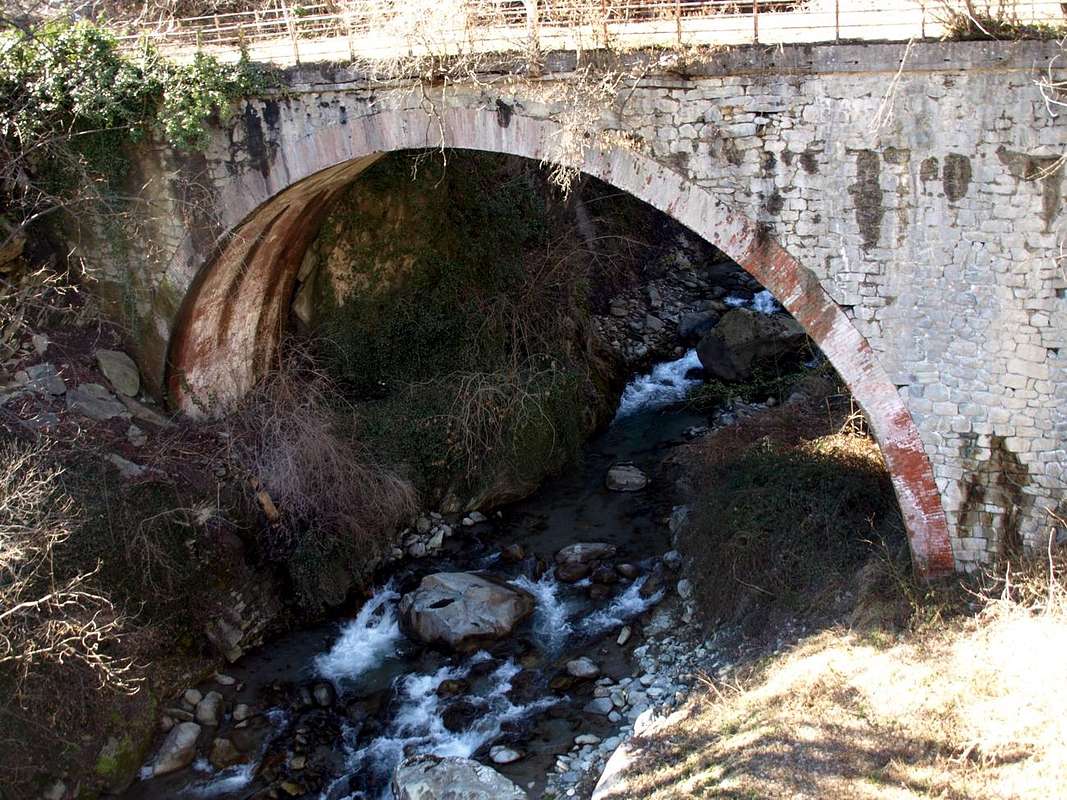
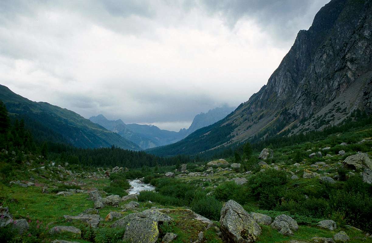
The torrents and streams begin when "die" glaciers, giving form to any hint of life with their fresh and still unspoiled waters, as willed by the Mother Nature.
The same quench the Mountaineer and Hikers returning from the goal achieved by giving him a first signal of peace, safety and contentment. After so much hard work ...
I torrenti iniziano là dove "muoiono" i ghiacciai, dando forma a qualsiasi spunto di vita con l'acque fresche ed ancora incontaminate, come sol in Madre Natura.
Le stesse dissetano l'Alpinista e l'Escursionista al rientro dalla meta raggiunta donandogli un primo segnale di riposo, sicurezza ed appagamento. Dopo tante dure fatiche ...
How many Dora in Aosta Valley, in addition to the Central Baltea that plows from the West or by the Valleys of Vény Ferret at the foot of Mount Blanc towards Southeast, where lies the Valley of the Po? On the opposite side we count seven others but no more Dora but important streams perpendicularly down to the Baltea and always with the same previous criteria: Gressoney or Lys, Ayas, Valtournanche, St. Barthélemy, Valpelline, Ollomont with Basin By and, finally, the Valley of Great St. Bernard.
But if from the City of Aosta go up the Media and the High Valley or Valdigne towards Courmayeur we find a series of streams, perhaps less important and certainly less known, coming down in their respective valleys towards the Dora Baltea. They are called Clou, Clusella, La Crête or Verrogne, Vertosan, Planaval, Liconi, Lavancher and Sapin.
solcantela da Ovest ovvero dai Valloni di Vény e Ferret ai piedi della Catena del Monte Bianco verso Sudest, ove si estende la Valle del Po? Sull'opposto ne contiam altri sette ma non più Dore bensì importanti torrenti perpendicolarmente alla Dora Baltea e, sempre con il medesimo criterio: Gressoney, Ayas, Valtournanche, St. Barthélemy, Valpelline, Ollomont con soprastante Conca di By ed, infine, Valle del Gran San Bernardo.
Ma se dalla Città di Aosta risaliamo la Media-Alta Valle o Valdigne in direzione di Courmayeur troviamo una serie di torrenti, forse meno importanti e sicuramente meno conosciuti, che scendono nelle rispettive valli verso il corso della Dora Baltea. Prendono il nome di Clou, Clusella, La Crête o Verrogne, Vertosan, Planaval, Liconi, Lavancher e Sapin.
By car:
Western and Northern Sides:
From Courmayeur to Aosta Town
From Courmayeur (1198m) towards Pont des Chèvres, Notre Dame de la Guérison, Lassy Dèsot/Perthud Villages, Gabba, Chalets du Miage, La Visaille Cave, Plan de Lognan Alp (1676m), with Municipal Road; from this to Lake Combal (1950m) and to Refuge Elisabetta-Soldini (2197m), through dirt road.
From Courmayeur-Notre Dame de la Guérison Sanctuary (1444m), through private dirt road, to Monte Bianco Refuge (1666m).
From Courmayeur-la Palud (1370m), towards Montitaz, Planpincieux (1593m) Villages, Tronchey (1620m), Praz Sec du Milieu, Lavachey (1640m), Arnouva Dèsot (1769m) Villages, through Municipal Road, to Malatrà Vallon and Walter Bonatti Refuge. Also from Arp Nouva to Elena Refuge, through dirt road on valley floor; or from the fork after Planpincieux, small bridge, towards Leuchey Dèsott, Damon Pastures to Mont de la Saxe Hump/Giorgio Bertone Refuge.
From Courmayeur-Villair Dessus (1282m), with Municipal Road and through dirt road to fork 1470 metres and path to Refuge Bertone in Val Sapin.
From La Salle 1001m), with Regional Road, towards Challancin (1610m), Cheverel, Morges (1829m), Planaval Hamlets (1750m); from this, through dirt road in North-northeast, passing Maison Blanche Pasture, to Rantin (2333m) and Bonalé (2340m) Alpages, in Upper Planaval Vallon.
From La Salle, with Regional Road, towards Challancin Village, Ponteilles (1741m), Arpilles (1862m) Pastures to Bard Pass (2178m) in Arpilles Conca.
From Saint Pierre-Pommier (783m), Champretavy, Rumiod, alternative just after Persod (1351m), Ravoise, Chaillod, Clavel, Cerlogne (1580m) to Vens small Villages (1750m), with Regional Road in West-northwest. From this last to Joux Saddle (1930m): through short descent to Vertosan Vallon
From Saint Pierre-Chateau Sarrod de la Tour, Rumiod, Petit and Grand Sarriod (1444/5m), Gerbore, Vetan Dessous (1670m) and Dessus (1737m), with Regional Road to Vetan Basin. From this, through dirt road, towards Genevrine Pasture, Chatalanez, Toules, Grand Arpilles Alps to Chaz Creuse Alp (2398m).
From Sarre (657m), with Regional Road, towards Plèod, Vert Dessous and Dessus, Vareille, Caillod/Ville sur Sarre/Remondet, Moulin/la Cort, forks 1225, 1301 metres, Salet, Chavalançon (1426m) small Villages to Thouraz Dessous Dessus Hamlets (1652m); from the last to Closella and Met small Valleys.
Southwestern Side:
From Aosta Town to Merdeux Basin
From Gignod Commune (988m) with Great Saint Bernard State Road n° 27 to alternative nearby Condemine Hamlet (1137m); leaving left through Municipal Road to Grand e Petit Buthier Villages (1302m, 1439m) in Chaligne Comba. From this last, with private dirt farms roads and through Mendey, Roncaille, Rombason Pastures up to the Chaligne Shelter (1936m), below Costa Tardiva (2380m), Tardiva Hill (2410m) and neighbor the Punta Chaligne (2608m).
From Etroubles Commune (1270m), with dirt road and through Champ-Reclos (1425m), Yettes (1591m), Eteley (1716m), fork before Praz-Gallet (1626m), Ars (1975m) Pastures on Arsy Vallon, up to Chaz d'Arsy (2543mn); from this paths to Ars Pass (2534m), Costa Labiez (2632m).
From Etroubles Commune (1270m), with dirt road through Champex (1411m; fork), Flassin de Meitin (1654m), Flassin (1700m), Tsa de Flassin (2258m) Pastures on Flassin Vallon; from this paths to Fenêtre Pass (2729m), Flassin Hill (2605m), Testa Cordella (2663m) and Tête Bois de Quart (2248m).
From Saint-Oyen Commune (1377m), with State Road n° 27 to alternative 1502 metres; leaving North the same to great St. Bernard Hill, continue West to St. Leonard Fraction. From this to Citrin Vallon up to the Mont Flassin (2772m) Citrin Hill (2484m), Punta Valletta (2801m) and La Raye du Sodzé (2640m).
From Saint-Oyen Commune (1377m), with previous Municipal Road to Mottes (1660m) Fraction, Farettes (1666m) Village; from this, with path through Arp du Bois Dèsott Pastures (1936m), alternative 1959 metres to Serena Vallon up to the Hill Serena (2547m) and Testa Serena (2830m). Variant: continue West from Farettes Village to Saint Michel (1732m) Fraction; from this last, tourning South always with Municipal Road, to Arp du Bois Dèsott Pastures.
Northwestern Side:
From Malatrà Hill to Grand Saint Bernard Basin Basin up to the
From Saint-Oyen (1377m), with previous road to Mottes, continue West-northwest to Devies Village (1723m) at the beginning of Merdeux Comba; from this with paths through Merdeux Dèsott (1919m), Cotes (1930m), Manda (1973m), Tsa de Merdeux (2285m) Pastures to Malatrà Hill (2928m).
From Saint Rhémy en Bosses Commune (1619m), through Municipal Road, on Merdeux Comba to Tsa de Merdeux (2285m) and Malatrà Hill (2928m).
From Saint Rhémy en Bosses Commune (1619m) to Tula Comba to Saulié Pass (2817m), Aiguille des Cengles (2869m) and Angroniettes Pass (2936m).
From Saint Rhémy en Bosses Commune (1619m) to Grand Saint Bernard Valley up to the Crévacol Hill and Testa (2498m, 2610m) Saint Rhémy Hill (2540m), Mont Rodzo (2632m), Pain de Sucre (2900m), Mont Fourchon (2902m), Fenêtre de Ferret Hill (2600m) and Grand Saint Bernard Hill (2469m).
Northeastern Side:
From Allain/Doues to Ollomont/Valpelline Communes with By Basin
From Allein Commune (1251m), with Regional and Municipal Roads, to By Basin; from the entrance of this (various alpages reached by private dirt farms roads), through paths, up to the Mont Saron Southern Antesummit (2681m) and traverse on crest to Tete de la Praz (2751m) and Crou de Bleintse (2824m).
From Doues Commune (1176m), with in asphalt Municipal Road, to By Basin; from this, with paths or dirt roads, to Mont Saron (2681m), Crou de Bleintse (2824m), Letey Refuge below Champillon Pass (2430), Mont Chenaille two Summits (3144m), Tsa d'Ansermin (2388m) and Monte Rotondo (2572m).
From Ollomont Commune (1356m), trhough noumerous paths and variaous upper dirt farms roads, to By Conca; from this various routes in all directions up to the Maria Cristina Rosazza at Savoie Bivouac (2674m), Refuge Franco Chiarella-Amiante (2979m), Filon Alp (2478m), Bonne Mort Pass (2646m), Fenêtre Durand Hill (2797m), Nino Regondi Bivouac (2599m) and Lakes, Tsa de Berrio Alp (2165m), Cormet Hill (2354m) and Breuson Hill (2194m).
Northeastern Side:
From Valpelline towards Valpelline Valley
From Valpelline (580m), with Regional Road, to Oyace Commune (1316-1377m); from this to Northern and Southern Vallons (Brison, Crête Sèche, Vertsan, Comba be la Tsa, Comba du Grand Chamin, Comba des Lacs and Comba d'Orein up to the entrance on Petite/Grande Murailles/Valpelline Hill Vallon.
From Oyace (1377m), with R.R., to Bionaz Commune (1612m) and Places Moulin artificial Dam (1970/80m) and Northern and Southern Vallons (Bella Tsa, Combes de Valcornière, Livourneaz, Montagnayes; Vessonaz, Verdonaz, Vieille, Verdzignolaz, Arpisson, Gran Comba and Roisan-Praperiaz Basin.
Eastern and Northern Sides:
From Aosta Town to Verrès Pont Saint Martin Municipalities
From Saint Christophe-Prevot (about 640m), reached by Regional Road from Aosta, to Sorreley Village; from this, with Municipal, towards Veynes Fraction.
From subsequent alternative before Lumian (1025m): *** in East deviation to Cretallaz, Jeanceyaz, Morgonaz Villages at the entrance on Senevé Comba).
On asphalt road in Northwest, to Parléaz Village (1274m), Blavy Hamlet (1475m) and, through dirt road or path, to Viou Alpages, in Blavy Viou Vallon.
From Quart-Villair towards Epilaz, Argnod Villages or from State Road n° 26 nearby La Plantaz (540m), with Regional and Municipal Roads, towards Chétoz, Vignil, Fornail, Ville sur Nus-Planeville, Buignod, Porsan Villages to Trois Villes-Avisod Village (1398m). From this to Senevé Alps (2206m), in Senevé Comba.
From Quart to Fonteil with previous route; from this through dirt road, towards La Seyvaz (2184m), Valchourda Alps (2392m), in Comba Dèche.
From Nus-La Plantaz in State Road to Ville sur Nus-Planeville (1113m); from this, towards Buignod, Avion (1312m) Villages. Also from Porsan through Trois Villes (1398m), Avion, fork (1250m) to Effraz Village (1487m), with Municipal Roads. From this to Ronc (1737m), Machaussy Alps, in Effraz Comba.
From State road n° 26, nearby Chambave, to Regional Road; towards Ollières, Marseiller (801m) to Verrayes (991m). With Municipal Road towards Tessellaz, Marquis, Dorinaz (1323m), Charrière Villages to Grand-Villa Hamlet (1437m), in Verrayes/Saint Denis Basin and to Aver-Longhede Area.
From A)- Verrayes, with Regional Road, towards Del (1260m), Plau (1305m), Semon to Cheresoulaz (1487m) Villages. Also from B)- Saint Denis (803m; reached from Chambave, Marseiller) with Regional Road towards Gubioche, Etrobleyaz, Petit Bruson, to Del Villages. C*** Road Connection towards Roves, Lozon (1520m), Clavon, Fontane Villages, Pastures to Bornes Alp). From Cheresoulaz, through Municipal/Regional Roads, to Saint Pantaléon Hill (1650m).
From Châtillon (549m), with Municipal Road, towards Chavod, Domianaz to Nissod Villages (1371m); from this, through dirt road to Nuarsaz Alp (1713m).
From Saint Vincent (575m), with Regional Road, towards Moron (844m), Grun (991m), Salirod (1102m), Amay (1466m) Hamlets to Joux Hill (1635m).
From Saint Vincent, towards Cillian, Feilley Villages also from State Road n° 26, towards Estaoud (595m), the both with Regional Roads, to Emarese Commune (1048m); from this towards Erésaz (1163m), Cuignon/Sommarèse/Longeon (1549m, 1536m, 1516m) Hamlets to Zuccore Hill (1607m).
From Verrès (390m), before with Regional Road after through path, to Collegiate Church of Saint Gilles, immediately below Mount Saint Gilles (967m).
From Pont Saint Martin (345m), with Regional Road in Gressoney Valley, to Gressoney La Trinitè (1468m); from this, through dirt roads and paths in East, up to the Upper Bettolina Pass (3058m); also in West to Gabiet Loch (2363m).
By plane:
 |
 |
 |
 |
 |