


bigwilly - Mar 15, 2005 9:54 pm - Voted 10/10
big helpThanks for the picture, it is very helpful. Challenger is one of my more immediate goals.

Grant - Mar 16, 2005 5:25 pm - Hasn't voted
Re: big helpThanks bigwilly, if the exposure doesn’t bother you then the standard way has better footing.
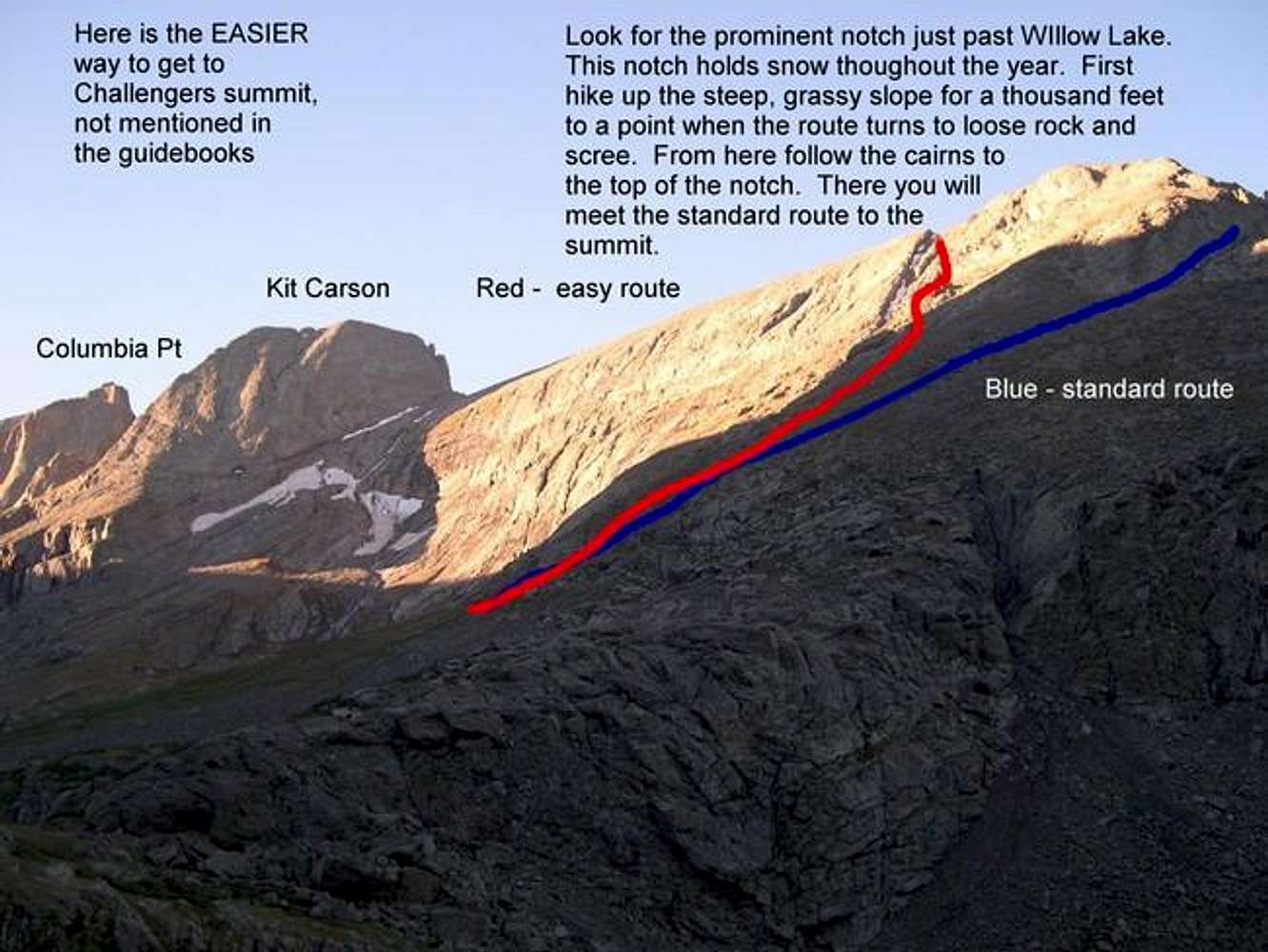
The less exposed route has about 300-500 hundred feet of scree. It has a trail going up but it's still pretty loose. Be careful on this route since rocks can be dislodged and run down the entire thousand foot slope. A rock (about the size of a golf ball) came tumbling down and missed my head by about a foot when I was going down this route

Alan Ellis - Mar 16, 2005 8:19 pm - Hasn't voted
Re: big helpI agree with Grant. This route is very loose and is better used as a descent route or not at all. Rockfall is common. A better alternative is to the left of the gully. Here is the route.

ClydeLovett - Apr 12, 2007 12:53 am - Hasn't voted
Red lineWell, the blue line route would have been considered by me to be the "Wrong way." I have always ascended by the red route - more or less - going up the gulley. The gulley is the line to follow, either side. I find the south side a bit easier, but have gone up and down both sides many times. Even with snow, I prefer the gulley path (red line).
The blue line route looks longer. I would need a reason to go out of my way I suppose.
I have seen hikers go up the gulley and then south (towards the blue line) thinking they are making challenger - and then back track to make the real summit.


Comments
Post a Comment