
-
 5432 Hits
-
 71.99% Score
-
 3 Votes
|
|
Mountain/Rock |
|---|---|
|
|
37.61934°N / 22.51447°E |
|
|
Download GPX » View Route on Map |
|
|
Arkadia & Argolida |
|
|
Hiking, Mountaineering |
|
|
Spring, Fall, Winter |
|
|
5804 ft / 1769 m |
|
|
Overview
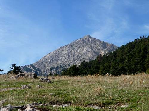
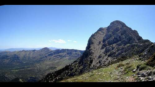
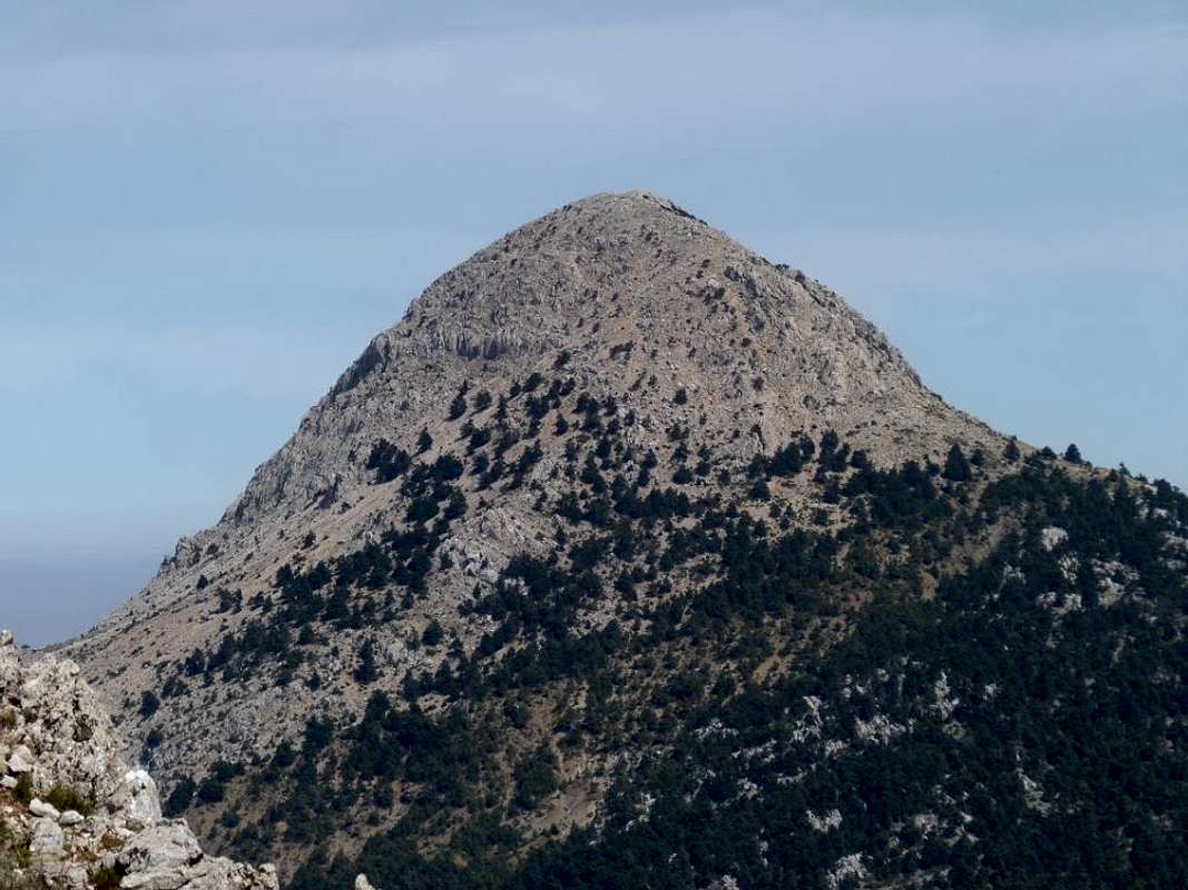
Artemisio Mountain (1,769m) ["Αρτεμίσιο όρος"] is a rocky summit situated between Arkadia & Argolida in the Peloponnese region of Greece. It is directly connected with Ktenias (1,634m) ["Κτενιάς"] to the South through its extended ridge; it is also considered connected to Lurkeio (1,755m) ["Λύρκειο"] to the North. The summit is located just above the village of Karya ("Καρυα") and rises prominently above the tree line at approx. 1,300m. The orientation of the peak’s ridge is North to South with the primary trail tackling the South face.
While one of the shorter major summits in the Peloponnese, it provides excellent views to the East into the Aegean Sea and is a beautifully exposed and prominent objective. It is about 2 hours from Athens and is also known as a significant area for bird migration and is passed through by the central Athens to Tripoli highway.
History & Area Guide
|
|

|
According to the ancient Roman-Greek geographer, Pausanias, at the summit there used to be located a temple dedicated to the goddess Artemis (“Αρτέμης”), hence the name meaning Mountain of Artemis. The temple was said to have been surrounded by evergreen trees, however, those were progressively cut down due to their quality and today very few remain of the mountain while the summit is sheer rock.
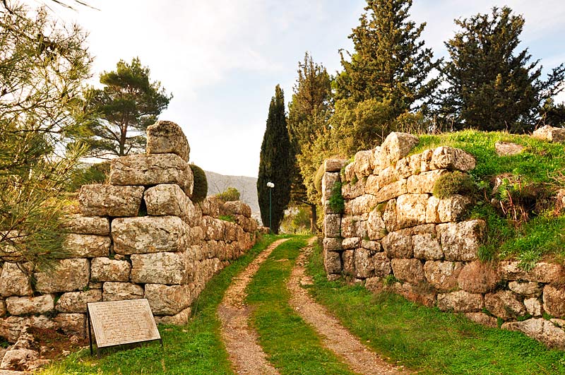
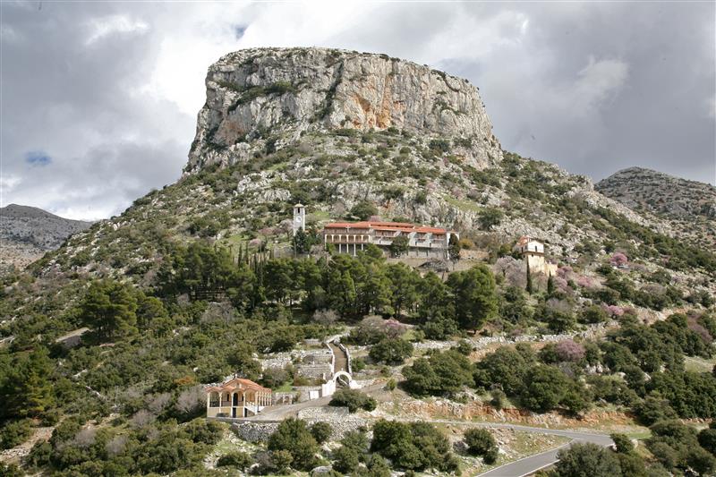
The nearby village of Nestani (“Νεστάνη”) located on Eastern foothills of the mountain has been inhabited since ancient times benefiting from a prime location between Argos and Arkadia, as well as plentiful areas for animal grazing. The village has an ancient acropolis which was destroyed even by the time of Pausanias in 200 AD. In around 338 AD Macedonian king Philip II built a spring in the village. Above the village and just below the imposing East face of Vrachos of Goulas (1,160m) [“Βράχος του Γουλά”] is the monastery of “Panagia Gorgoepikoou” which was founded before the 14th century, today it houses an all-women convent.
The peak of Artemisio (1,769m) is part of a larger complex of peaks in the area with it, Ktenias (1,634m) and Kafouria (~1,460m) being considered as one complex by some. Geologically, they are part of the larger range which includes Lurkeio (1,755m).
Aspects of the Mountain
|
|
Getting There
Because of its orientation and general steep geomorphology, it can best be accessed through the flanks, those being the villages of Karya (“Καρυα”) to the NE and Nestani (“Νεστανη”) to the W. The Standard Route starts above the village of Karya.
Going up form Karya the trailhead starts – i.e. the paved road ends – at 1,080m on the Nestani Pass. During times periods without recent snow or rain it may be possible to continue up the dirt road to 1,340m; it is of course not cleaned of snow during the winter.
Actual Trailhead: 37.62293N, 22.52291E (elevation: 1,340m)
Paved-road Ends: 37.63711N, 22.52847E (elevation: 1,080m)
Route
There are in total 3 routes to the summit, one is only possible during the winter and when there is enough snow cover. All 3 routes start at various points of the Nestani Pass, between Nestani and Karya.
Standard Route (South Face)
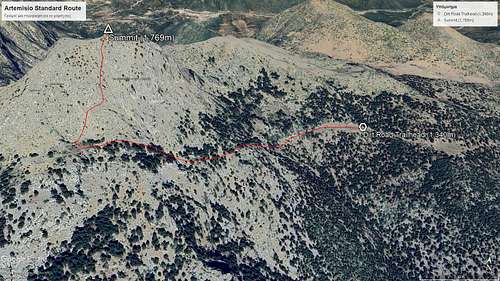
- Distance: 2.7km (one-way)
- Duration: 2 hours (one-way)
- Elevation Gain: 550m
- Difficulty: Medium
- Water: None
Overview
This is the standard route; it is the shortest and safest and can be done in less than 3 hours during dry weather. It starts above the village of Karya and can be started as high as 1,340m. It is 5.4km round trip and features exposed sections and clear views over the Gulf of Argos.
Forest
This is the traditional approach to the summit which begins at between 1,080m and 1,340m depending on how far you drive up the dirt road from the pass. From the clearing at 1,340m follow the marked trail first East and South around the base of the summit pyramid. The trail will incline slowly through the forest up to 1,510m. Where the trail bends nearly 160 degrees to face North a snow-hole is located.
Headwall
From here the trail traverses the South Face diagonally up the mountain for the final 250m of elevation gain. It requires hiking on a thin, exposed rocky trail. You do need to be wary of a couple of spots that may require jumping over fallen trail sections or balancing against steep rocks.
North “Ribs” (“Χτένια”)
This route is accessible from the same trailhead as the Standard South route but moves onto the North ridge at a crossroads in the middle of the forest, from there it tracks the ridge up to the summit. It has the same elevation gain of 550m, around 3km in length and takes longer at approx. 3 hours. This route is significantly more exposed and can be classified as a scramble. It takes you up through a “corridor” on the side of the North ridge and may require ropes.
Check out this Drone Video of Athens Mountaineering Club (AOS) tackling the route in deep snow.
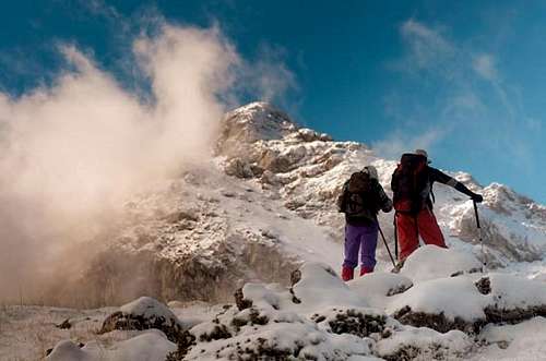
North Face Couloir (Winter Only)
During winter it is possible to summit through the distinctive couloir on the NW aspect which requires a longer approach when snow cover is extensive. Due to the steepness and loose pebbles in the couloir, it is not possible to tackle it during the dry months. This is an exceptional Ski Mountaineering objective.
Check out this Guide + Trip Report Blog in English by Olympus Mountaineering.
When to Climb
Hikers should attempt this objective in dry conditions, mainly during the months of late September to early December and early March to late May. The largest issues would be rainfall, or generally wet conditions – which would cause rockfall – and heat, given the low elevation and Southern location of the mountain.
Mountaineers should attempt this objective between mid-January and early-March, given that the snow-cover is sufficient.
The mountain can be quite dangerous in extreme weather due to its location and is not recommended to be tackled in sub-par weather, e.g. high winds, fog, after rains.
Huts & Camping
Wild camping is generally permitted in Greece. This mountain is not recommended for camping, although I’d be possible to do so on its Southern base, where the access road ends. It is also possible to camp around the area of Nestani Pass, on the North of the mountain. Setting up a fire on the mountain is not permitted.
There are no huts or refuges in the area.
Summit Panorama
Important Area for Birds in Greece
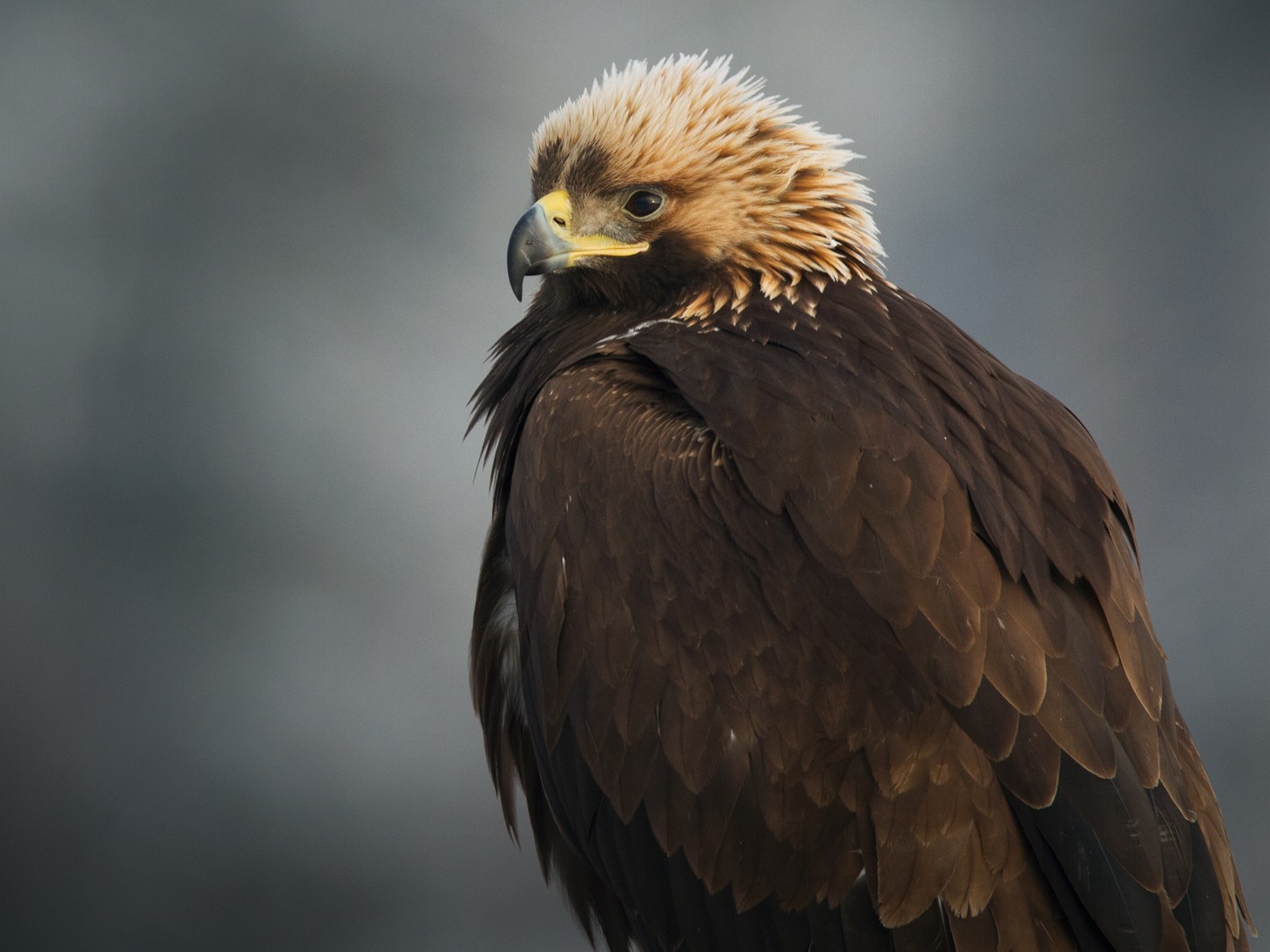
The area Artemisio (1,769m) and nearby Lyrkeio (1,755m) fall under the NGO classification of “Important Area for Birds of Greece” although the area is not under protected status. In total 5 species of bird live here including the Lesser Kestrel – a small hawk – and at least a pair of Golden Eagles, which are rare in Southern Greece.
Artemisio Mountain Run
An annual trail running race has been happening on the mountain since 2018, it usually takes place during the first days of December and has four routes, Mountain Run (26km), Trail Run (12km), Trail Race (5km), Kids Walk (1.5km).
Find out more on the Artemisio Trail Run website.
Altitude Inconsistencies
Like some other low interest mountains in Greece – especially at this elevation range – the elevation of the summit is not recorded correctly. PeakBagger claims 1,772m, Hiking Experience .gr claims 1,771m while Open Street Maps and Google Earth both show <1,750m.
Authors Note: In 2017 when I summited, I used a Samsung S4 and the software ViewRanger to note the elevation, which showed 1,769m. This reading is used in this page.
External Links
Athens Mountaineering Club (AOS) summiting during Winter using the North "Ribs" route, Youtube video.
Olympus Mountaineering, "Mount Artemisio, Winter Ascent via the NW Col.", 2023.
Important Area for Birds in Greece "Oros Artemisio and Oros Lyrkeio"
Artemisio Trail Run official website