
|
|
Mountain/Rock |
|---|---|
|
|
46.79912°N / 120.42774°W |
|
|
Kittitas |
|
|
Hiking |
|
|
Spring, Summer, Fall, Winter |
|
|
3212 ft / 979 m |
|
|
Overview
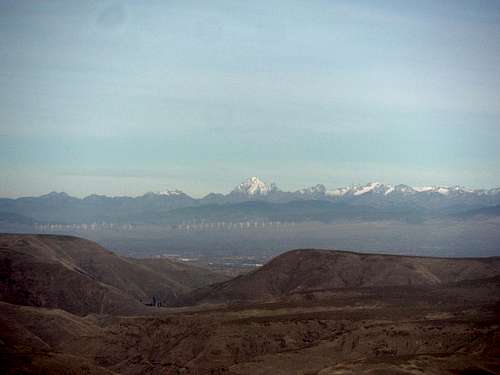
Oh no, it is another Baldy. To make matters worse it is not even one of the taller Baldys on SummitPost. But I will be honest this peak is a really cool summit despite it lower height. Yes it only has 825 feet of prominence and the hike itself is only 5 miles roundtrip and just over 1900 feet of elevation gain but it is well worth the visit. For one thing this Baldy is located just north of Yakima is the semiarid region of central Washington. This summit does not have any trees on top but the grassland that is on the summit and all around the peak is not tundra but sagebrush. Because Baldy, like the city of Yakima 20 miles to the south of of it, is on the lee side of the Cascade Mountains. Therefore very little rain can penetrate through the Cascades leaving this area very dry and semiarid.
 Looking north to Stuart | 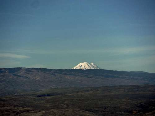 Rainier towering to the west |
 Looking into the canyon | 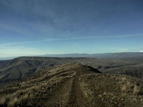 Looking west from the summit |
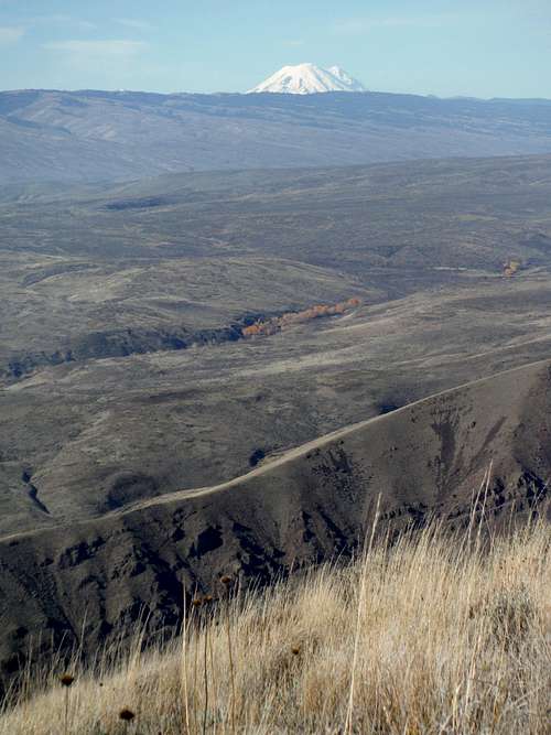
The dry grassland make this mountain scenic from start to finish. One can look down to the canyon from any elevation going up Baldy and enjoy a good view into the canyon. Once you get above 2500 feet Mount Stuart, Mount Rainier and Mount Adams come out in the distance. The views of all these peaks are distant but are special nonetheless. The summit of Baldy also has view over the surrounding countryside with all of it sagebrush covered hills. The hills in this area are similar in elevation and appearance to mountains in the Pennsylvania and Maryland Appalachians. The big difference here though is that there are no trees on these summit due to Cascade Mountains located just to the west.
Getting There
From Points North and West: Take I-82 6 miles south from Interstate I-90 and turn off on Thrall Street. Head west (right on Thrall street for 3/4 mile and then make a left onto Canyon Road. Take Canyon Road (Highway 821) almost 15 miles to the south to Big Pines Campground. This campground will have a fee during summer and early fall even in the day use area. This will be where you park. The trailhead will across the street 100 yards north and will be marked with a gate.From Point South: Take I-82 North from Yakima for 9 miles before turning off on Exit 26. Make a left off the ramp and head north on 821 for almost exactly ten miles and the Big Pine Campground will be on your left. This campground will have a fee during summer and early fall even in the day use area. This will be where you park. The trailhead is across the street 100 yards north and will be marked with a gate. Add Getting There text here.
Route
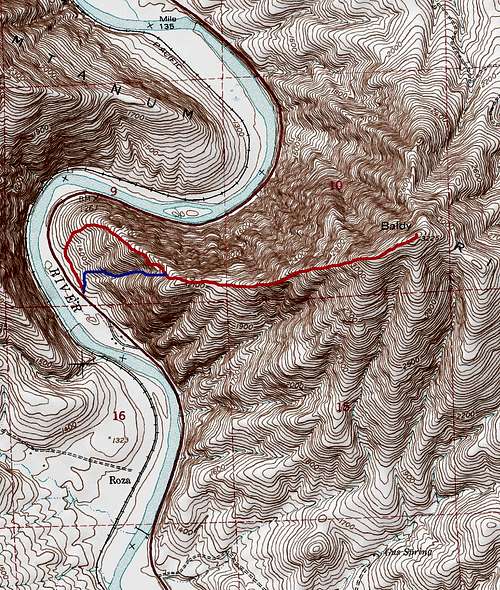
Map of the Routes up Baldy
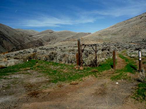
The trailhead gate; left for the longer gradual trail, go through the gate for the steeper trail
From the beginning of the trail there are actually two routes to get up the first 900 feet up this mountain. If you go through the gate you will be taking the way marked in Blue. The first way marked in Blue on the map above is the more direct, steeper, shorter, and less scenic way up to Baldy. This way goes up a steep gully but does offer some sun protection in the early morning. It will meet with the second way which is more gradual and much more scenic. When you hit the gate at the beginning you take the trail that head left of the gate and seems to follow the road for a couple hundred yards. From the trail steepens up more and starts going through switchbacks as it attains the ridge and then traverses the ridge all the way to the meeting with the more direct trail.
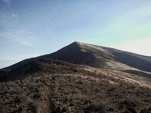 Looking at the big push to Baldy | The summit view looking west |
Once the two trails combine they become quiet gradual for a while until they hit the 1000 steeper incline to the summit area. This section is fairly steep and tends to rise up in a series of shelves. Before you crest over the to general summit area turn around and take a look at the dramatic view into Yakima Canyon. Once the slope beings become gradual enough to the final summit Add Route text here.
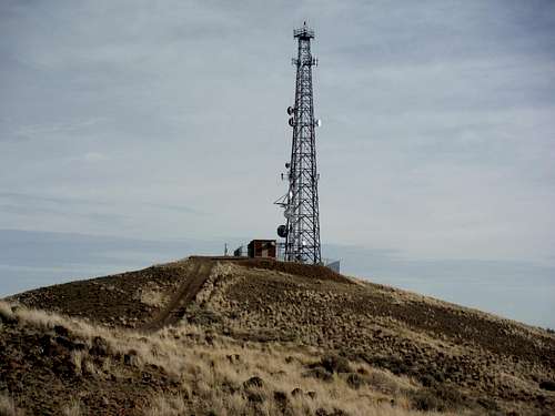
The summit cell phone tower.
Red Tape
From May to October Big Pines Camping Area is subject to camping fees. There is also a day use fee here as well from May to early October. Starting in 2015 the BLM is going to have a reservation system for this campground. In the offseason November to April there are no fees for using this camping area and no fees for parking either.When to Climb
You can climb this peak at any time of the year but I would not recommend summer at all. It should be noted that there is absolutely no cover from the sun. When I was hiking this peak in November I could clearly feel the affects on me from the sun and I was on this summit no more than 2 hours.Therefore save Baldy for November through March because once the spring sun comes out it can get very uncomfortable here. Summertime comes with a brutal dry heat with temperatures in the region often going over 100 degrees. With no shade one can dehydrate rapidly especially considering there is no water on this trail.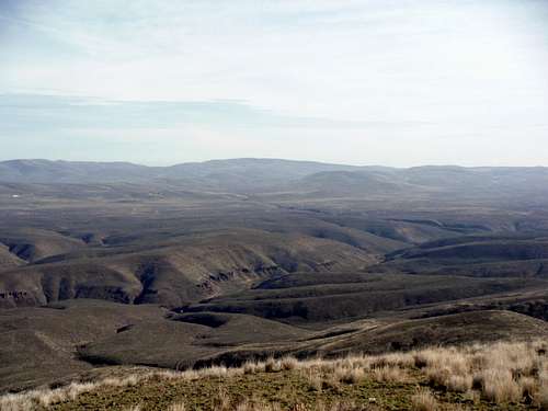
Beautiful but not a place you want to be in the summer heat.
Camping
Big Pines Camping Area is a great place to camp. There is a fee during the spring and summer to camp here but in fall and winter this camping area is free as of 2014. They are presently renovating Big Pines Campground for the 2015 season. .External Links
Baldy Peakbagger PageThis is a directory of great trip reports from the WTA