
| Campground | Status | Comments |
| Deer Park | Open | Primitive (no water) |
| Dosewallips | Closed | Walk-in only. Road washed out 6.5 miles from campground. Primitive. Pit toilets only and no potable water. Pack out all trash. |
| Fairholme | Open | Closing for the season November 2. |
| Graves Creek | Open | Flush toilet available for summer only, no potable water. Pack out all trash. |
| Heart O' the Hills | Open | |
| Hoh | Open | |
| Kalaloch | Open | Reservations through recreation.gov. |
| Mora | Open | Reservations for peak season on recreation.gov Comfort station renovation in Loop C |
| North Fork | Open | Primitive. Pit toilet only and no potable water. Pack out all trash. |
| Ozette | Open | Flush toilet and drinking water available during summer season only. |
| Queets | Open | Primitive. Accessible only from Upper Queets Valley Road. |
| Sol Duc | Open | Closing for the season September 27. Campground operated by Sol Duc Hot Springs Resort. Reservations through recreation.gov. |
| South Beach | Open | Closing for the season September 28. |
| Staircase | Open | Currently primitive with vault toilets and no drinking water. Potable water and flush toilets available during summer season. |
-
 18844 Hits
-
 74.08% Score
-
 5 Votes
|
|
Mountain/Rock |
|---|---|
|
|
47.90537°N / 123.77742°W |
|
|
Clallam |
|
|
Hiking, Mountaineering, Skiing |
|
|
Spring, Summer, Fall, Winter |
|
|
5474 ft / 1668 m |
|
|
Overview
Bogachiel Peak is located high on a ridge called the High Divide in Olympic National Park. The summit boasts spectacular views across the Hoh Valley of Mount Olympus and the Blue Glacier. Until mid July or sometimes later, an ice axe is usually necessary to travel up and around Bogachiel Peak, along the High Divide, and into the basin. Although it stands at a fairly low elevation of 5,474 feet it has a distinctly alpine flavor and boasts one of the most classic views in Washington state. To the south lies the Mount Olympus massif across the Hoh River valley. In the east is Mount Carrie and the Burke Range noted as some of the most remote areas in Washington. You can see the Pacific Ocean to the west and the Hurricane Ridge area to the north.Directly below the summit to the north is the beautiful Seven Lakes Basin which is a must visit place in late summer. Bogachiel Peak has 499 feet of prominence so it also stands proudly as the highest point on the High Divide.

Getting There
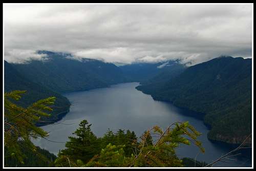
From Port Angeles head west on Highway 101 for 27 miles where you reach the Sol Duc Hot Springs Road. On the way you drive along the southern shore of beautiful Lake Crescent where you can kill time swimming, hiking to Marymere Falls, or just have a nice picnic. At the west end of the 9 mile long lake is the small town on Fairholm where you'll find the Fairholm General Store. Don't expect friendly hours of operation though! A nice swimming area and dock is located just across from the store and the classic Lake Crescent photo is taken from here. Just past the lake you head up a hill and at the top of the hill, turn left (southeast) onto the signed Sol Duc Road and follow it all the way to the end where there is a huge parking lot. Park at the furthest open spot you can find as close to the trail-head as possible. You will pass by the Sol Duc hot springs resort (located on the south side of the Sol Duc River) and the campground.
|
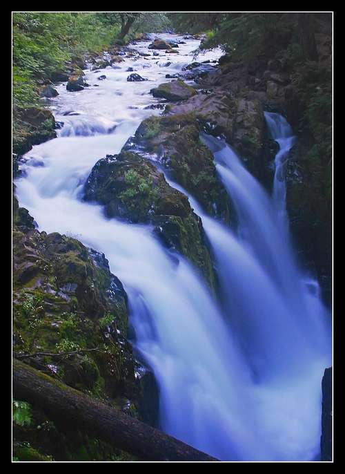 Sol Duc Falls Sol Duc Falls |
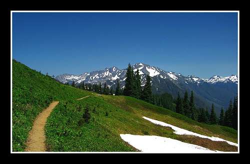
From the trailhead begin by hiking up the Sol Duc River trail which follows its north side for about a mile to the famous Sol Duc Falls where a nice bridge crosses over the top of the large cascade. There is also a nice shelter here to escape from the rain (because it is probably raining!) From the falls, you can either turn south on the Deer Lake Trail or continue east up the Sol Duc Trail. It's an 18 mile loop hike from here with 3,050 feet of elevation gain and it doesn't matter which way you decide to go. I'll describe the route assuming you chose to take the Deer Lake Trail first. So from the falls, continue south as the trail climbs a gently 1,500 feet through the forest over a distance of 2 miles to Deer Lake. You will probably notice deer here...trust me. Just past the lake you will see a trail junction. Turn left and continue on the High Divide Trail which continues to climb up beautiful slopes, passing a small tarn at 4,100 feet and reaching the crest of the High Divide at 4,550 feet. Once on the ridge, continue along the trail as it crosses back and forth from one side to the other until you reach another junction with the Hoh Lake trail which descends south off the High Divide just below the summit of Bogachiel Peak. Just before this junction, look for a short branch trail that leads up for 250 feet through some brush right up to the summit. At the top there is enough room for a large group and a few trees to offer some shelter from wind.
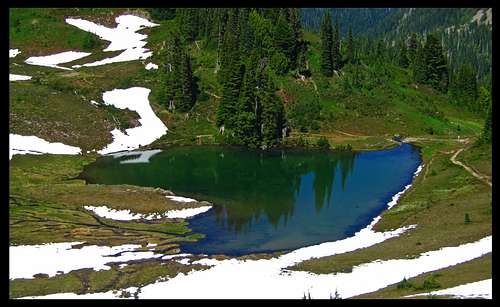
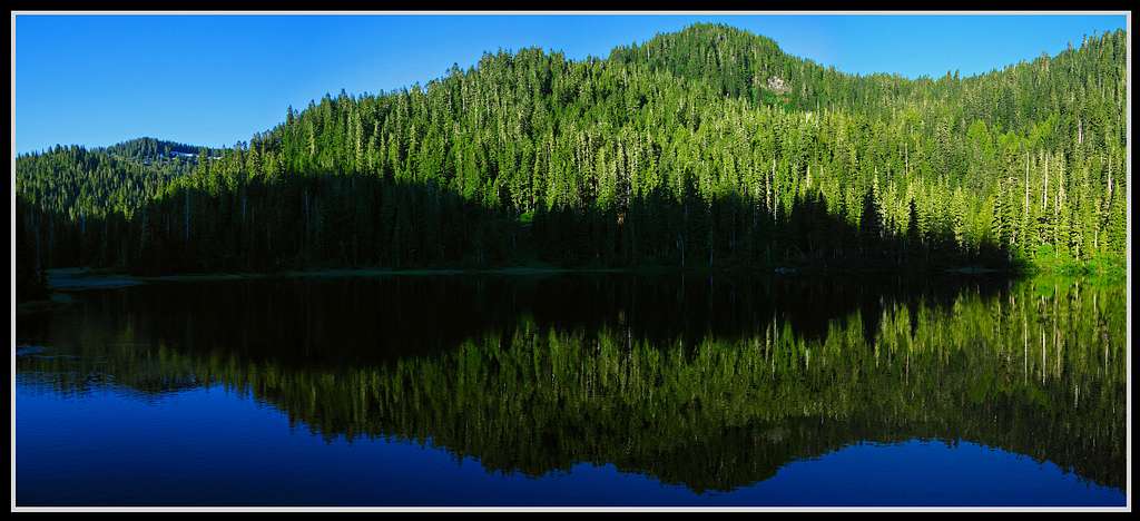 Morning reflection on Deer Lake
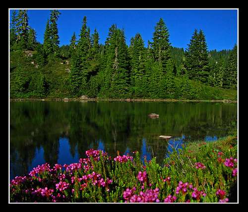 Small tarn above Deer Lake Small tarn above Deer Lake |
 Mt. Olympus from the High Divide Mt. Olympus from the High Divide |
 High Divide Trail looking east towards Cat Peak High Divide Trail looking east towards Cat Peak |
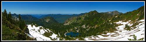
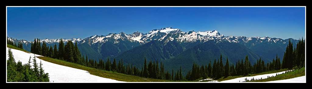 Mtount Olympus Panorama from Bogachiel Peak
For your descent, it is advised you finish the loop and follow the High Divide east an additional 2 miles over some stunning terrain until you are just above Heart Lake (you'll notice it right away!) where there is a small sign. Views into the Seven Lakes Basin are always amazing and Mount Olympus stares at you to the south the entire time. Turn left at this sign (continuing straight along the ridge takes you to the Cat Basin area) and follow the trail which descends 250 feet down a steep slope to the lake. From Heart Lake, it's a 6.5 mile hike back down the Sol Duc River Trail to the trailhead.
 Looking down at Heart Lake Looking down at Heart Lake |
 Nice meadows just below Heart Lake Nice meadows just below Heart Lake |
Map
Camping/Red Tape
Backcountry permits are required for overnight trips and can be obtained at the Wilderness Information Center in Port Angeles. Rangers do patrol this area due to its popularity. Camping limits are in place for all areas in the Sol Duc/Seven Lakes Basin. Obtain permits at the WIC in Port Angeles, Eagle Ranger Station (Sol Duc) or Hoh Visitor Center during business hours. Camping is in designated sites only. There are many nearby campgrounds where you can car camp which are operated by the national park. These are described below in the table which is provided by the National Park Service.
Table last updated October 2020
External Links
 Lake Number 8 from the High Divide