
-
 16423 Hits
-
 82.48% Score
-
 15 Votes
|
|
Mountain/Rock |
|---|---|
|
|
34.38943°N / 115.42811°W |
|
|
San Bernardino |
|
|
703 ft / 214 m |
|
|
Overview
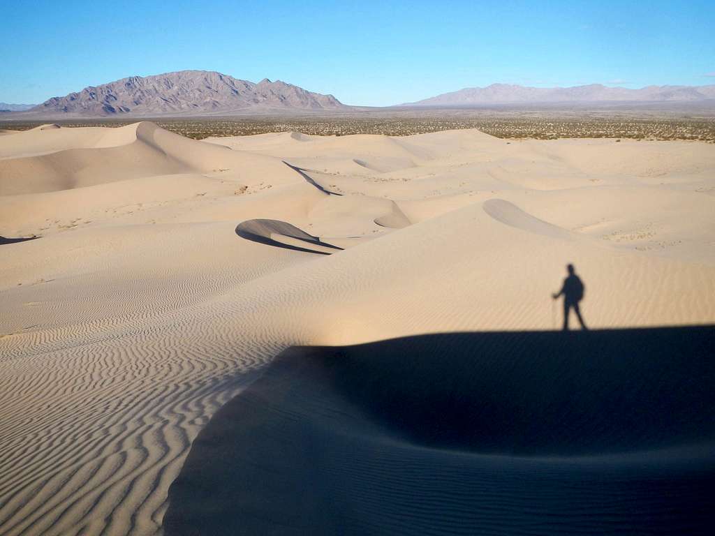
Ship Mountains and Old Woman Mountains from Cadiz Dunes
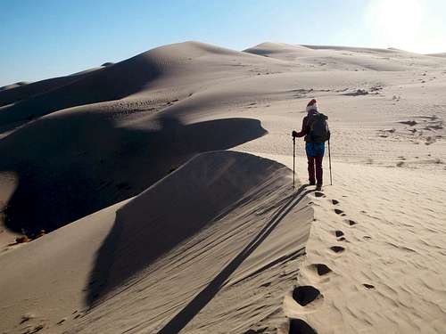
What the Cadiz Dunes lack in general height, they make up for in pristine unspoiled beauty. This system of dunes is one of the most remote in California and fortunately it saw little to no OHV use before it was protected in 1994 as part of the Desert Protection Act. The valley the dunes are located in lies between the Sheephole Mountains to the southwest, the Ship Mountains to the north, the Old Woman Mountains to the northeast, and the Iron Mountains to the southeast.
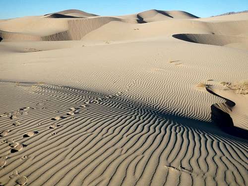
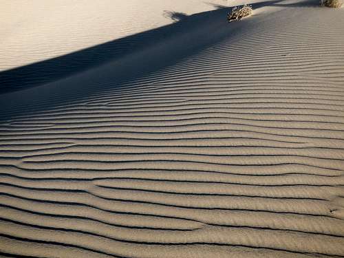 Wind Ripples | 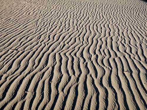 Wind Ripples |
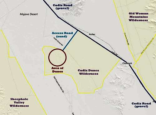
Cadiz Wilderness Map
The dunes are home to typical Mojave wildlife and plants included one rare endangered species, called Borrego milkvetch. Salt mining in the area began in the 1880’s and continues to this day. Brine water is pumped up from wells which penetrate 6 feet of mud and then it is deposited into evaporation ponds. In fact, the nearest salt mine operations are only a few miles south of the Cadiz Wilderness boundary.
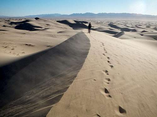
Blowing Sand
Ultimately, the same events which deposited the salt under the surrounding playa created the Cadiz Dunes. In Pleistocene times this valley contained Cadiz Lake, now a dry lake. All that remains is sand above and brine below the playa.
Red Tape
Cadiz Dunes
No motorized vehicle use inside the wilderness area. The access road follows the northwest edge of the wilderness.
Summer temperatures often exceed 115 degrees and sometimes go above 120. Make sure you have extra water in your vehicle and are adequately prepared for emergencies.
Getting There
Note: The final 2.4 mile long access road is made of sand and has deep tire ruts in sections. High clearance and 4WD/AWD only! Fortunately the access road is short, so 2WD drivers can park and easily walk the road out to the dunes.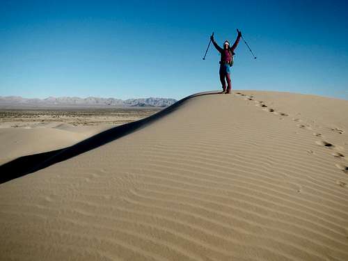
Cadiz High Dune
The Cadiz Dunes Wilderness is located in southeastern California between Highway 62 and Interstate 40. It is accessed from Cadiz Road either from the northwest (Old Highway 66) or southeast.
If coming from Interstate 40 you will want to take Old Highway 66 to the town of Chambless and turn southeast. Continue on Cadiz Road for another 10.1 miles to the turnoff.
If coming from Highway 62 the turnoff is 63 miles east of the Twentynine Palms airport or 23.4 miles west of Vidal Junction. Turn northwest on Cadiz Road and proceed 35.6 miles to the turnoff.
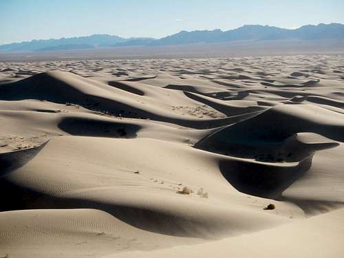
Sea Of Sand
Whether you are coming from the north or south, Cadiz Road has some rough sections. Watch for the occasional tire killer pothole as well as minor washed out sections of road caused by flash floods. Usually the washouts have easy work-around tracks.
Dunes access Road (34.426415, -115.393419)
Cadiz Road/Highway 62 junction (34.106982, -114.932379)
Cadiz Road/Old Highway 66 junction (34.561890, -115.544164)
Highest Dune as of December 2015 (34.389432, -115.428111)
Once on the access road, it’s a good idea not to stop or slow down until you get to the parking area. The parking area is hard pan and has enough traction that it is safe to stop on.
Contacts
Dune Walk
Bureau of Land Management
Needles Field Office
1303 S. Highway 95
Needles, CA 92363
Phone:(760) 326-7000
Email:m1daniel@blm.gov