
-
 7737 Hits
-
 79.04% Score
-
 10 Votes
|
|
Mountain/Rock |
|---|---|
|
|
49.91462°N / 123.04387°W |
|
|
Hiking, Skiing |
|
|
Spring, Summer, Fall, Winter |
|
|
6535 ft / 1992 m |
|
|
Overview
Clinker East Face
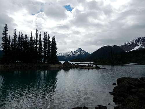
"Clinker Mountain" was the previous name for Mount Price but the main peak was renamed in 1930 for Thomas E. Price, a local mountaineer. Because of this, the Clinker name was officially shifted to it's western sub-peak in 1972. Clinker Peak and Mount Price are a few of the stratovolcanos in Garabaldi Provincial Park in southern British Columbia. On the southern shore of Garabaldi Lake, between the towns of Squamish and Whistler, these volcanoes are considered active since the last eruption occurred sometime between 9,000 and 10,000 years ago. They are part of the Garabaldi Volcanic Belt, the northernmost segment of the Cascade Volcanic Arch. The immediate area around Garabaldi Lake is surrounded by volcanic peaks in various stages of glacial erosion.
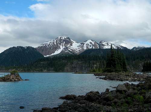
Mount Price (left) and Clinker Peak (right) with unnamed high point in between
Clinker Peak is actually a breached volcanic side vent of the larger volcanic cone which is Mount Price. The most recent eruption of Clinker Peak occurred roughly 9000 years ago releasing an immense lava flow of molten basaltic andesite. This lava flowed down out of the breached cone, both to the north and to the south, pooling up against the retreating continental ice sheet. The southern flow moved down toward the headwaters of what is now Culliton Creek, while the northern flow filled in what is now known as The Barrier. The unstable wall of volcanic rock which remained after the recession of the continental ice sheet dammed up melt-water throughout the ages, thus forming the Garabaldi Lakes.
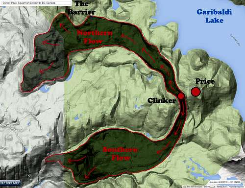
7000 BC Eruption
The Barrier is what is known as a lava dam. It presents a significant risk to the populations of Squamish and the lower Cheakamus River valley. A partial or total collapse of The Barrier could release a tremendous amount of earth and set free the water of Garibaldi Lakes. The most recent partial collapse of The Barrier took place between 1855 and 1856 and created a large boulder field around Rubble Creek. For this reason camping and residing in the area immediately below The Barrier is forbidden.
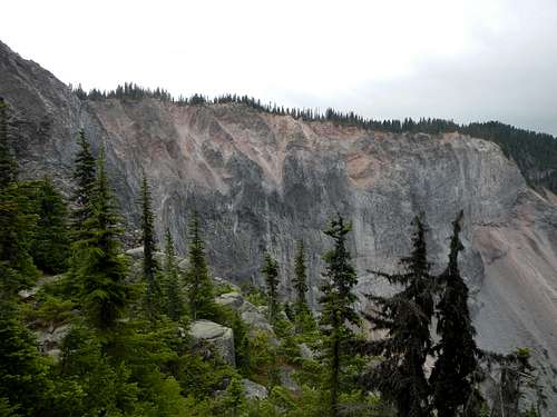
The Barrier
Hiking or skiing to the top of Mount Price and Clinker Peak is a rather long endeavor for a single day, however in the summer it is not unheard of. The standard route begins below The Barrier and makes use of trails to reach Garibaldi Lake. Official camping is provided by the Provincial Park on the west lakeshore but requires a backcountry permit and payment of a fee. Shared cabins on the lake are also available. From the lake a climbers path follows along a minor ridge through brush and lava boulder fields to the base of the mountain. Scree and snow slopes can be easily ascended to the summit.
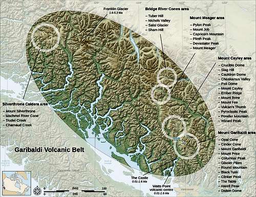
Garibaldi Volcanic Belt
Route Maps
Note: The above GPS track log does not show the traverse to Clinker Peak.
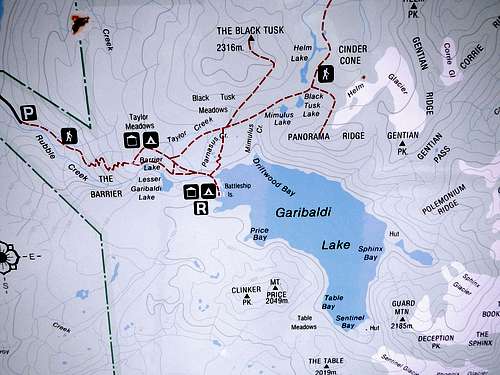
Hiking Signboard Map
Standard Route
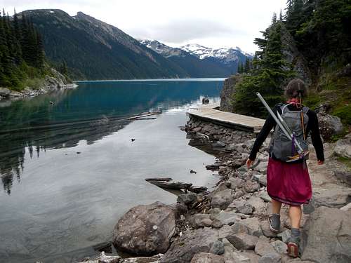
Garibaldi Lakeshore Trail
Battleship Islands
From the Rubble Creek parking lot follow the steep trail up past The Barrier to the Taylor Meadows trail junction. Take the right fork to Barrier Lake and continue toward Lesser Garibaldi Lake. At the largest of the three lakes, Garibaldi Lake, turn right at a fork and descend slightly to the Rubble Creek bridge crossing.
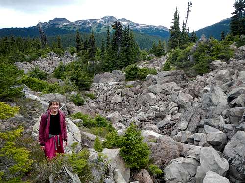
Crossing Lava Boulders
The trail contours the lake-shore and soon comes to the campground. Continue past the campground to Battleship Islands and continue until you come to the rangers boathouse. The Price/Clinker climbers path is behind the boathouse and usually marked with some flagging.
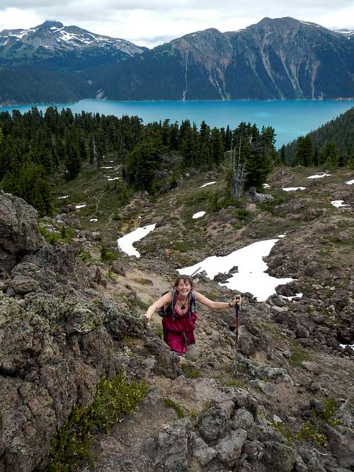
On The North Ridge
The climbers path winds through several boulder fields and can be tricky to follow amid the rocky sections, but is easy to discern for the most part. It will lead all the way to the base of the north ridge which emanates from the high point between Mount Price and Clinker Peak.
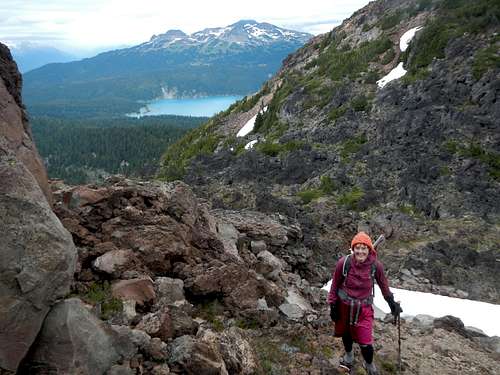
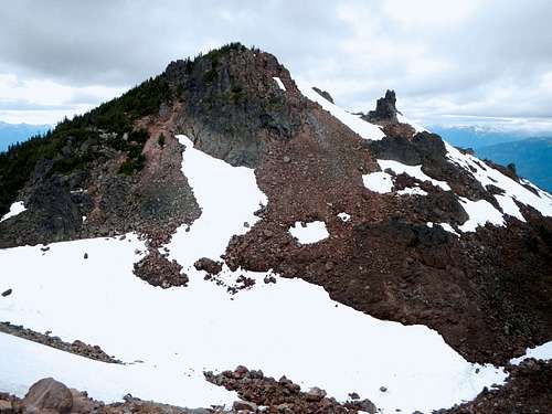
Clinker Saddle
Scramble class 2 on this north ridge or ascend easy snow slopes to near the top of the high point between Price and Clinker. If snow cover is at a minimum, expect some amount of volcanic scree. With lots of snow, be careful of avalanche danger on the upper slopes. Traverse west to the saddle which is east of Clinker Peak. There might be some rock hopping or easy scrambling on volcanic boulders.
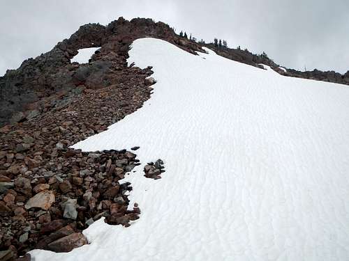
Snowfield Below The Summit
From the saddle ascend snow or rock to the upper north face passing between the main summit and a rocky spire. Ascend the final snowfield to the upper ridge crest and then follow the ridge crest back east to the highest summit rocks. Depending on how much snow is present, some class 3 scrambling might be necessary or it could be entirely a snow climb.
Camping Permit Link
Email: ParkInfo@Victoria1.gov.bc.ca
External Links
BC Parks WebsiteCamping Permit Link
Email: ParkInfo@Victoria1.gov.bc.ca
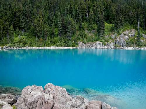 Azure Waters of Garibaldi Lake | External Trip Reports
Useful Wikipedia Links |