-
 10798 Hits
-
 84.82% Score
-
 19 Votes
|
|
List |
|---|---|
|
|
Aosta Northern and Switzerland Shouthern Valleys |
|
|
MATTERHORN also CERVINO OVERVIEW > to 10° ~
MONT BLANC/JORASSES/VERTE and 33 MOUNTAIN CHAINS of the AOSTA VALLEY & SURROUNDINGS
AOSTA VALLEY 360° from West to East and from East to West in TOPOGRAPHIC clockwise system and order from Seigne Pass towards Seigne Pass (PARTS A+B+C+D+E+F+G).
THIRD PART:
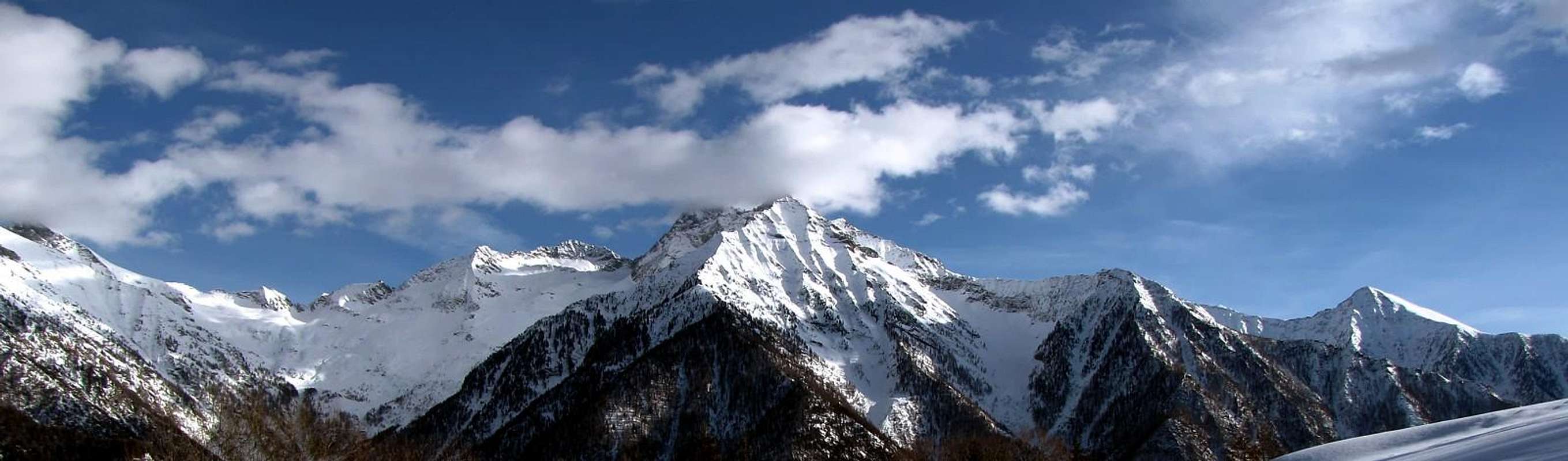
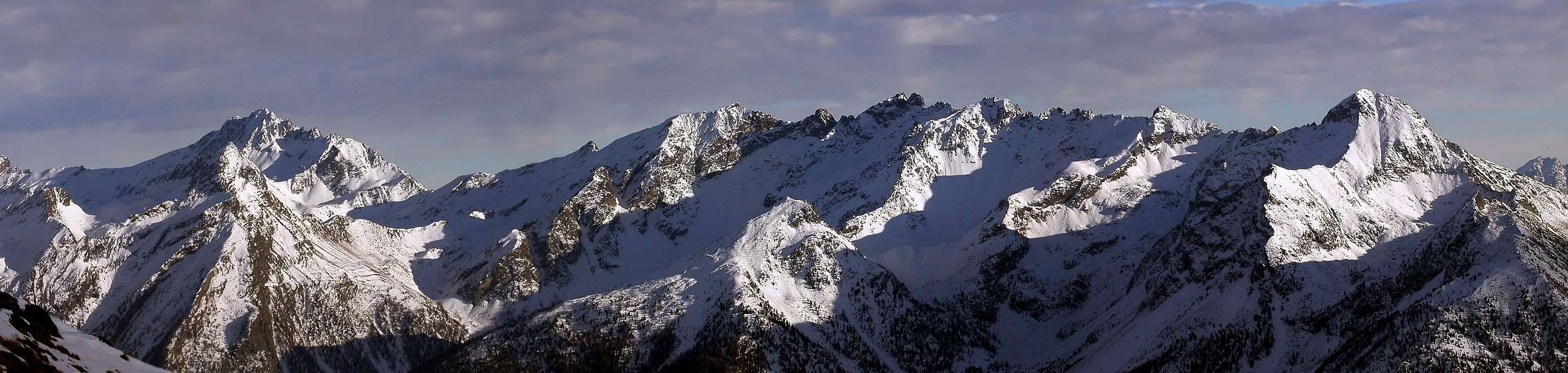
PART D)- AOSTA VALLEY PARTIAL HALFCIRCULAR NORTHERN PERIMETER (10°~) OUTSIDE AREA.
***
I am the PRINCE of Wild Ridges Rocky, my Elegance is unmatched,
by Corvus
![]()
^^^^^^^
LEGENDA
In red: paths, routes, cable railway, chair lift & main roads;
in green: Summits, Spurs, Buttress, Spires;
in blue: Glaciers, Lochs, Ponds, Streams, Torrents, Brooks & Fountains;
in purple: Passes, Saddles, Hills, Brèches, Carvings & Collars;
in brown: Historical Remarks, Sanctuaries, Hermitages, Oratories, Castles, Churchs, Chapels, Crosses, Cairns, Tumulus, Mines, Historic Bridges or Roads, Campings, meaning of place names & various informations.
Getting There
By car:- From TORINO, MILANO Cities, etc: Motorway A5. Exits at IVREA or
Pont St. Martin to Hone/Bard-Arnad little Towns: (Crabun-Cima Pietre Bianche South Slopes; Vert, Civa Arche, Finestra Passes and Machaby Corma; Rock Gym, among Champagnolaz, Sengla, Machaby, Albard di Bard Villages);
Verrès (Ayas Valley and Southern appendages to Becca Torché-Corno del Lago-M. dell'Aquila-Cima Graulà) and Vert, Civa, Dondeuil Passes;
Saint Vincent: (Zerbion-T. di Comagna-M. Ros Area, near Saint Pantaléon and Zuccore Passes);
Chatillon: (Valtournenche Valley and Southern appendages to Tantané-Zerbion Mounts, South Slope Area, near Joux Pass; to Becca d'Aver Area, near Saint Pantaléon Pass);
Nus: (Saint Barthélemy Valley and Mount Faroma-Becca of Luseney Area and Southern appendages to Aver-Longhede Area, near Saint Pantaléon Pass);
AOSTA Est: (Becca of Viou-Tsaat à l'Etsena little chain from Blavy and Trois Villes Villages; Becca Conge-Mount Faroma Area, near Saint Barthélemy Pass.
D1)- *** ALL EXTERNAL PASSES, saddles, brèches, collars, "carvings" & ROUTES from AOSTA VALLEY to SWITZERLAND
D1)- *** ALL EXTERNAL PASSSES, saddles, brèches, "carvings" and ROUTES from AOSTA VALLEY to SWITZERLAND. From West to East-northeast BETWEEN ITALY and SWITZERLAND from: Tourna(e)che, Leone, Breuil, Furggen, to Teodulo or Saint-Théodule also Théoduljoch. BETWEEN Tournenche Valley (I) and Zermatt-Valleise Valley (S): *** From Breuil-Cervinia (2000m) to e1)- TOURNA(E)NCHE or TORNENTZE also TORNENZA PASS (3486m); e1bis)- ; e1ter)- , e1quater)- APPROACH VARIANTS 1/4and descent, by Chérillon Pass (3536m); e2)-LEONE PASS (3571m). e1)- From Breuil-Cervinia (2000m; parking 2008m), through West direction, road toward Morces Village (2065m) and winding road 2117m; by path n° 11 and same direction to forkpaths with path n° Alta Via n° 3 (Aosta Valley High Route), near junction of two Mabérge Torrent, in quota 2250m. To cross in North-northeast direction toward Cors Pasture (2261m) and, up Cors Torrent, Alp 2332m (little lake 2292m, to Southeast), Crot Pasture (2367m), alternative 2400m~ with grounroad, near small Chérillon Dam and Torrent. By winding route to various ramifications of Fossu Torrent, in quota 2489m; cross and, by a large hairpin bend, before in Southeast, after in Northeast, to forkpaths in quota 2590m. Continue to left (Northwest), through Western ramification, along Chérillon Buttress (source, near little torrent, in quota 2640m~). By Chérillon Glacier left or Eastern lateral moraine, in edge, doubling in left (East) a rocky roundish promontory towards glacier (end of the path in quota 2910/30m~). To cross, by Northeast direction, moderate snowy slope (25°/30°) and, between quota 3100/200m~, turn right (East) to buttress. Climb easily (rocky plates I°/I°+) and by South/North direction to continue (quota 3183, 3321, 3412m), doubling in East some roughness, to terminal snowfield (27/8°) and Nino and Enzo Benedetti Bivouac (2510m). Descent to East, through snowy crest easily and briefly, to Tourna(e)nche or Tornentze also Tornenza Pass (3486m). The ascent directly, by very steep and difficult rocks (285/90m~), of the Southern Face, Never Made. Route for M a lot of Exp. e1bis)- VARIANT 1. From Breuil-Cervinia (2002m; near Golf Course), through West direction, road toward Chateau Village (2074m; +), Morces Village (2065m) and preceding routes. e1ter)- VARIANT 2. From Breuil-Cervinia (2000m; parking 2008m), through North direction, road toward Crétaz Village (2041m), crossroads 2110m to Chérillon Dam bridge 2936m and preceding routes. e1quater)- VARIANT 3. From Breuil-Cervinia (2000m; parking 2008m), through North direction, road toward Crétaz Village (2041m), crossroads 2110m; to continue, by same direction and road, to (+ Chapelle aux Morts de la guerre; war to Deaths Chapel; externally on lawn world wars olds cannons), in grassy promontory, quota 2143m (wonderful view to Matterhorn, South Face, West-southwest Ridge or Lion Crest, Southeast Edge also Furggrat). To reach, through road or path n° 12, the Lower Crot de Palet Alp (2273m), Higher Crot de Palet Alp (2411m) and Crot de Làbies Alp (2487m); from pastures, by West direction, to forkpaths 2516m and previous route e1)-. Route e1)- and all VARIANTS for Hikers as far as Chérillon Glacier. In descent: from bivouac, by West-northwest direction, snowy sommital crest, briefly, to Chérillon Pass (3536m); go down, by a enough steep and snowy slope (40°/35°; 550m), into Tiefmattengletscher, great amphitheatre (unbelievale views to Matterhorn, Zmuttgrat, West Face, Lion Crest and toward Dent d'Hérens Northern ice Face), in quota 2990m~, near a small rocky strip (2972m). Cross, before by North-northeast direction at Matterhorn Zmuttgrat base (Sattelti), in quota 3000m~. After, cross in Northwest to Zmuttgletscher, in quota 2700m~ (junction with Schonbielgletscher) to Schonbielhutte (2694m) and route d20)- towards Zermatt. The ascent or descent directly, by very steep snowy slope with hangings séracs (50°, even 55°, after 45°/40°; 365/70m~) of the North Face, Never Made. Rarely used pass, only through Chérillon Pass. Routes for M Exp; in day, for M Exp, a good training. e2)- From Breuil-Cervinia (2000m; parking 2008m), through North direction, road toward Lower Crot de Palet Alp winding road 2273m; turn in Northeast direction and, still by groundroad and path ---> n° 13, to cross the Porteiller Torrent toward winding road 2399m; from hairpin bend, through path, to Mont de l'Eura Pasture (2546m) and crossing three times the dirt road (source in quota 2688m), toward Duca degli Abruzzi Refuge (2810m, near two ponds 2789, 2806m and the Western sources of Mount Cervin Torrent; end of the dirt farm road). From refuge, still by same path, in left direction (Northwest), pond2806m, hairpin 2847m and, through North direction, to Croix de Carrel 2950m (Cross in memento of Jean Antoine Carrel "The Bersagliere", of Lion Crest winner on 1865, here dead, returning with clients in the storm from Matterhorn); to continue, by North direction, and briefly at Lion Head South Edge base, in quota 3007m. Climb left (West), by a snowy or debris cone, at a first large balcony (3145/50m~); again to left and, through a rubbles couloir before in diagonal after vertically in edge (I°/I°+), supere the higher rocky band to a second short balcony and a more large snowfield. Before, turn briefly right (East) and to skirt along eastern border; after go up directly to a small narrowing and following upper snowfield, below the of Lion Head Summit Southern Wall (30°/35°; I°+; exposed in East; rocks falls danger). Cross, level route to right (East-northeast), by a Leone Pass (3571m), between Lion Head/Tyndall Peak. Route for M Exp; a good training in day from Cervinia toward Zermatt. *** From Duca degli Abruzzi Refuge to e2bis)- LEONE Pass (3571m); e3)- BREUIL PASS also BREUILJOCH (3329m CNS). e2bis)- DIRECT VARIANT. From Duca degli Abruzzi Refuge, by same route, to a first large balcony; turn right (Northeast) and, by a easy snowfield, rubbles and small rocks, reach the Peak Tyndall Upper Glacier, in altitude 3200/10m~. To cross entirely and easily, by North-northeast direction, at South-southeast Face base, in quota 3330m~; climb, by a snowy narrow gully or a rocky Eastern side, to Leone Pass (3580m). Route now historical and rightly deserted, >continuously rocks fallings exposed; (first, by Victor Carrel and Gabriele Maquignaz on 1857 and in S/N traverse by Paul Gussfeldt with famous swiss Mountain Guide Alexander Burgener in 1881; from N/S Albert Fredrick Mummery, still Burgener in 1880). For M very Exp; and a good training in day. In descent: by North direction, a repulsive, winding and dangerous gully, or by right (East) rocky side, (60°, even 65°; III°+; 445/450m~, continually rocks falls exposed; verglass possibilities, almost sureness), to go down into Higher Tiefmattengletscher, in quota 3125m~. Cross the glacier, by North direction, to "plateau" 2975/3000m~, Sattelti and previous route e1)-. Same previous remarks. Route for M very Exp; in day and for M deal of Exp. and a good training from Cervinia toward Zermatt. e3)- From Duca degli Abruzzi Refuge go up, through North direction, of dirt road terminal part, between the little lakes 2789, 2806m, traces and rubbles to minilake 2852m, near Lower Peak Tyndall Glacier, left lateral moraine. Turn right and, by traces in moraine, to Mount Cervin Glacier Western source, in quota 2900m~; cross, by East-northeast direction, entirely and easily the glacier, below Peak Tyndall, Matterhorn, Peak Muzio Southern Faces, at Furggrat or Furggen Crest base, in quota 3200m~ (splendid views toward Matterhorn South Wall, West and Southeast Ridges).To climb in "soft" right diagonal, by snowfields or debris, below a clear rocky strip, to Breuil Pass also Breuiljoch (3329m CNS), between quota 3335/3350 m and near the Oreste Bossi Bivouac (3345m). From Cervinia to Duca degli Abruzzi Refuge for Hikers (E). From refuge to Breuiljoch for HikExp. (EE); crossing in day from Cervinia toward Zermatt for Hik. Exp (EE) a good training. *** From Breuil-Cervinia (2000m) to e3bis)- VARIANTS 1/2 toward or near Duca degli Abruzzi Refuge, also e4)- directly to FORCLAZ PASS or FURGGJOCH (3273m); e5)- Western FURGGSATTEL (3350m); e6)- Eastern FURGGSATTEL (3351m) and e6bis)- VARIANT 1 from Teodulo Refuge (3316m); e7)- TEODULO PASS also THE'ODULJOCH or SAINT-THEODULE (3316m); e7bis)- VARIANT 1. From Testa Grigia (Grey Head) Cable Railway (3480m); Matterhorn Guides Refuge ;3467m).e3bis)- VARIANT 1. From Breuil-Cervinia (2000m; Guides Home (2089m), near Djomein (2056m), Fallinier (2097m) Villages to road obstruction, in quota 2105m; to continue, by various farm dirt roads to left and in right with connections. Better to right, by East-northeast direction, path ---> n° 14, along Vieille Torrent, near Djomein Crest to Plan Torrette Alp (2470m); from pasture, through brief digression to Southeast, to Plan Maison Station Cable Railway (2561m). Continue, by North direction, path ---> n° 14, crossing afterwards the Vieille Torrent and Plan Maison Torrent in Plan Maison Tableland to fork paths, in quota 2671m. From cross two possibilities: 1)- turn left (West-northwest) and, by same path, 2)- to right, by unnumbered path with halfcircular route, to ex K2 Cabine, in altitude 2822m. From cabine, by Northeast direction, discontinuous of path trace to quota 3007m, below the Mount Cervin Glacier Eastern sources. Leaving East the deviation to Forclaz Pass or Furggjoch, reach the glacier, in quota 3150m~ and route e3). In descent, by North-northwest direction, moderate snowy slope (28°; 555m) into Furgg Gletscher, in quota 2975m, near a basal rocky strip. Double in right (East) the séracs fall, below Matterhorn East Face (goods views, as well to Breithorn/Lyskamm North ice Walls); go down, by moderate descent, in Furgg Gletscher toward lateral moraine (arrival Station of Chair Lift, in quota 2670m), little lake, near the path (to Ornlihutte), in quota 2720m~. Descend, by Northeast direction, path to Schwarzsee (2558m), Schwarzsee Hotel (2589m), near Furgg Station (2432m), fork, Hermettji Alp, Furi Village (1886m), Zermatt. Same previous remarks; for HikExp (EE) a good training. e4)- From Breuil-Cervinia (2000m; P 2008m), through preceding routes e3)- , e3bis)- to Mount Cervin Glacier Southern sources, in quota 3030/40m~; turn right (East) and, by path/trace, snowfields, easily, to Forclaz Pass or Furggjoch also Furggen (3273m), between Quota 3350m/Quota 3281m Forclaz Crest. In descent: by Northeast direction, moderate snowy slope (27°; 100m) to Quota 3350m North Ridge, in quota 3170/5m~; go down, by traces and debris towards a narrowing above Furgg Gletscher, in quota 2950m~. Cross to Northwest rejoing the previous route e3)- and same descent. To Duca degli Abruzzi Refuge for Hikers (E); from refuge to Breuiljoch for HikExp. (EE); crossing in day from Cervinia toward Zermatt for HikExp (EE) a good training. e5)- From Breuil-Cervinia (2000m), by previous route e3bis)- to Plan Maison Station Cable Railway (2561m); continue, by dirt road/path n° 15, between Vieille Torrent and Plan Maison Torrent to of chair lift arrival, in quota 2792m. Go up, by North-northeast direction, grassy, rubbles and moraine, between Vieille Torrent and Fornets Entrenchment (3050m) at Forclaz Crest base, in quota 3125m~; by a rocky band enough steep of South Wall and traces (I°+; 225m), to Western Furggsattel (3350m), between Forclaz Head/Furgghorn. In day from Cervinia to Western Pass: for HikExp (EE), a good training. In descent: by North direction, snowy slope (32°/30°; 150m) to Furgg Gletscher/Oberer Theodulgletscher junction, in quota 3150/200m~, near a rocky islet 3168m. From Furgg/Theodul junction two possibilities: 1)- to cross in easy descent, by Northwest direction on Furgg Gletscher to e3)- , e4)- previous routes; 2)- descend, by Northeast direction, and to cross, by moderate slopes, the Oberer Theodulgletscher to Gandegghutte (3036m). From refuge: a: with Norht direction, path ---> n° TMR, to Trockener Steg 2946m); b: by North-northeast direction, path along ponds 2952, 2863, 2859m (path connection near two last ponds) toward Lichenbretter/Uf der Mur /Garten Area. From paths junction, by half-circular route to Lichenbretter Area, cross twice the two Gerwetsch Torrents, in quota 2800m~; continue, by North-northwest direction and almost level route, to Sandiger Boden Torrent, in quota 2685m~ above Uf der Mur (2713m). By path and sinuous route in Garten, to road, near Gartfad; from this point others two alternatives: a)- with West direction, road to Furgg Steg (2432m), Schwarz Hotel (2589m) and previous route to Zermatt. b)- by Northwest direction, path to Furggbach, in quota 2350m. Go down, by Northeast direction, before along the torrent East border, after to cross in quota 2225m~; descend to North, near the Furi/Furgg Cable Railway to and between Schweigmatten (1822m) / Furi (1886m) Villages by Zermatt. Crossing in day from Cervinia to Zermatt: for Hik. Exp (EE), a good training. e6)- From Breuil-Cervinia (2000m), by previous routes e3bis)-, e5)- to Plan Maison second station of chair lift to Theodulhorn Southeast Crest, near winding road 2792m; continue, by East-southeast direction, groundroad/path n° 15, TMR, near two ponds and between Fornets Entrenchment (3050m) and Bontadini Chapel (3048m; to right). Go up, by East-northeast direction, grassy moderate slope, rubbles (sources in Southeast) to small debris promontory 3205m; with same direction and moraine, easily, to Eastern Furggsattel (3351m), between Furgghorn/Theodulhorn. For Hikers (E). e6bis)- VARIANT 1 from Teodulo Refuge (3316m; see e7)-), by North-northwest direction in moraine and little easy rocks, briefly, to previous route, up the pass. For Hikers (E).![CERVINO (MATTERHORN) South Wall September 2003]()
![<B>From <font color=green>LITTLE MATTERHORN </font>to NORTHWEST ....... <FONT COLOR=ORANGE> AT SUNSET </FONT></B>]()
![From Klein to Matterhorn]()
![<B>From <font color=green>LITTLE MATTERHORN </font>to WEST in .......<FONT COLOR=BLUE>THE MORNING</FONT></B>]()
![CERVINO (MATTERHORN) from Mont Corquet September 2003]()
In descent: by brief, moderate, easy slope (25°/27°; 100m), below Swiss station ski chair lift from Trockener Steg to Theodulhorn into Oberer Theodulgletscher, in quota 3250m~; by North-northeast direction, to, and below a second Fornet ski chair lift, connection trace Gandegghutte/Teodulo Refuge, in quota 3150m~. From connection: a)- by brief and easy ascent to Teodulo Pass (see e7)- ); b)-, by crossing in North-northeast direction Oberer Theodulgletscher to Gandegghutte. In descent: for M or HikExp. (EE/A). e7)- From Breuil-Cervinia (2000m), by routes e3bis)- , e5)-, e6)-, East-southeast direction, same groundroute/path ---> n° 15, TMR, below the Plan Maison third station of chair lift, to winding road 3175/80m~; continue, before by South-southeast direction, after East to Teodulo Pass or Théoduljoch also Saint-Théodule (3316m). In descent: by North direction and by crossing on Oberer Theodulgletscher, below the Theodul Swiss chair lift, easily to connection. For M or HikExp. (EE/A); in very ancient times for mules. e7bis)- VARIANT 1. From Testa Grigia (Grey Head) Cable Railway (3480m; Matterhorn Guides Refuge (3467m), by brief, easy descent and crossing on Oberer Theodulgletscher, speedly, to Saint-Théodule Pass. For Hik. Exp. (EE). 2)- INSIDE RANGES Dora Baltea Stream Left Hydrographic Watershead from West to East-southeast: to East from Courmayeur Tourist Town and Morgex little Town in Valdigne; from La Salle, Saint Pierre, Sarre little Towns in Middle AOSTA VALLEY to AOSTA Town (East). To Southeast: from Saint Rhémy en Bosses, Saint Oyen, Etroubles, Gignod Communes in Great Saint Bernard-"Coumba Freida" Valley to AOSTA (Southeast). To East, Northeast, East and Southeast: from City to Saint Barthélemy, Valtournanche, Ayas Valleys (Northeast) and to Quart, Nus, Chambave, Verrayes, Saint Denis, Chatillon, Saint Vincent, Emarese, Montjovet, Verrès, Arnad, Bard, Donnas, Pont Saint Martin, Perloz little towns (East-southeast) in AOSTA VALLEY.D2)- *** AOSTA VALLEY DORA BALTEA HYDROGRAPHIC CATCHMENT BASIN ALL SUMMITS of Left Side. GREAT TRIANGULAR AREA, vertex MATTERHORN amongst Valpelline, Coumba Freida, Central Valley (Aosta), Saint Barthélemy, Valtourna(e)nche (Breuil-Cervinia), Val d' Ayas
^^^^^^^ ![]()
GRAND (3379m) & LITTLE TOURNALIN (3207m) DOUBLE TRAVERSE, on SEPTEMBER 22th, 1974 31)- Grand TOURNALIN little Chain: Petit Tournalin/Bec Trécare;Pointe Trécare; Pointe Fallinère-Pointe Fontana Fredda/Mont Charvaz; Bec de Nana/La Grand Dent/Mont Tantané/Mont Zerbion/Pic Bellin/Mont Jetire/Cima Botta/Testa di Comagna/Pointe de Tzecore or Zuccore/Monte Obrè/Mont Ros/Mount Saint Gilles.![<font color=purple>TOURNALIN s Pass</font> (3145m) on 1974]()
![Great Tournalin (3379m) ascent by South Ridge & <B><FONT COLOR =BLUE>DOUBLE TRAVERSE</FONT> on 1974</B>]()
![Grand Tournalin (3379m) on the True SUMMIT 1974]()
![Grand Tournalin (3379m) descent by North Ridge on 1974]()
![Grand Tournalin (3379m) on NE or True SUMMIT 1974]()
SENEVE POINT (2928m) First or Second Absolute Ascent?, by Southeast Slope in ascent and in descend and Double Traverse through the Southwest Ridge, on OCTOBER 08th, 1972 & MOUNT MARY/POINT of CHAMEROD/LES PRELES Traverse, on SEPTEMBER 30th, 1971 32)- Becca di Roisan/Becca di Blavy/Becca di Viou/Mont Mary/Pointe de Chamerod/Les Prèles West and East/Tete d'Arpisson/Quota 2888 meters/Pointe de Senevé/Campanile di Senevé/Quota 2945 metres around/Tsaat à l'Etsena West and East. Punta Henry/Becca Conge. Mont Faroma Southern Area: Grand Pays/Becca d'Aveuille. Three Denti di Vessona/Mont Pisonet; Becca Fontaney. Cima Franco Nebbia/Becca del MERLO little Chain.![From NE Crest of M. Mary September 1971]()
![Chamerod s very ancient rascard desasparecido 1972]()
![PUNTA di SENEVE (2928m) Second Ascent?]()
![Senevé s Point & the ridge toward West]()
![Senevé s Points (2928m) First or Second Absolute Ascent?]()
![Ancient tree & Arpisson s Head above Senevé Alpage]()
GRAND PAYS (2726m), near the Valchourda Alp (2392m) under the Lechy Pass (2585m) and BECCA of AVEILLE (2623m) on SUMMIT, by Northern Face, in OCTOBER 13th, 1974 ![Becchi di Fana Northern Slopes from Grand Pays 1974]()
![Valchourda Alp <i>(2385/92 meters about)</i>)]()
![BECCA d AVEILLE (2623m), lone on the TOP on 1974]()
BECCA di LUSENEY, Superdirect new route: THIRST & FATIGUE, in AUGUST 15th, 1977 ![<b><font color =blue>LUSENEY Becca</font> (3504m) <font color=blue>North Face</font> 1977 <font color=blue>Feast of the ASSUMPTION</FONT></B>]()
![<b><font color =blue>LUSENEY s Becca NORTH Face</font> (3504m) <B><FONT COLOR=RED>AUGUST HOLIDAY </FONT>(15th, 1977)]()
![Becca di Luseney]()
![<font color=red><b>AOSTA s </font>VALLEY in the <font color=blue>SUMMITS <FONT COLOR=GREEN>LUSENEY</FONT></font> <font color=brown>THE TWO SNAKES</FONT>: <font color=red>THIRST</font> & <font color=purple>FATIGUE</b></font>]()
![<font color=red><b>AOSTA s </font>VALLEY in <font color=blue>SUMMITS</font> <font color=green>LUSENEY</FONT> NORTH<font color=red> FACE </font>Superdirect route</b>]()
![Becca di Luseney]()
![AOSTA s VALLEY in SUMMITS EMO & SUGG BECCA di LUSENEY (3503 m) on the TOP]()
Luseney-Ollière Aspis VIPER (JUNE 27th, 2000) to North Face Actually Years 2000 ![AOSTA VALLEY in the SUMMIT <font color=brown>Becca of Luseney ASPIS</FONT></B>]()
![Luseney: Dissolution Ice Age]()
![<font color=red>AOSTA</font> VALLEY in the<font color=green> SUMMITS LUSENEY s BECCA</font> <font color=brown>Ollière s VIPER</FONT>]()
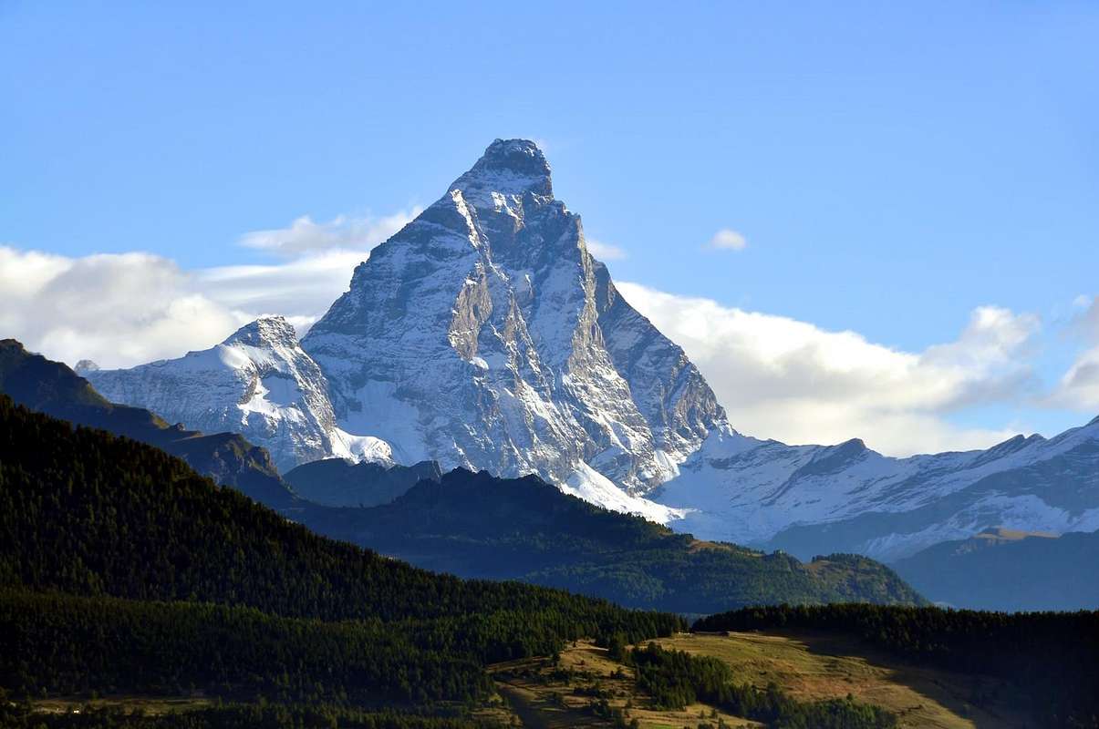
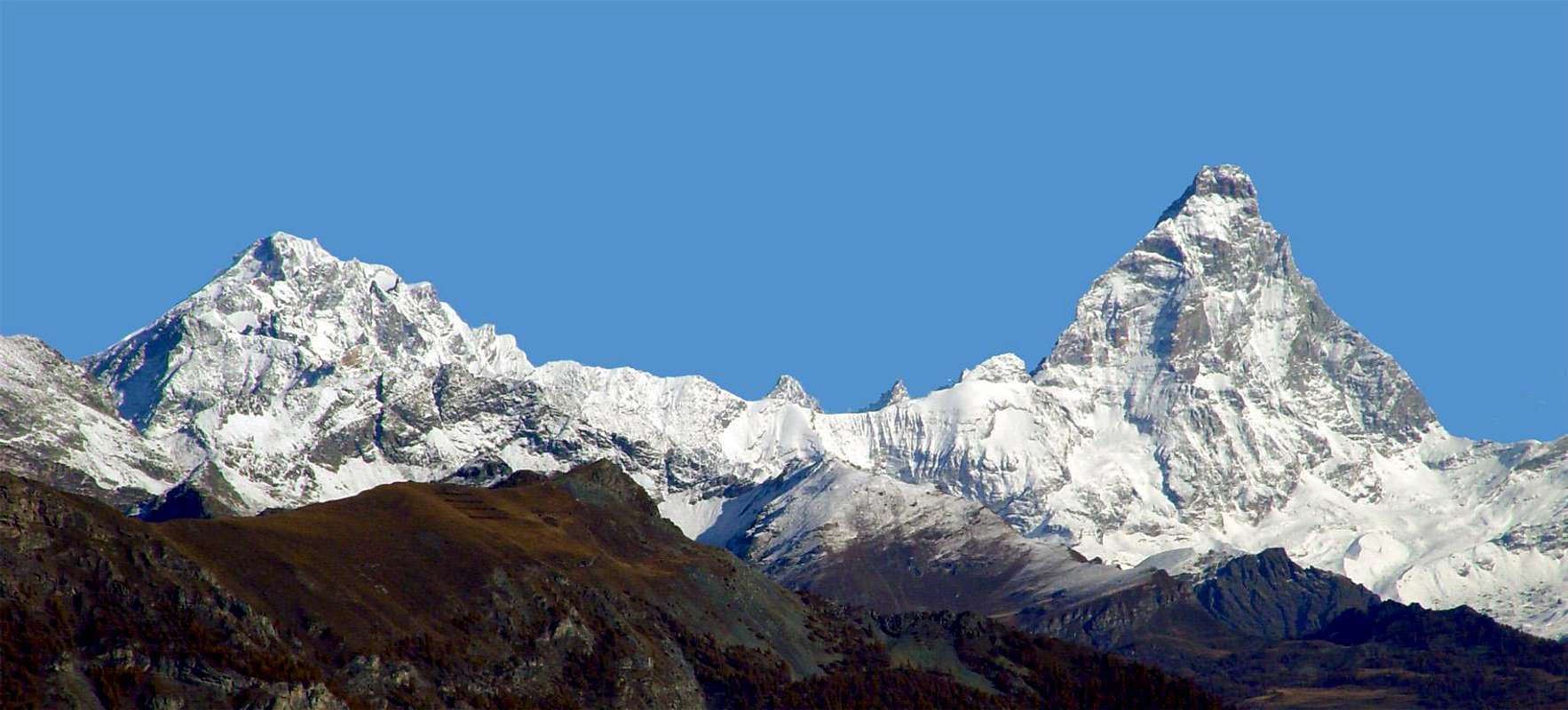
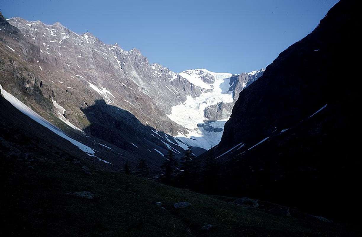
DENT d'HERENS / CERVINO also MATTERHORN AREA
![]() DENT d' HERENS Area: Albertini Crest to South - Pellissier-Albertini Bivouac. Great ramification to East: Pointe Carrel - Pointe Blanche - Pointe Maquignaz - Novella Bivouac - Pointe Marie-Christine - Quote 3674, 3637, 3529, 3544m - Benedetti Bivouac, near Tournenche Pass - Tete du Lyon - (+ Carrel; + dead of the War Chapel, to South) and Duca of the Abruzzi Refuge in South; Jean Antoine Carrel and Luigi Amedeo Refuges to East - Pic Tyndall - CERVINO (Matterhorn; *; +)) AREA:: Solvayhutte and Hornlihutte on Northeast Ridge - Bossi Bivouac at Furggrat Edge base, near Breuil Pass or Breuiljoch - Tete de la Forclaz or Furggen - Tete du Breuil also Furgghorn - Mont de Saint Théodule or Theodulhorn or Corno del Teodulo - Tete Grise - Matterhorn Guides Refuge. Ramification to South: from Plateau Rosà Pass or from Cimes Blanches North Pass: Gran Sometta Cimes Blanches Lake to North - Motta de Plète (East, Central, West (+)) Great Golliet Lake - Bec du Pio Merlo; Cimes Blanches (Bec Carré, Pointe North and South) Adventine Lakes to Northeast - Mont Roisetta. Little ramification to Southwest: Dents d'Aran - M. Palon - Becca d'Aran - Mont de Molar - Albergo Panorama Bich to Southwest.
DENT d' HERENS Area: Albertini Crest to South - Pellissier-Albertini Bivouac. Great ramification to East: Pointe Carrel - Pointe Blanche - Pointe Maquignaz - Novella Bivouac - Pointe Marie-Christine - Quote 3674, 3637, 3529, 3544m - Benedetti Bivouac, near Tournenche Pass - Tete du Lyon - (+ Carrel; + dead of the War Chapel, to South) and Duca of the Abruzzi Refuge in South; Jean Antoine Carrel and Luigi Amedeo Refuges to East - Pic Tyndall - CERVINO (Matterhorn; *; +)) AREA:: Solvayhutte and Hornlihutte on Northeast Ridge - Bossi Bivouac at Furggrat Edge base, near Breuil Pass or Breuiljoch - Tete de la Forclaz or Furggen - Tete du Breuil also Furgghorn - Mont de Saint Théodule or Theodulhorn or Corno del Teodulo - Tete Grise - Matterhorn Guides Refuge. Ramification to South: from Plateau Rosà Pass or from Cimes Blanches North Pass: Gran Sometta Cimes Blanches Lake to North - Motta de Plète (East, Central, West (+)) Great Golliet Lake - Bec du Pio Merlo; Cimes Blanches (Bec Carré, Pointe North and South) Adventine Lakes to Northeast - Mont Roisetta. Little ramification to Southwest: Dents d'Aran - M. Palon - Becca d'Aran - Mont de Molar - Albergo Panorama Bich to Southwest.![Matterhorn seen From Dent...]()
![Dent d Herens]()
![Tour du Creton and the Bivouac Laura Florio .]()
![Mont Blanc du Créton]()
![<font color =green>DENT d HERENS</font> (4175m) on the SUMMIT SEPTEMBER 1966]()
![DENT d HERENS on the snowy terminal crest, on1966]()
![CERVINO also MATTERHORN from DENT d HE RENS SUMMIT]()
![Dent d Hérens]()
![]()
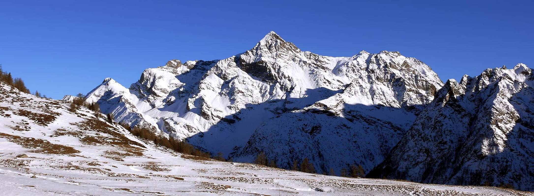
GRAND TOURNALIN / MONT ZERBION AREA
![]() Continuation great ramification in arc to South between Valtournanche/Ayas Valleys: Bec de Nana; Mont Facebelle to East little Crest; La Grand Dent - Cleyva Bella Lake in West - Mont Tantané (+; Neolithic traces in Southwest; ski-mountaineering) - Champlong Lakes in Northwest, Charey, Croux, Grande Puine little Lakes in West - Lod Lake, near La Magdeleine Tourist Village above Antey Saint André Bourg - Mont Zerbion Little Area (great Virgin Mary statue): Pic Belin - Mont Jetire - Cima Botta - Testa di Comagna - Punta Zuccore or Zucore also Tzecore - Mont Obrè - Mont Ros (X mines) - Mount Saint Gilles (+).
Continuation great ramification in arc to South between Valtournanche/Ayas Valleys: Bec de Nana; Mont Facebelle to East little Crest; La Grand Dent - Cleyva Bella Lake in West - Mont Tantané (+; Neolithic traces in Southwest; ski-mountaineering) - Champlong Lakes in Northwest, Charey, Croux, Grande Puine little Lakes in West - Lod Lake, near La Magdeleine Tourist Village above Antey Saint André Bourg - Mont Zerbion Little Area (great Virgin Mary statue): Pic Belin - Mont Jetire - Cima Botta - Testa di Comagna - Punta Zuccore or Zucore also Tzecore - Mont Obrè - Mont Ros (X mines) - Mount Saint Gilles (+).![Becca Trecarè]()
![Grand and Petit Tournalin]()
![Grand and Petit Tournalin]()
![Becca d Aran]()
![from the left, Zerbion, col...]()
![steepy route]()
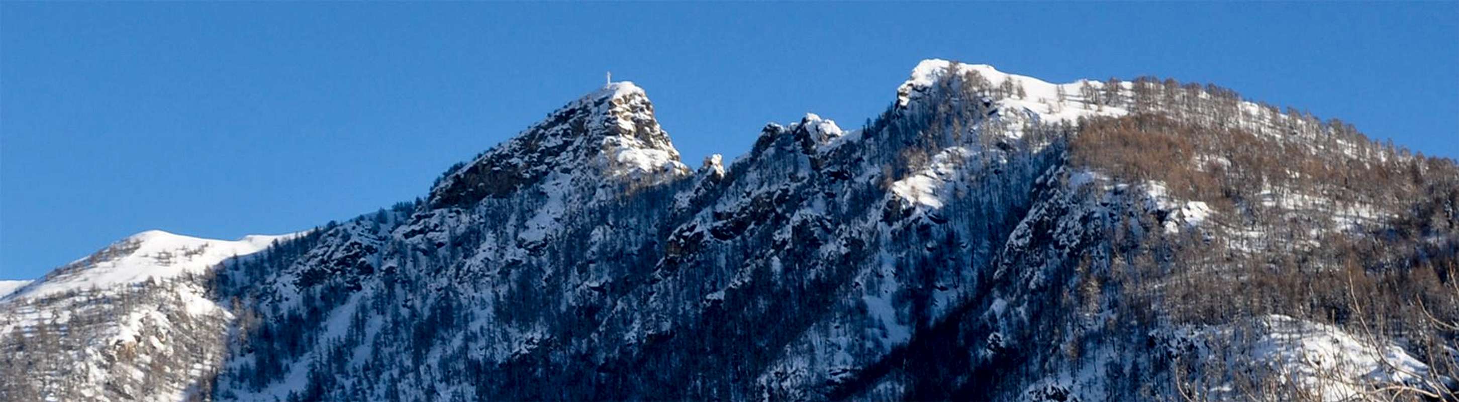
![<font color =blue><b><i>ARRIVING</I></FONT> to <font color=blue>WINTER ZERBION</FONT> and <FONT COLOR=BLUE><font coloR=blue>VIRGIN MARY Statue</B></FONT>]()
![Grand Tournalin]()
![]()
MONT NERY-DAMES de CHALLAND / CORNO del LAGO / MONT CRABUN AREA
![]()
![]()
![]()
BECCA di VIOU / MONT FAROMA / BECCA del MERLO AREA
![]() Mont Faroma Area (*): Vessona Jags - Mont Pisonet; Becca Fontaney (above Cuney Sanctuary) - Champorcher Coastline - Mont morion also Mont-Rion (Round Mount). Cima Franco Nebbia. Great ramification to North-northwest: Punta Vallepiana - Becca de l'Aqueloù or Becca de La Culo(a)z also Becca dou Teuro (to smoke, for the landslides) - Becca Etresenda - Becca du Mélèze - Becca d'Invergnaou (Southwest, Central, Northeast Summits). From Southwest Summit to West-northwest: M. Echeut - Rayes d'Adam. From Northeast Summit to North: Cornet de l'Invergnaou (South Point, Central or Pointe du Bonhomme, North also des Bergers (Shepherds Point) - Pointe de Bachal or du Bachà - la Gran Becca. Becca del Merlo Area (*): Little Becca del Merlo; Hermite de Cuney - Punta Montagnaya or Montagnayes Points to Montagnaya Pass
Mont Faroma Area (*): Vessona Jags - Mont Pisonet; Becca Fontaney (above Cuney Sanctuary) - Champorcher Coastline - Mont morion also Mont-Rion (Round Mount). Cima Franco Nebbia. Great ramification to North-northwest: Punta Vallepiana - Becca de l'Aqueloù or Becca de La Culo(a)z also Becca dou Teuro (to smoke, for the landslides) - Becca Etresenda - Becca du Mélèze - Becca d'Invergnaou (Southwest, Central, Northeast Summits). From Southwest Summit to West-northwest: M. Echeut - Rayes d'Adam. From Northeast Summit to North: Cornet de l'Invergnaou (South Point, Central or Pointe du Bonhomme, North also des Bergers (Shepherds Point) - Pointe de Bachal or du Bachà - la Gran Becca. Becca del Merlo Area (*): Little Becca del Merlo; Hermite de Cuney - Punta Montagnaya or Montagnayes Points to Montagnaya Pass![CERVINO or MATTERHORN Mont Faroma Cross 1999]()
![View of the mountains of the...]()
![la becca del Merlo]()
![Games shadow]()
![Vessona s Jags]()
![Mount Faroma from North]()
![Monte Faroma]()
![Monte Faroma]()
![CERVINO or MATTERHORN Mont Faroma Summit 1999]()
![]()
BECCA di LUSENEY / CIMA BIANCA / BECCA d'AVER AREA
![]() Southern ramification: from Praz Terray Pass Saint Barthélemy Crest - Crottes Becca and Tower - Cime(a) Bianca (+) - Mont Miracle - Mont Meabé (North and Southwest (+) - Praz roux - M. de la Fenetre - Becca d'Aver - Cima di Longhede (+) - Tete du Filon - Monte Ander - Cima La Pesse.
Southern ramification: from Praz Terray Pass Saint Barthélemy Crest - Crottes Becca and Tower - Cime(a) Bianca (+) - Mont Miracle - Mont Meabé (North and Southwest (+) - Praz roux - M. de la Fenetre - Becca d'Aver - Cima di Longhede (+) - Tete du Filon - Monte Ander - Cima La Pesse.![Patrese climbing the eastface]()
![at 2600 meters]()
![A snow couloir above the Prà de Dieu.]()
![The east ridge.]()
![The east ridge.]()
![Becca d Aver and Cima di Longhede from Mont Meabé]()
![Cima Longhede da N-NW]()
![Becca de Luseney seen from Monte Cervo.]()
![]()
MONTE DRAGONE / FONTANELLA / PUNTE di BALANSELMO / DOMES/PUNTA CIAN AREA
![]() Valcornera or Valcournera also Valcornière Pass and from pass Punte di Fontanella Area(South (*), Central, North Summits) - Monte Dragone; Petit Mont Dragon; to Bella Tsa Pass - Bella Tsa little lakes, Grand Lake, Mount Dragone Lake and Perucca-Vuillermoz Refuge to South. Angular ramification bifore to East and after to South: from Cian or Tsan Pass - Punta Cian (+) - Rivolta Bivouac in Fort Pass - Becca di Salé - great Cignana Lake and Barmasse Refuge, in East - Mont Saleron - Mont d'Ersaz - Cortina little Lake, in East - Quote 2754, 2711, 2657, 2547m to Ersaz Pass (two) and Quote 2477, 2471, 2438m to Ersaz Fenetre above (+) Gilliarey Sanctuary .
Valcornera or Valcournera also Valcornière Pass and from pass Punte di Fontanella Area(South (*), Central, North Summits) - Monte Dragone; Petit Mont Dragon; to Bella Tsa Pass - Bella Tsa little lakes, Grand Lake, Mount Dragone Lake and Perucca-Vuillermoz Refuge to South. Angular ramification bifore to East and after to South: from Cian or Tsan Pass - Punta Cian (+) - Rivolta Bivouac in Fort Pass - Becca di Salé - great Cignana Lake and Barmasse Refuge, in East - Mont Saleron - Mont d'Ersaz - Cortina little Lake, in East - Quote 2754, 2711, 2657, 2547m to Ersaz Pass (two) and Quote 2477, 2471, 2438m to Ersaz Fenetre above (+) Gilliarey Sanctuary .![Retrait of Dome de Cian glacier]()
![Punta Cian - Placche Rey]()
![Gruppo di Punta Cian]()
![Dome de Cian SE Normal Route Upper Chavacour Valley]()
![Dome de Cian - Lake Cian]()
![Dome de Cian SE Side Normal Route]()
![The rimaye at the left of the wall]()
![The wall]()
![]()
COMPLETE WORKS & OPERA PHOTOGRAPHIC SUMMARY
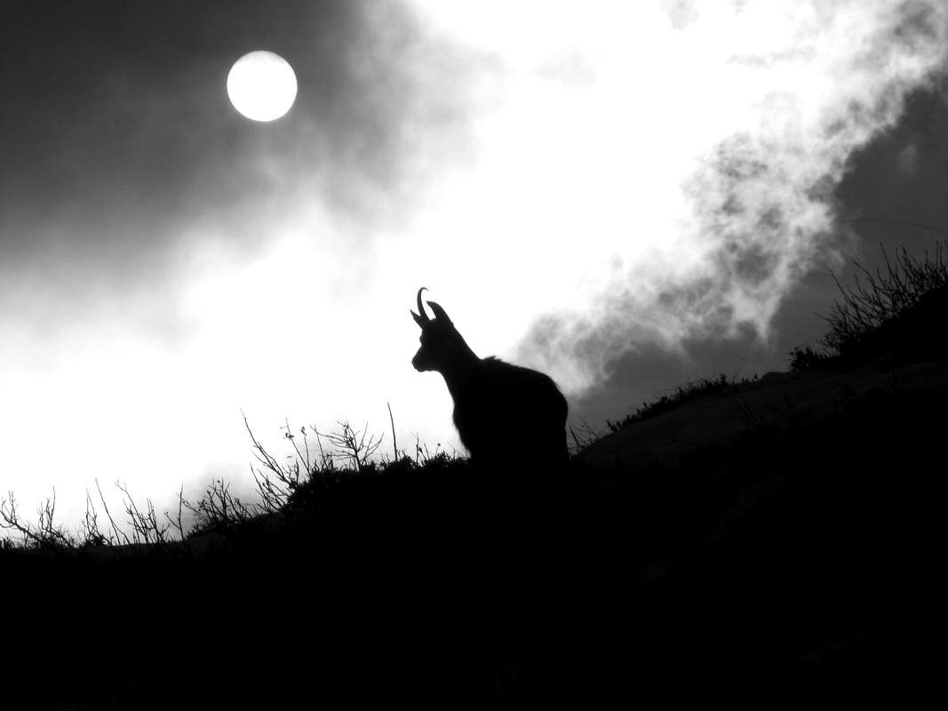
Idealization, of the Omnia Work and texts, by Osvaldo CARDELLINA. Mountain Chains & action Colorphotos, colorpictures, B&W photographs, by Antonio GIANI, Emilio BERTONA & Osvaldo CARDELLINA. Moreover, Action photographs & other, by Various AUTHORS & WRITERS: "Luseney NORTH FACE Superdirect route"; by Camillo Roberto FERRONATO; "BECCA di LUSENEY(3503m) on the TOP"; by Camillo Roberto FERRONATO; "Ollière Viper", by Camillo Roberto FERRONATO; "Luseney Asp", by Camillo Roberto FERRONATO; "LUSENEY THE TWO SNAKES: THIRST & FATIGUE", by Camillo Roberto FERRONATO; "Great Tournalin (3379m) ascent by South Ridge & DOUBLE TRAVERSE on 1974", by Marco COSSARD; "Grand Tournalin (3379m) descent by North Ridge on 1974", by Marco COSSARD; "From LITTLE MATTERHORN to NORTHWEST ....... AT SUNSET", by Gianni JUNOD; "From LITTLE MATTERHORN to WEST in .......THE MORNING", by Gianni JUNOD; "BECCA d'AVEILLE (2623m), lone on the TOP on 1974", by Marco COSSARD "Senevé Points (2928m) First or Second Absolute Ascent?", by Camillo Roberto FERRONATO; "PUNTA di SENEVE' (2928m) Second Ascent?", by Camillo Roberto FERRONATO; "Valchourda Alp (2385m)", by Marco COSSARD; "TOURNALIN Pass (3145m) on 1974", by Marco COSSARD; "Ancient tree & Arpisson Head", by Saverio CUSUMANO; "From NE Crest of M. Mary September 1971", by Saverio CUSUMANO; "Chamerod very ancient "rascard" desasparecido 1972", by Camillo Roberto FERRONATO; "Senevé Point & the ridge toward West", by Camillo Roberto FERRONATO; "Retrait of Dome de Cian glacier", by fabrizior; "The rimaye at the left of the wall", by fabrizior; "The wall", by fabrizior; "Punta Cian - Placche Rey", by Maurizio DANGELO; "Dome de Cian SE Normal Route Upper Chavacour Valley", by Silvia MAZZANI; "Dome de Cian - Lake Cian", by Silvia MAZZANI; " Dome de Cian SE Side Normal Route", by Silvia MAZZANI; "Becca de Luseney seen from Monte Cervo", by andrea.it; "The east ridge.", by andrea.it; "The east ridge.", by andrea.it; "A snow couloir above the Prà de Dieu.", by andrea.it; "at 2600 meters", by jodeljodel; "Patrese climbing the eastface", by jodeljodel; "From Klein to Matterhorn", by Gianni JUNOD; "Grand Tournalin (3379m) on NE or True SUMMIT 1974", by Marco COSSARD; "Grand Tournalin (3379m) on the True SUMMIT 1974", by Marco COSSARD; "Becchi di Fana Northern Slopes from Grand Pays 1974", by Marco COSSARD "Crevassino"; "Becca di Luseney", by Marco COSSARD; "View of the mountains of the...", by maria grazia s; "Monte Faroma", by Corvus; "la becca del Merlo", by SalVal; "Games shadow", by Corvus; "Monte Faroma", by p-mike; "steepy route", by mar.ali; "from the left, Zerbion, col...", by maria grazia s; "Becca d'Aran", by Luca BERTOLLO; "Grand and Petit Tournalin", by Corvus; "Grand and Petit Tournalin", by p-mike; "Becca Trecarè", by p-mike; "CERVINO also MATTERHORN from DENT d'HERENS SUMMIT", from Mountain Diary 1964-69 by Ilaio Antonio GARZOTTO; "DENT d' HERENS on the snowy terminal crest, on 1966", from Mountain Diary 1964-69 by Ilario Antonio GARZOTTO; "DENT d'HERENS (4175m) on the SUMMIT SEPTEMBER 1966", from Mountain Diary 1964-69 by Ilario Antonio GARZOTTO; "Mont Blanc du Créton", by Alessandro Giusto CARDELLINA; "Tour du Creton and the Bivouac "Laura Florio".", by andrea.it; "Dent d'Herens", by Corvus; "Matterhorn seen From Dent...", by andrea.it; "Dome de Cian", by Gabriele ROTH (gabriele); "Grand and Petit Tournalin", by Corvus; "Chamois under the sun", by Corvus; "The Matterhorn", by TimB; "Luseney: Dissolution Ice Age", by Camillo Roberto FERRONATO; "CERVINO or MATTERHORN Mont Faroma Summit 1999", by emilius aka Emilio Bertona; "CERVINO or MATTERHORN Mont Faroma Cross 1999", by Gianfranco Vicentini.BASE BOOKS & MAPS
BASE BOOKS: "Voyages dans les Alpes", by Horace Bénedict De Saussure, Tome I 1779, Tome IV 1796; "Manuel du voyageur en SUISSE et à Chamonix" - Nouvel Ebel, by Adolphe Joanne, Second Edition 1859; "La Vallée d'Aoste", by Edoard Aubert, 1860; "A Handbook for Travellers in Switzerland, Savoye, and Piedmont", by John Murray, Twelfth Edition 1867; "Studi sul Gruppo del Gran Paradiso", by Martino Baretti, 1867; "Historique de la Vallée d'Aoste", by Jean Baptiste De Tillier, 1888; "Climbers Guide to the Central Pennine Alps", by William Martin Conway, 1890; "The Mountains of Cogne", by George Yeld and W.A.B. Coolidge, 1893; "Guida delle Alpi Occidentali Vol. II°, Parte 2°, by Giovanni Bobba and Luigi Vaccarone, 1896; "Scrambles in the Eastern Graians 1878-1897", by George Yeld, 1900; "Nel Regno del Cervino", by Edmondo De Amicis, 1905; "Les Alpes Occidentales", by Federico Sacco, 1913; "Guide du Valpelline", by Abbot Joseph Maria Henry, 1925; "Le Alpi Pennine", by Silvio Saglio, 1951; "La Luce delle vette", by Francesco Cavazzani, 1954; "Guida della Regione Autonoma della Valle d'Aosta", by Mario Aldrovandi, 1964; Monte Marzo e la cresta dal Colle dei Corni al Colle di Valbella", by Piero Falchetti, 1966; "Dal Bec d'le Steje alla Cima Battaglia", by Piero Falchetti, 1968; "Gran Paradiso - itinerari scelti", by Roberto Mantovani and Renato Misischi, 1974; "80 itinerari di escursionismo alpinismo sci alpinismo in valle d'aosta", by Osvaldo Cardellina, 1977; "Guida del Monte Emilius, by Osvaldo Cardellina, 1978. C.A.I./T.C.I. Collana Guide dei Monti d'Italia-Italy's of the Mounts Guides SERIES, Volumes: "Monte Rosa", by Sivio Saglio and Felice Boffa, 1960; "Gran Paradiso", by Emanuele Andreis, Renato Chabod and Mario Carlo Santi, 1939; Reprint 1963; "Monte Bianco Volume I°", by Renato Chabod, Laurent Grivel and Silvio Saglio, 1963; "Aggiornamenti alla Guida del Gran Paradiso (Seconda Edizione)", by Renato Chabod and Piero Falchetti, 1964; "Monte Bianco Volume II°", by Renato Chabod, Laurent Grivel, Sivio Saglio and Gino Buscaini, 1968; "Alpi Pennine Volume II°", by Gino Buscaini, 1970; "Alpi Pennine Volume I°, by Gino Buscaini, 1971; "Gran Paradiso", by Emanuele Andreis, Renato Chabod and Mario Carlo Santi, Third Edit. with revisions and collaborations by Renato Chabod, Ugo Manera and Corradino Rabbi, 1980; "Alpi Graie Centrali", by Alessandro Giorgetta, 1985; "Monte Rosa e Mischabel", by Gino Buscaini, 1991; "Monte Bianco Volume I°", by Gino Buscaini, 1994; "Emilius Rosa dei Banchi Parco del M. Avic", by Giulio Berutto and Lino Fornelli, 2005; BASIC MAPS • "Alta Valle n° 1", Carta della Comunità Monte Cervino, Ediz. 1999 e successive 1:25.000. • "Media Valle n° 2", Carta della Comunità Monte Cervino, Ediz. 1999 e successive 1:25.000. • "Fondo Valle n° 3", Carta della Comunità Monte Cervino, Ediz. 1999 e successive 1:25.000. • Cartoguide ALP "Cervino n° 4", Azienda di Promozione Turistica Monte Cervino, Ediz. Vivalda Editori - Ingenia, 1999 1:35.000. • L'Escursionista Carta dei Sentieri n° 6 "Valpelline Saint-Barthélemy" 1:25.000. • L'Escursionista Carta dei Sentieri n° 7 "Valtournenche Monte Cervino Val d'Ayas ovest" 1:25.000. • L'Escursionista Carta dei Sentieri n° 8 "Val d'Ayas Val di Gressoney Monte Rosa" 1:25.000. • Kompass "Breuil/Cervinia-Zermatt" Carta turistica 1:50.000. • I.G.C. Istituto Geografico Centrale Torino "Cervino e Monte Rosa" 1:50.000. • Studio F.M.B. "Cervino Monte Rosa" Bologna 1:50.000. • I.G.C. Istituto Geografico Centrale Torino "Monte Rosa Alagna e Macugnaga" (n° 10), 1:50.000. • "Valle del Cervino Map" a cura dell'Ufficio Regionale del Turismo e dell'Ufficio del Turismo Cogne (Con n° 2 Carte "Alta Valle del Cervino" e "Fondo Valle del Cervino" 1:25.000); Ediz. L'escursionista sas 2010. • "Carta Turistica della Valle d'Aosta", della Regione Autonoma della Valle d'Aosta Assessorato al Turismo, a cura di Alessio Nebbia; Istituto Geografico De Agostini Novara, 1957 1.100.000.