Toggle navigation
Mountains
Routes
Images
Trip Reports
Forum
What's New
People
Areas & Ranges
Articles
Trailheads
Canyons
Huts & Campgrounds
Albums
Logistical Centers
Fact Sheets
Lists
Custom Objects
Gear
Plans & Partners
WELCOME TO SUMMITPOST
SIGN IN
REGISTER
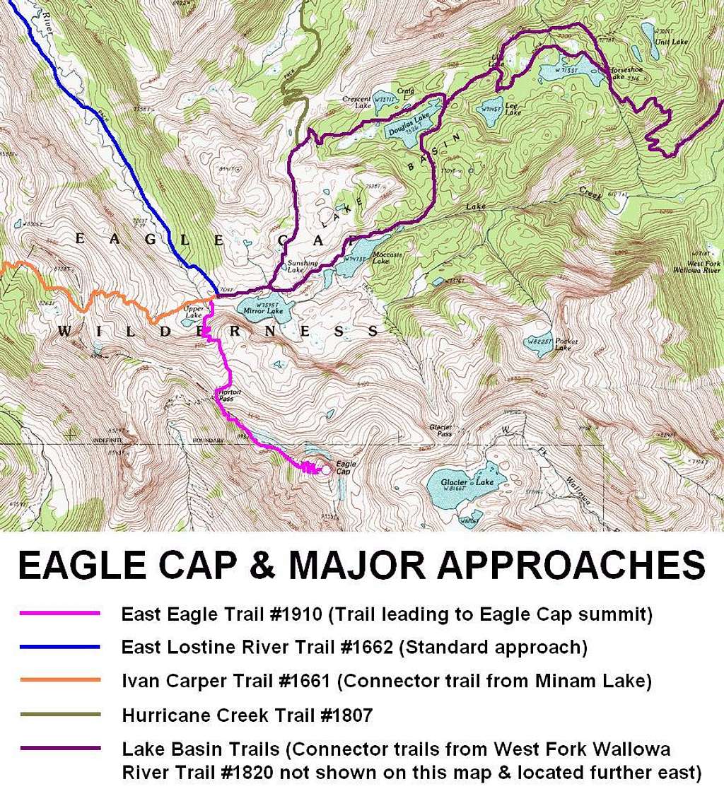
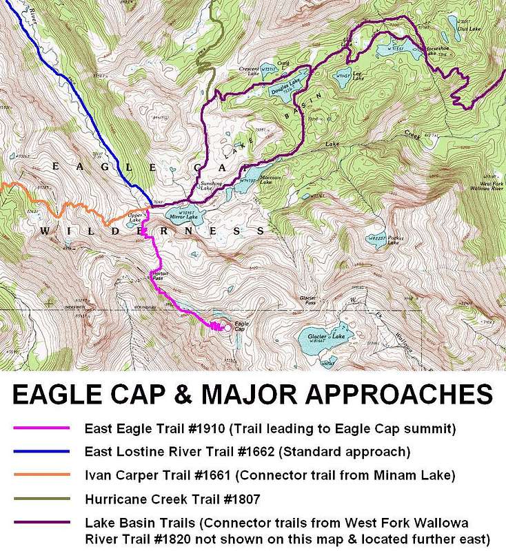
Eagle Cap - Standard Approaches
Eagle Cap - Standard Approaches
View High-Resolution Image
Eagle Cap - Standard Approaches
A close-up map view of Eagle Cap and the various standard hiking/trail approaches leading to the mountain. Route map created on December 20, 2013.
« PREV
NEXT »
Redwic
on
Dec 20, 2013 4:20 pm
Comments & voting
Other parents
Lat/Lon:
45.16369°N / 117.30162°W
Image Type(s):
Hiking
Image ID:
880303
9826 Hits
73.06
% Score
3
Votes
Log in to vote
Comments
No comments posted yet.
to post!
Don't have an account?
Redwic's Image Gallery
« PREV
Viewing
#913 of 3228
GALLERY
NEXT »
×
You need to login in order to vote!
User Name
Password
Remember me
Forgot your password?
Log me out when I close my browser.
Keep me logged in all the time.
sign in as a user
Don't have an account?
Register now for FREE
Rating available
Suggested routes for you
People who climb the same things as you
Comments Available
Create Albums
Register Here


