
-
 4075 Hits
-
 71.06% Score
-
 1 Votes
|
|
Area/Range |
|---|---|
|
|
38.02061°N / 23.13430°E |
|
|
Hiking, Mountaineering, Bouldering |
|
|
Spring, Summer, Fall, Winter |
|
|
4491 ft / 1369 m |
|
|
Overview
The mountain range of Geraneia is situated south-west (SW) of Athens on the Loutraki peninsula. With its highest peak Markiplagi at 1369m and multiple other peaks over 1000m, it is a non-impressive range but its flora, views and climate make for amazing hikes. It is a quite prominent range rising directly from the Corinthian gulf, it is the geological continuation of the northern Peloponnese mountains (e.g. Zhreia) and I mainly rocky.
The mountain is very lush and gets quite a lot of rain during Autumn and winter, the terrain is rugged and rocky made generally by hard rock that due to the fact that it isn't sponge-like there aren't many rivers although there are many traces of old rivers and gorges scattered throughout the range.
Getting There
The range sits above the city of Loutraki, Schinos, Kineta and many more. To get there from Athens Int, the closes airport, head towards Corinth and when reaching Kineta enter the roads towards Sparta or Pisia, this way you enter the general area of Geraneia.
To reach:
- Makriplagi (1396m): Head NW from Kineta towards Peraxwra,
- Pintiza (1032m) Just after Loutraki head N and drive up the mountain,
- Megali Douskia (1068m) Drive from Loutraki to Peraxwra and then to the village of Schinos (NW).
The Range
 Map of peaks
Denoted with Light Blue (left) is the peak of Pintiza at 1032m situated over the city of Loutraki.
Denoted with Lime (right) is the peak of Makriplagi at 1369m situated in the remote centre of the range overlooking the city of Kineta. The peak has a base on the southern plains that are large high altitude hills (at around 600m).
Denoted with Blue (middle) is the peak of Megali Douskia at 1068m just over the village of Schinos on the northwestern side of the range.
Denoted with Yellow is the main ridgeline of all the high central peaks on the range.
Denoted with Red (dots, far right) is the geographic limit of the range.
On the far right, we can see the Vouliagmeni lake, a large and popular lake, that is a great example of the geology of the Range.
Pintiza
This summit, at 1032m I a not all that impressive summit but its steep south face directly above the sea offers great hiking. There are 3 trailheads to reach the peak, two starts at around 550m of elevation whilst one starts at 730m.
The trailheads are:
- Patapiou Monastery to Pintiza (3.2km and 540m vertical)
- Pisia to Pintiza (2.8km and 450m vertical)
- Trailhead 3 to Pintiza (3.6km and 350m vertical)
The peak is rugged throughout both faces and plateaus at around 850m to a flat top and hill like peaks.
Megali Douskia
This summit, more rugged and rocky at 1068m is not a very high and impressive peak but it's more taunting appearance above Schinos village invites you to climb it. It can only be climbed from one side, the Northern Schinos village side.
Makriplagi
The highest peak in the range, Makriplagi, at 1369m can be seen through the area; the peak houses a telecommunications station on the imposing ridge. The ridge is quite long at 1.8km and is pretty much bare without trees and just hard rock. The peak can be accessed by road and trail. The main trail starts under the summit on the West-side and continues between two peaks.
 The telecoms station at the summit
 The long summit ridge
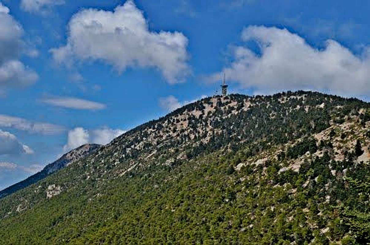 The summit from the south road
Climate
The climate at the mountain pretty much copies the climate of Parnitha Athens highest peak. The weather is not so extreme due to the location of the mountain and the relatively low altitude of its summit. Although if you climb it through a storm high winds on the ridge should be expected.
It almost never snows on the mountain although a large storm like the January 2017 storm would get snow on the mountain.