I)- Northern RANGES Summary

I)- Northern RANGES Summary

Aosta Valley, Italy, Europe
Page Type Page Type: List
Additional Information County: Aosta Northern Valleys, Haute Savoie, Switzerland Southern, Piedmont Western Valleys
Sign the Climber's Log

WHITE OVERVIEW

At the beginning of Innominata & Péuterey Ridges, by Camillo Roberto Ferronato


The latter are five parts (from A to E) servon to complete this work on throughout the Alps of the Aosta Valley and some mountains bordering Switzerland and Piedmont, which directly connect to our mountain ranges. The goal is to propose a synthetic track of how many and all other previous parts (A, B, C, D and E ) that divide the Valley into seven distinct and different sectors. In this ninth part , or Part I, you make a riepilogazione of Parts "A) - MOUNT BLANC / GREAT JORASSES / AIGUILLE VERTE - LEFT SIDE First Part" , "B ) - GREAT COMBINS / MOUNT VELAN - LEFT SIDE Second Part," "C ) - CHARDONNEY - TSEUCCA / BLANCHEN - SENGLA / BRAOULE' -D . BOUQUETINS - T . VALPELLINE Third Part," "D ) - MATTERHORN ( MATTERHORN ) / DENT OF HERENS - LEFT SIDE Fourth Part" and "E) - AOSTA VALLEY in SUMMITS: MOUNT ROSE or ROIZA ' - LEFT SIDE Fifth Part", with the purpose of giving an overview of the most easily readable, as well as a summary thereof. It took highlight in their linear ranges, topography and natural development while maintaining the order of description of time, in this case from South-southwest to the Northeast and from there to the East and from North to South up to the finally Colma (Top) of Mombarone at the end of the Aosta Valley and at the beginning of the Plaine of Po River. Hence always within the Graian, begins the Mount Blanc Massif belonging to another was compared to previous Geological and oldest orogeny. Following are the Pennine Alps, which may, in turn, be divided into three areas: the West up to the imposing Mount Grand Combin, the Central arriving at the magnificent pyramids of the Matterhorn and Dent d'Hérens and the East who reach last from thys the majestic Chain of Mount Rosa, the triple border between Aosta Valley, Valais and Piedmont Region. They are inserted, with regard to the Mount Blanc Massif, and connected to the crests of the Northern and Westerner border Appendices make up the divider between the main valleys, or between walloons and walloons to the land of France. Other areas "inner" directed generally toward the Central Valley of the River Dora Baltea are analyzed and classified by summarizing and grouping them together in the last section, also trying to maintain a description of these semi-circular clockwise from the South to the Northwest first and after the Northeast, or the peaks over the head Liconi-Grande Rochère towards the tiny Subgroups of Serena 's head and concluded the most extensive in the east to the Group of Mount Fallère above the Commons of Saint Nicolas, Saint Pierre and Sarre and the latest Appendices which slope above the Town of Aosta. These inland areas form a large triangle in the heart of Aosta Valley in its entirety medium/high. Another big triangle is formed in the same, in his sector medium/low, which reaches from Aosta progression in the small Municipalities of Saint Christophe, Quart, Nus, Chambave, Verrayes, Chatillon, St Vincent, Verres and Donnas and ends at Pont Saint Martin, where do the appendices Southern Mount Rosa, designed to separate the Regions from the Aosta Valley Piedmont with its three Provinces ( from North to South) of Novara, Biella and Turin.

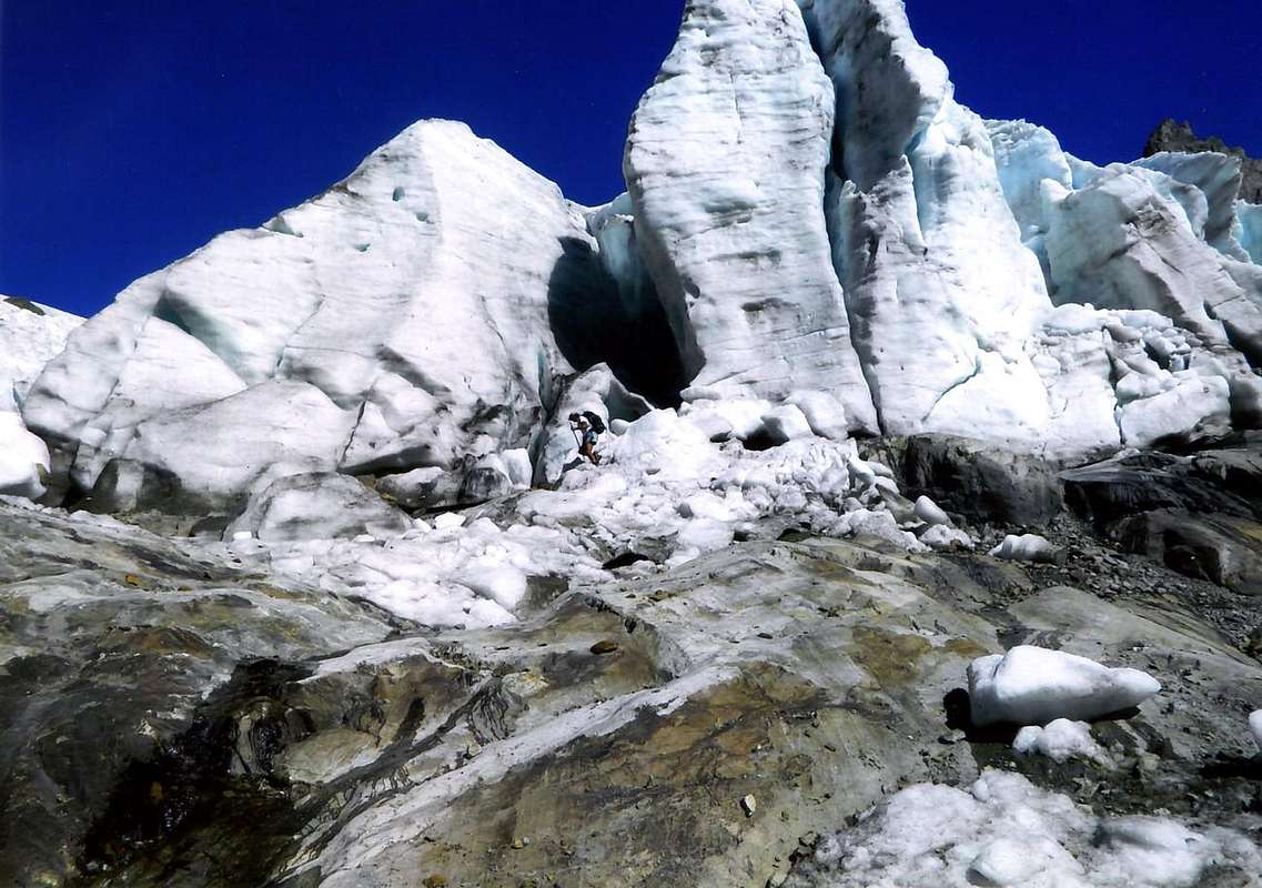
Aiguilles Noire de Péuterey & Aiguille de la Brenva, by Camillo Roberto Ferronato


^^^^^^^


In composing this summary it is preferred to use a different criterion from the compilation made ​​for the individual treatments of the seven groups. It has maintained a line of continuity throughout the entire border between Italy and Switzerland first and then among the bordering regions of Aosta Valley and Piedmont. All along this chain division were merged only the mountains that come from the watershed to the valleys below, while all the others were grouped in a final section that deals exclusively with the inner areas of the Valley of Aosta according to a central axis that runs from West to East. The same were in turn divided into three major areas: the Middle/Upper Valley from Courmayeur to Aosta Town and appendices mountainous North facing toward the Great Saint Bernard Valley, Middle/Lower Valley from Aosta to Saint Vincent with relative interior valleys and inside walloons of Northern Valpelline to that address. Last the Lower Valley with mountain ranges that go back into parallel valleys Tournanche, of the Ayas and Gressoney from Dora Baltea to the Swiss border, while the divider between the Gressoney Valley and the Province of Turin, Biella and Novara was analyzed in the first part, being on the border. Instead, with regard to the Mountain Chain of Mount Blanc we have chosen to leave the extensions to the West and North in the direction of France and Switzerland incorporated into the same description by making a small section at the bottom of the central axis that reaches from the Aiguille of Glaciers, Mount Blanc, the Grandes Jorasses and then finish with a long range to the Dolent. This choice, in my opinion, gives a better grip and a systematic analysis of the most simple and immediate vision on the development of the mountain ranges themselves; incidentally any kind of division and classification remains somewhat subjective and arbitrary, because the mountains are something global and not to split or fragmented. The exposure of the same is more something artificially constructed and systematic methodological purposes that do not represent what nature itself, the purpose of compiling Mountain Guidebooks or treated by various outside its primordial intent. The design has been realized by climatic conditions, the erosion of time, from water and glaciers and not by man.
The final part or the tenth, finish the job and will consist of an Index and a General Glossary useful to trace the characteristics of interest. This part also primarily combined with analytical work on Valleys and the Walloons of the Aosta Valley has been restored to its original intent, namely synthesis, even in this northern sector carry the same considerations that South noting that the excessive expansion work in the other direction did exceedingly decay from its primary purpose.
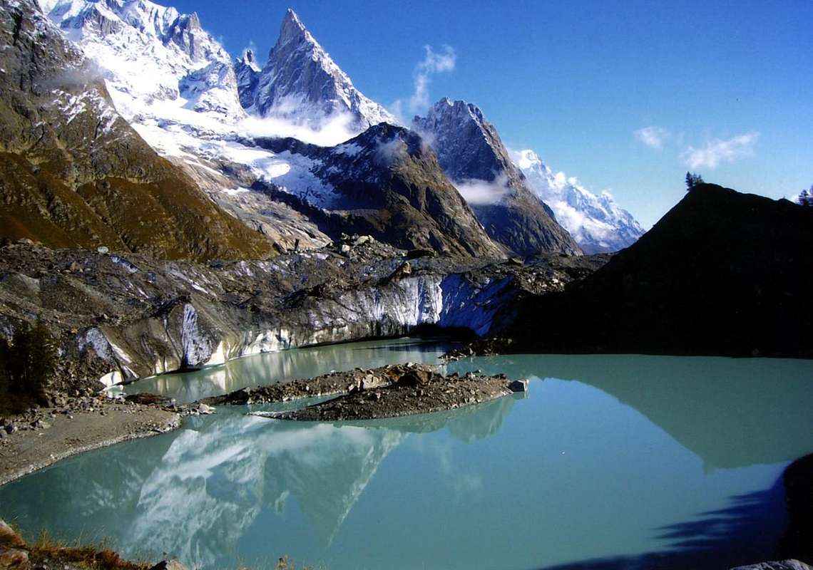
This is an area of ​​great glaciers, an area "white" in the heart of Europe.

Big Seracs & Glaciers, by Camillo Roberto Ferronato


^^^^^^^


Quest'ultime cinque Parti (A, B, C, D ed E) servon a completare questo lavoro concernente tutto l'arco alpino della Val di Aosta nonché alcune montagne confinanti con la Svizzera ed il Piemonte, che direttamente si collegano alle nostre catene montuose. L'obiettivo é quello di proporre una traccia sintetica di tutte e quante le altre precedenti parti (da A ad E) che dividon la Valle in sette ben distinti e differenti settori. In questa nona Parte, o Parte I, s'effettua una riepilogazione delle Parti "A)- MOUNT BLANC / GREAT JORASSES / AIGUILLE VERTE - LEFT SIDE First Part", "B)- GREAT COMBINS / MOUNT VELAN - LEFT SIDE Second Part", "C)- CHARDONNEY-TSEUCCA / BLANCHEN-SENGLA / BRAOULE'-D. BOUQUETINS-T. VALPELLINE Third Part", "D)- CERVINO (MATTERHORN) / DENT D'HERENS - LEFT SIDE Fourth Part" e "E)- AOSTA VALLEY in SUMMITS: MOUNT ROSA or ROIZA' - LEFT SIDE Fifth Part", col proposito di darne visione d'insieme più facilmente leggibile, nonché riassuntiva delle medesime. Si son volute evidenziare le catene montuose nel loro lineare, topografico e naturale sviluppo mantenendo sempre l'ordine di descrizione orario, in questo caso da Sud-sudovest a Nordest e da questo ad Est e da Nord infine verso Sud insino alla Colma (Punta) di Mombarone al termine della Valle di Aosta ed all'inizio della Pianura Padana. Qui, pur sempre all'interno dell'Alpi Graie, s'inizia il Massiccio del Monte Bianco appartenente ad altra Era Geologica rispetto alle precedenti e più vetuste orogenesi. Dopo vengono le Alpi Pennine che si posson, a lor volta, dividere in tre aree: le Occidentali fino alla imponente Catena del Grand Combin, le Centrali che arrivano alle splendide piramidi della Dent d'Hérens e del Cervino e le Orientali che da questo ultimo raggiungono la maestosa Catena del Monte Rosa, al triplice confine tra Valle di Aosta, Vallese e Piemonte. Si son inserite, per quanto concerne il Massiccio del Monte Bianco, e collegate alle creste di confine le Appendici Settentrionali ed Occidentali costituenti il divisorio tra le principali valli, oppur tra vallone e vallone verso la terra di Francia. Altre aree "più interne" rivolte, in genere, verso la Valle Centrale del Fiume Dora Baltea son state analizzate e classificate riassumendole e raggruppandole insieme nell'ultima sezione, cercando anche per codeste di mantenere una descrizione semicircolare in senso orario da Sud verso Nordovest dapprima e Nordest dopo, ovvero dalle cime oltre la Testa di Liconi-Grande Rochère in direzione dei minuscoli Sottogruppi della Testa di Serena per poi concludere maggiormente ad Oriente verso l'esteso Gruppo del Mont Fallère sopra i Comuni di Saint Nicolas, Saint Pierre e Sarre e le ultime appendici del quale digradano sopra la Città di Aosta. Queste aree interne formano un grande triangolo nel cuore della Valle di Aosta nella sua parte medio/alta. Un altro grande triangolo viene formata nella medesima, nel suo settore medio/basso, che da Aosta raggiunge in progressione i piccoli centri di Saint Christophe, Quart, Nus, Chambave, Verrayes, Chatillon, Saint Vincent, Verrès e Donnas per poi concludersi a Pont Saint Martin, ove arrivan le appendici Meridionali del Monte Rosa, atte a separare la Regione Valle di Aosta da quella del Piemonte con le sue tre Province (da Nord a Sud) di Novara, Biella e Torino.

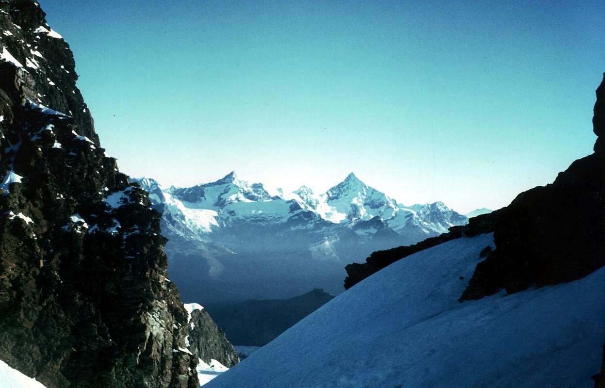
East Jorassses & Walker Spur, by Camillo Roberto Ferronato


^^^^^^^


Nel comporre questo Sommario s'é preferito utilizzare un criterio diverso dalla compilazione effettuata per le singole trattazioni dei sette gruppi. Si é mantenuta una linea di continuità su tutto l'arco di confine, dapprima tra Italia e Svizzera e poi tra le Regioni confinanti di Valle di Aosta e Piemonte. Lungo tutta questa catena divisoria son state accorpate solo le montagne che provengono dallo spartiacque verso le valli sottostanti, mentre tutte le altre sono state raggruppate in un'ultima sezione che tratta esclusivamente le zone interne della Valle di Aosta secondo un asse centrale che va da Ovest verso Est. Le medesime son state a loro volta suddivise in tre grandi aree: Medio/Alta Valle da Courmayeur ad Aosta ed appendici montuose rivolte a Nord verso la Valle del Gran San Bernardo, Medio/Bassa Valle da Aosta a Saint Vincent con relative valli e valloni interni e propaggini Settentrionali indirizzantesi alla Valpelline. Ultima la Bassa Valle con le catene montuose risalenti in parallelo le Valli Tournanche, d'Ayas e Gressoney dalla Dora Baltea ai confini elvetici, mentre il divisorio tra la Valle di Gressoney e le Province di Torino, Biella e Novara é stato analizzato nella prima parte, essendo di confine. Invece per quanto concerne la Catena del Monte Bianco s'é scelto di lasciare i prolungamenti verso Ovest e Nord in direzione di Francia e Svizzera inglobati nella stessa descrizione, effettuandone un piccolo capitolo in calce all'asse centrale che dall'Aiguille des Glaciers raggiunge il Monte Bianco, le Grandes Jorasses per poi terminare con lungo spartiacque verso il Mont Dolent. Questa scelta, a mio avviso, concede una miglior analisi sistematica ed una presa di visione più semplice nonché immediata sullo sviluppo delle catene montuose medesime; daltronde qualsiasi tipo di suddivisione e di classificazione permane sempre alquanto soggettiva ed arbitraria, poiché le montagne son un qualcosa di globale e non di frazionato o frammentario. L'esposizione delle stesse é più un qualcosa d'artificialmente costruito con finalità metodologiche e sistematiche che non quanto rappresenti la natura in sé stessa; lo scopo di compilare Guide di Montagna o trattati varii esula dai suoi intenti primordiali. Il disegno é stato realizzato dalle condizioni climatiche, dall'erosione del tempo, da acque e ghiacciai e non dall'uomo.
Un'ultima Parte L, ovvero la decima, concluderà il lavoro e sarà costituita da un Indice Generale e da un Glossario utili a rintracciarne le peculiarità di interesse. Questa parte, inoltre, primariamente abbinata ad un lavoro di analisi sulle Valli ed i Valloni della Valle di Aosta é stata ripristinata nel suo intento originario, ovvero di sintesi; anche in questo settore Settentrionale effettuiamo le stesse considerazioni che per quello Meridionale constatando che l'eccessivo ampliamento del lavoro in altre direzioni lo facevano oltre misura decadere dal suo scopo primario.
E' questa area di grandi ghiacciai, una zona "bianca" nel cuor d'Europa


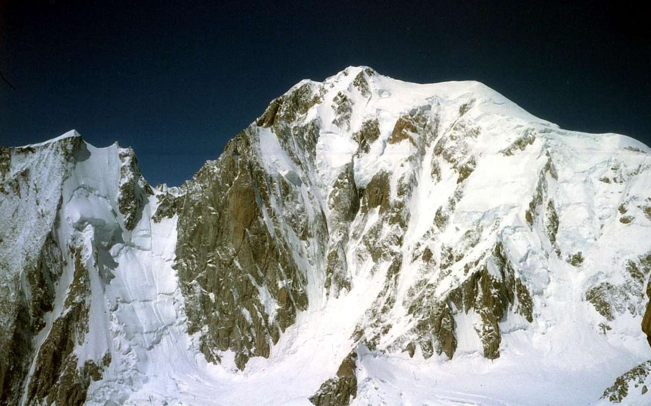
From the Porta Nera to Obergabelhorn & Zinal, by Camillo Roberto Ferronato


^^^^^^^

From Seigne to Ferret Hills


^^^^^^^


MOUNTAIN CHAINS & SUMMITS

In succession fronter watershed from the Col de la Seigne to Col du Grand Ferret


WATERSHED between Aosta Valley-Italy/Savoie-French/Ferret Valley-Swiss from South-southwest to North-northeast up to the MOUNT DOLENT:

From de la Seigne Hill and surroundings to Mount Blanc through great North-northeast watershed. Inside: Pyramides Calcaires Higher and Lower. Montagnes des Glaciers/Petite Aiguille des Gaciers
(3817m)/Aiguille des GLACIERS/Aiguille de la Lex Blanche/Aiguilles de TRELATETE: Northwest, Central, Southeast (3930m) and East Summits/Aiguille de l'Aigle/Petit Mont Blanc/Aiguille de Combal/Mont Tseuc; Tete Carrée/Domes de Miage/Quote 3834, 3833, 3622, 3814, 3810m/Aiguille de BIONNASSAY (4052m)/Aiguille de Tricot/Pointes de Tricot SE or Superior, Central, Northwestern or Inferior/Mont Vorassay.
Calotte des Aiguilles Grises/Tour des Aiguilles Grises/Quote 3676, 3599, 3419, 3138, 3245, 2910m/Chaux de Pesse Group.
DOME du GOUTER
(4306m)/Quota 4282m; Rochers Foudroyès; Grande and Petite Bosse; Pointe Pfann/Rochers du Mont Blanc, Quote various; La Tournette/MOUNT BLANC MOUNTAIN CHAIN (4808/10m): la Tourette/Mont Blanc de Courmayeur (4765m).

Brouillard Ridge: Picco Savoia Prince Luigi Amedeo, of Abruzzi Duke
(4470m)/Mont du Brouillard or Breuillat (4068m)/Quota 4005m/Punta Martino Baretti (4006m)/Quote 3863, 3790, 3648, 3364, 3349m/Aiguilles Rouges du Brouillard and Southwestern appendages (Quote 3364, 2981 3349, 3098, 2881, 3151, 3110, 2940m).

Innominata Ridge: Pic James Eccles
(4045m)/Punta Innominata/Quotas 3730m the mayor, 3656, 3617, 3438, 3151, 3388m/Aig. Jean Joseph Croux (3251m)/Aig. de Châtelet.

Brenva, Grand Pilier d'Angle & Freney Pylons from East-northeast, by Antonio


^^^^^^^


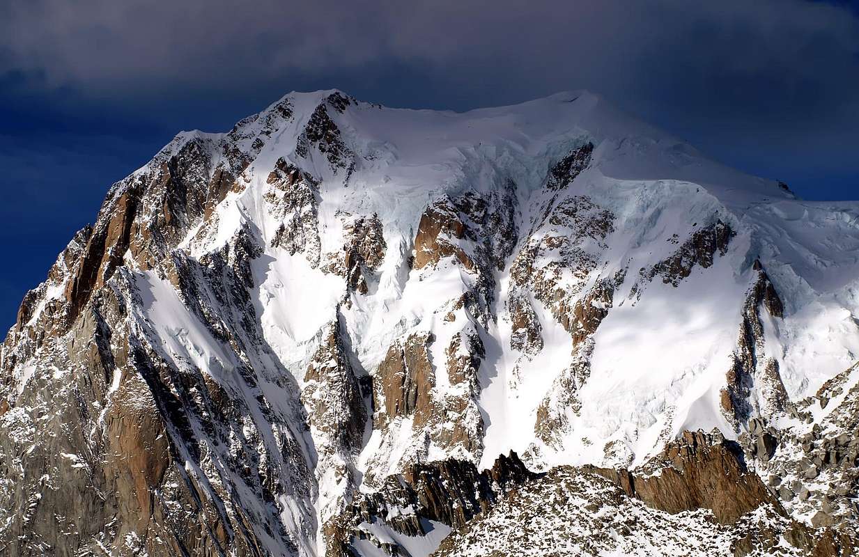
Péuterey Ridge: Grand Pilier d'Angle or Quota 4308m/Aiguille BLANCHE de Péuterey (4108m)/L'Epée/Picco Gian Battista and Giuseppe F. Gugliermina (3893m); Les Dames Anglaises (L'Isolée, Punta Giacomo Casati, Punta Amilcare Crétier or La Vierge, Punta Antonio Castelnuovo, Punta Savoia Princess Jolanda)/Aiguille NOIRE de Péuterey (Pointes Edouard Bich, Osvaldo and Arturo Ottoz or Fifth Tower, Karl Brendel or Fourth Tower, Willo Welzenbach or Third Tower) (3773m)/Pic Gamba or First Tower/Monts Rouges de Péuterey (Quote various, the mayor 2941m); Monts Noirs de Péuterey (North Summit 2955m).

From MONTE BIANCO MOUNTAIN CHAIN before to North, after to East and Tour Ronde: Rochers Rouges (Little, Higher and Lower)/MONT MAUDIT
(4468m)/Pointe de l'Androsace; Pic A. W. Moore; Brenva Fourche and Calotta/Brenva Trident.


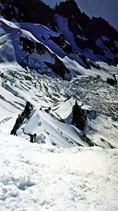
Great ramification to North-northeast from Mont Maudit Mont Blanc de Tacul (West 4248m and East Summits) great inside Area: Aiguilles du Diable (L'Isolée, Pointe Carmen Pointe Lépiney, Pointe Mediane, Pointe J. Chaubert, La Corne du Diable).

Tacul East-northeast satellites: Le Chat/La Pyramide du Tacul; Les Aiguillettes (Northwest and Southeast);

Mount Blanc of Tacul satellites: GRAND CAPUCIN
(3838m) /Le Carabinier/Petit Capucin (3693m); Roi du Siam; Pic Adolphe (3535m); Le Clocher/Le Petit Clocher/La Chandelle/Le Trident du Tacul; Pilier du Diable or Devil Pillar/Three Points Pillar; East Pillar of the Northeast Buttress; Pointe Jean Louis Lachenal (3570m); Le Gros Rognon/Petit Rognon towards Vallée Blanche Glacier.

Continuation of the great ramification to North from Midi Pass: Cosmiques Refuge and Abrì Simond/Pointe Paul René/Aiguille du Midi Area: Rognon du Plan/Aig. du Plan
(3673m); Pain du Sucre/Dent du Requin (3422m); Le Chapeau à Cornes; Capucin du Requin/Quote 2851, 2784m/d'Envers des Aiguilles Réfuge. Dent du Crocodile/Aig. du Peigne (3192m)/Plan de l'Aiguille.
Les Aiguilles de Chamonix Area: Le Caiman - Aiguille de Blaitière
(3521m)/Aiguille du Grépon (3482m)/Aiguille des Grands Charmoz (3485m)/Aig. des Petits Charmoz/Frètes des Charmoz; Aig. de la République (3305m)/Les Cornes des Chamois/Tete de Trélaporte.

Ramification from Mount Maudit to Point Helbronner: TOUR RONDE
(3798m)/Pic de la Brenva/Quota 3384m/Le Père Eternel/Aiguille de la Brenva (3278m)/Tour de la Brenva/Rochers de la Brenva; Aiguille d'Entrèves/Tour d'Entrèves; /Aiguille de(s) Thoule(s)/Grand Flambeau/Petit Flambeau/la Vierge; Punta Helbronner, little Group.

Croz, Whymper & Walker Summits of Great Jorasses from South, by Antonio


^^^^^^^


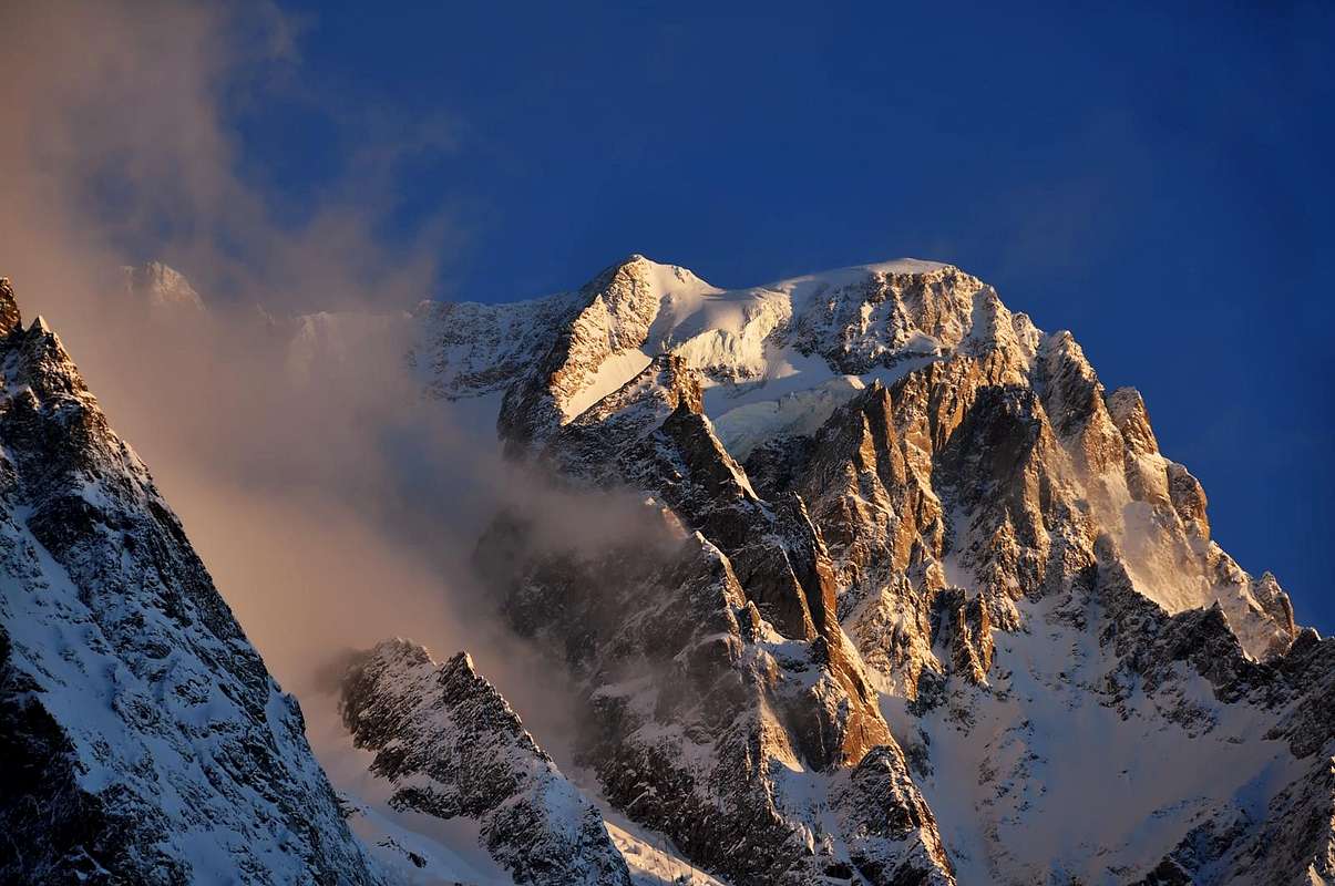
DENT of GEANT/ROCHEFORT RIDGE/MOUNT MALLET/ROCHEFORT DOME/GREAT JORASSES/HIRONDELLES POINT/LITTLE JORASSES/JORASSES TOWER; AIG. of LESCHAUX-GREUVETTA/AIG. of EBOULEMENT/AIG. of TALEFRE/AIG. of SAVOIE/PAPILLONS POINT/ISABELLA POINT/AIG. of TRIOLET/MOUNT DOLENT/MOUNT GRAPILLON MOUNTAIN CHAIN:

From Giant Pass to Point Walker of Grandes Jorasses: Aiguilles Marbrées North and South/Jetoula Tower and Jag
(3342m; 3406m); DENTE del GIGANTE (4014m)/Arete de Rochefort: Aiguille de Rochefort (4001m); Mont de Rochefort/Aiguilles Rouges de Rochefort; Dome and Calotte de Rochefort (4014m; 3966m)/GRANDES JORASSES: Pointes Geoffrey Wintrop Young, Queen Margherita, Duchess Elena, Michel Croz, Edward Wymper and Horace Walker (4208m), Mountain CHAIN.

Northwestern appendages from Géant Jag: Pointe George Yeld/La Noire.

Northern appendages from Rochefort Crest: Mont Mallet/Pointe Cupelin of the Périades Points/Fenetre Point/Sisyphe Point/Nini Pietrasanta/Pointe Simon/Les Périades. Capucin du Tacul; Aiguille du Tacul/Clocher du Tacul/Chandelle du Tacul.

Southern Appendages from Helena Point of Great Jorasses: Rochers du Reposoir/Rognon de la Grande Bouteille; Tour des Grandes Jorasses; Prà Sec Crest (Quotas various); Aig. de Tronchey/Aig. de l'Eveque (Quote various).

From Arete des Hirondelles to Mont Dolent: Pointes des Hirondelles/Pointes de Fréboudze or Frébouge South (Corrado Alberico), Central (Guido Antoldi) and North (Luigi Borgna)/Petites Jorasses
(3649m)/Aiguille des Leschaux (3759m)/Mont Greuvetta (3684m)/Mont Rouge de Greuvetta (Quotas various); l'Aiguillon/Aiguille de l'Eboulement (3601m)/Aiguille de TALEFRE (3730m)/Aig.de Savoie (3604m)/Pointe des Papillons South and North/Pointe Isabella South and North/Petites Aiguilles de Triolet Western and Eastern/Aiguille de TRIOLET (3874m)/Monts Rouges de Triolet (Quote various, the major 3435m)Aiguilles Rouges de Triolet Northwest and Southeast; Triolet Aiguillon or Quota 3656m/Pointe du Domino/Quota 3613m/Pointe de Pré de Bar/Pointe Superieure de Pré de Bar/MONT DOLENT (3749m)/Mont Grapillon/Quota 3516m/Pointe Gratien Volluz/Petit Grapillon/Punta Allobrogia/Quota 3028m /Quota 2818m/Tete de Ferret.
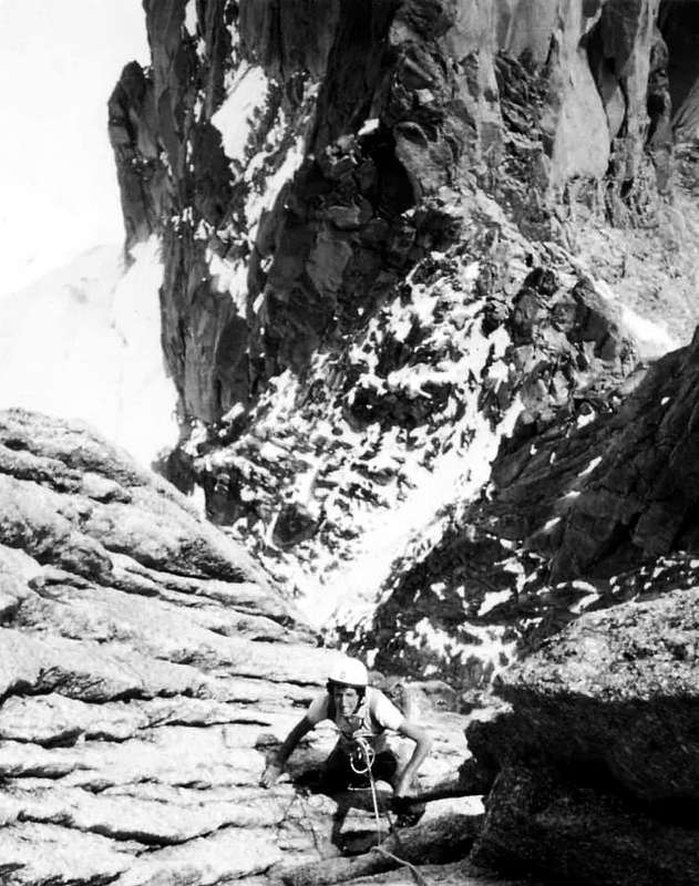
^^^^^^^


Granite Capucin, by Ilario Antonio Garzotto


^^^^^^^


From Dolent to Aiguille Verte & Northern Appendages

^^^^^^^


MOUNTAIN CHAINS & SUMMITS

In succession fronter watershed from Mont Dolent towards the France


WATERSHED between Savoie-French/Ferret Valley-Swiss from South to North up to the ARGENTIERS GROUP:

AIGUILLES de CHAMONIX/AIGUILLE VERTE/LES DRU; TOUR NOIR/AIGUILLES d'ARGENTIERE MOUNTAIN CHAINS:

A2c)-French and Swiss appendages. Mount Blanc Northern appendages: Domes/Pointe des Lanchettes/Mont Tondu; Aig. de Bellaval/La Grande Ecaille/Pointe de la Tepiaz; Tete d'Enclave/Tete de Bellaval/Tetes des Fours NE and SW. Domes de Miage/Aig. de la Bérangère/Pointe de Cheuton; Pointe de Covagnet/Mont Truc; Aig. de Tricot/Pointes de Tricot/Mont Vorassay. Aiguille du GOUTER/Aiguilles du Gouter Refuge/Les Rochers Rouges.
Ramification to North: Quote 3257, 3154, 3025, 2829, 2765m/Le Gros Béchar. Tete Rousse/Tete Rousse Refuge/Les Rognes Baraque Forestière des Rognes/Le Nid d'Aigle/Mont Lachat; Montagne des Faus; Montagne de Taconnay; Montagne de la Cote. Pointe Bayeux; Pointe Bravais; Les Grands and Les Petites Montées/Rocher de l'Heureux Retour Rocher Pitschner/Les Grands Mulets/Grands Mulets Refuge/La Jonction. Pointe Capt. Mieulet/Pointe Charles Durier/Aig. Horace Bénedicte De Saussure.
Pointe de Talèfre/Aiguilles de Pierre Joseph (Lower, Higher and Western Points)/Leschaux Refuge/Quota 2940m/Pierre à Beranger/Séracs de Talèfre/Les Egralets/Tete du Couvercle/Le Chien Rouge/Couvercle Réfuge in South/ Aig. du MOINE/La Nonne/L'Eveque/Le Cardinal.

Drus from Northwest, by Antonio


^^^^^^^


Verte & Drus from South-southwest, by Antonio


^^^^^^^


AIGUILLE VERTE Mountain CHAIN: Pointe Croux/Pointe Petigax/Pic Sans Nom/Aiguilles du DRUS (Grand and Petit Dru)/Pointe de la Charpoua or Quota 2940m; Aig. Carrée/Pointe Farrar/Petite Aig. Verte/Aig. des Grands Montets; Aig. à Bochard; Aig. du Jardin/ Les Droites/Les Courtes/Aig.s Ravanel.

From Mont Dolent North-northwestern branch: TOUR NOIRE - Aiguilles d'Argentière Area.


From Mount Blanc to Combins Group

^^^^^^^


MOUNTAIN CHAINS & SUMMITS

In succession fronter Italian/Swiss watershed from Ferret Hill towards Fenetre Durand Hill


From Val Ferret to Gran Saint Bernard Hill with various small ramifications: Mont Quichette/Mont Charfière; Mont du Tapier; Aiguille de Bellecombe/Petit Golliaz; Aiguille de Saulié or des Ceingles/Saulié Aiguillon/Saulié/Quotas various; Crest/Grand GOLLIAZ or Golliat/Aiguilles des Angroniettes/Pointe de Combette/Grand Six Blanc/Les Marmontains Crest/Les Grands Creux/Six des Bornettes; Les Six Potò; Les Econduits Crest; Aiguille de Leisasse (ski-mountaineering)/Olline Coastline/Testa Crevacol/Mont Borzalet/Testa Bassa.
Unnamed Aiguilles/Mont Fourchon (ski-mountaineering)/Pain de Sucre/Tour des Fous; Vens Crest/Pointe de la Fenetre/Tetes de Fonteinte/Quota 2861m/Pointe des Trois Lacs/Monts Telliers; Pointe du Drone/Grande Chenalette/Pointe des Lacerandes/Les Lacerandes; Petite Chenalette. Subgroup above Great Saint Bernard (I)/Entremont (S) Valleys.

From Grand Saint Bernard Hill to Hannibal Pass and small Southern Appendages: Mont Mort-Testa di Barasson; Barasson Coastline (ski-mountaineering)/Mont Tchoume/Plan Puit(z).
Punta di Barasson; Quotas various/Monte Paglietta/Mont Morteret; Tchola(e)ire Crest (Tete Verte or Babylone, Tete Rouge)/Bec Noir/Becs Noirs Crest; Mont Menouve or Menovy/Quota 2955m/Grande Mol(l)ine; Pointe Rayons de la Madeleine/Pointe de Crete Sèche/Pointes de Moline/Mont Tunnel/Tete Grise/Hannibal Pass and West Ridge.

From Mont Velan to Northern long Buttress: Aiguille du Déjeuner/Mont VELAN
(3734m); Quota 3678m/Dome du Velan/Aiguille du Velan/Aiguilles de Proz or Quote 3561m and 3488m/Dents de Proz; Mont de Proz; Quota 3223m/Petit Velan South and North Summits/Mont Orge/Croix de Tsousse/Le Tseudet; Arete de la Gouille/Mont de La Gouille Southeast and Northwest/La Gouille; Summitals Aiguilles du Velan (Quote 3708, 3672, 3650m.

Southern small Buttress: Faceballa four Points/Faudery three Points/La Salliaousa; Mont-Riond also Morion; Tete des Cretes/Mont Chenaille North and South/Crou de Bleintse or Bleinchy also de Blentze/Tete de la Praz/Mont Saron/South Antesummit (+; ski-mountaineering).

From Mont Velan to Grand Tete de By Ridge: Velan Horns/Velan Jags/Tete d'Ariondet/Mont Capucin/Doigt du Velan/Mont Cordine/Petit Frère/Trois Frères de Valsoray/Valsorey five Molars/Aiguilles des Louisettes de Valsorey (various little tops)/Dents de Valsorey (Le Rateau-Grand Carré/Mont Percé Southwest and Northeast/Les Three Luisettes/Aiguille Verte/Valsorey Sphink/Pic d'Amiante/Mont Sonadon Group.

GRANDS COMBINS Mountain Chain with Buttress to North: Aiguille de Bocheresse/Combin du Meitin/Arete des Maisons Blanches (Petite Aiguille des Maisons Blanches, Le Moine, Quota 3571m, Grande Aiguille des Maisons Blanches; Six Noire; Mont Beaufort/Pointe de Penna/Tete de Bois; Quota 3605m, Aiguille de l'Epée; Quota 3215m; Aiguilles du Meitin South and North, Aiguille de Challand, Dome du Ritord, Aiguille de Ritord, Le Mérignier); Quota 3307m, Bonhomme du Tsapi. Combin de Boveyre/Combin de Corbassière; Petit Combin/Pointe de Boveire de Valsorey. Combin de Valsorey/Combin de GRAFENEIRE
(4314m)/Great Shoulder SE 3946m; Combin de Tsessette/Tour de Boussine/Les Gendarmes de Boussine. Mulets de Tsessette (Quote 4010 and 3695m)/Quota 3630m/Tournelon Blanc/Bec de l'Alia; Aiguille de Bocheresse or de Bagnes; Pointe de Mauvoisin or Quota 3164m/Grand Tavé/Pointe des Otanes/Pointe de Plangolly/Bec de Corbassière.

On fronter Ridge from Grand TETE de BY to Fenetre Durand and Southern small Appendages: Punta Garrone; Les Champignons West and East/Quota 3363m/Tete Blanche; Pointe Farinet; Grande Maison/Pointe Ratti; Tete du Filon; Arete de la Bonne Mort;/Mont de Balme/quote various (2559, 2454, 2323m); Tete de la Balme; Dent(s) d'Ansermin or Punta Touring Club; Mont AVRIL/Quotas of the NE Ridge (3231, 3046, 2963, 2904m) little Group.

From Fenetre Durand to Mont Gelé and Southern great Morion Ridge up to the Ollomont/Valpelline Municipalities: Great Shoulder 3446m or West Summit/Mont GELE'/NE Crest (Quotas various (3167, 3150m)/Pointe d'Ayace; Mont de Balme/Pointe d'Ayatse also Oyace/Trouma des Boucs Crest/Trouma des Boucs.
Becca Faudery/Becca Crevaye/punta Edoardo Gaia/Punta Alessandro Martinotti/Trident de Faudery (Joseph-Maria Henry, Paolo Ferrario, Alfred George Topham Points)Le Due Sante (Judith and Esther Points)/Sega del Morion/Mont Morion North (Michele Baratono, Enrico Auguto, William Douglas Monro Points)/Campanile del Morion/Central MORION/Punta Emilio Gallo/South Morion/Mont Clapier also du Clapey; Monte Traversagne; Punta Lino Binel/Punta Renato Chabod/Punta Jean-Baptiste Gontier/Punta FIORIO; Pointe Aimé Gorret; Tete Nino Quaini/Tete Louis "Jean" Bonin/Mont Berrio; little Berrio Pyramid or Quota 2478m/Pointes du Corn(m)et; Pointes d'Ollomont or du Breuson/Monte Faceballa/Pointe des Faces/Pointes des Arsines/Pointe de Sereina Mountain Chain above Ollomont/Valpelline Municipalities.

Arol(l)etta little Spur from Gelé Pass up to the Ruz/Dzovenno Hamlets in Valpelline: Upper AROLLETTA North and South/Bec Noir/Punta Angelo Bozzetti/Lower Arolletta/La Vierge/Pic de la Vierge/Trident de l'Arolletta: Punta Alessandro "Dino" Charrey, Punta Cino Norat, Punta Jean Charrey)/Pointe Duc/Berger de l'Aroletta/Aiguille de l'Arolletta/Tour du Freyty.

BARASSON / LA SALLIOUSA / MONT VELAN / VALSOREY ARETE / LES LUISETTES / AIG. VERTE AREA

Great ramification to East: from GREAT SAINT BERNARD PASS Mont Mort Barasson Testa (Head) Little ramification to South: Barasson Rocky Coastline/Mont Tchoume/Plan Puit (Napoleonic Route, fortifications and defences).
From Barasson Eastern Pass Barasson Point; Monte Paglietta/Mont Morteret; Tchola(e)ire Crest (Babylone or Tete Verte, Tete Rouge, Les Becs Noirs)/Menouve or Rayons de la Madeleine Point/Pointe de Crète Sèche/Mollines Points/Mont Tunnel/Testa Grisa to HANNIBAL Pass and Ridge.

From Faceballa Saddle Southern ramification from North to South: Faceballa Tetes (four)/Faudery Points (three)/La Salliaousa; M. Rotondo or Mont-Riond; T. des Cretes/Mont Chenaille (North and South)/Champillon Refuge in Southeast/Crou de Bleintse or Bleinchy/T. de la Praz/Mont Saron (+ in South Antesummit). Mount Velan Area: Eastern ramification from West to East: Corni del Velan (Velan Horns)/Dents du Velan (Velan Jags)/Tete d'Ariondet/Mont Capucin/Doigt du Velan/Mont Cordine to Valsorey Pass and from pass Savoye/Rosazza Bivouac in Southeast/Cabane du Velan in North/Valsorey Petit Frère/Trois Frères (Three Brothers) Valsorey Five Molaires (Molars: I°, II°, III°, IV°, V°)/Aiguilles des Luisettes Points (various little summits)/Valsorey four Jags (Le Rateau, Grand Carré, Mont Percé (South and North Summits)/Les Luisettes (three)/Aiguille Verte/Valsorey Sphink/Pic d'Amiante/Mont Sonadon.

GRANDS COMBINS AREA

GREAT COMBINS AREA: From Sonadon Pass Quota 3664m - Bivouac on Isler Shoulder - Valsorey Grand Combin. Little ramification from West to Northeast: Aiguille de Bocheresse/Combin du Meitin/Valsorey Hut in Southwest.
Great ramification to North: Arete des Maisons Blanches/Petite Aiguille des Maisons Blanches, Le Moine, Quota 3571m, Grande Aiguille des Maisons Blanches; Six Noire; Mont Beaufort/Pointe de Penna/Tete de Bois; Quota 3605m, Aiguille de l'Epée; Quota 3215m; Aiguilles du Meitin South and North, Aiguille de Challand, Dome du Ritord, Aiguille de Ritord, Le Mérignier; Quota 3307m, Bonhomme du Tsapi. Combin de Boveyre/Combin de Corbassière; Petit Combin/Pointe de Boveire de Valsorey.

COMBIN de GRAFENEIRE (*)/Great Shoulder SE 3946m; Combin de Tsessette.
Little ramification to East-souheast: Tour de Boussine/Bussine Gendarmes (Quote 3260, 3203, 2980m).
Great ramification to North: Mulets de Tsessette (Quote 4010 and 3695m)/Quota 3630m/Tournelon Blanc/Great Dam or Mauvoisin Lake in East/Bec de l'Alia; Aiguille de Bocheresse or de Bagnes; Pointe de Mauvoisin or Quota 3164m/Grand Tavé/Panossière Hut in West/Pointe des Otanes/Pointe de Plangolly/Bec de Corbassière.

Terminal ramification to South-southwest: from Quaini Pass: Tete Nino Quaini/Incliousa or Clousa Lake in Northwest/Tete Louis (said Jean) Bonin/Mont(e) Berrio (Stone Mount in dialect valdotain).
Little ramification in Northwest bifore and after in Southwest: Pointes des Corn(m)ets (three little Summits)/Cornet, Des Eaux Blanches Lakes in North/(+; Gaula Oratory in West) above Glassier Village.
To South: from Ollomont Pass Pointes d'Ollomont (North and South)/Mont Faceballa (+; near Breuson or Brison Pass)/Pointe des Faces/Pointe des Arsines/Punta di Serena above Valpelline little Town.
Ramification to South-southeast from Faudery Pass Costiera (little range) of Arol(l)etta Little Area from North: Aroletta Superiore (Upper) North, Souht Summits, Bec Noir, Punta Angelo Bozzetti, Arletta Inferiore (Lower)/Franco Spataro Bivouac (2600m~), in East/La Vierge de l'Arolletta, Pic de la Vierge, TRIDENT de l'Aroletta (Alessandro "Dino" Charrey, Cino Norat, Jean Charrey Points), Pointe Auguste Duc, Berger (Shepherd) de l'Aroletta, Aiguille de l'Arolletta, Tour du Fréyty/Crete Sèche Refuge (2446 m), to East.

Velan from East-northeast, by Marco979


^^^^^^^


Combin from South-southeast, by Antonio


^^^^^^^


GRANDE TETE de BY / MONT AVRIL AREA

Grande TETE de BY (*) little Area to South: Punta Garrone/Amiante-Chiarella Refuge.
Ramification to East-northeast: from Amiante Pass Pointes Champignons West and East or Les Champignons (The Mushrooms)/Quota 3263m/Tete Blanche.
Appendages to South: Pointe Farinet; Grande Maison/Punta Ratti; Tete du Filon.
To South: Arete de la Bonne Mort/Mont de(s) Balme(s)/By, little sources, Farinet Lakes in Southwest; Tete de Balme.
To South-southeast: Punta Touring Club or Dent d'Ansermin also des Ansermins.

Mont Avril Area: Quotas various in the Northeast Arete, the major 3231m to Tsè Bourgo/Chanrion Lake and Chanrion Hut in Northeast, neighbor Otemma Point.
Ramification to East-southeast: Quotas 3192, 3084m/Fenetre Lake in Southeast to FENETRE Durand Pass.

To Central Pennine Alps & Matterhorn

^^^^^^^


MOUNTAIN CHAINS & SUMMITS

In succession fronter watershed from Fenetre Durand towards the Central Pennine


MONT GELE' / MONT MORION / PUNTA FIORIO / AROLETTA MOUNTAIN CHAIN AREA

From Fenetre Durand Pass to Mount Gelé West Summit, Great Shoulder or Quota 3440m Fenetre Lake in West - Mont Gelé Area (*) to Northeast: Pointes d'O(A)yace also Ayatse.
Before to Southeast and after to Northeast: Mont de la Balme/Dents d'Ayatse/Troume des Boucs Crest (Quotas 2975, 3170, 3151m)/Trouma des Boucs (South or Quota 3217m, Central, North or Quota 3225m Summits) to Chardon(n)ey Pass.
Great ramification to South: from Mount Gelé Pass Becca Faudery/Becca Crevaye/Punta Edoardo Gaia/Punta Alessandro Martinotti/Trident de Faudery: (Punta Joseph Maria Henry, Punta Paolo Ferrario, Punta Alfred George Topham) - Le Due Sante: (Punta Judith, Punta Esther)/Mount MORION Northern: (Punta Michele Baratono, Punta Enrico Augusto, Punta William Douglas Monro)/Campanile del Morion (Morion Bell-Tower)/Mount Morion Central/Punta Emilio Gallo/Mount Morion Southern/Bonseya or Beuseya also Basèya Lake in West/Mont Clapier/Nino Regondi Bivouac (2590m).
In West: Mont Traversagne in Southeast of SE Edge; to South: Punta Lino Binel/Leitou or Leita Lake in West/Punta Renato Chabod/Punta Jean-Baptiste Gontier/Punta Cesare FIORIO or Becca dou Tor also Tor de Breuson (very ancient name = Breuson Tower).
Little ramification to Southeast: Pointe Aimé or Amé Gorret/Arete des Clocherots (Quote 3090, 2983, 2629 (+), 2424m).

Terminal ramification to South-southwest: from Quaini Pass: Tete Nino Quaini/Incliousa or Clousa Lake in Northwest/Tete Louis (said Jean) Bonin/Mont(e) Berrio (Stone Mount in dialect valdotain).
Little ramification in Northwest bifore and after in Southwest: Pointes des Corn(m)ets (three little Points)/Cornet, Des Eaux Blanches Lakes in North/(+; Gaula Oratory in West) above Glassier Village.
To South: from Ollomont Pass Pointes d'Ollomont (North and South)/Mont Faceballa (+; near Breuson or Brison Pass) - Pointe des Faces - Pointe des Arsines/Punta di Serena above Valpelline little Town.
Ramification to South-southeast: from Faudery Pass Costiera (little range) of Arol(l)etta Little Area from North: Aroletta Superiore (Upper) North, Souht Summits, Bec Noir, Punta Angelo Bozzetti, Arletta Inferiore (Lower) - Franco Spataro Bivouac (2600m~), in East - La Vierge de l'Arolletta, Pic de la Vierge, TRIDENT de l'Aroletta (Alessandro "Dino" Charrey, Cino Norat, Jean Charrey Points), Pointe Auguste Duc, Berger (Shepherd) de l'Aroletta, Aiguille de l'Arolletta, Tour du Fréyty/Crete Sèche Refuge (2446 m), to East.

Gelé from Southeast, by Marco Cossard "Crevassino"


^^^^^^^


Dents des Bouquetins, D'Hérens & Matterhorn from Southwest, by andrea.it


^^^^^^^


Mont Berlon/Quote 3119, 3088, 2931, 2937, 2922m/Mont de Crete Sèche/Quote2907, 2902, 2893, 2543m. Becca Chardoney West, Central, NE Summits/Noeud de la Rayette/Becca Rayette/Pointes Jardin des Chamois (Quote various, the major 3271m); Monte Cervo also Serf/Quote various, the major 3384m/Pic or Gendarme de Charmontane/Tour de la Tsa/Tsa Crest/Mont de la Tsa; Mont Charmontane/Quote various, the major 2819m. Becca Picion or Becca des Pecons/Dents d'Epicoun/Petit Epicoun also Punta Maria Luisa Balestreri/Grand Epicoun also Grand Pecon; Berger de la Sassa; Petite Aouille.
Aouille TSEUCCA little Groups: Grand Becca BLANCHEN/La Sengla; Punta Marcel Kurz/Becca Vannetta/Gran Vanna; /Tetes Chavanne/Blanche/Tete de Valpelline Groups.

Dent d'Hérens/Pointe Carrel/Pointe Blanche/Pointe Maquignaz/Pointe Marie Christine.
Testa del Leone/Pic Tyndall/CERVINO or MATTERHORN Mountain CHAIN/Furgghorn/Theodulhorn/Testa Grigia.

Towards Breithorns Lyskamms & Monte Rosa

^^^^^^^


MOUNTAIN CHAINS & SUMMITS

In succession fronter watershed Italian/Swiss from Matterhorn to Mount Rosa:


Klein Matterhorn/BREITHORNS Western, Central, Eastern/Zwillinge/Roccia Nera or Schwarzhorn Area.

Breithorns & Lyskamms from West, by Gianni Junod


^^^^^^^


Summit of Rosa from East, by Gabriele


^^^^^^^


Gemini: Pollux and Castor/Punta Felik/LYSKAMMS West, East and Nose/ Punta Zumstein/Punta Dufour (this last to North completely in Switzerland and on Oriental border with Piedmont)/ Punta Gnifetti or Signalkuppe Area.

From Monte Rosa to Southern Ranges

^^^^^^^


MOUNTAIN CHAINS & SUMMITS

In succession watershed Aosta Valley/Piedmont from Signalkuppe to Mombarone


Punta Zumstein/DUFOURspitze MONTE ROSA MOUNTAIN CHAIN/Punta Gnifetti or Signalkuppe/Ludvigshohe/Schwarzhorn also Corno Nero/Balmenhorn/Pyramid Vincent/Punta Giordani/Punta Indren/Stolenberg.

Corno del Camoscio/Punta di Straling/Corno BIANCO/Corno Rosso/Corni del Pallone/Monte Cossarello, amongst Gressoney/Alagna Valsesia/Valgrande Valleys.

Corno Bianco from North-northwest, by Antonio


^^^^^^^


Mont Mars from West-northwest, by Corvus


^^^^^^^


Monte Mars and Reserve/Punta Tre vescovi/Colma di Mombarone, borderland between Aosta Valley (West) and Piedmont (East).

Internal Mountain Chains


INSIDE MOUNTAIN CHAINS: (High/Middle Valley & Great Saint Bernard Northern Slopes)


Dora Baltea Stream Left Hydrographic Watershead from West to East-southeast: to Southeast from Courmayeur Tourist Town and Morgex little Town in Valdigne; to East from Morgex, La Salle, Avise, Saint Nicolas, Arvier, Saint Pierre, Sarre little Towns in Middle VALLEY to AOSTA Town (East).
To Southeast from Saint Rhémy en Bosses, Saint Oyen, Etroubles, Gignod Communes in Great Saint Bernard-"Coumba Freida" Valley to (Southeast).

Dora Baltea Stream (Central Valley from Courmayeur Town to Aosta City) Left Hidrographic Watershed: M. Cormet/Grande Testa or Testa di La /Testa di Liconi (West and East Summits) and Liconi Lake; Testa Drumiana; Testa del Currù - Aiguilles de Chambave (Northwest and Southeast Summits)/Quota 2727m or Little Aig. de Liconi.
Little angular ramification before to Northwest, after to SW: Testa della Tronche/Testa Bernarda (between T. Bernarda and M. de la Saxe, in Sapin Valley, ancient goldmine, by Romans exploited)/Monts de la Saxe (various little Summits) and Courmayeur Guides Rocky Gym above Entrèves/Courmayeur.
From Battaglione Aosta Pass little ramification to Northwest: Grand Rochère West Shoulder or Quota 3134m/Testa di Sécheron/Tete d'Entre-Deux-Sauts/Punta di Lavachey or Quota 2644m.
From South over Planaval Morgex Fraction to Grande Rochère: Bec Aoulie or Bric Aouilé/Testa Nera/La Varise/Mont de la Varise/Petite Rochère or Quota 3267 meters.

Grande Rochère Group from Southwest, by Antonio


^^^^^^^


Grande ROCHERE Area (*): Aiguille de Bonalé/Aiguille de Malatrà/Aiguille d'Artanavaz (ski-mountaineering)/Grand Creton (Northwest and Southeast Summits).
From Southeast Summit to East-northeast: Pointe d'Entremont and from antesummit to East: Tete des Faces.
To Southeast: Creton du Midi/Serena Coastline (Quote 2785, 2744, 2710m). From Serena Pass to South: Testa di Serena (ski-mountaineering or snowshoes)/Ziule Lakes/Testa dei Frà Serena Lake in Northwest; Punta Ziule.
To South: Punta Felita or Fetita (North and South little Summits)/Court de Bard.
From Serena Head to East: Corléans Crest (various little elevations, the more high 2807 meters)/Punta Valletta/Citrin little Lake in East/La Raye du Sodzé - Cote de Citrin between Quotas 2460 meters and 2208 meters.
From Citrin Pass ramification to East-southeast: Citrin Coastline/Mont Flassin ((Northwest, Central 2772 metres and Southeast or Quota 2758m Summits) to Vertosan Pass.
From Mont Flassin Summit small ramification to Northeast: Testa Cordella/Quota 2509m Testa de Bois de Quart.
From Joux Saddle: Punta Aouillette (little statue Black Virgin Mary in summit)/Punta Leissè (+; ski-mountaineering)/Punta Paletta/Leissé or Leysser Lake to West/Monte Rosso di Vertosan (ski-mountaineering and snowshoes)/Mont Flassin Southeast or Quota 2758 metres between Citrin, Vertosan Passes/Mont Vertosan/Fallère Northwest Shoulder or Quota 2973m/Mont d'Arsy or Quota 2707m/Arsy little Lakes to East/Costa Labiez/Grande Testa.

Mont FALLERE Little Area (*; Cross and Vierge little statue in Summit); Morto, delle Rane Lakes in West and Clapin, Fallère, delle Foglie or des Feuilles Mortes Lakes in South.
From Saddle 2255m small branch to Southeast: Quota 2348 meters - Becca France.
From Pass 2674m ramification to East-northeast: Costa Mayan or Mont d'Arsy also d'Ars/La Tsa/Costa Tardiva.
To South-southeast: Punta Chaligne also Tzaligne (+)/Punta di Met, above Sarre little Town, Aosta City, Gignod little Town.

Mont Fallère Group from Southwest, by Antonio


^^^^^^^


AIG. de BELLECOMBE / GRAND GOLLIAZ or GOLLIAT / AIG. de LAISASSE / PAIN de SUCRE / POINTE du DRONE AREA

From Malatrà Pass (malus attractus = unksunny) ramification to Northwest: Mont Quichette/Mont Charfière/Belle Combe Shoulder.
Ramification to Northeast: Mont du Tapier/Aiguille de Bellecombe/Little Golliaz.
From Saulié Pass ramification to Southeast: Aiguille de Saulié or des Ceingles/The Saulié Aiguillon/Ceingles Crest (Unnamed Quote 2904, 2607m). Great GOLLIAZ (*) or Golliat Area: from Ban Darrey Pass.
Ramification to South: Aiguilles des Angroniettes/Grand Golliaz North-northwest Crest (Quote 2944, 3052m).
Ramification to Northeast: Pointe de Combette/Grand Six Blanc/Les Marmontains Crest/Les Grands Creux (Quotas 2796, 2604m)/Six des Bornettes; Le Six Potò.
From Pointe de Combette ramification to Northwest: les Econduits to GREAT FERRET Pass.

From Angroniette Pass: Aig. de Leisasse to Saint Rhémy Pass, small ramification to South: Cote des Ollines (M. Rodzo)/Testa Crevacol Private Little Refuge/Mont Borzalet/Testa Bassa.
Northeast ramification from little saddle 2840m~ or from Fourchon Pass: Unnameds Aiguilles/Mont Fourchon.
PAIN de SUCRE Little Area: Fous Tower (Madman Tower).
From Fourchon Pass angular ramification to Northeast and to Southeast: Arete des Vans (Quota 2855m - T. Fenetre)/Tetes de Fonteinte (Southern and Northern)/Quota 2861m.
Little ramification to North: Pointe des Trois Lacs/Fenetre Lakes in West/Les Bastillons/Petit Lé, Grand Lé, Grouille du Lé Lakes in East/Monts Telliers (Chemin des Chevaux from Great Saint Bernard and Chevaux Pass).
Pointe du DRONE Little Area: Great and Little Chenalette Jardin du Vallis little lakes in East to GREAT SAINT BERNARD PASS/Saint Bernard Lake (Canons Hospice; Saint Bernard dogs; Hotel Italia; Roman Mansio and Jupiter Tableland).
INSIDE AREAS AOSTA VALLEY IN WEST/EAST LONGITUDINAL AXIS

From Courmayeur-VAL FERRET to Morgex/La Salle/Avise/Saint Nicolas/Arvier/Villeneuve/Saint Pierre/Sarre/Aosta City/Gignod/Etroubles Communes:

Dora Baltea Central Valley and inside walloons from Val Ferret to Aosta Town into great triangular area with Great Saint Bernard Valley: Testa di Liconi/Testa del Currù/Aiguilles de Chambave/Petite Aiguille; Bec Aoulie (é)/Testa Nera/La Varise/Mont de la Varise/Petite Rochère/Grande ROCHERE/Aiguille de Bonalé, Aiguille de Malatrà, Aiguille d'Artanavaz/Grand Creton/Creton du Midi/Serena Coast line/Testa di Serena/Testa dei Frà/Punte Felita or Fetita/Court de Bard above La Salle Municipality.
From Testa di Serena to Northeast: Corléans Crest (various elevations, the most 2663, 2807, 2782 metres)/Punta Valletta/La Raye du Sodzé/Cote de Citrin between Quotas 2460 meters and 2208 meters .

Connection from Punta Valletta to Mont Fallère: Mont Flassin Northwest, Central and Southeast Summits; to Northeast: Testa Cordella/Testa di Bois de Quart; to Southeast: Quota 2758 metres/Mont Vertosan.

Into Dora Central Valley: Punta Aouillette/Punta Leissé or Leysser (+; ski-mountaineering)/Punta di Paletta/Monte Rosso di Vertosan Southwest and Northeast/Fallère Northwestern Shoulder or Quota 2973 meters/Mont Fallère.

From Mount Fallère great Northwestern Shoulder 2973 metres the ridge to Northeast above Saint Oyen/Etroubles Municipalities: Mont d'Ars also Mont d'Arsy or Quota 2707 meters/Costa Labiez also Labiéz/Grande Testa or Grande Tete.

The small Crest From Mont Fallère to South-southeast above Saint Pierre Municipality: Quota 2348 metres/Becca France.

From Mount Fallère the ridge to Southeast above Sarre/Aosta Municipalities: Costa Mayan or Mont d'Arsy also d'Ars/La Tsa.

From la Tsa to North-northeast:Tardiva Coastline; to South-southeast: La Tsa/Pointe Chaligne/Pointe de Met above Sarre Municipality/Aosta City Area.

INSIDE MOUNTAIN CHAINS: (Middle/Lower Valley, Valpelline Northern Slopes & Saint Barthélemy, Valtournanche Valleys)


Piccolo Monte Dragone/Monte DRAGONE/Punte di FONTANELLA/Punte di Valcornera/Pic Innomée/Cima di Balanselmo/Punta Gianotti/Punta di Cignana/Pointe Innomée/Domes de Cian/Pointes de Chavacour; Punta di CIAN/Becca di Salé/Mont Saleron/Mont d'Ersa Area.

Petites Murailles: CHATEAU des DAMES/Mont Blanc de Creton/Tour Noir de Creton//Vofrède Crest/Punta Budden; Grande Tete de Bellatsa-Petite Tete de Bellatsa-Tete des Roèses.

Grandes Murailles (Dent d'Hérens Mountain CHAIN): Becca di Guin/Punta Sella/Punta Giordano/Punta Ester/Pointe Lioy/Punta Gastaldi/Pointe des Cors/Punta Margareth Cima South/Punta Mackenzie/Pointe Margareth Central/Pointe North/Albertini Crest/Dent d'Hérens.

BECCA di LUSENEY Group and Cima Bianca-Pointe de Chomioi or Tsomioy/Monte Miracolo/Mont Meabé-Antesummit South/Praz Croux/Mont Fenetre/Becca d'Aver/Cima Di Longhede/Tete du Filon/Monte Ander/Cime La Pesse little chain.

Becca di Roisan/Becca di Blavy/Becca di VIOU
(2856m)/Mont Mary/Pointe de Chamerod/Les Prèles West and East/Tete d'Arpisson/Quota 2888 meters/Pointe de Senevé/Campanile di Senevé/Quota 2945 metres around/TSAAT à l'ETSENA West and East.
Ramification to North-northeast: Punta Henry/Becca Conge. Mont Faroma Southern Area: Grand Pays (ski-mountaineering)/Becca d'Aveuille. Three Denti di Vessona/Mont Pisonet; Becca Fontaney. Cima Franco Nebbia/Becca del MERLO little Chain.

INSIDE MOUNTAIN CHAINS: (Low Valley, Valtournanche, Ayas & Gressoney Valleys)


Grand TOURNALIN little Chain: Petit Tournalin/Bec Trécare;Pointe Trécare; Pointe Fallinère-Pointe Fontana Fredda/Mont Charvaz; Bec de Nana/La Grand Dent/Mont Tantané/Mont Zerbion
On Sout-southheast Ridge: Pic Bellin/Mont Jetire/Cima Botta/Testa di Comagna/Pointe de Tzecore or Zuccore/Monte Obrè/Mont Ros/Mount Saint Gilles.

Testa Grigia/Rollin Gobba or Hump. Inside: Rollin Point/Quote various or Aventine Points; Quote various/Rocca di Verra.

Testa Grigia/Monte Pinter/Corno Vitello/Punte di Palasina/Punta del Lago/Corno Bussola/Punta di Briguez/Mont Palon/Punta della Gua; Monte Chiappa or Quiappa; Punta di Valfredda/P. di Valnera/Bieteron; Mont Ciosé North, Central, South Mountain Chain.

Punta della Regina/Taf/Mont Nery also Becca di Frudiera/Becca di VLOU-Becca Torché/Punta del Dondeuil/Corno del Lago or Pic des Allemands/Mont Crabun/Cima Pietre Bianche Mountain Chain and Groups.


Geography