Toggle navigation
Mountains
Routes
Images
Trip Reports
Forum
What's New
People
Areas & Ranges
Articles
Trailheads
Canyons
Huts & Campgrounds
Albums
Logistical Centers
Fact Sheets
Lists
Custom Objects
Gear
Plans & Partners
WELCOME TO SUMMITPOST
SIGN IN
REGISTER
Thurston Peak via Kays Creek - Details & Pics
Additional Parents
Image
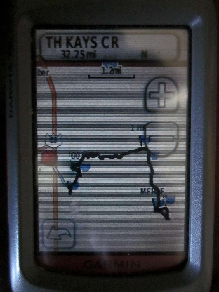
Kays Creek trail to Thurston Peak
View High-Resolution Image
Kays Creek trail to Thurston Peak
This view of my GPS track shows how the trail unspools: proceed north, follow switchbacks east, contour south southeast and turn north to the summit. The other GPS track photo illustrates the more direct way between the "merge" and the summit.
« PREV
NEXT »
Moogie737
on
Oct 1, 2012 5:37 pm
Comments & voting
Other parents
Image Type(s):
Hiking
Image ID:
817504
824 Hits
0
% Score
0
Votes
Log in to vote
Comments
No comments posted yet.
to post!
Don't have an account?
Thurston Peak via Kays Creek - Details & Pics
(Trip Report)
« PREV
Viewing
#38 of 39
GALLERY
NEXT »
Moogie737's Image Gallery
« PREV
Viewing
#394 of 474
GALLERY
NEXT »
×
You need to login in order to vote!
User Name
Password
Remember me
Forgot your password?
Log me out when I close my browser.
Keep me logged in all the time.
sign in as a user
Don't have an account?
Register now for FREE
Rating available
Suggested routes for you
People who climb the same things as you
Comments Available
Create Albums
Register Here


