
Comments
No comments posted yet.
|
|
Trip Report |
|---|---|
|
|
45.71276°N / 6.94416°E |
|
|
Jul 2, 2017 |
|
|
Hiking, Mountaineering, Trad Climbing, Sport Climbing, Toprope, Bouldering, Ice Climbing, Aid Climbing, Big Wall |
|
|
Spring, Summer, Fall, Winter |
All pictures of this page are by Ilario Antonio Garzotto, Antonio Giani & Osw
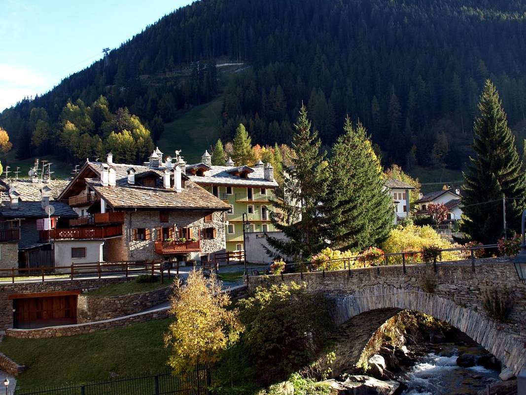
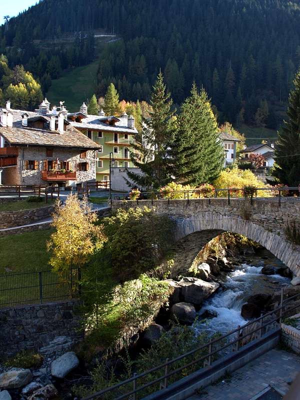
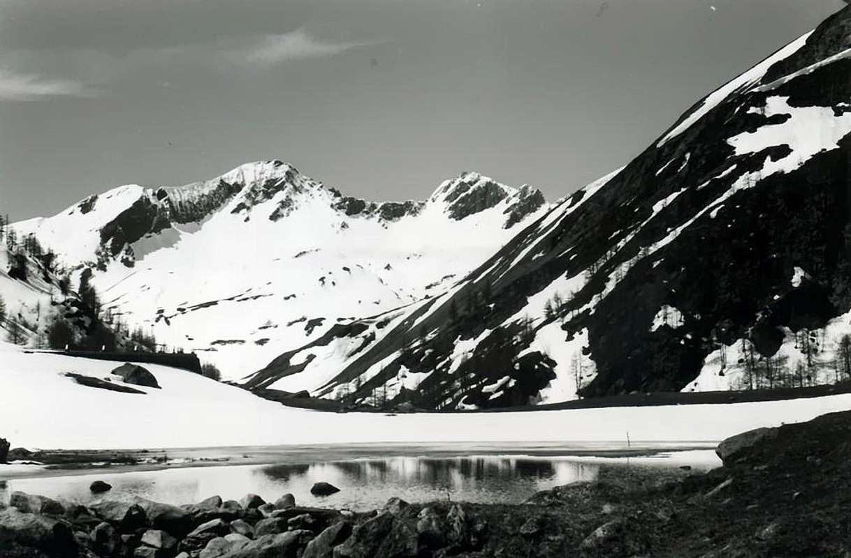
Throughout this great environment, where you can breathe an air of great classical mountaineering, many streams flow from the three cardinal directions but especially from the West to the East, ie from the Dora or Verney Stream to which the Torrent de Orgère Just before reaching the Dora of La Thuile, crossing the entire Little Saint Bernard Valley at the border with the french Tarentaise.
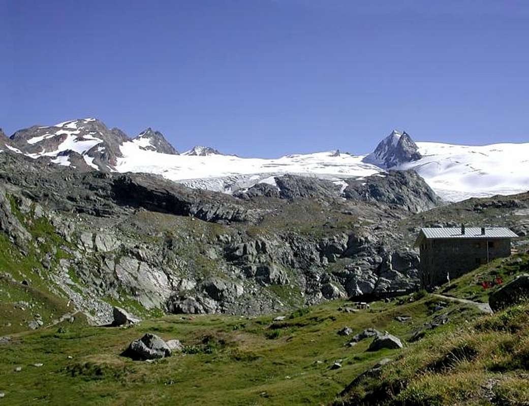
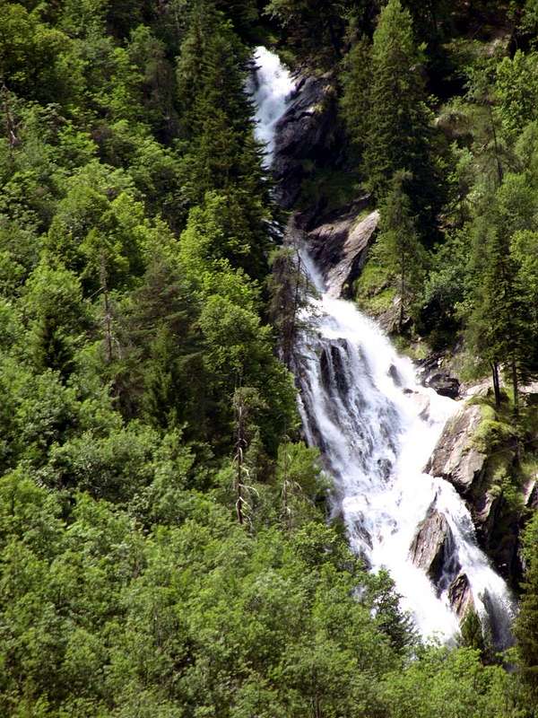
A whole series of streams slip, "wounding" the various small valleys, from West to East to the Verney's Doire or, if you like, the Dora of La Thuile. The last tributaries come from the West: first with the Orgère's Torrent, from the Vallon with the same name, followed in succession from East to West by those of Chavannes, Breuil and Tormotta and up to Lake Verney (2088m). A series of valleys descending from North, each of which gives the name to the creek flowing into the same. Or viceversa. (You will never know it, because it's like talking if the egg or chick first was before born ...). On the other side, or the South, they descend from Plan de la Suche, Chaz-Dura Monte Belvedere of the little torrenties. While on the valley opposite, and to the parallel and adjacent Valgrisenche, from Mont Paramont (3300m) the most important Torrent des Ussellettes descends, which originates from the homonymous glacier, reaches the Ussellettes Lakes just above the Albert Deffeyes Refuge (2494m). Then from the large glacier of the Testa del Rutor (Rutor's Head 3486m) and down to the Northwest to the Grande Assaly (3174m) and the neighboring Lakes of Bellecombe / Tachuy expands itself a enormous mass of ice that give rise to lakes, waterfalls and streams above the La Joux Fraction (1559m). This is where the Dora of La Thuile is born that from the Torrent of Rutor, after marrying with that of the Ussellettes, goes down to reach the tortured Torrent de Verney (from the Little Saint Bernard Vallon), near the two Golette Fractions (Petite or Little 1476 meters while the neighboring Grande or Great is of 1489 metres). A water concert, an orchestra going to sublimate itself in La Thuile's Doire. Along with this, all that remains is to go down to the most important and central Baltea. There, at the below Pré Saint Didier Commune, where an ancient and hardy stonebridge with the famous Pré St. Didier Horrid/Gorge, in foreground, "binds" this Southern orographic-hydrographic part with the opposite or the North.
Oggi una strada asfaltata la percorre integralmente raggiungendo La Thuile (1441 m), ove inizia questa avventura. In tutto questo grande ambiente, dove si respira un'aria di grande alpinismo classico, scorrono molti torrenti che provengono dalle tre direzioni cardinali ma in particolar modo da Ovest verso Est, cioé dalla Dora o Torrente di Verney al quale si aggiunge il Torrent de Orgère, seguito, in successione da Est verso Ovest, da quelli di Chavannes, Breuil e Tormotta e insino al Lago Verney (2088m) poco prima di raggiungere la Dora di La Thuile, percorrendo l'intera Valle del Piccolo San Bernardo al confine con la francese Tarentaise. Una serie di valloni discendenti da Settentrione ognuno dei quali dona il nome al torrente che vi scorre dentro. O viceversa (non lo si saprà mai, perchè é come il discorso se sia nato prima l'uovo od il pulcino ...). Sull'altro lato, o Meridionale, scendono in progressione da Plan de la Suche, Chaz-Dura e Monte Beledere dei torrentelli; mentre sul versante opposto, e verso la parallela ed adiacente Valgrisenche, dal Mont Paramont (3300 m) scende il più importante Torrent des Ussellettes che, originato dall'omonimo ghiacciaio, raggiunge i Laghi di Ussellettes appena al di sopra del Rifugio Albert Deffeyes (2494 m). Poi dai grandi ghiacciai della Testa del Rutor (3486 m) e giù verso Nordovest fino a raggiungere la Grande Assaly (3174 m) ed i viciniori Laghi di Bellecombe/Tachuy si espande una massa di ghiacci che danno origine a laghi , cascate e torrenti fino sopra la Frazione di La Joux (1559 m). Qui nasce la Dora di La Thuile che dal Torrent del Rutor, dopo essersi sposato con quello di Ussellettes, scende fino a raggiungere, presso la località di Golette (1476 metri la "Piccola" o Petite mentre 1489 metri é la vicina Grande), il tortuoso Torrent de Verney. Un concerto d'acque, un orchestra che và a sublimare sé stessa nella Doire de La Thuile. Con questa, non rimane, ora, che discendere verso la più ch'impetuosa centrale Dora Baltea. Là presso la sottostante Pré Saint Didier, dove antico ponte in pietra ardito giusto di fronte al celebre Orrido/Gorgia di Pré St. Didier "lega" questa parte orografica-idrografica Meridionale con l'opposta o Settentrionale.
 |
 |
 |
 |
 |