
-
 7031 Hits
-
 87.31% Score
-
 24 Votes
|
|
Mountain/Rock |
|---|---|
|
|
47.76740°N / 121.13641°W |
|
|
Download GPX » View Route on Map |
|
|
Hiking, Mountaineering |
|
|
Spring, Fall, Winter |
|
|
5627 ft / 1715 m |
|
|
Overview

Spinnaker Ridge
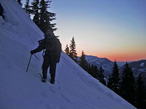
K9, Thor Peak, and Mount Daniel : Taken April 23, 2011
 False Summit |  Deep Snowy Creek |  Pathway Up |  Hiking along Spinnaker |  Snow Slope |
Getting There

Mount Index on the Way

Mount Persis on the way
From Leavenworth: Drive east along Highway 2 almost until Steven's Pass. About 2.3 miles from the trail head highway 2 forks back together (west and East bound) which once it forks together the turn will be on your second left.
Route Information
From the trail head travel onto the other side of the highway which you head West for a few hundred feet. Then take a sharp right which you'll be hiking though what feels like a miniature community of cabins, pretty soon the road then will curve to the left. In total it is about .9 miles of road walking from the trail head to the woods. From here there is no luxurious trail, but as long as your navigation skills through forests and low mountains are ok then things should be easy to find the way. So start out heading West and perhaps a little north going down hill which you will soon encounter a creek.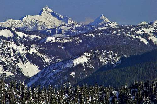
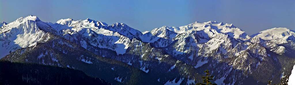
Views of Sloan Peak and Mount Pugh
During the Spring months sometimes the creeks can get a bit deep if you know what I mean, so don't be surprised if you find deep snow cracks or have a hard time crossing the creek. Fortunately both times I went there was a log on one of the creeks which then created a mini snow bridge making crossing much easier. Then on the second one we made a bit of a leap.
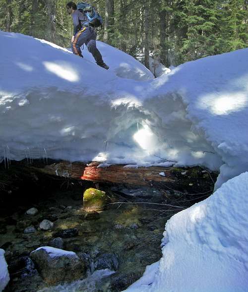
Crossing a Logged Snow Bridge
Depending on how things are, you may find easier crossings a little lower down stream. Keep heading West following on the right of Nason Creek which eventually both you and the creek change direction going South West until you get to a meadow (treeless snow field in winter). Proceed further South west through the woods with slightly ascending to your right (on the lower part of Spinnaker Peak) to assure that you make it to the clearing which you will see a nice cleared out section on the mountain that goes all the way up to a mini pass between Spinnaker and Point 5261.
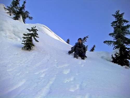
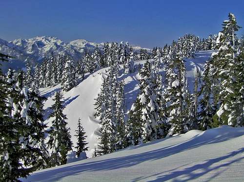
Heading off of Point 5261
Along the Ridge in the Morning
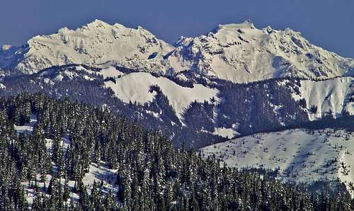
Columbia Peak and Kyes
The Summit Approach
Be sure to take a left which goes onto the ridge that leads to the summit of Spinnaker Peak. After following the ridge for a ways to the summit of Spinnaker, be sure to continue down Southwest of the summit which leads so a mini gap. Then ascend back up on the East ridge to the summit of Martin which has much better views and is virtually treeless. Congratulations, you won a great view so long as you have good weather, plus snow always makes it more worthy in my opinion.
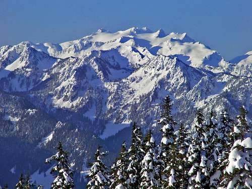
Mount Daniel during April
Alternative Route: There is a small variation for summer time which follows along the Pacific Crest Trail and goes to the basin with no complications which from the trail head after crossing the street rather than taking a right on the road, you would take a left and follow a mini road up to the PCT and then go right. Now I'm not an expert on this because I have not actually done to PCT route, but on a map looks reasonable.
Red Tape
No Permit is required for the trip folks. In winter time Steven's Pass road has been known for getting icy at times which chains for your tires may come in handy depending on how the road conditions are.
The name is some what debatable because of its lack of prominence. Peakbagger calls it Martin Peak while MyTopo calls it just Martin. So because it's a nice addition to Spinnaker and has a Benchmark it's safe for now to call it Martin Benchmark.
The name is some what debatable because of its lack of prominence. Peakbagger calls it Martin Peak while MyTopo calls it just Martin. So because it's a nice addition to Spinnaker and has a Benchmark it's safe for now to call it Martin Benchmark.
Camping
Half way up the mountain there are some flat zones which seem like they would be decent places to camp as well as on the ridge. Camping is not allowed before leaving the road section due to rented cabins and such.Gear Required
10 EssentialsSnowshoes (In Winter or when heavy Snow Covered)
Camera
You may also want to bring a Ice Axe for glissades and if you happen to go up the false summit of Spinnaker Peak as well as a pair of ski polls for Balance.
Crampons/Micro Spikes might be useful if conditions manage to get icy depending on the snow pack, when we went both times they were never needed.
Weather and Mountain Conditions for Martin Peak
For Weather information check in with the Noaa Forecast.
For Avalanche forecast's check in with the North West Avalanche Center.
Here is a constantly updated web cam photo of Steven's Pass road
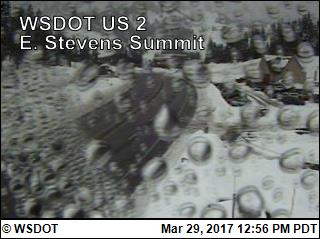
See here for more web cams of Steven's Pass.
Click here for the road conditions to the trail head.
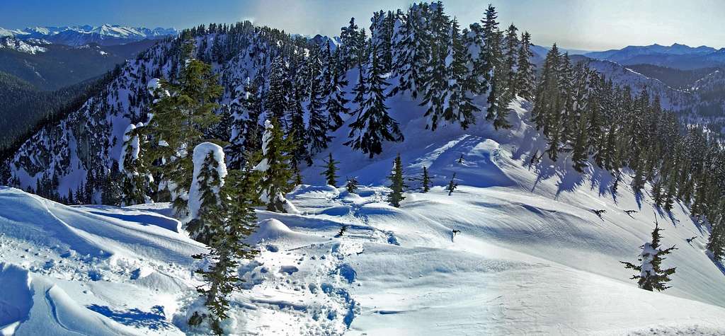
![Misty View from Spinnaker]()
Misty View from Spinnaker
For Avalanche forecast's check in with the North West Avalanche Center.
Here is a constantly updated web cam photo of Steven's Pass road
See here for more web cams of Steven's Pass.
Click here for the road conditions to the trail head.
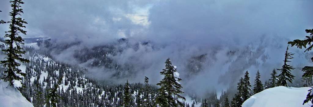
Misty View from Spinnaker
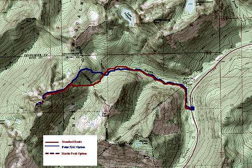
Topographic Maps
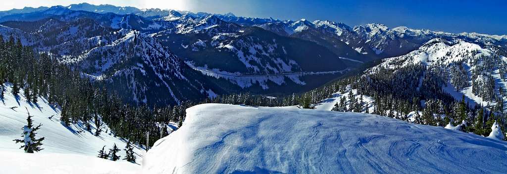
Views from Martin
 Looking Towards Stuart |  K9 and Thor Peak |  Alpenglow |  The Sunrise |
 The Sun Beaming through |  Litchenburg |  Mountain to the East |  Looking towards Fernow |
Looking Towards Cowboy Mountain (South)
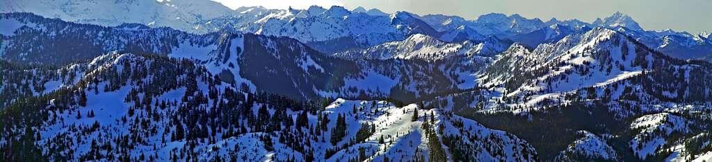
Panoramic View Looking East
The Summit of Spinnaker from Martin
Videos
Spinnaker and Martin Documentation by Bryan K.
Sunrise on Spinnaker Peak
External Trip Reports
- Spinnaker and Martin Peaks: February 9, 2011
A Modern Trip Report on this Peak Posted on Nwhikers - Spinnaker, Martin, Valhalla Mountain: 03/22/09
Some info with Photos - Kendall, Sky, Tye, Martin - Ski Tours - 2/15,16/09
One way to bag many peaks in one day.