
|
|
Mountain/Rock |
|---|---|
|
|
43.99914°N / 123.06031°W |
|
|
Hiking |
|
|
1233 ft / 376 m |
|
|
Overview
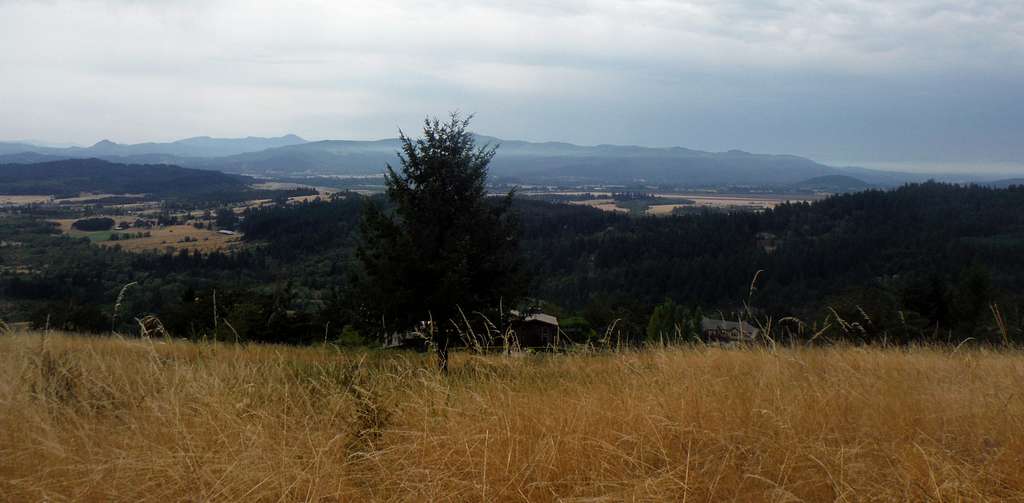
The view east from the ridge-line
Oh no, it is yet another Mount Baldy. This one is a small summit right outside of Eugene, Oregon. This is a wonderful small summit/mountain nestled in the beautiful and quaintly amazing Willamette Valley. The mountain is very popular and well-loved among those Eugene natives and University of Oregon students in Eugene for a “quick hit” with a satisfying and quick punch to the top. I found out that it was well loved because a woman who had grown up in Eugene all her life had told me that though she has hiked other mountains, it was her favorite. Our friend, Jordan, said he liked Mt. Baldy and hikes it frequently. My guess on why it is his favorite is because it is short and sweet.
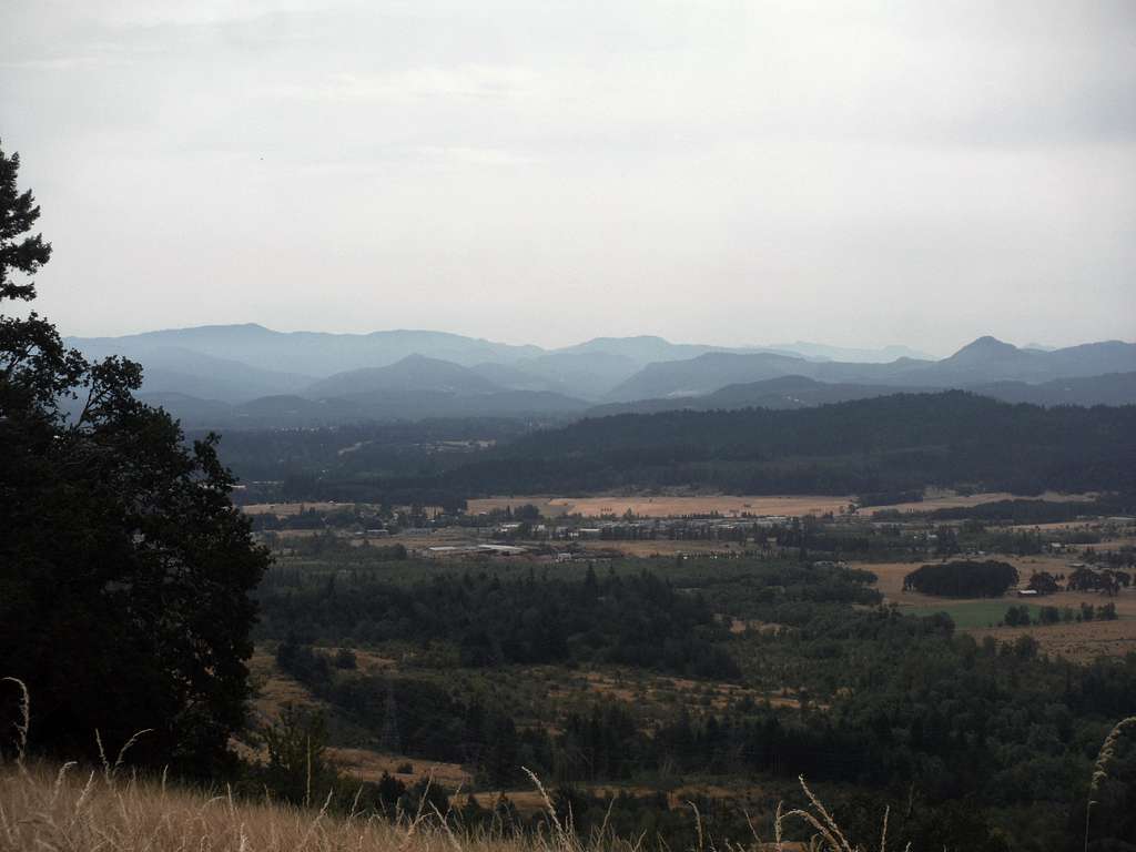
Looking over the valley toward the Cascades
Being that I am 100 pounds overweight, I loved the fact that I did not have to struggle much to get up this mountain. That being said, I struggle a lot in general, and, with my weight at an all-time high, I am struggling hard right now on everything so that should give you an idea on how relatively easy it is. This mountain was a welcome change after summiting Spencer Butte just an hour earlier. For EastKing and I it was no more that 45 minutes which means it will be much sooner for the average person. There is a rock on the trail that supposedly marks the summit. EastKing and I did go into the field a little bit and tackled what we thought and a map and aerial photo confirmed as the true summit of Mount Baldy. It should be noted that this is a grass field and though rare, rattlesnakes are present in this part of Oregon so be a little cautious here.
 Where the summit marker is. Where the summit marker is. |  Where we think the true summit is. Where we think the true summit is. |
However, the views are more gorgeous as you are going up the mountain than on the summit. The “true” summit is through tall grass and straw like brush with burrs that will get on you when you are walking through it. My husband, EastKing, is really good at knowing what the summit is. There is a little bit of a view on the summit towards the East towards the Cascades. There is a field where there are views of the Cascades and a number of views off to the west to downtown. The trail is only a mile round trip and 300 feet elevation gain from either the Spring Trailhead or the Dillard Trailhead.
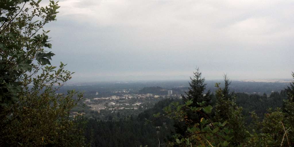
Downtown Eugene from the viewpoint
Getting There
FROM DOWNTOWN EUGENE TO DILLARD TRAILHEAD:Head south on Amazon Pkwy for 1.2 mi. Make a right onto Hilyard Street. At 0.2 mi make a left onto E Amazon Dr. At 1.1 miles make a left onto Dillard Rd. The trailhead will be on your left.
FROM DOWNTOWN EUGENE TO SPRING TRAILHEAD:Head south on Amazon Pkwy for 1.2 miles. The road will then change to East 30th Ave. At 0.7 miles from the change make a right onto Agate Street. At 0.7 miles make a left on Spring Blvd and take for 1 mile until the trailhead.
FROM I-5 TO SPRING TRAILHEAD:
From I-5 get of on 30th Street on the south side of and stay on it for 2 miles. Turn left onto Spring Blvd and then a quick left onto Firland Road. The name of Firland Road will then turn to Spring Blvd. Take that road all the way to the end where the trailhead awaits.
FROM I-5 TO THE DILLARD TRAILHEAD:
From I-5 get of on 30th Street on the south side of and stay on it for 2.5 miles. Make a left onto Hilyard Street. At 0.2 mi make a left onto E Amazon Dr. At 1.1 miles make a left onto Dillard Rd. The trailhead will be on your left.
Route
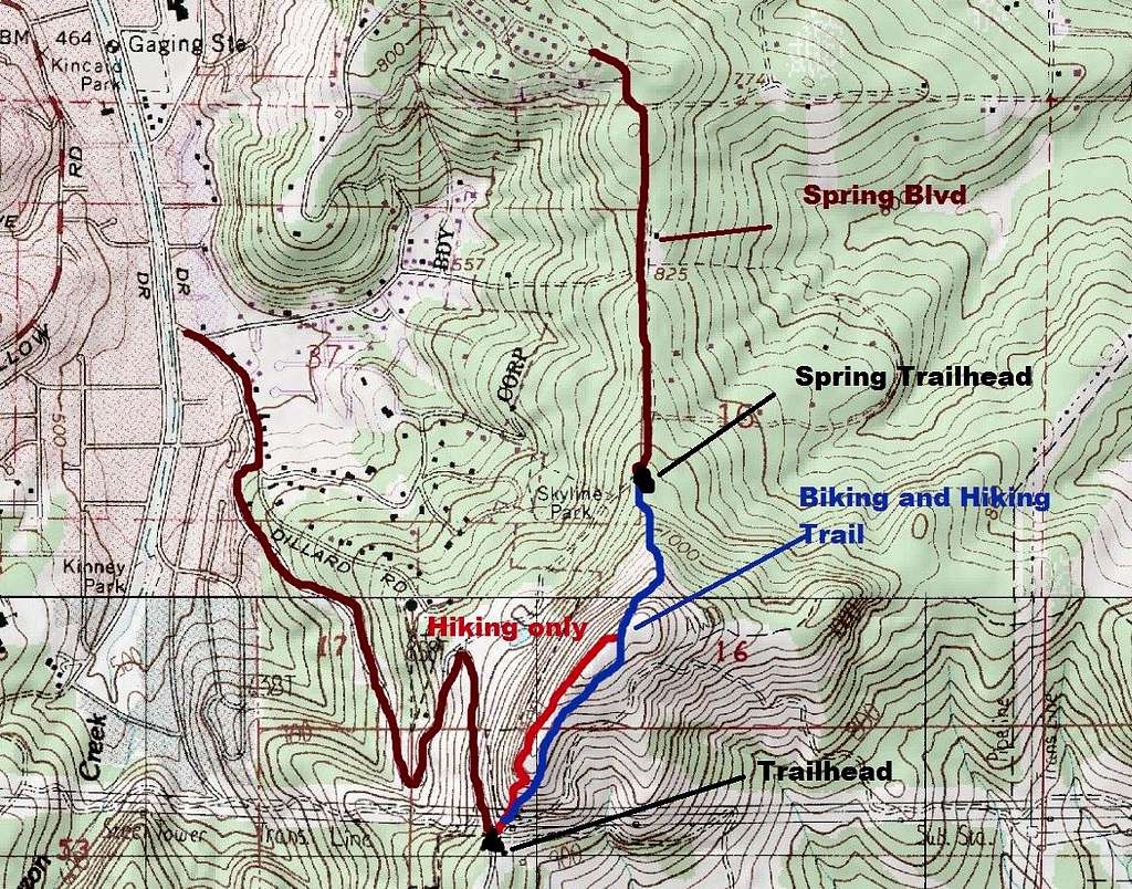
Map of the Routes
The routes up this mountain are simple. From the Dillard Trailhead there is a separate hiking and mountain biking/hiking route to the summit. Both of these routes are mild with the bulk of the elevation gain at the beginning as you climb through the power lines. Both of these trails meet at the summit area at about 0.5 miles. You can combine these trails to make a nice one mile loop. From the Spring Trailhead there is a nice mountain biking/hiking trail to the top which is only 1.2 miles roundtrip.
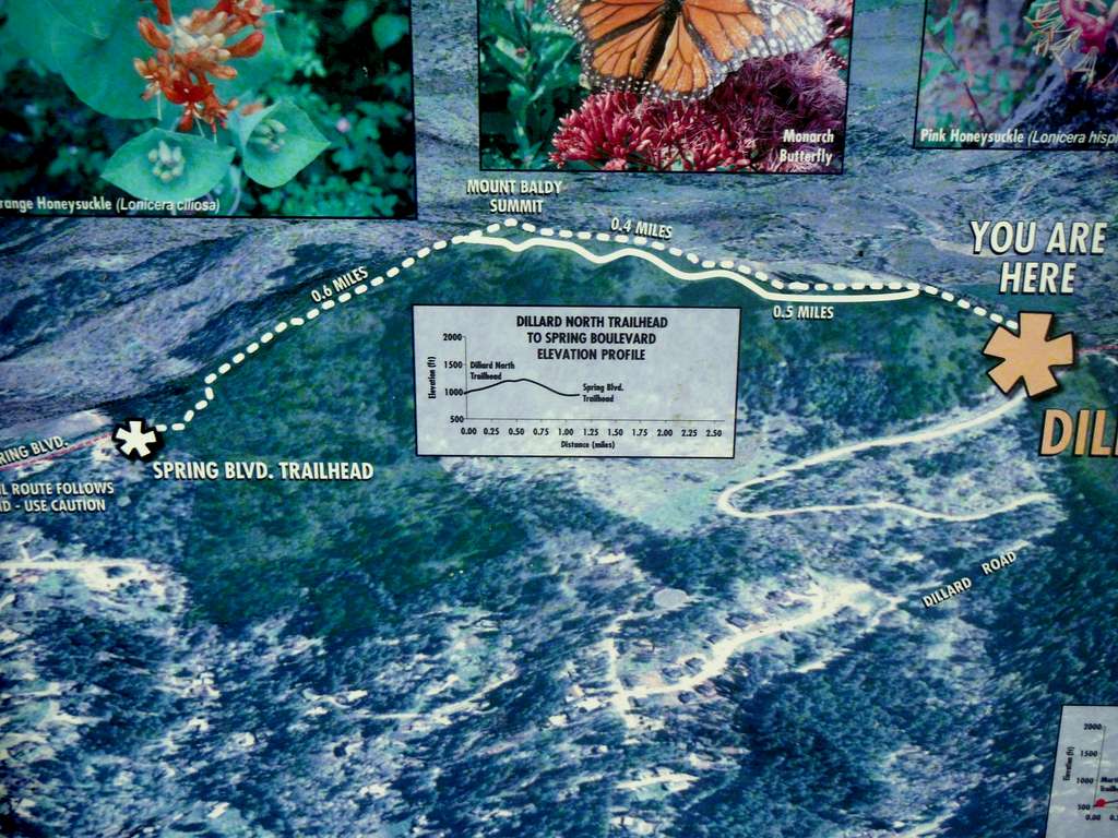
Picture of the map at the trailhead
Red Tape
There is no read tape except for the hours of the park which is that the trailhead is open from dawn to dusk 365 days a year.When to Climb
This peak can be hiked or mountain biked all year round. Snow is very rare in winter but even with snow this mountain can be done without an extra equipment.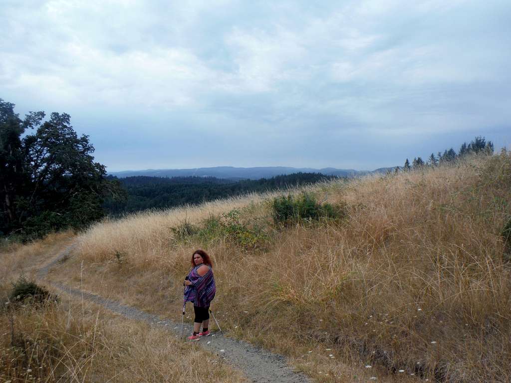
BearQueen heading down the bike path.
Camping
There is no camping allowed on this summit because this is a city park. There are private campgrounds all around Eugene and a full array of lodging accommodations in the town of Eugene, the second largest city in Oregon.External Links
Mount Baldy Peakbagger PageMount Baldy Trail Link