Page Type Page Type: Mountain/Rock
Location Lat/Lon: 48.54052°N / 123.12678°W
Additional Information County: San Juan
Additional Information Elevation: 736 ft / 224 m
Sign the Climber's Log

Overview


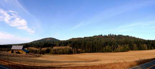
Mount Dallas and Mount Grant from West Valley Road


Mount Grant is a 736' high point located five miles west of Friday Harbor, WA. While not much more than a minor foothill by Washington State standards (or even San Juan County standards), it does provide what are probably the best public access views on San Juan Island. Certainly, there are other nice viewpoints on the island (Young Hill and Mount Finlayson, as examples), but Mount Grant is unique in that it offers views in all directions (provided you are willing to move around the summit area a bit).

Mount Grant is accessible to vehicles on Sundays from 9am to 7pm - for a much more pleasant summit experience, I highly recommend going at any other time. While Sunday afternoons bring throngs of tourists to Mount Grant's summit areas, on weekdays it is not uncommon to have the entire hill to yourself. Sunrise and sunset would be a particularly nice time to arrange a visit, and would probably provide better wildlife viewing opportunities as well. 

Prominence peakbaggers are probably curious why I am creating a page for Mount Grant in lieu of a page for Mount Dallas, San Juan Island's high point (1.3 miles south of Mount Grant). Unfortunately, Mount Dallas is located on private property, and has limited drive-up views (don't ask me how I know this). Interestingly, Mount Grant almost suffered the same fate as Mount Dallas. Until recently, it was slated to become 'Lawson Ridge Residential Estates'. I'm not familiar with the story of how this land was acquired for public use, but those interested can get more information from the San Juan Preservation Trust's website

Getting There


I'm going to be a little presumptuous, and guess that anyone on San Juan Island did not go through all the trouble of getting there just to walk up Mount Grant. Just on the off chance you need some help finding your way there from Anacortes, here is a link to the Washington State Ferries website. Please note that Washington State Ferries is now recommending reservations for the San Juan Island's ferry runs. 
 
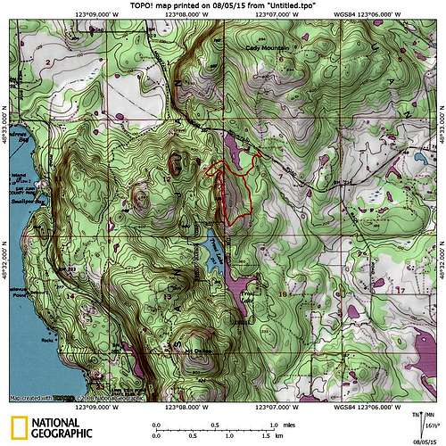
Mount Grant topo map


From Friday Harbor, take Guard Street west out of town. Guard Street will turn into Beaverton Valley Road, and then West Valley Road. At a point five miles from town, look for a signed turnoff for Mount Grant on the left side of the road (If you drive past Lawson Pond, you have gone too far).
 
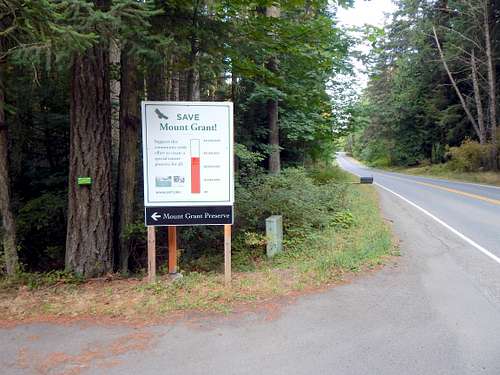
Start of Mount Grant Road
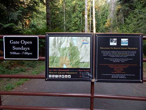
Turn left on the Mount Grant Road - after a short distance, you will arrive at a gate and parking area, complete with porta-potty.

Mount Grant gate
Mount Grant gate


Route


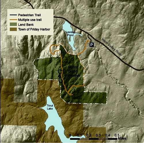
Mount Grant trail map


From the gate, begin walking up the Mount Grant Road - after 0.25 miles, you will arrive at a junction.
 
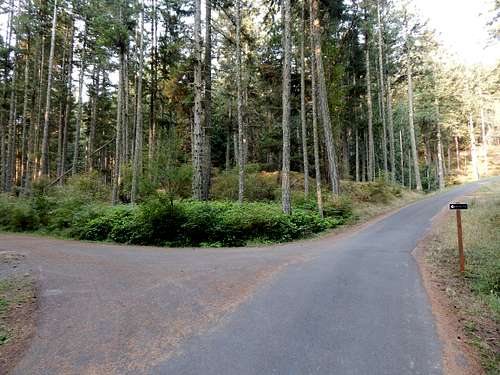
Mount Grant Road split

It really makes very little difference which fork you choose - distance and elevation gain are identical for both routes. If you happen to be here on a Sunday, the left fork will provide a little more peace and quiet. Any other day of the week, flip a coin. The left fork does have one section of steep gravel near the top, so if you're not feeling energetic, opt for the right fork.

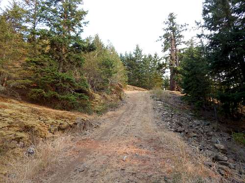
Approaching Mount Grant summit via the 'non-motorized' trail

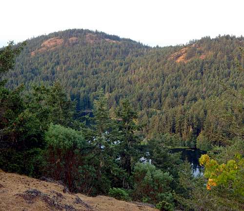
If you choose the right fork, the road will pass by the south end of Lawson Pond. Approaching the pond would require trespassing on private property - truthfully, the view is better from the West Valley Road, anyway.

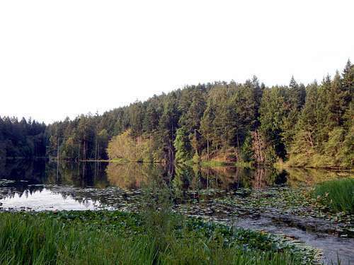
Lawson Pond from West Valley Road

Distance to Mount Grant's summit via the left or right fork will be about 0.75 miles, or a total distance of one mile from the gate. There is not one area that gives up a 360 degree view, but by moving about the summit area a bit, views in most directions can be found. Use caution, as there are substantial cliffs on the west side of the summit. My apologies for the quality of the photos, it was a bit hazy on the day I visited.

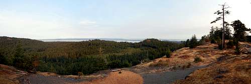
Mount Grant west view

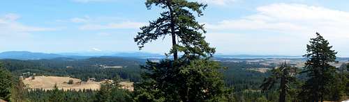
Mount Grant east view

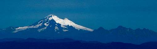
Mount Baker and Twin Sisters from Mount Grant

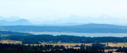
Cascades from Mount Grant

Mount Dallas and Trout Lake from Mount Grant


Red Tape


There are no parking permits required for this trailhead. Please do not trespass on private property located along the Mount Grant Road. Additionally, please stay out of the Trout Lake area (marked on map), as this provides drinking water for the town of Friday Harbor.
 

When to Climb


Any time you want - again, I recommend staying away on Sunday to avoid crowds.

Camping


There are numerous options for camping and lodging on San Juan Island - it would be prudent to plan ahead and make reservations during the summer months.