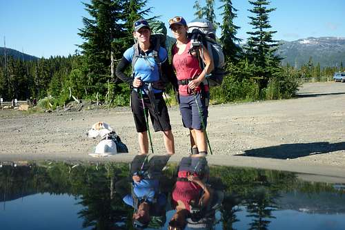
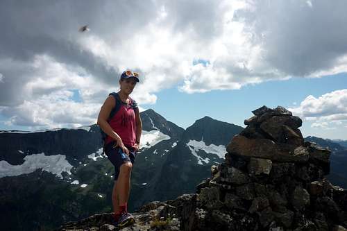
Mt Jutland via Paradise Meadows: Not to be underestimated!
Mt Jutland is 1821m in elevation about 3kms northeast from Mt Albert Edward. It is much less travelled, which made it appealing to me. This was a hike my girlfriend and I decided we would do as a one-nighter. We approached Mt Jutland from the Mt Albert Edward route via Paradise Meadows. We decided to camp at Moat Lake, rather then the well-populated Circlet Lake, and try something new.
![Unnamed Image]()
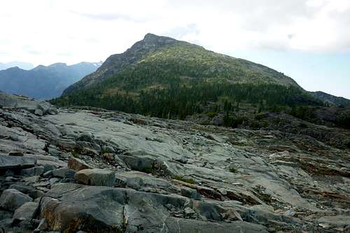
Leaving the parking lot (Mt Jutland on the right)
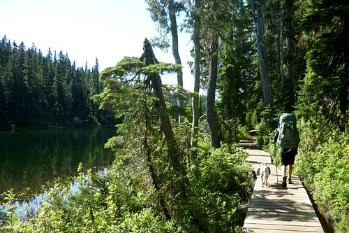
We arrived at the Paradise Meadows trailhead and were ready to hit the trail at 0915. We decided to take the longer route to Moat Lake to the south, which passed through Murray Meadows. We were looking to try a different trail, and didn't mind that this way was longer by about 1km or so. This route was much flatter and had much more boardwalk, thus, I feel as though it didn't take us much longer than the route which passes the ranger cabin.
![Unnamed Image]()
Battleship Lake
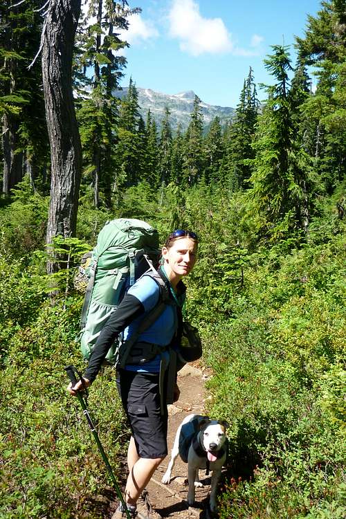
We came up beside Battleship Lake at 1000 and there were some people out paddling in a canoe. The trail from here passed through beautiful meadows and eventually weaved by Lady Lake, Croteau Lake, Kwai Lake, and Mariwood Lake. There were only a few spots where we had to go up and down, which was great because it was smoking hot. Just before Kwai Lake the trail headed down through a small section of forest and there were great views of Castle Craig, Frink, Albert Edward, and Jutland. We were at Kwai by 1120.
![Unnamed Image]()
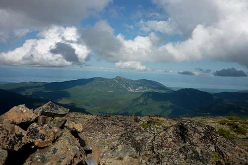
View of Mt Albert Edward
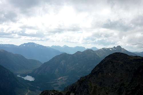
At 1230 we hit the turn off for Moat Lake. From here we were greeted by amazing views of the Cruickshank Canyon over some bluffs. We made it to the lake, dropped our bags, and began setting up our camp for the night. So far we had travelled around 12-13kms from the trailhead. A couple groups passed us here. One group had just done the MAE, Frink, Castlecrag loop that we did the year previous. After about 45mins we slapped on day packs and headed back down the trail we had just travelled to meet up again with the MAE trail.
![Unnamed Image]()
View down the Cruickshank Canyon from the Moat Lake trail
We joined back up with the trail at 1405 and it took us around an hour to get to the top of the ridge we would take to ascend Mt Jutland. We ran into a number of people heading down from Mount Albert Edward. From the ridge we could see Mt Jutland and it looked much farther up then I remembered from previous years. Maybe it was my tired legs and sore feet...
![Unnamed Image]()
Looking northwest towards Mt Jutland from the ridge
We followed the few cairns that headed towards Jutland along the rocky ridge. Occasionally there was an obvious trail, but it only lasted around 20 ft or so and would disappear. The cairns were starting to become more spread apart and followed what looked like an old grassy creek bed through thin trees along the south aspect of the mountain. Eventually we could not find any more cairns and decided if we went any further south we would be wasting time so we turned and headed straight up the mountain. It was a bit of an exhausting scramble, up rocks and through small bushes, and we lost site of the top a few times in the more dense areas. When we arrived where the terrain flattened out for a brief moment we could see cairns again and there were pools of water for the dog to drink from. We could easily see the summit from here and followed the cairns to the last section of steep scrambly rock before our goal.
![Unnamed Image]()
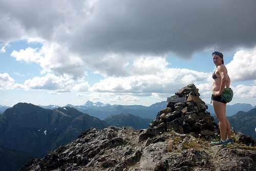
Mt Jutland summit looking to the west
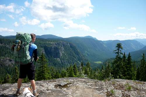
We arrived at the summit of Mt Jutland, about 16-17kms from the trailhead, at 1550 and it was quite the view. We could see the ocean to the east and mountains of the Strathcona to the west. I could even spot Elkhorn and the Golden Hinde. There was also a magnificent view of Mt Albert Edward and Mt Regan. Below us I spotted Gem Lake and had to pull out my park map to identify Pearl Lake at the base of Alexandra Peak. We sat for about 30-40mins and soaked in the incredible view. We also signed the registry and discovered that we were the 6th party to sign it this year.
![Unnamed Image]()
View of Mt Washington
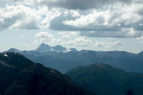
![Unnamed Image]() View of the Golden Hinde
View of the Golden Hinde
![Unnamed Image]() Me with my back to MAE and Regan
Me with my back to MAE and Regan![Unnamed Image]()
Pearl Lake and Alexandra Peak
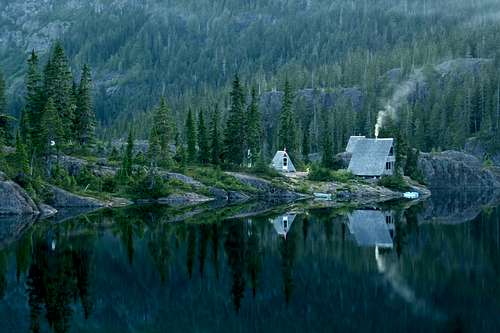
After we felt slightly rested, we headed back down to our camp. I thought we might cut off more time then we did, but the hike down required careful footing and a bit of scrambling. By the turn to Moat Lake we were lightly jogging and happy to be on the path to relaxation. We arrived back at camp at 1815 and the lake was beautiful. Plus, we still had the camping spot all to ourselves, with the exception of the Wood family out on the island. For those that are not aware, the Wood family has had rights to this island (actually peninsula) since 1937, because they were here before it was made into the Strathcona Park. They have a couple small boats with electric motors (I am assuming they flew in via aircraft) and some small A-frame cabins. To this day the family frequents the island, and who wouldn't?!
![Unnamed Image]()
The view of Stuart Wood island from our camp
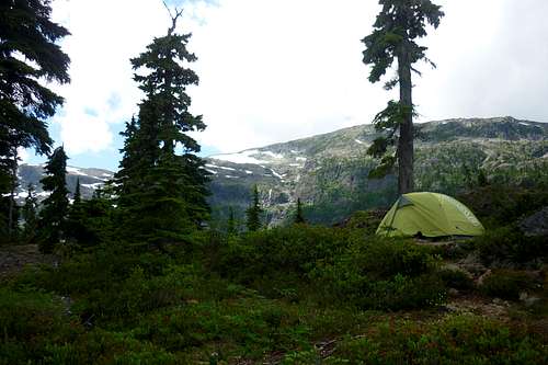
![Unnamed Image]() Our camp looking to the west
Our camp looking to the west
When we got back to camp we purified some water for our packs and made dinner. While we were doing this we were visited by a family of whisky jacks. We fed them a few crackers and got some good video footage of them eating food off our hands and the tops of our heads. Following dinner we sat on the rock above our camp facing the mountains and Stuart Wood Island sipping vodka and taking in the clean fresh evening air. At one point we spotted a couple deer in a small meadow at the end of the lake. We headed to bed fairly early due to pure exhaustion. I figure we had travelled at least 23-24kms that day.
The next morning we climbed out of the tent at 0630. We had breakfast and coffee overlooking the lake and bid it farewell... We set out on the trail at around 0815 and stopped once along the way for about 20mins or so to chat with a couple hikers we met the day previous that were also heading home. We made it to the parking lot at 1130.
In the end, Mt Jutland was much more challenging and breath-taking then I ever imagined. I thought I might be a bit jealous of those hiking to MAE, but in fact I ended up being proud of climbing a mountain not as many people choose to do.
Comments
No comments posted yet.