
-
 13918 Hits
-
 79.04% Score
-
 10 Votes
|
|
Mountain/Rock |
|---|---|
|
|
16.65518°N / 120.78658°E |
|
|
Hiking |
|
|
Winter |
|
|
8819 ft / 2688 m |
|
|
Topographic isolation: 11 km.
Nearest higher peak: Mt. Tabayoc, 2812 m
Prominence: 938 m![Cabbage terraces on Mt. Singakalsa]()
The vegetable terraces of the Philippines![Like a Greek theatre - in the hillside of Mt. Singakalsa]()
Cabbage![The trailhead to Mt. Singakalsa is here]()
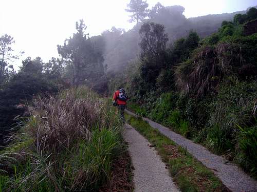
The trailhead is here![Overview Map - Mt. Singakalsa]()
Overview map about the route to Mt. Singakalsa
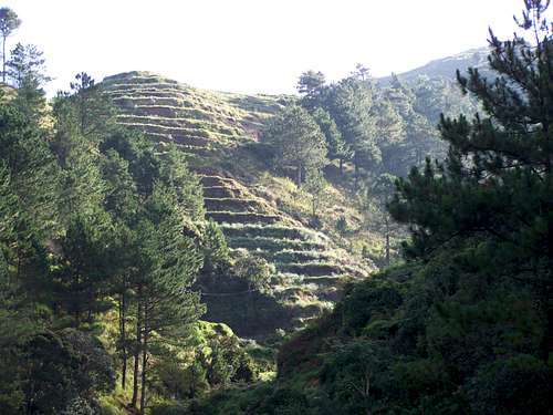
![The well-paved way leading up the mountain]()
Steep roadThe jump-off point – on the Halsema Highway is at km 55, on elevation of 2240 m above see level.
![Near the peak of Mt. Singakalsa]()
The last hundred meters...
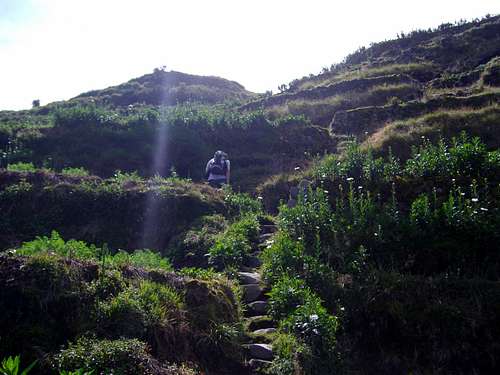
From the Halsema highway you have to turn right to a very steep cement-paved side road. There are a few forks but it's easy to distinguish the main road. If you stray away from the main path, all the other roads terminate at one of the houses of the locals who would then direct you back to the main road after offering you a cool fill of water! The main road is actually the same road that traverses Timbak down to Kabayan Barrio. Along the way, you'll see houses and vegetable gardens, be corteous (the mountaineer way) to locals as I've been told, they take strangers for rebels. You will pass by the elementary school. Here you may ask the locals for the trail to the peak. Following the main road farther would lead you to the Timbak mummies. You see, getting lost there means discovering something else cool.
If you plan to spend here the overnight, then find a flat area to pitch your tents on. Be aware of the nightly winds and rain. It's as cold as Pulag there, can be near the freezing point. Also locals would be very willing to put you up for a night, if the group is not big. Altogether it’s useless to plan spending the night on the hill – it’s a peak perfect to do within 1 day.
Near the top you may be lost in the labyrinth of narrow trails between the vegetable gardens.![Red berries on the top of Mt. Singakalsa]()
Red berries
![A monument shaping a red star]()
Why is this red star here??The very top of the peak has a radio transmission station. Of course it’s not nice, but 150 meters farther – still in almost the same height – there is a Calvary with magnificent view. From the Calvary you can see the nearby cabbage gardens, but between the Calvary and the radio transmission station there is an interesting red berry field. This vegetation is not usual in the Philippines.
From the peak – in good weather – you can have a magnificent view around. Mount Tabayoc (2812 m) in 11 km distance to east, and Mt. Pulag (2922 m) in 13 km distance to SE.
![Mt. Pulag in the distance]()
Good weather - not raining
Nearest higher peak: Mt. Tabayoc, 2812 m
Prominence: 938 m
Overview
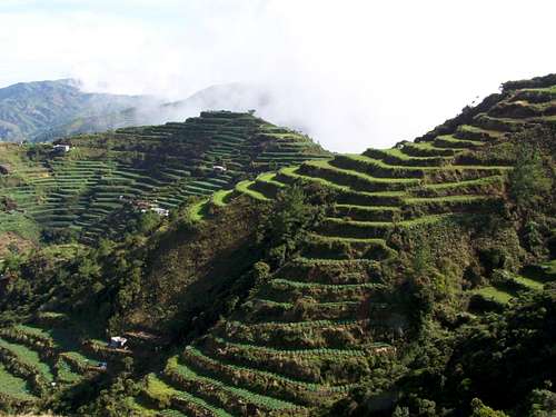
The vegetable terraces of the Philippines
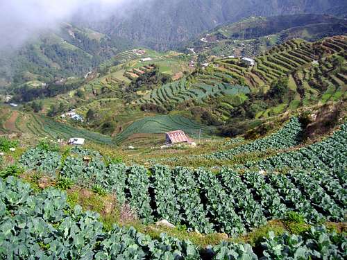
Cabbage
Mount Singakalsa – also called Mount Timbak is the 3rd highest mountain of the Luzon island of Philippines. Singakalsa is one of the peaks of the Cordillera Mountains. There are contradictive records about its hight. According to PinoyMountaineer – the leasing mountaineering website of the Philippines – it is 2717 m high above see level. On the other hand it is 2688 m high according to the map published in Lonely planet. It is in the province of Benguet.
However, its height is not the primary reason why people go there. After all, you can reach almost all the way to its summit with a 4×4. And its summit is unlike the typical summit that mountaineers aim to reach. Depending on the month of the year it can either be a vegetable or a flower farm. Most people travel all the way to the high mountains of Benguet to see the Mummies of Mt. Timbak. (I didn’t do this – I aimed for the peak)
Getting There
The trailhead is here
Yes, this is the good point in going to this peek. It is the relatively most easily accessible peak of the Cordillera Mountains. Relatively…
Most hikers go to Mt. Singakalsa from Manila or from Baguio City. Going from Manila first you must get to Baguio City. The easiest way is to get an evening bus from Metro Manila, from the Victory Liner Bus Terminal in Cubao, EDSA. It’s advised to get an evening bus at 10 p.m. that will get to Baguio 6-6.5 hours later. There are buses to Baguio every hour.
From Baguio you must take a bus going to the direction to Bontoc, via the Halsema Higway. Buses going in this direction depart from the terminal of Slaughterhouse Road. The distance of the Slaughterhouse Road terminal is 1.6 km from the Victory Liner Bus Terminal. You can take a taxi or just walk over. There is an early morning bus (6 a.m.) operated by the Rising Sun Bus liner. It takes you in approximately 2 hours to the jump-off point at the 55 km of the Halsema Highway.
The way up to the peak

Overview map about the route to Mt. Singakalsa
Steep road
The last hundred meters...
From the Halsema highway you have to turn right to a very steep cement-paved side road. There are a few forks but it's easy to distinguish the main road. If you stray away from the main path, all the other roads terminate at one of the houses of the locals who would then direct you back to the main road after offering you a cool fill of water! The main road is actually the same road that traverses Timbak down to Kabayan Barrio. Along the way, you'll see houses and vegetable gardens, be corteous (the mountaineer way) to locals as I've been told, they take strangers for rebels. You will pass by the elementary school. Here you may ask the locals for the trail to the peak. Following the main road farther would lead you to the Timbak mummies. You see, getting lost there means discovering something else cool.
If you plan to spend here the overnight, then find a flat area to pitch your tents on. Be aware of the nightly winds and rain. It's as cold as Pulag there, can be near the freezing point. Also locals would be very willing to put you up for a night, if the group is not big. Altogether it’s useless to plan spending the night on the hill – it’s a peak perfect to do within 1 day.
Near the top you may be lost in the labyrinth of narrow trails between the vegetable gardens.
On the Peak
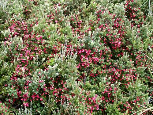
Red berries
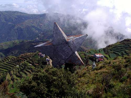
Why is this red star here??
From the peak – in good weather – you can have a magnificent view around. Mount Tabayoc (2812 m) in 11 km distance to east, and Mt. Pulag (2922 m) in 13 km distance to SE.
Best Season to Climb
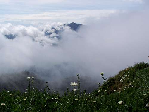
Good weather - not raining
Best season to climb - practically any time, but in order to get less chance for rain, the best is between November and March