Toggle navigation
Mountains
Routes
Images
Trip Reports
Forum
What's New
People
Areas & Ranges
Articles
Trailheads
Canyons
Huts & Campgrounds
Albums
Logistical Centers
Fact Sheets
Lists
Custom Objects
Gear
Plans & Partners
WELCOME TO SUMMITPOST
SIGN IN
REGISTER
Muddy Mountains
Additional Parents
Muddy Mountain (Muddy High Point)
Image
Muddy & Muddy HiPt Tracks
View High-Resolution Image
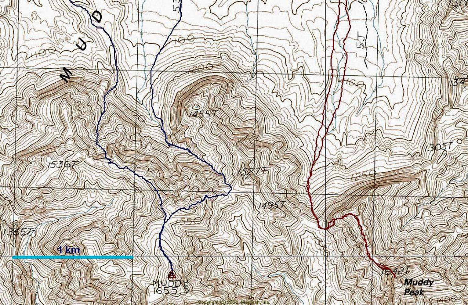
Muddy & Muddy HiPt Tracks
This map shows GPS tracks for the traditional route to Muddy Peak (red, right), and two paths to Muddy Highpoint (blue, left). The blue track was supplied by Nick N. The rightmost blue track is the usual route up Muddy High Point from Hidden Valley.
« PREV
NEXT »
MoapaPk
on
Feb 22, 2007 10:16 pm
Comments & voting
Other parents
Lat/Lon:
36.29863°N / 114.71429°W
Image Type(s):
Topo/Diagram
Image ID:
272276
4000 Hits
73.06
% Score
3
Votes
Log in to vote
Comments
No comments posted yet.
to post!
Don't have an account?
Muddy Mountains
(Area/Range)
« PREV
Viewing
#27 of 39
GALLERY
NEXT »
MoapaPk's Image Gallery
« PREV
Viewing
#333 of 537
GALLERY
NEXT »
Muddy Mountain (Muddy High Point)
(Mountain/Rock)
Loading....
×
You need to login in order to vote!
User Name
Password
Remember me
Forgot your password?
Log me out when I close my browser.
Keep me logged in all the time.
sign in as a user
Don't have an account?
Register now for FREE
Rating available
Suggested routes for you
People who climb the same things as you
Comments Available
Create Albums
Register Here


