|
|
Mountain/Rock |
|---|---|
|
|
57.01082°N / 3.84194°W |
|
|
Hiking, Mountaineering |
|
|
Spring, Summer, Fall |
|
|
3343 ft / 1019 m |
|
|
Overview
Pronounced – Moolack-Clack a’ Vlair
Summit height - 1,019 m (3,338 ft)
Meaning – Summit of the stone of the plain
The Cairngorm National Park was formed in 2003 to protect this unique area. It is the UK's largest national park with a large mountain range at its heart and with many diverse communities around it. The habitat offers a secure haven for many rare species and the forests include remnants of the original, ancient Caledonian pine forest. These contrast with large areas of heather moorland.
Mullach Clach a’ Bhlair lies in the far southwestern corner of the western Cairngorms plateau. The National Park land extends much further south and west but the vast majority of the land falls below the 900m contours.
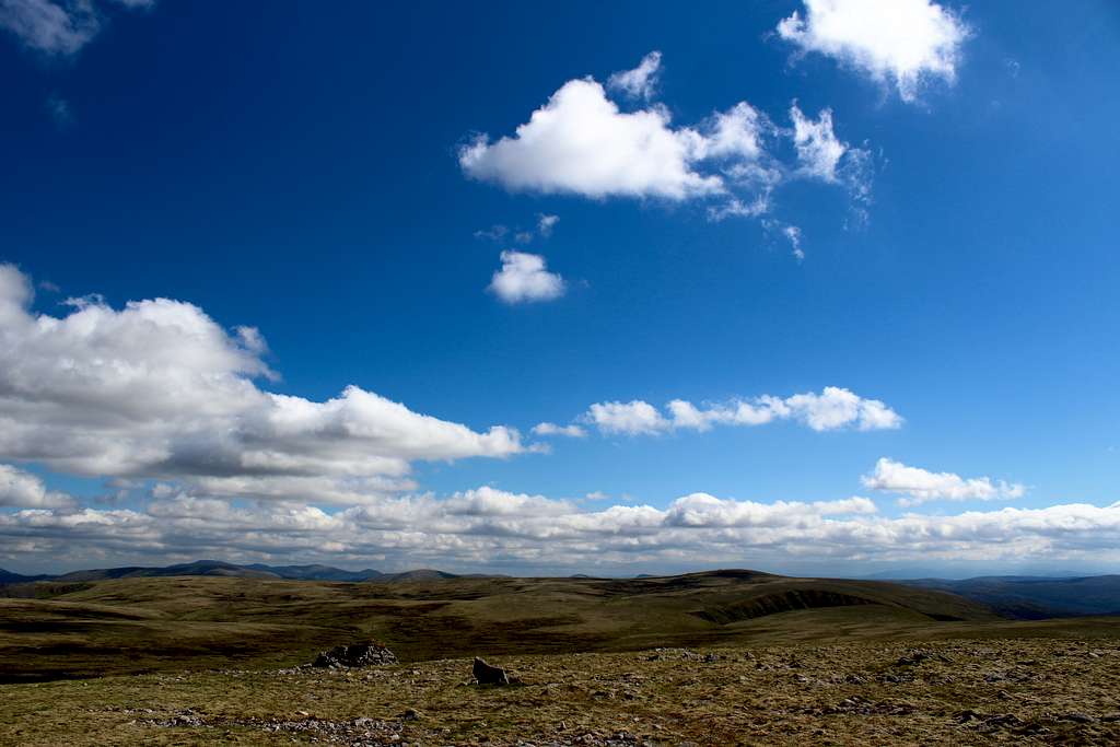
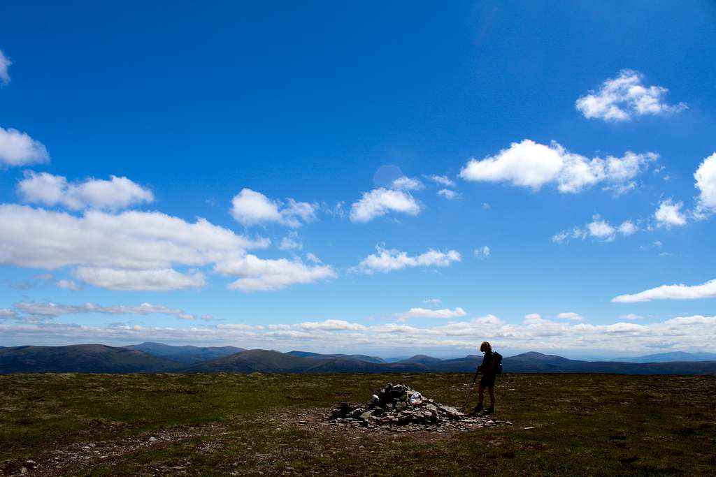
The summit itself is represented by a small cairn – a pile of stones at the high point of a grassy, open hillside, a significant navigational challenge in poor conditions. Strong wind and sudden storms can often be a problem here. Couple this with the fact that the summit is on the edge of the largest and highest area of mountain environment in the British Isles means a mountaineer should be prepared for anything.
Having said that, this wilderness has a lonely beauty of its own and the ascent can be a real pleasure in good conditions.
Getting There
Getting there
Aviemore is the main town to use as a base for the northern Cairngorms. It has many hotels and shops and provides a good bus service to the area as well as a good train service to the wider country.
By road, Aviemore is easily accessed from the main A9 road which links Glasgow with Inverness. From Aviemore, take the road towards the Coire Cas ski development but just before Inverdruie, take a right turn on the B970 towards Feshiebridge.
Follow this road down Glen Feshie for approximately 6 miles to the edge of Feshiebridge and take the left turn sign posted towards Lagganlia and Achlean.
Continue down to the end of the public road and to the free car park at Achlean.
Route
Route A
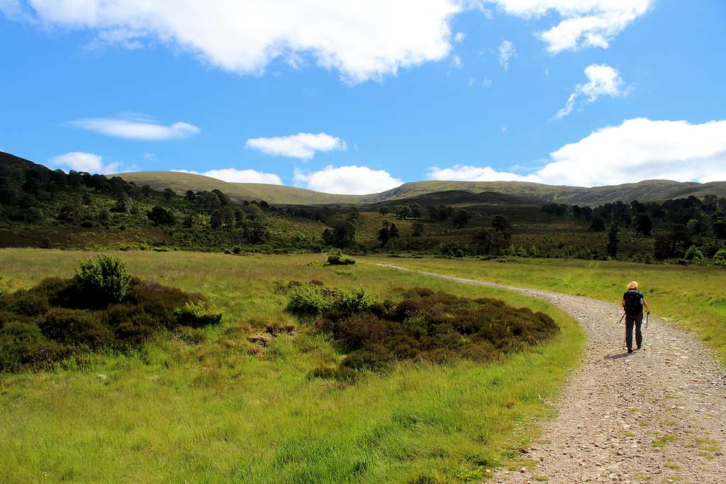
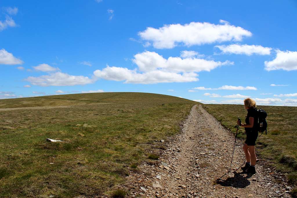
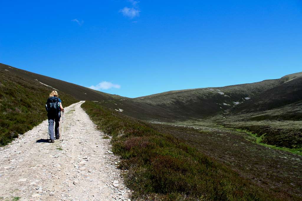
From the car park at Achlean, walk down the road towards the farm of Achlean. Leave the road (which is private from this point on) by taking a path on the left through a gate. Walk along the path for approximately 200m until the path splits, take the right turn here.
The path will lead you behind the farm buildings at Achlean on a route that runs alongside the River Feshie. This path may change from season to season depending on the weather and conditions underfoot but generally follows the course of the river. It may be necessary to cross tributaries as you continue southwards.
In the early summer 2022 when we were there, the route was very dry but several sections of the path had been washed away by the winter/spring floods.
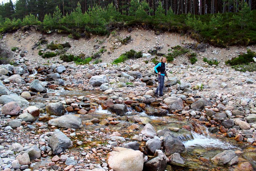
Cross the Allt Garbhlach, a major tributary. Again, the banks had been washed away but crossing this was not too difficult.
Soon after this, the path enters a forest of pines, continue on the route parallel to the river, ignoring intersecting paths.
As the wood starts to thin out, it will be possible to see some white buildings on the opposite bank of the River Feshie, this is shown as “Carnachuin Meml” on the OS map. The map also shows a bridge across the River Feshie here but as far as I am aware, this was washed away many years ago.
Continue past the white buildings until the track to the aforementioned (washed away) bridge crosses your track, turn left (east) here.
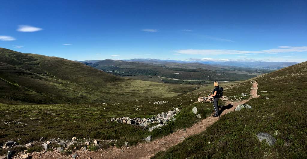
This ATV track climbs the valley above the Allt Choire Chaoil and will be your route up onto the Cairngorms plateau.
On a clear day, the views west and south from this track are exceptional – remember to take photos in the morning as you will be looking into the sun in the afternoon!
As the track passes the 950m contour, ignore the turn on the left and continue on for a short distance as the track turns sharply right and contours around the hillside.
This track passes to the north of the summit. Look out for a feint path heading south up the hillside – there was a small cairn to mark it in 2022 but this may have gone.
Follow the path for around 300m until a small cairn marks the summit.
On a clear day, all of the western Cairngorm summits are visible (except maybe The Devil’s Point).
In poor conditions, leaving the ATV track could be a major decision. Confidence in your route finding abilities would be essential.
From the summit, the easiest descent route is to retrace your footsteps all the way back to the car park.
Alternatively, return to the ATV track and head back the way you came on the way up.
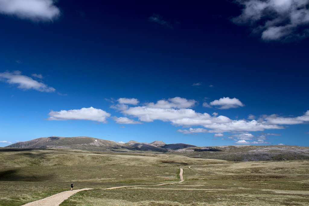
Instead of descending down the Allt Choire Chaoil route, take the right turn (heading northeast) and follow this ATV track across the plateau towards the Moine Mhor.
Again, there are two choices:
Route A
Continue on the ATV track, following it all the way to PT 957m. Here, turn left (heading in a northwest direction) and follow the feint track up to the bealach ahead. The path improves until the cairn is reached. Continue straight ahead.
Alternate route
Look for a feint path leaving the ATV track on the left (heading in a northwest direction) around the edge of Coire Garbhlach and towards the highpoint marked as Pt 951m on the map.
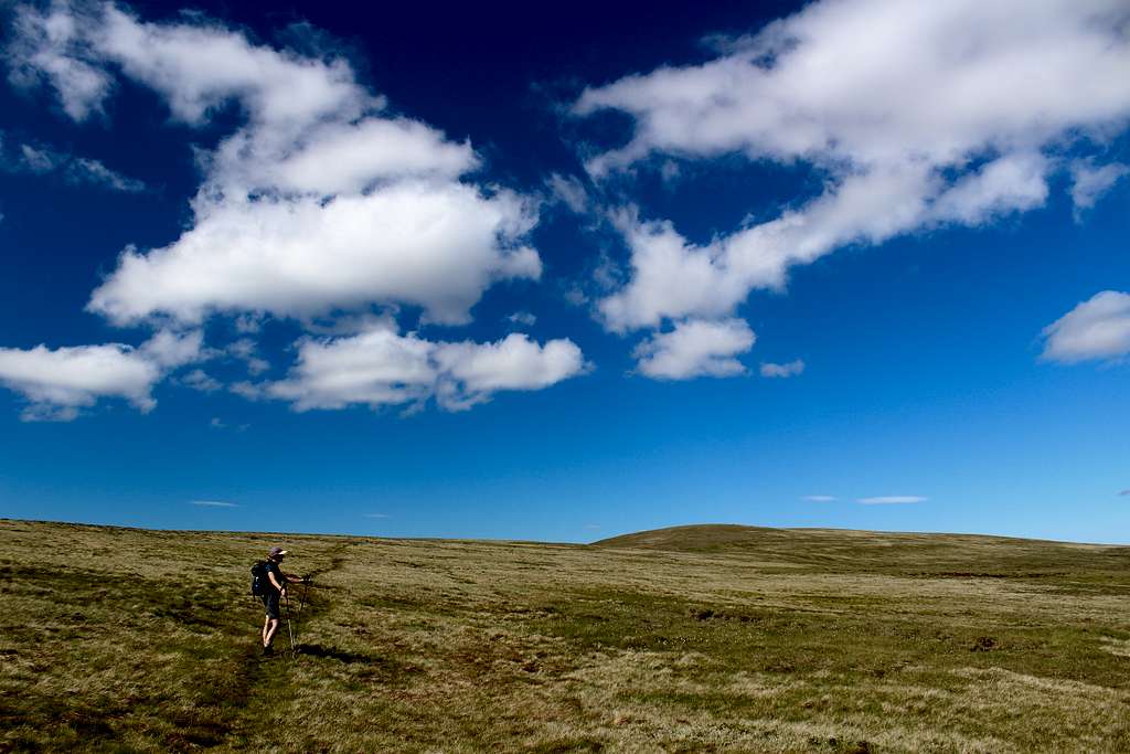
This area is on the edge of the Moine Mhor (The Great Moss)and can be wet and boggy, not surprisingly!
From here, the path continues northeast following a broad ridge of grass and rock towards Carn Ban Mor, crossing two minor tops (Pt 966m and Pt 1029m) along the way.
The Munro top of Meall Dubhag is to the west here and with a short diversion, it can be included too.
Heading northeast and before Carn Ban Mor is reached, a major path crosses the route at a cairn (mentioned above). Turn left on this (heading northwest) and rejoin Route A.
Both routes (Return to Route A)
This is a substantial path as it descends Coire Fhearnagan in a route parallel to the original ascent route.
Follow this path down to pass through a small, wooded area. As this ends, the path rejoins the route taken on the ascent and it is a matter of walking back down the road to the car park.
It is possible to link this route with one of the other nearby mountain routes for much longer days. See the descriptions on SP for Sgor Gaoith, Beinn Bhrotain and Monadh Mor
Red Tape
Red tape
No red tape.
However, Scotland has an Outdoor Access code, see link:
https://www.outdooraccess-scotland.scot/practical-guide-all
When to Climb
When to climb
Spring, Summer or Autumn (Fall) depending on conditions.
Warning: The above description is for use in reasonable summer conditions. Winter conditions can occur at almost any time of the year. In winter condition, this mountain is a much more serious proposition. Any paths may be covered by snow and ice and gale force winds are common. Ice axe, Crampons, the knowledge of how to use them allied with excellent map reading and compass skills are essential.
Accomodation
Accomodation
Hotels and self-catering accommodation around Aviemore. Many campsites in Aviemore, Coylumbridge and Loch Morlich but probably best to book a place in advance during high season.
It is possible to wild camp in Scotland. See the Outdoor access code for more details.
Map
OS Explorer Cairn Gorm and Aviemore No. OL57 – 1: 25,000
External Links
Walk highlands - https://www.walkhighlands.co.uk/
SMC - https://www.smc.org.uk/
Cairngorms club - https://www.cairngormclub.org.uk/
Cairngorms National Park - https://cairngorms.co.uk/