One-week trip around Castles Churches and Shrines: Aosta Town / B-bis

One-week trip around Castles Churches and Shrines: Aosta Town / B-bis

Page Type Page Type: Trip Report
Location Lat/Lon: 45.74183°N / 7.32377°E
Date Date Climbed/Hiked: Aug 2, 2015
Activities Activities: Hiking
Seasons Season: Spring, Summer, Fall, Winter

Enlarged Overview

The inclusion, in addition to the Basin Pila, Cogne Valleys, Savarenche, Rhêmes South and Gran San Bernardo and Valpelline North of the City of Aosta recommended extrapolate from a previous job reserving the supplementary page. Incidentally things to see and admire are very numerous (Monuments, Chapels, Churches, Shrines and Castles) and deserve to make a more thorough visit to this ancient city, founded in 24/25 BC in honor of Gaius Octavian Caesar Augustus. Above what was even more antiquated "Cordelia or Cordella", capital of the People of the Celtic Salassians and led by its most Popular Commander called by Romans "Cordelus" and, most likely from the premises, "Corléans also Corglians", so that there is still in the Western suburbs of the District "Saint Martin de Corléans" while in the nearby Jovençan Common we find the ancient and semi-ruined Château de "Cité de Corléans". Then with a History, which is alternated between the Dora Baltea Stream in the South and one of the three Buthiers (Bosses, Ollomont and Valpelline) to the North, with well over 3000 years since Cordelia 1158 BC. But it is also an more ancient history that is lost in the "Night of the Times", as evidenced by the burials "sitting" of 5/6000 years ago in the neighboring locality of Champagnole in the Common of Villeneuve or in the other side, just to the East of the City, the remains of a Neolithic Necropolis in Vollein, neighboring the Village of Vignil, in the nearby Municipality of Quart. A history that precedes even the arrival of the Salassians People. Everything near the Baltea, which descends from the glaciers of Mont Blanc, and which intersects with the Buthier coming from Great St. Bernard and Valpelline, at the Arch of Augustus (23 BC) to the Eastern entrance of the City, including the Group of Emilius in the South and Velan and Grand Combin North.
On the opposite way to the Helvetia and towards the Gaul.


Very Ancient Roman "Augusta Praetoria Salassorum", after the Salassian Cordelia,

by om


L'inserimento, oltre al Comprensorio di Pila, delle Valli di Cogne, Savarenche, Rhêmes a Sud e di Gran San Bernardo e Valpelline a Nord consiglian d'extrapolare la Città d'Aosta dal precedente lavoro riservandole una pagina supplettiva e raccomandandovi di allungare d'una giornata la vostra settimana di visite a Castelli, Monumenti e Chiese e Santuari della Valle d'Aosta. Daltronde le cose da vedere e da ammirare sono numerosissime e merita d'effettuare una visita più approfondita a quest'antica città fondata nel 24/25 avanti Cristo in onore di Caio Ottaviano Cesare Augusto. Al di sopra quella che era l'ancora più vetusta (1158 a.C.) "Cordelia o Cordella", capitale del Popolo Celtico dei Salassi e guidata dal suo più Popolare Comandante chiamato dai Romani "Cordelus" e, molto probabilmente dai locali, "Corléans o Corglians", tanto che sussiste ancora in periferia Ovest il Quartiere di "Saint Martin de Corléans", mentre nel viciniore Comune di Jovençan troviamo l'antico ed in semi rovina Château de "Cité de Corléans", sempre ad immemore ricordo della medesima e del suo Condottiero. Una storia, avvicendatasi tra il corso della Dora Baltea a Mezzogiorno e quello dei tre Buthiers (Bosses, Ollomont e Valpelline) a Settentrione, quindi con ben più di 3000 Anni da Cordelia nel 1158 avanti Cristo. Ma é anche storia più antica perdentesi nella "Notte dei Tempi", come testimonian le sepolture "sedute" di 5/6000 anni orsono nella vicina località Champagnole nel Comune di Villeneuve oppure dal lato opposto, subito ad Oriente della Città, i resti d'una Necropoli del Neolitico a Vollein, presso il Villaggio di Vignil, nel limitrofo Comune di Quart. Una Storia precedente anche l'arrivo dei Salassi.
Tutto nei pressi della Dora Baltea, discendente dai ghiacciai del Monte Bianco, incrociandosi col Buthier dal Gran San Bernardo e dalla Valpelline, presso l'Arco di Augusto (23 avanti Cristo) all'ingresso Orientale della Città, tra il Gruppo dell'Emilius a Meridione ed il Mont Velan e Gran Combin all'opposto. Sull'antica strada per l'Helvetia e le Gallie.


St. George Church & "Cité de Cordèle" ancient Castle in the surroundings of Jovençan,

by Osw

With an extra day to better visit the City


Aosta historical plan model,

by Osw 2015


Aosta City


1)- Walled Roman: began a rough construction in 41 BC as a legacy of "Castrum" by the Roman Consul Aulo Terenzio Varro Murena to what was the "Rome of the Alps", on the road from Eporedia (Ivrea) led to the "Alpis Graja" (Little St. Bernard). The walls with square towers with two floors and four input ports, which still exists today in fairly good condition, dated 23/25 BC On the alignment of the axis South/North, the "Cardo Maximus" leading to "Summus Poenninus" (Great St. Bernard). The "Porta Praetoria" or Eastern, opposite to the "Decumana", formed by three inputs (one large and two smaller side). At that South bronze statues of Julius Caesar and Augustus, and monument to King Umberto I° at the "Tour Pailleron"; nearby Public Gardens statues of Italy's King Vittorio Emanuele II° in costume as hunter of ibexes and to Doctor Laurent Cerise.
2)- Augustus Arch: built in 24/25 BC has an arch 8.89 metres wide and is 11.50 metres high, celebrates the Varro victory on the People's local Salassi, founders in 1158 with their Cape Cordelus. C. the ancient Bourg of Cordelia also Cordella. Under the arch wooden Crucifix of 1449 called the "Saint-Voult or Saint-Voeu" (Holy Face or Holy Vow).
3)- Roman Theatre and Amphiteater: building with four floors high 22 metres for 4.000 spectators, still existing and recently completely restored; it seems that the primitive theater had already been partially dismantled by the Romans to build an imperial house. The second, finished in 729 AD, was elliptical (axes of 86.41 and 76.86 metres, arena of 60x47 metres) for 20.000 spectators with Doric columns with capitals in gray marble Aymavilles and 60 arches, of which now there are only a few. In the Middle Ages it was known as "Palatium rotundum". There are also the remains of a "Forum" of 11 BC, two temples of uncertain date and an "Emporium" (barn) long 30x10 metres.
4)- Roman Bridge: besides the various aqueducts along the Buthier (Balteus for the Romans), still remains an arch of the four existing Roman Bridge over the same; the continuous flooding meant that the stream is of course is shifted more towards the West, where there is the current bridge closer to the Arch, probably then reached.


From Roman Amphiteater towards Monte Emilius Group,

by om


5)- Medieval Towers and Churchs: after the passage of the Goths in 410 AD, between the end of the III°/IV° and the beginning of the fifth Century the Town and the Valley began to be evangelized; also suffered the domination of the Lombards and Franks, became part of the Kingdom of Burgundy, while in the XI° Century passed to Umberto Biancamano Savoy with the title of Count. In 1302 he became a Duchy of Savoy, but the real masters were the various Bishops and the powerful Families Feudal Lords of Prez, Bard, and Valeise Challants. In this huge amount of time were built towers and castles a little everywhere and in Aosta and surroundings we find the imposing cylindrical "Bramafam Tower" with its castle of the XII° Century, inhabited by the Counts of Challant, the "Tower of Bailiffs or Tower by the Lords Palatio", always the same century, which, after an addition of 1537, became the first Court of Justice and then from 1702 prison until thirty years ago, before the recent restructuring. Still, the famous "Leper's Tower", the Roman square tower was rebuilt in the twelfth century, which locked up for 30 years, the leper Bernardo Guasco with his sister Maria Lucia. The Historician Romantic Xavier de Maistre told the pathetic story in a famous novel very successful at the time. Also near the "Castle of St. Christophe" with square tower of the XII° Century, currently owned by the Counts Passerin Entrèves, the "Brissogne Castle", built in the thirteenth Century by Henry of Quart, while in the neighboring Municipality Sarre we find in the sacristy of the same century frescoes. Next and at the same we find the Campanile (Bell Tower) of the XI° Century, while in the locations Chesalet one similar of XII°. Also in respect of religious antiquities quickly point out the "Cathedral" of Aosta the XI° Century (but recent archaeological excavations prove existence of an antecedent) with two Romanesque Bell towers and statues of Sant'Ansemo (then Archbishop of Canterbury where is buried), San Giocondo, St. John the Baptist, Immaculate and St. Orso; the current form with three naves dates from between the fifteenth and sixteenth Centuries. Also stained glass windows of the XV° and XVI° Centuries and a wooden crucifix of '300, the oldest of the entire Valley of Aosta. Floor mosaics of the twelfth with "Four Rivers of Paradise" and in the top of the thirteenth "Tigris and Euphrates"; yet the internal splendid Gothic Choir of 1469 with thirty stalls and the tomb of Thomas II° of Savoy to end '300. The Crypt, with capitals Longobardi and Carolingian, is the ninth Century, the Cloister of the fifteenth century and the "Sacristy Treasury" we find an image of the Emperor Honorius with the inscription 406. From Central Square with the Town Hall with neoclassical form of 1839 and going out of the Praetorian Gate to the East in the direction of the Arch of Augustus, we find the ancient Bourg of Sant'Orso with its namesake and Medieval Church, built over the primitive Cathedral of Aosta; its huge, square stone Bell tower (obtained from the perimeter walls) with Romanesque style, 46 meters high, is of the 1131. Opposite is the "Collegiate of Sant'Orso" with the facade of '400 and the Gothic portal, the whole contained in a pre-Romanesque Bell tower; here there was the small Church of St. Peter, where Sainct Orso performed the Mass; major repairs were carried out with the crypt and paintings attic with the renowned St. Anselm (1033-1109) Bishop. Between 1468 and 1509 the Prior Giorgio di Challant enriched the Church, three naves with chancel and apse with paintings of the '400, with Choir of carved wood, the work of Jeninus Braye. Crucifix and altar are of the '700, while the silver statue with the relics of Saint Orso is of 1359. Next to it is a "Cloister" rectangular with scenes of 1133 the Old and New Testament; or "Priory of St. Orso", built by George of Challant between 1494 and 1506. Another very ancient Church that of "Santo Stefano or St. Etien", in North of Center, just before the State Road to the Great St. Bernard and the adjacent Valpelline Valley.


Aosta Town from Rutor Group or West-southwest,

by Antonio


Città d'Aosta


1)- Cinta di Mura Romane: iniziata un'approssimativa costruzione nel 41 a.C. come eredità del "Castrum" Romano da parte del Console Aulo Terenzio Varrone Murena per quella ch'era la "Roma delle Alpi", sulla via che da Eporedia (Ivrea) conduceva alla "Alpis Graja" (Piccolo San Bernardo). La cinta muraria con torri quadrate a due piani e quattro porte d'ingresso, ancora oggi esistente in discreto stato, porta la data del 23/25 a.C. Sull'allineamento dell'asse Sud/Nord, il "Cardo Maximus" conduceva al "Summus Poenninus" (Gran San Bernardo). La "Porta Praetoria" o Est, opposta alla "Decumana", formata da tre ingressi. A quella Sud statue in bronzo di Giulio Cesare e di Augusto, nonché monumento a Re Umberto I° presso la "Tour Pailleron"; nei vicini Giardini pubblici statue del Re Vittorio Emanuele II° in costume da caccia e del Dottor Laurent Cerise.
2)- Arco di Augusto: eretto nel 24/25 a.C ha un'arcata 8,89 metri ed é alto 11,50 metri, celebra la vittoria di Terenzio Varrone sul Popolo locale dei Salassi, fondatori con il loro Capo Cordelus nel 1158 a. C. dell'antica Città di Cordelia o Cordella. Sotto l'arco Crocefisso in legno del 1449 detto il "Saint-Voult o Saint-Voeu" (Santo Volto o Santo Voto).
3)- Teatro ed Anfiteatro Romano: la prima delle due costruzion con quattro piani nonché alta 22 metri ospitante fino a 4.000 spettatori, ancora esistente e di recente completamente restaurata; la seconda, terminata nel 729 d.C, era di forma ellittica (assi di 86.41 e 76.86 metri con arena d'asse maggiore di 60 metri e minore di 47 metri) per 20.000 spettatori con colonne con capitelli Dorici in marmo grigio di Aymavilles e 60 arcate, delle quali ne restan ormai sol alcune. Nel Medio Evo era denominato "Palatium rotundum". Inoltre resti d'un "Forum" del 11 a.C, due templi d'incerta datazione nonché un "Emporium" (granaio romano) lungo 30 metri e con una larghezza di 10.
4)- Ponte Romano: oltre ai vari acquedotti sul Buthier (Balteus pei Romani), rimane ancora un'arcata delle quattro esistenti del Ponte Romano sopra lo stesso; le continue inondazioni han fatto sì che il corso del torrente si sia naturalmente spostato più verso Ovest, ove esiste l'attuale ponte più vicino all'Arco, probabilmente allora raggiunto.


From "Becca" towards Aosta Town,

by Alberto Sciardi


5)- Torri Medioevali e Chiese: dopo il passaggio dei Goti nel 410 d.C., tra la fine del III°/IV° e l'inizio del V° secola la Città e la Valle iniziarono ad essere evangelizzate; subìto anche il dominio di Longobardi e Franchi, divenne parte del Regno di Borgogna, mentre nell' XI° Secolo passò a Umberto di Biancamano di Savoia col titolo di Conte. Nel 1302 diventò un Ducato della Savoia, ma i veri padroni erano i vari Vescovi nonché le potenti Famiglie Feudali dei Signori di Prez, Bard, Valeise e Challant. In questo enorme lasso di tempo furono costruiti torri e castelli un pò dappertutto ed ad Aosta e dintorni troviamo l'imponente e cilindrica "Torre di Bramafam" con il suo castello del XII° Secolo, abitato dai Conti di Challant, la "Torre dei Balivi o Torre dei Signori Palatio", sempre dello stesso secolo, che, dopo un'aggiunta del 1537, diventò prima Corte di Giustizia e poi dal 1702 prigione fino ad una trentina d'anni orsono, prima della recente ristrutturazione. Ancora, la famosa "Torre del Lebbroso", torre quadrata romana, rimaneggiata nel XII° secolo, che rinchiuse per 30 anni il lebbroso Bernardo Guasco con la sorella Maria Lucia. Lo Storico Romantico Xavier de Maistre narrò la patetica vicenda in un celebre romanzo di grande successo all'epoca. Inoltre nei dintorni il "Castello di St. Christophe" con torre quadrata del XII° Secolo, attualmente di proprietà dei Conti Passerin d'Entrèves, il "Castello di Brissogne", eretto nel XIII° Secolo da Enrico di Quart, mentre nel vicino Comune di Sarre troviamo nell'antica sacrestia affreschi del medesimo secolo. Accanto ritroviamo il Campanile dell'XI° Secolo, mentre in località Chesalet uno similare del XII°. Sempre a riguardo delle antichità religiose rapidamente segnaliamo la "Cattedrale" d'Aosta dello XI° Secolo (ma recenti scavi archeologici mostran d'un esistenza ben antecedente) con due Campanili Romanici e le statue di Sant'Ansemo (poi Arcivescovo a Canterbury ov'é sepolto), San Giocondo, San Giovanni Battista, dell'Immacolata e di Sant'Orso; la forma attuale a tre navate risale tra il Quattrocento ed il Cinquecento. Inoltre vetrate colorate dei Secoli XV° e XVI° ed un Crocefisso in legno del '300, il più antico dell'intera Valle di Aosta. Mosaici pavimentali del XII° con i "Quattro Fiumi del Paradiso" ed in quello superiore del XIII° il "Tigri e l'Eufrate"; ancora all'interno lo splendido Coro Gotico del 1469 con trenta stalli ed il monumento sepolcrale di Tommaso II° di Savoia di fine '300. La Cripta, con capitelli Longobardi e Carolingi, é del IX° Secolo, il Chiostro del XV° e nella "Sagrestia del Tesoro" troviamo un immagine dell'Imperatore Onorio con l'iscrizione 406. Dalla Piazza Centrale con il Municipio con forma neo-classica del 1839 ed uscendo dalla Porta Praetoria verso Oriente in direzione dell'Arco d'Augusto, arriviamo all'antico Borgo di Sant'Orso con la sua omonima e Medioevale Chiesa, costruita sopra la primitiva Cattedrale d'Aosta; il suo enorme e squadrato Campanile in pietra (ricavata dalle mura) con stile Romanico, alto 46 metri, é del 1131. Di fronte si trova la "Collegiata" con facciata del '400 e portale Gotico, il tutto inserito in un Campanile preromanico; qui esisteva la Chiesetta di San Pietro, dove Sant'Orso effettuava Messa; importanti restauri furono effettuati con la cripta e le pitture sottotetto con Sant'Anselmo (1033-1109) Vescovo. Tra il 1468 ed il 1509 il Priore Giorgio di Challant arricchì la Chiesa, di tre navate con presbiterio ed abside con dipinti del '400, con il Coro di legno intagliato, opera di Jeninus Braye. Crocefisso ed altare sono del '700, mentre la statua in argento con le reliquie di Sant'Orso é del 1359. A fianco alla medesima trovasi un "Chiostro" rettangolare del 1133 con scene dell'Antico e del Nuovo Testamento; inoltre "Priorato di Sant'Orso", fatto costruire da Giorgio di Challant tra il 1494 ed il 1506. Chiesa antichissima quella di "Saint Etien o Santo Stefano" a Settentrione del Centro Città ed appena prima che s'inizi la Strada per il Gran San Bernardo e l' attigua Valpelline.


Tour de Pailleron in Southern Aosta,

by Osw

Varying the Route between Second & Third Days

By doing so you can change the path by combining with a visit to the City of Aosta with that of its Eastern suburbs. In fact, to streamline the Second and Third day of our Week, we can combine the first visit of the district which is located immediately to the East and Northeast (the Municipalities of Quart and Saint Christophe) and Southeast (Grand Brissogne and Pollein) thereof . Also the viability invites you to do this being all four common closely linked. Then, optionally, you can take a look at the "Envers" and then to "Adret" (Pats in the South and in the North of the course of Dora Baltea) then head through the National Road No. 26, past the region called the "Amerique" in the Municipality of Saint Christophe (*** here just above the entrance to the city in locality Busseyaz is an ancient Mound, probably the burial place of a Salassian Prince. But across the entryway "ad Urbem", at least a mile, was used for the burial of the Roman Patricians, as incidentally happened in Rome. This is the testimony, collected personally in the Eighties, of those who attended the excavations in the San Rocco location in the early Seventies with the discovery of tombs full of amphoras and jewelry, then without warning and specifically destroyed secretly at night to prevent the suspension of work), to the Aosta City, which is reached at Torrent Buthier between the "Roman Bridge" and the "Arch of Augustus", the 23 BC, One more than a triumphal entry in the "Urbe" very close to the triple Oriental "Praetorian Door" and the "Amphitheatre & Theatre", a short distance from the central square and, of course, always under the watchful eye of Monte Emilius and Becca di Nona (3559m, 3142m) in the South and Becca Viou (2856m), just to the North. Also through this variant, from the hills, you can admire the Scenic View that covers almost the entire Valley to the South (From Mont Nery and Dames de Challand to East, the Groups of Tersiva, Roises and Emilius centrally and up to Groups Testa del Rutor and Mont Paramont to West).


Emilius & "Becca" under the watchful eye of Trois Villes Church,

by andreaperino


Così facendo si può variare il percorso combinando la visita alla Città di Aosta con quella delle sue periferie Orientali. Infatti, per snellire la Seconda e la Terza Giornata della nostra Settimana, é possibile abbinare alla prima la visita del circondario che trovasi subito ad Est e Nordest (Comuni di Quart e Saint Christophe) ed a Sudest (Grand Brissogne e Pollein) della medesima. Anche la viabilità invita a far ciò essendo tutti e quattro i comuni strettamente collegati. Quindi, a scelta, si può dare un'occhiata all'"Envers" e poi all'"Adret" (parti a Meridione ed a Settentrione del corso della Dora Baltea) per poi dirigersi, oltrepassata la località "Amerique" in Comune di Saint Christophe, tramite la Strada Statale n° 26 verso la Città d'Aosta (*** qui appena sopra l'ingresso alla città in località Busseyaz si trova un antico Tumulo, probabilmente atto alla sepoltura di un Principe Salasso. Ma tutta le via di ingresso "ad Urbem", almeno per un Kilometro, era adibita alle sepolture dei Patrizi Romani, come daltronde avveniva a Roma. Questo dalla testimonianza, raccolta personalmente negli Anni Ottanta, di chi ha partecipato e presenziato direttamente agli scavi in località San Rocco con il ritrovamento di innumerevoli tombe, ricche di anfore e monili, poi inopinatamente ed appositamente distrutte di nascosto durante la notte onde prevenire il blocco dei lavori), che si raggiunge al Torrent Buthier tra il "Ponte Romano" e l'"Arco di Augusto" del 23 avanti Cristo, Un'ingresso più che trionfale nell'"Urbe" a due passi dalle triplici Orientali "Porte Pretoriane" e dall'"Anfiteatro e Teatro", a poca distanza dalla piazza centrale e, logicamente, sempre sotto il vigile sguardo di Emilius e Becca" (3559 m, 3142 m) a Mezzogiorno e della Becca di Viou (2856 m) subito a Settentrione. Inoltre tramite questa variante, dalla zona collinare, si può ammirare il Panorama che copre quasi tutta la Valle verso Mezzogiorno (Dal Mont Néry e Dames de Challand ad Est, ai Gruppi Tersiva, Roises ed Emilius centralmente e fino ai Gruppi di Rutor e Mont Paramont ad Ovest).

"Envers" (Quart-Villefranche Grand Brissogne & Pollein Commons)

Wanting to change the path in between the Second and Third Day, agreed by the Municipality of Quart (about 4 km. From the City of Aosta), "Ad Quartum milium for the Romans (16/18 Km. around from Châtillon/Saint Vincent Municipalities) to leave temporarily the National Road No. 26 and turning Southward on the big bridge over the Dora Baltea in the locality Villefranche (557m).You leave temporarily the Regional Road along the course of Baltea going instead to the South in direction of the Common of Grand Brissogne and reach a roundabout, they discarding left (Southeast) the diversion to the nearby Saint Marcel Municipality and right (West) that is directed towards that of Pollein.
Let's see in detail: Quart (546/56m; Church of San Eusebio, "Camping Aosta") to leave the National No. 26, crossing the bridge over the Baltea in locality Villefranche of Quart (557m); reach a roundabout you leave momentarily the Regional along the course of Baltea going instead to the South in the direction of the Municipality of Grand Brissogne reaching Primaz locality, with town hall (906/19m, Château de Brissogne; Churches of "Madonna of Oropa", Santa Caterina and S.S. Fabiano Sebastiano). A brief and "winding" descent through a small road Municipal reports on Regional to the Pollein Commune, passing the village of les Ayettes (849m) to those of Chaney, Château and Pt. Pollein ((557m; Church "Marriage of the Virgin"). Continuing to the West, it passes the Villages of Gr. Pollein ((547m; Votive Chapel), Prefieur, Tharençan reaching Pollein Commune (546m; Church of San Giorgio). A brief digression in the Southwest to reach the Hamlet of Chenaux (656m; Church of Santa Barbara), at the entrance of the Dard Gorge, while a connecting road to reach, passing over the Torrent Comboé, those Roulaz and High Félinaz ((591m; Church of Santa Anna), now into Charvensod.

One-week trip around ... Grand Brissogne Castle 2015
One-week trip around ... Grand Brissogne Church 2015
One-week trip around ... Grand Brissogne Castle 2015
One-week trip around ... M. Emilius plastic model 2015
St. Barthélemy Valley B. d Aveuille from Brissogne 2015


From Grand Brissogne towards Pollein Communes,

by Osw


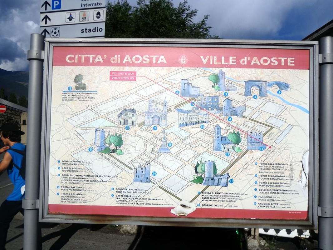
Volendo variare il percorso a cavallo tra il Secondo ed il Terzo giorno, conviene dal Comune di Quart (4 Km. circa dalla Città di Aosta), "Ad Quartum milium) per i Romani, (16/18 Km. circa da Châtillon/Saint Vincent) s'abbandona momentaneamente la Strada Statale n° 26 e svoltando verso Sud sul grande ponte sopra la Dora Baltea in località Villefranche (557 m). Si lascia momentaneamente la Strada Regionale lungo il corso della Baltea salendo invece a Mezzogiorno in direzione del Comune di Grand Brissogne e, giunti ad una rotonda, si scartano a sinistra (Sudest) la deviazione per il vicino Comune di Saint Marcel ed a destra (Ovest) quella che si indirizza verso il Comune di Pollein.
Vediamo nel dettaglio: partendo dal Comune di Quart (546/56 m; Chiesa di San Eusebio; "Camping Aosta") si raggiunge la località di Primaz, sede del Municipio (906/19 m, Château de Brissogne; Chiese di "Madonna d'Oropa", Santa Caterina e S.S. Fabiano e Sebastiano). Una breve e "tortuosa" discesa tramite una Stradina Municipale riporta sulla Regionale per il Comune di Pollein, passando dal Villaggio di les Ayettes (849 m) a quelli di Chaney, Château e Petit Pollein ((557 m; Chiesa "Sposalizio della Vergine"). Continuando ad Ovest si oltrepassano i Villaggi di Grand Pollein ((547 m; Cappella Votiva), Prefieur, Tharençan raggiungendo Pollein ((546 m; Chiesa di San Giorgio). Breve divagazione a Sudovest permette di raggiungere la Frazione di Chenaux ((656 m; Chiesa di Santa Barbara ), all'imbocco della Gorgia del Dard, mentre una stradina di collegamento permette di raggiungere, passando il Torrent de Comboé, quelli di Roulaz ed Alto Félinaz ((591 m; Chiesa di Santa Anna ), ormai in Charvensod.

"Adret" ( St. Christophe Municipality & Aosta Surroundings)


Tour de Chétoz in front of Dora Baltea bridge near Villefranche,

by Osw


From Pollein Municipality or area of the "Envers" (Southern, but less sun as covered by mountains), there are two possibilities to visit the zone of the "Adret".
1)- to return to Quart with the opposite direction (
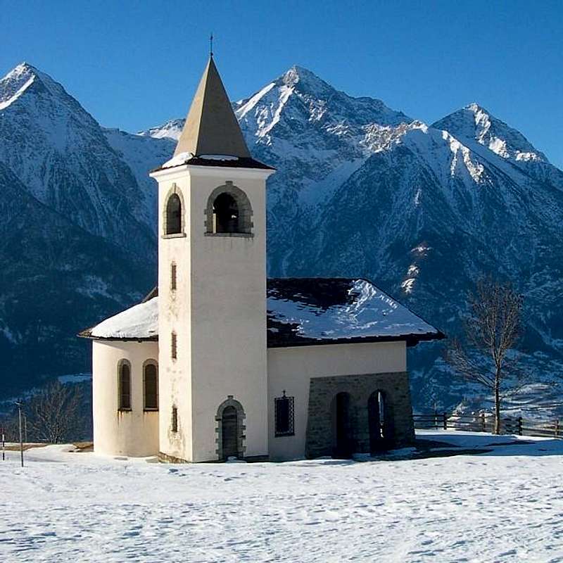
Tour de Chétoz above Quart, Villefranche locality, and clearly visible from the bridge over the Dora Baltea; Sant'Eusebio Church, between Carné Prebenda small Villages) to the one carried out this far and starting from Quart Municipality on Regional Road with a detour (2 Km. further to West; brown sign), with a detour to the North to that of Etollin ( Church with Romanesque Bell Tower) to reach the above Villair de Quart Fraction (627/64m; Church of Saints Fabiano, Sebastiano and Rocco) and continuing in a short time you get to the Château de Quart and Church of St. Nicholas (774m); wanting a short trip to the Northeast with small trail reported n° 7 leads to the above Hermitage of St. Emeric (1130m; Little votive Chapel and Altar with Cross, 1h'15/1h'30), under the same name "Bois". Returning and proceeding with an alternative Regional Road, higher than the State, you reach the Municipality of Saint Christophe (584/619m; Churches Santa Anna San Cristofero) with overlying Fractions Sorreley (790; Church of St. Gottardo) and West of Senin (766/805 m; Church of St.s Barbara and Michael). The descent reaches Aosta passing near the Castles of "Passerin d'Entrèves" and "Duca degli Abruzzi" or Jocteau and home to "Alpine Military School of Aosta", dedicated not long to General Alpine Troops Antonio Cantore. Here, near the Busseyaz Village (664m), we find an old and round "Mound Celtic", currently under exploration (Tomb of an ancient burial of a Salassian Prince?). This on the hill just before the entrance to the city and in a meadow just upstream of the Alpine Military School of Aosta.

Aosta Town / B-bis Etollin Church with Bell Tower 2015
Aosta Town / B-bis XI° Century Quart-Villair Castle 2015
Aosta Town / B-bis Quart Chateau North Side 2015
Aosta Town / B-bis St. Christophe Castle & Emilius 2015
Aosta & Surr ...  XI° Century Quart Savoy Castle 2015


2)- : Wanting to discard the first hypothesis, from Pollein Commune through the new bridge on the Dora Baltea can quickly get to the National Road No. 26 and this in a moment to the Municipality of Saint Christophe, now at the gates of Aosta City. After reaching a roundabout with a monument dedicated to the "Local Cuisine", you will soon reach the Chief town (619m; Church of San Cristoforo). Left to right deviation "Mountagne", which leads to the small Village of Prevot (584m; Church of Santa Anna; secondary connections with the fraction of Villair de Quart), however, continue to the left (West) with a long diagonal, passing the Fractions and Chabloz Fontanalle, reaches next round with a monument to the "Popular Sports" (tsan, rebatta and fiollet) near a small Votive Chapel dedicated to a Partisan shot by the Nazis in 1944. The road splits: a)- a branch up to the right (Northeast) to the important Fractions Sorreley and Veynes (790m, 805m; Churches of San Gottardo San Rocco; wanting to continue on the hill you will reach the Villages Cretallaz, Jeanceyaz (1087m; Church of San Leonardo) and Morgonaz at entrance to the Combe de Sénevé and beautiful routes to the Castle of Villair de Quart. Or with a fork from Lumian small Village (1025m) Northwest to the Villages Parléaz or Parleyaz and Blavy (1274m, 1467m, Church of S.S. Margaret Bernard and Napoleonic fireplace, Church of St. Bernard), at the foot of Becca's Viou (2856m), as well as the emblem of the Commons of Saint Christophe and Aosta-Northeast. In this case, however, it is limited somewhat the next time to visit the city. b)- From the second roundabout (junction 692 metres nearby the "Castello" St. Christophe or Passerin d'Entrèves, you continue left (Northwest) reaching the Hamlet of Senin (766/805m; Church of S.S. Barbara and Michael). b)- : playing field for Traditional Sports over the "Area Tsatelet" with Quota BP or Baden Powell). From the Castle of St. Christophe the Regional Road falls in the Southwest, and surpassed the Castle of the Alpine Military School, soon reached the city at 
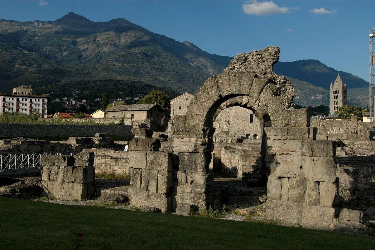
Roman Bridge, Arch Augustus's. From here, going to the West, in an equally short time (500 metres about) you reach the entrance to the city and the triple Porte Praetoriane (Pretorian Doors of "Augusta Praetoria Salassorum"). Downright you are now inside the ancient Urbs.
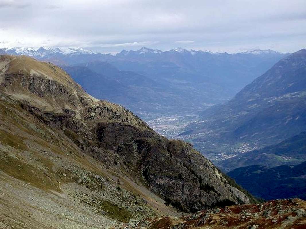


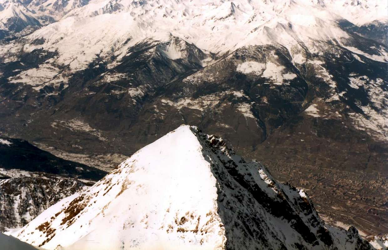
Saint Christophe and Aosta East from Becca di Nona Summit,

by Antonio


Da Pollein o zona dell'"Envers" (a Meridione, ma la meno esposta al sole poiché coperta dalle montagne) esistono due possibilità per andare a visitare l'"Adret".
1)- : rientrare a Quart con il percorso inverso a quello fino a qui effettuato (Tour de Chétoz sopra Quart in località Villefranche e ben visibile dal ponte sulla Dora Baltea; Chiesa di Sant'Eusebio, subito più avanti ad Ovest tra i Villaggetti di Carné e Prebenda) e partendo da questi sulla Strada Regionale, con una deviazione (2 Km. oltre verso Ovest con segnalazione color marron) a Nord per quello di Etollin (Chiesa con Campanile Romanico), si raggiunge il soprastante Villair (627/64 m; Chiesa dei S.S. Fabiano, Sebastiano e Rocco) e proseguendo in breve tempo si arriva al Château de Quart e Chiesa di San Nicola (774 m). Volendo una breve escursione a Nordest con sentierino segnalato come n° 7 conduce all'Eremo di San Emerico (1130 m; Cappelletta votiva ed Altare all'aperto con Croce; 1h'15/1h'30), sotto l'omonimo "Bois". Ritornando e procedendo con un'alternativa Strada Regionale, più in alto rispetto alla Statale, si raggiunge il Comune di Saint Christophe (584/619 m; Chiese di Santa Anna e San Cristofero) con le soprastanti Frazioni di Sorreley (790 m; Chiesa di San Gottardo) ed a Ovest di Senin (766/805 m; Chiesa dei S.S Barbara e Michele). La successiva discesa raggiunge Aosta passando dai 
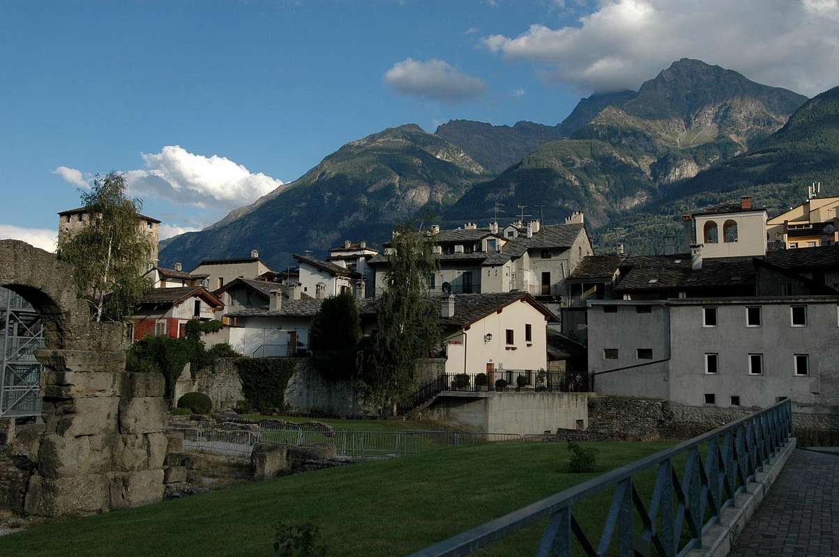
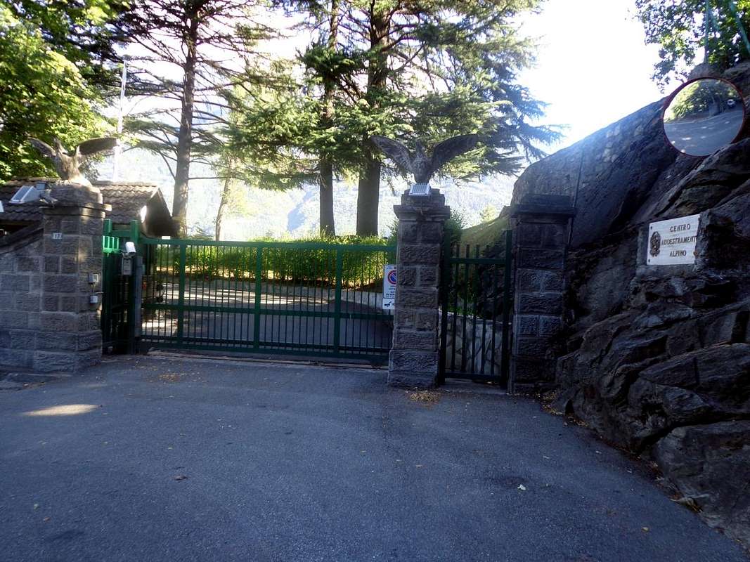
Castelli dei Passerin d'Entrèves e Duca degli Abruzzi o Jocteau "Scuola Militare Alpina di Aosta", dedicata da non molto al Generale Antonio Cantore. Appena prima del Villaggio di Busseyaz 664 m), troviamo un antico tondeggiante "Tumulo Celtico", attualmente ancora in fase d'esplorazione (Tomba d'un antica sepoltura d'un Principe Salasso?). Questo sulla collina appena prima dello ingresso alla città ed in un prato subito a monte della Scuola Militare Alpina.


Entrance of Alpine Military School of Aosta in North by Aosta,

by Osw


2)- : volendo scartare la prima ipotesi, da Pollein il nuovo ponte sulla Dora Baltea permette d'arrivare rapidamente alla Strada Statale n° 26 e da questa in un attimo al Comune di St. Christophe, ormai alle porte d'Aosta. Raggiunta una rotonda con monumento dedicato alla "Cucina locale", in breve si raggiunge il Capoluogo (Chiesa di San Cristoforo. Lasciata a destra la deviazione "Montagne", che conduce al Villaggio di Prevot (584 m; Chiesa di Sant'Anna; collegamenti secondari col Villair di Quart), si prosegue invece a sinistra (Ovest) con un lungo diagonale che, passando le Frazioni di Chabloz e Fontanalle, raggiunge una successiva rotonda con monumento agli "Sports Popolari" (tsan, rebatta e fiollet) vicino ad una Cappelletta Votiva dedicata ad un Partigiano fucilato dai nazisti nel 1944. Qui la strada si sdoppia: a)- un ramo sale a destra (Nordest) verso le importante Frazioni di Sorreley e Veynes (790 m, 805 m; Chiese di San Gottardo e San Rocco). Volendo continuare sulla collina si raggiungono i Villaggi di Cretallaz, Jeanceyaz (1087 m; Chiesa di San Leonardo) e Morgonaz, all'ingresso della Comba di Senevé e con bella strada di collegamento col Castello del Villair de Quart. Oppure con un bivio da Lumian (1025 m) a Nordovest verso i Villaggi di Parléaz o Parleyaz e Blavy (1274 m, 1467 m; Chiesa dei S.S. Margherita e Bernardo e camino Napoleonico, Chiesa di San Bernardo), alle falde della Becca di Viou (2856 m), emblema del Comune di St. Christophe e di Aosta-Nordest. In questo caso però si limita alquanto il tempo successivo per la visita della Città. b)- Dalla seconda rotonda (bivio 692 metri), appena sopra il Castello di St. Christophe o Passerin d'Entrèves, si continua a sinistra (Nordovest) raggiungendo la Frazione Senin (766/805 m; Chiesa dei S.S. Barbara e Michele; campo da gioco per gli Sports Tradizionali sopra l'Area Tsatelet con Quota BP o Baden Powell). Dal Castello di St. Christophe la Regionale scende a Sudovest e, sorpassato il Castello della Scuola Militare Alpina, in breve raggiunge la Città presso Ponte Romano ed Arco d'Augusto. Da qui, andando ad Ovest, si raggiungono l'ingresso alla Città e le antiche triplici Porte Praetoriane. Siete ormai dentro l'antica Urbs.


Arch Augustus's Triumph 23 BC at the entrance in Aosta City,

by Osw


Comments

No comments posted yet.