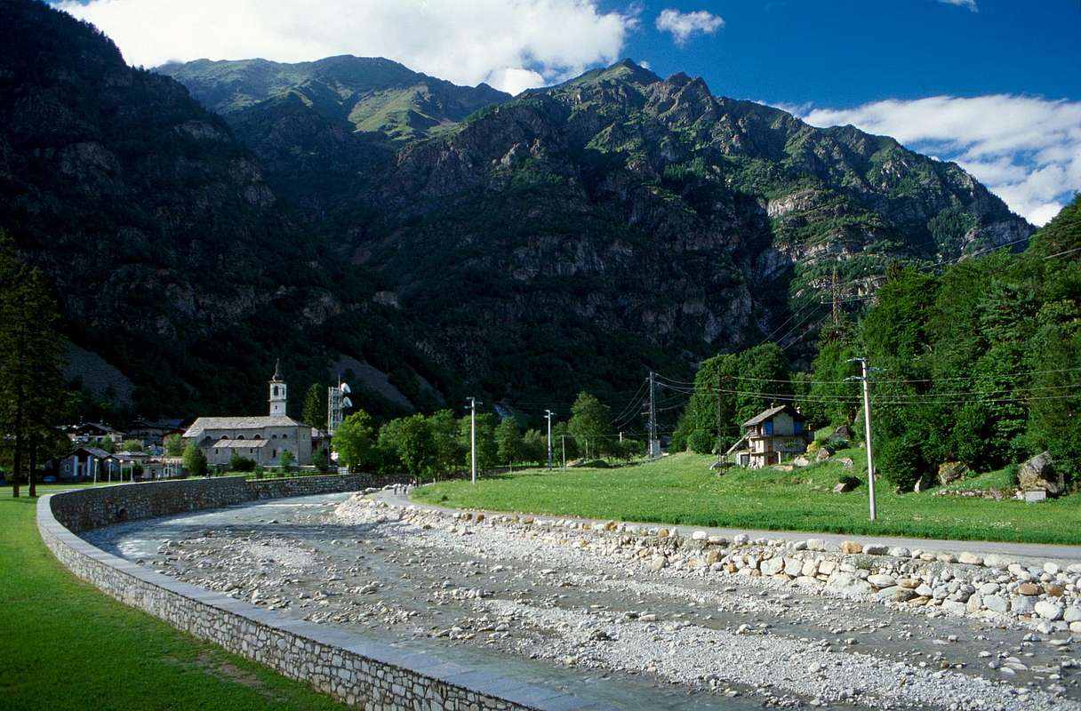
, which goes by the Municipality of Quart the outskirts of Aosta until that of Pont Saint Martin to the border with the Canavese Zone (Piedmont), we continue our journey on the side basin left or North of the course of the same. An area full of beautiful castles (Villair de Quart, Cly in Chambave, Passerin Entrèves Châtillon, Graines in the Lys Valley and Savoy to Gressoney), nine Shrines (Saint Emeric in the Basin of Senevé, Cuney in the Valley of Saint Barthélemy, Machaby above Arnad, Saint Gilles in Verrès, Santa Anna above Staffal Village Gressoney, of Barmasc above Antagnod, of the
nearby Perloz and Ivery over Pont Saint Martin Communes at the end of the Aosta Valley on the border with the Canavese Area (Piedmont Region). But in the bottom of the above Gressoney Valley we find the Sanctuary of Voures or in local dialect Vourry. Of interest also the many parish churches, votive chapels and other particulars concerning all those small commons that lie North of Dora Baltea (Quart, Nus, Chambave, Châtillon, Saint Vincent, Emarèse, Mongiovet, Verrès, Arnad, Hône, or Donnaz Donnas and Pont Saint Martin as well as those included in the Valleys of Saint Barthélemy, Basin Verrayes / Saint-Denis, Valtournanche, Valle del Lys and Gressoney). Clearly, to make a full tour of all the
and adjacent valleys you must make a choice that is the fact of opting for all that is in the North or South of the Dora Baltea, bearing in mind that the Northern valleys are long and the opposite of most difficult journey. Therefore we recommend to
the paths that have a logic in the relationship between available time and track forward, or presenting a
between the sightseeing by car and the walk-hike next rapprochement with the same.
Dopo l'area Centrale della Dora Baltea, la Città di Aosta ed il settore Meridionale, che va dal Comune di Quart alle porte di Aosta fino a quello di Pont Saint Martin al confine con il Canavese (Piemonte), continuiamo il nostro viaggio sul lato idrografico sinistro o Settentrionale del corso della medesima. Una zona ricca di splendidi manieri (Villair de Quart, Cly a Chambave, Passerin d'Entrèves a Chatillon, Graines nella Valle del Lys e Savoia in quella di Gressoney), nove Santuari (Saint Emeric nella Conca di Senevé, Cuney nella Valle di Saint Barthélemy, Machaby sopra il Comune d'Arnad, Saint Gilles a Verrès, di Barmasc ad Antagnod, della "Madonna della Guardia" a Perloz, e di Ivery sopra Pont Saint Martin al termine della Valle di Aosta nonché al confine col Canavese (Piemonte). Invece in fondo alla soprastante Valle di Gressoney troviamo i Santuari di Voures od in "patois" Vourry e di Sant'Anna sopra il Villaggio di Staffal. Di interesse inoltre le molte chiese parrocchiali, le cappelle votive ed altre particolarità concernenti tutti quei comuni che trovansi a Settentrione della Dora Baltea (Quart, Nus, Chambave, Châtillon, Saint Vincent, Emarèse, Mongiovet, Verrès, Arnad, Hône, Donnas o Donnaz e Pont Saint Martin oltre a tutti quelli inseriti nelle Valli di Saint Barthélemy, Bacino di Verrayes/Saint-Denis, Valtournanche, Valle del Lys e Gressoney). Chiaramente per effettuare una visita completa di tutta la "Bassa Valle" e valli adiacenti devesi effettuare una scelta consistente nel fatto di optare per tutto ciò che si trova a Nord oppure a Sud della Dora, tenendo presente che le vallate Settentrionali sono lunghe e le opposte di più difficile percorrenza. Per questo consigliamo di "legare" dei percorsi che presentano una logica nel rapporto tra tempo a disposizione e tracciato da seguire, oppure che presentano un "misto" tra la visita turistica e la passeggiata-escursione a seguito del trasferimento con i mezzi di trasporto.
But it is also a journey to the "Christianity". Of course, as these places have grown the cult of Christianity, as evidenced shrines, oratories, convents, monasteries, churches and votive chapels, a little scattered throughout the territory. A trip to the interior of another journey, that surely comes after the Age of the Mountains but that precedes that of the Castles, Palaces and Noble, going nell'etensione of human time at the time of the local Salassians People and Romans dating respectively 1158 BC to "Cordelia", very ancient Capital of Leader "Cordelus" for the first and always with the 25/23 BC with the foundation of "Augusta Praetoria Salassorum", current City of Aosta. Immediately below, ie around the III°/IV° Century came the phenomenon of the Evangelization on the entire and complete Aosta Valley. A phenomenon gradually spread, first to the Valley of Baltea, then to all the valleys reaching even the smallest of villages, up to the last pasture. A hyphen key, a "trait d'union" to tie the ancient peoples to the modern.
Ma pure un viaggio verso la "Cristianità". Certamente, poichè questi luoghi hanno visto crescere il culto del Cristianesimo, come testimoniano Santuari, Oratori, Conventi, Monasteri, Chiese e Cappelle, un poco disseminate ovunque sul territorio. Un viaggio allo interno di un altro viaggio, che sicuramente arriva dopo l'Era delle Montagne ma che precede quella dei Castelli e dei Nobili, succedendo nell'etensione del tempo umano all'epoca del locale popolo dei Salassi e dei Romani che datano rispettivamente con il 1158 avanti Cristo per Cordelia", antichissima Capitale dei primi e con il 25/23 sempre avanti Cristo con la fondazione di Augusta Praetoria Salassorum, attuale Città d'Aosta. Subito appresso, cioé intorno al III°/IV° Secolo avvenne il fenomeno di Evangelizzazione della Val d'Aosta. Progressivamente diffuso dapprima verso la Valle Centrale della Dora, poi a tutte la valli raggiungendo anche il più piccolo dei villaggi, fino allo ultimo alpeggio. Un testimone, un trait d'union fondamentale per legar popoli antichi e moderni.
After the Central area of Baltea, the City of Aosta and the Southern sector we go to a ride to the Northern over the course of Dora. Visiting Aosta with its suburbs, remain to see the
"Upper Valley, ie towards Mont Blanc, and the
"Lower Valley", which is in the direction of the City of Ivrea and Piedmont, with the side valleys of the Matterhorn and Monte Rosa one side and the
"Regional Park of Monte Avic" and Graians from another. We begin by the latter, which immediately imposes a fundamental choice: take the South side of Baltea, so-called
"Envers", or the opposite or
"Adret", that is what most move towards the sun. Even here we choose the latter that first, from the gates of Aosta and Quart, leads us to the next towns at the foot of the Valleys of St. Barthélemy, Basin Verrayes-St.-Denis,
"Tornanze" or Valtournanche, Lys and Gressoney. Even in such a way, however, all in one day not you can see for which I will have to make more choices. In my humble opinion, basically
consist of three:
![]()
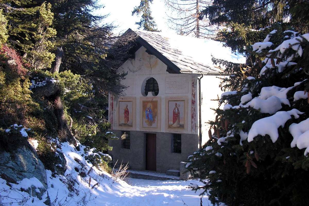
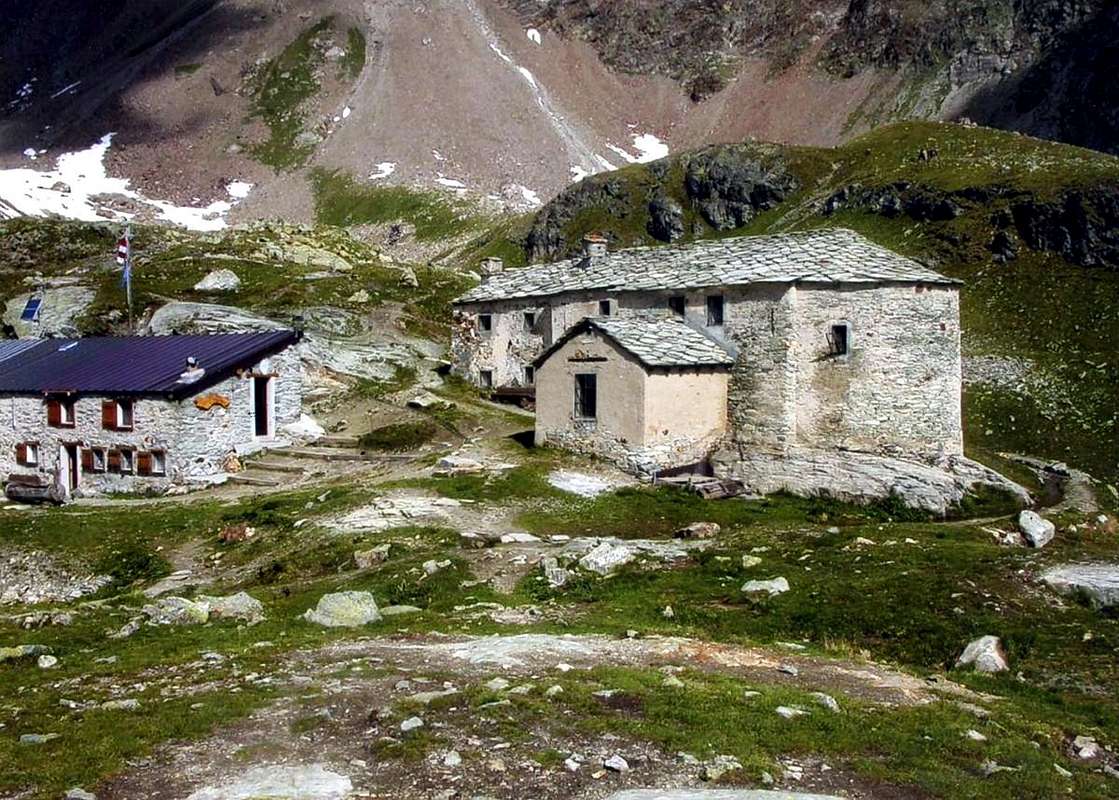
Cuney ancient Sanctuary under the Becca del Merlo,
by Camillo Roberto Ferronato
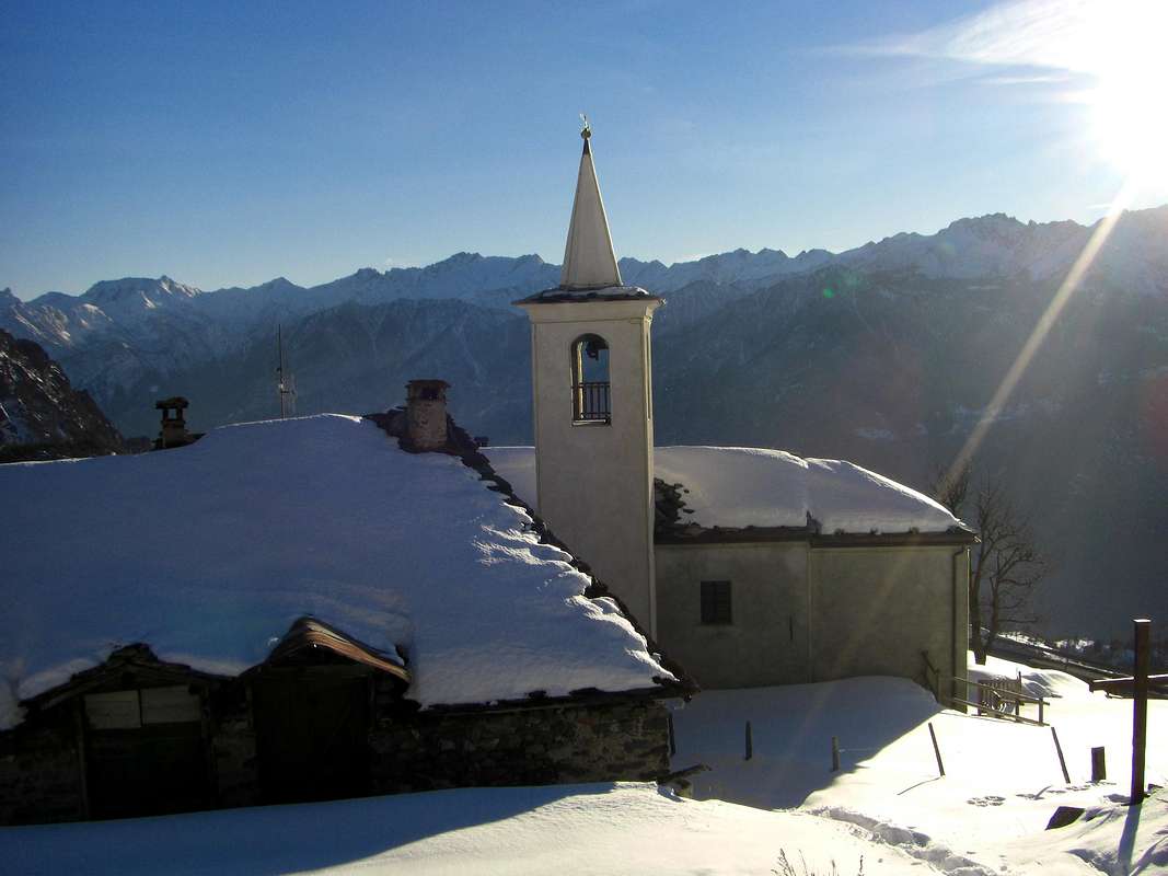
1)- From Quart Common back, near the Chétoz location, its hill at the foot of the Croix de Fana
(2212m) to reach the triple Village of Trois Villes
(1299/1398m), where at that of Avisod you can visit the small
Church dedicated to St. Rocco, St. Barbara and St. Anselm of Aosta; just ahead, and after a nice fountain is the squared
Bell Tower, last remnant of an ancient Church destroyed. But, if you hurry, you can turn to the Northeast in the direction of the Valley of St. Barthélemy already near the Village Buignod
(1135m). A side street, passing by to Effraz Hamlet at the slopes of Becca d'Aveuille
(2623m), leads before to Arlod Village and then, crossing the Torrent de St. Barthélemy, to the Fractions Clémensod and Lignan (
1655m, 1633m; renowned
Observatory Astronomical) Saint Barthélemy. Continuing to the East-northeast along the valley floor passing those of Issologne, Verney, Les Fontanes, Le Rascard and Praz
(1777m), where the road had ended. From here you can go further to the North and with the trail
n° 13/14 reach the
Sanctuary of Champlaisant (+; 1906m), from which up to Refuge de la Servaz (
2070m;
Chapel), and from this through the path
n° 12 the most famous
Sanctuary of Cuney (2653m), reaching the
Alta Via n° 1 at the foot of the Becca del Merlo
(3240m). Otherwise you can reach Issologne
(1514m) along the entire Valley of St. Barthélemy starting from next Nus Common and passing through the Villages of Petit Fénis, Blavy
(1056m) Val Dessous Dessus and reaching with the Regional Road the previous one. In this case it is recommended that the reverse path reaching Trois Villes and Effraz Villages
(1398m, 1487m) downhill and then eventually conclude
"in beauty" going from Villair, Fraction of Quart, via the scenic route with a visit to the beautiful
Castle Lords of Quart and then Savoy of 1185. Oh, do not forget that down to Fornail Village
(1082m) you will find the tiny
Chapel of Sainte Barbe, while in the Vollein area
(891m), at the Village of Vignil, there is the fascinating and wide
Necropolis Neolithic.
![]()
Villair de Quart ancient Castle below the Valseinte,
by Osw
Dopo l'area Centrale della Dora Baltea, la Città di Aosta ed il settore Meridionale andiamo a far un giro in quello Settentrionale.
Dopo aver visitato Aosta con la sua periferia, rimangono da vedere l'
"Alta Valle", cioé verso il Monte Bianco, e la
Bassa Valle", ovvero in direzione della Città di Ivrea ed il Piemonte, con le valli laterali del Cervino e del Monte Rosa da un lato ed il
"Parco Regionale del Monte Avìc" e le Alpi Graie dallo altro. Incominciamo da quest'ultima, dove subito s'impone una scelta fondamentale: percorrere il lato Meridionale della Dora Baltea, cosiddetto
"Envers", oppure l'opposto od
"Adret", cioé quello maggiormente sposto al sole. Anche qui scegliamo dapprima questo secondo che, dalle porte d'Aosta o Comune di Quart, ci conduce verso quelli successivi ai piedi delle Valli di St. Barthélemy, Bacino di Verrayes-St.-Denis, Tornanche, del Lys e Gressoney. Anche in siffatto modo, però, tutto in un giorno non si può vedere per la qual cosa si devono effettuar ulteriori opzioni, che, a mio avviso,
consiston in tre:
![]()
Near Buignod on Quart Mid Hill towards St. Barthélemy,
by Osw 2015
1)- da Quart risalire, presso la località Chétoz, la sua collina ai piedi della Croix de Fana
(2212 m) raggiungendo il triplice Villaggio di Trois Villes
(1299/1398 m), dove presso quello di Avisod si può visitare la Chiesetta dedicata a
San Rocco, Santa Barbara e Santo Anselmo di Aosta; appena più avanti e dopo un bel fontanile si trova il quadrato
Campanile, ultimo resto di un'antica Chiesa andata distrutta. Ma, se avete fretta, potete girare verso Nordest in direzione della Valle di St. Barthélemy già nei pressi del Villaggio di Buignod
(1135 m); una strada secondaria, che passa da quello di Effraz alle pendici della Becca d'Aveuille
(2623 m), conduce ad Arlod e poi, oltrepassato il Torrent de St. Barthélemy, alle Frazioni Clémensod e Lignan (
1655 m, 1633 m; famoso
Osservatorio Astronomico) di Saint Barthélemy. Continuando ad Est-nordest lungo il fondovalle si passada quelle di Issologne, Verney, Les Fontanes, Lo Rascard e Praz
(1777 m), dove la stada và a terminare. Da qui si può proseguire maggiormente a Settentrione e con il sentiero
n° 13/14 raggiungere il
Santuario di Champlaisant (+; 1906 m), dal quale salire al Refuge de la Servaz
(2070 m; Cappella) e da questo con il sentiero
n° 12 al più famoso Santuario del Cuney
(2653 m), raggiungendo l'
Alta Via n° 1 ai piedi della Becca del Merlo
(3240 m). Altrimenti si può raggiungere Issologne
(1514 m) percorrendo l'intera Valle di St. Barthélemy partendo dal successivo Comune di Nus e passando per i Villaggi di Petit Fénis, Blavy
(1056 m) Val Dessous e Dessus raggiungendo con la Strada Regionale quella precedente. In questo caso si consiglia di effettuare il percorso inverso raggiungendo Trois Villes ed Effraz
(1487 m) in discesa per poi concludere eventualmente
"in bellezza" passando dal Villair de Quart tramite la strada panoramica con visita al bel
Castello Signori di Quart e poi Savoia del 1185. Ah, non dimenticatevi scendendo che a Fornail
(1082 m) trovate la
Cappelletta di Sainte Barbe, mentre nell'area di Vollein
(891 m), presso Vignil, esiste l'affascinante, estesa
Necropoli Neolitica.
![]()
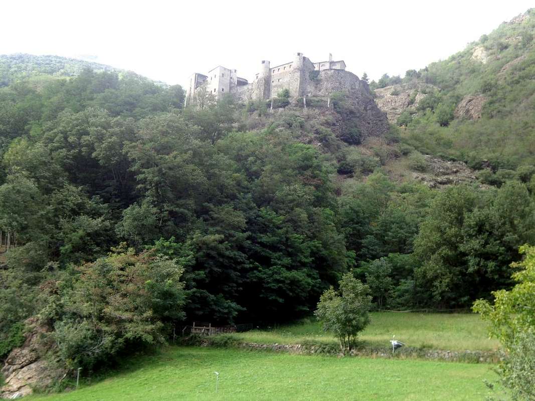
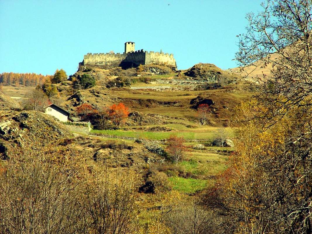
Remains of the Cly ancient Challant Castle built in 1351,
by Camillo Roberto Ferronato
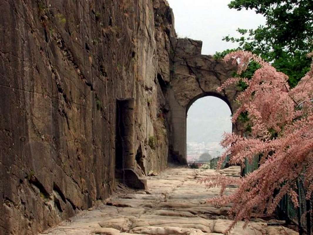
Visiting Valleys Marmore & Evançon
![]() Consular Roman Road from Pont St. Martin to Aosta,
Consular Roman Road from Pont St. Martin to Aosta,
by Maria Grazia Schiapparelli
The Valtornanche or "Valtornenza"2)- The second choice is to go visit one by one the two adjacent Valleys Tournanche of the Torrent Marmore, well known as the Valley of the Cervino also Matterhorn, and Evançon, or even the Valley of Lyskamms respectively above the neighboring Municipalities of Châtillon and Verrès, leaving for last and for the day after the very long Gressoney, or Valley of the Monte Rosa, which rises from the last Common in the Aosta Valley, or Pont St. Martin. The first municipality, leaving to the East little Town of Saint Vincent at the foot of Mount Zerbion
(2773m) go up between this and the
"Promontory of Sarrasin" to the West in altitude of
1668 metres (St. Evence Chapel), towards the North Valtournanche coming, after the Villages of Champlong and Chessin to
Antey St. André (
1080m; Parish Church National Monument); the same, very old, he dominated on the whole Valley of the Matterhorn. In 1452 the Parish Priest Symond built the
Cloister, then demolished in 1512, after the reopening of the
Convent of St. Gilles Verrès, from the work of Prior Charles of Challant, at the entrance of the Lys Valley. But the early church was the
Chapel of Petit Antey, while its Bell tower is "only" of 1100. The Church has a
silver urn of 1481, where, apparently, are the relics of Saints Andrew, Peter, Barbara, Margaret and Grateful. Two
Crucifixes enrich the Church: one very old and anyway dated before XV° Century and the other
"double-faced" of 1400, plated bronze and silver placed along with two
Altars and other contemporary furniture in the sacristy, always of 1400. Amongst the
Bells, that known as
"Sol Paris", is like the oldest and is dated 1620, while the exterior has been restored by Canon Ferdinand Bordet together to
"Mary Help of Christians" Chapel, which he endowed the Church even of an organ and instituted the
Asylum for over 100 children and donated to the Sisters of the regency to
"Istituto San Giuseppe in Aosta". The Feast of the Patron Saint, Andrea, takes place on November 30th, and on May 4th and October 3th will be played two
Fairs. Antey St. André is positioned low into the valley floor between the two Commons of Torgnon to the West and La Magdeleine East, that the overhang of respectively
410 and 160 metres.
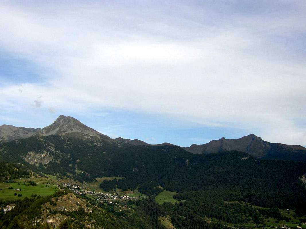
![]() Mont Zerbion & Tantané above La Magdeleine Common,
Mont Zerbion & Tantané above La Magdeleine Common,
by sarmeBy Antey St. André, leaving the detour to the West by the Municipality of
Torgnon (
1489m; Chapel "Notre Dame de la Pitié" to Triatel and
Parish Church of San Martino with Campanile of 1300; Sainct Evance Chapel of 500; Chésod Hospice 1300. Again
San Nicola Chapel at Chaté 1300 and by San Pantaleone before 1600 and tiny Chapel-Sanctuary "Madonna della Neve", built in 1928
50 metres below Becca d'Aver) and East the nearby deviation to the Commune of
La Magdeleine (
Parish Church 1789 built over ancient
Chapel at Brengon locality of 1482 "Santa Maddalena" and Masselod Chapel 1672, nearby the Lo, Lod or Loth Lake (
*** brief walk by Pt. Antey with path
n° 4 passing Chaillein or Challin small Hamlet; 1h'10;
1092m, 1387m) and under Mont Tantané
(2737m). Moreover through the trail towards the Southwest
n° 8; 0h'40 by La Magdeleine, in turn accessible after 18 Km. from Châtillon (
549m, 46 Km. from Ivrea and 24 by Aosta; with
Bell Tower Church of the XIV° Century National Monument with columns in granite work of the Architect from Turin Saroldi;
Bridge 1766 with arch 22 metres high and over 40 on the Torrent Marmore;
Church Medieval "Our Lady of Grace"; Medieval Bridge of 1380, the remains of the
Roman Bridge 240 BC; Capuchin Monastery of 1633, Castle Counts Challant of 1350, today "Passerin d'Entrèves"; Casaforte Nives XVI° Century and "Tours des Granges" XIV°) and about 42 Km. from Aosta, Valtournenche (
1524m; Parish Church built on ancient
Chapel of 1412). But the first Church was built in Barmaz location where there are remains of the walls prior to the year 1000. Expanded in 1420 and rebuilt, after a period of contrasts with the inhabitants, in 1855 it has a
portal of 1854 and two wooden altars and Campanile of 1760. In addition there are several
Chapels such as the old Breuil front of the year 1000 or
"Notre Dame des Hermites", "Notre Dame de la Garde" 1679 Crétaz 1711, "Notre Dame de Guérison" 1686, "Notre Dame de Singlin and Losanche" 1790, Ussin 1612 Crépin 1700 at their respective locations. Nearby the above Lake Cignana
(2149m), in the vast and wild basin immediately West of Valtournanche from which we find the
"Barmasse Refuge (2175m) below the partition Mont Saleron-Becca di Salé-Pointe and Dome de Cian-Peaks Balanselmo-Pointes of Valcornière-Castelletto (little Castle) Wymper-Mont-Rouge-Mont Seriola-Mont Pancherot Yellowtail, are located on the Northern bank the
Chapelle de Tsignanaz; beautiful hike of
about 3h'00 starting from
"Notre Dame de la Garde" with trail
n° 8 or by Valtournanche through path
n° 6/Haute Route n° 1. At the top of the basin we find, one after the other and between Lakes Balanselmo, of Mount Dragon and the Grand Lac, the
D. Manenti Bivouac (2783m) and the
Refuge "Perucca-Vuillermoz" (2909m), both below the Colle di Valcournière or Valcournera
(3075m). While, climbing to the Matterhorn, he come to the very picturesque
Chapel of Sainct Bernard "Patron Saint of Mountaineers". Above the Breuil, currently and improperly
Cervinia, we find, from
Château (+; 2074m) through a short and easy walk along the private road concomitant path
n° 12/13 (about half an hour), the above characteristic promontory at an altitude of
2143 metres the "
Chapelle aux morts de la guerre" with a small cannon on wheels at the outside and great views on the South Face of the Cervino also Matterhorn, between the two
"Ridges Leone and Furggen or Furggrat". Wanting to extend the hike with the trail
n° 12/13 (an hour and a half) to the
Refuge Duca degli Abruzzi (2810m) and not at the very top
"Oriondé" the "Croix de Carrel" (+, 2950m), where he died the famous Jean Antoine Guide with customers, in return after a terrible storm endured on the Cervino or for the inhabitants the
"Gran Becca". Otherwise, starting from Breuil-Cervinia,
"Cielo Alto" locality (
"Sky High" (2101m), and heading towards the Southeast through the trail
n° 16 is reached with nice excursion, via the Alps Chavanon
(2235m) and Goillet
(2431m), the Lac de Goillet
(2516m) under the Eastern Motta di Pleté
(3018m) and Gran Sometta
(3166m). Continuing with the same first and then with the farm dirt road, but most in the Northeast, you get to the upper Lacs des Cimes Blanches (
2804m;
2h'15/2h'30 from Breuil), surrounded by a number of smaller lakes below the Testa Grigia (
"Gray Head") and the culmination of the
"Cable car Plateau Rosa" (3480m, Refuge "Guide del Cervino").
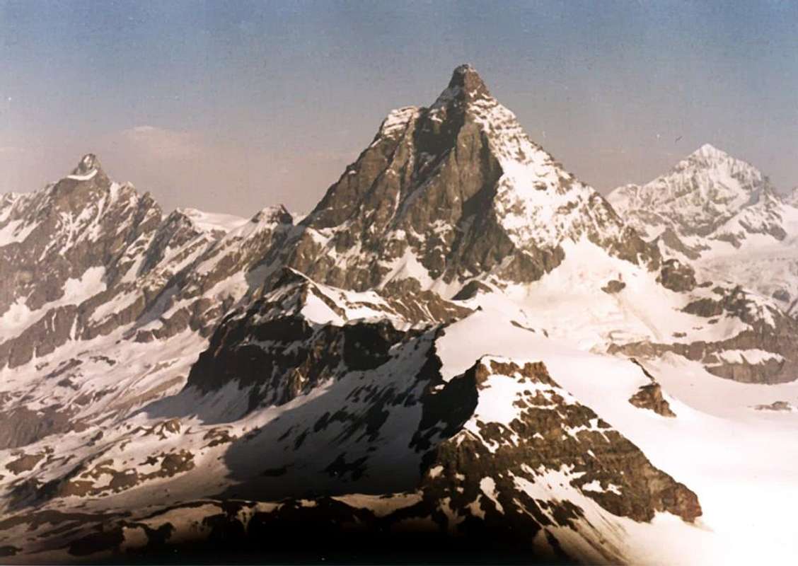
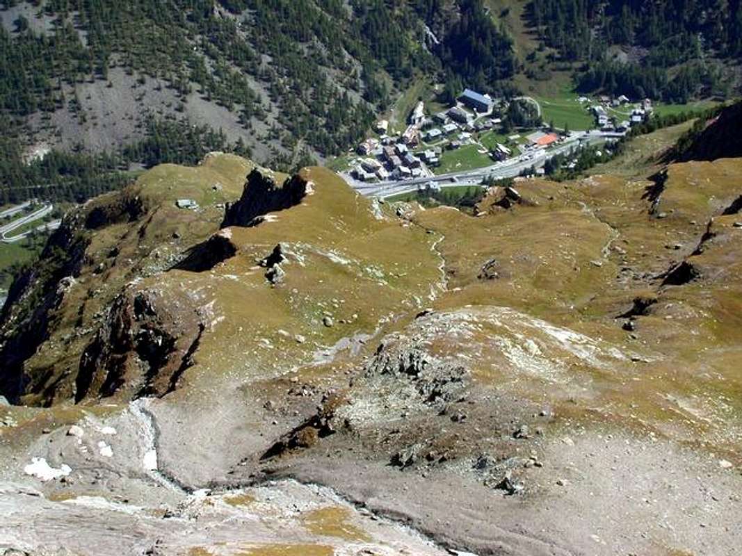
![]() Cervino or, better, the "Gran Becca" by Breuil's inhabitants,
Cervino or, better, the "Gran Becca" by Breuil's inhabitants,
by Gianni Junod 2015
La Valtounanche o "Val Tornenza"2)- La seconda scelta consiste nell'andar a visitare una dopo l'altra le due adiacenti Valli Tournanche o del Marmore, una meglio conosciuta quale Valle del Cervino, e l'altra dell'Evançon o dei Lyskamms, rispettivamente al di sopra dei vicini Comuni di Châtillon e Verrès; lasciando per ultima e per il giorno appresso quella molto lunga di Gressoney, o Valle del Monte Rosa, risalente dall'ultimo Comune della Valle di Aosta al confine con il Canavese (Piemonte), ovvero Pont St. Martin. Dal primo Comune, lasciando ad Est la Cittadina di Saint Vincent ai piedi del Monte Zerbion
(2773 m) si risale tra questo ed il Promontorio detto
"dei Sarrasin" presso il
Santuario di St. Evence (1668 m) ad Occidente, verso Settentrione in direzione della Valtournanche arrivando, dopo le Frazioni di Champlong e Chessin al Comune di
Antey St. André (
1080 m; Chiesa Parrocchiale Monumento Nazionale); la stessa, molto antica, dominava su tutta la Valle del Cervino. Nel 1452 il Parroco Symond fece costruire il
Chiostro, poi abbattuto nel 1512, dopo la riapertura del
Covento di St. Gilles a Verrès, ad opera del Priore Carlo dei Challant, all'entrata della Valle del Lys. Ma la Chiesa primitiva era la
Cappella di Petit Antey, mentre il suo
Campanile é "soltanto" del 1100. La Chiesa possiede un'
urna di argento del 1481, dove, a quanto sembra, sono conservate le reliquie dei S.S. Andrea, Pietro, Barbara, Margherita e Grato. Due
Crocefissi l'arricchiscono: uno antichissimo e non databile e comunque antecedente il XV° Secolo e l'altro
"double-face" del 1400, placcato in bronzo ed in argento nonché collocato insieme a due
Altari ed ad altri mobili contemporanei nella sagrestia. Tra le
Campane, quella detta del
"Sol di Parigi", risulta come la più antica ed é del 1620, mentre gli esterni son stati restaurati dal Canonico Ferdinando Bordet insieme alla
Cappella di "Maria Ausiliatrice", il quale inoltre istituì un
Asilo per oltre 100 bambini e donato in reggenza alle Suore dell'
"Istituto San Giuseppe di Aosta". Festa Patronale di Sant'Andrea il 30 Novembre e
Fiere al 4 di Maggio ed al 3 d'Ottobre. Antey St. André é collocato sul fondovalle tra i due Comuni di Torgnon ad Occidente e di La Magdeleine ad Est, che lo sovrastano di
410 e 160 metri circa.
![]() Ponty Chapel (1580m) above Torgnon & Antey-St. André,
Ponty Chapel (1580m) above Torgnon & Antey-St. André,
by Maria Grazia Schiapparelli
Da Antey St. André, lasciando ad Ovest la deviazione per il Comune di
Torgnon (
1489 m; Cappella di "Notre Dame de la Pitié" a Triatel e
Chiesa Parrocchiale di San Martino con Campanile del 1300; Cappella di Sant'Evanzio del 500: Ospizio di Chésod del 1300. Ed ancora
Cappelle di San Nicola presso il Chaté, del 1300, e di San Pantaleone anteriore al 1600 e Cappella-Santuario "Madonna della Neve", eretta nel 1928
50 metri sotto la Becca d'Aver) ed ad Est la vicina deviazione per quello più elevato di
La Magdeleine (
1650 m; Chiesa Parrocchiale del 1789 sopra antica
Cappella a Brengon del 1482 dedicata a
"Santa Maddalena" e
Cappella di Masselod del 1672) presso il Lago di Lo, Lod ed anche Loth (
*** breve passeggiata dal Villaggetto di Petit Antey tramite sentiero-mulattiera
n° 4 passante per quello di Chaillein oppure Chaillin; 1h'10;
1092 m, 1387 m), nonché al di sotto del Mont Tantané
(2737 m). Oppure tramite il sentiero verso Sudovest
n° 8; 0h'40 da La Magdeleine, a sua volta raggiungibile, dopo 18 Km. da Châtillon (
549 m; 46 Km. da Ivrea e 24 da Aosta (
Chiesa con Campanile del XIV° Secolo Monumento Nazionale con colonne in granito ad opera dell'Architetto torinese Saroldi;
Ponte del 1766 con arco di 22 metri ed alto oltre 40 sul Torrent Marmore;
Chiesetta Medievale di "Nostra Signora delle Grazie"; ponte Medioevale del 1380; resti Ponte Romano del 240 avanti Cristo; Convento dei Cappuccini del 1633; Castello dei Conti di Challant del 1350, oggi "Passerin d'Entrèves"; Casaforte di Nives XVI° Secolo e "Tours des Granges" XIV°) e 42 Km. da Aosta, Valtournanche (
1524 m; Chiesa Parrocchiale costruita sulle rovine dell'antica
Cappella del 1412). Ma la
primitiva Chiesa era stata costruita nella località di Barmaz ove sussistono resti di mura anteriori all'anno 1000. Ampliata nel 1420 e riedificata, dopo un periodo di contrasti tra la Chiesa e gli abitanti d'Antey Saint André, nel 1855 presenta un
portale del 1854 e due altari lignei e Campanile del 1760.
![]()
From Zerbion to St. Pantaleon Hill over Torgnon Resort,
by andreaperinoInoltre esistono diverse
Cappelle come l'antica del Breuil anteriore all'anno 1000 oppure
"Notre Dame des Hermites", "Notre Dame de la Garde" 1679, Crétaz 1711 in Val di Cogne,
"Notre Dame de Guérison" 1686, "Notre Dame de Singlin e Losanche" 1790, Ussin 1612, Crépin 1700 presso le rispettive località. Al soprastante Lago di Cignana
(2149 m), nel vasto e selvaggio bacino subito ad Ovest di Valtournanche presso il quale riscontriamo il
"Rifugio Barmasse (2175 m) al di sotto del divisorio Mont Saleron-Becca di Salé-Pointe e Dome de Cian-Cime di Balanselmo-Pointes de Valcornière-Castelletto Wymper-Mont Rouge-Monte Seriola-Mont Pancherot, ne troviamo sulla sponda Settentrionale la
Chapelle de Tsignanaz; bella escursione di
3h'00/3h'30 circa partendo da
"Notre Dame de la Garde" con sentiero
n° 8 oppure direttamente da Valtournanche tramite il
n° 6/Alta Via n° 1. Nella parte superiore del bacino troviamo invece, uno appresso allo altro e tra i Laghi di Balanselmo, del Monte Dragone ed il Grand Lac, il
Bivacco D. Manenti (2783 m) ed il Rifugio
Perucca-Vuillermoz (2909 m), entrambi sottostanti al Colle di Valcournière o Valcournera
(3075 m). Mentre, salendo al Cervino, si incontra la veramente pittoresca
Cappella di San Bernardo "Santo Patrono degli Alpinisti". Sopra il Breuil, attualmente ed impropriamente
Cervinia, troviamo, passando dal
Château (+; 2074 m) tramite una facile e breve passeggiata sulla strada poderale concomitante al sentiero
n° 12/13 (mezz'oretta), sul soprastante caratteristico promontorio a quota
2143 metri la "Chapelle aux morts de la guerre" con tanto di cannoncini con ruote all'esterno e vista grandiosa sulla Parete Sud del Cervino, compresa tra le
"Creste del Leone e di Furggen o Furggrat". Volendo prolungare l'escursione con il sentiero
n° 13 (un'oretta e mezza) si raggiunge il
Rifugio Duca degli Abruzzi (2810 m) e non molto sopra presso l'
"Oriondé" la "Croix de Carrel" (+; 2950 m), dove spirò la celebre Guida Jean Antoine al ritorno con i clienti, dopo una terribile bufera patita sul Cervino o
"Gran Becca". Altrimenti, partendo da Breuil-Cervinia, località
"Cielo Alto" (2101 m), e dirigendosi verso Sudest coll sentiero
n° 16 si raggiunge con bella escursione, passando per le Alpi Chavanon
(2235m) e Goillet
(2431m), il Lac de Goillet
(2516 m), sotto la Motta di Pleté Orientale
(3018m). Continuando dapprima con il medesimo e poi con la strada poderale, ma più a Nordest, si arriva al superiore Lac des Cimes Blanches (
2804 m;
2h'15/2h'30 dal Breuil), contornato da una serie di laghetti al di sotto della Testa Grigia e del Glacier de Valtournanche ed al punto d'arrivo della
"Funivia del Plateau Rosà" (3480 m, Rifugio "Guide del Cervino").
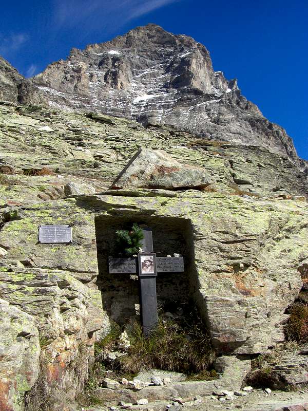
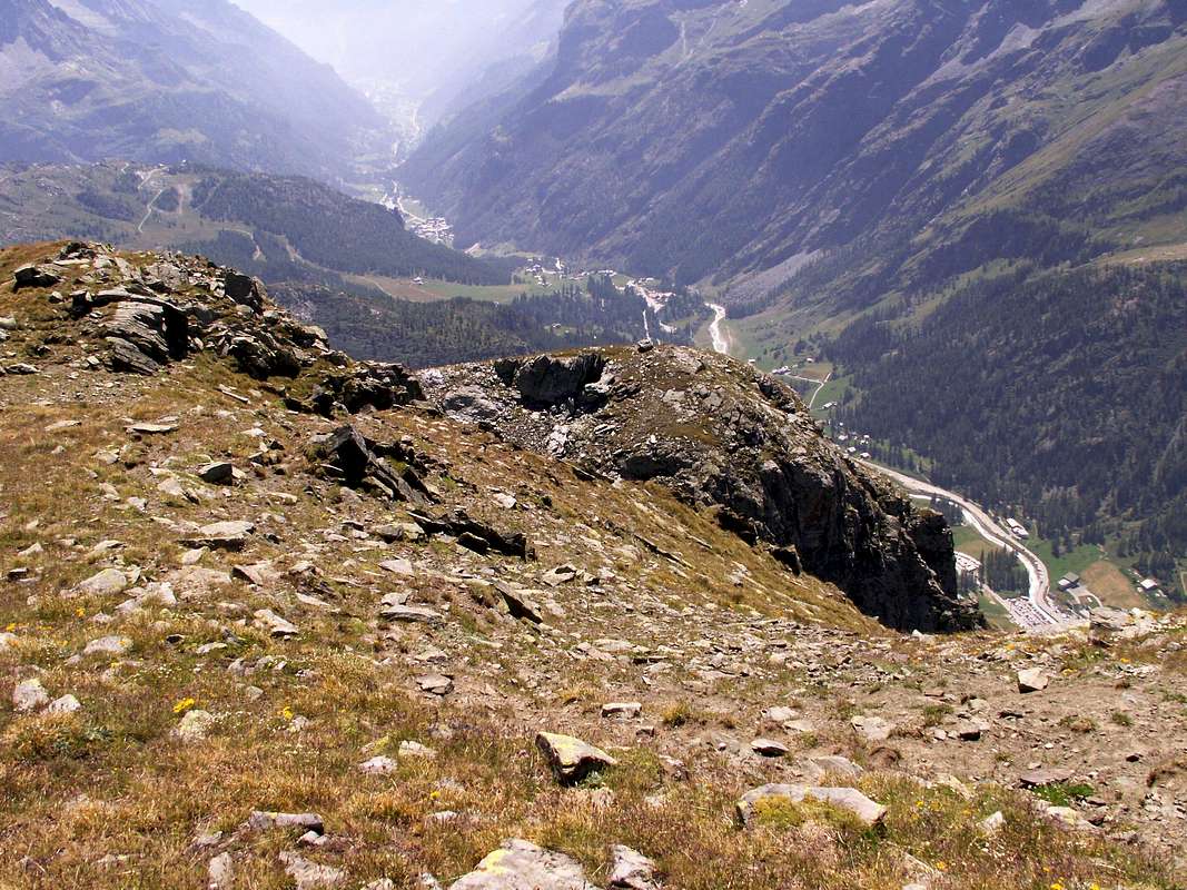
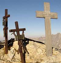
![]() Jean Antoine Carrel Cross below Pic Tyndall,
Jean Antoine Carrel Cross below Pic Tyndall,
by Gabriele Corvini aka Corvus
Val d'Ayas or called Champoluc's Valley or Valley by the "Challant" also "Challand"2bis)- The second alternative choice it regards the Ayas Valley or of the Evançon Torrent. The same originates on the Southern slopes of Eastern Breithorn, Schwarzuken or Roccia Nera, Pollux and Castor, all below the Grand and Petit Glaciers de Véraz and Castorgletscher, and down to Verrès Common with a distance of approximately 35 Kilometres and a width ranging from 6 to 10. Known, speaking tourists, even as the Valley of Champoluc in relation to this Fraction of the last Villages Frachey Ayas, St. Jacques and Fiery, sites between the Gray Head (East) and the Rocca di Verra with its glacier overlooking the floor of the same name. It also keeps even the most ancient name of
Valley of the Challand, from
"Chafland" or
"Valley of the Sheep", commonly known as to give a tone of nobility must link his name to that of the most powerful Family in Val d'Aosta in centuries past: Accounts Challant. These gentlemen possessed it and ruled for four Centuries and his 15 Fiefs, starting from Bosone Challants arrived here in 1100 with the noble title of Viscount of Aosta Town, to administer Justice in the name of the Savoy as wanted by Count Umberto II°. A long rule that goes by Ebalo said
"the Great", founder of the underlying
Castle Montjovet (
385m; Romanesque Church with Campanile of XII° Century; Castle by Chenal Lords X° transformed in Fortress by Duke Amedeo VIII° Savoy in 1438 and administered from the same since 1190 until 1274 then returning Chenal property, historically renowned
"Ponte delle Capre" or "Goats Bridge"), to Aymone, in turn founder of magnificent
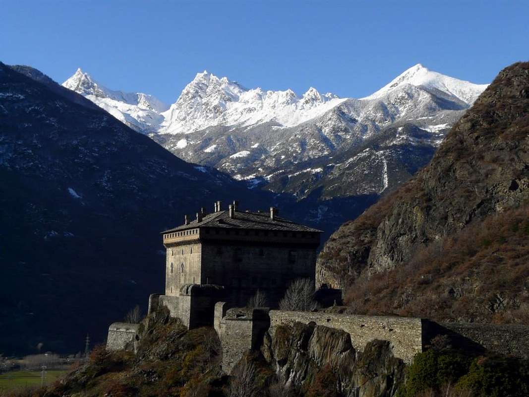
Fénis Castle on the other side of the Dora Baltea to reach Ibleto, certainly the most famous, builder of the
Castle Verrès between 1361 and 1390 and died in February 1410, and his successor Francesco father of Margaret and Catherine Princesses. The
"mania" of the Challants founding castles involves another Challants, not Noble but Clerical: the Prior George built in 1480, this time right in front, the splendid
Castle of Issogne. A long and interesting history that came until 1550 when the Family is divided into five branches, while the
"public relations" with the Savoy Piemont State enabled him to almost all components achieve the title of Count.
![]() Graines Castle (1313m) above Brusson Common,
Graines Castle (1313m) above Brusson Common,
by emiliusVal d'Ayas detta anche di Champoluc o Valle dei Challant o ChallandAnother version wants instead to derive the name from
"Shall Land" or Land of Sound, while Ayas seems to derive from the nearby Village of Antagnod by the Roman
"Ante Lignum"" (
"Before the Wood") Capital City of the Municipality of Ayas. Last but not least the Torrent Evançon that It characterizes emerging Lake Bleu under the Verra Glacier. Comes from the dialect of the Aosta Valley or patois
"Avinçon" and means
"Soapy Water", as this appears during the flood period when the water is mixed with the loose sands in the overlying moraines. A bit of history to move from the Valley of the
"Matterhorn" at first, starting from the West, including those of the Monte Rosa but, setting aside the flights of fancy, we go to practice starting from the Municipality of
Verrès (
390m, 31 Km. from Ivrea City and 38 by Aosta;
Challant Castle of 1361; Collegiate Church and Convent of Saint-Gilles X° Century). Passing by or near Targnod, Villa, Corliod,
Allesa or Allesaz, Tilly and Quinçod arrive in 5 Km. to
Challant St. Victor, whose these fractions (
765 m; in places Cisan
Parish Church of St. Victor, Martyr of the Theban Legion, while most of the villages has a
Chapel). Other 4.5 Km. Lead us to
Challant St. Anselme (
1060m; Ancient Church with
Altar by Sculptors of the Sesia Valley); near numerous
Votive Chapels of which the most famous is that of
Santa Anna.
![]()
Watershed between Ayas and Valtournanche Valleys,
by sarme
Val d'Ayas detta anche di Champoluc o Valle dei Challant o ChallandBeyond
Arcesaz Hamlet (
1225m; Chapel of St. James of the XIII° Century), Municipality of
Brusson you reach this important tourist center (
1332m, 16 Km. from Verrès; Medieval Houses with Gothic windows, Castle of San Martino in Graines, immediately above Village), placed between the Testa Comagna (West; Roman
Goldmines") and Punta della Gua or Guà. On the right (East) opens the important Vallon Estoul that reaches the Col of the Ranzola with Gressoney Valley. A detour to the Northwest from the main road leads us first in
Antagnod (
1709m; Casaforte of Challant; Medieval House known as "The Granary" Eastward;
Parish Church of St. Martin 1497, recognized as a National Monument and
Altars "of the Trinity and Our Lady of Oropa"; 10 famous Bells judged in terms of musicality higher quality as compared to the Parisian Montmartre;
Parish of 515 founded by the Monks of Agaunum with the internal works of the Students of Witz and by Jean and Martin Barret;
Sanctuary of Barmasc of 1580 con renowned Procession), the Chief-town of
Ayas. Continuing then with the Regional Road can be reached in succession the Fractions of
Champoluc (
1570 m; 1718 Church of Santa Anna, Patroness of Champoluc),
St. Jacques (
1670m; Church of St. James that a document of 1277 states have received Indulgence from Pope Honorius III°;
Cave "Our Lady of Lourdes"; headstones to the Fallen and the Abbot-Mountaineer Aimé Gorret Valtournanche , winner of the Matterhorn
"Italian Cresta del Leone") and
Fiery (1878m), the last Village before going up to Lake Bleu
(2211m) at the foot of Monte Rosa Mountain Chain with a nice, short and easy walk-excursion through the trail
n° 7/8 (1h'00/1h/'15; even possibility to continue towards
Refuge "Ottorino Mezzalama" and above
"Rifugio Guide Valle d'Ayas" (3009m, 3394m), concomitant for a while with the farm private dirt road starting by and between Blanchard and Armaz tiny Villages and dating back to superior Alpage de Véraz
(2394m).
![]()
Lac Bleu at the end of Lys Valley, above Plan de Verra,
by Franco Lucianaz
Val d'Ayas detta anche di Champoluc o Valle dei Challant o Challand
2bis)- La seconda nonché alternativa scelta riguarda la Valle di Ayas o del Torrente Evançon. La medesima trae origine alle pendici Meridionali di Breithorn Orientale, Polluce e Castore e scende fino a Verrès con un percorso di circa 35 Kilometri ed un'ampiezza variabile da 6 a 10. Conosciuta, turisticamente parlando, anche come la Valle di Champoluc in rapporto a questa Frazione di Ayas, presenta gli ultimi Villaggi di Frachey, St. Jacques e Fiery, siti tra la Testa Grigia o Grauhaupt (Est) e la Rocca di Verra con il suo ghiacciaio dominante l'omonimo pianoro. Inoltre mantiene anche il più antico nome di
Valle di Challand, da
"Chafland" o
"Valle delle Pecore", volgarmente detta, mentre per darle un tono di nobiltà bisogna legare il suo nome a quello della più potente Famiglia della Valle di Aosta nei Secoli scorsi: i Conti Challant o Challand. Questi Signori la possedettero e dominarono per circa quattro Secoli insieme ai suoi 15 Feudi, partendo da Bosone di Challant qui arrivato nel 1100 con il titolo nobiliare di Visconte d'Aosta, per amministrare la Giustizia in nome dei Savoia, come voluto dal Conte Umberto II°. Un lungo dominio che passa da Ebalo
"il Grande", fondatore del sottostante
Castello di Montjovet (385 m; Chiesa Romanica e Campanile del XII° Secolo; Castello dei Signori di Chenal X° Secolo trasormato in Fortezza dal Duca Amedeo VIII° di Savoia nel 1438 ed amministrato dagli stessi dal 1190 al 1274 tornando poi di proprietà dei Chenal, storicamente famoso
"Ponte delle Capre"), ad Aymone, a sua volta fondatore del
Castello di Fénis sull'altra sponda della Dora Baltea per arrivare ad Ibleto, sicuramente il più famoso, costruttore del
Castello di Verrès tra il 1361 ed il 1390 e morto in febbraio 1410, ed il suo successore Francesco padre di Margherita e Caterina. La "mania" dei Challant di fondare castelli coinvolge un altro Challant: il Priore Giorgio che nel 1480 costruì, questa volta proprio dirimpetto ed oltre il corso della Dora Baltea, lo splendido
Castello di Issogne. Una lunga storia che arrivò fino al 1550 quando la Famiglia si suddivise in cinque rami, mentre le public relation con i Savoia permisero a quasi tutti i componenti di raggiungere il titolo di Conte. Un'altra versione vuole invece fare derivare il nome da
"Shall Land", ovvero
"Terra del Suono", mentre Ayas pare che derivi dal vicino Villaggio di Antagnod dal Romano
"Ante Lignum" nonché Capoluogo del Comune di Ayas. Buon ultimo il Torrent Evançon che la caratterizza nascendo al Lago Bleu
(2211 m) al di sotto del Ghiacciaio e della Rocca di Verra
(3137 m) ed appena al di sopra dell'omonimo vasto pianoro.
![]() Azure Lake Bleu at the begining of Verra Moraine,
Azure Lake Bleu at the begining of Verra Moraine,
by Camillo Roberto FerronatoDeriva dal dialettale
"patois Avinçon" e significa Acqua Insaponata, come tale appare durante il periodo di piena allorché le acque sono frammiste alle sabbie sciolte nelle morene soprastanti. Un pò di storia per traslocare dalla Valle del
"Matterhorn" alla prima, partendo da Occidente, tra quelle del Monte Rosa ma, accantonando i voli pindarici, andiamo al pratico partendo dal Comune di
Verrès (
390 m; 31 Km. da Ivrea e 38 da Aosta;
Castello Challant del 1361; Collegiata e Convento di Saint-Gilles X° Secolo). Passando da o nei pressi di Targnod, Villa, Corliod, Allesa, Tilly e Quinçod arriviamo in 5 Km. a
Challant St. Victor al quale appartengono queste Frazioni (
765 m; in località Cisan
Chiesa Parrocchiale di San Vittore, Martire della Legione Tebea, mentre la maggior parte dei villaggi possiede una
Cappella). Altri 4,5 Km. ci conducono a
Challant St. Anselme (
1060 m; Chiesa Antica con
Altare Maggiore ad opera di Scultori della Valle del Sesia); nei dintorni numerose
Cappelle Votive delle quali la più famosa é quella di
Santa Anna. Oltrepassata
Arcesaz (
1225 m; Cappella di San Giacomo del XIII° Secolo, Frazione di
Brusson si raggiunge questo importante Centro Turistico (
1332 m, 16 Km. da Verrès; Case medievali con finestre gotiche, Castello di San Martino a Graines), posto tra la Testa di Comagna (Ovest) e la Punta della Gua o Guà. sulla destra (Est) si apre lo importante Vallone di Estoul che raggiunge il Colle della Ranzola con Gressoney. Una breve deviazione a Nordovest dalla strada principale ci porta dapprima ad
Antagnod (
1709 m; Casaforte dei Challant; Casa Medioevale detta "Il Granaio" verso Est;
Chiesa Parrocchiale di San Martino del 1497 riconosciuta come monumento nazionale e con
Altari "della Trinità e Madonna di Oropa"; 10 famose Campane giudicate in fatto di musicalità superiori come qualità rispetto alle parigine di Montmartre; Parrocchia del 515 fondata dai Monaci d'Agauno con all'interno opere degli Allievi di Witz e di Jean e Martino Barret;
Santuario di Barmasc del 1580), Capoluogo del Comune di
Ayas. Continuando poi con la Regionale si raggiungono in successione le Frazioni di
Champoluc (
1570 m; Chiesa del 1718 di Santa Anna, Patrona di Champoluc), St. Jacques (
1670 m; Chiesa di San Giacomo che un documento del 1277 dichiara avere ricevuto Indulgenza da parte di Papa Onorio III°;
Grotta "Madonna di Lourdes"; lapidi ai Caduti ed all'Abate Aimé Gorret, vincitore del Cervino
"italiano") e Fiery
(1878 m), ultimo Villaggetto prima di salire al Lago Bleu
(2211 m) ai piedi del Monte Rosa con una breve, facile e bella passeggiata-escursione tramite il sentiero
n° 7/8 (1h'00/1h'15, anche con possibilità di poi continuare verso i due Rifugi Ottorino Mezzalama e
"Rifugio Guide Valle d'Ayas" 3009, 3394 metri) concomitante per un tratto con la poderale iniziante tra i Villaggetti di Blanchard ed Armaz e risalente sin all'Alpe Vèraz
(2394 m).
![]() Barmasc with the Sanctuary above Antagnod Common,
Barmasc with the Sanctuary above Antagnod Common,
by Maria Grazia Schiapparelli
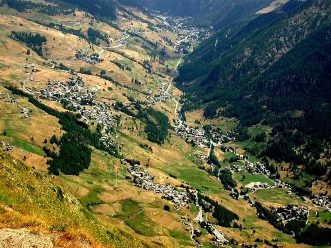
The last or Lys also Gressoney Walsers Valley
![]() Nearby Machaby old Sanctuary above the Corma,
Nearby Machaby old Sanctuary above the Corma,
by Camillo Roberto Ferronato3)- It remains for the latest Valley Lys or Gressoney reaching its end the Villages of St. Jean and La Trinité, at the foot of the Monte Rosa mountain range that, from Lyskamm Eastern, reaches the summit Zumstein, Gnifetti, Swarzhorn and Pyramid Vincent. From
Pont St. Martin (
345m; "Devil's Bridge" of 224 BC, Ancient Parish dedicated to the
"Precious Blood of Jesus" of 1597, Cross 1600, Chapel Cemetery of the XIII° Century, Suzey Castle Lords of Quart and Vallesa, definitively abandoned due to a fire in 1743 and which remain only the ruins,
Chapel with frescoes of 1500) at the confluence of the Lys Torrent with the Dora Baltea, we are just above the East
Sanctuary Ivery (672m). After passing the Roman bridge climb along a beautiful trail that
signaled to the Village of Ivery, the protected area of
"Holey Pond" and the
Castle Susey or Suzey (of the Soldier) that I mentioned above. Continue along the paved flat road for about 3km until you reach the area around Perloz. But, before you get to Pont, coming from Aosta and after coming from Ivrea, above the Corma Machaby with its large rock face used by climbers not only local, amongst the Commons of Verrès, Arnad and Donnas or Donnaz, we find the ancient
Sanctuary Machaby of 1000 (696m) located just above the village of the same name and built by the Benedictine Monks. It is from Arnad or Arnaz and is dedicated to
"Our Lady of the Snows". A legend and folklore claim that Our Lady was kept in a more ancient
Oratory-Sanctuary at Col Finestra (1671m), between the Croix Corma and Monte Rosso and above Perloz and Lillianes. Always the legend of a fight between those of Arnaz and residents of Perloz with the latter distroying the Oratory stealing the statue and hiding in a cave, where due to a strong storm took shelter the shepherds of La Cou finding the same. So La Cou Machaby and was renamed in 1300 to it was built a
primitive Chapel, as the documents of Prince Thomas II° of Savoy. The terrible flood of Baltea in 1408, nearly destroying the
Abbey and Church of Arnaz 1020, forced the inhabitants to seek shelter here looking for salvation. It became a place of worship and pilgrimage, became in
1503 the Sanctuary and in 1689 Church with three naves. At the outside you can see a
"Calvary" soapstone, the work of Artist Jean Vuillermoz already known for the works in the nearby
Issogne Castle.
![]()
"... Fontainemore Bridge ...",
by sergioenricoContinuing on the Regional Road to Gressoney, after the Municipalities of Lillianes, Fontainemore, Issime, Gaby arrive in
St. Jean Village, where, just before we find the splendid and quite recently
Savoy Castle (1440m), located in the beautiful forest at the foot of Mont Ciosé or Stallerhorn and Col Ranzola (2680m, 2170m). Not far beyond the edge of the Regional Road, it is open to the
"House Hunting" Baron (title granted by the King of Bavaria in 1840 with his brother Charles) Joseph Anthony Beck Peckoz (owner of the homonym Reserve in St. Marcel Valley currently
"Preserve of Grand Avert" owner the Marquis Attilio Turati Turin) and founder of factories for the processing of platinum, gold, zinc and lead) and Heirs. At Perloz Common, to start immediately and to the West of the Regional Road for the Gressoney Valley, we find, in addition to the very ancient
"Route of the Salassians" that through the Finestra Hill down to Albard and Donnaz Hamlets, we find the remains of the
Tour d'Hereraz made built by the Lords of Vallesa in the fourteenth Century and now restored as
Bell tower. The very, very ancient legend tells of a rescue by a young Perloz for a knight about not to fall into the Stream Lys; the providential intervention saved his life and even that of the horse and from the Lords of Perloz rewarded him with the magnificent gift of the
Perloz Castle.
![]() The Village of Perloz "perched" under Window Hill,
The Village of Perloz "perched" under Window Hill,
by om 2015
Remaining instead on the main road, after 7.5 miles from Pont, we arrive in Lillianes
(655m), a small town made up of about 500 inhabitants and
"wedged" between the Hills Finestra (West) and Giassit (East). The specific name derives from the Latin
"Insula Haeliana", as the Romans called this location, which has
medieval bridge and the Church of the fifteenth Century built on ancient
Chapel 1490 with door 1605 renovated in 1724. Bell is also of the fifteenth Century, while the interior of the
Church of San Rocco find a large wooden altar and Baroque plaque, which is dedicated to the Bishop of Aosta, Giovanni Battista Jans, a native of Lillianes. But the more important religious aspect which regards this joint is to be attributed to the party, once annually and today four, with its renowned
Procession to the Oropa Sanctuary in the Biella Province (Piedmont) through the Valley of Mont Mars and over the Col Carisey
(2132m). In a moment you arrive at Fontainemore (
760m; medieval bridge prior to 1300; Church and Parish in 1483 with front Chapel of St. Anthony, Chapel Kiry 1560, reached at
1600 metres starting from Fraction Cara
1182 metres towards Alpe Prial). This, by the Master Antonio Goyet of Issime also author of the sculptures on the entrance door, it was rebuilt in 1679 when it was also partially transformed using the same material was a result of a landslide that hit her. Internally, however, there are traces of the
Early Church, recognized as a national monument. After another 4 Kilometres and a half poor is reached Issime (
980m; houses with stone staircases of the '600; Church of St. James, Protector of Issime, 1500). This last was built on the remains of an
Primitive Church owned by the Collegiate of Sant'Orso Aosta from 1184 to 1228 and the Convent of Verrès since 1228 until 1647. On the facade of the Cross of St. Maurice and of a magnificent painting of the Brothers De Ericis Valsesia that, with Flemish style, proposes the
"Last Judgement", reproduction, as it seems, from a painting of the time. Unfortunately much of the original value has fallen because of an unfortunate restoration in 1701. On the other hand, remain the original wooden
High Altar of 1600 and another prior since 1300. The
Campanile is the XI° Century, and before the Church exists the
"Via Crucis" of 1726. Around Issime we find also many
Votive Chapels, dedicated to
St. Grato in 1374, St. Margaret 1602, San Antonio 1720, Valentine 1400, Nunes "Our Lady of the Snow" 1580. Monument Square War Memorial and at the door of the Municipality Hall Court of 1500, represented by a
"chair of speeches" or seat of Judges, as wanted by the Lords of Vallesa of which is the coat of arms carved on the back. So we reach the Commune of Gaby, after little more than 18 Kilometres from Pont St. Martin and the slopes of the Vallon of Niel, which seems to have sheltered the population after a flood, and that leads to the two Hills of the Mologna (
1042m; Roman Bridge with foundations Salassian; "Soala of Maisonnasse", where people took shelter in the Plague of 1630,
Church of St. Michael; Votive Chapels of St. Ambrose and St. Nicholas; Bridges of Trenta, 60 metres high, and
Niel; Shrine of Vourres). Finally, after the great Basin Champsil
(1277m) and the Villages of Bielciuken, Gressomatto and Valdobbia is reached to Gressoney. Immediately to the left (West) you can see the
Castle Savoy, at the foot of Ranzola Hill and residence of Queen Margherita of Italy. Many villas among which stand out those of the Lords
Baron Beck Peckoz, Prof. Thuminger 1601, Burgundy, Drissger, Vincent, Albertini, De-Filippi and many more, it deserves a special visit with the first iron gate, park , garden with fountain, stables and the inner two bronze ibexes, chamois and Steinbocks heads, numerous stucco, dining style German XVII° Century, Studio in eastern wood, coffered ceiling with sculptures and so on. With regard to the religious part of the
Chapel Chamonal 1749 with kneeler 1593, Ecco's Chapel 1657, St. Joseph). Last but not least, and after another 6.5 Kilometres and 35 from Pont St. Martin reach the bottom of the valley Gressoney-La-Trinité, in the Testa Grigia (Grey Head) or Grauhaupt and at the foot of majestic Monte Rosa mountain range (
1637m; Church of the "Holy Trinity" rebuilt Chapel of the 1400s; Chapels Chaffal or Staffal 1624, 1626 Betta, Orsia 1652 and Shrine of Santa Anna of 1690 reached even through trail
n° 8/TMR starting by Ogre Hamlet;
Cemetery with tombstones in German; old mill and bakery in 1600; tombstones and plaques by the C.A.I. dedicated to Giovanni Nicolaus Vincent and to the Senator-Mountaineer Costantino Perazzi,
legendary Explorers in the "Monte Rosa History").
![]() Issime Common towards Gressoney Valley,
Issime Common towards Gressoney Valley,
by om 20153)- Rimane per ultima la Valle del Lys o di Gressoney che raggiunge al suo termine i Villaggi di St. Jean e La Trinité, ai piedi della Catena del Monte Rosa che, dal Lyskamm Orientale, raggiunge le Sommità di Zumstein, Gnifetti, Swarzhorn e Piramide Vincent. Dal Comune di
Pont St. Martin (
345 m; "Ponte del Diavolo" del 224 a. C.; Antica Parrocchia dedicata al
"Prezioso Sangue di Gesù" del 1597, Croce del 1600, Cappella Cimiteriale del XIII° Secolo, Castello di Suzey dei Signori di Quart e quelli di Vallesa, definitivamente abbandonato a causa di un incendio nel 1743 e del quale rimangono esclusivamente dei ruderi,
Cappella con affreschi del 1500) alla confluenza del Torrente del Lys con la Dora Baltea, troviamo subito al di sopra ad Est il
Santuario di Ivery (672 m). Dopo aver superato il ponte romano si sale lungo una bella mulattiera
segnalata che raggiunge l’abitato di Ivery, l’Area protetta dello
"Stagno di Holey" ed il
Castello di Susey o Suzey (del Soldato) di cui dicevamo sopra. Per dirigersi verso la Valle di Gressoney, si prosegue lungo la strada pianeggiante asfaltata per circa 3 km. sino a raggiungere il territorio del viciniore Comune di Perloz, posto subito ad Occidente della Strada Regionale. Ma, prima d'arrivare a Pont, dalla Città d'Aosta e dopo giungendo da quella d'Ivrea, al di sopra della Corma di Machaby con la sua grande parete rocciosa utilizzata dagli Arrampicatori non soltanto locali, tra i Comuni di
Verrès, Arnad, Donnas o Donnaz, troviamo l'antico
Santuario di Machaby del 1000 (696 m) collocato subito sopra l'omonimo Villaggio e costruito dai Frati Benedettini. Si raggiunge dal Comune di
Arnad o Arnaz ed é dedicato alla
"Madonna delle Nevi". Una leggenda e la tradizione popolare affermano che la Madonna fosse custodita in un più antico
Oratorio-Santuario del Col Finestra (1671 m), tra la Croix Corma ed il Monte Rosso e sopra i Comuni di
Perloz e
Lillianes. Sempre la leggenda racconta d'una lite tra quelli d'Arnaz e gli abitanti di Perloz con questi ultimi che distrussero l'Oratorio trafugandone la statua e nascondendola in una caverna, dove a causa di un forte temporale si ripararono i pastori di La Cou ritrovando la medesima. Così La Cou venne ribattezzata in Machaby e verso il 1300 fù eretta una
Primaria Cappella, come dai documenti del Principe Tommaso II° di Savoia. La terribile alluvione della Dora Baltea del 1408, quasi distruggendo l'
Abbazia e la Chiesa di Arnaz del 1020, obbligò gli abitanti a qui riparar cercandone salvezza; divenuto luogo di culto e di pellegrinaggio, diventò nel
1503 Santuario e nel 1689 Chiesa con tre navate. All'esterno ammirasi un
"Calvario" in pietra ollare, opera dell'Artista locale Jean Vuillermoz già apprezzato per le opere nel viciniore
Castello di Issogne.
![]()
"Dominating Gressoney-La Trinité at the end of Lys Valley",
by buxlexProseguendo invece da Pont Saint Martin verso Settentrione, dopo i Comuni di Lillianes, Fontainemore, Issime, Gaby arriviamo nel Villaggetto di
St. Jean ove, appena prima troviamo lo splendido ed abbastanza recente
Castello Savoia (1440 m), sito nella bella foresta ai piedi del Mont Ciosé o Stallerhorn, del Colle della Ranzola
(2680 m, 2170 m) e della Punta della Regina, dedicata alla Regina d'Italia Margherita e per la quale era stato costruito il medesimo. Non molto oltre sul ciglio della Strada Regionale, é visitabile la
"Casa di Caccia" del Barone (titolo concesso dal Re di Baviera nel 1840 insieme al fratello Carlo) Giuseppe Antonio Beck Peckoz (tenutario dell'omonima Riserva a St. Marcel attualmente
"Riserva del Grand Avert" del proprietario torinese Marchese Attilio Turati, nonché fondatore di stabilimenti per la lavorazione del platino, oro, zinco e piombo) ed Eredi. A Perloz, subito all'inizio ed ad Ovest della Strada Regionale per la Valle di Gressoney, troviamo, oltre all'antichissima
"Strada dei Salassi" che tramite il Colle Finestra scende al Villaggio di Albard ed al sottostante Comune di Donnaz, ritroviamo i resti della
Tour d'Hereraz, fatta costruire dai Signori di Vallesa nel XIV° Secolo ed oggi trasformata in
Campanile. La leggenda narra d'un salvataggio da parte di un giovananotto di Perloz nei confronti di un Cavaliere in procinto di precipitare insieme al suo cavallo dentro il Torrente Lys; l'intervento provvidenziale salvò la vita sia dell'uno che dell'altro per la qual cosa i Signori di Perloz lo ricompensarono con il magnifico dono del castello.
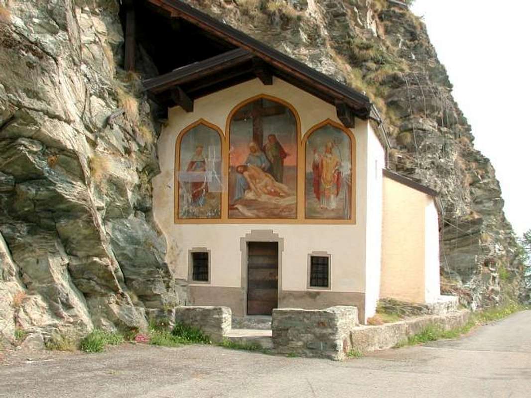
![]() "... Kiry Chapel above Fontainemore & at Prial Alp ...",
"... Kiry Chapel above Fontainemore & at Prial Alp ...",
by Gabriele Corvini aka Corvus
Restando invece sulla strada principale, dopo 7,5 Kilometri da Pont, arriviamo a Lillianes
(655 m), piccolo comune composto da circa 500 abitanti ed
"incuneato" tra i Colli Finestra (Ovest) e Giassit (Est). Il particolare toponimo deriva dal latino
"Insula Haeliana", come chiamavano i Romani questa località, che presenta
ponte medioevale e Chiesa del XV° Secolo costruita su
Cappella del 1490 con portone del 1605 ristrutturato nel 1724; anche il
Campanile é del XV° Secolo, mentre all'interno dell'attuale
Chiesa di San Rocco ritroviamo un notevole
altare ligneo e barocco e lapide, che é dedicata al Vescovo di Aosta Giovanni Battista Jans, originario di Lillianes. Ma la parte religiosa più importante che riguarda questo comune é da attribuirsi alla festa, una volta annuale ed oggigiorno quadriennale, con relativa e rinomata
Processione al Santuario di Oropa in Provincia di Biella (Piemonte) per il Vallone del Mont Mars ed attraverso il Colle Carisey
(2132 m). In un attimo s'arriva a Fontainemore (
760 m; ponte medioevale anteriore al 1300; Chiesa e dal 1483 Parrocchia con anteriore Cappella di Sant'Antonio; Cappella di Kiry del 1560, raggiungibile a
1600 metri partendo dalla Frazione Cara a
1182 metri verso l'Alpe Prial). Questa, opera del Maestro Antonio Goyet d'Issime autore anche delle sculture sul portone d'ingresso, fu ricostruita nel 1679 quando venne anche parzialmente trasformata usando lo stesso materiale rimasto a seguito d'una frana che la colpì; internamente però permangono tracce della
Chiesa Primitiva, riconosciuta come monumento nazionale. Dopo altri 4 Kilometri e mezzo scarsi si raggiunge Issime (
980 m; case con scale in pietra del '600; Chiesa di San Giacomo, Protettore di Issime, del 1500). Questa ultima é stata costruita sui resti di una
Chiesa primitiva di proprietà della Collegiale di Sant'Orso di Aosta dal 1184 al 1228 e del Convento di Verrès dal 1228 al 1647. Sulla facciata
Croce di San Maurizio nonché di un grandioso dipinto dei Fratelli De Ericis della Valsesia che, con stile fiammingo, propone il
"Giudizio Universale", riproduzione, come sembra, da un quadro dell'epoca. Purtroppo molto del valore originale é decaduto a causa di un malaugurato restauro avvenuto nel 1701. in compenso, rimangono originali l'
Altare Maggiore in legno del 1600 ed un altro anteriore al 1300. Il
Campanile é dello XI° Secolo, mentre anteriormente alla Chiesa esiste la
"Via Crucis" del 1726. Intorno ad Issime riscontriamo inoltre molte
Cappelle Votive, dedicate a
S. Grato 1374, S. Margherita 1602, S. Antonio 1720, S. Valentino 1400, Nunes "Madonna della Neve" 1580. in piazza Monumento ai Caduti e presso la porta del Municipio
Tribunale del 1500, rappresentato da una
"sedia delle arringhe" o seggio dei Giudici, come voluto dai Signori di Vallesa dei quali rimane lo stemma scolpito sul retro. Quindi raggiungiamo il Comune di Gaby, dopo poco più di 18 Kilometri da Pont St. Martin ed alle pendici del Vallone di Niel, dove sembra si sia riparata la popolazione dopo un'alluvione, e che conduce ai due Colli della Mologna (
1042 m; Ponte Romano con fondamenta Salasse; "Soala di Maisonnasse", dove si riparò la gente nella Peste del 1630;
Chiesa di San Michele; Cappelle Votive di Sant'Ambrogio e San Nicola; Ponti di Trenta, con due grandi arcate ed alto 60 metri, e di
Niel; Santuario di Vourres). Infine, dopo la bella Conca di Champsil
(1277 m) ed i Villaggi di Bielciuken, Gressomatto e Valdobbia si raggiunge quella di Gressoney. Subito a sinistra (Ovest) si intravvede il
Castello Savoia, ai piedi del Colle della Ranzola nonché residenza della Regina d'Italia Margherita. molte le ville tra le quali si distinguono quelle dei signori
Barone Beck Peckoz, Prof. Thuminger del 1601, Borgogna, Drissger, Vincent, Albertini,De-Filippi e molte altre, ma una particolare visita la merita la prima con cancellata in ferro, parco, giardino con fontanile, scuderie ed allo interno due
stambecchi in bronzo, teste di camosci e stambecchi, numerosi stucchi, Salone da pranzo stile tedesco XVII° Secolo, Studio in legnami orientali, soffitto a cassettoni con sculture ecc. Per quanto concerne la parte religiosa
Cappella di Chamonal 1749 con inginocchiatoio del 1593, Cappella di Ecco del 1657, San Giuseppe). Buon ultimo e dopo altri 6,5 Kilometri e 35 da Pont Saint Martin raggiungiamo al fondo della valle Gressoney-La-Trinitè, sotto la Testa Grigia o Grauhaupt ed ai piedi della maestosa Catena del Monte Rosa (
1637 m; Chiesa della "Santa Trinità" ricostruita su Cappella del 1400; Cappelle di Chaffal o Staffal del 1624, Betta 1626, Orsia 1652 e Santuario di Santa Anna del 1690, raggiungibile anche con sentiero
n° 8/TMR partendo dal Villaggio Ogre;
Cimitero con lapidi in tedesco; vecchio mulino e forno del 1600; lapidi del C.A.I., dedicate a Giovanni Nicolaus Vincent ed al Senatore-Alpinista Costantino Perazzi
mitici Esploratori nella "Storia del Monte Rosa").
![]() "... Lys Walser Valley ...",
"... Lys Walser Valley ...",
by Romuald Kosina