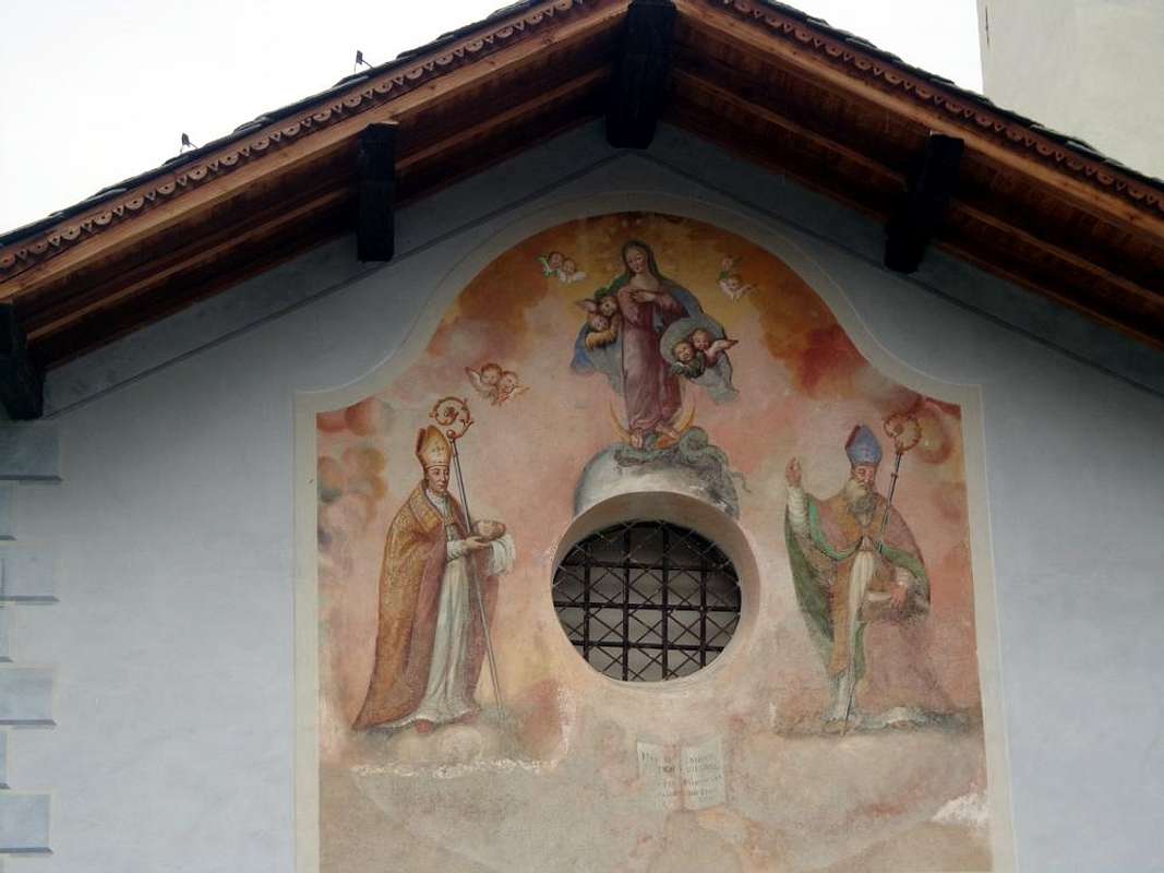
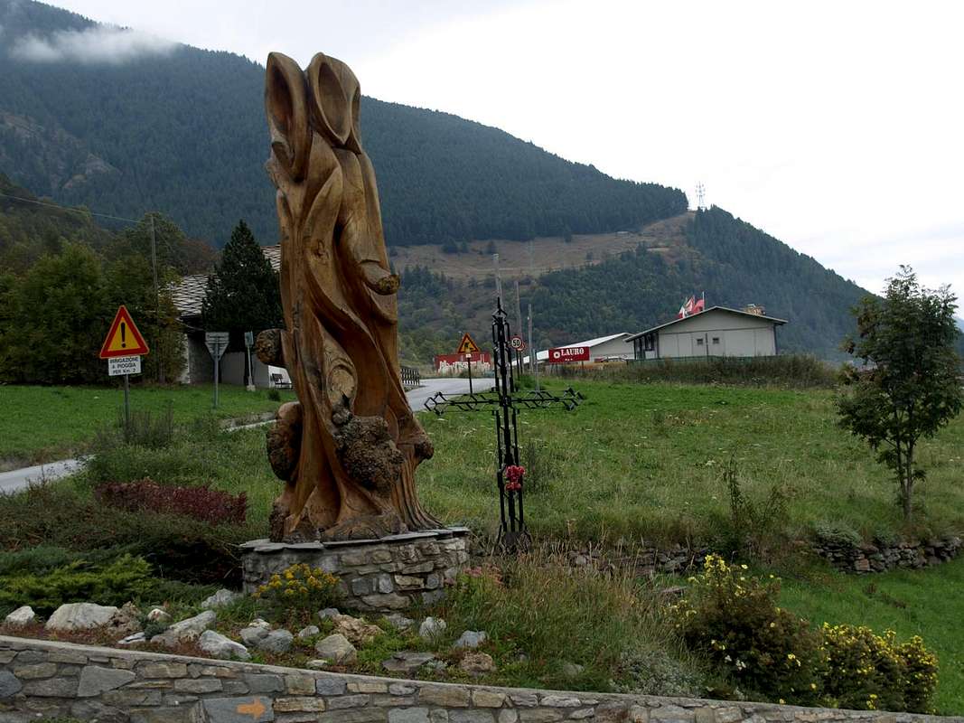
Ma queste due vallate offrono anche Costumi e Tradizioni significative, come a Saint-Rhémy-en-Bosses dove un
, rievocativo del passaggio di Napoleone Bonaparte con la sua Armata di 35.000 uomini, 40 cannoni e 3.500 cavalli nel Maggio 1800. Sembra che sia nato per irridere al matrimonio di due molto anziani chiamati
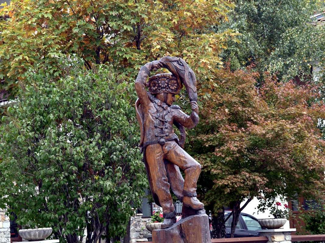
e vede un connubio tra le due vicende che coinvolge un pò di tutto e tutti. Da Napoleone a cavallo, soldati e cavalli, suonatori, il Diavolo, demoiselles, arlequins, mascre in abito nero a rappresentar l'inverno ed i lupi a quel tempo presenti come gli orsi e, come palliativi, logicamente il domatore, il dottore ed il prete per curare sia il corpo che l'anima. Ma é anche il paese di un rinomato
che, accompagnato da un buon vinello, forse é il vero Re di tutta questa grande festa popolare. Questo il motivo per il quale, oltre alla
al fine d'allietare sia corpo che spirito. Inoltre troviamo, in una tradizione comune col vicino Vallese, le incruente
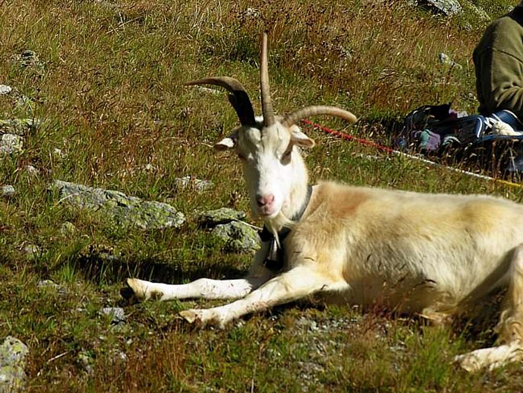
, ovvero le Regine della Battaglia e della maggiore produzione di latte rispettivamente ornate con fiocchi rossi oppur bianchi. Più in là a Valpelline invece riscontriamo, sempre incruenta ma con grandi incornate, la caotica
, cioé delle Capre.
This complete Area which includes 11 Commons, noting that "Adret" means the most exposed to the sun and vice versa. Day Three the interior of 11 Municipalities (Area
"de l'Est Adret" or St. Christophe, Roisan, Gignod, Etroubles, St. Oyen, St. Rhémy-en-Bosses; Allein, Doues, Valpelline, Oyace and Bionaz):
the visit of this Eastern Area, which then expands to the North (Gran San Bernardo) and Northeast (Valpelline) comprises 11 Municipalities in addition to that of Aosta. The starting point coincides with that of the second day and, crossing the Common of Saint Christophe, reaches the City of Aosta. Here of course the rest is more prolonged, given the huge amount of sites visited and of which we give a unique rapid and meager track. In this first part we must therefore calculate a good half day; then you can go to the Valley of the Gran San Bernardo (Municipalities of Roisan, Gignod, Etroubles, Saint Oyen and Saint-Rhémy en Bosses) and the branch to the Northeast in Valpelline (Municipalities of Allein, Doues, Ollomont, Valpelline, Oyace and Bionaz). Starting from Quart Municipality on Regional Road with a detour to the North to reach the above Villair de Quart Fraction (
627/64m; Church of Saints Fabiano, Sebastiano and Rocco) and continuing in a short time you get to the
Château de Quart and Church of St. Nicholas (774m); wanting a short trip to the Northeast with
unnumbered small path leads to the above
Hermitage of St. Emeric (
1130m;
1h'15/1h'30), under the same name
"Bois". Returning and proceeding with an alternative Regional Road, higher than the State, you reach the Municipality of Saint Christophe (
584/619m;
Churches of Santa Anna and San Cristofero) with overlying Fractions Sorreley (
790; Church of St. Gottardo) and West of Senin (
766/805 m; Church of Saints Barbara and Michael). The descent reaches Aosta passing near the
Castles of "Passerin d'Entrèves" and "Duca degli Abruzzi" or Jocteau and home to
"Alpine Military School of Aosta". Here, in near the small Village of Busseyaz
(664m) we find an old and round
"Mound Celtic", currently under exploration (
Tomb of an ancient burial of a Prince of the Salassians?).
Variant "High": avoiding the city, you may with street in asphalt from Senin-Thovex attaining progressively the Villages Serod, Porossan (
723m; Chapel of San Vittore) and Closellinaz Dessus (
800m; Churches of St. Thomas of Canterbury, San Filippo Neri) Roisan reaching the junction with the National No. 27 for the Gran San Bernardo.
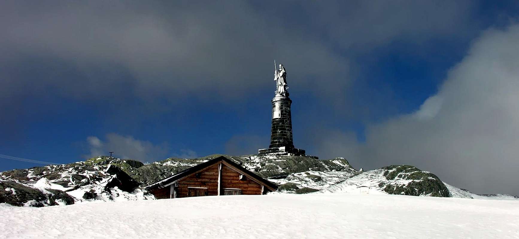
![]() San Bernardo Statue on Great Saint Bernard also Jupiter or Jovis Pass,
San Bernardo Statue on Great Saint Bernard also Jupiter or Jovis Pass,
by AntonioInto the Great St. Bernard ValleyFrom Aosta with the National Road No. 27 to the North to the Gran San Bernardo you reach the hamlet of Variney (
782m;
Church of the "Holy Shroud"; Farm "the Myosotis") enters into the Municipality of Gignod (
915/94m; "Maison-strong Arch" and Tour de Gignod; Churches of "Our Lady of Protection", San Ilario). From here the road bends more to the Northwest and, leaving left the detour to Condemine and Grand Buthier (
1137m, 1302m; Church of S.S. Margherita Rocco), under the Punta Chaligne, gradually reaches the villages of la Clusaz (
1199m; "Farmhouse La Clusaz"), Echevennoz (
1233/64m; "Hostel Marietty") and finally the Municipality of Etroubles (
1280m, 15 km. from Aosta; Church of San Rocco), above the Rio Artanavaz. With a short diagonal to the West-northwest in the road comes to St.-Oyen (
1373m; Château Verdun) and, bending over to North and avoiding the deviation to the right for the Tunnel, to St. - Rhémy en - Bosses (
1632m; Church of 1700; Casemate to Bosses and Chevillen the XIII° Century), the input of the actual Valley of Gran San Bernardo. From here decisively starts the road to the Great St. Bernard and Entremont Valley): from the parking just after Saint-Rhémy Center towards Great Saint Bernard Valley, crossing under Saint Bernard Tunnel Road in altitude
1860 metres, forks between Praz Dzentor/Plan d'Arc
(1876m), Praz d'Arc
(1992m), Fonteinte Pastures (+;
2203m near
"La Cantine d'Aoste"); continue with State Road to Montagna Baou below Tour des Fous, and after a short tunnel in a terminal diagonal to Great Saint Bernard Lake & Hill, through Southern Slopes,
(2469m; "Roman Mansio, Jupiter Statue, Hotel Italia, Restaurant of Lake, Saint Bernard Hospice, Bazars, Exposition Saint Bernard Dogs, Ancient Morgue".
E/F; 2h '30/3h '00)). From the pass possibility of descent to swiss Entremont Valley in Switzerland with Swiss State Road and towards the
"Combes des Morts" nearby Le Tronchet mini parking or continue te descent to Hospitalet
2116m), Bourg Saint Bernard
(1918m) near Mauvoisin long Dam, Bourg Saint Pierre
(1632m) to Orsières
(879m).
Notes: This route is useful in order to do the trail with snowshoes; otherwise you must reach the junction from the parking lot to the Dzellette Arp
(1870m) and, staying on shore hydrographic left (East) of Torrent Gr. St. Bernard, continue with the trail
n° 13B/TAM/TdC/VA that, passing under Plan de Raye, rejoins the
"Napoleonic Via" towards Alp Fonteinte. In addition, starting from Gignod, goes into the woods the restored and ancient
"Via Francigena" in parallel and above the National reaches the Etroubles Common through off-trail comfortable and well marked path
n° 1.
The Hospice, properties of Monks, Rule of St. Augustine, built "ab immemorabilis" above a statue dedicated to Jupiter, while the actual statue of San Bernardo was inaugurated in 1905; in the Church are the relics of St. Faustina taken from the Roman catacombs and donated in 1828 by Pope Leo XII° to the Hospice. A
"latere or fringes" of an ancient tombstone II°/III° Century that reads
"Faustina dulcis anima or Faustina sweet soul". Moreover immediately behind is the ancient
"Morgue", where the dead were withheld until the spring waiting for proper burial; many deaths occurred because of avalanches in an attempt to force a passage in the middle of winter. That occurred often in the
"Vallon des Morts" and who registered even recently, is also in 2015 against three Ski-Mountaineers, while in the past mainly affecting Cigarette Smugglers and Pilgrims.
![]() Beyond Etroubles on "Pilgrims Route", towards Gran San Bernardo,
Beyond Etroubles on "Pilgrims Route", towards Gran San Bernardo,
by Osw
L'Area completa comprende 11 Comuni, facendo notare che per "Adret" s'intende la zona più esposta al sole e viceversa.
Terzo giorno visitando 11 Comuni (Area
"de l'Est Adret" o Comuni di St. Christophe, Roisan, Gignod, Etroubles, St Oyen, St. Rhémy-en-Bosses; Allein, Doues, Valpelline, Oyace e Bionaz):
la visita di questa Area Orientale, che poi si espande a Settentrione (Gran San Bernardo) ed a Nordest (Valpelline) comprende 11 Comuni oltre a quello d'Aosta. Il punto di partenza coincide con quello della seconda giornata e, attraversando il Comune di Saint Christophe, raggiunge la Città di Aosta. Qui logicamente la sosta é maggiormente prolungata, vista la enorme quantità di siti visitabili e dei quali diamo una esclusiva rapida e scarna traccia. In questo primo tratto bisogna quindi calcolare una buona mezza giornata; dopodiché si può proseguire verso la Valle del Gran San Bernardo (Comuni di Roisan, Gignod, Etroubles, Saint Oyen e Saint Rhémy-en-Bosses) ed alla diramazione verso Nordest in Valpelline (Comuni di Allein, Doues, Ollomont, Valpelline, Oyace e Bionaz). Partendo da Quart sulla Strada Regionale con una deviazione a Nord si raggiunge il soprastante Villair (
627/64 m; Chiesa dei S.S. Fabiano, Sebastiano e Rocco) e proseguendo in breve tempo si arriva al
Château de Quart e Chiesa di San Nicola (774 m); volendo una breve escursione a Nordest con sentierino
non numerato conduce all'
Eremo di San Emerico (
1130 m;
1h'15/1h'30), sotto lo omonimo
"Bois". Ritornando e procedendo con un'alternativa Strada Regionale, più in alto rispetto alla Statale, si raggiunge il Comune di Saint Christophe (
584/619 m; Chiese di Santa Anna e San Cristofero) con le soprastanti Frazioni di Sorreley (
790 m; Chiesa di San Gottardo) ed a Ovest di Senin (
766/805 m; Chiesa dei S.S Barbara e Michele). La successiva discesa raggiunge Aosta passando dai
Castelli dei Passerin d'Entrèves e Duca degli Abruzzi o Jocteau "Scuola Militare Alpina di Aosta". Qui, nei pressi del Villaggetto di Busseyaz
664 m) troviamo un antico e tondeggiante
"Tumulo Celtico", attualmente in fase di esplorazione (
Tomba d'un antica sepoltura di un Principe dei Salassi?).
Variante "Alta": evitando la città, si può con strada in affalto da Senin-Thovex raggiungere progressivamente i Villaggi di Serod, Porossan (
723 m; Cappella di San Vittore) e Closellinaz Dessus (
800 m; Chiese di San Tommaso di Canterbury e San Filippo Neri) arrivando a Roisan alla congiunzione con la Statale n° 27 per il Gran San Bernardo.
Dentro la Valle del Gran San BernardoDa Aosta con la Strada Statale n° 27 verso Settentrione per il Gran San Bernardo si arriva alla Frazione di Variney (
782 m; Chiesa del "Santo Sudario"; Agriturismo "le Myosotis") entrando poi nel Comune di Gignod (
915/94 m; "Maison-forte Arch" e Tour de Gignod; Chiese di "Nostra Signora della Protezione" e San Ilario). Da qui la strada piega più a Nordovest e, lasciando a sinistra la deviazione per Condemine e Grand Buthier (
1137 m, 1302 m Chiesa di S.S. Margherita e Rocco), sotto la Punta Chaligne, raggiunge progressivamente i Villaggi di la Clusaz (
1199 m; "Agriturismo La Clusaz"), Echevennoz (
1233/64 m; "Ostello Marietty") ed infine il Comune di Etroubles (
1280 m, 15 Km. da Aosta; Chiesa di San Rocco), sopra il Rio Artanavaz. Con un breve diagonale ad Ovest-nordovest la strada arriva a quello di St.-Oyen (
1373 m; Château Verdun) e, piegando più a Nord nonché evitando a destra la deviazione per il Tunnel, raggiunge St. - Rhémy en - Bosses (
1632 m; Chiesa del 1700; Case Forti a Bosses e Chevillen del XIII° Secolo), allo ingresso della vera e propria Valle del Gran San Bernardo. Da qui decisamente parte la strada per il
Colle del Gran San Bernardo e la svizzera Valle d'Entremont: dal parcheggio subito dopo il centro di Saint-Rhémy verso la valle del Gran San Bernardo, attraversando al di sotto del Tunnel sulla Strada Statale n° 27 in altitude di
1860 metri, successivi bivi per e tra gli Alpeggi di Praz Dzentor/Plan d'Arc
(1876 m), Praz d'Arc
(1992 m), Fonteinte (+;
2203m presso
"La Cantine d'Aoste"); continuare con la Statale verso la Montagna Baou sotto alla Tour des Fous, ed al successivo breve tunnel con diagonale, sotto il versante Meridionale, verso il Lago del Gran San Bernard appena precedente il Colle,
(2469m; "Roman Mansio, Statua di Giove, Hotel Italia, Ristorante del Lago, Saint Bernard Hospice, Bazars, Esposizione dei Cani del Gran San Bernardo, Antica Morgue".
E/F; 2h '30/3h '00)). Dal colle possibilità di scendere nella Valle d'Entremont in Svizzera tramite la Statale svizzera in direzione della
"Combes des Morts" presso la piazzola di Le Tronchet oppure proseguire verso Hospitalet
(2116 m), Bourg Saint Bernard
(1918 m) presso la Diga di Mauvoisin, Bourg Saint Pierre
(1632 m) sino al Comune di Orsières
(879 m).
Note: Questo itinerario é utile volendo effettuare il percorso con racchette da neve; altrimenti conviene dal parcheggio raggiungere il bivio per l'Arp Dzellette
(1870 m) e, restando sulla sponda idrografica sinistra (Est) del Torrent Gran San Bernardo, proseguire con il sentiero
n° 13B/TAM/TdC/VA che, passando sotto Plan de Raye, si ricongiunge alla
"Via Napoleonica" verso l'Alpe Fonteinte. Inoltre, con partenza dal Comune di Gignod, sale dentro il bosco l'antica e ripristinata
"Via Francigena" che, parallela sopra la Strada Statale, raggiunge il Comune di Etroubles tramite il largo e comodo sentiero-mulattiera ben segnalato
n° 1.
L'Ospizio, costruito proprio al valico é di proprietà dei Monaci, Regola di Sant'Agostino; eretto
"ab immemorabilis" sopra d'un simulacro dedicato a Giove, mentre la statua attuale di San Bernardo é stata inaugurata nel 1905. Nella Chiesa vengono conservate le reliquie di Santa Faustina prelevate dalle catacombe romane e donate nel 1828 da Papa Leone XII° all'Ospizio. A "latere" un'antica lapide del II°/III° Secolo che recita
"Faustina dulcis anima". Subito dietro trovasi l'antica
"Morgue", ove venivano trattenuti i morti insino a primavera in attesa d'adeguata sepoltura. Molti decessi avvenivano a causa di valanghe nel tentativo di forzarne il passaggio in pieno inverno, evento verificatosi anche recentemente (2015) nell'adiacente
"Vallon des Morts" nei confronti di tre Sci-Alpinisti, mentre nel passato colpiva soprattutto Contrabbandieri e Pellegrini dispersisi.
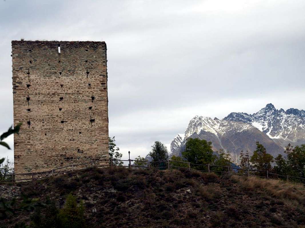
![]() "De Ginio Lords Tower" in Gignod Common at the entrance in two valleys,
"De Ginio Lords Tower" in Gignod Common at the entrance in two valleys,
by Osw
Towards the Valpelline wild Valley
From Croix de Fana above Quart towards St. Christophe, Aosta, Roisan, Gignod, Valpelline, Doues & St. Rhémy Communes
by maulwurf, emilius, Antonio & OswTowards the ValpellineAnother choice is that from the junction on the main road of Moulin (777/65m) after the Municipality of Roisan (
643m; Churches of San Vittore and S.S. Sebastiano, Fabiano), reached as mentioned also by Senin, rather than the San Bernardo there shall Northeast towards Valpelline.
Connection variant: it is also possible to
"bind" the two routes through the return from San Bernardo to the Municipalities of Allein (
1253m; Church of Santo Stefano) and Doues (
1251m; Parish Church) with descent from the latter to Valpelline (
938m; Church of St. Pantaleon). Otherwise from the crossroads of Moulin continuing on Regional Road next to the Torrent Buthier you first reach the village of Rhins (
785m; Château de Rhins. *** Even from here with Road Regional towards Doues) and little ones of Collin, Avillier, Creusevy, Chanodaz, Liarey
(+; 904m) and Valpelline. This valley, in turn, gives two opportunities:
1)- Valpelline just after the junction
1029 metres between Cleyval and Chosoz take toward North Regional Road to Ollomont Commune (
1356m; Parish Church in Cognen; or
2)- continue to Est-northeast reaching Villages Lavod, Berrio, Thoules
(+; 1045m) and the Municipality of Oyace (
1316m; Church of St. Michel), at the foot of the Mountain Chain of Mont Morion and dominated by the
Tour d'Oyace (1477m). The last part of this secluded valley and wild moves towards the Bionaz with the gigantic dam of the same name, also known as the Places de Moulin. Oyace from the Regional Road reaches the Villages of Serignan, Close, Place, Balme (
1515m; Church of Saint-Roch), the Lexert Lake
(1552m) with its small
"Area Naturalistic" Dzovenno (
1564/77m; Church of "Notre Dame des Neiges"; ex ancient copper mine), Perquis and Bionaz
(1622m). From there reaches Ferrère, Chamin, Léchère (
1812m; Church of Saint-Roch) to finish at Place Moulin
(1980m) to West front of the Dam. But it is also possible to completely this big stage in a single day traveling by car all the ways indicated; certainly this choice will go at the expense of a more detailed visit, watching the whole thing
"in passing", but also renouncing to up some short and pleasant walk on foot. It is advisable to divide it into two parts, making choices.
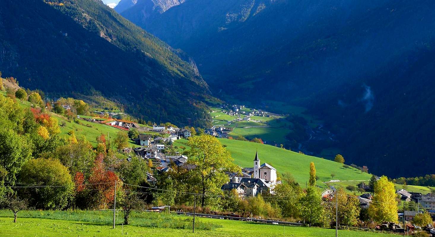
![]() Valpelline Valley from West,
Valpelline Valley from West,
by AntonioVerso la ValpellineUn'altra scelta consiste che dal bivio sulla Statale di Moulin (777/65 m) dopo il Comune di Roisan (
643 m; Chiese di San Vittore e S.S. Sebastiano e Fabiano), raggiungibile come già detto anche da Senin, invece che per il San Bernardo si proceda a Nordest verso la Valpelline.
Variante di collegamento: inoltre é possibile
"legare" i due itinerari passando al ritorno dal San Bernardo per i Comuni di Allein (
1253 m; Chiesa di Santo Stefano) e di Doues (
1251 m; Chiesa Parrocchiale) con discesa da questo ultimo a Valpelline (
938 m; Chiesa di St.-Pantaléon). Altrimenti dal bivio di Moulin continuando sulla Strada Regionale a fianco del Torrent Buthier si raggiunge dapprima il Villaggio di Rhins (
785 m; Château de Rhins. *** Anche da qui Strada Regionale per Doues) e po quelli di Collin, Avillier, Creusevy, Chanodaz, Liarey (+; 904 m) e Valpelline. Questa valle, a sua volta, concede due opportunità:
1)- subito dopo Valpelline al bivio
1029 metri tra Cleyval e Chosoz prendere verso Nord la Strada Regionale per Ollomont (
1356 m; Chiesa Parrocchiale a Cognen; oppure
2)- continuare verso Est-nordest raggiungendo i Villaggi di Lavod, Berrio, Thoules
(+; 1045 m) ed il Comune di Oyace (
1316 m; Chiesa di St. Michel), ai piedi della Catena del Mont Morion e sovrastato dalla
Tour d'Oyace (1477 m). L'ultima parte di questa valle isolata e selvaggia si indirizza verso il Comune di Bionaz con la mastodontica omonima Diga, conosciuta anche con il nome di Places de Moulin. Da Oyace la Strada Regionale raggiunge i Villaggi di Serignan, Close, Place, Balme (
1515 m; Chiesa di Saint-Roch, il Lago Lexert
(1552 m) con la sua piccola
"Area Naturalistica", Dzovenno (
1564/77 m; Chiesa di "Notre Dame des Neiges"; ex Miniera di rame), Perquis e Bionaz
(1622 m); da qui raggiunge Ferrère, Chamin, Léchère (
1812 m; Chiesa di Saint-Roch) per terminare a Place Moulin
(1980 m) al fronte Occidentale della Diga. Ma é anche possibile effettuare completamente questo tappone in un'unica giornata percorrendo in auto tutte le vie indicate; certamente questa scelta andrà a discapito di una visita più approfondita, osservando il tutto
"en passant", ma soprattutto rinunciando a qualche breve e simpatica passeggiatina a piedi.
From Champignon Alpages above Doues towards Ollomont, Valpelline Oyace and Bionaz Communes up to the Places des Moulins Dam
by Osw 2015