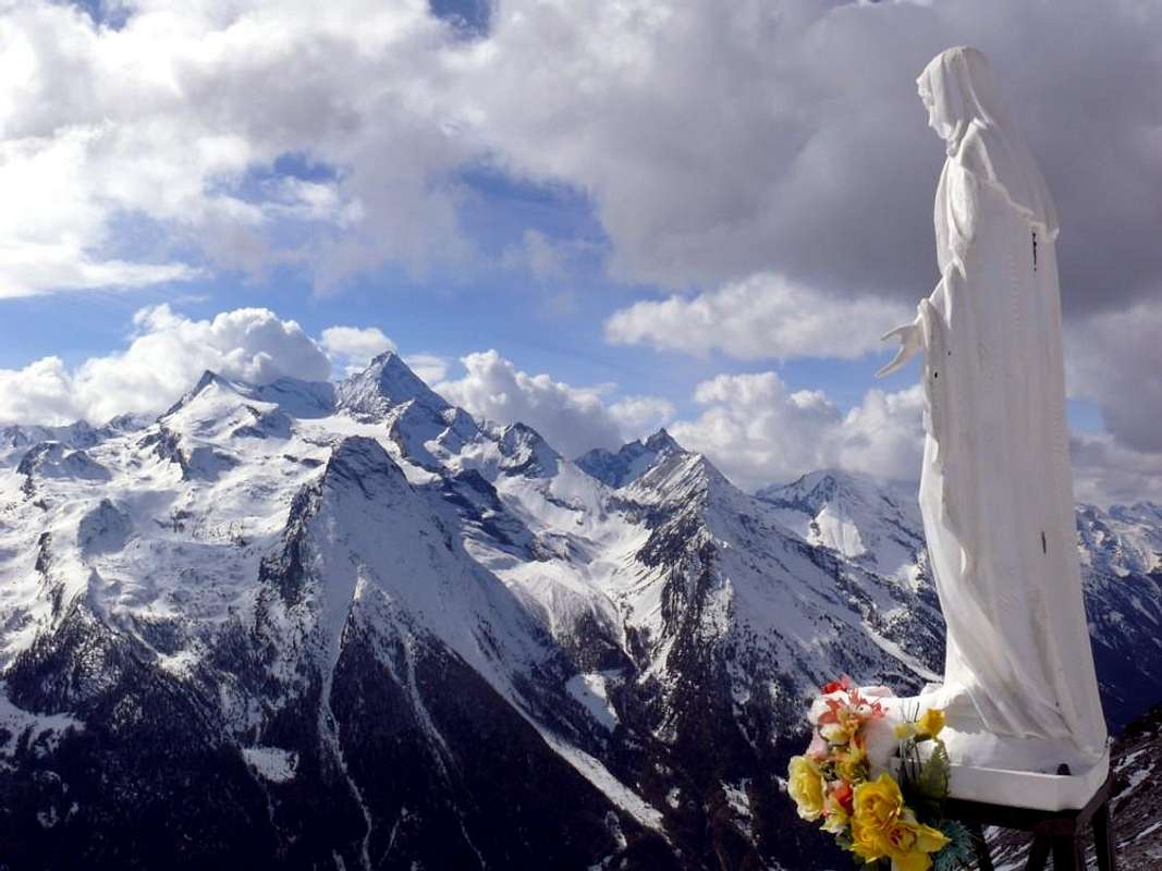
Non vogliamo farvi patire il freddo e neppure la fame, anche se qualche bel giro può essere effettuato anche in pieno inverno quando tutta la Valle di Cogne presenta un volto nuovo. Ancora più bianco e scintillante dei suoi ghiacciai. Una
con le Racchette da neve presenta sempre qualcosa di suggestivo, anche ad altitudini poco elevate. Permette di gustare più in solitudine questi magnifici posti selvaggi, incontrando soltanto gli animali che scendono progressivamente per difendersi dal freddo e per cercare il loro cibo. Inoltre, se sei un pò Filosofo, puoi meditare respirando all'unisono con la Natura. Ma anche le stagioni intermedie offrono squarci imponenti con i loro colori prepotenti ed i loro profumi particolari e non troverete ancora la massa, mentre in estate potete sempre salire un poco più in alto allontanandovi dalla gente ed avvicinandovi agli eterni ghiacciai.
The intent is to make known to you all locations starting making a full turn from the North-northwest to South-southwest across the entire Cogne Valley.A particular finishing line is not easy but not too hard to get; just know how to organize it with the goals to be pursued diluted with a week or so. This choice allows you to visit the whole of the valley without
"stagnate" always in the usual places, even if the most famous and popular and frequented. Takes some desire for the
Explorations going in search even of the most remote corners and less frequented by the masses of holiday-makers, tourists and hikers who
"hang out" around here and sometimes influenced by famous names, or by renowned mountains, being addressed to mountaineers and climbers, protrude from their capacity or more simply by their level of physical preparation or training. Is, at the same time, an invitation not to fall back into the opposite extreme
"sitting" slavishly retrace routes with more than trivial visits of very little importance and relative satisfaction. An alliance, that proposed, which allows players to achieve better results by combining short walks or trips to visits to
"taste" the cultural and historical heritage, always well wedged in the fabric of this reality increasingly changing, increasingly facing the external fashion, often alien from the reality, that not to
local Traditions.
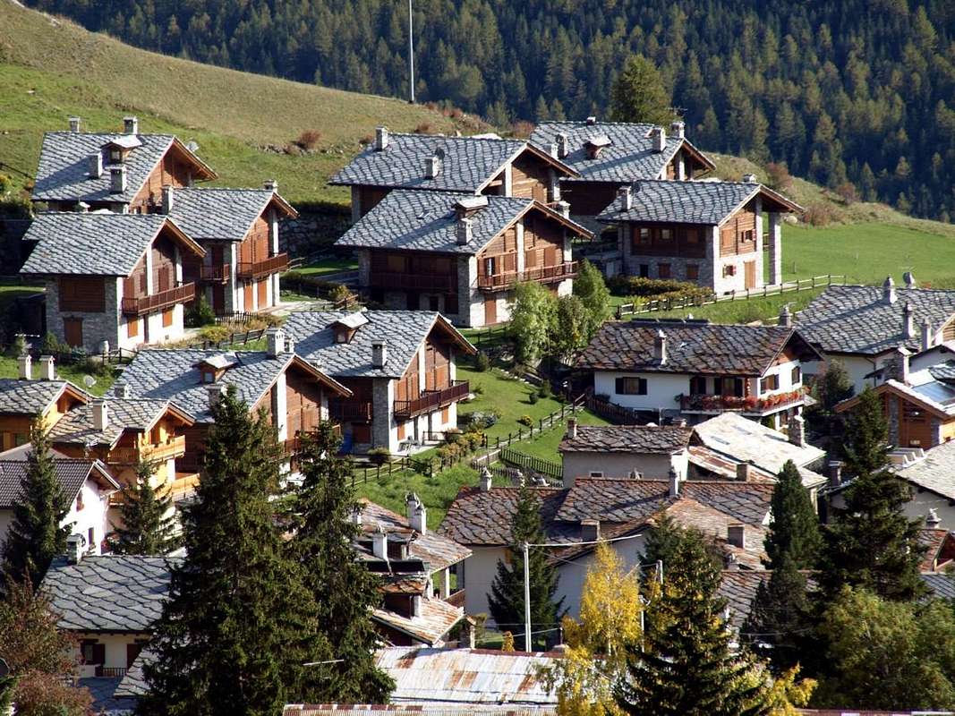
However you have to give a Rule or, better, some small Tip with which we recommend starting N-NW, above Aymavilles, to end S-SW, over Sylvenoire-Vieyes.
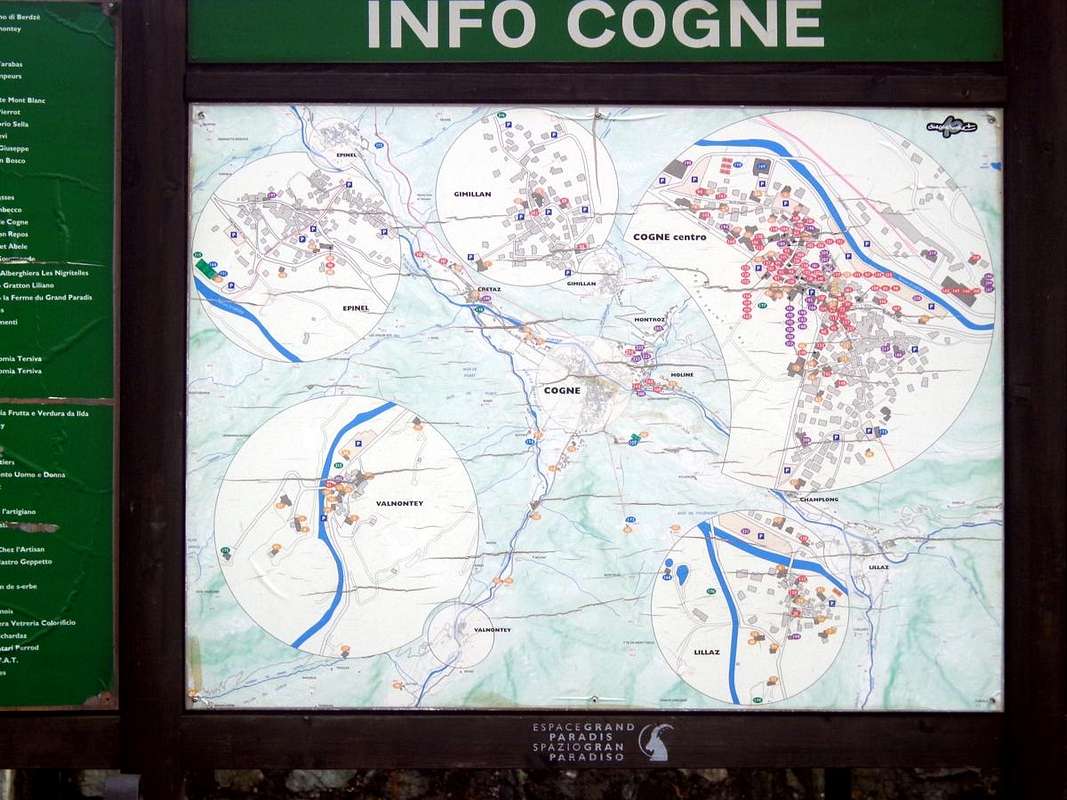
A ride almost 360° from the Basin Ozein-Tourlin, bordering the District of Pila, takes us to visit all the valleys of the North until you reach Urtier to the extreme East starting from the villages Tourlin Dessus, Ozein Epinel, Montroz, Gimillan, Moline and Champlong. From here along the Southern sector, starting with the most famous Lillaz, Cogne and Valnontey, the
"reenter" occurs through Crétaz and reaching toward the West those of Vieyes and Sylvenoire then declined, closing the circle, again above Aymavilles Common.
First Day toward North-northwest (Ozein Conca)1)-: Walk Turlin Dessus
(1521m) Alp Bren di Milieu
(1642m) passing Premù o Premou e Grand Pailler localities. Or even crossing towards Fernier and Pila-Posse in round trip.
2)-: Excursion Ozein alternative near Dailleuy
(1349m, 1480m) through Rompérein, Champchenille Pastures and la Pierre Alp up to the Pointe Vadaille or Vedailles
(2338m).
Second Day to the North (Val de Lussert, Arpisson and Tsa Sètze Vallons)3)-: Walk Epinel
(1434/9m) towards Pian de Sèutse
(2198 m) passing through Alp Tavaillon
(2013m) into minuscule Val de Lessert below
Bivouac "Arno" at Couìss
(2611m).
4)-: Excursion Epinel
(1439m) towards the Col Tsa Sètze
(2815 m) through Teuvre, Tsavanìs and Arpisson Pastures
(1792m, 1859m, 2328m) in Arpisson Vallon, before the fork
2400 metres about towards the Plan Bessey and
Franco Nebbia Camp under the Garin Hill, Lake Garin and Punta di Pian Bessey
(2740m, 2815m, 2854m, 3085m).
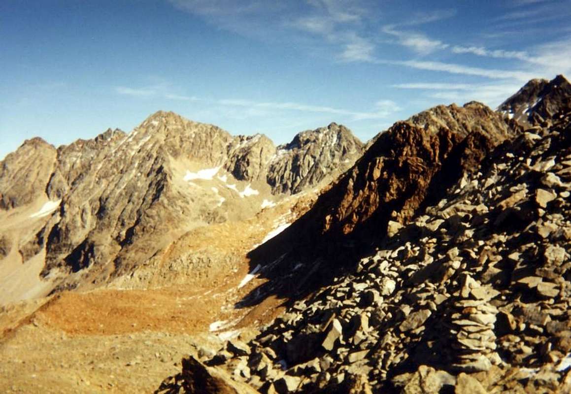
![]() Third Journey to the North also Norrtheast (Grauson Vallon and Magnetitemines of Larsinaz-Costa del Pino-Colonna)
Third Journey to the North also Norrtheast (Grauson Vallon and Magnetitemines of Larsinaz-Costa del Pino-Colonna)5)-: Excursion by Gimillan
(1785m) reaching the Col des Laures
(3035m), passing through the localities of Tarabouc, Révènti, Tcheheu and l'Ecloseur, up to the Grauson Vieux and Nuove Pastures
(2273m, 2540m) into the homonym vallon and through the three Lussert Lochs
(2713m, 2790m, 2906m), into more Western branch Grauson/Lussert.
6)-: Walk from Montroz small Hamlet
(1681/1702 m) at the entrance on Grauson long and wide Valley also from Moline Village
1539 m) below the Mont-Salet
(2764m), up to reach the Loadstonemines with the Veins of Larsinaz
(1899m), Costa del Pino
(2026m) and Colonna
(2390 m) through ascent from one and relative descent toward the other.
Fourth Journey towards North-northeast and East (Liconi Basin and Urtier Vallon)7)-: Walk from Champlong-St. Pierre
(1596m) in North towards Alp Facette
(1662m), Colonna and Liconi magnetite Veins
(2390m, 2395m) under Monte Creya
(3015m).
8)-: Excursion from Lillaz
(1631m) through Goilles Dèsott, Bouc, Planes,
"Casotto" P.N.G.P. (1831m, 1861m, 2023m, 2156m), through Alta Via number 1 and leaving right (South) the ramifications towards Bardoney, Acque Rosse and Miserino Vallons, up to the
"Sogno di Berdzé" Shelter (2537m) under the Finestra di Champorcher
(2826m).
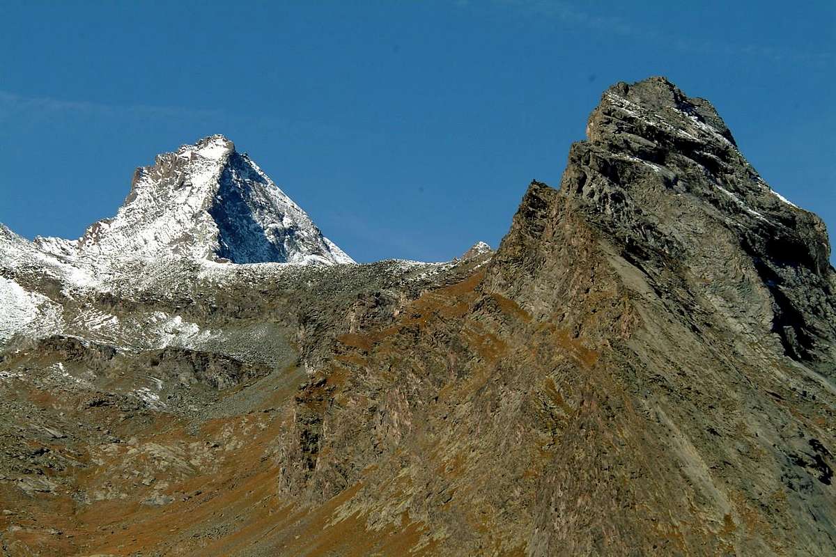
![]() Fifth Day towards East-southeast and Southeast (Bardoney and Valeille Vallons)
Fifth Day towards East-southeast and Southeast (Bardoney and Valeille Vallons)9)-: Walk by Lillaz three Lillaz Waterfalls, Quertaset Pasture
(1775 metres about) Alp of Loie
(2217m) and Loée Loch
(2346m) at the Western entrance on Bardoney Valley.
10)-: Excursion from the Fraction Lillaz neighboring the
"Camping Al Sole" (1619m) towards South along the Valeille up to the junction
(1910m); after to the South-southeast and, fording Torrent de Valeille, to the homonym Alpe
(1902m). With the same direction, again for short time, towards the Cabine P.N.G.P. Arolla
2258m), then decisively to the East reaching Northern Arolla Hill
(2915m), below the Pointe-de-Chésère
(3117m) also indifferently, but pathless and esclusively through traces into the quite steep screes-moraines or snowfields, towards the Southern Pass
(2892m) or to the Colle della Petite Arolla
(2838m), this last collocated at the base of North Ridge Petite Arolla
(3234m).
Sixth Day towards South and South-southwest (Valnontey and Lauson Basin)11)-: Walk from Cogne-central square
(1531m) to the South reaching the locality Insurerriaz
(1577m) and from this with the path more to the South-southwest and along the Torrent de Valnontey in direction of the two
"Campings Bouva and Stambecco" (1681m) up to reach Valnontey Fraction
(1674m). by the parking in soil continue towards the junction of Bouvaz
"Camping Gran Paradiso" (1675m) and from this before to the isolated Verné Pasture
(1721m) then to the more important of Vermiana
(+; 1729m); this to reach the Pont des Erfaulets (Eurfalets Bridge;
1826m) at the end of head and in front of great Tribolazione Glacier with Gran Paradiso, and nearby the departure for all the various bivouacs of this wide area (from East to the South:
Money, Alessandro Martinotti, Stefano Borghi, Carlo Pol and Marcello Gerard- Ettore Grappein).
12)-: Excursion by the Fraction Valnontey
(1674m), passing the wooden bridge on the homonym Torrent, toward West-southwest reaching the Tsantelet (
1677m; Alpine Garden Paradisia) and the (
"Cascata" or "Waterfall" 1991m); then more to the West and, flanking Torrent de Lauson, at the Thoules and Pacheu Alpages
(2111m, 2222m). With same trail again in short time towards that of Lauson nearby the Cabine P.N.G.P.
(2506m), and briefly to
Refuge Vittorio Sella (2579m). Various opportunities towards Rossa (to Northwest and Punta Rossa;
3190m), Nera (to West-northwest towards Punta Nera and Bianca just at the entrance on Trajo Glacier below The Grivola;
3487m) and Lauson (in West to Valsavarenche;
3296m), also in direction of the two homonym ponds (in South-southeast;
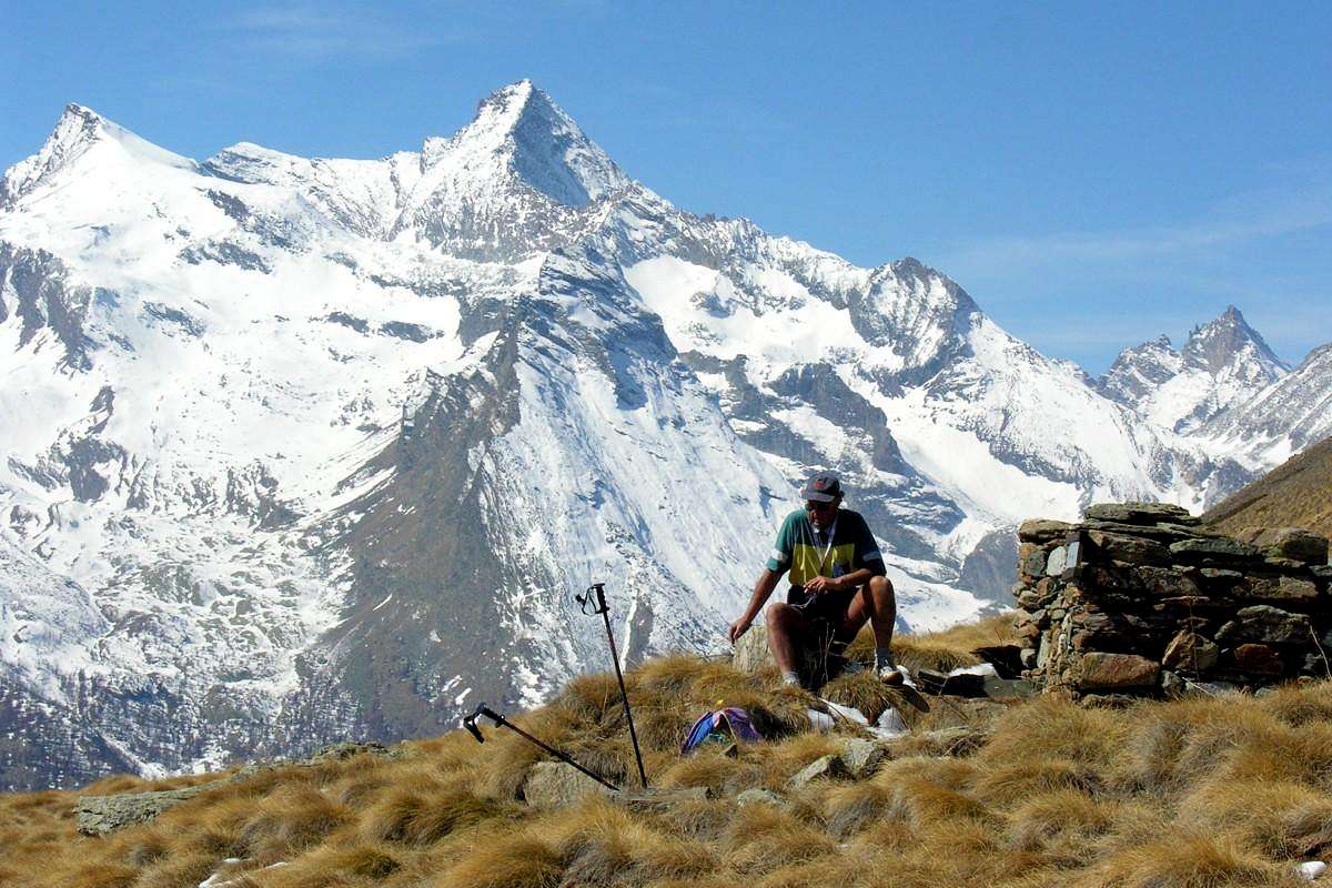
2636m, 2655m) with splendid views to La Grivola
(3968m) and the mountain chain that from L'Herbetet
(3778m) reachs Gran Paradiso
(4061m) bypassing Becca de Montandayné
(3840m) and Little Paradiso
(3872m, 3919m, 3926m).
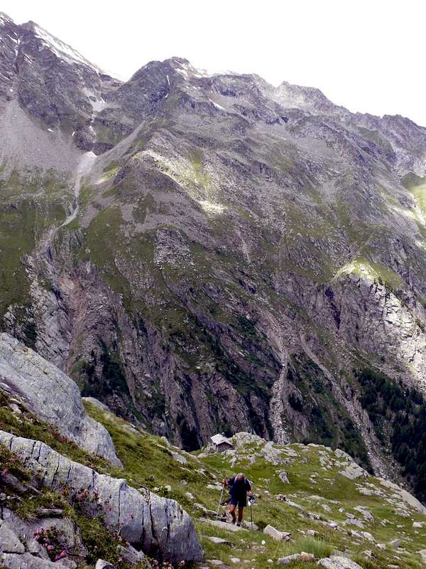
![]() Seventh and last Day towards Southwest and West-southwest (Pousset and Nomenon Vallons)
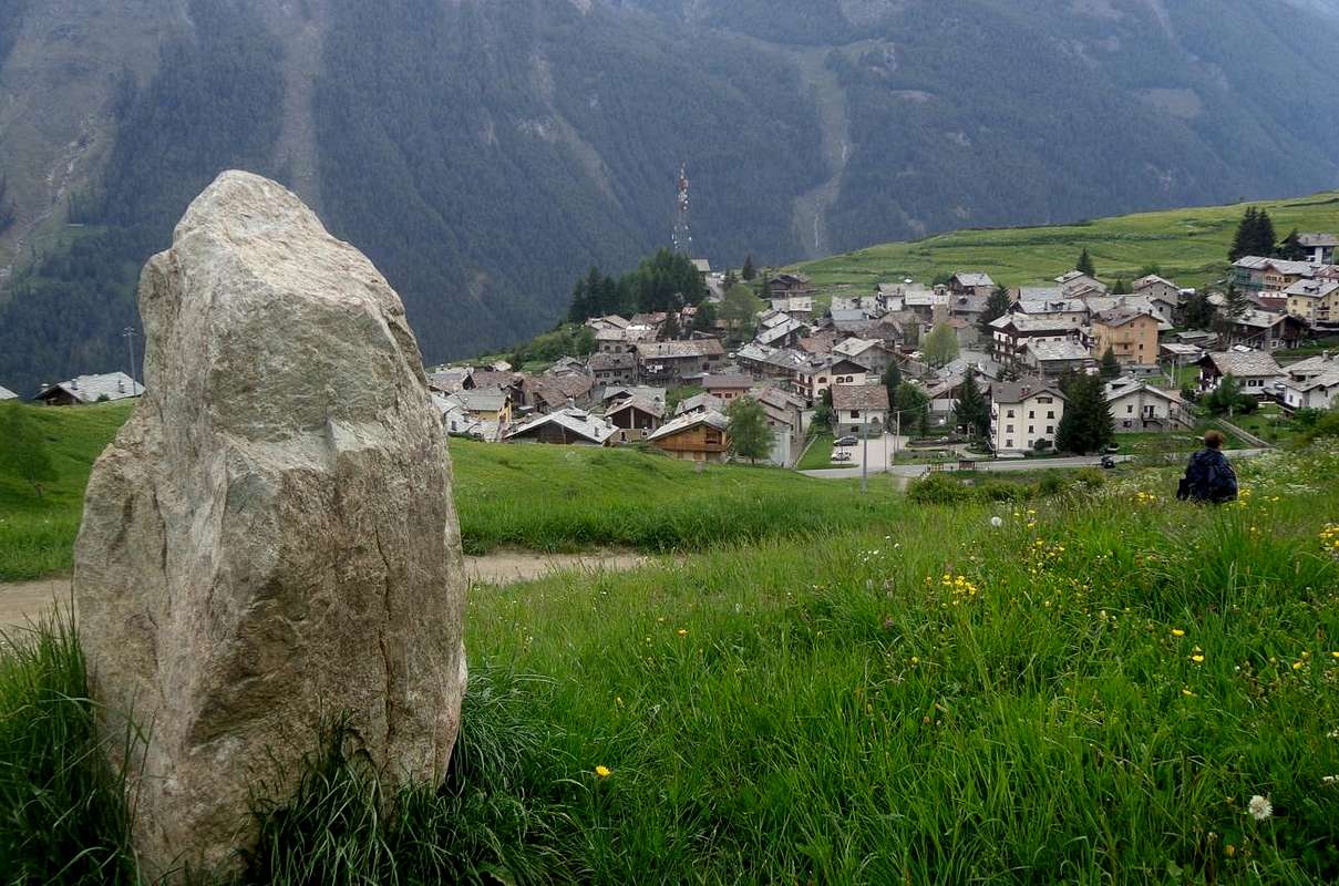
Seventh and last Day towards Southwest and West-southwest (Pousset and Nomenon Vallons)13)-: Walk by Crétaz Fraction
(1494m) towards Southwest through Teppe
(1507m), Ronc
(1663m) and Les Ors Dèsott Dessus Pastures
(1862m, 2052m) along the Torrent des Ors; from this last with crossing to the West reaching Alp Pousset Dèsott (
2176m; beautiful and ancient wooden
"rascards"). Also here you can get with departure from Epinel Fraction and short downhill towards the stone bridge on Grand'Eyvia Torrent nearby the sports area
(1434m, 1417m), following ascent towards the Planes Pasture
(1694 m) and traverse through the Grand Bois (Great Wood, better Forest) passing neighboring Récongé and Eyfié Alpages
(1798m, 1950m). Ability to climb from one side and down the other by connecting via the trail (along the ski-country run) that links the two villages at the base coming from the great
"Sant'Orso Meadow" at Cogne Common.
14)-: Excursion by Sylvenoire o from nearby Vieyes
(1331m, 1139m) rispectively through the dirt road or with the paths which join at the Pastures of Plan Pessey
(1382m, 1373m). From this point continue to the South flanking the Torrent Grand Nomenon up to the Petit Nomenon Alp
(1896m) from that by path with very narrow hairpin bends snail-shaped reach that of Grand Nomenon nearby the
Mario Gontier Bivouac (
2323m; ask for the key to the Aymavilles Municipality) with possibility to continue towards the Passes of Charbonnière (to the West;
2916m) or Trajo (in Southeast;
2873m) both hills below the splendid and icy Northwest and Northeast Walls of La Grivola
(3968m).
![]()
L'intento rimane quello di farvi conoscere tutte le località di partenza compiendo un giro intero da Nord-nordovest fino a Sud-sudovest nell'intera Val di Cogne.Un obiettivo non facile ma nemmeno troppo difficile da ottenere; basta infatti sapersi organizzare nelle mete da perseguire diluendole in una settimana o poco più. Questa scelta permette di visitare integralmente la valle senza
"stagnare" sempre nei soliti posti, anche se più famosi nonché conosciuti e frequentati. Richiede un pò di desiderio di
Esplorazione andando alla ricerca anche degli angoli più remoti e meno frequentati dalle masse di villeggianti, turisti ed escursionisti che
"bazzicano" da queste parti ed a volte condizionati da nomi famosi oppure da montagne che, essendo rivolte agli alpinisti, fuoriescono dalle loro capacità o più semplicemente dal loro grado di preparazione fisica od allenamento. E', allo stesso tempo, invito a non ricadere nell'estremo opposto
"sedendosi" pedissequamente a ripercorrere itinerari più che banali con visite di ben scarsa importanza e relativa soddisfazione. Connubio, quello proposto, che permette invece di ottenere risultati migliori abbinando piccole passeggiate od escursioni a visite di
"sapore" culturale e storico, sempre ben incuneate nel tessuto di questa realtà sempre più in evoluzione, sempre di più rivolta verso le aliene mode esterne che non alle
locali Tradizioni.
Comunque una Regola devesi darla o, meglio, qualche Suggerimentino, iniziando da N-NO, sopra Aymavilles, per terminare a S-SO verso Sylvenoire e Vieyes.Un giro quasi a 360° che dalla Conca di Ozein-Tourlin, ai confini col Comprensorio di Pila, ci porta a visitare tutti i valloni Settentrionali fino a raggiungere quello dell'Urtier ad Oriente partendo dai Villaggi di Tourlin Dessus, Ozein, Epinel, Montroz, Gimillan, Moline e Champlong. Da qui lungo il settore Meridionale, iniziando dai più famosi di Lillaz, Cogne e Valnontey, il
"rientro" avviene passando Crétaz e raggiungendo verso Occidente quelli di Vieyes e Sylvenoire per poi scendere, chiudendo il cerchio, nuovamente su Aymavilles.
Prima giornata verso Nord-nordovest (Conca d'Ozein)1)-: Passeggiata Turlin Dessus
(1521 m) Alpe Bren di Miliue
(1642 m) per la Premù o Premou e Grand Pailler. Anche attraversando verso Fernier e Pila-Posse in andata-ritorno.
2)-: Escursione da Ozein bivio di Dailleuy
(1349 m, 1480 m) attraverso gli Alpeggi di Rompérein, Champchenille e la Pierre Alp insino alla Pointe Vadaille o Vedailles
(2338 m).
Secondo Giorno verso Settentrione (Val de Lussert e Valloni d'Arpisson/Tsa Sètze)3)-: Passeggiata da Epinel verso il Pian de Sèutse
(2198 m) per l'Alpe Tavaillon
(2013 m) nella minuscola Val de Lessert al di sotto del
Bivacco "Arno" al Couìss
(2611 m).
4)-: Escursione da Epinel
(1434/9 m) al Col Tsa Sètze
(2815 m) attraverso le Alpi di Teuvre, Tsavanìs ed Arpisson
(1792 m, 1859 m, 2328 m) nel Vallone dell'Arpisson nonché prima del bivio
2400 metri circa per il Plan Bessey e
Bivacco Franco Nebbia al di sotto del Col Garin, Lago Garin e Punta di Pian Bessey
(2740 m, 2815 m, 2854 m, 3085 m).
![]() Terza Giornata a Settentrione e verso Nordest (Vallone del Grauson e Miniere di Larsinaz-Costa del Pino-Colonna)
Terza Giornata a Settentrione e verso Nordest (Vallone del Grauson e Miniere di Larsinaz-Costa del Pino-Colonna)5)-: Escursione da da Gimillan
(1785 m) al Col des Laures
(3035 m), passando per le località di Tarabouc, Révènti, Tcheheu e l'Ecloseur, fino alle Alpi del Grauson Vecchie e Nuove
(2273 m, 2540 m) nell'omonimo vallone ed attraverso i tre Laghi del Lussert
(2713 m, 2790 m, 2906 m), nella ramificazione più Settentrionale del Grauson/Lussert.
6)-: Passeggiata dal Villaggetto di Montroz
(1681/1702 m) all'inizio del lungo ed esteso Vallone del Grauson, oppure da quello di Moline
(1539 m) sotto il Mont-Salet
(2764 m), fino a raggiungere le Miniere di magnetite con i Filoni di Larsinaz
(1899 m), Costa del Pino
(2026 m) e Colonna
(2390 m) con salita da uno e con relativa discesa verso l'altro.
Quarto Giorno verso Nordest ed Est (Conca di Liconi e Vallone dell'Urtier)7)-: Passeggiata dal Villaggetto di Champlong
(1596 m) a Nord verso l'Alpe Facette
(1662 m) per i Filoni di Colonna e Liconi
(2390 m, 2395) sotto il Monte Creya
(3015 m).
8)-: Escursione da Lillaz
(1631 m) attraverso le Alpi Goilles Dèsott, Bouc, Planes, Casotto P.N.G.P.
(1831 m, 1861 m, 2023 m, 2156 m), tramite l'Alta Via numero 1 e lasciando a destra (Sud) le deviazioni pei Valloni di Bardoney, Acque Rosse e Miserino, insino al
Rifugio "Sogno di Berdzé" (2537 m) sotto la Finestra di Champorcher
(2826 m).
![]() Quinto Giorno verso Est-sudest e Sudest (Valloni di Bardoney e Valeille)
Quinto Giorno verso Est-sudest e Sudest (Valloni di Bardoney e Valeille)9)-: Passeggiata da Lillaz
(1631 m) tre Cascate di Lillaz, Alpe Quertaset
(1775 metri circa) Alpe di Loie
(2217 m) e Lago di Loée
(2346 m) all'ingresso nel Vallone del Bardoney.
10)-: Escursione dalla Frazione di Lillaz nelle vicinanze del
"Camping Al Sole" (1619 m) verso Sud lungo la Valeille fino al bivio
(1910 m); poi a Sud-sudest e, guadando il Torrent de Valeille, all'omonima Alpe
(1902 m).Con la stessa direzione ancora per breve verso il Casotto P.N.G.P. di Arolla
2258 m), quindi decisamente verso Est raggiungendo il Colle Settentrionale di Arolla
(2915 m), al di sotto della Pointe-de-Chésère
(3117 m) oppure indifferentemente, ma questa volta senza sentieri ed esclusivamente tramite tracce nelle pur ripide pietraie o nevati, il Colle Meridionale
(2892 m) o il Colle della Petite Arolla
(2838 m), quest'ultimo posto alla base della Cresta Nord della Petite Arolla
(3234 m).
![]() Sesto Giorno verso Sud e Sud-sudovest (Valnontey e Conca del Lauson)
Sesto Giorno verso Sud e Sud-sudovest (Valnontey e Conca del Lauson)11)-: Passeggiata da Cogne-piazza centrale
(1531 m) verso Mezzogiorno raggiungendo la località di Insurerriaz
(1577 m) e da questa con il sentiero più verso Sud-sudovest e lungo il Torrent de Valnontey in direzione dei due
"Campings Bouva e Stambecco" (1681 m) sino a raggiungere la Frazione di Valnontey
(1674 m). Dal percheggio in terra continuare verso il bivio di Bouvaz
"Camping Gran Paradiso" (1675 m) e da questo dapprima l'isolato Alpeggio di Verné
(1721 m) e poi quello ben più importante di Vermiana
(+; 1729 m); da questo raggiungere il Pont des Erfaulets
(1826 m) al termine della testata e di fronte al Grande Ghiacciaio della Tribolazione ed al Gran Paradiso, nonché presso la partenza per tutti i bivacchi di quest'area (da Oriente verso Sud:
Money, Alessandro Martinotti, Stefano Borghi, Carlo Pol e Marcello Gerard- Ettore Grappein).
12)-: Escursione dalla Frazione di Valnontey
(1674 m), passando il ponte sul Torrent omonimo, verso Ovest-sudovest allo Tsantelet (
1677 m; Giardino Alpino Paradisia) fino alla
"Cascata (1991 m); poi più ad Ovest e, lungo il Torrent de Lauson, alle Alpi Thoules e Pacheu
(2111 m, 2222 m). Con la stessa direzione ancora per breve verso quella di Lauson vicino al Casotto P.N.G.P.
(2506 m), donde in breve al
Rifugio Vittorio Sella (2579 m). Da questo varie opportunità per i Colli della Rossa (a Nordovest verso la Punta Rossa;
3190 m), Nera (ad Ovest-nordovest verso la Punta Nera e la Bianca nonché all'ingresso sul Ghiacciaio del Trajo;
3487 m) e Lauson (ad Ovest verso la Valsavarenche;
3296 m), oppure verso gli omonimi laghetti (a Sud-sudest;
2636 m, 2655 m) con grandiose vedute su Grivola e spartiacque che dall'Herbetet raggiunge il Gran Paradiso.
Settimo ed ultimo Giorno verso Sudovest ed Ovest-sudovest (Valloni del Pousset e del Nomenon)13)-: Passeggiata da Crétaz
(1494 m) verso Sudovest attraverso le Alpi Teppe
(1507 m), Ronc
(1663 m), Les Ors Dèsott e Dessus
(1862 m, 2052) lungo il Torrent des Ors; da quest'ultima con traversata ad Ovest raggiungendo l'Alpe Pousset Dèsott (
2176 m;
"rascards" in legno). Oppur qui arrivando con partenza da Epinel e discesa al ponte sulla Grand'Eyvia presso l'area sportiva
(1434m, 1417m), salita all'Alpe Planes
(1694 m) e traversata del Grand Bois passando presso le Alpi Récongé ed Eyfié
(1798 m, 1950 m). Possibilità di salire da un versante e scendere dall'altro collegandosi tramite la pista di fondo che lega i due villaggi alla base arrivando dal grande
"Prato di Sant'Orso" a Cogne.
14)-: Escursione da Sylvenoire oppure dal viciniore di Vieyes
(1331 m, 1139 m) rispettivamente con poderale oppure tramite sentiero ricongiungentisi presso gli Alpeggi di Plan Pessey
(1382 m, 1373 m). Donde proseguire a Mezzogiorno affianco al Torrent Grand Nomenon insino all'Alpe Petit Nomenon
(1896 m) dalla quale con sentieri a stretti tornanti a guisa di scala a chiocciola si perviene a quella di Grand presso il
Bivacco Mario Gontier (chiedere la chiave al Comune di Aymavilles;
2323 m) con possibilità di continuare verso i Colli Charbonnière (ad Ovest;
2916 m) o Trajo (a Sudest;
2873 m) rispettivamente al di sotto delle splendide e ghiacciate Pareti Nordovest e Nordest della Grivola.
Some Getting There
By car:
- From TORINO, MILANO, etc: Motorway A5. Exit at IVREA or Quincinetto (PIEDMONT) also Pont Saint Martin, Verrès, Châtillon, AOSTA East (Nus) and West (Aymavilles) Municipalities (AOSTA Valley).
From IVREA Town towards Pont St. Martin, Donnas, Bard, Verrès, St. Vincent, Châtillon, Nus, St. Christophe, Aosta, Sarre and Aymavilles Municipalities.
![]()
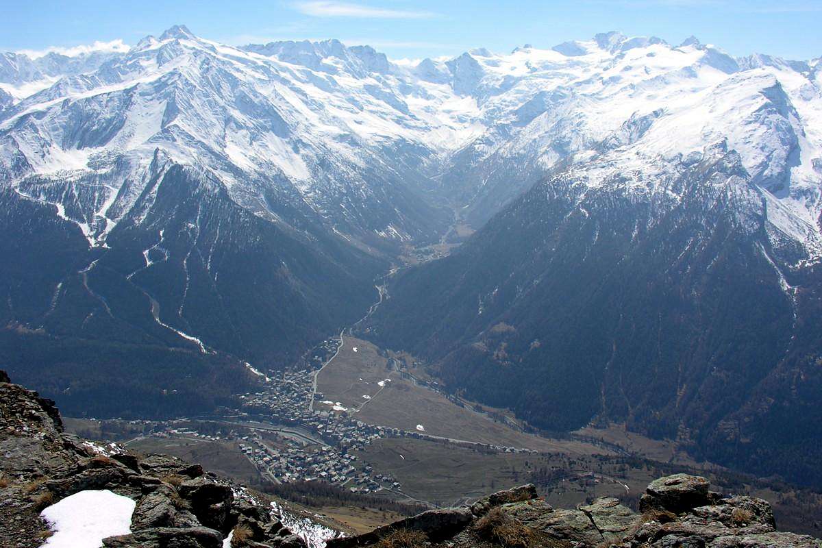
From Aymavilles to Cogne Valley
From Aymavilles (646m) towards Cogne Valley with Regional Main Road: Vieyes (1132/58m) Fraction, Mario Gontier private Shelter, through small path in Nomenon Vallon. Continue to Sylvenoire (1331m), Laval's Bridge (1364m) before Epinel Crétaz Hamlets (1434m, 1494m), Cogne (1534m) Resort, through Main Road.
![]()
To Valnontey (1678m), through Municipal Road: to Money, Alessandro Martinotti, Stefano Borghi, Carlo Pol, Marcello Gerard and Ettore Grappein, Lionello and Lucio Leonessa, Mario Balzola, Luciano Gratton (this last from Epinel or Crétaz) Bivouacs, through paths, moraines and glacier, and Vittorio Sella Refuge, through muletrack). From Lillaz Fraction (1607m) to Sogno di Berdzé, Denis Gérard and Guido Antoldi and Laura Malvezzi Refuges, by dirt road, muletrack or paths in Urtier and Valeille Vallon. To Gimillan Village (1785m), Franco Nebbia Bivouac, with path in Upper Arpisson Vallon. All the three last through Regional Roads from Cogne.
![]()
It is not necessary to take Motorway A5: you can drive on State Road n° 26, in the direction of AOSTA - IVREA - TURIN.
By plane:
- Aeroporto Internazionale "Corrado Gex" Saint Christophe (Aosta)