Triton 500
| Page Type | Gear Review |
|---|---|
| Object Title | Triton 500 |
| Manufacturer | Magellan |
| Page By | mattpayne11 |
| Page Type | May 6, 2009 / May 6, 2009 |
| Object ID | 6105 |
| Hits | 5840 |
| Vote |
Product Description
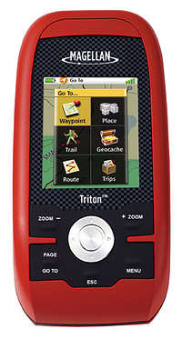
The Magellan Triton 500 was my second GPS. I owned the Triton 300 for about a month before opting to return it for the upgraded 500 unit because of the 500's SD Card feature. One should be cautioned that you can only use cards up to 2 GB in capacity with this unit.The Triton 500 is not too bulky, and weighs in at 6.6 oz. The menues are intuitive and the product did not require me to have a master's degree in GPS use.
I was impressed with the functions of the unit and the software that came with it.
The number one reason I chose this unit and brand was because of its compatibility with the National Geographic TOPO! program. You are required to upgrade that program to the 4.0 version for $20.00 but it is well worth it.
I purchased a 2GB SD Card and connected the unit to my computer, fired up the TOPO! program, and proceeded to download nearly the entire State of Colorado onto my GPS. This included USGS 1:100,000-scale topographic and
USGS 1:24,000-scale topographic.
The unit transitions from the base map to these TOPO! maps seamlessly. I can zoom out, move around the State, and zoom in to see the fine details of the 7.5 minute maps. It is amazing.
I'll mostly be using the unit for geocaching and mountain climbing.
The only visible drawback to the unit is that the included instructions are fairly crappy and the keypad is small and hard to manipulate.
The online help for the unit is very well done however.
I would reccommend this unit for the novice user looking for a good price on a handheld GPS unit.
Features
PHYSICALCase Rubber armored impact-resistant plastic, water-resistant seal, IPX-7
Pre-Loaded Maps Built-in basemap of Contiguous U.S., Alaska, Canada and Worldwide Geographic Boundaries
Size 4.65" x 2.16" x 1.22"
Weight 6.6 oz (187.1 g) - w/ battery
Screen Size 2.2" (5.59cm) diagonal, QVGA (240 x 320) resolution, LED backlit
SD RAM SD Card
Memory available for map storage Secure Digital (SD) Card
Antenna Type Built-in multidirectional patch
Keypad Nine direct-access keys
Operating Range 14 to 140°F (-10 to 60°C)
PERFORMANCE
GPS SiRF Star III™ 20 channels, WAAS/EGNOS
Acquisition Time Hot: 20 seconds, Cold: 60 seconds, Initial: 2 minutes
Update Rate Once per second
GPS Accuracy 3 to 5 meters (10 - 16 feet) - WAAS/EGNOS, < 7 meters (15 feet) - GPS only
Languages English, French, German, Dutch, Italian, Spanish, Danish, Norwegian, Swedish, Finnish, Portuguese.
Coordinate Systems Latitude/Longitude, UTM, OSGB, Irish, Swiss, Swedish, Finnish, German, French, USNG, MGRS, Indian, Dutch.
POWER
Source Two AA Batteries (not included)
Battery Life 10 hours
Images
 |