Toggle navigation
Mountains
Routes
Images
Trip Reports
Forum
What's New
People
Areas & Ranges
Articles
Trailheads
Canyons
Huts & Campgrounds
Albums
Logistical Centers
Fact Sheets
Lists
Custom Objects
Gear
Plans & Partners
WELCOME TO SUMMITPOST
SIGN IN
REGISTER
Mount Lovenia
Additional Parents
Image
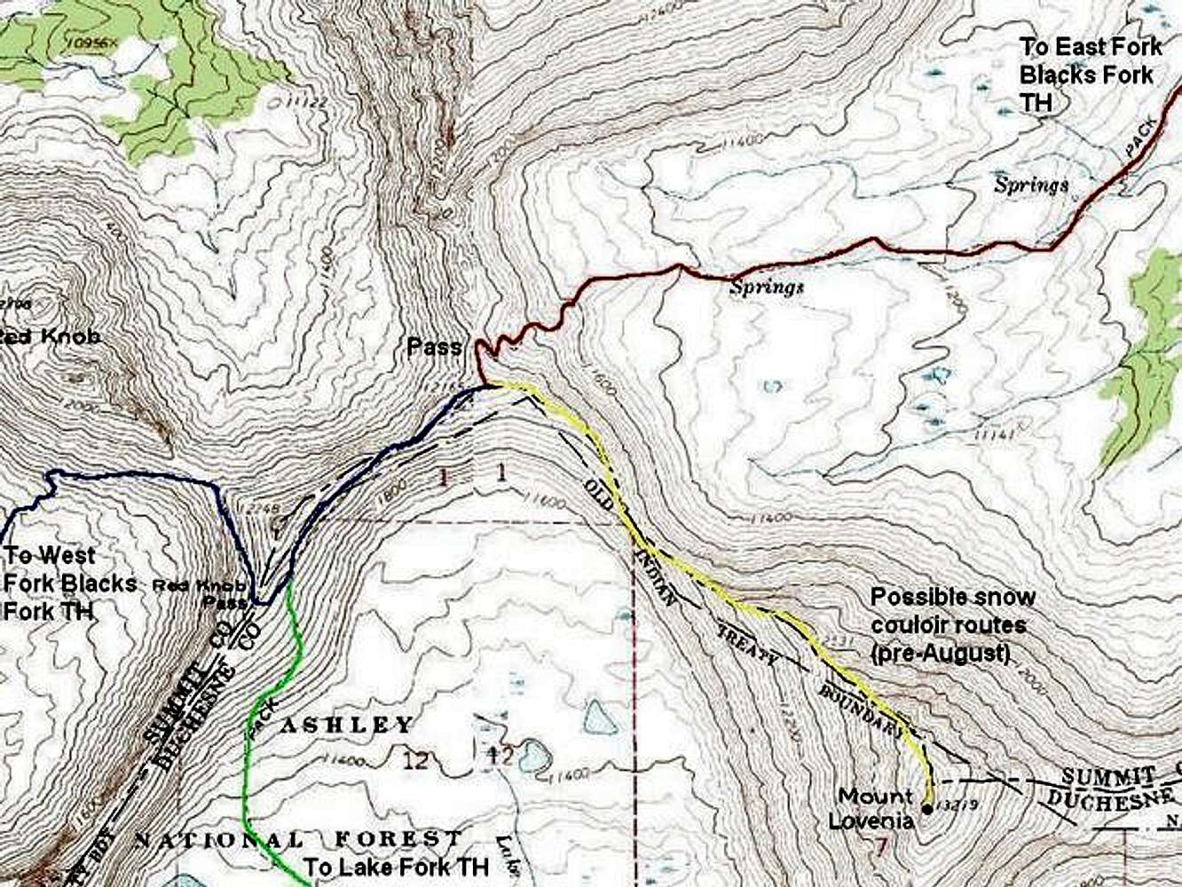
Overview of the final section...
View High-Resolution Image
Overview of the final section...
Overview of the final section of the routes to Lovenia.
Red = East Fork Blacks Fork Trail
Blue = West Fork Blacks Fork Trail
Green = Lake Fork Trail
Yellow = Standard route up Mount Lovenia (no trail)
« PREV
NEXT »
Scott
on
Dec 19, 2005 12:46 pm
Comments & voting
Other parents
Lat/Lon:
40.75690°N / 110.6074°W
Image ID:
141757
4936 Hits
72.08
% Score
2
Votes
Log in to vote
Comments
No comments posted yet.
to post!
Don't have an account?
Mount Lovenia
(Mountain/Rock)
« PREV
Viewing
#35 of 39
GALLERY
NEXT »
Scott's Image Gallery
« PREV
Viewing
#3915 of 8138
GALLERY
NEXT »
×
You need to login in order to vote!
User Name
Password
Remember me
Forgot your password?
Log me out when I close my browser.
Keep me logged in all the time.
sign in as a user
Don't have an account?
Register now for FREE
Rating available
Suggested routes for you
People who climb the same things as you
Comments Available
Create Albums
Register Here


