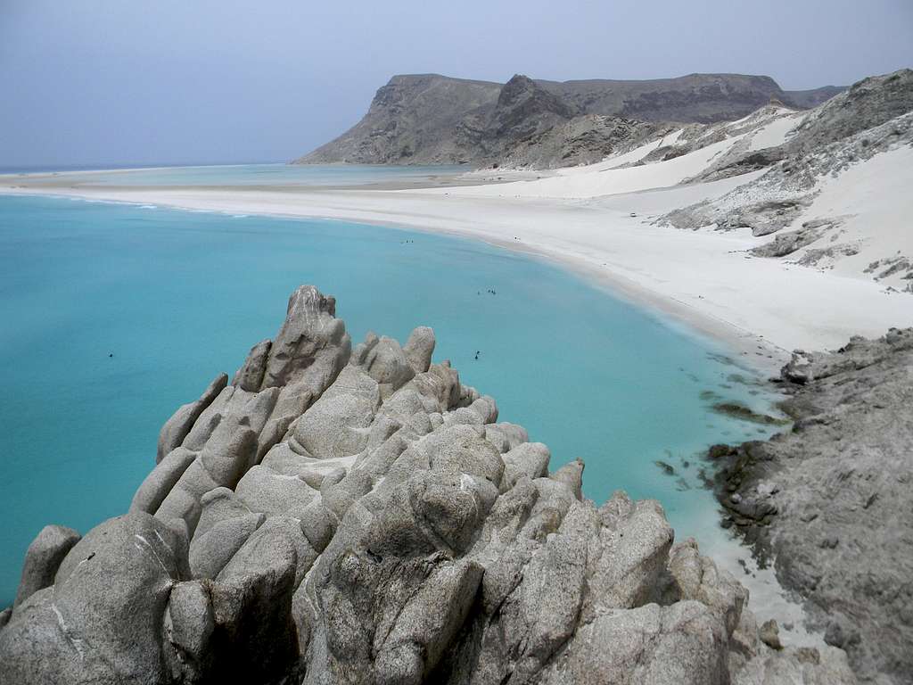
In the background behind the lagoon is a large, more gentle, peak on the left, and in front of that a smaller, sharper limestone peak. This peak makes for an outstanding hike as described below:
From the town of Qalansiyah, at the location where the S2 road dead ends in the town, turn right onto the road heading towards Detwah Lagoon. Either take this to the small spur road that branches off to the left (north) and reaches the shores of the lagoon. Drive East on the beach of the lagoon until the mountain looms before you. A couple hundred yards west of the steep cliffs, there is a broken ridge that ascends south to the larger east west ridge that eventually ascends the mountain to the east. Follow the crest of this ridge south on reasonable rock until the junction of with the larger ridge. From here, follow this ridge east until it arrives at steep limestone cliffs. The wonderful thing about the limestone, though, is that ascent of seemingly daunting stretches is actually quite simple on this rock! Climb up the ridge, largely on the south side of the ridge, but possibly on the west side in places as well, to the summit of the peak. There are actually three high points all about equal in height. It would be easy to continue from the top of the sharp, limestone peak to the broader, more gentle summit by following the ridge.
There are quite a few arches on the south side of this peak, including the one posted in the Island of Bliss article with the bottle tree on its top. That arch can be reached by traversing right across the slope when you reach a more gentle section of ridge after a steep rise, before climbing a final steeper stretch. The arch has coordinates of: 12 degrees 41.909 minutes north; 53 degrees 30.783 minutes east. There is also an unusual arch on the west side of the ridge which can be accessed from this same gentle part of the ridge by walking northwest and slightly downhill towards the large west facing cliff. Its coordinates are 12 degrees 41.9662 minutes north; 53 degrees 30.6757 minutes east.
Both peaks could also be climbed by taking the road east from S2 to its end then following the trail/road up. This would be easier but not as interesting.


