Toggle navigation
Mountains
Routes
Images
Trip Reports
Forum
What's New
People
Areas & Ranges
Articles
Trailheads
Canyons
Huts & Campgrounds
Albums
Logistical Centers
Fact Sheets
Lists
Custom Objects
Gear
Plans & Partners
WELCOME TO SUMMITPOST
SIGN IN
REGISTER
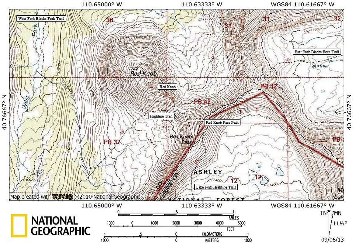
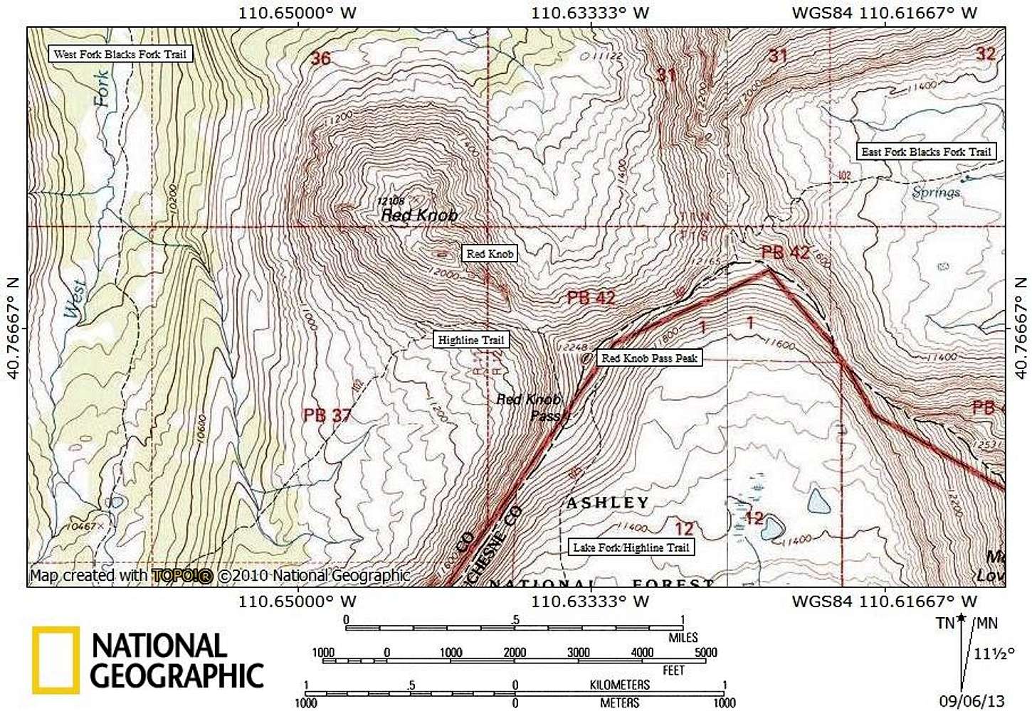
Red Knob area topo map
View High-Resolution Image
Red Knob area topo map
Topo map for Red Knob area, Uinta Mountains, Utah.
« PREV
NEXT »
ZeeJay
on
Aug 30, 2013 5:35 pm
Comments & voting
Other parents
Lat/Lon:
40.76984°N / 110.64186°W
Image Type(s):
Topo/Diagram
Image ID:
864177
3466 Hits
74.92
% Score
5
Votes
Log in to vote
Comments
No comments posted yet.
to post!
Don't have an account?
"Red Knob Pass Peak"
(Mountain/Rock)
You are at
the First
Image
Viewing
#1 of 1
GALLERY
You are at
the Last
Image
ZeeJay's Image Gallery
« PREV
Viewing
#1195 of 1388
GALLERY
NEXT »
"Red Knob Pass Peak"
(Mountain/Rock)
Loading....
Red Knob
(Mountain/Rock)
Loading....
×
You need to login in order to vote!
User Name
Password
Remember me
Forgot your password?
Log me out when I close my browser.
Keep me logged in all the time.
sign in as a user
Don't have an account?
Register now for FREE
Rating available
Suggested routes for you
People who climb the same things as you
Comments Available
Create Albums
Register Here


