Today a road asphalt along the entirety reaching Thumel
(1879m), where the adventure begins. But just before the same another trail reaches an important moment dedicated to the first Rhêmes's Mountanin Guide, that Casimiro Thérisod, that one memento in memory plaque down near the Notre Dame Municipality.
But this is also, par excellence, since 1922 the Valley of P.N.G.P. (always National Park Gran Paradiso) that coinvole, but not so complete like this, the nearby Valleys of Cogne, Valsavarenche and Isère's Valley, this last in France. Throughout this great environment, where you can breathe an air of great classical mountaineering, many torrents flow from the three cardinal directions: from the "Meridione" or South at the slopes of the Tsanteleina Glacier, contained between the Punta Calabre and Roc du Fond; from the East with all the Western satellites of
Gran Paradiso (4165m), ie, from South to North, Punta Galisia, Punta Bousson, Punta Basei, Cime di Nivoletta and, more beyond and far, Grand Vaudala, Punta Rosset, Punta del Leynir and down up to the Col de l'Entrelor
(3007 m). Here the ridge rises to form the
Bioula (3414m) before declining towards the Dora Baltea. Not before he formed the blackish daring and threatening pyramid of the Becca del Ran. A whole series of streams slip,
"wounding" the various valleys, from East to West to the
Savara or, if you like, the
Dora of Valsavarenche. The last tributaries come from the West: first with the
Golette's Torrent, from the Lake with the same name
(2629m), which collects the waters of a series of beautiful lakes, small lakes and ponds scattered along or just above its morainic plateau (at the foot of the great rocky Eastern Wall of Granta Parei); then also here with identical characteristics of the opposite slope, flowing from West to East in the direction of the bottom valley from the watershed divide with the adjacent in East Valsavarenche. A water concert, an orchestra going to sublimate itself in
Rhêmes's Doire. Along with this, all that remains is to go down to the
Baltea.
There, at the below Villeneuve, where an ancient and hardy stonebridge, "binds" this Southern orographic-hydrographic part with the opposite or the North.
![]()
Between Tsanteleina Lavassey Glaciers, Doire's Sources
Finiti i tempi che, per poterla visitare, vedevano partire gli Alpinisti addirittura dal fondo valle (Villeneuve) verso Rhêmes St. Georges & Notre Dame bypassando Introd (rinomato "Parc Animalier", Castello e famoso Orrido) alla giunzione con l'adiacente Valsavarenche, entrambe nel Parco Nazionale del Gran Paradiso.
Oggi una strada asfaltata la percorre integralmente raggiungendo Thumel
(1879 m), ove inizia questa avventura. Ma subito prima del medesimo un altro momento é dedicato alla prima Guida della Valle di Rhêmes, quel Casimiro Thérisod, che una targa ricorda giù presso il Municipio di Notre Dame.
Risulta anche, per eccellenza, dal 1922 la Valle del P.N.G.P. (Parco Nazionale del Gran Paradiso) coinvolgente, ma non in modo completo come questa, le viciniori Valli di Cogne, Valsavarenche e la Val d'Isère in Francia. In tutto questo grande ambiente, dove si respira un'aria di grande alpinismo classico, scorrono molti torrenti che provengono dalle tre direzioni cardinali: da Meridione dalle pendici dei Ghiacciai della Tsanteleina, contenuto tra Punta Calabre, Roc du Fond e la Granta Parei; da Oriente con tutti i satelliti Occidentali del
Gran Paradiso (4165 m), cioé, da Sud a Nord, Punta Galisia, Punta Bousson, Punta Basei, Cime di Nivoletta nonché, più all'indietro a Settentrione e lontane, Grand Vaudala, Punta Rosset, Punta del Leynir insino a discendere al Col de l'Entrelor
(3007 m). Qui la cresta si rialza per formare la
Bioula (3414 m) prima di declinare verso la Dora Baltea. Non prima di aver formato l'ardita, nerastra nonché minacciosa piramide della Becca del Ran. Tutta una serie di torrenti scivolano,
"ferendo" i vari valloni, da Est ad Ovest verso la
Doire o, se volete, il
Torrent de Golette, originario dall'omonimo Lago
(2629 m). Gli ultimi affluenti provengono tutti dall'Occidente: dapprima con la
Dora del Nivolé, che raccoglie le acque di una serie di splendidi laghi e laghetti disseminati lungo od appena al di sopra del suo morenico altipiano (alle pendici della grande rocciosa Parete Est della Granta Parei); poi, anche qui con identiche caratteristiche del versante opposto, defluendo da Occidente verso Oriente in direzione del fondovalle dallo spartiacque divisorio con l'attigua ad Oriente Valsavarenche. Un concerto d'acque, un orchestra che và a sublimare sé stessa nella
Doire de Rhêmes. Con questa, non rimane, ora, che discendere verso la più ch'impetuosa
Dora Baltea.
Là presso la sottostante Villeneuve, dove antico ponte in pietra ardito, "lega" questa parte orografica-idrografica Meridionale con l'opposta o Settentrionale.
![]()
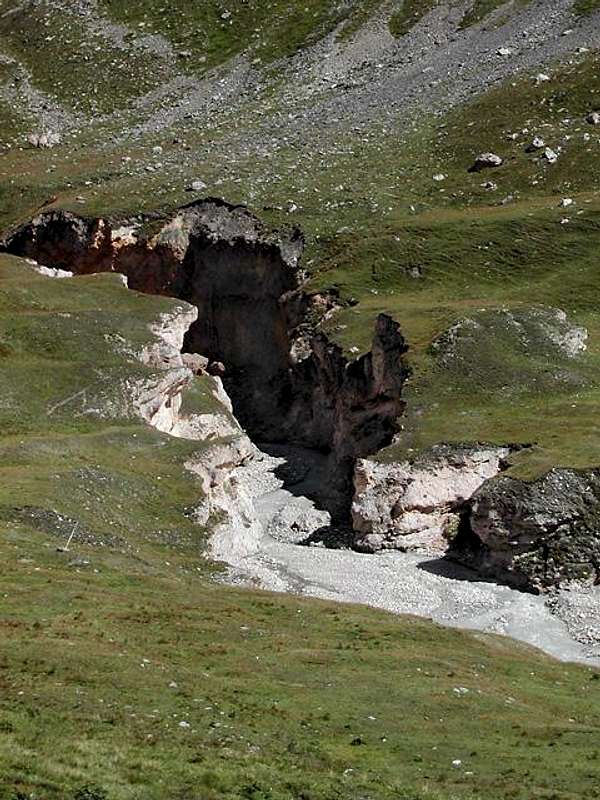
Rhêmes Dora near the famous Introd Bridge with Gorge
Getting There
By car:
- From TORINO, MILANO, etc: Motorway A5. Exit at IVREA or Quincinetto (PIEDMONT)
AOSTA West Villeneuve, Introd, Rhêmes Saint Georges, Notre Dame Municipalities.
![]()
Pellaud between Rhêmes St. Georges Notre Dame
From Aosta Town (East) or from Courmayeur-Resort (West), through the State Road number 27, towards Villeneuve (670m); also by the Motorway A5 from Aosta West (Aymavilles) or from Morgex Communes. From those to the Rhêmes Valley, Introd (880m), Rhêmes Saint Georges (1171m), Rhêmes Notre Dame (1725m) Municipalities, through Main Road, up to the Thumel Village (1879m) with Municipal Road and Benevolo Refuge (2280m), through dirt farms road or path.
- From FRANCE: through the Mont Blanc Tunnel to Entrèves-crossroads to Vény/Ferret Valleys nearby Courmayeur.
![]()
Thumel very ancient Village from Northwest
By Little Saint Bernard Hill, closed since November until half May to La Thuile Valley - Pré Saint Didier - Courmayeur.
It is not necessary to take Motorway A5: you can drive on State Road n° 26, in the direction of AOSTA - IVREA - TURIN.
By plane:
- Aeroporto Internazionale "Corrado Gex" Saint Christophe (Aosta)
The Doire with its Surroundings
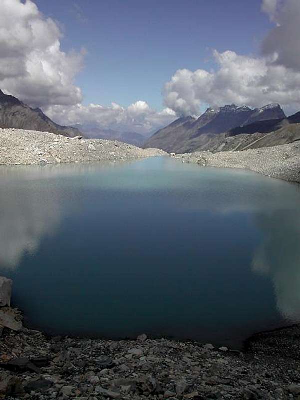
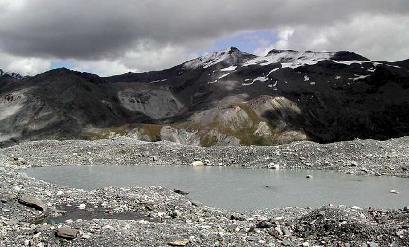
Doire from Thumel Village towards Notre Dame St. Georges & Introd![]() Tsanteleina Upper & Highest Lake at the end of Rhêmes's Valley
Tsanteleina Upper & Highest Lake at the end of Rhêmes's Valley