Toggle navigation
Mountains
Routes
Images
Trip Reports
Forum
What's New
People
Areas & Ranges
Articles
Trailheads
Canyons
Huts & Campgrounds
Albums
Logistical Centers
Fact Sheets
Lists
Custom Objects
Gear
Plans & Partners
WELCOME TO SUMMITPOST
SIGN IN
REGISTER
State Peak
Additional Parents
Image
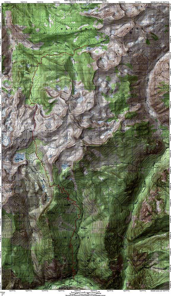
Route Map for State Peak
View High-Resolution Image
Route Map for State Peak
Route from Copper Creek Trailhead to the summit of State Peak. The trail is shown in red, cross-country in blue. Prints best on legal sized paper.
« PREV
NEXT »
mrchad9
on
Aug 6, 2013 12:09 am
Comments & voting
Other parents
Lat/Lon:
36.93194°N / 118.5455°W
Image ID:
859958
1702 Hits
77.48
% Score
8
Votes
Log in to vote
Comments
No comments posted yet.
to post!
Don't have an account?
State Peak
(Mountain/Rock)
« PREV
Viewing
#11 of 15
GALLERY
NEXT »
mrchad9's Image Gallery
« PREV
Viewing
#532 of 636
GALLERY
NEXT »
×
You need to login in order to vote!
User Name
Password
Remember me
Forgot your password?
Log me out when I close my browser.
Keep me logged in all the time.
sign in as a user
Don't have an account?
Register now for FREE
Rating available
Suggested routes for you
People who climb the same things as you
Comments Available
Create Albums
Register Here


