
|
|
Mountain/Rock |
|---|---|
|
|
46.73543°N / 120.42965°W |
|
|
Yakima |
|
|
Hiking |
|
|
Spring, Summer, Fall, Winter |
|
|
3024 ft / 922 m |
|
|
Overview
The Maane Event Reflecting
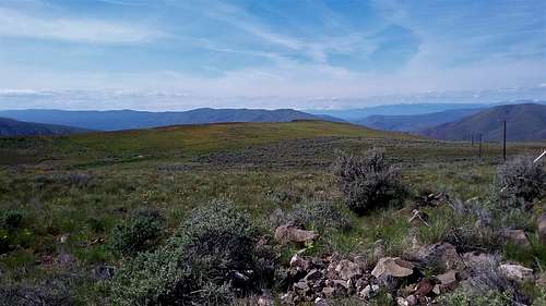
There is a rough road called Saleh Creek Rd located to the south towards the town of Saleh in which provide you have sturdy vehicle you can drive to the top provided the gate is open close to the top. From the little bit that I walked up, the road seemed rough and though some can put there regular vehicles on it I would advise going with a truck myself.
![Map of the Route]()
Map of the Route
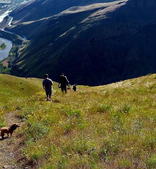
Selah Butte can best be described and a mostly short steep hike with areas of lose footing on the way up. It is 4 miles roundtrip and 1800 feet of elevation gain. The trail up is a walk up but there are parts of the trail that are in and out. The trail is open from bottom to top and in spring, summer, and fall it is home to rattlesnakes so use some caution. ![Heading down the steep trail]()
Heading down the steep trail
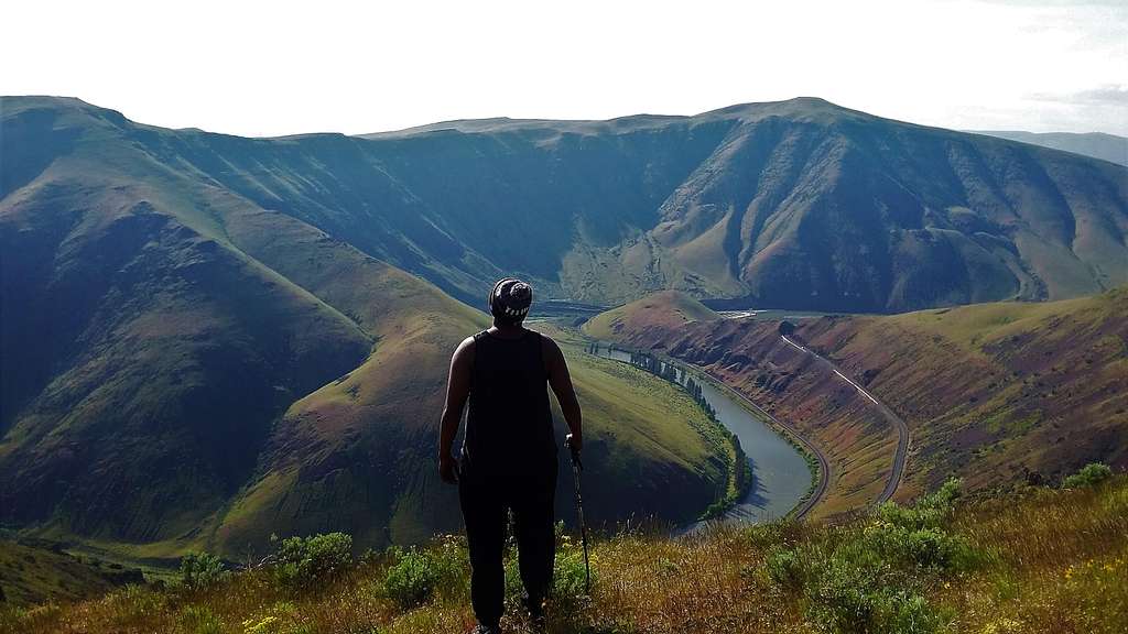
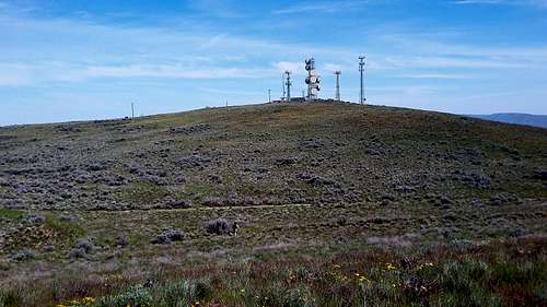
From the parking area you can either take the gradual left trail or the steep right trail up. They will both merge roughly a hundred feet up. From there it is a well beaten trail for 1500 feet of elevation gain all the way to a large poll that mark the top of the ledge and what looks to be the end of the trail. I assume many stop here but this is clearly not the summit. From there walk to your left roughly 200 feet where you pick up a faint jeep path. Take the Jeep Road as it goes over the crest of the hill and drops 75 feet to a jeep path. On the crest of the hill you will be right at the summit of Selah Butte with all of its cell phone towers. You make a left at the Jeep Path and take it all of the way to the summit towers where a great view of Yakima awaits.![View north from the summit]()
View north from the summit
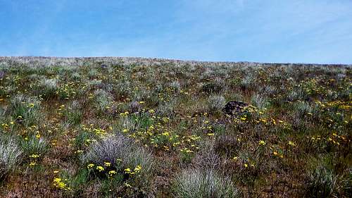
![Spring flowers]()
Spring flowers
You can do this hike at anytime. However in winter be prepared for icy conditions. Springtime is the preferred time to do this hike because the slopes of Yakima Canyon are at their greenest and the balsam root along with other flowers were out. I went during this time and as handsomely rewarded with great weather, great flowers and excellent views.
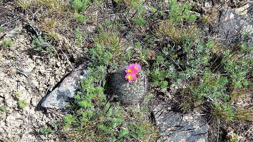
![Cactus flower]()
Cactus flower
Summer time can be very hot and dry in this region. Weather can be over 100 degrees for days at a time because this area is semiarid. I would avoid hiking in this area unless other areas are going to through an unusual rainy summer storm.
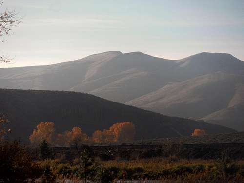
![Selah Butte from Big Pines Campground]()
Selah Butte from Big Pines Campground in fall
Fall can be very scenic as well. Some of the trees below in the canyon change a very beautiful fall color and make for a good foreground for shots of nearby mountains.
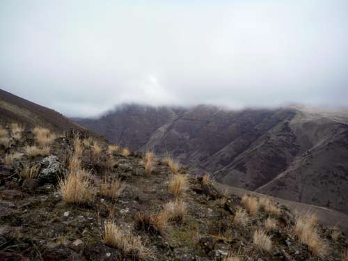
![Looking at Selah Butte]()
Looking at Selah Butte from ridge heading up to Gracie Point
There are also a number of developed camping areas off of 812 such as Big Pines Camping Area, and Untanum Creek Recreation Areas. Many of these campsite do have fees when they are open.
 The summit of Selah Butte | 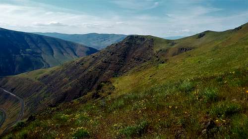 Looking north from the trail to Selah Butte |
 The view from the summit | <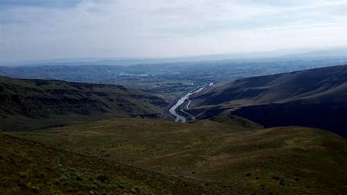 Looking at the southern terminus of Yakima Canyon. |
Getting There
VIA THE TRAILHEAD PULLOUT ON HIGHWAY 812: The parking lot is located just in from the southern terminus of Yakima Canyon. Come off of Exit 26 on Interstate 82 and then head west. Make an immediate right on Highway 812 and head north all the way into Yakima Canyon. Stay north and 4 miles from where you turned will be a nice pullout to park in which 3 to 5 cars can park. There is a trail to the right and the left and both do meetup slightly higher and merge into the route up Selah Butte.Route
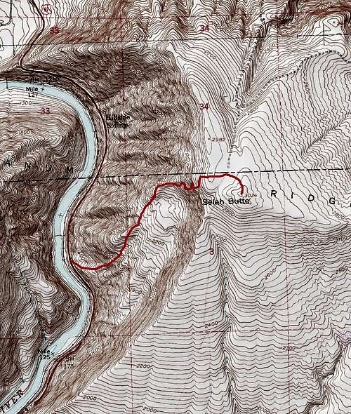
Map of the Route
Heading down the steep trail
From the parking area you can either take the gradual left trail or the steep right trail up. They will both merge roughly a hundred feet up. From there it is a well beaten trail for 1500 feet of elevation gain all the way to a large poll that mark the top of the ledge and what looks to be the end of the trail. I assume many stop here but this is clearly not the summit. From there walk to your left roughly 200 feet where you pick up a faint jeep path. Take the Jeep Road as it goes over the crest of the hill and drops 75 feet to a jeep path. On the crest of the hill you will be right at the summit of Selah Butte with all of its cell phone towers. You make a left at the Jeep Path and take it all of the way to the summit towers where a great view of Yakima awaits.
View north from the summit
Red Tape
There is no red tape for this hike.When to Climb
Spring flowers
Cactus flower
Summer time can be very hot and dry in this region. Weather can be over 100 degrees for days at a time because this area is semiarid. I would avoid hiking in this area unless other areas are going to through an unusual rainy summer storm.
Selah Butte from Big Pines Campground in fall
Fall can be very scenic as well. Some of the trees below in the canyon change a very beautiful fall color and make for a good foreground for shots of nearby mountains.
Looking at Selah Butte from ridge heading up to Gracie Point
Camping
I did not see any rules stopping you if you wanted bivy on the way up. I would strongly advise not to bivy by the cell towers on top because they might have workers working the towers. I would not do it though because I saw two rattlesnakes while I was up there.There are also a number of developed camping areas off of 812 such as Big Pines Camping Area, and Untanum Creek Recreation Areas. Many of these campsite do have fees when they are open.