
|
|
Mountain/Rock |
|---|---|
|
|
48.64559°N / 122.966°W |
|
|
San Juan |
|
|
Hiking |
|
|
Spring, Summer, Fall, Winter |
|
|
931 ft / 284 m |
|
|
Overview
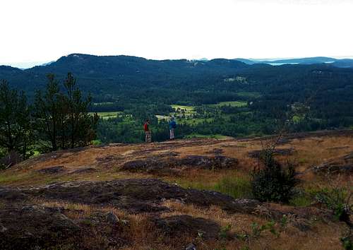
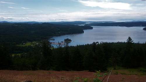
Views from the Ship Peak
Ship Peak, the southern highlight of the Turtleback Mountain Preserve is home to some of the most scenic hiking on the San Juan Island. One could say that it is only beaten by its northern neighbor Orcas Knob (Turtlehead) located on the northern area of the Preserve. Views on the way to Ship Peak from both the north and the south are very beautiful with the true summit having excellent views of Mount Constitution and the eastern San Juan Islands as well as Mount Erie to the south. A good 2.2 mile roundtrip can be done of Ship Peak in which at least 60 percent of the trail has some sort of view. It more than makes up for the actual Turtlehead Mountain which does not have any views on the summit.
At under 100 feet of prominence Ship Peak is more of just a very pretty sub-peak of Turtleback Mountain and it clearly has the bulk of the popularity in the preserve. But if you are just in it for the views than Ship Peak has the vast amount of views on the southern side of the preserve.

Map courtesy of the San Juan Land Trust Bank
Getting There
VIA THE SOUTH TRAILHEAD: From the Orcas Ferry take Orcas Road roughly 2 miles to Deer Harbor Road. Stay on Deer Harbor Road for almost three miles as it traverses the coast. Turn on Wildrose Lane and you will then see the parking area immediately on the righthand side. If you are solely doing Ship Peak this is the trailhead that you want.
VIA THE NORTH TRAILHEAD: From the Orcas Ferry take Orcas Road roughly 2 miles to Deer Harbor Road. Make a left on Deer Harbor Road and then make a right onto Crow Valley Road. Take Crow Valley Road 4 miles north and the North Trailhead will be on your left. Add Getting There text here.
Route
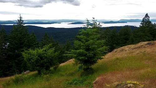
View near Ship Peak
If you are solely focusing on doing the Ship Peak loop you will want to use the South Trailhead. From the South Trailhead take South Trail to the Morning Ridge Trail. From there take it all the way until it reconnect to the Ship Peak Trail 0.3 miles south of Ship Peak. From there take the trail north to the summit. To make it loop continue north 0.3 miles until you reach to the Lost Oakes Trail. You will return down this steeper trail back to the South Trail for a total trip of 2.2 miles and 950 feet of elevation gain. For another additional 3 miles roundtrip and 600 feet of elevation gain you can continue on the Ridge Trail/Center Park/ Raven Ridge Trail/Jeep Path to the true summit of Turtleback Mountain. Be warned though because the bulk of the views are on the Ship Peak Loop.
Views from the Ship Peak
Red Tape
There is no red tape except that this is a day use park onlyWhen to Climb
Views from the Ship Peak
Hiking can be done here at any time of the year. In winter monitor the temperatures and weather and be prepared if there has been snow in the lowlands recently.
Camping
There is no camping allowed on the Land Trust or Preserve.External Links
Information on Turtleback Mountain Conservation
Seattle Times Article on Turtleback Mountain