
|
|
Mountain/Rock |
|---|---|
|
|
47.54991°N / 121.61414°W |
|
|
King |
|
|
Hiking |
|
|
Spring, Summer, Fall, Winter |
|
|
5028 ft / 1533 m |
|
|
Overview
South Bessemer
So what is so great about South Bessemer and why is it becoming such a desired attraction for many winter hikers and climbers in the local area? After all South Bessemer only has 228 feet of prominence and is by Washington definition a sub-peak of Bessemer Mountain also know as North Bessemer. In summertime this peak is a long (13 miles 4200 feet of elevation gain) slog through forest road to the summit of South Bessemer that is often more fit for a mountain bike than a hiker. South Bessemer is nowhere near as desirable as the northern summit of Bessemer in terms of the technical skill needed to climb to the summit. South Bessemer is a true walk up by the easiest route whereas North Bessemer is low Class 5 by most accounts and requires rope work to get to the true summit.
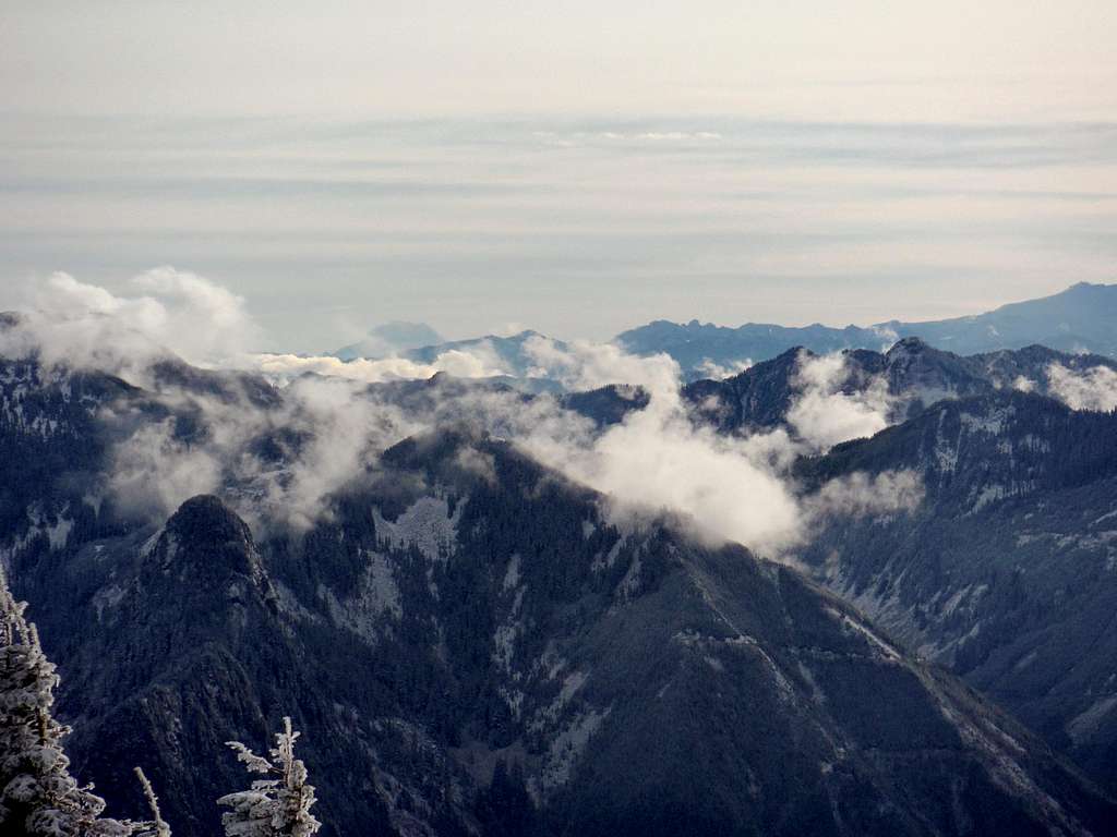
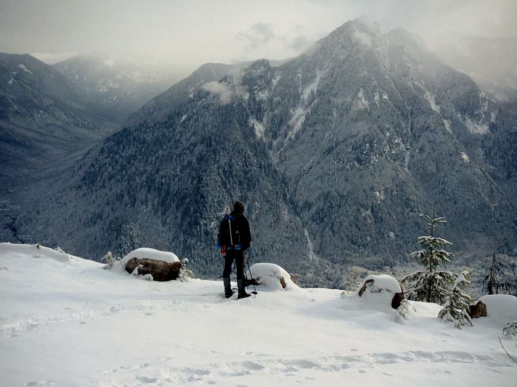
Looking at North Bessemer, the true and more technical highpoint on Bessemer Mountain
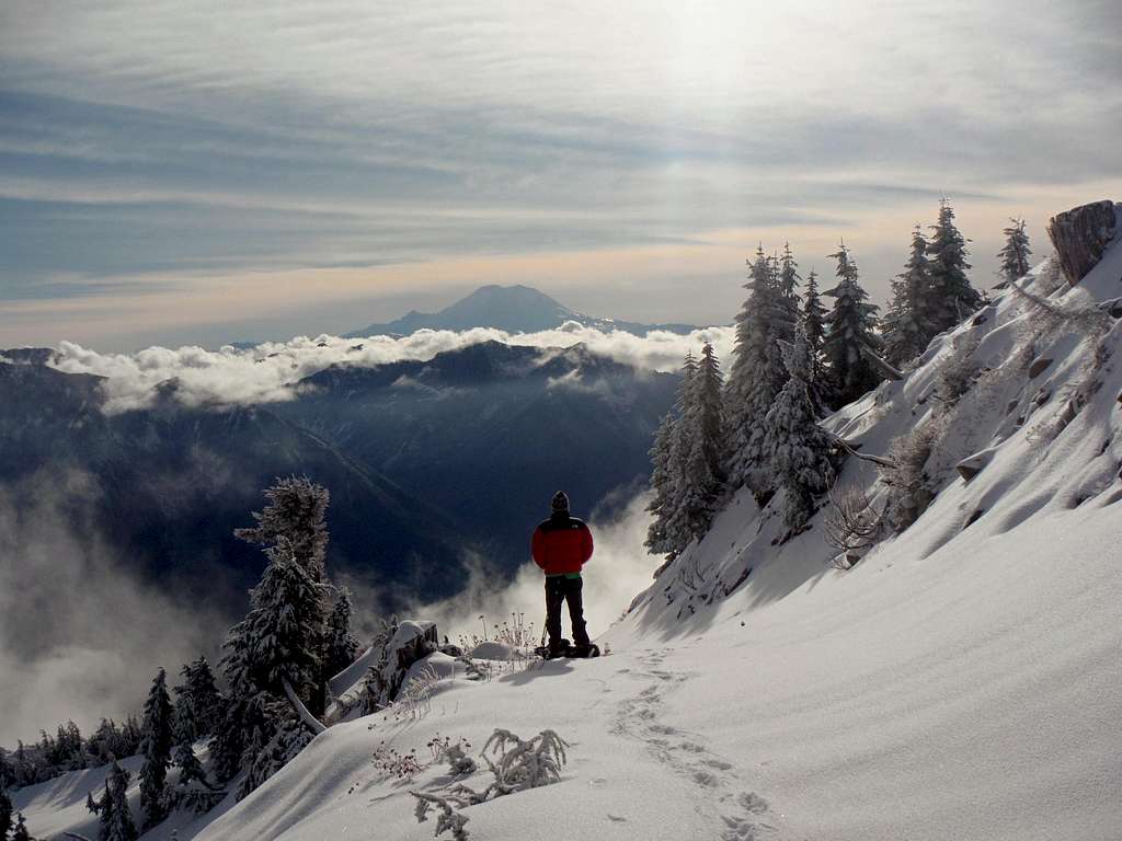
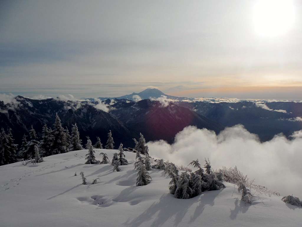
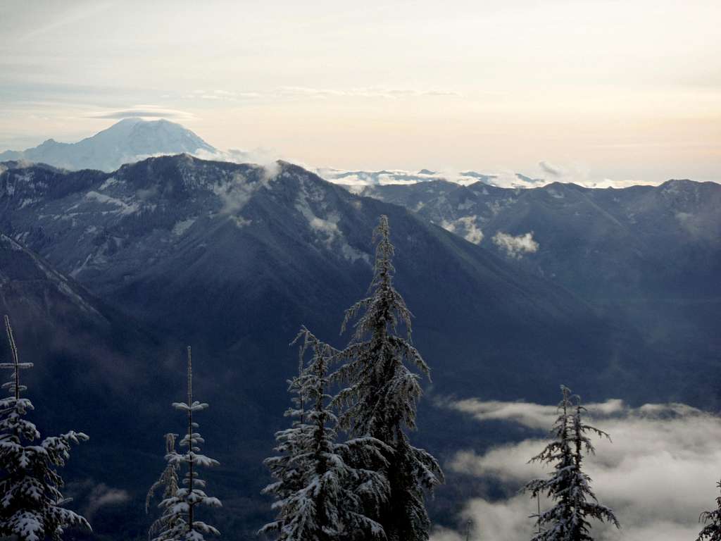
Yes you can see Mount Adams from South Bessemer
That doesn't take into account the winter and shoulder seasons in which many of the hikes and climbs in the region are often compromised by poor snow conditions, high avalanche seasons, or rough conditions over the passes. I would not recommend climbing any mountain in considerable or high avalanche danger. This mountain though is a decent mountain to do in moderate avalanche danger due to the fact that it is mostly a road walk and the slopes are mostly forested. What brought my attention to this mountain is that in the early winter of 2013-2014 the mountains have been receiving below average snowfall. This was leaving many of the other snow routes up other peaks still closed and it kept sketchy talus and boulders open causing iffy conditions on neighboring peaks such as Moolock Mountain. The pure road walk and snowshoe to South Bessemer was the perfect alternative in that it is a safe reliable snowshoe all the way to the summit.
An easier grade forest road takes you to special views
Of course reliability and safety are not the only reason to be heading to the summit of South Bessemer. On a clear day the views of Mount Adams, Mount Rainier , Glacier Peak and Mount Baker cannot be denied along with many other mountains in the region. You can easily see over a hundred mountains in the region. The false summit just below the true summit has the majority of these views while the true highpoint of South Bessemer, which is marked by a tree, has a good view north towards the more technical North Bessemer.
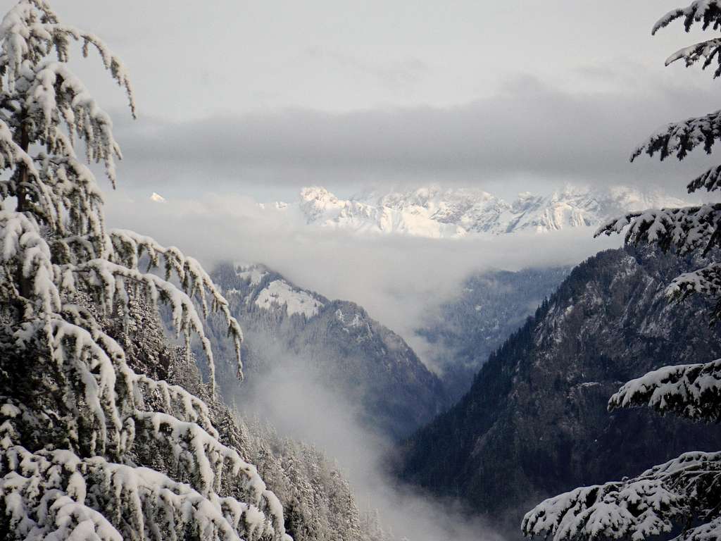
Hi Rainier!!
The popularity for South Bessemer, North Bessemer and Moolock has been growing in the past couple years. So much so that the State of Washington now requires a Discovery Pass at the turnout there. Parking is quiet limited as of 2013 but expect that to change in 2014 when the Middle Fork Road is expected to be paved. As with other mountains in the region such as Mount Teneriffe and Mailbox Peak, expect South Bessemer to continue to grow in popularity as people continue to look for alternative destination from the ever popular Mount Si.
There is a good possibility that more people will head here to see these views.
Getting There
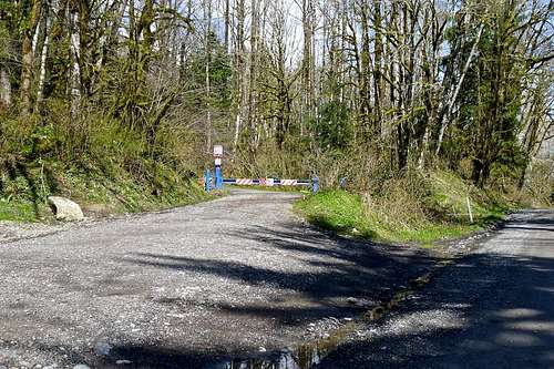
The pull out trailhead.
FROM I-90: From Exit 34 just east of North Bend head north on 486 Ave SE for a half mile. Make a right onto Middle Fork Road and stay on that for 3.0 mile until just past the Mailbox Peak Trailhead it becomes National Forest Road 5600. Stay on it for 5 miles and the turn out will be on your left hand side.
Route
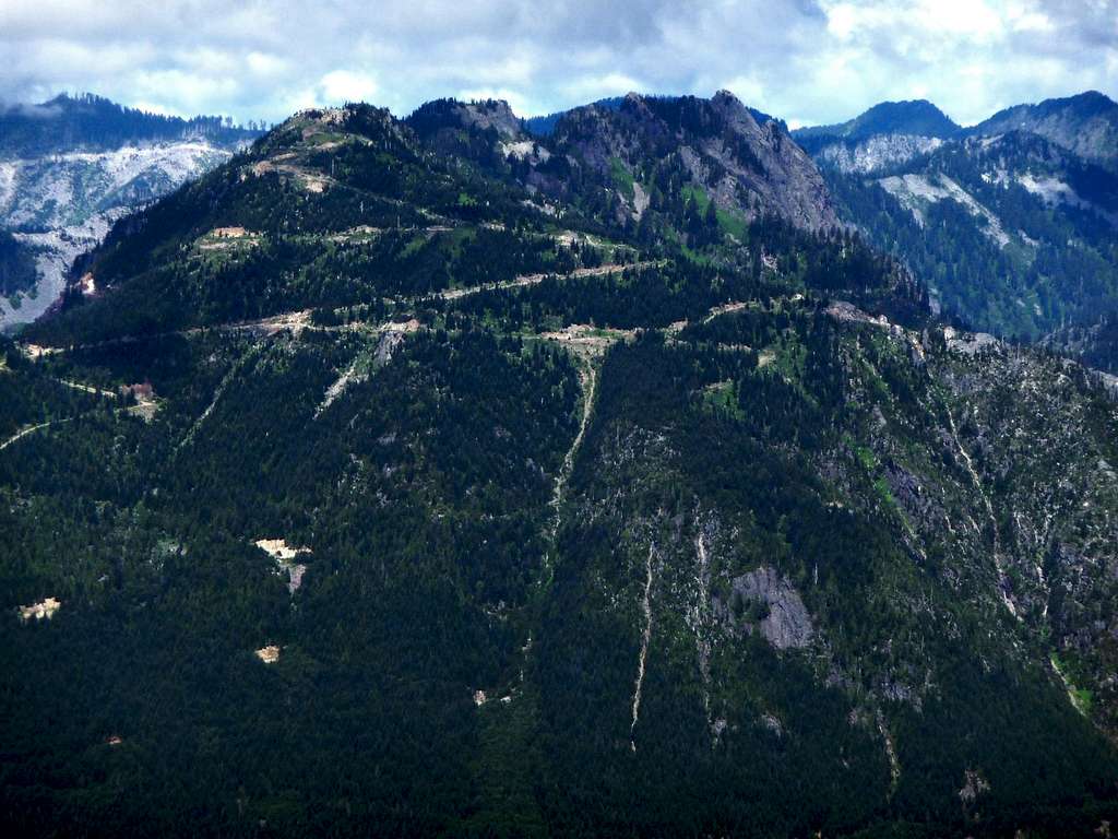
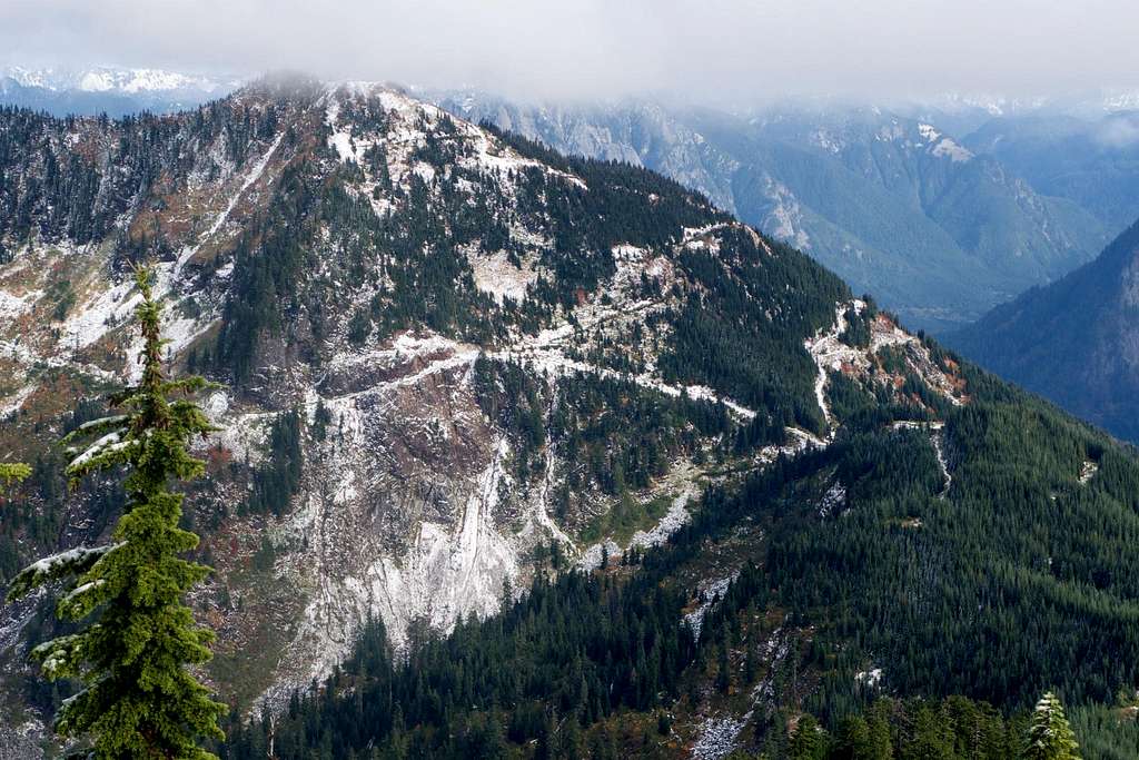
South Bessemer and its forest roads from Thompson Point
The route to the summit will require you to head up a number of logging roads including some that are still acitve. You want to head right up the Bessemer Road. From there you will head up until you see an obvious T section will the left side now gated off. Head right and in a half mile you will in another fork. Head left, and stay on the road as it head more steeply up to South Bessemer. At 1600 feet you will hit some sort of weight station on the side for what appears to be talus mining or logging. Continue up the road as it goes through several long switchbacks and slowly gets steeper.
Zephyrus looking from a point on the road up
At around 3200 feet make a right at a road intersection. This road will get even steeper up until at 5.5 miles you will be feet from a 4000-foot saddle. Make a right hear and continue to head uphill here. Around 4500 feet you will hit another intersection right by a borrow pit. Take a left here on the gradual road (a right will lead you to the route toward North Bessemer) and take the switchbacks right to the summit of South Bessemer. During a heavy winter the high up sections of these roads will be snowed over and you can literally walk right up to the summit ridge. To give you an idea in December the true summit had trees on it whereas by April there was so much snow these the trees were nearly completely covered by snow.
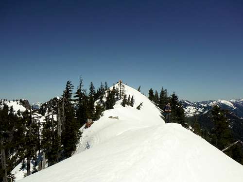
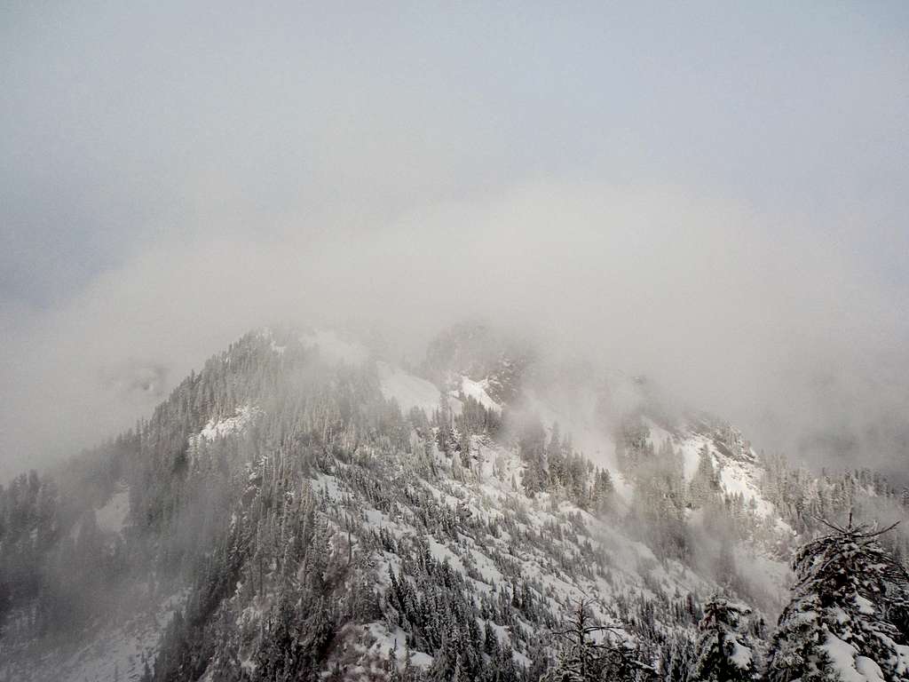
The snowy summit ridge of South Bessemer in April!
Map of the Route
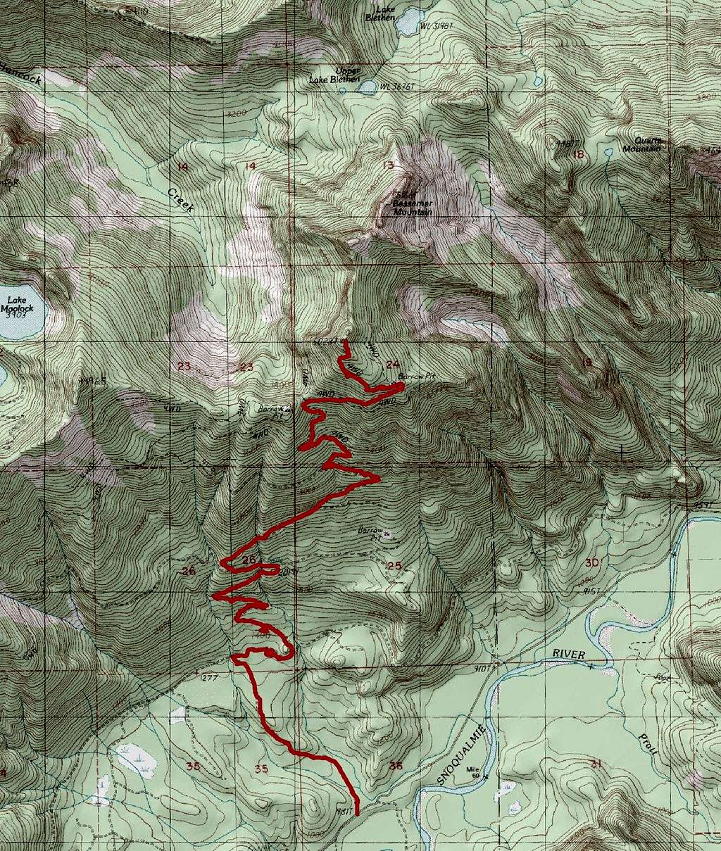
Map of the Route up South Bessemer
Red Tape
A Discover Pass is now required at the trailhead. There is also no kiosk at the trailhead to buy the pass but they are presently sold at all Big 5 Sporting Good Stores, Sports Authority and REI along with many other outdoor stores in the reason. As of 2013 the day pass is $10 while the year pass is $30.When to Climb
You can hike this at any time but I would personally save it for winter myself.
You can climb this summit at any time of the year. I though personally recommend making this a wintertime destination or a side peak when you do the higher North Bessemer in summer. Others like to combine South Bessemer with Moolock Mountain as well.
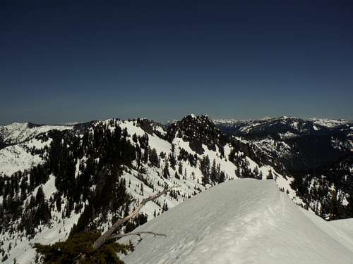
North Bessemer from South Bessemer on a clear April day!
Camping
No camping is allowed in the Mount Si National Resources Conservation Area which is take most of the area west of South Bessemer including the parking area. There is also still traffic on the Bessemer Road so talus mining and forestry is still actively going on in route to South Bessemer. Therefore it is advised to not camp at South Bessemer.External Links
South Bessemer and Moolock Trip ReportA winter South Bessemer Trip
A trip report from Jim Kuresman on South Bessmer
South Bessemer Peakbagger Page