


-
 2230 Hits
-
 80.49% Score
-
 12 Votes
|
|
Mountain/Rock |
|---|---|
|
|
45.74490°N / 7.72217°E |
|
|
Hiking |
|
|
Spring, Summer, Fall, Winter |
|
|
6909 ft / 2106 m |
|
|
Note
|
La montagna chiama i suoi figli, ed essi rispondono fedelmente al suo appello… Osvaldo Cardellina, Diario alpinistico, 1964-65 Page texts: @ OsvaldoCardellina "Osva", passed away on May 2, 2022. Page owners: Christian Cardellina e Osvaldo Cardellina. Any updates from September 12, 2022: Antonio Giani, page administrator, friend and climbing companion. Testi della pagina: @ OsvaldoCardellina "Osva", scomparso il 2 maggio 2022. Proprietari pagina: Christian Cardellina e Osvaldo Cardellina. Eventuali aggiornamenti dal 12 settembre 2022: Antonio Giani, amministratore della pagina, amico e compagno di salite. |
Emarese Overview Brusson
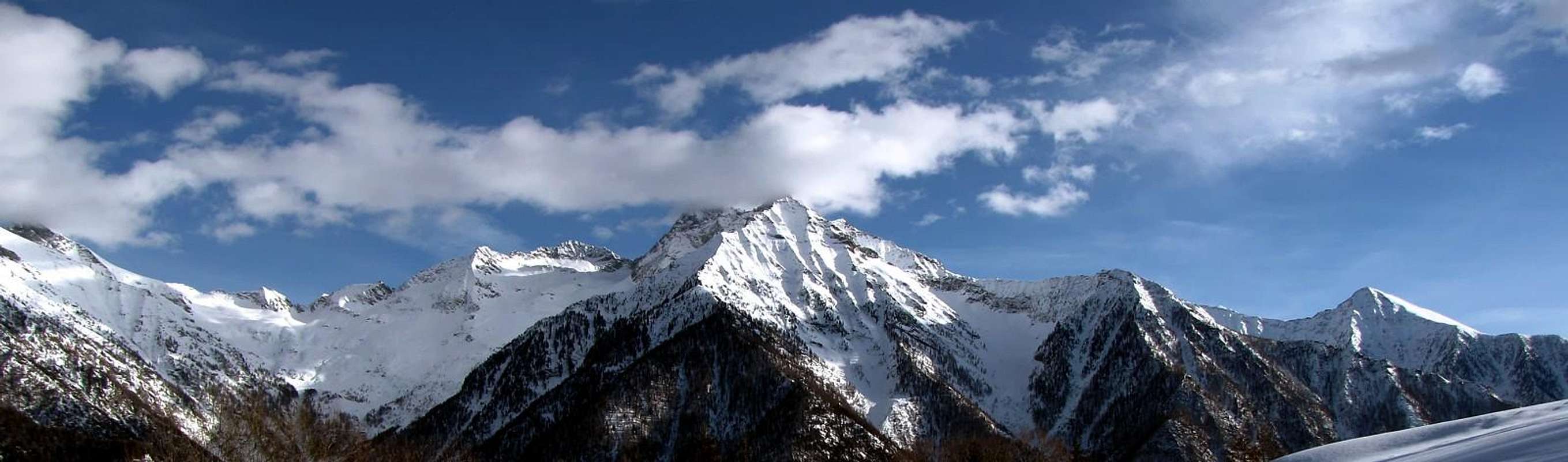 General Landscape of "Dames de Challand between Ayas and Gressoney Valleys from West-northwest by Antonio
This small Summit is located amidst Col Zuccore or Tzecore (1.616m) to the South and Col de Joux ("Jupiter Hill"; 1.639m) in Northwest and front to the two "Dames de Challand" or Vlou and Torché Becca or "Curved" (3.032m, 3.016m), between Val d'Ayas and Lys or Gressoney Valley. More precisely, it is located between the Village of Sommarèse (1.516m) in Southwest and that of Archesaz (1.146m) to the East in the valleyfloor into the adjacent longest and wide Val d'Ayas. A Hilltop already known, traveled and explored by the local Salassians People first and later by the Romans, on the Eastern side of which there had opened a more than important Gold Mine. But if ye are true lovers & you love particular features, the view stretched over the Estoul's numerous and splendid Lakes, just down below in distance between the North Northwest, towards Corno Bussola (+; 3.023m) and Mount Zerbion (2.720m), right above the town of St. Vincent known as the "Riviera of the Alps" ...
![]()
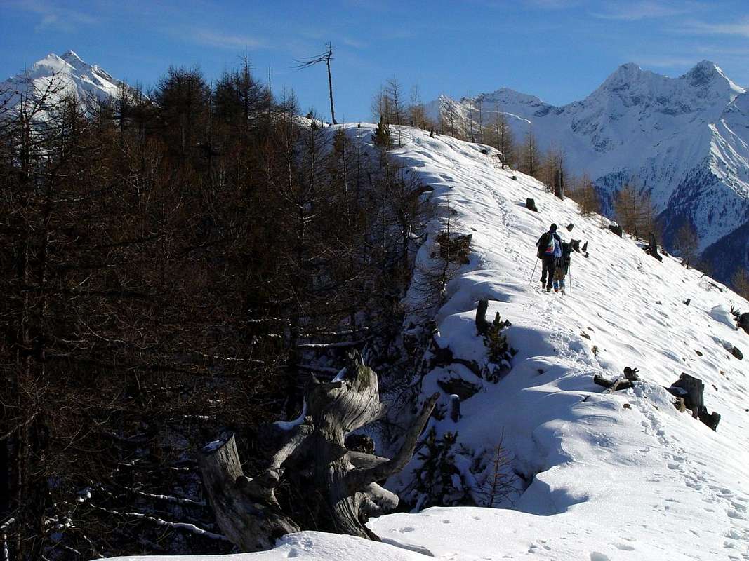
Climbing to Testa Comagna (2.066m) from Tzecore Hill, by emilius 2006
Più precisamente é situata tra il Villaggetto di Sommarèse (1.516 m) a Sudovest e quello di Archesaz (1.146 m) ad Est e sul fondovalle nell'adiacente Val d'Ayas. Una Sommità già conosciuta, percorsa ed esplorata dal Popolo Salasso prima ed in seguito dai Romani, sul fianco Orientale della quale vi avevano aperto una più che importante Miniera di oro. Ma se siete proprio veri amanti delle peculiarietà, allungate la vista sopra ai numerosi e splendidi Laghi di Estoul e, laggiù in fondo tra il Settentrione ed il Nordovest, verso il Corno Bussola (+; 3.023 m) e lo Zerbion (2.720 m), giusto al di sopra della Cittadina di Saint Vincent conosciuta come la "Riviera delle Alpi" ...
![]()
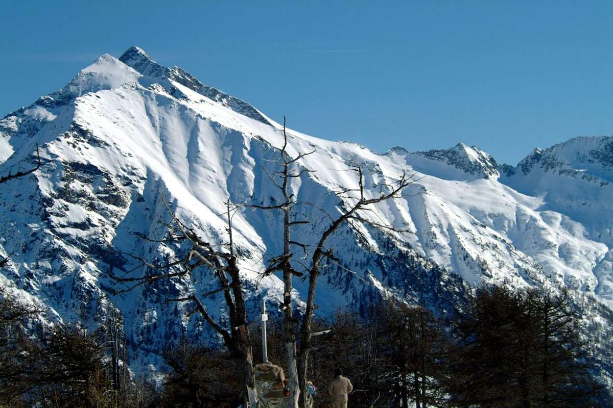
Tête de Comagne Summit cairn with stone altar, by Emilio Bertona 2002
![]()
![]()
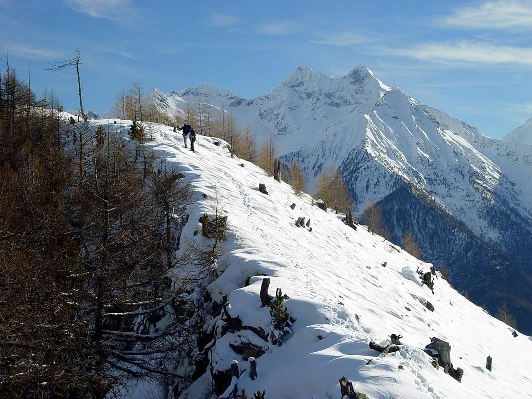
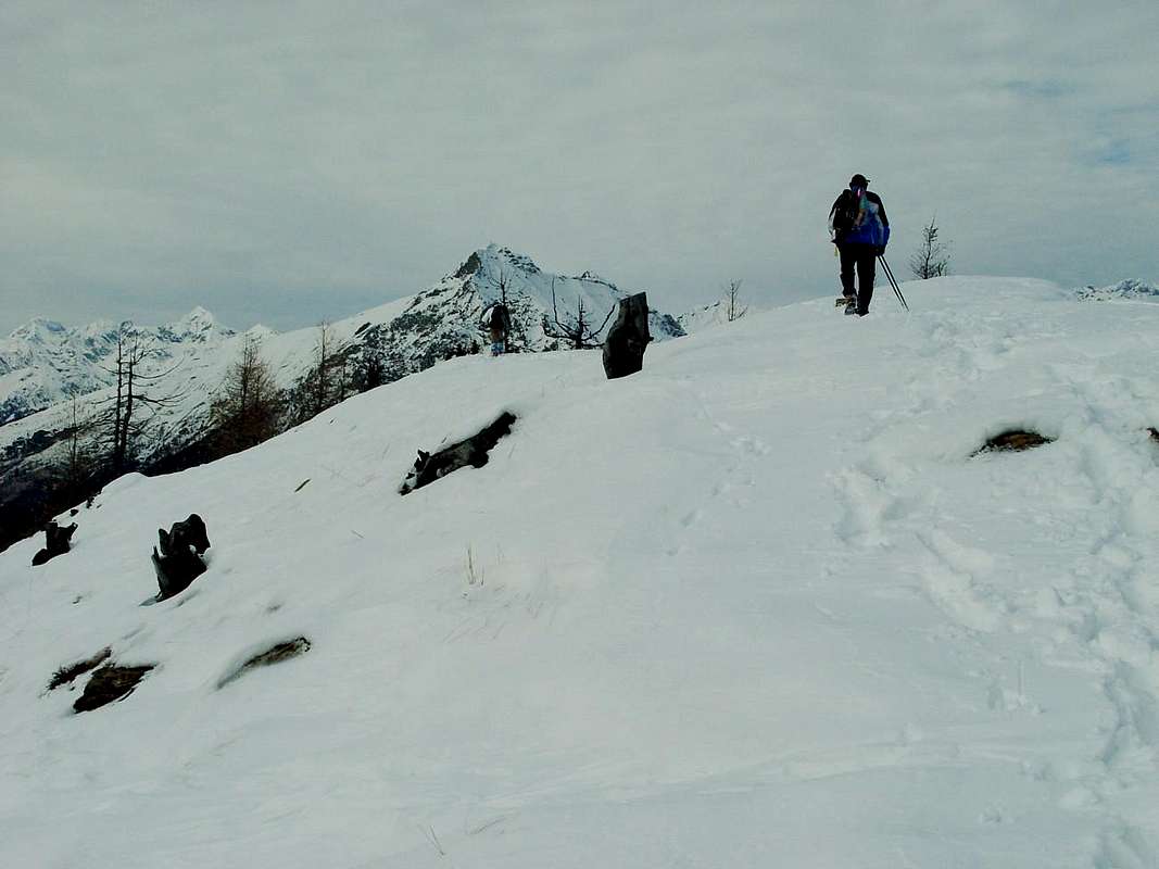
Near the Summit, by emilius 2002
Questa piccola Sommità é collocata tra il Col Zuccore o Tzecore (1.616 m) a Sud ed il Col de Joux ("Colle di Juppiter o di Giove"; 1.639 m) a Nordovest nonché frontalmente alle due "Dames de Challand" ovvero alla Becca di Vlou ed alla Torché o Ricurva (3.032 m, 3.016 m), site tra la Val d'Ayas e Lys o di Gressoney.
Getting There from St. Vincent Montjovet & Verrès
BY CAR:
- From TORINO, MILANO, etc: Motorway A5. Exit at IVREA or Quincinetto (PIEDMONT).
- From IVREA Town: in West (Southern side) to Pont Saint Martin, Verrès, Châtillon, Nus, Aosta in West and to Gignod, Valpelline, Oyace and Bionaz Municipalities in Northeast from Aosta Town. From Courmayeur Resort: in East-southeast (Norheastern side) to Aosta, Gignod, Valpelline, Oyace, Bionaz Municipalities in Northeast and to Nus, Châtillon, Verrès, Pont Saint Martin Communes to South-southeast.
- Northeastern Side: From Nus, Châtillon, Verrès, Pont Saint Martin Municipalities towards Saint Barthélemy, Valtournanche, Val d'Ayas and Gressoney Valleys From Nus (960m), with Regional Road, to Lignan-Saint Barthélemy Municipality; from this, through various dirt roads and numerous paths, (1.628m) up to the Becca de Luseney (Luca Reboulaz Bivouac (2.575m neighbor the Luseney Lake), Livourneaz Pass 2.840m and Cian Fenêtre (2.736m)). From Châtillon (549m), with Regional Road, to Valtournanche and Breuil Cervinia Municipalities (2.004m); from this, through paths in West, to Tsan Bivouac, Lake (2.489m, 2.441m), Cignana Lake (2.149m) or, through dirt road and paths more in East, to Gran Sometta (3.166m). From Verrès (549m), with Regional Road, to Champoluc and Saint Jacques Communes (1.697m); from these, path in West, to Grand Tournalin Refuge (2.544m). From shelter, through path in North, to Mont Brun (2.895m); also in valley floor to Lake Bleu (2.211m) and in East to Pinter Pass (2.776m). From Pont Saint Martin (345m), with Regional Road in Gressoney Valley, to Gressoney La Trinitè (1.468m); from this, through dirt roads and paths in East, up to the Upper Bettolina Pass (3.058m); also in West to Gabiet Loch (2.363m) and from this, with path, to Corno del Camoscio (3.026m).
- Specific Roads from St. Vincent or Montjovet also from Brusson:
- A) - From Saint Vincent or from Montjovet Municipalities with Regional Roads in asphalt towards Northeast or to the Northwest until the Col Zuccore.
- B) - From Brusson Commune through the Regional road always in asphalt to the South-southwest until the Col de Joux.
- From FRANCE: through the Mont Blanc Tunnel to Entrèves-crossroads to Vény/Ferret Valleys - Courmayeur. By Little Saint Bernard Pass, closed since November until half May to La Thuile Valley - Pré Saint Didier - Courmayeur. It is not necessary to take Motorway A5: you can drive on SS.26, in the direction of AOSTA - IVREA - TURIN.
BY PLANE:
- Aeroporto "Corrado Gex" Saint Christophe (Aosta).
Route
Testa di Comagna (2.106m) Approach from Emarese Common towards the Hills of Joux or Zuccore or Tzecore with Regional Road: from Saint Vincent Municipality, with Regional Road to Brusson in Val d'Ayas, towards the Joux Hill (1.635m); from this in ascent through small path n° 6 into rhe forest on Northern Slope to Western Shoulder (around 1.930m) and following traverse, through West Crest, to Tête de Comagne (2.106m; great cairn with altar and Cross in Summit; E; 1h'30/1h'45). Or, through the opposite slope, from Col Zuccore (1.607m), reached with Regional Road by Emarese Common (1.048 m), on North Crest into forest and crossing Monte Zuccore (1.882m) with path n° 5 (E/F; 1h'00/1h'15).
Avvicinamento dal Comune di Emarese con la Strada Regionale verso i Colli di Joux oppure Zuccore o Tzecore: dal Comune di Saint Vincent, tramite la Strada Regionale verso Brusson in Val d'Ayas sino al Col di Joux (1.635 m); da questo in salita con il sentierino n° 6 attraverso la foresta sul Versante Settentrionale dello Spallone Occidentale (circa 1.930 metri) e successiva traversata sulla Cresta Ovest verso la Tête de Comagne (2.106 m; grande ometto con altare votivo e Croce sulla Cima; E; 1h'30/1h'45). Oppure dall'opposto versante tramite il Col Zuccore (1.607 m), raggiungibile con la Strada Regionale da e per il Comune di Emarese (1.048 m), per mezzo della Cresta Meridionale ed attraversando il Monte Zuccore (1.882 m) tramite il sentiero n° 5 sul filo della cresta spartiacque e per brevi tratti di bosco alla Cima (E/F; 1h'00/1h'15).
Equipment & Difficulty
This route can be considered EE/F for the crest watershed.L'itinerario è da classificare in EE/F per la cresta spartiacque.
Equipment For Hiking or by Snowshoes.
 |
 |
 |
 |
 |
Da Escursionismo oppure con Racchette da neve.
Mountain Conditions
- You can get meteo information at the official site of the Regione Valle d'Aosta:
- Valle d'Aosta Meteo
Books and Maps
- "Guida dei Monti d'Italia - Alpi Pennine" (Vol. 2) di Gino Buscaini - Club Alpino Italiano/Turing Club Italiano, Luglio 1970 (In Italian).
- "Diari Alpinistici" di Osvaldo Cardellina e Indice Generale accompagnato da Schedario Relazioni Ascensioni 1964-2019 (unpublished).
 |
 |
- Kompass "Breuil/Cervinia-Zermatt" Carta turistica, 1:50.000.
- I.G.C. Istituto Geografico Centrale "La Valpelline", (carta n° 115) Map1:30.000.
- Hapax "Les Sentiers" Luglio 2000, 1:25.000.
Important Information
- REGIONE AUTONOMA VALLE D'AOSTA the official site.
- FONDAZIONE MONTAGNA SICURA Villa Cameron, località Villard de la Palud n° 1 Courmayeur (AO) Tel: 39 0165 897602 - Fax: 39 0165 897647.
- A.I.NE.VA. (Associazione Interregionale Neve e Valanghe).
Useful numbers
- Protezione Civile Valdostana località Aeroporto n° 7/A Saint Christophe (Ao) Tel. 0165-238222.
- Bollettino Valanghe Tel. 0165-776300.
- Bollettino Meteo Tel. 0165-44113.
- Unità Operativa di Soccorso Sanitario Tel. 118.