Mountains, Hills, and Landmarks: The Effort Scale of Highpointing the Fifty US States
Brief History of Highpointing
Highpointing is the pursuit of reaching the highest elevation within a specified area. The formalization of highpointing each of the 50 US states is credited to the late Jack Longacre when back in 1986 he took notice of people mentioning their highpoint achievement in log books at the top of various summits. As a result, he went on to form the Highpointers Club. Jack became the seventh person to achieve standing on the summits of all 50 US states, and as of year-end 2018 only about 300 more people had followed suit.
The US state highpoints range from landmarks as low as 345 feet to mountains as tall as 20,320 feet. Some highpoints can be driven to, requiring little or no walking effort, whereas others take skilled mountain climbers’ days or even weeks to scale on foot.
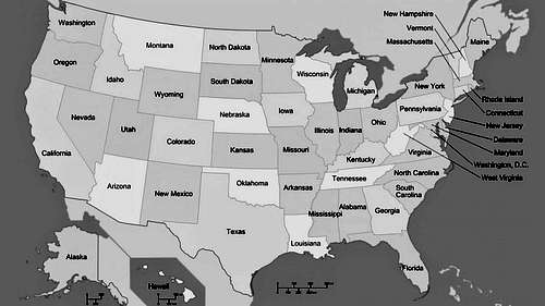
Map of the USA, showing each of the fifty states.
Not a One to One Comparison
Too often people incorrectly equate the effort of reaching one highpoint to that of reaching another; unconsciously assuming that since all are highpoints all amount to equal effort. However, with the highpoints having such a wide range of geographical makeup there are many factors which influence their individual difficulty.
Traits such as prominence, isolation, type of terrain, vertical gain, weather, distance from a road, and natural dangers all influence the struggle (or lack of struggle) of reaching a highpoint. Likewise factors such as personal fitness, experience level, sensitivity to altitude, preparation, risk tolerance, time available, gear required, team size/dynamics, and mental clarity, just to name a few, also influence difficulty. As such difficulty/effort rankings tend to be (and rightly so) mostly a matter of opinion, and personal experience.
One highpointer might avoid walking when a driving option is available, use guides to lead him up the most challenging summits, and/or only venture out in fair weather. Whereas another might tackle highpoints solo or only during winter months, and avoid driving in favor of hiking.
Adding to the confusion, the Highpointers Club offers no hard and fast rules for obtaining a highpoint indorsing “any route to the top” be it by horse, automobile, foot, helicopter, or what have you – leaving the means of ascent to personal choice.
Furthermore, one might also incorrectly assume that a list of the 50 US state highpoints ordered by elevation would suffice as a list of difficulty. Unfortunately, that too falls short. For example, Mt Marcy of New York stands shorter than Nebraska’s Panorama Point with the latter being nothing more than a spot on a prairie requiring no uphill walking and the former being a mountain rising over 3000 feet from the trailhead.
What is Difficulty?
The dictionary defines difficulty as a thing that is hard to accomplish, and effort as strenuous physical exertion. For purposes of this article, and the Effort Scale, difficulty and effort should be considered alternative words.
For some the difficulty of highpointing might be finding the time to pursue the undertaking, or coming up with the money needed. For others it might be very challenging to plan the logistics of highpointing trips. Others might have no interest in visiting landmarks, and their challenge is to find the motivation to do so.
It is impossible to know and to measure all the factors that make a challenge difficult. Thus, for the 50 US state highpoint challenge the Effort Scale considers only measurable and probable variables which when combined result in level of effort.
Effort Scale Explained
The goal of the Effort Scale is to compare how much human-only effort is needed to reach one highpoint, as opposed to another, under one’s own foot-power exclusively. In other words, it is a measure of the walking, hiking, and/or climbing effort from the point where one steps out of the automobile (or plane), and makes his way, under solely his own power, to the highpoint and back down.
The scale does not try to account for all the various routes or means that lead to a highpoint; nor all the things that might happen en route. Rather it derives its measurements based on the least technical standard route, completed within a typical timeframe, with proper acclimation, and under probable average weather. Although the author does not recommend driving to highpoints, the least technical standard route is always the driveable route when such an option exists, meaning the highpoint receives an effort score of 0.
The Effort Scale assigns effort points to each highpoint, with these points being a combination of total hiking mileage, vertical gain, terrain difficulty, nights required, and expected cold weather days. All other factors are exogenous to its model, and for the sake of simplicity must be ignored. Points are totaled for each highpoint, and then convert to a 0 through 1000 scale.
With a magnitude of effort number assigned to each highpoint the Effort Scale is also able to record the percent of physical effort each peak contributes to the whole task of reaching each of the 50 US state highpoints.
Effort Scale Methodology
As the baseline, the Effort Scale assigns one point to each round-trip hiking mile. Hiking distances less than 500 feet are considered insignificant and have been rounded to 0 miles; likewise vertical gains under 20 feet are truncated to 0 feet.
The Effort Scale equates vertical gain to round-trip distance by multiplying vertical gain, in miles, by a difficulty factor and adding that to the baseline. The vertical gain used is an estimate of all elevation gain, including gain related to rising and falling terrain.
The scale considers it to be 15 times more difficult to climb 1 mile then to walk 1 mile, and arrives at this number by comparing the distance a reasonably fit person can walk in an hour to the distance the same person can climb in an hour. It is estimated that 3 miles can be walked in 1 hour, and likewise 1000 vertical feet (0.189394 miles) can be climbed in one hour. Truncating the ratio of 3/0.189394, the Effort Scale arrives at the multiplier of 15. As such the Effort Scale awards 1 point for each 352 feet of gain. Decimal places are carried through to the one and only final rounding.
To the round-trip distance and vertical gain points the scale next accounts for terrain difficulty by adding 6 points if a highpoint involves climbing with the use of both hands and feet, but not the protection of a rope, and 12 points if a highpoint involves roped rock climbing or roped glacier travel. Denali, Gannett Peak, Mount Hood, and Mount Rainier each earn 12 terrain points as they warrant roped glacier travel. Likewise, Granite Peak also earns 12 terrain points as it necessitates roped rock climbing. While Borah Peak earns 6 terrain points as it involves unroped scrambling using both hands and feet.
Next 1 point for each night required is added in. Mount Rainier, Granite Peak, and Kings Peak each earn 2 night points as a typical trip to their respective summits involve staying over for two nights. Mount Whitney earns 1 night point, Gannett Peak 3, and Denali 17.
As a means of accounting for weather, double points are awarded for each day where afternoon temperature can be expected to remain near or below the freezing point. For example, the average summer month temperatures on the summit of Rainier are close to the 32 F freezing point. As such a 3-day trip up Rainier earns 2 weather points for the summit day when the temperature likely will be at or below freezing. On Denali, everyday can remain below freezing so an 18-day trip earns 36 weather points. None of the other highpoints qualify for weather points.
Once the points, and any fractions thereof, are summed the results are rounded and then normalized to a 1 - 1000 scale, to allow easy comparisons.
The equation is as follows: Effort Score= 1000[mileage + 15(vertical distance in miles) + difficulty + nights + 2(temperature)] / [Maximum Points^].
^Maximum points are the total raw points of the highpoint with the most points before conversion to the 0-1000 scale. The table below does not list the raw points. Raw points can be calculated as explained above, or one can contact the author if interested in obtaining the raw points.
Table 1: The Effort Scale of US state Highpoint Difficulty
The table below is ordered by the most physically demanding (highest effort/difficulty) down to the least demanding as determined by the Effort Scale. If one highpoint has the same Effort Scale number as another, the highpoints are ordered alphabetically by US state name – in which case the reader may want to compare vertical gain and round-trip miles as a means of breaking a tie. Although not part of the Effort Scale model, elevation numbers are listed for interest sake and to alert climbers that acclimation techniques, for mountains over 7,500 feet, might need to be part of their climbing preparations.
As previously stated the Effort Scale is based on the least technical standard route which is always the driveable route when such an option exists. Some will find it helpful to see the "0" Effort Scale number and know the highpoint can be driven to within 250 feet and will entail 20 feet (or less) of elevation gain to reach from the parking area.
The round-trip distances and vertical gains listed below are "common knowledge" although they may vary slightly from one source to another. Most of the vertical gain, and round-trip numbers listed below were found on summitpost.org. A summitpost.org article titled "Highpointing by Tom Martin" was extremely useful for confirming vertical gain distances and round-trip miles, and when possible my own field observations and/or measurements from maps were used to further confirm these numbers.
Effort Scale
Highpoint
Vertical Gain (ft)^^
Round-Trip (miles)^^^
1000 (21.96%)
Alaska - Denali (M) 20,320 ft
19000*
39**
506 (11.11%)
Wyoming - Gannett Peak (M) 13,804 ft
8650
40.4
368 (8.08%)
Montana - Granite Peak (M) 12,799 ft
7700
22.2
366 (8.04%)
Washington - Mount Rainier (M) 14,411 ft
9100
16
291 (6.39%)
Utah - Kings Peak (M) 13,528 ft
5350
28.8
263 (5.78%)
California - Mount Whitney (M) 14,497 ft
6750
21.4
222 (4.88%)
Oregon - Mount Hood (M) 11,239 ft
5300
8
181 (3.98%)
Idaho - Borah Peak (M) 12,662 ft
5550
6.8
151 (3.32%)
New York - Mount Marcy (M) 5,344 ft
3200
14.8
147 (3.23%)
Colorado - Mount Elbert (M) 14,433 ft
5000
9
141 (3.10%)
Maine - Katahdin (M) 5,268 ft
4200
10.4
126 (2.77%)
Nevada - Boundary Peak (M) 13,140 ft
4400
7.4
120 (2.64%)
Arizona - Humphreys Peak (M) 12,633 ft
3500
9
106 (2.33%)
Texas - Guadalupe Peak (M) 8,749 ft
2950
8.4
98 (2.15%)
New Mexico - Wheeler Peak (M) 13,161 ft
3250
6.2
81 (1.78%)
Virginia - Mount Rogers (M) 5,729 ft
1500
8.6
68 (1.49%)
Oklahoma - Black Mesa (H) 4,973 ft
775
8.6
64 (1.41%)
South Dakota - Black Elk Peak (M) 7,242 ft
1500
5.8
55 (1.21%)
Minnesota - Eagle Mountain (M) 2,301 ft
600
7
31 (0.68%)
Connecticut - Mount Frissell-South Slope (M) 2,380 ft
450
3.6
29 (0.64%)
North Dakota - White Butte (H) 3,506 ft
400
3.4
28 (0.61%)
Vermont - Mount Mansfield (M) 4,393 ft
550
2.8
27 (0.59%)
Maryland - Backbone Mountain (M) 3,360 ft
750
2.2
21 (0.46%)
Illinois - Charles Mound (H) 1,235 ft
275
2.5
14 (0.31%)
Louisiana - Driskill Mountain (H) 535 ft
150
1.8
12 (0.26%)
Tennessee - Clingmans Dome (M) 6,643 ft
330
1
10 (0.22%)
Arkansas - Magazine Mountain (M) 2,753 ft
225
1
7 (0.15%)
Hawaii - Mauna Kea (M) 13,796 ft
230
0.4
5 (0.11%)
Wisconsin - Timms Hill (H) 1,951 ft
120
0.4
3 (0.07%)
Missouri - Taum Sauk Mountain (M) 1,772 ft
30
0.4
3 (0.07%)
North Carolina - Mount Mitchell (M) 6,684 ft
100
0.2
2 (0.04%)
New Jersey - High Point (H) 1,803 ft
40
0.2
2 (0.04%)
South Carolina - Sassafras Mountain (M) 3,553 ft
50
0.15
2 (0.04%)
West Virginia - Spruce Knob (M) 4,863 ft
20
0.3
1 (0.02%)
Kentucky - Black Mountain (M) 4,139 ft
0
0.1***
1 (0.02%)
Massachusetts - Mount Greylock (M) 3,491 ft
20
0.1
1 (0.02%)
Rhode Island - Jerimoth Hill (H) 812 ft
0
0.2
0
Alabama - Cheaha Mountain (M) 2,407 ft
0
0
0
Delaware - Ebright Azimuth (L) 448 ft
0
0
0
Florida - Britton Hill (L) 345 ft
0
0
0
Georgia - Brasstown Bald (M) 4,784 ft
0
0****
0
Indiana - Hoosier Hill (L) 1,257 ft
0
0
0
Iowa - Hawkeye Point (L) 1,670 ft
0
0
0
Kansas - Mount Sunflower (L) 4,039 ft
0
0
0
Michigan - Mount Arvon (H) 1,979 ft
0
0
0
Mississippi - Woodall Mountain (H) 806 ft
0
0
0
Nebraska - Panorama Point (L) 5,424 ft
0
0
0
New Hampshire - Mount Washington (M) 6,288 ft
20
0
0
Ohio - Campbell Hill (H) 1,550 ft
0
0
0
Pennsylvania - Mount Davis (M) 3,213 ft
0
0
(x.yz%) = Percent of Total Difficulty, M = Mountain, H = Hill, L = Landmark
^^When possible to estimate vertical gain includes all gain, not just the difference between the trailhead and the summit.
^^^Round-trip distances listed are the most recent available as of November 2019. Very rarely, yet possible, routes can have a change of starting point, meaning some of the numbers listed in the Effort Scale are subject to change over time.
* In the case of Denali, the ascent distance doesn’t equal the descent distance because climbers typically repeat sections of the climb for acclimation purposes and in the process of moving up supplies. The West Buttress route from base camp to the summit of Denali is 16.75 miles, but with repeated sections it becomes closer to 22.25 miles on the ascent resulting in a round-trip distance of 39 miles.
** The elevation difference between Denali’s base camp (of the West Buttress Route) and the summit is 13,120 feet. However, with sections being repeated, as explained above, the elevation gain of Denali is listed as 19,000 ft.
*** Black Mountain Ridge road is not maintained, and as such an automobile with decent clearance is advised if attempting to drive to the highpoint of Kentucy.
**** A shuttle bus service is provided from the parking lot to the highpoint of Georgia.
Table 2: The Effort Scale Variation
Many are interested in a variation of the Effort Scale in which routes other than the standard routes are used to reach the highpoint. Since many routes exist for every highpoint it would not be feasible to attempt to account for all of them. However, for interest, the author has listed the routes he used in lieu of the standard driving option for five of the highpoints. The five are highlighted below with a blue background and white text.
Notice how the Effort Scale numbers stay the same for all the highpoints remaining on the standard route. The other five, of course, have a new bigger Effort Scale number. However, because the five non-standard route highpoints require more effort, the effort percentage (listed under each Effort Scale number) changes for most of the other highpoints, as total percentage cannot add up to more than 100%. When the effort percentage of one highpoint changes, one or more others will also change.
Effort Scale
Highpoint
Vertical Gain (ft)^^
Round-Trip (miles)^^^
1000 (20.86%)
Alaska - Denali (M) 20,320 ft
19000*
39**
506 (10.55%)
Wyoming - Gannett Peak (M) 13,804 ft
8650
40.4
368 (7.68%)
Montana - Granite Peak (M) 12,799 ft
7700
22.2
366 (7.63%)
Washington - Mount Rainier (M) 14,411 ft
9100
16
291 (6.07%)
Utah - Kings Peak (M) 13,528 ft
5350
28.8
263 (5.49%)
California - Mount Whitney (M) 14,497 ft
6750
21.4
222 (4.63%)
Oregon - Mount Hood (M) 11,239 ft
5300
8
181 (3.78%)
Idaho - Borah Peak (M) 12,662 ft
5550
6.8
151 (3.15%)
New York - Mount Marcy (M) 5,344 ft
3200
14.8
147 (3.07%)
Colorado - Mount Elbert (M) 14,433 ft
5000
9
141 (2.94%)
Maine - Katahdin (M) 5,268 ft
4200
10.4
129 (2.69%)
New Hampshire - Mount Washington (M) via Tuckerman Ravine 6,288 ft
4300
8.2
126 (2.63%)
Nevada - Boundary Peak (M) 13,140 ft
4400
7.4
120 (2.63%)
Arizona - Humphreys Peak (M) 12,633 ft
3500
9
106 (2.21%)
Texas - Guadalupe Peak (M) 8,749 ft
2950
8.4
98 (2.04%)
New Mexico - Wheeler Peak (M) 13,161 ft
3250
6.2
81 (1.69%)
Virginia - Mount Rogers (M) 5,729 ft
1500
8.6
79 (1.65%)
Vermont - Mount Mansfield (M) via Long Trail 4,393 ft
2800
4.6
68 (1.42%)
Oklahoma - Black Mesa (H) 4,973 ft
775
8.6
64 (1.34%)
South Dakota - Black Elk Peak (M) 7,242 ft
1500
5.8
55 (1.15%)
Minnesota - Eagle Mountain (M) 2,301 ft
600
7
35 (0.73%)
North Carolina - Mount Mitchell (M) via Old Mitchell Trail 6,684 ft
700
3.6
31 (0.65%)
Connecticut - Mount Frissell-South Slope (M) 2,380 ft
450
3.6
29 (0.60%)
North Dakota - White Butte (H) 3,506 ft
400
3.4
27 (0.56%)
Maryland - Backbone Mountain (M) 3,360 ft
750
2.2
21 (0.44%)
Illinois - Charles Mound (H) 1,235 ft
275
2.5
15 (0.31%)
Georgia - Brasstown Bald (M) from the main parking lot (no shuttle) 4,784 ft
400
1.2
15 (0.31%)
Massachusetts - Mount Greylock (M) via AT from Intersection of Rockwell Rd and Summit Rd 3,491 ft
320
1.5
14 (0.29%)
Louisiana - Driskill Mountain (H) 535 ft
150
1.8
12 (0.25%)
Tennessee - Clingmans Dome (M) 6,643 ft
330
1
10 (0.21%)
Arkansas - Magazine Mountain (M) 2,753 ft
225
1
7 (0.15%)
Hawaii - Mauna Kea (M) 13,796 ft
230
0.4
5 (0.10%)
Wisconsin - Timms Hill (H) 1,951 ft
120
0.4
3 (0.06%)
Missouri - Taum Sauk Mountain (M) 1,772 ft
30
0.4
2 (0.04%)
New Jersey - High Point (H) 1,803 ft
40
0.2
2 (0.04%)
South Carolina - Sassafras Mountain (M) 3,553 ft
50
0.15
2 (0.04%)
West Virginia - Spruce Knob (M) 4,863 ft
20
0.3
1 (0.02%)
Kentucky - Black Mountain (M) 4,139 ft
0
0.1***
1 (0.02%)
Rhode Island - Jerimoth Hill (H) 812 ft
0
0.2
0
Alabama - Cheaha Mountain (M) 2,407 ft
0
0
0
Delaware - Ebright Azimuth (L) 448 ft
0
0
0
Florida - Britton Hill (L) 345 ft
0
0
0
Indiana - Hoosier Hill (L) 1,257 ft
0
0
0
Iowa - Hawkeye Point (L) 1,670 ft
0
0
0
Kansas - Mount Sunflower (L) 4,039 ft
0
0
0
Michigan - Mount Arvon (H) 1,979 ft
0
0
0
Mississippi - Woodall Mountain (H) 806 ft
0
0
0
Nebraska - Panorama Point (L) 5,424 ft
0
0
0
Ohio - Campbell Hill (H) 1,550 ft
0
0
0
Pennsylvania - Mount Davis (M) 3,213 ft
0
0
Conclusions
The Effort Scale reflects the Pareto Principle which states that for most tasks roughly 80% of the results come from 20% of the effort. According to the Effort Scale reaching 39 of the 50 highpoints (aka 78%) requires only 20.14% of the effort. The remaining 11 highpoints (aka remaining 22%) requires 79.86% of the effort.
The Effort Scale classifies highpoints as mountains, hills, and landmarks. Conventionally a mountain is a landform that rises significantly above its surroundings, generally exhibiting steep slopes, a relatively confined summit area, and obvious prominence. Comparably, a hill is a raised section of land, typically not as elevated or rugged as a mountain. Even less prominent, a landmark is understood to be a highpoint which is neither a mountain nor a hill. As far as the Effort Scale is concerned hills are understood to be easier to climb than mountains, with landmarks being the easiest of the three to reach requiring no significant physical effort. The Effort Scale considers 34 of the 50 U.S. State Highpoints to be mountains and they require 96.93% of the effort. Another ten are deemed hills requiring 3.07% of the effort. The remaining 6 are branded as landmarks which contriubte nothing to the total effort.
Denali has a score basically twice as large as any of the other mountains, plainly showing it requires twice as much effort to climb than its next counterpart. In fact, it requires the next two highest ranking mountains plus one other to come close to its score – meaning one would need to climb Gannett, Granite, and at least one more highpoint to compare to the effort of climbing Denali.
The average effort score is 91 (73 without Denali), whereas the highest 10 have an average of 350 (264 without Denali). Denali alone has a score of 1000.
There really is no comparison between reaching a drive-up landmark and that of climbing a mountain, and the Effort Scale reflects this. If one divides the score of any mountain, for instance Mount Elbert of Colorado by the score of any of the zero ranked landmarks, such as Ebright Azimuth of Delaware, the result is mathematically undefined telling us there is no comparison. Whereas if one divides the score of Mount Elbert by the score of West Virginia’s Spruce Knob (for example) he learns that Mount Elbert requires 73.5 times more effort to summit.
For any combination of highpoints, summing the percentage number listed below their Effort Scores of Table 1, reveals the proportion of effort those highpoints jointly contribute to the total effort of ascending all. For example, 3.10% for Katahdin plus 2.33% for Guadalupe Peak plus 0.11% for Timms Hill informs us that those three combined contribute 5.54% to the total effort of reaching the highest spot in every US state.
About the Author
The Author
The author’s highpointing calling reaches back to May 2001 when he and two friends, having never heard of highpointing, drove to the top North Carolina’s Mount Mitchell. By the fall of that same year he tagged a second highpoint without yet having a goal to reach all fifty. Over the next eight years he completed another six, followed by another seven between 2010 and his 2014 climb of Denali. Following Denali he tagged another four, and then went into highpointing hibernation for over four years. August 2019 his highpointing desire returned and over the next couple of months he increased his highpoint count to twenty-nine.
Recognizing his remaining twenty-one highpoints seem less physically severe, the author began to wonder what percent of the total physical effort he had remaining. As such he developed the Effort Scale. Although his remaining highpoints account for less than 4.0% of the overall physical effort he knows they will not come without other types of struggles. He is not holding himself to it, but he hopes to complete all fifty within a twenty-year timeframe before June 2021.
As of October 21, 2020 the author completed Alaska and the lower 48 states, leaving only Hawaii to go.
Due to the world-wide COVID-19 pandemic travel to Hawaii proved to be excessively problematic prior to July 2021. Once Hawaii opened to fully USA vaccinated travelers the author straight away visited the Big Island. By summiting Mauna Kea July 22, 2021, he concluded the amazing pursuit of standing on the highest point of each of the 50 US states. This huge, worthwhile, goal spanned 20 years and 2 months! Read my Summitpost Article about my US State Highpointing Journey.
The insights, experimental results, observations, formulas, and conclusions contained in this article are my own - anyone assuming otherwise is mistaken. Likewise, anyone attempting to take credit for, or claiming they influenced this article, is also mistaken. This article was derived solely from common knowledge (for example elevations, and distances), and from my own thoughts. No one aided me in writing this article and no one besides me has edited this article - it has been, indeed, a solo effort.
Highpoint Quiz
Test your knowledge of the US State highpoints with this 50 question quiz! The answer key follows, at the bottom, after the last question.
1.On which high point is someone buried?
a.Backbone Mountain, MD
b.Kings Peak, UT
c.Panorama Point, NB
d.Mount Mitchell, NC
2.Which peak is the highest in the Allegheny Mountains?
a.Denali, AK
b.Mount Whitney, CA
c.Black Elk Peak, SD
d.Spruce Knob, WV
3.Hoye Crest is located upon which mountain?
a.Mount Arvon, MI
b.Backbone Mountain, MD
c.Timm’s Hill, WI
d.Mount Davis, PA
4.During the busy summer months which high point employees a Summit Steward to protect its alpine ecosystem?
a.Mount Roger, VA
b.Mount Marcy, NY
c.Eagle Mountain, MN
d.Jerimoth Hill, RI
5.Of the following four high points which requires the most hiking distance
a.Mount Elbert, CO
b.Katahdin, ME
c.Mount Sunflower, KS
d.Kings Peak, UT
6.The Wind Rivers Range is home to which high point?
a.White Butte, ND
b.Mount Washington, NH
c.Mount Hood, OR
d.Gannett Peak, WY
7.Chicken Out Ridge is crossed to obtain which high point?
a.Clingmans Dome, TN
b.Borah Peak, ID
c.Black Mesa, OK
d.Denali, AK
8.More than 130 people have perished on Mount Hood, OR?
a.True
b.False
9.This mountain is the tallest of North America's Rocky Mountains
a.Mount Elbert, CO
b.High Point, NJ
c.Granite Peak, MT
d.Mount Whiteny, CA
10.This high point is a volcano which last erupted in 1894
a.Driskill Mountain, LA
b.Humphreys Peak, AZ
c.Mount Rainer, WA
d.Guadalupe Peak, TX
11.San Francisco Mountain is home to which high point?
a.Charles Mound, IL
b.Wheeler Peak, NM
c.Mount Whitney, CA
d.Humphreys Peak, AZ
12. This high point is less than 80 miles from the lowest point in the USA.
a.Mount Whitney, CA
b.Denali, AK
c.Granite Peak, MT
d.Mount Elbert, CO
13.Which is the 10th tallest high point?
a.Brasstown Bald, GA
b.Mauna Kea, HI
c.Granite Peak, MT
d.Mount Elbert, CO
14.Climbers typically begin hiking from the Taos ski resort to access this high point
a.Mount Wheeler, NM
b.Mount Hood, OR
c.Mount Greylock, MA
d.Sassafras Mountain, SC
15. Which high point is only 90 miles from the US/Mexico border
a.Driskill Mountain, LA
b.Guadalupe Peak, TX
c.Wheeler Peak, NM
d.Mount Whitney, CA
16.The southernmost high point is
a.Woodall Mountain, MS
b.Britton Hill, FL
c.Guadalupe Peak, TX
d.Mauna Kea, HI
17.The West Buttress Route on Denali was established in what year and by who?
a.1948 Edmund Hillary
b.1951 Bradford Washburn
c.1962 Ed Viesturs
d.1971 Reinhold Messner
18.Boundary Peak NV, is located in Great Basin National Park
a.True
b.False
19.Buffalo maybe spotted on which high point?
a.Black Elk Peak, SD
b.White Butte, ND
c.Panorama Point, NE
d.Borah Peak, ID
20.This high point was formerly named Harney Peak
a.Black Elk Peak, SD
b.Hawkeye Point, IA
c.Hoosier Hill, IN
d.Ebright Azimuth, DE
21.According to the United States Forest Service this high point, although located on private land, is within the boundaries of the Little Missouri National Grassland
a.Taum Sauk Mountain, MO
b.Magazine Mountain, AK
c.Campbell Hill, OH
d.White Butte, ND
22.The 2,200 mile Appalachian Trail terminates at this high point
a.Jerimoth Hill, RI
b.Mount Marcy, NY
c.Katahdin, ME
d.Mount Mansfield, VT
23. This high point has had a cat living in the summit Observatory since 1932
a.Mount Washington, NH
b.High Point, NJ
c.Greylock, MA
d.Brasstown Bald, GA
24.This high point is on a mountain that resembles the profile of a human face
a.Mount Mansfield VT
b.Black Mesa, OK
c.Cheaha Mountain, AL
d.Spruce Knob, WV
25.Legend has it this high points long, saddle-like profile inspired Herman Melville to write Moby Dick
a.Mt. Frissell Shoulder, CT
b.Sassafras Mountain, SC
c.Greylock, MA
d.Black Mountain, KY
26.Which of the following highpoints is on the border of two states?
a.Sassafras Mountain, SC
b.Mount Sunflower, KS
c.Granite Peak, MT
d.Ebright Azimuth, DE
27.Destructive practices by lumber companies resulted in deer having to be reintroduced to this high point in the early 1900s.
a.Clingmans Dome, TN
b.Brasstown Bald, GA
c.Woodall Hill, MS
d.Black Mountain, KY
28.Clingmans Dome, TN is located within a National Park?
a.True
b.False
29.Due to hollowed out coal veins under this high point conspiracists claim it could cave in
a.Mount Rainer, WA
b.Black Mountain, KY
c.Taum Sauk Mountain, MO
d.Black Elk Peak, SD
30.Wild ponies live on this high point
a.Hoosier Hill, IN
b.Panorama Point, NE
c.Boundary Peak, NV
d.Mount Rogers, VA
31.This high point includes a library on its summit
a.Mount Sunflower, KS
b.Britton Hill, FL
c.Ebright Azimuth, DE
d.Denali, AK
32.This plateau reaches three states forming the highest point in one of those states
a.Wheeler Peak, NM
b.Hoosier Hill, IN
c.Black Mesa, OK
d.Charles Mound, IL
33.This one is located only 14 miles from the USA/Canada border
a.Mount Rainer, WA
b.Granite Peak, MT
c.White Butte, ND
d.Eagle Mountain, MN
34.Located in the Huron Mountains is
a.Mount Arvon, MI
b.Mount Marcy, NY
c.Borah Peak, ID
d.High Point, NJ
35.This high point is the only one located within a county park
a.Timm’s Hill, WI
b.Backbone Mountain, MD
c.Hawkeye Point, IA
d.Katahdin ME
36.Corn has been grown on, or near, this highpoint
a.Panorama Point, NE
b.Hawkeye Point, IA
c.Guadalupe Peak, TX
d.Cheaha Mountain, AL
37. The private owners of which highpoint typically only allow visitors the first full weekends of June, July, August and September
a.Black Mountain, KY
b.Jerimoth Hill, RI
c.Charles Mound, IL
d.Driskill Mountain, LA
38.The long distance Ozark trail crosses directly over the highest point of Taum Sauk Mountain, MO?
a.True
b.False
39.Mt. Nebo a neighbor to this high point used to be called by the same name as this high point
a.Magazine Mountain, AR
b.Taum Sauk Mountain, MO
c.Wheeler Peak, NM
d.Britton Hill, FL
40.The Mt. Zion Presbyterian Church is associated with this high point
a.Mt. Frissell Shoulder, CT
b.Sassafras Mountain, SC
c.Driskill Mountain, LA
d.Black Mountain, KY
41.All the signs at this high point are labeled “Lakewood Park”, and the name the high point is commonly known as cannot be found.
a.Jerimoth Hill, RI
b.Ebright Azimuth, DE
c.Britton Hill, FL
d.Panorama Point, NE
42.The observation tower on this high point has walls as thick as six feet
a.Cheaha Mountain, AL
b.High Point, NJ
c.Spruce Knob, WV
d.Mount Mitchell, NC
43.This high point has Civil War significance due to a fierce and deadly battle fought between Confederate and Union soldiers in its immediate vicinity
a.Mount Rogers, VA
b.Woodall Mountain, MS
c.High Point, NJ
d.Brasstown Bald, GA
44.This high point has ties to the Cold War
a.Campbell Hill, OH
b.Borah Peak, ID
c.Mount Sunflower, KS
d.Hoosier Hill, IN
45.Arthur Harmon Marshall the first person to reach the highest point in each US state completed the task on which high point?
a.Guadalupe Peak, TX
b.Hoosier Hill, IN
c.Denali, AK
d.White Butte, ND
46.This high point is located on Negro Mountain
a.Mount Davis, PA
b.Ebright Azimuth, DE
c.Black Mesa, OK
d.Mount Whitney, CA
47.This high point is contained within a suburban neighborhood and its exact natural location may not be known.
a.Granite Peak, MT
b.Campbell Hill, OH
c.Ebright Azimuth, DE
d.Panorama Point, NE
48.This one is the highest point along the Kittatinny Mountains
a.High Point, NJ
b.Backbone Mountain, MD
c.Hawkeye Point, IA
d.Katahdin ME
49.This high point is typically accessed from a neighboring state
a.Mount Greylock, MA
b.Taum Sauk Mountain, MO
c.Mt. Frissell Shoulder, CT
d.Eagle Mountain, MN
50.This high point is only 40 miles from the Atlantic Ocean
Each highpoint name is followed by its elevation then the order in which I reached it. Learn more about my journey to the top of each U.S. state by reading Fifty Pinnacles.
Alabama: Cheaha Mountain, 2,407 ft. Number 41.
Alaska: Denali, 20,320 ft. Number 16.
Arizona: Humphreys Peak, 12,633 ft. Number 11.
Arkansas Magazine Mountain, 2,753 ft. Number 38.
California: Mount Whitney, 14,497 ft. Number 12.
Colorado: Mount Elbert, 14,433 ft. Number 8.
Connecticut: Mount Frissell at CT/MA border, 2,380 ft. Number 48.
Delaware: Ebright Azimuth, 448 ft. Number 46.
Florida: Britton Hill, 345 ft. Number 40.
Georgia: Brasstown Bald, 4,784 ft. Number 26.
Hawaii: Mauna Kea, 13,796 ft. Number 50.
Idaho: Borah Peak, 12,662 ft. Number 7.
Illinois: Charles Mound, 1,235 ft. Number 36.
Indiana: Hoosier Hill, 1,257 ft. Number 44.
Iowa: Hawkeye Point, 1,670 ft. Number 35.
Kansas: Mount Sunflower, 4,039 ft. Number 30.
Kentucky: Black Mountain, 4,139 ft. Number 28.
Louisiana: Driskill Mountain, 535 ft. Number 39.
Maine: Katahdin, 5,267 ft. Number 21.
Maryland: Backbone Mountain, 3,360 ft. Number 3.
Massachusetts: Mount Greylock, 3,491 ft. Number 24.
Michigan: Mount Arvon, 1,979 ft. Number 33.
Minnesota: Eagle Mountain, 2,301 ft. Number 32.
Mississippi: Woodall Mountain, 806 ft. Number 42.
Missouri: Taum Sauk Mountain, 1,772 ft. Number 37.
Montana: Granite Peak, 12,799 ft. Number 13.
Nebraska: Panorama Point, 5,424 ft. Number 18.
Nevada: Boundary Peak, 13,140 ft. Number 17.
New Hampshire: Mount Washington, 6,288 ft. Number 22.
New Jersey: High Point, 1,803 ft. Number 47.
New Mexico: Wheeler Peak, 13,161 ft. Number 14.
New York: Mount Marcy, 5,344 ft. Number 4.
North Carolina: Mount Mitchell, 6,684 ft. Number 1.
North Dakota: White Butte, 3,506 ft. Number 20.
Ohio: Campbell Hill, 1,549 ft. Number 43.
Oklahoma: Black Mesa, 4,973 ft. Number 31.
Oregon: Mount Hood, 11,239 ft. Number 9.
Pennsylvania: Mount Davis, 3,213 ft. Number 45.
Rhode Island: Jerimoth Hill, 812 ft. Number 49.
South Carolina: Sassafras Mountain, 3,553 ft. Number 25.
South Dakota: Black Elk Peak, 7,242 ft. Number 19.
Tennessee: Clingmans Dome, 6,643 ft. Number 27.
Texas: Guadalupe Peak, 8,749 ft. Number 15.
Utah: Kings Peak, 13,528 ft. Number 5.
Vermont: Mount Mansfield, 4,393 ft. Number 23.
Virginia: Mount Rogers, 5,729 ft. Number 29.
Washington: Mount Rainier, 14,411 ft. Number 10.
West Virginia: Spruce Knob, 4,863 ft. Number 2.
Wisconsin: Timm’s Hill, 1,951 ft. Number 34.
Wyoming: Gannett Peak, 13,804 ft. Number 6.
Elevations may vary slightly from one reference source to another.
Regarding highpoint names, for the most part I have followed common conventions. A highpoint contained on a mountain top is typically named the same as the mountain. Occasionally the highpoint goes by the name of the highest peak such as with Pennsylvania. The highpoint of Connecticut is a unique case as it is located on the shoulder of Mount Frissell directly on the border with Massachusetts making it a “liner.” To make that clear I refer to it as “Mount Frissell at CT/MA border” rather than “Mount Frissell – Southwest Shoulder.”
As someone who has almost no interest in highpointing, I still found this a very interesting and worthwhile read. I suppose one of the things that kind of put me off about highpointing was living in Nebraska for several years. There are some very beautiful and challenging scrambles on ranked summits in the Pine Ridge and the Wildcat Hills. Yet, these are often ignored by many that would prefer the drab and unchallenging highpoint of Nebraska to be of greater value.
I suppose highpointers would heartily disagree with me, but summits at the higher end of the Effort Scale seem worthwhile and memorable, while the stuff at the other end of the scale seems tedious. However, as the old saying goes, "to each his own". If this is where your interest is, more power to you. Thanks for posting this.
Thanks for taking the time to read it! I'm grateful for your comment. I mention in the article that for some the difficulty of highpointing is finding the motivation to visit landmarks (and we might add "just to check a box"). I suppose that is why I have done all the more difficult one first. I also have reasoned that, if necessary, I can save the landmarks and drive ups for my golden years. However this year I have visited a lot of less challenging highpoints and I have been very pleased with how much I enjoyed them. This endeavor is also an excuse to get out on vacations and to see new places, and so it's not just about climbing mountains (as many highpoints aren't mountains). Of course, yes "each to his own". Have a great evening!!!
I like how it combines altitude gain and distance. The scale is, of course, US oriented, so It would be great to think how to make it global. I wouldn't go for a Himalayan summit, representing max point, but would try to find something more universal. Our ancestors were as a measure of effort simply using the number of hours needed. But that would need to be carefully standardized - for example - number of hours a reasonably (average) fit hiker needs to reach the goal with an average pulse rate of 140 or whatever...
Having a good universal effort measure is important, because effort is one of key measures how difficult a tour is. The other one is technical difficulty. You can have a tower which requires only a little effort, but is very difficult regarding climbing skills. That's why we have good technical difficulty scales (SAC scale for hiking, all sorts of scales for technical climbing).
And the story of tour difficulty is not finished yet. Having effort and technical difficulty equal, one tour can be easy and the other one very demanding regarding orientation. Especially on a difficult terrain, where modern navigation is of little help. A good description helps - if there's one available and you are not left to apply moment-to-moment judgement.
And finally, there's also a psychological element, coming from situations, where you can't belay well, or there's huge objective danger (rock fall, avalanches, etc.) or simply due to vertigous situation, which itself is not dangerous, but has an impact as well.
Thanks for your comment. I'm glad to know you found the article interesting. Haven't you done some articles about the effort of mountain climbing?
The scale could be applied to any grouping of mountains one defined. In this case the grouping is US State Highpoints, and that is the only thing US oriented about it. The equation could be modified to do unit conversion thus not being limited to miles/feet.
Marie (my partner) and I met on a trip to the USA that included an ascent of Mt Elbert (Colorado) so we have one ticked off..... only 49 more to go!
Mike
We are Swedes and started out with hiking in Sweden and in the alps before we got an offer to work at our company's HQ in PA. A long move over the ocean and a few weeks later, we had our house, our stuff and a rental car and a three day weekend. We got a book on hiking in Western Pennsylvania and decided on a trail at Mt Davis - it seemed like a mountain and wasn't a too far of a drive. A sunny 9/1/2001 hike with a rattlesnake at the trail that ended on a hill with a high lookout tower. A sign told us that this was the highest point in PA.
Back home, we found out that every state had its own highpoint, to no ones surprise, and that there is a Highpointers Club. We became members and followed up PA with MD and WV that fall. After three years at the HQ, we moved back to Sweden with 30 HP in the bag. Five years later we flew to Hawaii to hike up Mauna Kea and became 50 State Highpoint completers. During these eight years, we started to visit the different highpoints in the states of Sweden and did some climbing in the alps. Not all of them the highest point of something but mountains we likes. With glaciers, crampons, maybe camping or a stay at a hut.
We found a new interest, starting low, going higher, as opposite to vanman that started high and may also bag the lower ones, maybe not.
The 50 projects that have to be taken on when highpointing the 50 US states, can be thought of as building projects, where 13 are like making a cutting board, 8 are like making a simple bird house, 10 a garden shed, 4 a single story house, 14 a three story mansion, and 1 a Skyscraper - that is the point the Effort Scale seeks to get across.
Being a Structural Engineer, I loved your analogy. I've built two 3-story mansions, two 1-stories, 4 Garden Sheds 3 bird houses and 9 cutting boards. I've never designed a skyscraper in real life nor in my high-pointing life--and never will. I'm already retired, but not from high-pointing. It's something I've done while travelling cross-country on road trips. I tagged Sunflower and Taum Sauk this past October. I even checked out a book from the library!
I climbed Guadalupe Peak in 1975 when the Park was new and the route started from the highway directly south of the peak. You just headed straight up the drainage to a saddle then turned west to the peak. I think it might have been more strenuous than hiking the built trail that they have there now.
Thanks for the article!
Interesting analysis and "Effort Scale" Walter, as with any formula, it is as good as its factual base, accuracy of assumptions, and completeness. Congratulations on your “efforts” in this regard. At the same time, it needs to be recognized that your assumptions are debatable/adjustable and as such can be refined. Further, other/additional variables impact effort and could be added. For example, you state that your formula assumes acclimatization to altitude and therefore does not include elevation. I believe this to be a short coming of your scale. A general recommendation is that individuals should acclimatize one day for each thousand feet climbed above ten thousand. This recommendation, to prevent/minimize mountain sickness, would change your effort scale. In addition, physiological studies have documented that physical “effort” increases exponentially with increasing altitude due to a lower concentration of oxygen.
Something that is also notable in your article, due to its absence, are references to works that have already been completed on this topic. It appears you have devised your formula and written your article utilizing information from other sources, including the “Martin Classification of Difficulty for U.S. State Highpoints.” I think it is incumbent upon you to recognize this in your article and place the source(s) of that information in your references. For example, this Summit Post article on Highpointing https://www.summitpost.org/highpointing/969589 contains the Martin Classification of Difficulty for U.S. State Highpoints.
Again, thanks for your article, your approach merits continuing effort/improvement to account for all variables that influence mountaineering “effort.”
Hi! I have been to several of these High Points and while all in all it seems to be a great summary of the difficulty to get to these high points, I believe the Pennsylvania information is incorrect. It is actually about a 2 mile out and back hike from a parking lot to the high point marker, which is on a rock near an observation tower. I believe you are going by a sign on the road which I believe is not the true high point.
Thanks for your comment. There are several routes on Negro Mountain which lead to it's highpoint Mount Davis. The shortest route is the "drive up" option. The Effort Scale is referring to that option. To drive up locate Mount Davis Road. As that road tops out look for Wolf Rock Road and take it south. Very soon you will encountered a sign pointing to the Pennsylvania highpoint. Turn left turn toward the highpoint and within a few yards pull into a parking lot. You will find the "rock" you mention next to the summit tower. You might have to walk a couple dozen steps, so few that the Effort Scale considers it no effort. Have a great day.
It looks as Dr. Martin has already beat me to it but I would like to again point out that an essential element in any allegorical and especially a mathematical formula for perceived effort has to be elevation. I thoroughly enjoyed the article, but without an elevation component in the equation, it (pardon the pun) falls flat. An example of this is the relative ranking of Mt. Marcy as harder than Mt. Elbert. Also, I would to point out that an arbitrary number of 15x for vertical elevation compared to horizontal distance is problematic to say the least. Gradient must be included. For example, it is exponentially harder to climb a vertical ladder for 5,000' than it is to walk up an inclined plane the same height. You do have a distance component but it is weighted linearly not as part of a gradient ratio of rise/run. Lastly, Dr. Martin's index needs a bibliographical credit. Thank you for your efforts! Keep Klimbing!
It is not impossible to account for elevation as each individual reacts differently to elevation. The article does mention "Although not part of the Effort Scale model, elevation numbers are listed for interest sake and to alert climbers that acclimation techniques, for mountains over 7,500 feet, might need to be part of their climbing preparations." Feel free to come up with your own effort scale that includes elevation if you have a way to do that. I'd be curious to read it. If fact you might want to include in your article "climber fitness level", as similar to elevation "fitness level" could be considered an essential element of perceived effort. The insights, experimental results, observations, formulas, and conclusions contained in this article are my own - anyone assuming otherwise is mistaken. Likewise, anyone attempting to take credit for, or claiming they influenced this article, is also mistaken. This article was derived solely from common knowledge (for example elevations, and distances), and from my own thoughts. No one aided me in writing this article and no one besides me has edited this article - it has been, indeed, a solo effort. Have a great day!


Comments
Post a Comment