Toggle navigation
Mountains
Routes
Images
Trip Reports
Forum
What's New
People
Areas & Ranges
Articles
Trailheads
Canyons
Huts & Campgrounds
Albums
Logistical Centers
Fact Sheets
Lists
Custom Objects
Gear
Plans & Partners
WELCOME TO SUMMITPOST
SIGN IN
REGISTER
San Joaquin Mountain
Additional Parents
Minaret Summit
Image
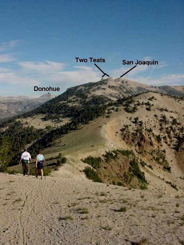
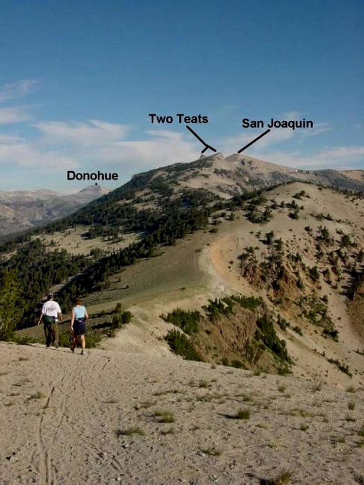
This is where the 4x4 trail...
View High-Resolution Image
This is where the 4x4 trail...
This is where the 4x4 trail ends and the use trail begins along the route from
Minaret Summit
. The fine use trail can be seen faintly along the ridge at the saddle below. July 15, 2002
« PREV
NEXT »
Bob Burd
on
Jun 7, 2004 1:09 am
Comments & voting
Other parents
Lat/Lon:
37.71870°N / 119.1047°W
Image ID:
55748
5927 Hits
75.81
% Score
6
Votes
Log in to vote
Comments
No comments posted yet.
to post!
Don't have an account?
San Joaquin Mountain
(Mountain/Rock)
« PREV
Viewing
#20 of 40
GALLERY
NEXT »
Bob Burd's Image Gallery
« PREV
Viewing
#224 of 606
GALLERY
NEXT »
Minaret Summit
(Route)
Loading....
×
You need to login in order to vote!
User Name
Password
Remember me
Forgot your password?
Log me out when I close my browser.
Keep me logged in all the time.
sign in as a user
Don't have an account?
Register now for FREE
Rating available
Suggested routes for you
People who climb the same things as you
Comments Available
Create Albums
Register Here


