Toggle navigation
Mountains
Routes
Images
Trip Reports
Forum
What's New
People
Areas & Ranges
Articles
Trailheads
Canyons
Huts & Campgrounds
Albums
Logistical Centers
Fact Sheets
Lists
Custom Objects
Gear
Plans & Partners
WELCOME TO SUMMITPOST
SIGN IN
REGISTER
Mount Constance
Additional Parents
South Chute
You'll die if you fall here: Mount Constance
Image
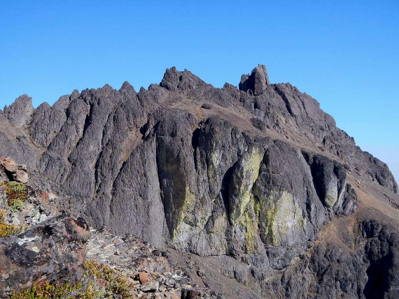
Mount Constance Upper Route
View High-Resolution Image
Mount Constance Upper Route
Much of our route is visible here. We crossed the diagonal ledge below yellow cliffs to reach the brown scree slopes above. We then scrambled up around the right side of the summit pinnacle and then the far side. Mount Constance, September 16, 2012.
« PREV
NEXT »
gimpilator
on
Oct 1, 2013 1:48 pm
Comments & voting
Other parents
Lat/Lon:
47.77281°N / 123.12735°W
Image ID:
870001
3234 Hits
73.06
% Score
3
Votes
Log in to vote
Comments
No comments posted yet.
to post!
Don't have an account?
Mount Constance
(Mountain/Rock)
« PREV
Viewing
#84 of 152
GALLERY
NEXT »
gimpilator's Image Gallery
« PREV
Viewing
#2854 of 5302
GALLERY
NEXT »
South Chute
(Route)
Loading....
You'll die if you fall here: Mount Constance
(Trip Report)
Loading....
×
You need to login in order to vote!
User Name
Password
Remember me
Forgot your password?
Log me out when I close my browser.
Keep me logged in all the time.
sign in as a user
Don't have an account?
Register now for FREE
Rating available
Suggested routes for you
People who climb the same things as you
Comments Available
Create Albums
Register Here


