Toggle navigation
Mountains
Routes
Images
Trip Reports
Forum
What's New
People
Areas & Ranges
Articles
Trailheads
Canyons
Huts & Campgrounds
Albums
Logistical Centers
Fact Sheets
Lists
Custom Objects
Gear
Plans & Partners
WELCOME TO SUMMITPOST
SIGN IN
REGISTER
Texel Group / Gruppo di Tessa
Additional Parents
Guido Lammer Biwak
Image
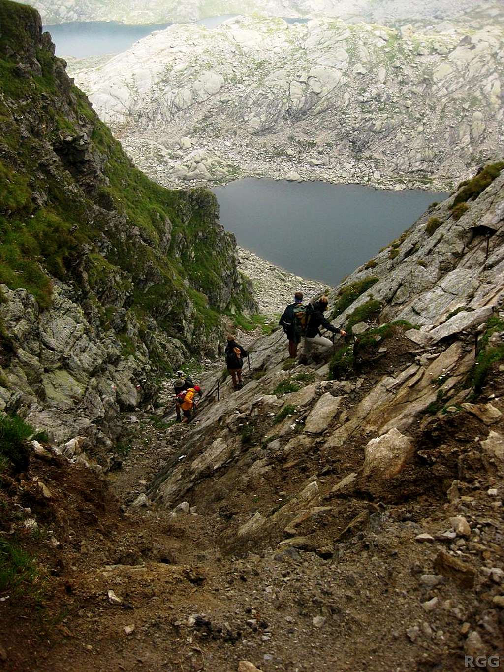
Descending from the Milchseescharte (2707m) to the Milchsee (2540m)
View High-Resolution Image
Descending from the Milchseescharte (2707m) to the Milchsee (2540m)
It's a very steep hiking trail, but with the iron cables along the way it could almost be classified as a Via Ferrata. 3 August 2012.
« PREV
NEXT »
rgg
on
Nov 28, 2013 9:58 am
Comments & voting
Other parents
Lat/Lon:
46.72600°N / 11.06800°E
Image Type(s):
Hiking
,
Scenery
Image ID:
877697
1914 Hits
76.66
% Score
7
Votes
Log in to vote
Comments
No comments posted yet.
to post!
Don't have an account?
Texel Group / Gruppo di Tessa
(Area/Range)
« PREV
Viewing
#56 of 434
GALLERY
NEXT »
rgg's Image Gallery
« PREV
Viewing
#1114 of 8665
GALLERY
NEXT »
Guido Lammer Biwak
(Album)
Loading....
×
You need to login in order to vote!
User Name
Password
Remember me
Forgot your password?
Log me out when I close my browser.
Keep me logged in all the time.
sign in as a user
Don't have an account?
Register now for FREE
Rating available
Suggested routes for you
People who climb the same things as you
Comments Available
Create Albums
Register Here


